Ohio River
Henderson, Kentucky (Mile 804) to Mile 799
July 17, 2013
My sincere thanks to one of the crewmen aboard
the steamboat American Queen who called to me from across the water to let me
know that I’d left my car door open at the ramp this morning!
The evening prior to taking
this trip I was walking along the river trail in Newburgh, Indiana and as I
looked through the trees at one point I spotted a beautiful passenger boat
passing by.
At the time I cursed my luck at not being able to get
a better view of this fantastic vessel, but I did note
the name - the
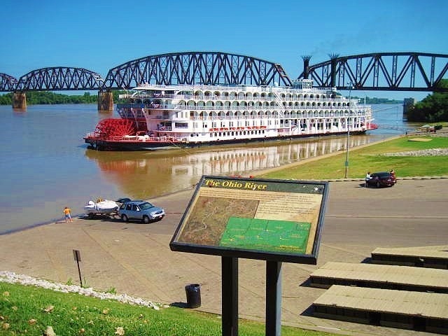
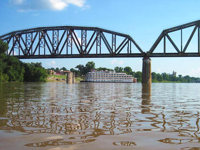
American Queen. Well, today I ended up
putting in right next to it in the town of
Henderson, Kentucky at river mile
804! Then, at the end of the
day, I got a second surprise as I found myself taking out alongside a
different steamship – the
Queen of the Mississippi!
It was pretty sweet, but
don’t get me wrong - my luck was not all that good!
Before leaving my residence I put my trail mix together
- part nuts and part dried fruit - into a container
and as I began to shake it to mix everything up I dropped the entire thing!
Trail
mix everywhere!
Then, once I’d
gotten on the water, I heard a shout and as I looked over I heard one of the
crewmen aboard the American Queen telling me something about my car.
Turns out,
my car door was wide open!
Embarrassment…
Anyway, I got on the water
today a little after 10am after taking numerous photos of the river, the park in
Henderson and the American Queen.
It must have been the beautiful surroundings that made me forget to shut my car
door.
I simply left the car, seeing
something that would make for a good picture, and then I kept seeing
more things that would make
for good shots.
In the process I
forgot to return and close the door.
Would I have eventually looked back toward my car and noticed?
Possibly, but if the guy on the boat hadn’t
yelled at me the door could have been left open all day – 8 hours and a sure
dead battery!
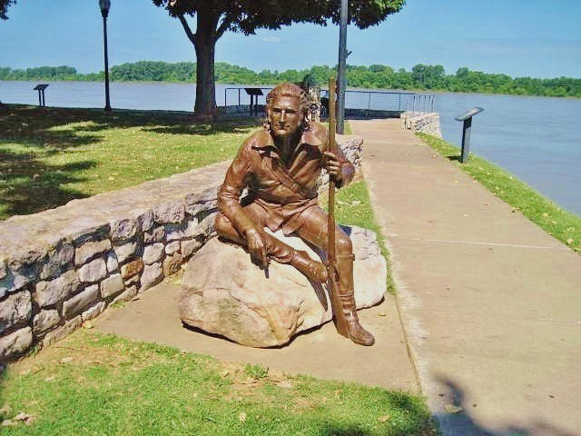
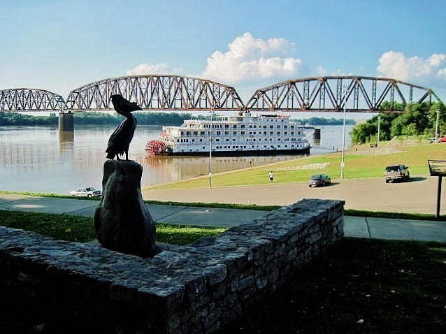
When you first get to the ramp right at the end of 2nd Street in downtown Henderson you’ll want to check out the park – Audubon Mill Park, that is. You see, Henderson is notable for being the spot where John James Audubon lived for many years painting his famous pictures of wildlife. The city, in turn, has celebrated the man by placing magnificent sculptures of his works all over town. It’s fantastic! You can also check out some relics of the old mill that he had here and you’ll even meet Mr. Audubon himself – in sculpture, of course... How incredibly life-like this sculpture is!
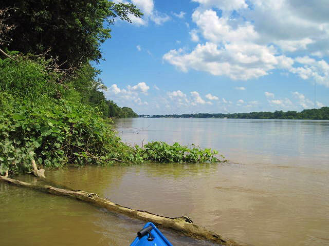
Once you get on the water
you’ll notice an island just about a mile downriver (called Henderson Island)
but today I decided to paddle upriver.
The current was strong, you see, and as a solo
paddler I didn't want to take any chances and possibly get stuck downstream, too tired to paddle back and
then have to catch a cab back to my car!
The Ohio had been flowing quite high this year.
In fact, the Green River was my backup plan for today and as I headed
around the American Queen I began to think I’d have to use it.
.jpg)
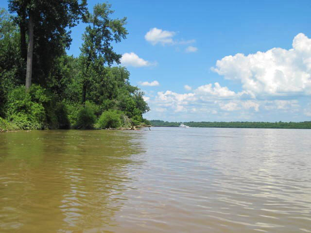
I’ve found that when you’re
paddling up a stream against a current it’s helpful to paddle along the
inside of a curve - and Henderson is located along just such a curve.
Problem is, it's on the outside
of the curve.
To get the benefit then, I was going to have
to paddle to the other side of the river. So, using the bridge spans of the CSX Railroad Bridge as periodic buffers to the current,
I headed over.
It seemed to work –
albeit very slowly - and before long I was snapping shots from across the water
(none of which turned out well enough to show).
Henderson does look great with its many parks so I hope to make this trip
again sometime so that I can give a better perspective.
Anyway, once I’d enjoyed
the scenery for a while I began to head upriver.
In the end I wasn’t quite able to make it to
Dogtown like I'd wanted so this trip
consisted almost entirely of one left curve - a curve that is notable for
stretching nearly 20 miles.
The curve is pretty sharp too. In fact,
it’s so sharp it nearly forms a circle with only
one last link to complete it.
Should that link ever be completed,
Henderson will no longer be a river town – it’ll be a lake town!
This entire river section will become one
oxbow lake, formed as the river cuts through a low lying stretch of Indiana to gain a more direct path to
the community of Mount
Vernon. That will probably take quite some time though.
At any rate, if you’re
travelling in the direction I was today (upriver toward Evansville) you’ll find
that the inside of this curve I’ve been describing will consist almost entirely
of one huge swath of farmland/floodplain which lies below Burdette Park in
Evansville.
Meanwhile, on the
Kentucky side, you’ll find Henderson and its outskirts.
Here you’ll pass more parks including Sunset, Red Banks and Atkinson
(Atkinson – located off of North Elm Street – has a boat ramp).
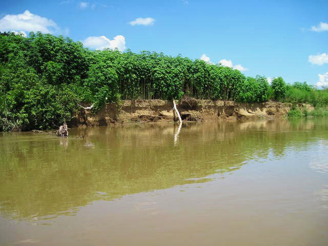
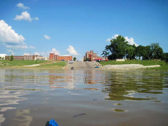
That large building you’ll see is the Commuity Methodist Hospital. Also notable in this
stretch are some interesting shoreline scenes and, since my best photos today
turned out to be the close-ups, I’ve decided to put up quite a few of these.
The following 3 were taken as I paddled along the Indiana side…
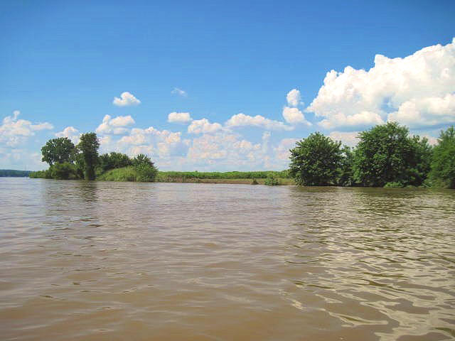
At about mile 801.5 you’ll
note a couple businesses onshore –
Home Oil & Gas
Company (characterized by several
white structures which presumably contain their products) and
M. Bowling, Inc.
(characterized by all the cranes you’ll see). M. Bowling looks to provide services which range from construction to concrete and dump
truck service.
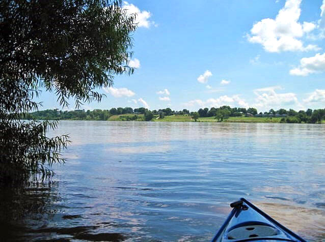
The photo below was
taken across the river at around this point…
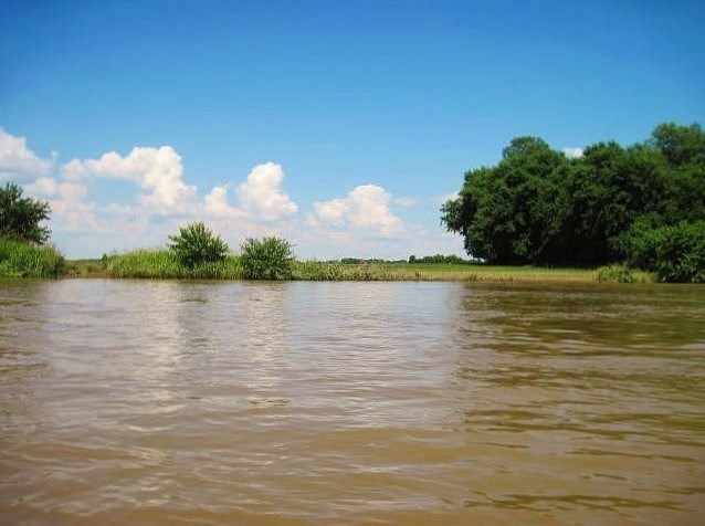
Given the current I didn’t
make it too much farther.
The
photos below were taken near a point where I stopped, presumably around mile
799 but there was a fantastic stretch of farmland here which I found quite
picturesque…
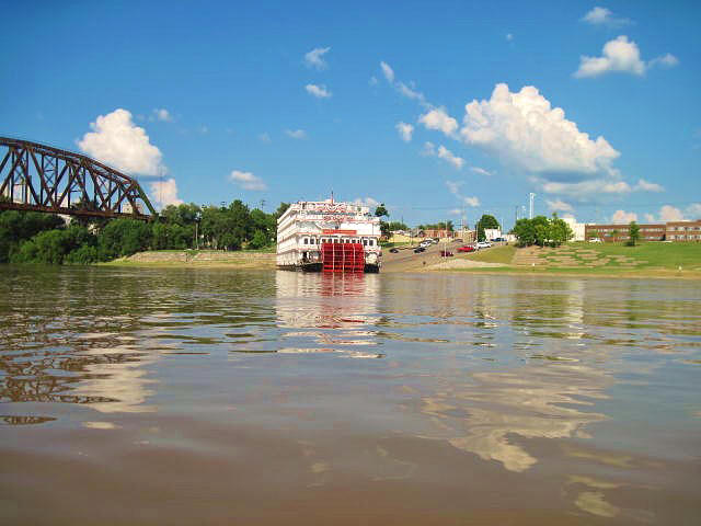
It was on the way back that
I heard the calliope.
A calliope,
for those unfamiliar, is basically an organ on a boat.
It sounds similar to an ice cream truck while being reminiscent of a
carnival.
It was totally
unexpected.
I can’t recall what the
tune was, but the Queen of the Mississippi soon overtook me and then curved
around to dock back at the ramp in Henderson - at almost exactly the same spot
that the American Queen must have just vacated. Thus, Henderson
just missed having two
paddlewheel boats docked on its shore!
I’ll leave you with several
shots of Henderson and the Queen of the Mississippi,
but this is one section that I’d really like to re-paddle and get better
pictures – especially if I can time the arrival of some more paddleboats next year.
This last one was taken
looking down at the water from Audubon Mill Park.
DIRECTIONS:
This put in is right in
downtown Henderson at the waterfront.
I followed US41 across the river from Evansville, went through the
million fast food joints that follow and then followed the signs to downtown
Henderson (you’ll curve onto US60 – or North Green Street - as you do this,
heading southwest).
The streets
will begin counting down from here and you’ll want to take a right on Second
Street, following it all the way to the water.