HIKING
HOME PADDLING
Ohio River
Evansville,
Indiana
Boat Ramp (Mile 792.5) to John T. Myers Dam in
Newburgh,
Indiana
(Mile 776.5)
Saturday, October 10, 2011
Yes, I overdid
it. I actually paddled 32 miles today. My
enthusiasm to make it all the way downriver to Evansville blinded me to the
strength of the river's current and to how long it would take me to get back to
my put-in point in Newburgh. On a normal trip I’ll go 7-10
miles in one direction and then return, but as a result of my actions today I
would get back 5 hours after nightfall - at
11:30PM!
Needless to say, it was a memorable trip! I’d occasionally
paddled after dark before but never by choice.
I'd find, however, that night paddling would give me a new appreciation for a few things:
1.
How eerie it is to have the spotlight beam from one of the pushboats play
over and around you in the dark as the captain tries to discern the obstacles in
his way, one of which is you!
2.
How clear the “hoots” of owls are as they carry over the waters’ surface.
3.
How vulnerable you can feel in the midst of the unknown and how much you
will appreciate the light of a full moon if you, too, wind up in this
situation - even if you are wearing a headlamp!
Today I began
at the Edgewater Grille in
downtown
Newburgh
around
7:30AM.
I walked my gear and kayak down the steps adjacent to the restaurant as vendors
were setting up for an outdoor market.
Newburgh,
Indiana
(town website
here and a historic site
here) is a
really nice little river town which is quite picturesque. I’d
recommend coming out to see it. It's got the best sunset view of any
on the river in my opinion, and you can also stop at one of a few
restaurants and/or browse through several antique and variety shops.
The put-in at
the bottom of the aforementioned steps is a rocky spot which is OK, but not
ideal for a paddler. It’s a bit slippery with rocks spaced
just well enough to make putting your boat in and stepping over into it a little
dicey. In fact, when I got back I used a boat ramp a little
further upriver as my take-out point (more on that in a sec…).
Today I entered
the water with a couple barge laden pushboats as company -
Southern Towing
Company’s Laura Tamble and
Ingram Barge's James E. Anderson.
Southern Towing is based in
Memphis.
I can't recall seeing
any of their boats before but according to their website
they specialize in transporting two things: bulk liquid fertilizer and anhydrous ammonia.
Meanwhile, you’ll see Ingram’s boats all up and down the river. Thus, when I see one it’s
not just a matter of seeing it, it’s a matter of seeing if I recognize
which vessel it is.
Ingram is based in
Nashville.
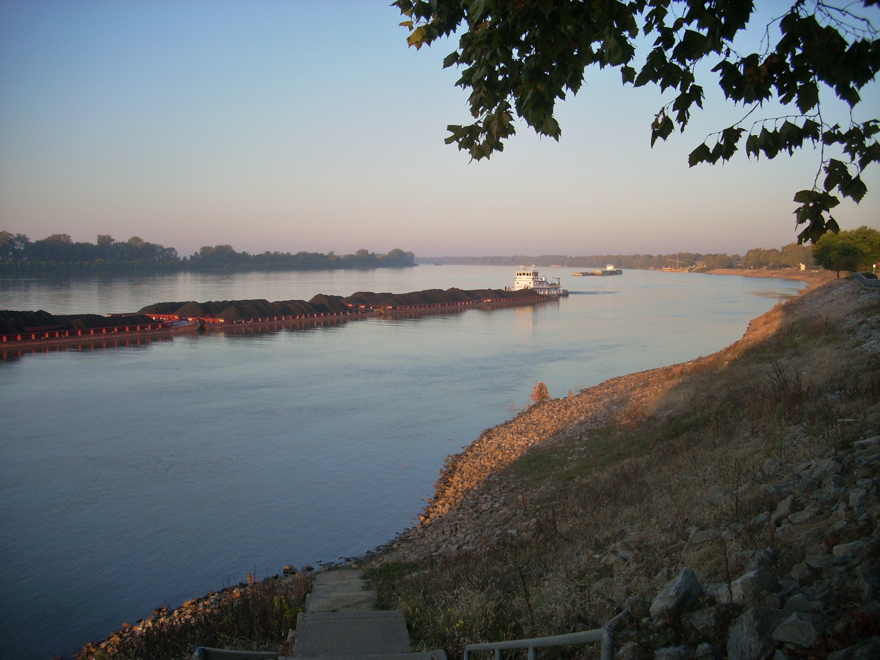
At any rate,
both of these vessels were waiting until the lockmaster could get them through
the John T. Myers Dam a little more than a mile upriver from the steps.
The dam is clearly visible from
Newburgh
and it was in this direction that I began. I wanted to try
and check out the dam – very gingerly - before I turned to head back downriver.
In this area of
the river it's the
Indiana
side that has all the activity. The
Kentucky
side probably hasn’t changed that much since the frontier days with its’
tree-lined, muddy bank. It may once have been more forested but
today it’s all farmland - not that that's boring!
In fact, it’s quite pleasant and serene to paddle along this side as you
try to spot wildlife, and if you happen to be looking away from
Newburgh
you might actually imagine yourself as one of the ancient Indians paddling
downriver to reach Angel Mounds centuries ago. Angel Mounds
is an old Indian settlement a couple miles downriver from
Newburgh
(more on that in a sec too…).
Anyway, there’s
one major thing of note between
Newburgh
and the lock and dam – an
older lock and dam, old #47! You see,
the present dam actually replaced two others - this #47 and old
#46 upriver in
Owensboro.
These old facilities are now recreation areas complete with boat ramps and
plenty of parking. I'd take advantage of this at the
end of the day. They don’t have lights right down at the
ramp but they do have several up above it, so if you arrive after nightfall like
I did you won’t be totally without light.
Anyway, as I paddled by
today at
about
8AM
I tried to get some good pictures of the current dam through the sunny haze of
the early morning. Yet, when I got fairly close I saw that
it probably wouldn’t be a good idea to get
too close.
The lock chamber wall will be jutting out right toward you as the river bank
curves slightly in, so it can be deceptive how close it really is. Also, since I
knew that those barges I mentioned would soon be passing me to enter this
chamber?
“Uh… No… I
think I’ll stop right here!!!”
I turned to head back downriver…
.jpg)

My plan at this
point was to first cross the river in order to get some good, fairly
all-encompassing pictures of
Newburgh
from this direction. Then I’d paddle downriver along
the
Kentucky
side, see how far I could get by
midday,
and then return on the
Indiana
side. Soooo… Once the barges had passed
and once I
was sure that there were no more were coming (and that there were no other boats
putting in at the old #47 ramp) I proceeded to cross the river, snapping
pictures of downtown Newburgh as I went. I'll try to get some better shots
in time.
As mentioned,
when you get to the
Kentucky
side you’re apt to find it very pleasant to paddle and you might very well get
lost in the timelessness of it until you reach mile 779 where your attention
will be drawn toward Mulzer
Crushed Stone on the
Indiana
side.
According to their website Mulzer is a family-run business that’s been around
since 1935. They provide crushed stone for construction projects.
“From driveways to highways” looks to be their motto.
Once past
Mulzer both sides of the river will look like a wilderness and on the
Indiana
side, somewhere between miles 780 and 782, lies the
Angel Mounds Historical site.
You wouldn’t know it from being down on the water because it’s a little
further inland, but the ancient Indians who lived here somewhere between
1100 and 1450 A.D. used to fish in this river. I’ve visited
Angel Mounds before and I can tell you that if you go, be sure to check out all the exhibits
and stroll around the grounds (particularly on a quiet weekday). You’ll get a
feeling of deep, deep peacefulness that you will be very grateful for – a
refreshment for the soul.
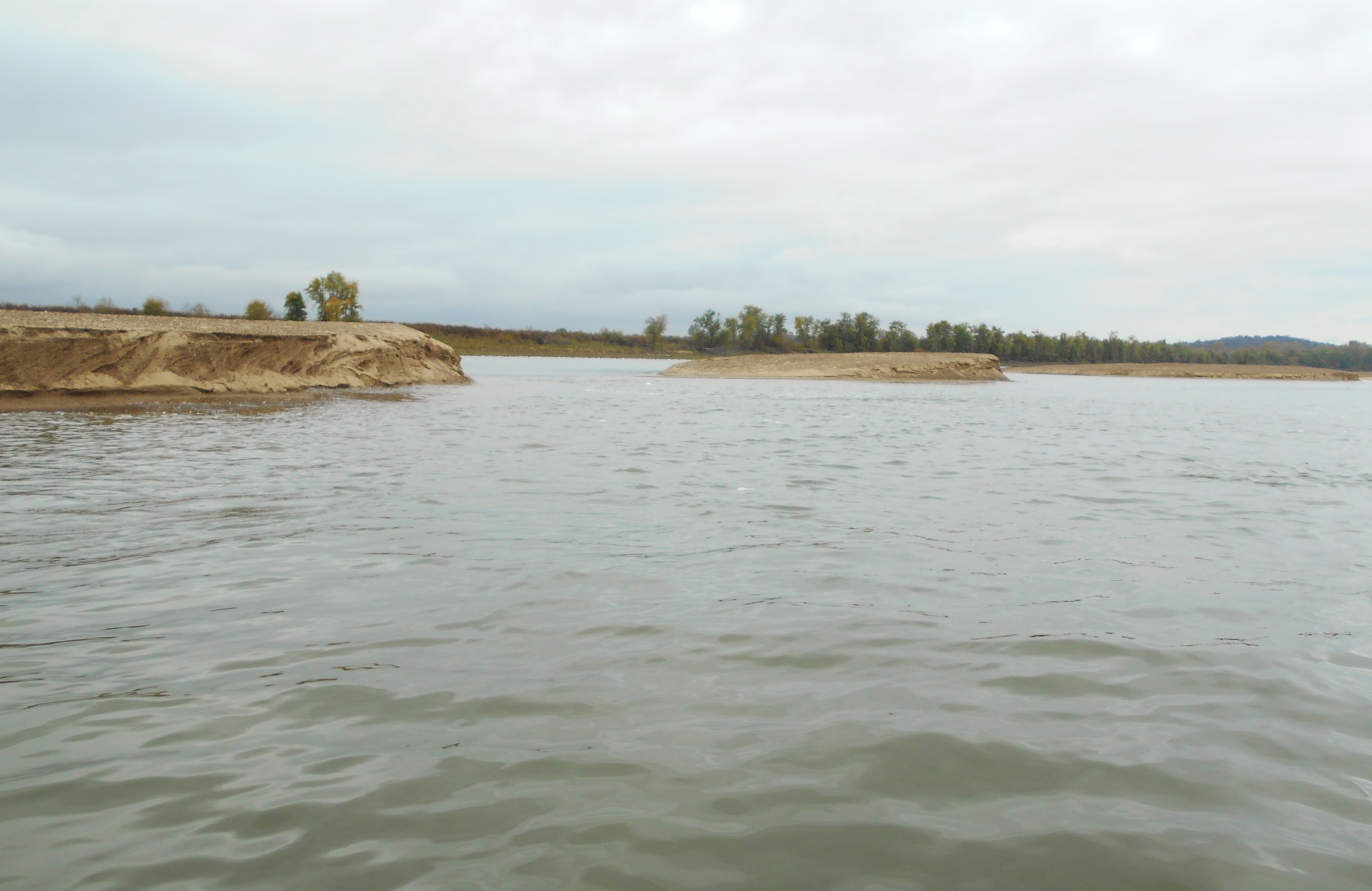
There’s also
supposedly an island along this bank (3 mile island) but I saw no indication of
the water leading around it - either on this morning or in the dark on the way
back. Looking at it on the charts it’s a
very thin one.
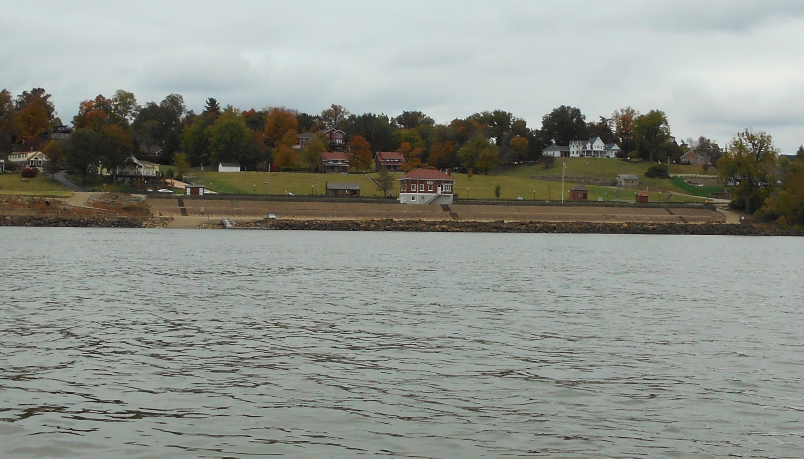
At mile 782 you’ll find a boat ramp named after Angel Mounds.
It looks nice as it’s apparently been renovated recently.
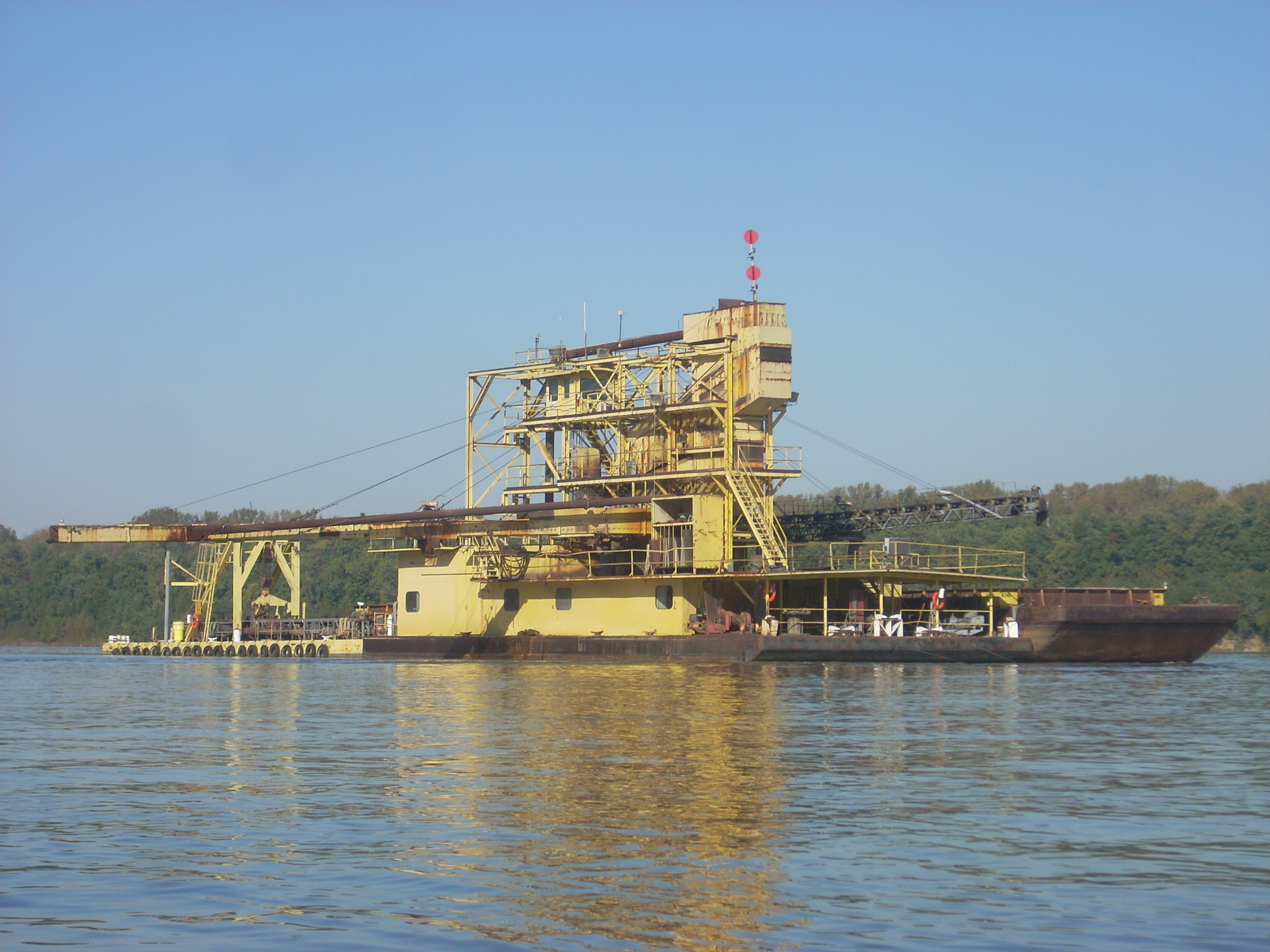
Meanwhile, it
was in the midst of paddling this section that I thought I’d seen a yellow
towboat coming toward me on the
Kentucky
side at about mile 781, but when I got right up to it I saw that it wasn’t
moving at all. Seemingly unmanned and anchored to the spot, I
wasn’t quite sure what this was doing out here all by itself.
I saw no insignia on it.
The charts indicate that there are
also a couple underwater dikes right in this area, but I
didn’t notice that they had much of an effect on the current today (there are a
lot more of them down in
Evansville).
May I also point out that there are some really nice beach-like spots
along this
Kentucky
side? They’ll continue intermittently pretty much all the way
down to
Evansville
making it pretty easy to stop and take a rest if you want.
NOTE: Paddling here in 2019 I found what might be the island
- or rather a series of a couple dozen hills of sand in the river. At
first I couldn't believe my eyes! These were skewed over toward the
Kentucky side and if I hadn't been paddling on this side I might have missed
them entirely, they're so thin.
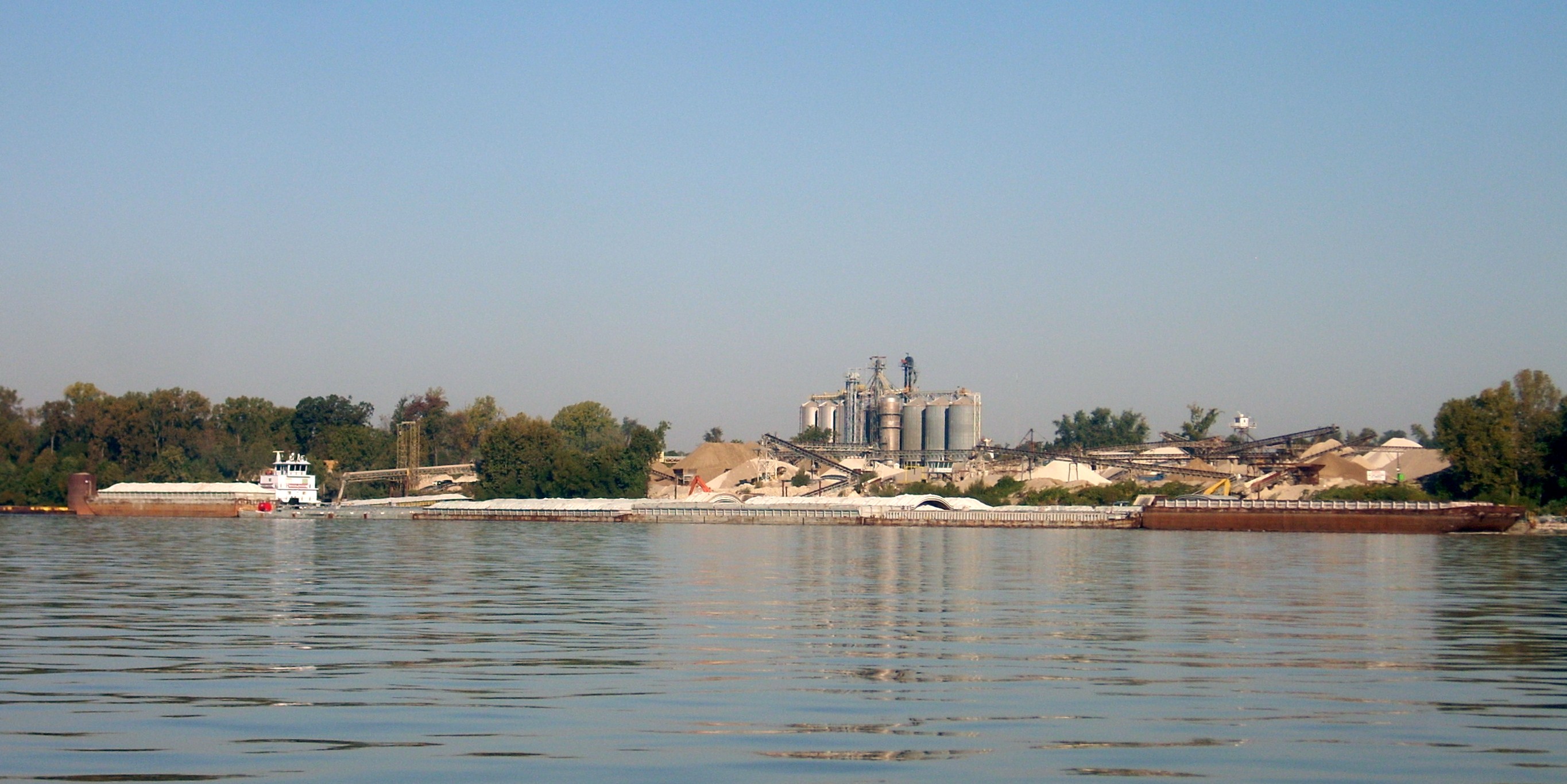
When you get to
mile 784 you’ll be in a pretty significant spot because not only will you have
the Southern Indiana Dock and Evansville Terminal on the
Indiana
shoreline, you’ll also have the
Green River
entering from
Kentucky.
The whole area is pretty congested and there are barges all over the place.
In fact, I took one look into the mouth of the Green and immediately
decided against paddling in. Not only was it clogged with
barges on both sides with a towboat working amongst them, but there were also a
ton more barges and 4 more towboats operating for about the next 5 miles on the
Kentucky
side of the
Ohio!
I steered clear of all this, abandoning my plan to paddle all the way down to
Evansville
on the
Kentucky
side. I paddled right back over to
Indiana
once I was downstream of the port!
A little more
on the Green
River…
You might never guess it from looking at its’ mouth, but you could probably
spend the better part of a year paddling this river and its tributaries. Not only do you
have the Green itself which runs some 384 miles with 3 forks, but you’ve also
got a couple large tributaries. The Barren River comes in
from the South and takes you clear past Bowling Green to Barren River Lake while
the Nolin River comes in from the North and takes you past Nolin Lake and almost
up to Elizabethtown, Kentucky.
.jpg)
Back to the
Ohio…
From the mouth
of the Green you’ll be making a looooong right curve all the way down to
Evansville.
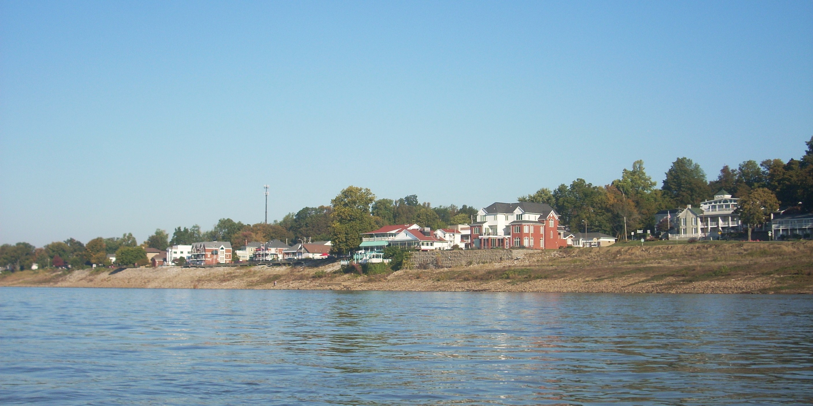
The curve will start with a line of dwellings in
Indiana
that runs all the way down to the US41 Bridge at mile 787 (the span
connects
Kentucky
to Indiana). I can
tell you that the people in here were incredibly
nice. As I was paddling in the dark
I had a couple really kind offers, one for food and another for a ride back to
Newburgh!
My thanks to these kind people if they ever happen to read this!
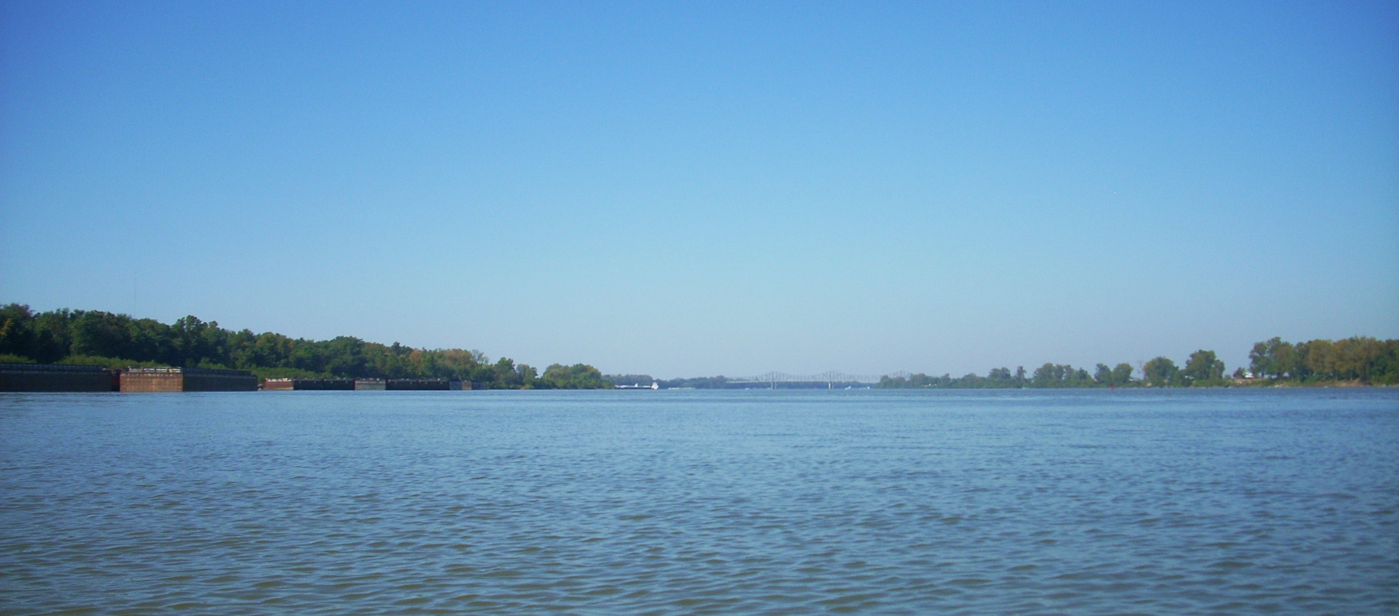
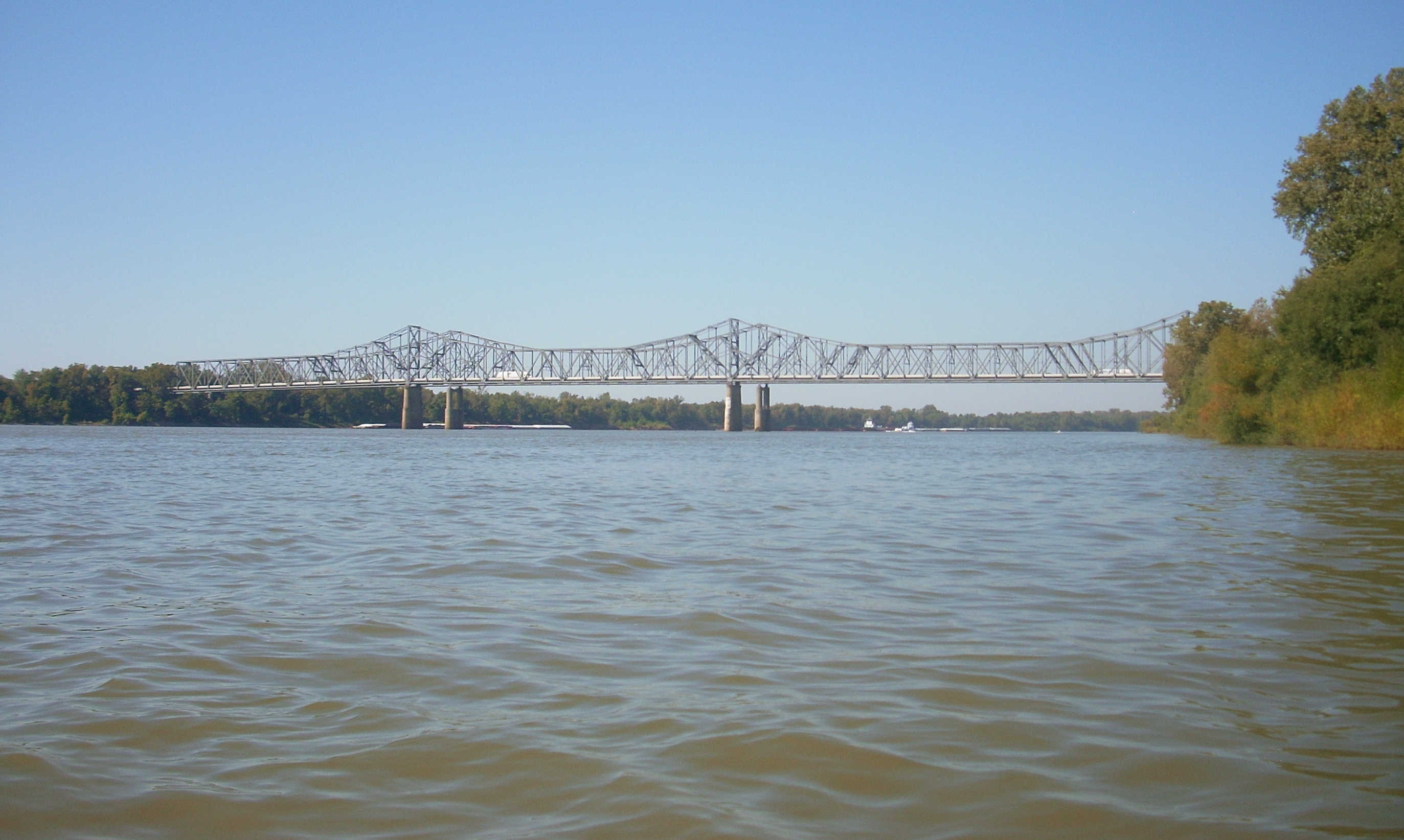
At any rate,
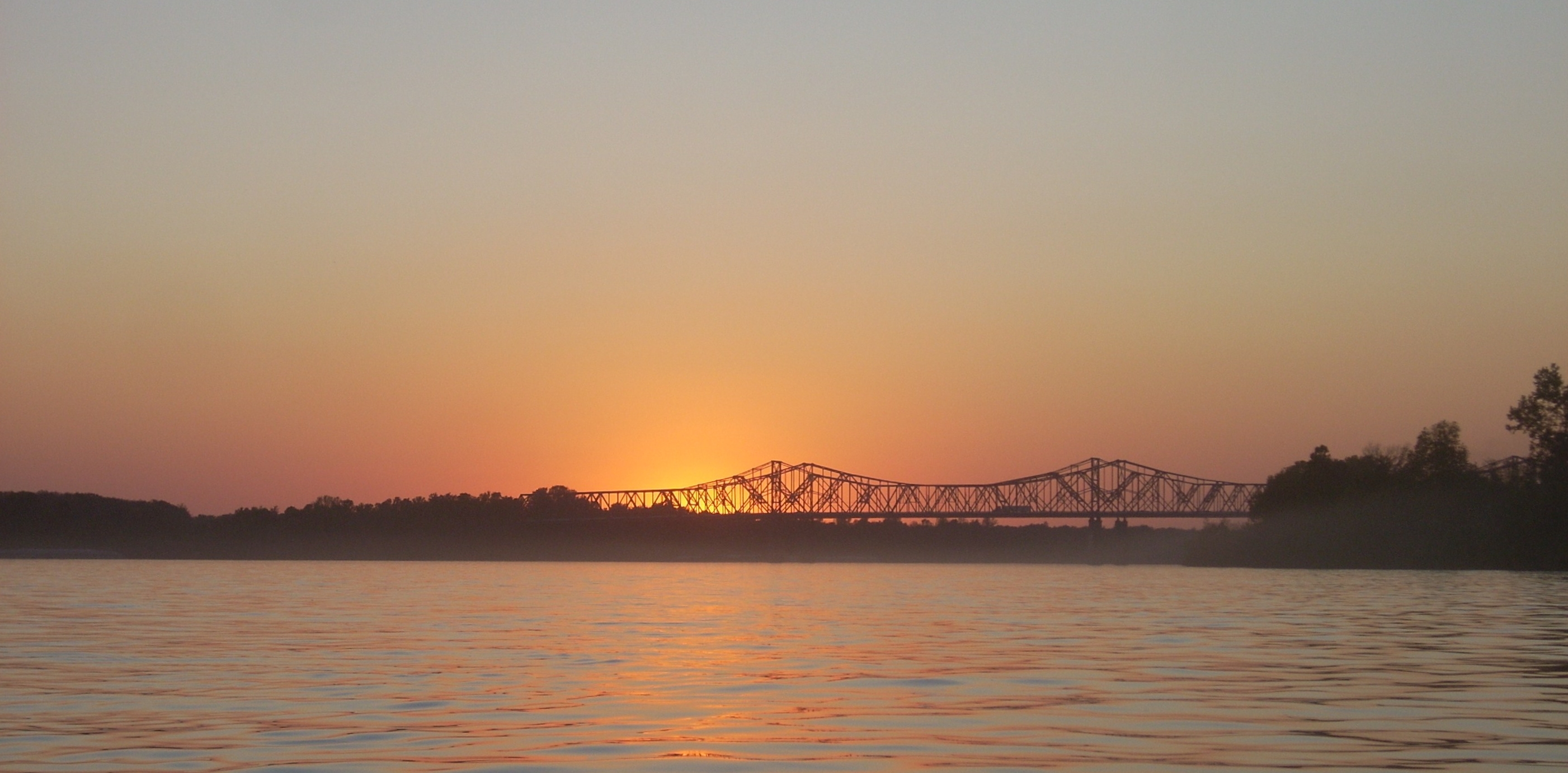
the bridge is actually plural. Known as the Vietnam
Gold Star Bridges (or just the US41 Bridges) the charts indicate that there’s a
boat ramp on the upriver
Indiana
side of them. I found that there were actually two of them, both
of which looked ancient and crumbly, however.
You probably wouldn’t be able to use them unless you’re a paddler.
Meanwhile, there were a few more barges moored just past the bridge (and a couple on the Indiana
side too) but after this I saw no more until I was down in
Evansville.
As for the pushboats, there were so many of them today that I stopped trying to
get all the names. I encountered at least a dozen.
You’re now back in
the wilderness after you pass the bridges with only the sounds of the cars
and maybe the power boats to interrupt your reverie. It was in this area that the
famous Club Trocadero used to operate. I’m not sure if it was
visible from down on the river but my grandmother lived in
Evansville
all her life and she used to tell me stories about this club.
She’d been there to see the Mills Brothers, probably sometime in the
1930’s or 40’s. “The Troc” as it was known, was a real hot spot with many
famous bands coming to play. It was also a gambling location and was
eventually closed down. This club always fascinated me, yet I
just missed coming to see it
before it burned down in 1990. Alas!
As the river
makes this bend into Evansville
from about mile 788 to 792 you'll find that the Kentucky banks will be rocky and
then they’ll become sandy at the end (in fact, this whole area is great if
you're a fan of sand and sediment formations!). You’ll also pass a couple light and daymarks
on the Kentucky side, and it was in here that two AEP pushboats passed me going in different
directions. Since this writing AEP (American Electric Power)
has sold their river operations division to
American Commercial
Barge Line so I assume I'll be seeing a lot more of their boats now.
American Commercial is based in
Saint Louis
as a transporter of dry bulk commodities.
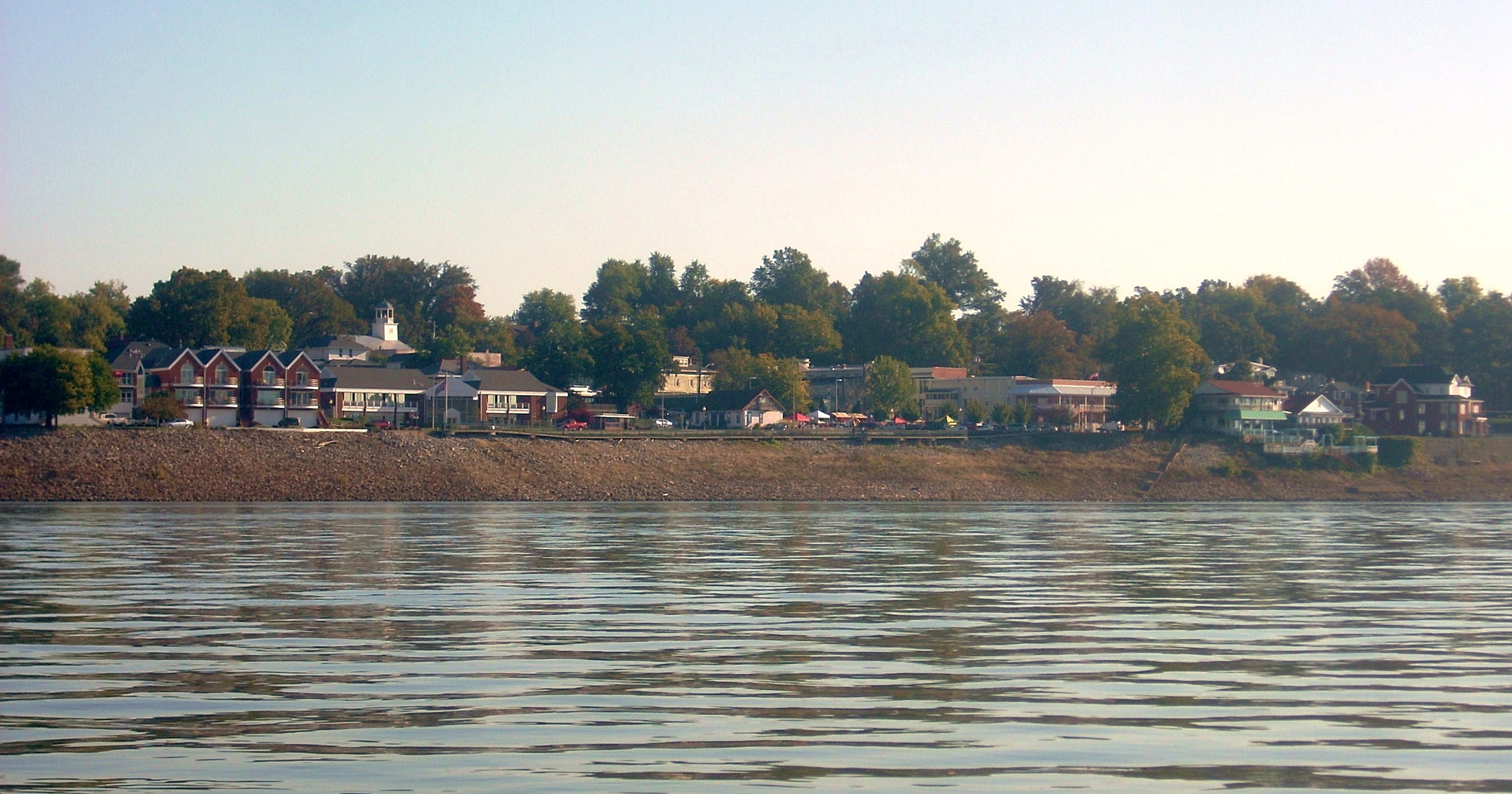
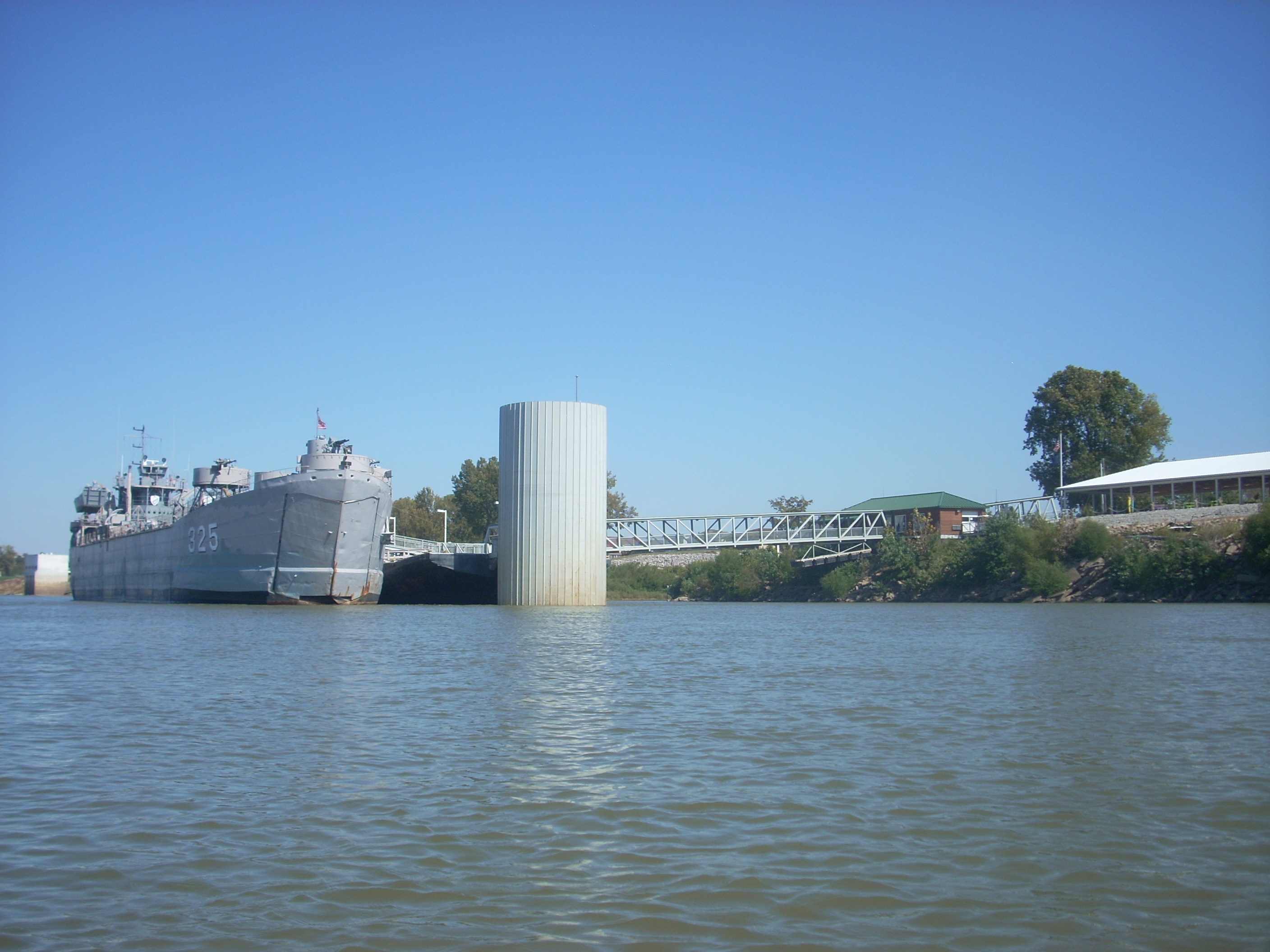
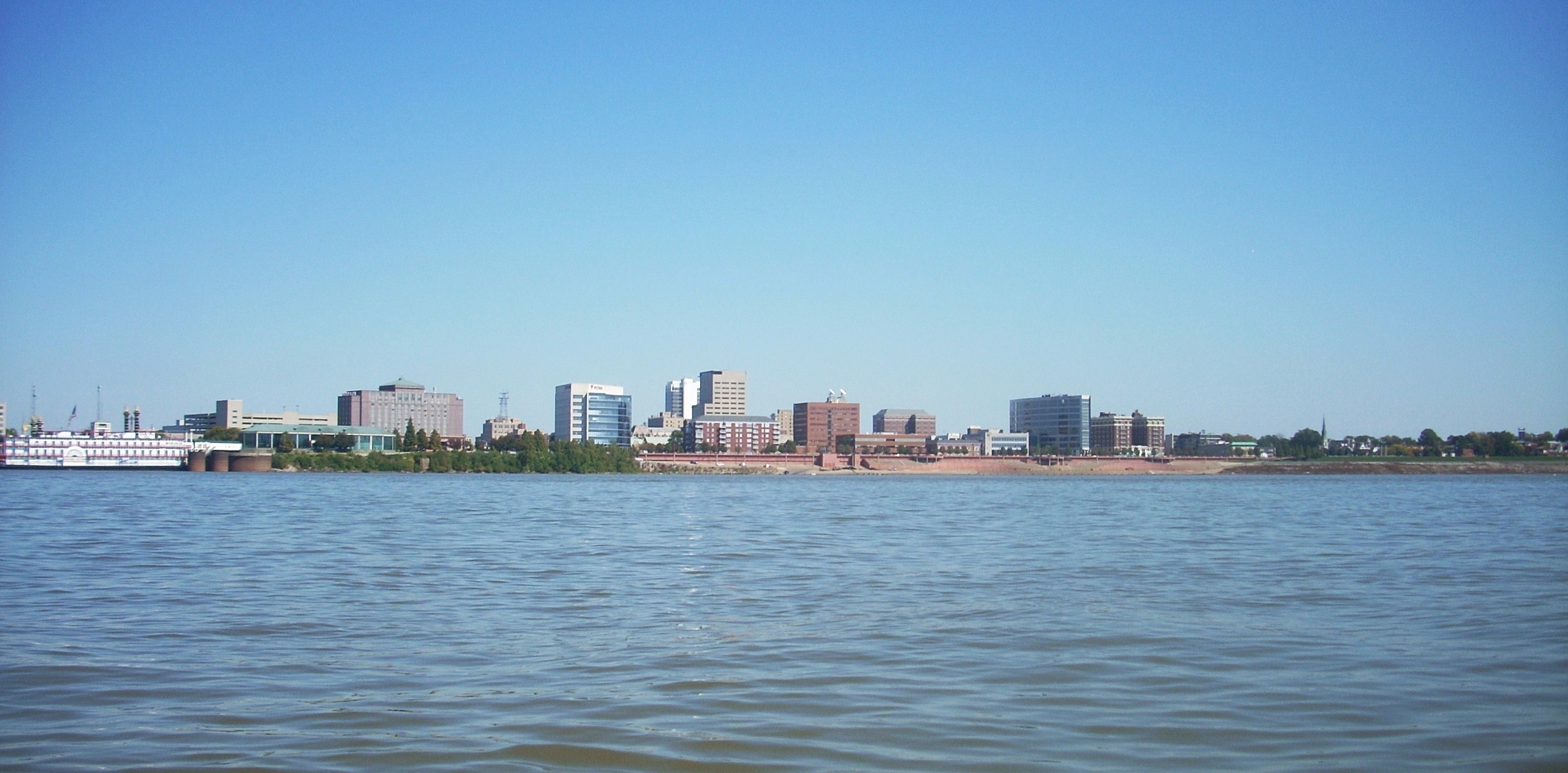
Evansville
was soon visible ahead of me with a docked warship as it's vanguard at about
mile 792.5. Evansville is a classic river town and you can find much more
information about it at Visit Evansville Indiana.
.jpg)
The ship is the U.S.S. battleship LST.
It's been retired here. I tried to get a picture as I paddled by, but
the prow of the ship so cut into the current that the water flow
quickly slipped me right past before I could get my camera ready!
Behind this ship is the mouth of a harbor called
Marina Pointe.
A few businesses have apparently come and gone here but it appears that they’ve
not yet given up on this great location. As I'm updating this journal in
2018 I see that the current business here is named
KC's Marina Point.
It looks like a fun place to check out.
What’s nice
about Evansville is that they’ve got a great scenic river walkway stretching the
length of the downtown area and if you were to walk along it sometime (something
I recommend) you’d get a history lesson, both on the Ohio and on the city itself from
all of the placards spaced along at different intervals.
Evansville
has a lot going from the business side here too. Some of the most
prominent ones in town have their headquarters here including Vectren Energy and Old National Bank. There’s also
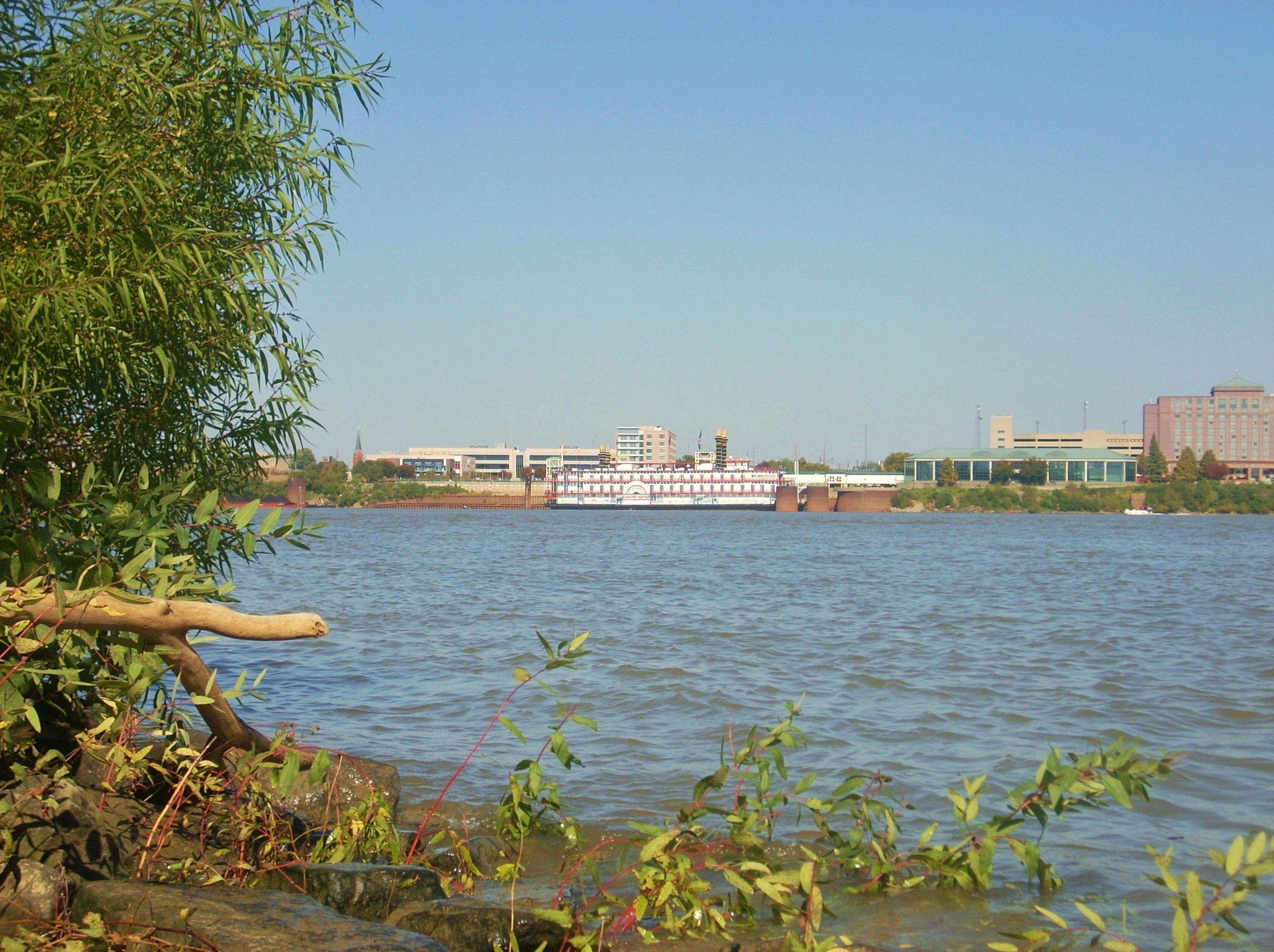
the Casino Aztar (now called the Tropicana) with its hotel and sternwheel boat
(now sadly gone) to go with a local museum and a
visitor center.
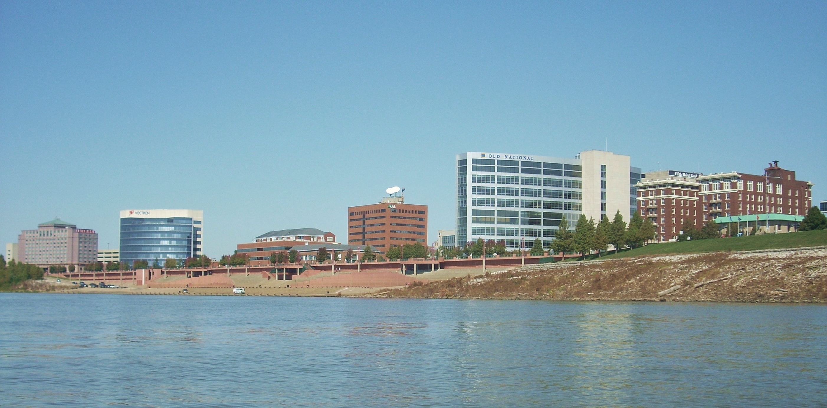
Perhaps most
interesting of all the structures is the old brick building you’ll see to the very right of the
picture above. This is the old McCurdy Hotel which opened in
1917. The McCurdy was once a premier place to stay, boasting
such visitors as Clark Gable, Katherine Hepburn and Richard Nixon!
My grandparents used to come here too when they were in the mood for an
upscale dining experience. Problem is, the hotel couldn’t
stay in business and it was eventually converted into a nursing home before
being unoccupied for many years at the time of this original writing in 2011.
I'd always hoped that they'd get someone to come in, restore it,
and maybe return it to being a hotel - or maybe even an apartment or
condominium complex. This is what occurred. The apartment website is
here.
Another nice
waterfront asset here is a large boating area, complete with a ramp and tons of parking.
The area is so nice and large that up until a couple years ago they used
it for hydroplane races.
This was a great event for the city and I hope they’ll be able to do it
again someday. Anyway, when I was younger I remember my
grandpa driving us all down to the river at this spot and how intimidated I used
to feel as a
young boy as we drove closer and closer toward the water. It
felt like we were entering the lair of some great beast! At such
times grandpa would tell us about the time he swam across this river on a bet as a teenager, probably sometime in the 1920’s or 30’s.
No small feat!
All of this was
a lot to reminisce on and there were lots of pictures to take too, so I paddled
around for quite a while to let the
significance of
Evansville
sink in. I didn’t want to leave. Never
do... I’ve been coming here ever since I was a toddler to visit relatives.
Now I return every year and it's become kind of a spiritual center for me; a
place to sort of “regroup” and reminisce. Every time I come back, though, I want
to stay. Maybe I will someday.
It
was about
2PM
now and I'd reached Casino Aztar's boat. It was about time
for me to head back or I was going to be in trouble (how much trouble I hadn't
yet realized!). I thus very carefully
but very quickly
passed over to the other side of the water and stopped for a time at a spot on
one of the sandy beaches, perhaps near the point at which my grandfather might
have stopped before swimming back to Evansville.
Anyway, once I
got going and began to work my way back upriver toward
Newburgh
I first encountered some oddly behaving water. There were
swirling eddies everywhere and I kept a mind on my balance.
This was the area where some more of those dikes were supposed to be - 4 on this
side and 3 of them would come in quick succession. One actually curved about half way into the river and then branched.
This was where the oddest water seemed to be, and I remember one time
when I was at the hydroplane races I saw a sandy island at about this point.
This dike may have accounted for that.
At any rate, it
was well before I reached the US41 Bridges that I realized I was going to be in
trouble. It seemed to take
forever just for them to come into view - and I was on the
Kentucky
side now with a clearer upriver perspective! I had really
misjudged the current, and I decided to cross
back over to the
Indiana
side as soon as it was safe to do so. I certainly didn’t want
to make that crossing after
nightfall! Besides, if I hadn’t done so I might not have
received those kind offers of help from the people onshore.
I’ve always thought that when your plans don’t work out it means that the Lord
wants to show you something. Maybe in this particular case it
was the kindness of strangers.
Below was the last picture I got for two reasons - my
camera does not take good pictures at night, and I only had one good set of
batteries left to use for my headlamp.
I'd need them. Luckily the light of the full moon was
enough for me to go for periods without the lamp and save battery power.
The only times I really needed it were when I noticed boats coming.
Speaking of which, I seemed to have one boat in
particular as company – the one I mentioned with the light that played on and
around me in the dark. The vessel was with me nearly the whole way back (at least I
think it was the same vessel).
At first it headed slowly downriver, passing me, and then it headed back up to
pass me again just
before I reached Newburgh.
What was my mindset after dark? It was
interesting. Once I surrendered myself to the realization that an extended
after-dark paddle was inevitable things were OK. Prior to that point the trip back
had seemed absolutely interminable. I think it was in accepting my fate that
I was made free to make the best of the situation - and you know what? I
ended up really enjoying
it! Yes, it was eerie and uncertain after dark but sometimes
you find the measure of yourself in such unknown situations.
In fact, I found it to be a downright beautiful experience to enjoy the peaceful
water around me amid the sounds of the river surroundings under the
moonlight.
The only thing
that spooked me in the darkness? Well, there were two things... One
was paddling around the aforementioned Southern Indiana Dock and Evansville
Terminal at mile 784. You see, there was a boat jutting out
toward me in a downriver direction from shoreline and I just couldn’t figure out
if it was moving or not! There were others boats moving on
the other side of the river. Was
this one moving??
It took several very tentative minutes before I realized that it was
stationary and that it was safe to move on!
The second
thing that spooked me was some kind of animal along the shoreline up near Angel
Mounds. At first I thought it was a deer or maybe even a large dog, but I
couldn't tell even with my light shining on it. Then, when it noticed me
it started swimming out toward me and it wasn't until I began paddling further
toward mid-river that the animal headed back to shore and promptly
disappeared! I never did learn what it was, but I'm pretty sure it was a
dear. On subsequent trips I've seen them further out into the
water than I would have ever believed possible! As of 2019 I've also seen
a news story about some fishermen who encountered a deer wandering 5 miles
offshore! Apparently they can escape predators by swimming and they're
actually pretty good at it!
Were
my shoulders ever sore by the time I got back to Newburgh! So much so,
that I didn’t really care to walk my boat and gear all the way back up the Edgewater Grille
steps. Instead, I paddled a little further upriver to the ramp at the old
dam, then walked back to my car in Newburgh before driving back to pick up my
boat. May I say that there’s nowhere else on the river that
I'd rather have taken out this night than in
Newburgh.
It’s seems to be a pretty safe. In fact there were
still many nice people out walking along the river even at
11:30
at night!
I will never
forget this trip, but if you decide to come out please be prepared that paddling down to
Evansville
and back makes for a looooong day!
DIRECTIONS:
From I64 take
exit 29A toward Evansville/Henderson, KY and head south until you get to the
exit for
Newburgh.
It’s SR662 or
Covert Avenue.
Head east. You’ll go through a few stoplights and then the
two lanes will merge into one prior to the last light. You’re
real close. Stay on the main road. You’ll
soon reach a stop sign right in
downtown
Newburgh.
Here you can take a right on State Street, park, and then head toward the Edgewater Grill
Restaurant.
You can’t miss it along the waterfront and the steps I used are right
beside it.
Alternatively, if you want to go to the boat ramp, just
take a left when State Street dead ends at the Edgewater Grill. The
ramp is a little way up at the site of an old lock and dam which will be on your on your right.