Not to start on a down note.
This was a very nice day and this is a very nice
seection of the river to explore, but have you ever had times in your life where
you just felt like giving up? That things were so bad you just didn’t think
they could possibly get worse - but do? Well, that was me today.
When this happens there’s only one way I
can deal with it – I get out on the water. Any body of water will do, but
I think a gently floating stream works best. It’ll really help you put the
circumstances of your life in perspective. In fact, it doesn’t matter just
how bad things are. Even if it seems like you can’t go on, you’ll
still be able to find solace. Your concerns will slowly melting away, to
be replaced by a feeling of acceptance. It’s almost like a blanket is
being placed over your problems – you’re putting them to bed. It’s really
quite amazing.
What I do is I get out on the water and then bring all my problems to focus in my
mind. I feel them, and I feel them acutely. Then I hold them there as I
envision myself as a molecule of water in the stream. If you think about
it, a molecule of water is totally at the mercy of whatever goes on around it.
It's journey might be quite tumultuous, but things will generally turn out OK.
After all, it’ll eventually wind up with all the other molecules in the same
place, right? Well, if I focus in this way my problems
will have completely faded by the end of the day! How dire can your
problems be and still be negated? Well, I’ll tell you…
On this day my misfortunes had left me with only one stock holding as net worth. Until recently I’d had 3. These had all been battered by the market but still had nothing but good things going for them. Long story short: the market dove and I was forced to sell what I thought were my 2 riskiest stocks while I held on to the least risky. The result: One of the stocks I sold was up by 50% a week after I was forced out. I’d held it for over a year while it did nothing. The other almost doubled, and the kicker - because these stocks had not gone up like this when I’d held them, I also had to sell a critical chunk of my final position on a margin call. I'd had a 50% hit in one week!
Devastated, I found myself wondering why some lives have to be fraught with adversity while others seem to sail right along. Well, it wasn’t until I got on the water today that the above water molecule analogy came to me. Also - could it be that certain people have been given an inordinate amount of adversity so as to somehow spiritually relieve it from others who might be in a more vulnerable position? That thought once occurred to me, and it gives me hope that the things I go through might be of some benefit to someone. So… I hope that anyone reading these will find the same kind of comfort I’ve found by getting out in nature, and that this website will prove useful to that end.
On
to the trip! The put-in I used can be arrived at by driving along the top of the levee at
the end of
Anyway, upon
arriving at the ramp I drove half way down to the water and then up a little
incline to park on the pier (which is lighted to provide an added measure of safety). Then, putting my last 4 bucks in
the drop box, I immediately made the crossing to the
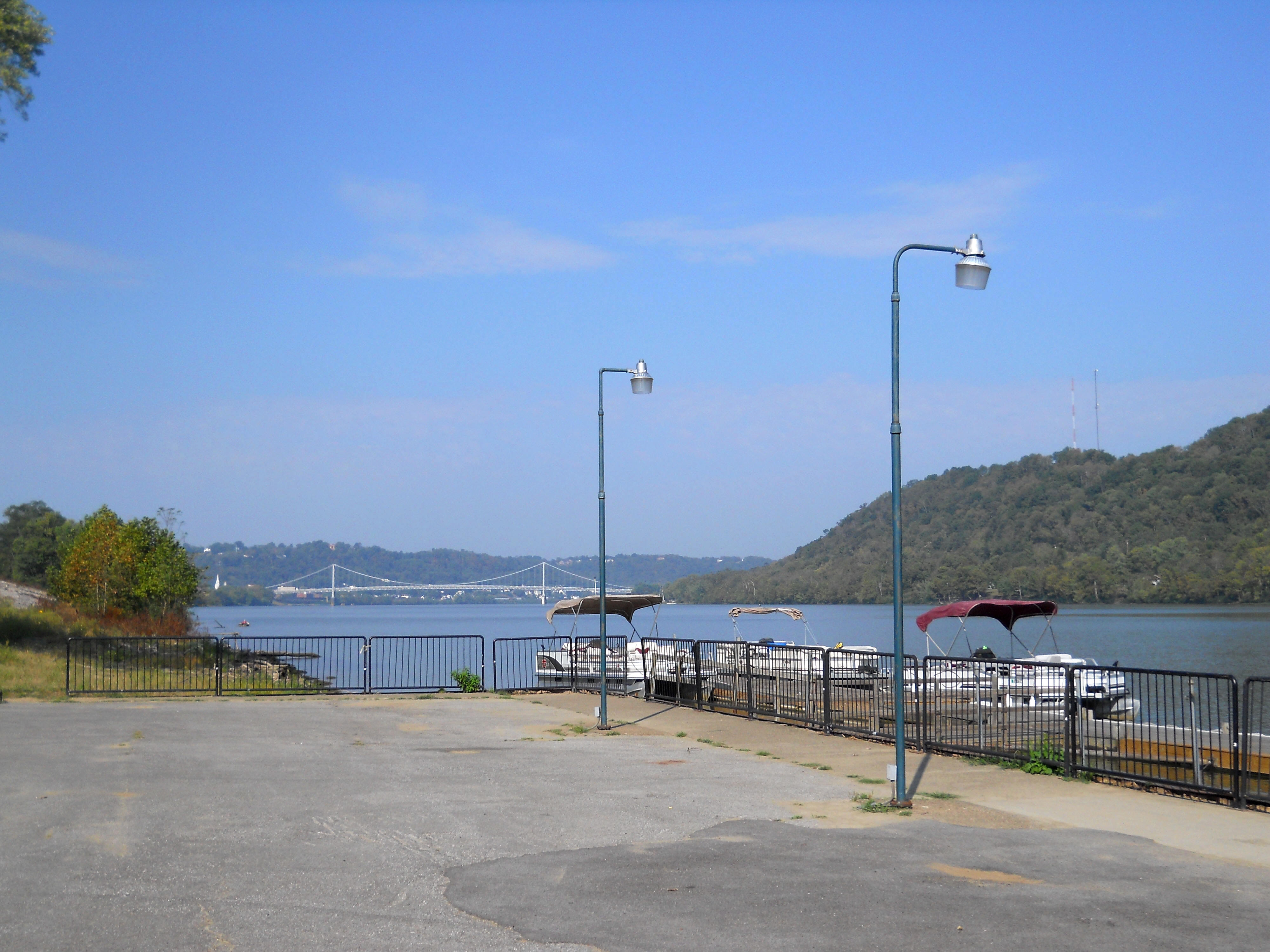
As
noted in the title, this is mile 407 with the
Meanwhile, despite all the industry in this first mile, there were plenty of
signs of wildlife. On the left along the gently sloping
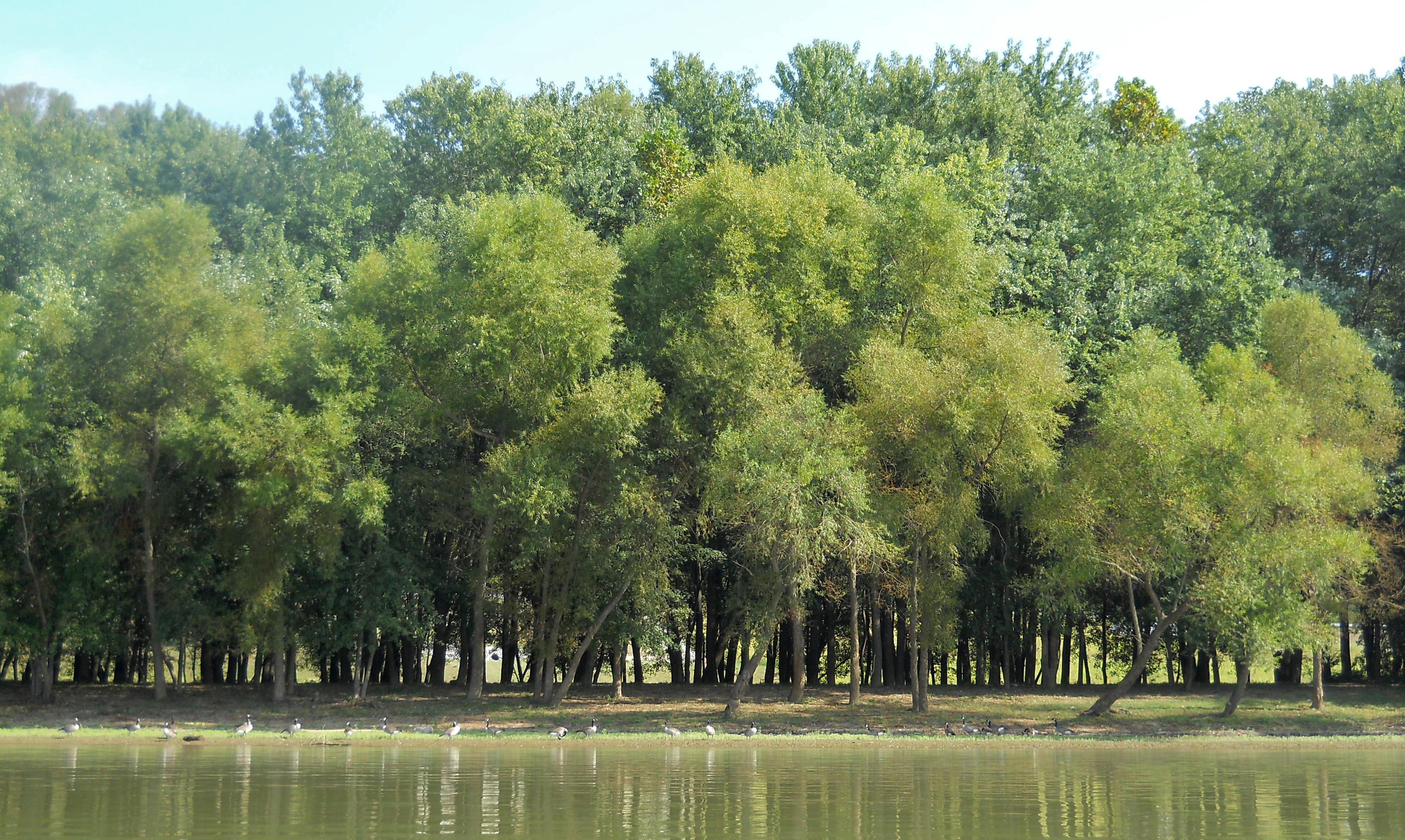
The
Three Mile Creek soon entered from the left as the power plant loomed large just
up ahead on the

At
any rate, I first had time to ponder my power plant navigation strategy on Three
Mile Creek as I paddled through a partial steel barrier and got back roughly ½ -
¾ mile through a fair amount of current - seems the plant was going through
quite a bit of water that it was returning back to the river via this creek.
In fact, I wondered just how much of this stream was attributable to the plant…
Would it even exist without it?
Now
emerging back onto the
Padding very slowly and cautiously I eventually made it through this section. Y’know, I didn’t realize it at first, but the grounds of Dayton Power and Light run for more than 2 miles - from mile 405.5 to about mile 403!

…and while I was paddling I actually thought that there might be 3 businesses in here, yet it was all apparently part of the same one...

The line of barges seemed to run forever too, and most were all loaded up and waiting to be pushed to their destination. Business must be good! I watched as one was loaded. It was an interesting process.

Meanwhile, the Crounse Corporation (http://www.crounse.com)
has a facility directly across the water from the plant in
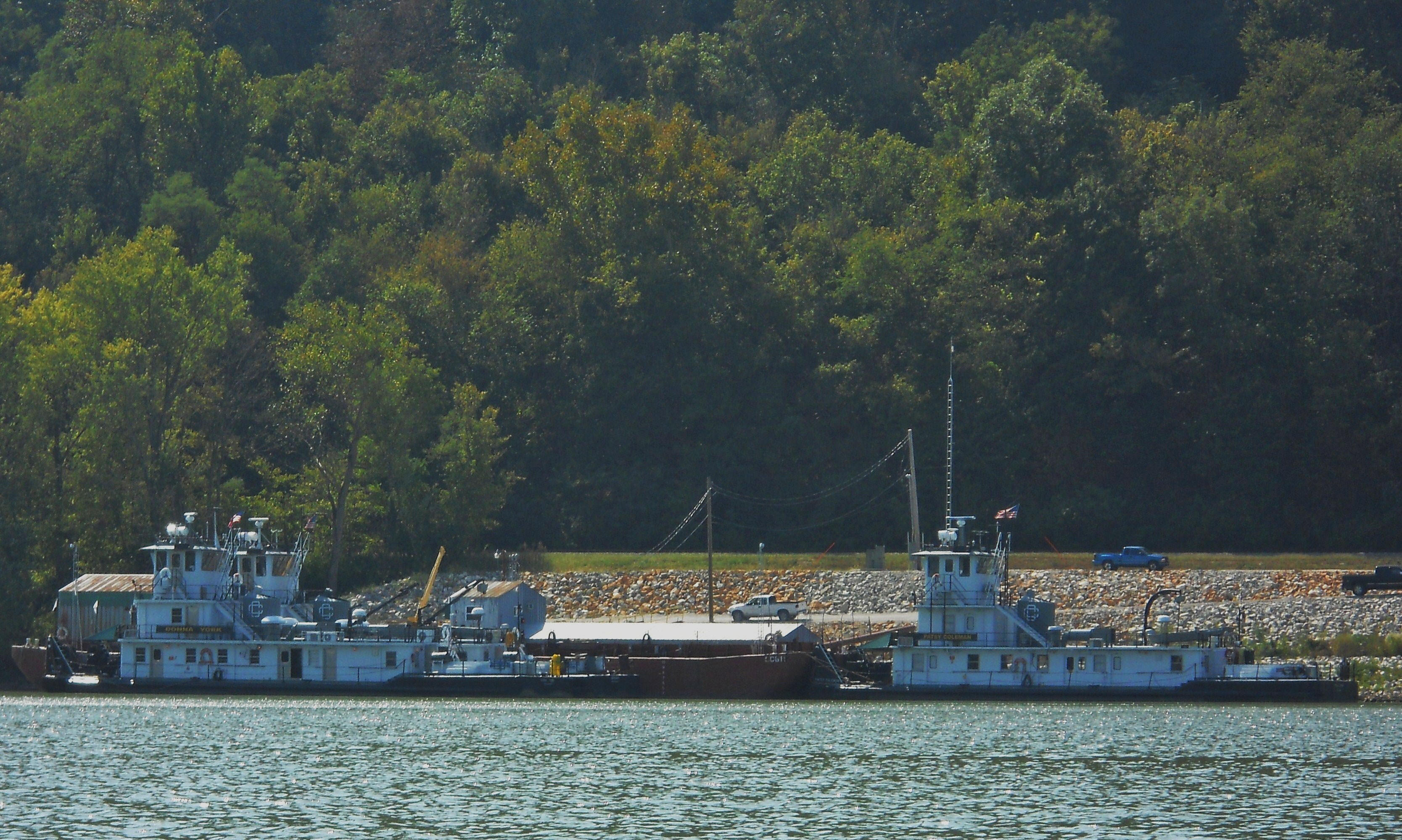
…and Carmeuse Lime, on the same side near mile 403 seems
to be a customer! Once you’re finally able to get around the last
of the mooring cells for the power plant on the

Carmeuse (http://www.carmeusena.com),
based in Pittsburgh, is a supplier of lime, limestone, and silica products to
industry and they have a pair of what look like grain elevators at this point on
the river. In fact, if you paddle back into Cabin Creek which also enters
here you’ll be able to see more of their operation. (Cabin Creek has a
railroad bridge going over it at the mouth and it was navigable to me about ¾ of
a mile, but you might be able to paddle back even further. I ran out time
on the way back.)
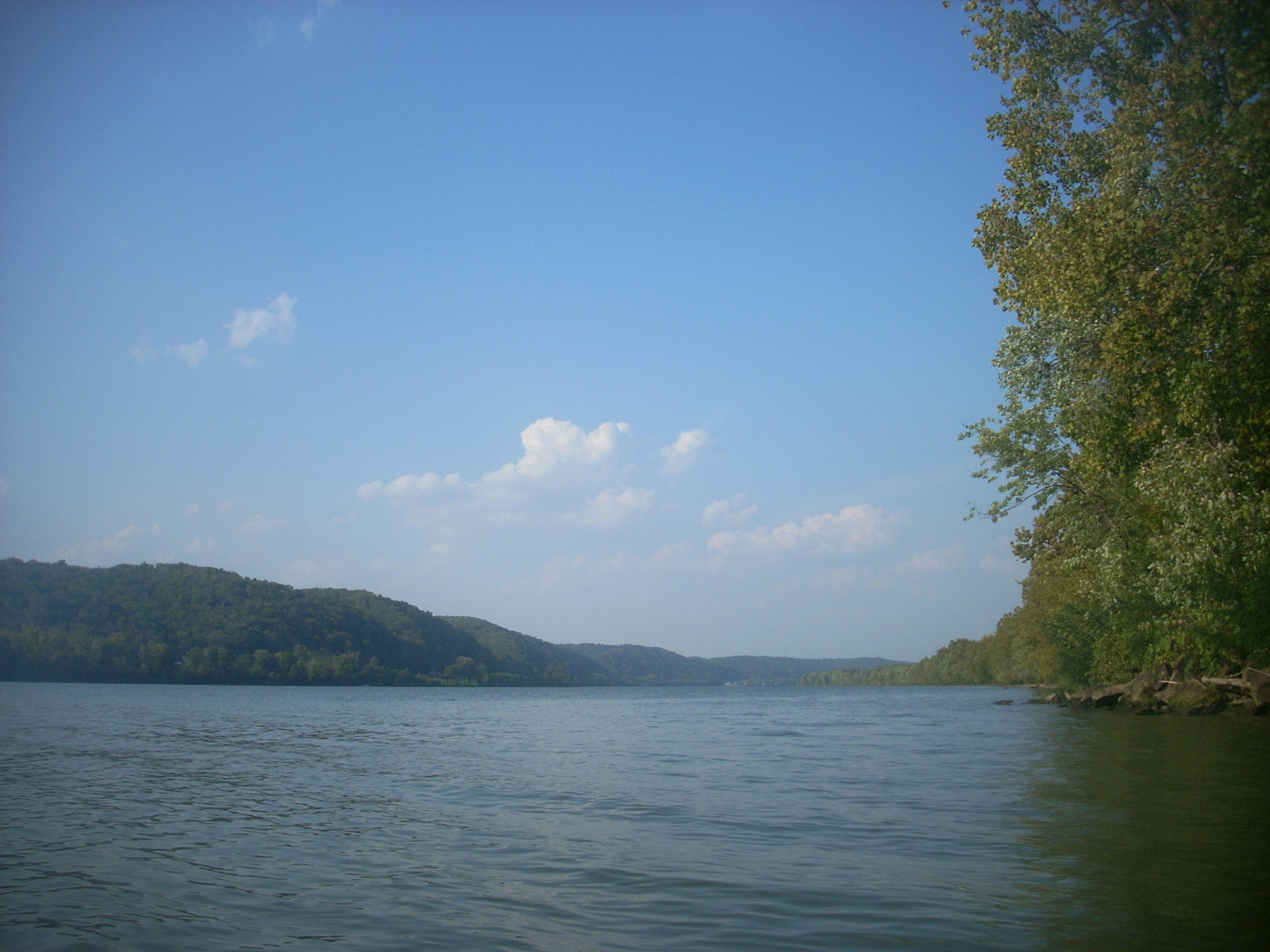
Now
by this point you’re on a left curve in the river, and you’ll find that its
character will have almost completely changed. Whereas you at first had
all the industry on the river, you’ll now be in the midst of a rural farmland
section on your way to
Parts of the shoreline were really inviting too, although that was more the case
on the

Crooked Creek enters the river at mile 401.5 with a railroad bridge of very
interesting construction going over its’ mouth. I got in about a mile to a
point where my progress was halted at a large rocky shoal. This creek, to
me, was a really pretty one - it’ll definitely be a favorite. In fact, it
reminded me a bit of Bull Runs’ stream just downriver from the convergence of
the

Anyway, from Crooked Creek you’ll next be on a straight
section, and looking down it you’ll see a cleared out area just past mile 399.
This spot marks the outskirts of
.jpg)
.jpg)
First,
I found one
little problem! You see, I like to explore both shorelines
and I'd been on the Kentucky side for most of this time. I needed to make
a crossing. Yet, there was this push boat approaching from behind
me, you see… Hmmm… I really had to get going, so I decided that
since the vessel was all the way over to my side, that I’d be able to clear his path much more quickly
and
safely than I would if he was on the opposite side.
Nevertheless, it was only after making sure that it was also moving
very slowly, that I began to very
quickly
make the crossing. I ended up being OK.
Now at this point it occurs to me to mention something.
At this point I’ve padded somewhere around 2000 miles and I can tell you that
like any other physical activity your body will adjust to paddling, becoming more efficient the more you do it.
However, I’ve also come to appreciate just how
powerful you can feel while you’re paddling as well as the affect it can have on
your body – specifically as regards your midsection. Not just your
abdominals, but
also your “lats” (latissimus dorsi). In fact, when you reach a certain
point you’ll start to feel extremely powerful in these areas because, when you do
it right, these muscle groups will seem to act in perfect harmony. I
think it’s pretty amazing…
When paddling, you’ll pull your right arm back using the lat muscles on your mid to upper right side. As you do so, it feels as if these muscles are being forced diagonally downward across your body toward your lower left abdominal area. At the same time you’ll be pushing your left arm forward using muscles from that same lower left abdominal section that’s being pushed down upon. This time, however, the force is exactly reversed, and it feels as if these abdominal muscles are being forced diagonally upward across your body toward those same lat muscles on your mid to upper right side that are still pushing downward. The effect is like that of a pair of fists meeting. One comes down very slowly and powerfully from the upper left and the other comes with equal strength and velocity up from the lower right. When they meet you’ll get a huge burst of power when they push off from one another. Then you’ll begin the next stroke. It’s almost like you’re drawing an “X” across your midsection with each series of 2 strokes. The effect is very interesting, immensely powerful, and extremely exhilarating! I felt it in full as I crossed the river here and it was a good thing! I’d need to keep it! I’d be paddling against the wind for most of my return trip!
It was after having made the aforementioned stream explorations that I arrived back to the ramp just past sunset, getting the best shots I could...
.jpg)
.jpg)
.jpg)
My overall impression today? If you come out here
be sure to bring your “A” game if you’re paddling! Yes, every section of
such a large river can pose challenges, but the first portion today alongside
the power plant can be especially so [although less so now with the
power plant closure]. The second half to
.jpg)
DIRECTIONS:
From