.jpg)
Ohio River
Pomeroy-Mason or US33 Bridge (Mile 251.5) to
Syracuse, Ohio (Mile 245.5)
Tuesday, August 21, 2012
(Navigation Charts 159)
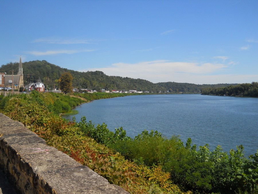
I began the day intending to put in at Pomeroy, Ohio. It was a town that I’d driven through before and really wanted to see a little more of, but when I got to the ramp right in the center of the downtown area I found that they had nothing but metered parking. Besides being a pet peeve of mine, I simply can’t afford to spend money on things like this if I can avoid it. I moved on... Please don’t get me wrong. I love Pomeroy! Besides having a very unique McDonalds with a boat dock, the community is also very picturesque as you’ll see.
Anyway, I knew from the
navigation charts that there was a put-in in a little further upriver in
Syracuse, Ohi
Anyway, it was just under
this wall that I had my first encounter with a groundhog (or woodchuck) down at
the water's edge! I thought it might have been a beaver at first but
I didn’t see the telltale tail! Looking it up, I found this
critter. Groundhogs are typically prone to residing in forests, but they’re also known to be great
burrowers. A river bank would thus seem to be a good habitat
for them.
.jpg)
It was also at this point that I took the picture
below (looking upriver from under the bridge). Downtown Pomeroy
looks awesome in the distance doesn’t it? Please also note
the McDonalds sign on the far left and the greenhouses on the right in West
Virginia. This greenhouse space apparently comprises the
headquarters of a company called
Bob’s Market and Greenhouses, Inc.
.jpg)
As for the McDonalds, it lies almost directly across the water from Bob’s. In fact, I’m composing this journal from the very spot! They’ve got some great 2-seater tables here overlooking the river which are perfect for either watching the water or for writing about it. The best picture I think I got of the restaurant was when that same tow boat passed – the Roger W. Keeney of AEP.
%20(2).jpg)
.jpg)
Anyway, right upriver from this – and just before you reach downtown Pomeroy -
you'll find another restaurant called the Wild Horse Café.
If you’re looking for dining which is a little more upscale this is a
good spot. You can check out their menu online and they, too,
have a dock.
.jpg)
.jpg)
.jpg)
.jpg)
Anyway, it was whilst I was taking all these photos that I happened to glance at a downed tree on the West Virginia side. It seems I was being watched!
.jpg)
.jpg)
Want to see what it looks like to be aggressed by a pushboat? See the next photo - and the boat had been closer than that as I'd paddled a little away from it before I snapped the photo... Revisiting this section in October 2023, I'd just past by the boat ramp above leaving 80% of the channel on my right (Ohio) side for any vessels that might overtake me heading downstream like I was and 20% on the left. Suddenly I heard a noise behind me and, glancing over my left shoulder I see a barge! I was astonished and surpised it hadn't run aground! Look how close it is to the shoreline!
I regularly glance behind me to better ensure my safety but I hadn't seen this guy coming. A train passing through had sounded it's horn more than 50 times, but this vessel gave no warning. It was also moving only one barge so it snuck up on me quickly. If I'd been heading to this Mason ramp I don't think there's any way this guy could have avoided hitting me. I was dumbfounded. I'd done nothing to deserve someone taking chances with my life! Luckily I was paddling a little further so as to get some better all-encompassing photos of Pomeroy before I headed back upriver to Syracuse. Such acts of unprovoked hatred convince me of 3 things...
God exists. This world is perfectly imperfect. It had to have been planned that way.
Satan exists. Darkness can reach you anywhere - even in the pursuit of peace and beauty.
Steering wheels are the greatest underappreciated source of darkness in our world. They sap our hearts and our minds, leaving us empty vessels for Satan to use.
.jpg)
Once past Pomeroy I couldn’t help but take some more pictures from this point of view. It was in here that the “Mr. King” of McGinness (a division of McNational, Inc.) passed me. I watched as the vessel headed upriver with the mountains behind as a nice backdrop.
.jpg)
.jpg)
.jpg)
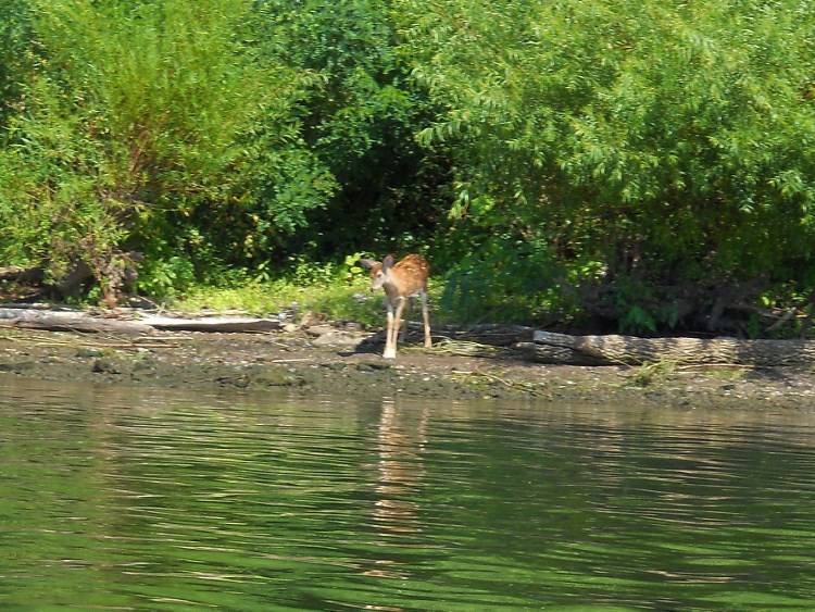
It was also in here that I
startled a little deer on the way down in the morning…
.jpg)
The river is making a pretty strong right curve here,
by the way. In fact, this entire stretch is one solid right curve which
ends just before the ramp in Syracuse. Ohio Route 124 (the
way you might have come in) will be well visible on your left side while a railroad
track will be with you on your right. It was in here that I
found that the barge traffic was getting thicker as two towboats passed me going
downstream in quick succession. First came the Jincy of
Crounse Corportation
followed by the Texas City of Marathon Oil.
As far as incoming streams
in this stretch, I didn’t really see much of the Permonkey and Carleton Creeks
in Ohio but the Sliding Hill Creek in West Virginia at mile 247 was visible. I couldn’t
get in due to a deadfall right past the mouth, though.
Later I encountered quite a colorful little shoal on the
West Virginia side…
.jpg)
.jpg)
Soon – and about the time you’ll note the LETS Dock and Campground in Ohio - you’ll find that the river starts to straighten out from its right curve to begin a left one at mile 246. The ramp comes right afterward. It sure is beautiful out here!
.jpg)
.jpg)
.jpg)
Finally, here are some last pictures of Pomeroy taken on a separate trip...
DIRECTIONS:
Google Maps makes directions so easy and you actually have 3 options here.
Option 1: To put in where I did, simply look up Syracuse, Ohio and drill down on the Syracuse Volunteer Fire Department. You'll find the ramp in the midst of Syracuse Municipal Park at the end of a very short lane called Marina Street. There's not a ton of parking, but a good enough amount in a paved lot.
Option 2: You can put in from the downtown Pomeroy, Ohio riverfront if you don't mind paying to park (they had meters when I came). There's a nice ramp to use.
Option 3: Mason, West Virginia has a nice ramp too and they're directly across the river from Pomeroy. Just search for "Mason City Park" on Google Maps for more detailed directions.