PLACES TO GO ON LAND HOME PLACES TO GO ON WATER
Ohio River
Mill Creek (Mile 231) to Granny’s Run (Mile
225.5)
Tuesday, September 26, 2012
River Charts 162 and 163
[If you come to a place of
business to use the internet I do hope you’ll do the right thing - order
something! It seems like a no-brainer to me yet you’ll see
people walk in, grab a choice table, plug in and lounge for a few hours without
ever patronizing the place! It’s true a person should be
judged by the content of his character – no doubt – but respect can’t be
expected. It’s got to be earned.]
3
times in a row putting in here at the Millwood Public Ramp! I
think in the future I’ll refer to this section as my Mill Creek Odyssey. As
mentioned in previous journals, this stream goes back a good 6 ½ miles from the
point at which it meets the Ohio so there’s a lot of water to paddle here.
Today I arrived at the ramp to find a couple
gentlemen painting the parking lot with dividing lines. It had
been a little confusing… When you park in a ramp lot you always want to leave
enough room for the power boaters to turn-around with their trucks, but other
than that you just have to use your best judgment while being as considerate as
you can – especially if there are no parking lines. The added
clarity will help a lot here.
I
happened to think afterward: “Could it be considered that
these men were, in fact, performing a de-stressing service for their fellow
man?” Ambiguity does lead to confusion, confusion leads to
anxiety and anxiety usually leads to stress. By putting lines
down in the parking lot these men were helping to clarify the situation. They’d
only had time to put down lines for one handicapped space when I left, but by
the time I got back 8 hours later the lot was done, complete with a second line
on the other side of my car that hadn’t been there before!
There’s now a little parking space alongside the ramp meant specifically for a
car. Thanks guys, on behalf of all us “kayak/canoe-on-top-of-car”
paddlers out there!
To get to the Ohio from this point on the water you’ll first take a right (from
the perspective of one looking out from the bottom of the ramp) and then you’ll
follow with a second right turn a little after a small side-stream.
Follow the channel straight from here as you go under a highway bridge
and then navigate around a sharp “S” turn to reach the Ohio.
You’ll be paddling a little over a mile.
This section of the Ohio contains a gentle left curve followed by a right curve
to end at Granny’s Run (and I’d love to get the story behind that name!).
It all has the appearance of a fish hook on the charts! You’ll
begin at the mouth of the Mill Creek which lies across from the community of
Apple Grove in Ohio at about mile 231.5. I couldn’t see much
of this community from the river, however.
Whoa…
Looking at this area on a map I’ve just noticed something that I found no sign
of on the river - either in this section or in the last one!
…and let me state right now so that the reader will not consider me a complete
oaf. No, I don’t want to know absolutely everything before I
go out on a trip. I want a little mystery so I’ll stay sharp.
For me, “knowing everything” has a tendency to make one
overconfident and complacent. It jades the senses and it
takes much of the fun out of the trip, in my opinion. I
therefore look at the charts and maps briefly before I go out on a trip in order
to get a general idea of where I’m headed but I didn’t today, nor do I usually,
go beyond that – dam areas excepted.
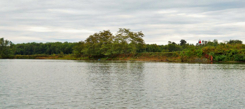
That said, would you know that there’s a wilderness area in Ohio just across
from the mouth of the Mill Creek that isn’t on the charts? It
lies just upriver from the Martin Marietta location that I mentioned in the last
journal. There looks to be a fairly large lake back there too
but I’m not sure if you can reach from the Ohio. Perhaps it’s
completely enclosed as an oxbow lake would be? I’m not sure.
What surprised me even more, however, was to find out that this was the location
of old Lock and Dam 23! The wilderness area is named after it, in
fact! You can usually see at least something of
these old locations onshore, yet everything that was here seems to have
been completely removed – much like it was back at the old #26 location above
the Robert Byrd Dam at mile 278.5.
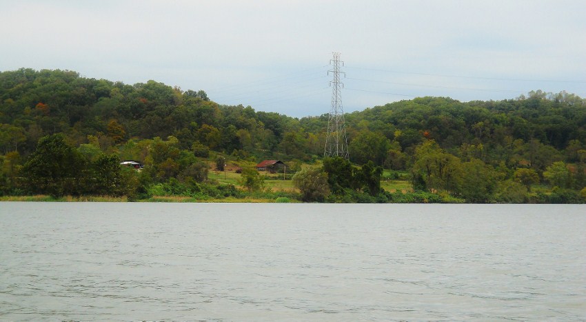
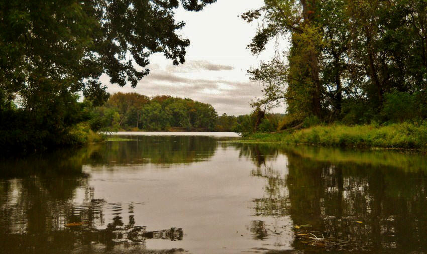
You’ll note from the pictures that the countryside out here in Ohio is really quite pleasant with its hilly farmland. There’s farmland in West Virginia too, of course, but it’s more level and when you reach a first line of RV’s you’ll note something interesting if you look at the navigation charts. Mill Creek is meandering back there and you will have come extremely close to meeting the Ohio River at about this point as you paddled out. You see, these RV’s lie on a very, very thin line of land indeed! In fact, my guess is that in not too many years the Ohio will have another island right here!
What’s more, if you look on a satellite map it appears that just after this
little line of RV’s ends – and just before the large plot of farmland – there’s
yet another body of water inland. I believe this to be an
oxbow lake, but I don’t know which stream would have created it. Was
it the Mill Creek or was it the Ohio River itself? An oxbow
lake, for those unfamiliar with the terminology, is a very interesting
phenomenon in which a meander in a river is cut off from the main stream to, in
effect, form a lake (in other words, the stream has gotten a little too fancy
for itself and closed itself in).
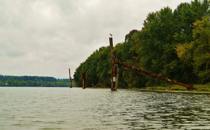
At any rate, you’ll find a light and day marker (the Ripley Light and Daymark)
just up ahead at mile 230 across from some moorings on the Ohio side.
This looks to mark the spot of an old Shelly Materials location. I
say an old location because I can’t see any sign of a business onshore
here even when I look at a satellite map. Shelly did have a
spot closer to mile 234 that I described in the last entry. Perhaps
the spot here was an old mining operation that tapped out.
I’ll try to find out… (Mike’s Run, by the way, also enters
the river here but it wasn’t paddle-able - neither were the Mill Run in Ohio at
mile 229 and the Spring Creek directly across from it in West Virginia.)
(Speaking of Light and Daymarks, why don’t they just call these things
“beacons”? I’m curious… Either that or
just completely spell it out and call them Night Light and Day Marks?)
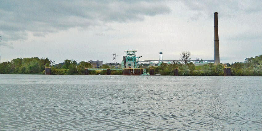
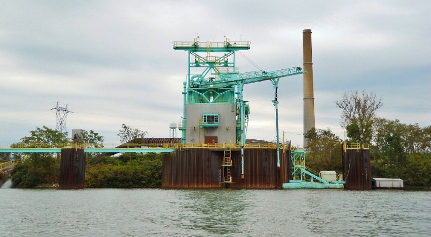
Valley Incorporated (http://www.valleyincwv.com/)
lies at mile 229.5. This is the same company that has the
pier/loading area that you’ll have passed on the Mill Creek if you came the way
I did. Valley is a lot larger than I originally thought.
Their website will show you some of the services they offer along with
some pictures of their operation, but judging from their location on the Ohio
they may have their own dedicated tugboat as well, the Dale Taylor.
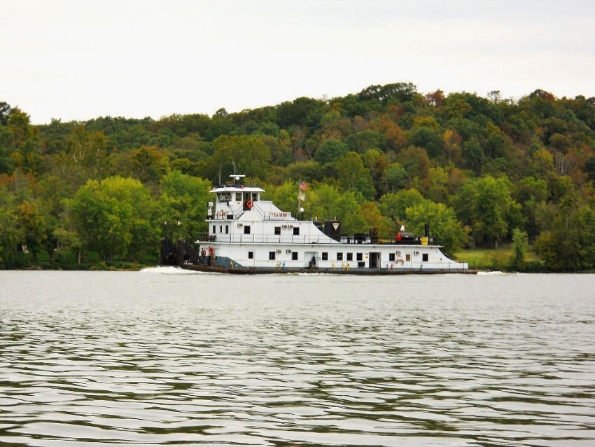
From this point I found
that the river really started to come alive as I was passed by two vessels in
quick succession followed by a third a little further up. The
first vessel, the Lydia Brent, was operated by a company I was unfamiliar with –
Kirby. Kirby is actually Kirby Inland Marine (http://www.kirbycorpjobs.com/)
and as I read more about them I’m surprised that I haven’t encountered them
before. As per the website they operate the largest fleet of
inland tank barges in the nation! They also seem to have a
very well-defined training program and career ladder for prospective employees.
The second vessel was the D. A. Grimm Campbell
Transportation (http://www.barges.us/).
I’ve become well familiar with Campbell by this point, having now seen
their boats on many occasions. They provide a wide range of
services to the industry from shipping to marine construction.
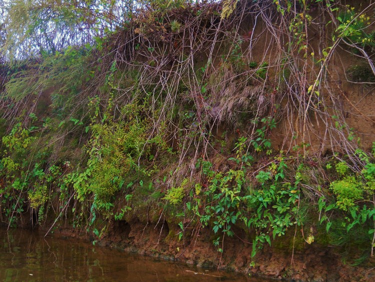
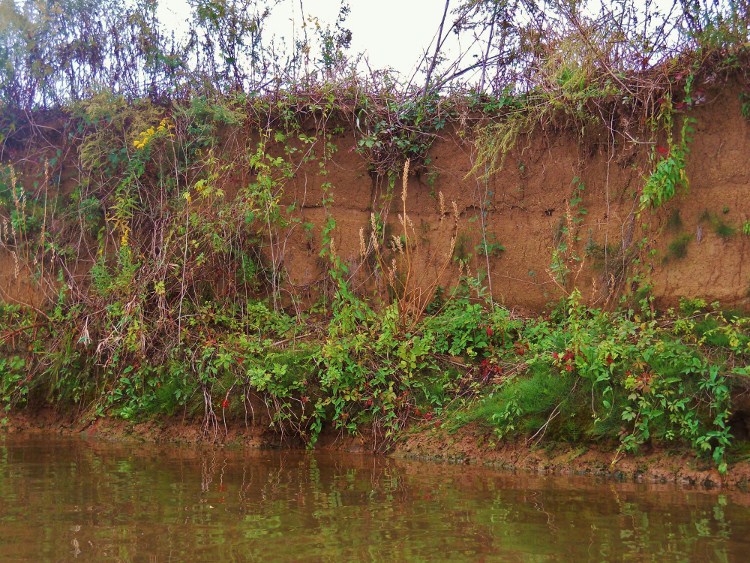
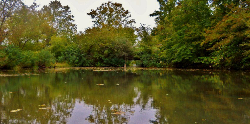
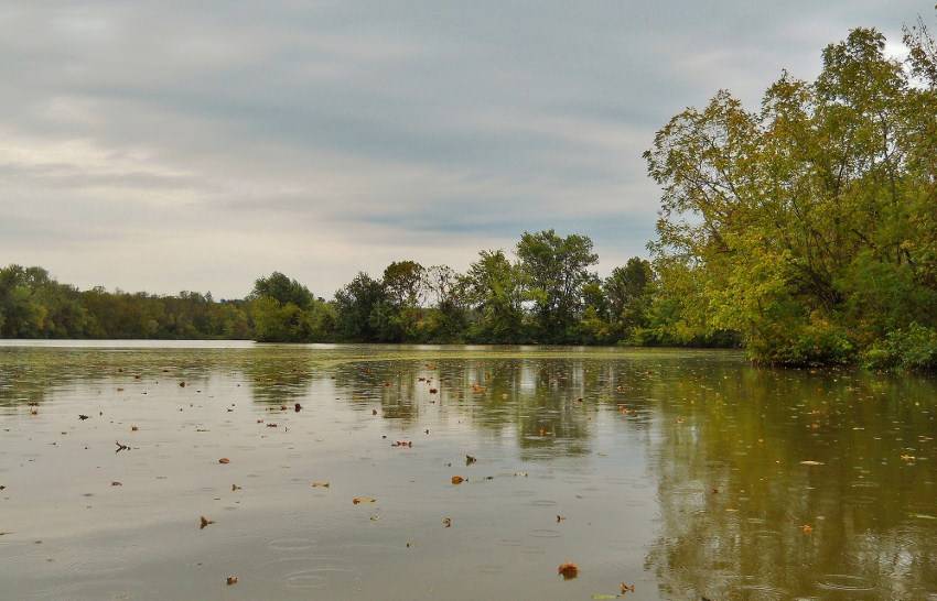
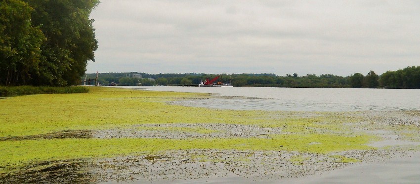
Don’t forget to check out the banks of the Ohio too. You’re
apt to find some really interesting floral environments…
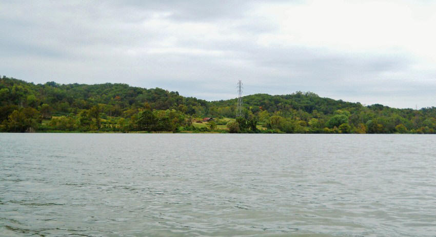
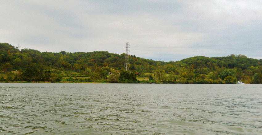
Tanners Run now enters the Ohio at mile 228 amid what has to be the most
spectacular farmland scenery I’ve seen on the river yet. Particularly striking
is that this scenery is actually visible amid the rolling hills!
Usually the land is so flat and the shoreline trees are so dense that I
can’t make anything out. Such was not the case here!
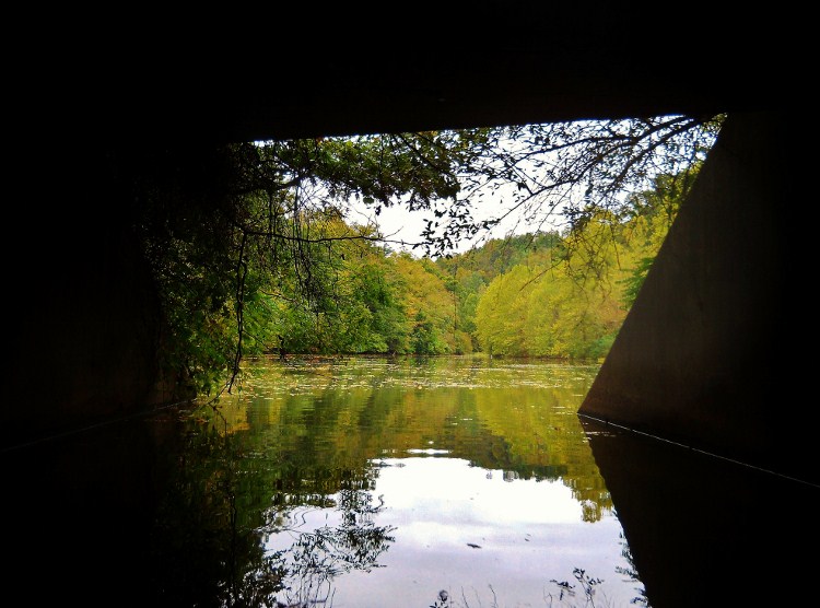
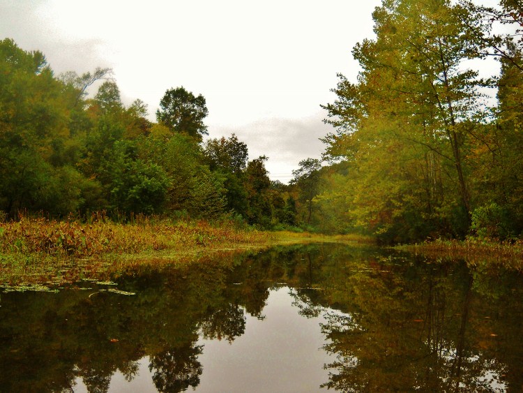
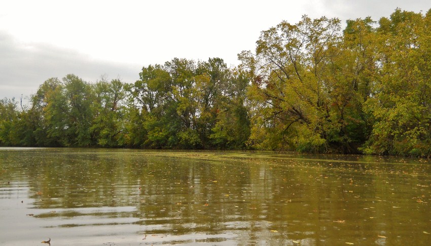
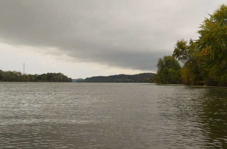
As for Tanners Run, it went back about 500 yards and it was incredibly pleasant
too - especially after I passed under a somewhat ominous looking culvert for
Route 338. A little foreboding actually came over me here as
I decided to go ahead and paddle under. There were
undoubtedly some mighty spiders living under here! The last two
pictures were taken looking back at the Ohio River channel.
Back on the Ohio you’ll
pass under two sets of power lines when you get to around mile 227.
A Century Aluminum location (http://www.centuryaluminum.com/ravenswood.php)
lies here and it encompasses almost the entire area between these lines amid the
community of Willow Grove, West Virginia. As per their web
page, the smelter Century operates here produces aluminum for the aerospace,
commercial transportation and automotive markets.
From this point it’s all about light and day markers as you’ll next pass two of
them within about ½ mile of each other. These are both on the
Ohio side and they’re both named after incoming streams. The
first is the Old Town Island location at mile 226 and the next is the Granny’s
Run at mile 225.5 with farmland in the background that stretches just about as
far as the eye can see. Alas, this scene was too vast and the
cloud cover too dense for me to get even a halfway decent picture.
That third vessel I
mentioned passed me at about this point too - the Jeffrey A. Raike of American
Electric Power (http://www.aepriverops.com/)...
As for the streams I mentioned, Old Town Creek was navigable for about ½ mile
today while Granny’s Run was not. I thought Old Town was very
attractive, yet there are signs back here which discourage you from paddling
past a certain point…
Granny’s Run marked the end of my trip today as the
rain really began to come down. Luckily there was no
lightning, but if you’re ever out on the water in the midst of a thunderstorm
I’m informed that your best bet is to find a grove of young trees in which to
seek shelter. You’ll also want to stay low to the ground.
Other than that, there’s really not much info.
I
always try to watch the weather forecasts very carefully before I go out, but
I’ve still run into thunderstorms a couple times. When this
happens I pretty much just paddle like crazy in order to minimize my time on the
water, all the while praying fervently!
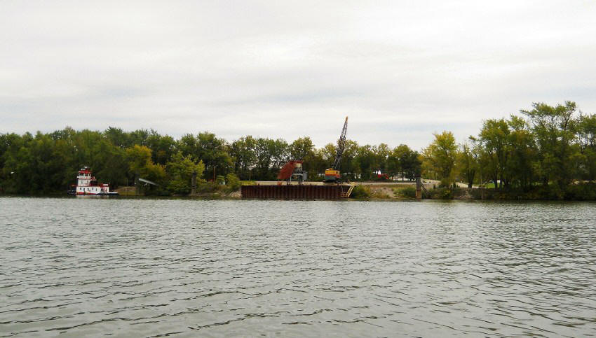
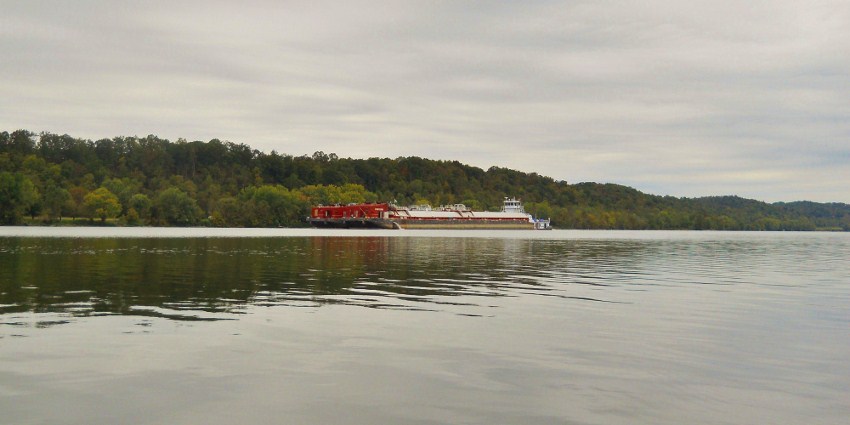
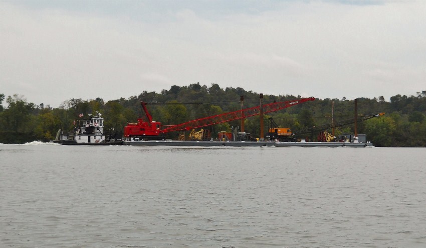
Following are some last
shots from my return trip where I encountered what I think was the same crane
toting barge that I saw a couple trips back near the Philip Sporn Power Plant in
Racine. That time it was being pushed upriver by the Andy
Mullens towboat, a vessel which is apparently operated by Madison Coal and
Supply (as per
http://www.tugboatinformation.com/tug.cfm?id=2009).
This time there were two vessels behind it pushing it downriver – the
Andy Mullins and another boat I couldn’t quite make out the name of, although I
see it had Amherst Madison insignia on it.
DIRECTIONS:
From the McDonalds in
downtown Point Pleasant, West Virginia head out of town on State Route 2 (toward
Ravenswood) and go 20 miles. Then keep your eyes peeled for
the State Route 62 intersection. (You’ll note that Route 62
will have veered off to your right earlier in this stretch – it rejoins Route 2
here). You’ll make a right and then another immediate right
into the ramp parking lot. You can’t really miss it – it’s
right there. I also saw a couple farm produce vendors across
from this point. This ramp has a good but not incredible
amount of parking. There are no facilities.