Ohio River
Forked Run (Mile 208) to Belleville Dam (Mile 204)
August 2019
Navigation Charts 165 and 166
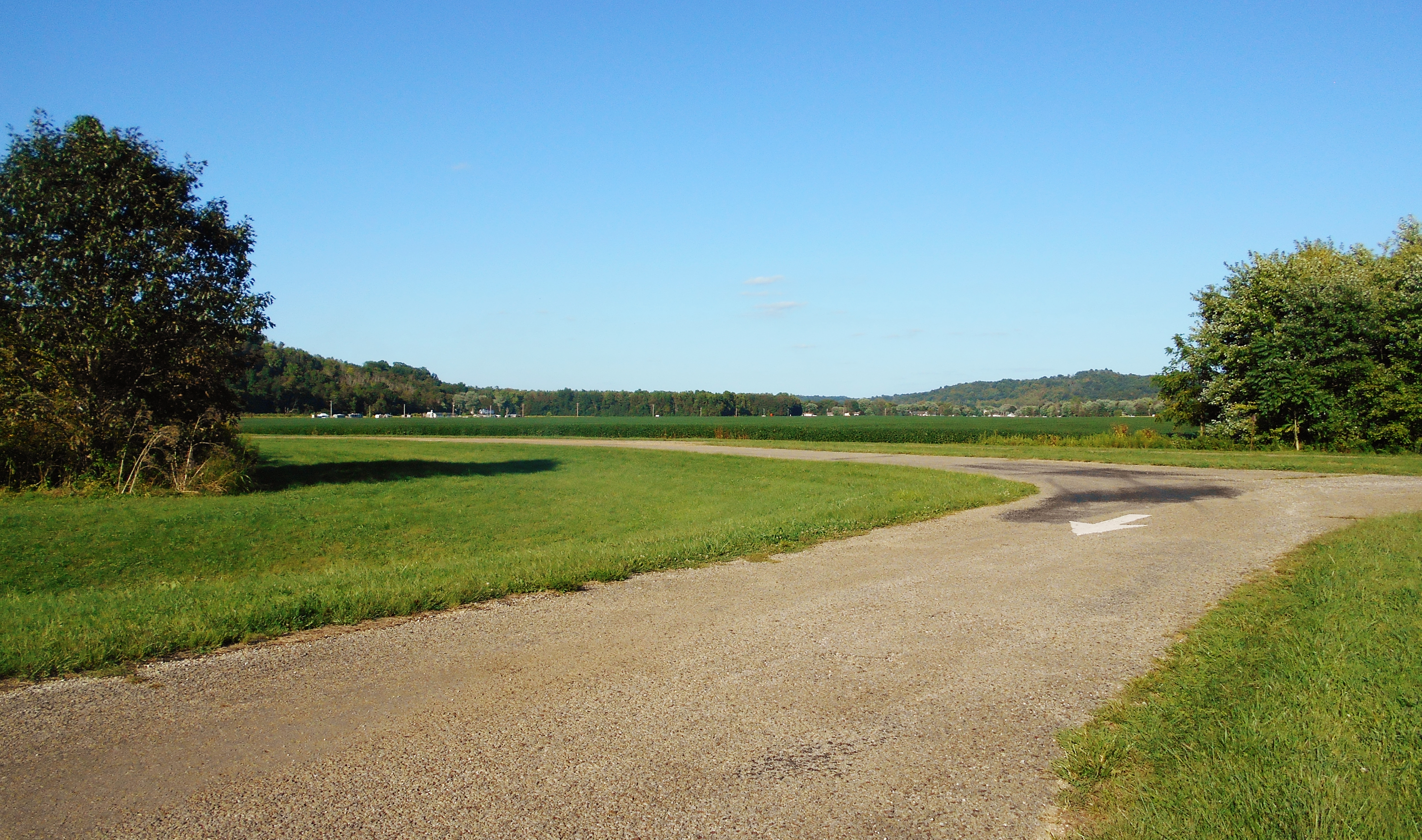
This is a relatively short span compared to some of the others, but I found it to be really peaceful in here and I thought that the Pond Creek which enters the river near mile 206 was really beautiful. As for the ramp I used today, it's technically part of the Forked Run State Park but it's not directly within that park. It's across Route 124 (part of the Ohio Scenic Byway) closer to the river, whereas the park is further inland (directions below). This ramp is in the midst of some beautiful farmland...
Once on the water you'll find yourself in the midst of a left curve in the river, an arc which will continue all the way up to the dam. I found the gently sloping banks on either side to be notable throughout this 4 mile stretch. The left bank was more of a mud/sand mix, and for 3 miles on this side you'll have a long line of houses and/or RV getaways. These appear to lie amid the community of Long Bottom, Ohio. By contrast, you'll have rocky shores on your right side which are more inviting for a break if you'd like one. Thing is, if you decide to do this I'd keep an eye out for "Keep Out" signs and for dwellings which are sometimes hard to see but are nevertheless pretty close to the shore. You don't want to be on someone's land who doesn't want you there.
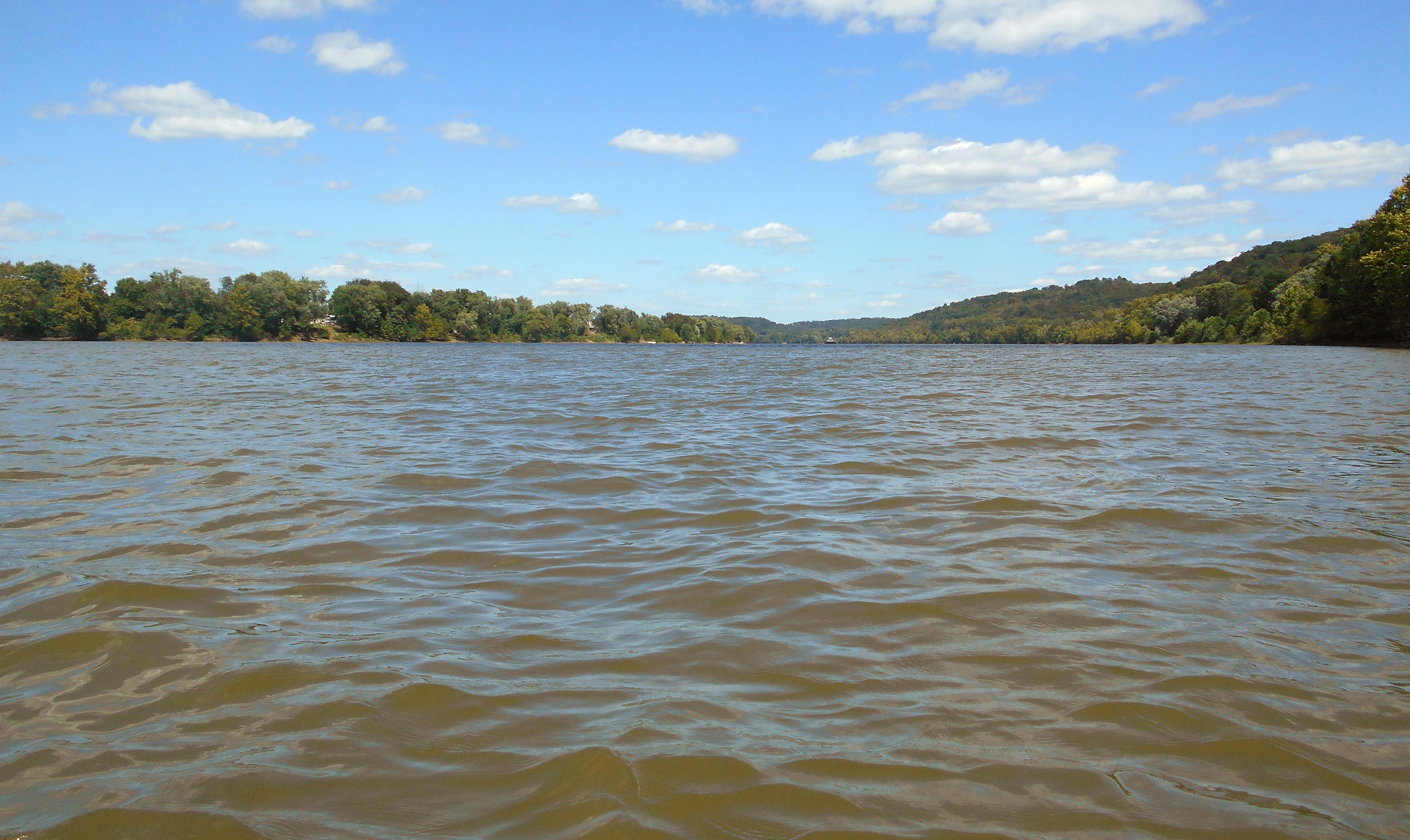
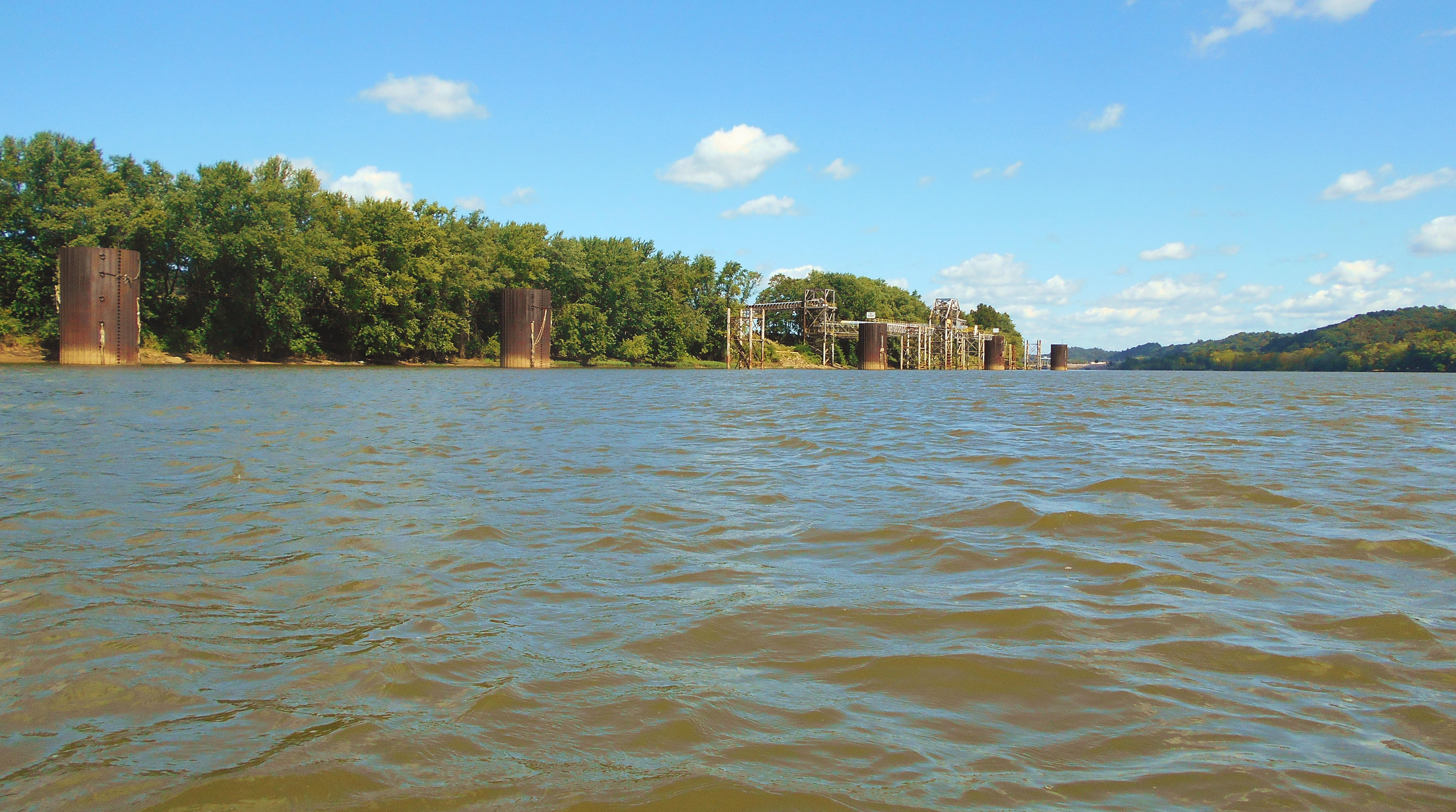
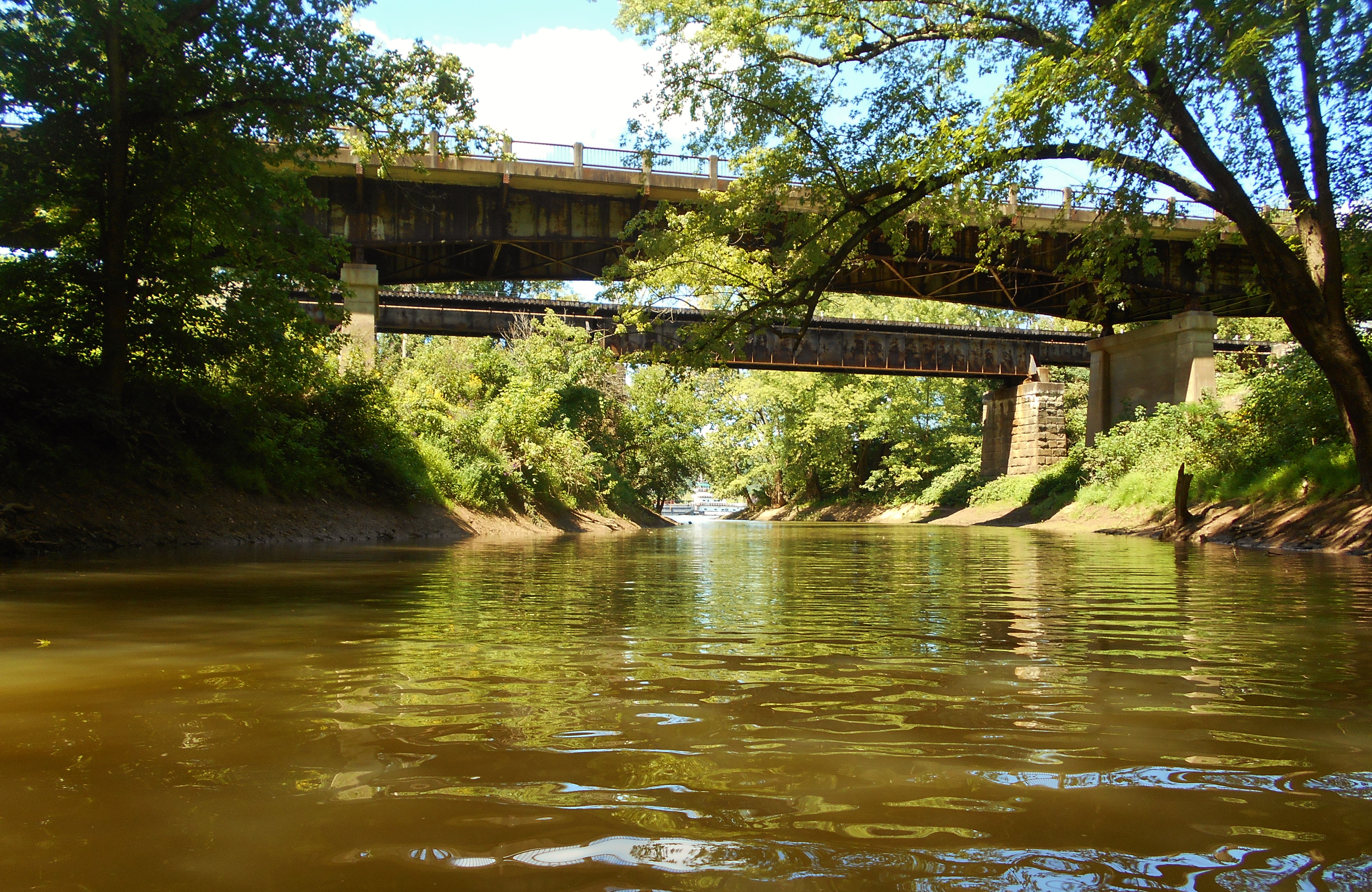
As for the Forked Run stream itself, namesake of this park? It comes in from the left at about mile 207 but it was too shallow to be navigable. In fact, I found 3 little streams on this left side but none of them were navigable. However, once the houses end on this side and you get to the Shelly Materials facility at mile 206 (pictured below) you'll find Pond Creek on the opposite side of the river. This one is a beauty!
I was only able to get into the creek about 150 yards but it was worth it! Note the rock wall/overhang as well as the very old bridge in the photo below. When I saw this bridge on the way in I had one of those wonderful "Wow..." moments! If anyone has any information on it I'd love to hear more about it!
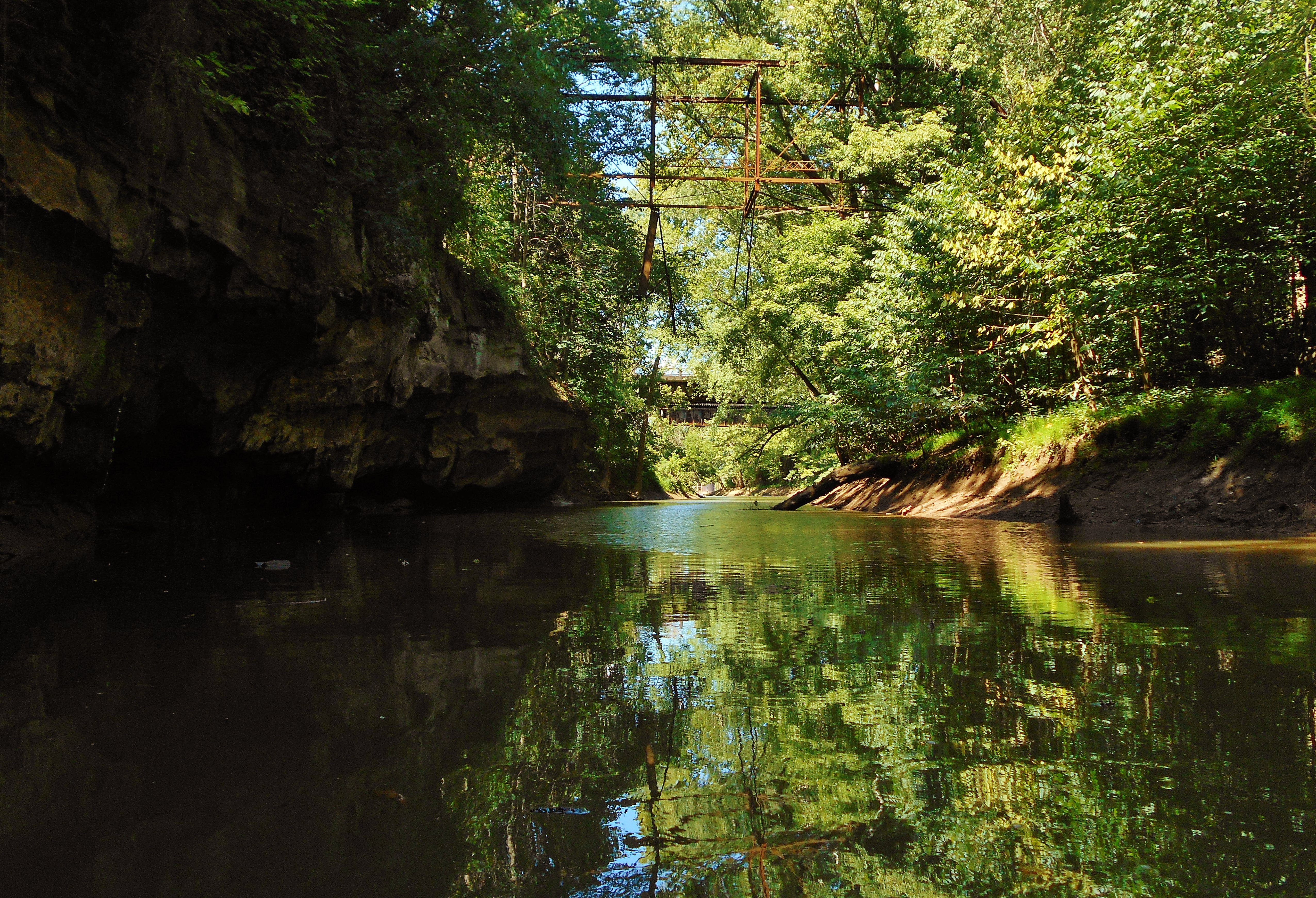
In this next photo you may be able to see the push boat in the distance. I had wanted to reach the main river in time to get a better photo, but I just missed.
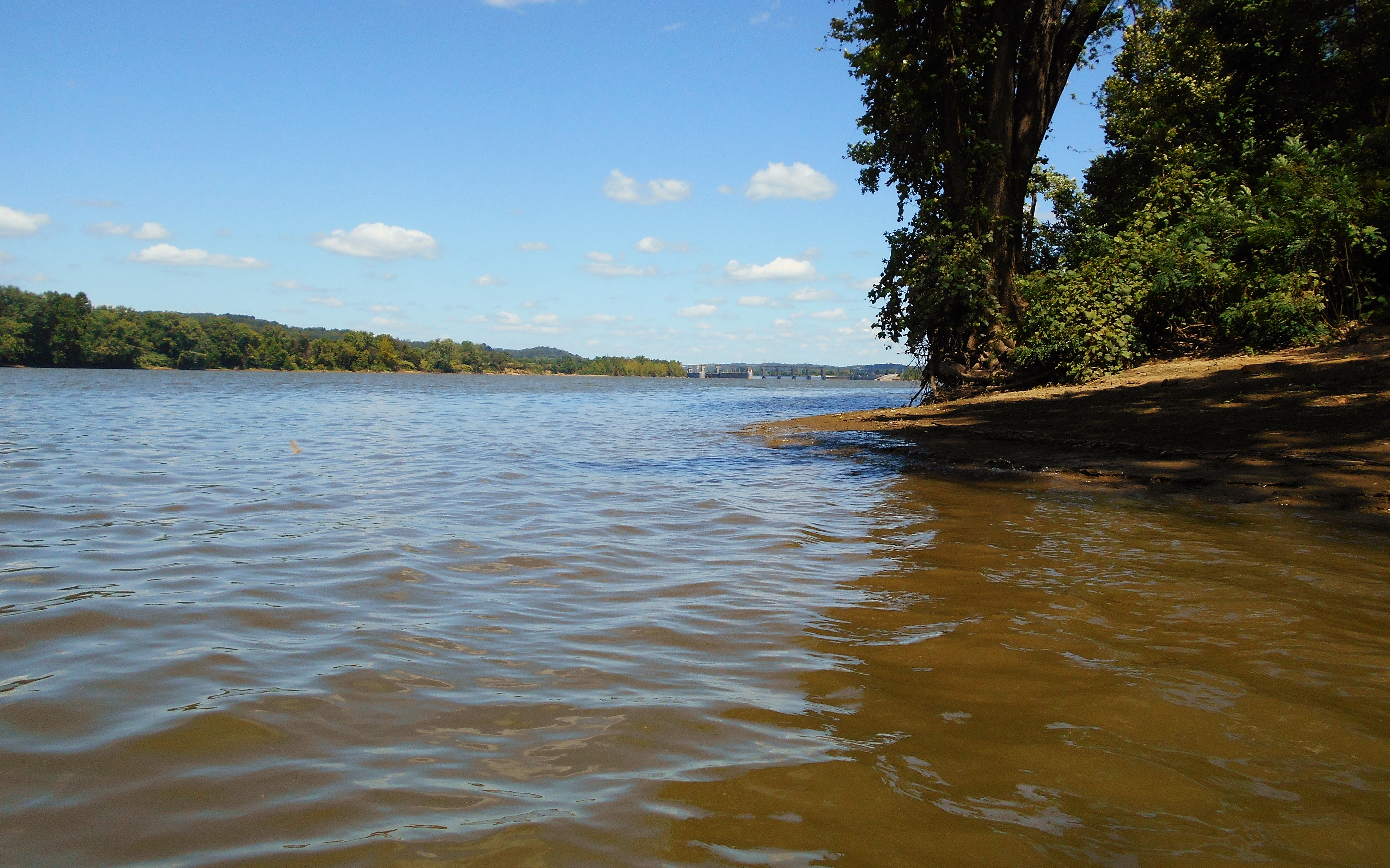
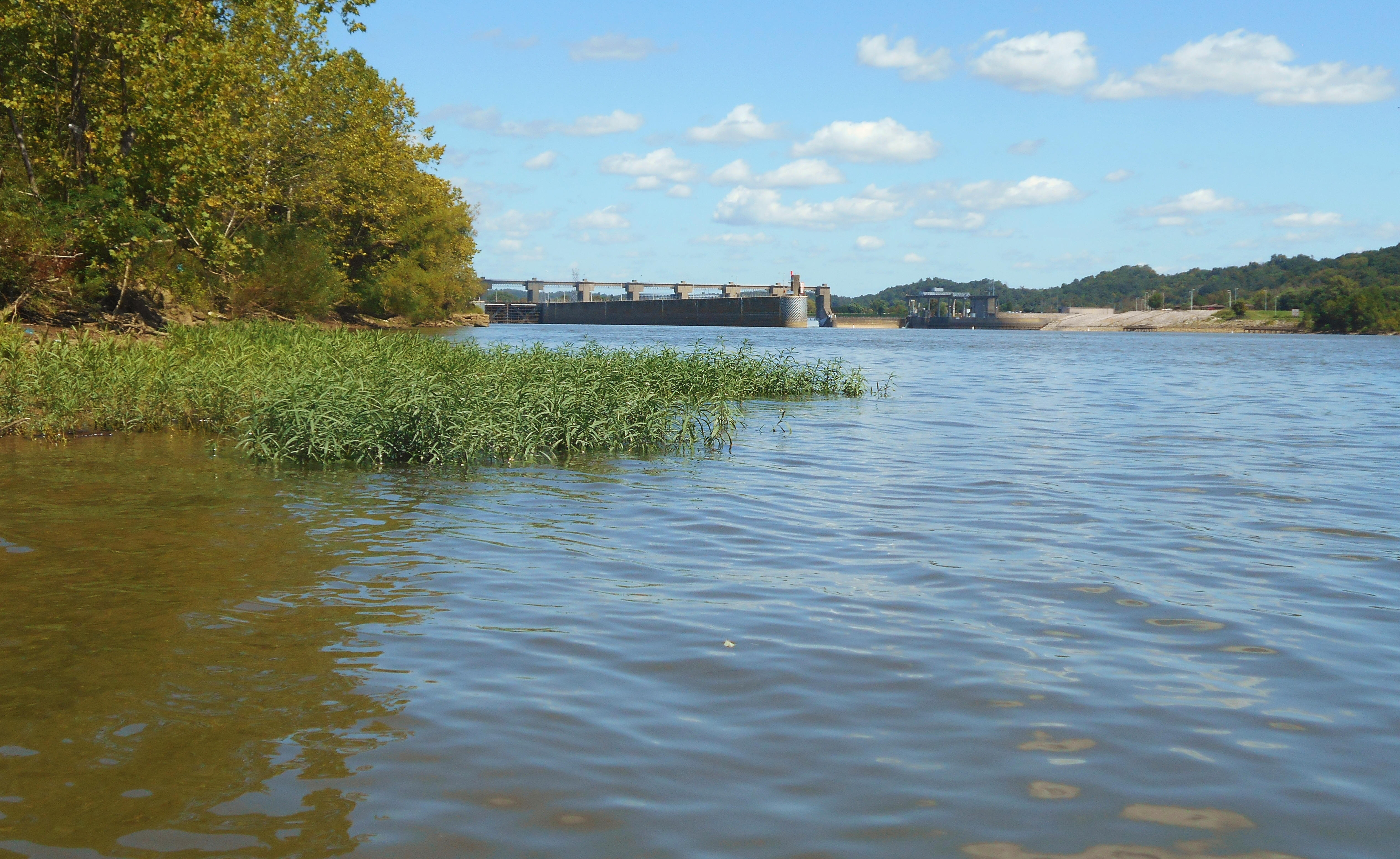
Also notable about this stream is that the Belleville Lock and Dam will be visible in the distance from the mouth (as seen in the first photo below). This dam, with Reedsville, Ohio on one side and Belleville, West Virginia on the other, is one that looks to have a fairly easy walk up to the lock (Ohio) side. On the way back home I saw a "Fisherman Access" sign and a road that would have led to about this point. The second photo below was taken on the water near the spot. I didn't take the time today, in part because I didn't know how long I'd have to wait, but this would be a great spot to watch a push boat in the process of locking through. I say this because, with the bend in the river here, you can fairly safely (as long as you hug the shoreline) reach a place that's really pretty close to the process.
This 8 mile out and back paddle would make for a nice day trip. Of course, you could always add to it by paddling some of the downriver section as well. That, or you could take in Forked Run State Park where you can swim or fish in Forked Run Lake or take a 2.6 mile hike. At the time of this writing there was this link to the hiking trails.
DIRECTIONS:
From Marietta, I took Route 7 to reach Route 124. From there I went exactly 13 miles on Route 124 through Hockingport and Reedsville to reach the ramp. Be careful to watch for the signs in here as there are some sharp turns. At mile 13 you'll find a brown sign with white lettering that directs you to your left. Just follow the road back.