.jpg)
Ohio River
Saint Mary's, WV (Mile 154.5) to the Frontier Boat Ramp (Mile 148.5)
July 2018
Navigation Charts 176 and 177
Today it was another nice put in within the community of Saint Mary's. Y'know, I think this would be a nice place to live:) They've got a nice library here, a nice park/marina and there's plenty of water to paddle too. Not only do you have the Ohio River itself but entering the Ohio in the middle of Middle Island is Middle Island Creek (say that 3 times fast!). I came out here about 3 years ago and paddled about 10 miles upstream! It was completely unexpected. You'd expect to paddle a day or more on the Muskingum River or the Kanawha, but Middle Creek?!? Apparently so!
At any rate, directions are at the end of this journal and if you're coming into town you may want to also take a side trip onto Middle Island Itself. Incredibly, there's a road bridge here which goes from the center of downtown Saint Mary's over to this 2 mile long island. It looks like you could drive your car over if you wanted but I'd suggest taking a little hike or a bike ride instead.
Today I put in and first headed downriver, to then turn around the tip of Middle Island and then head upriver. You can do it the same way or you can follow the channel upriver around the right side of the island. Either way, here's a shot of that bridge I mentioned with the heart of Saint Mary's visible ahead. In fact, that's the library you see immediately after the bridge.
This next shot is of the Hiram (or Hi) Carpenter Bridge. Wikipedia has a nice page on this bridge which was named after a man who apparently farmed some of the river islands like Middle Island. He also ferried mail across the river about 5 miles upriver in his early years. Later in his life he was instrumental in the construction of the original version of this St. Marys/Newport, Ohio bridge.
.jpg)
By this point I'd been hearing a push boat engine just on the other side of the island and I knew that I'd probably just be missing it by the time I caught up with the tip of the island. Below is what I got... This would be a nice place to simply float around for a while. It's a nice spot to watch boats go by or just watch the cars go over the bridge and just take things in. I myself am fascinated by the old abandoned red brick building at the top of the boat ramp you see in the second picture below. It's a shame it's not being used because it looks like it would be a great spot for something like a bed and breakfast. By the way, if you're a paddler touring the river and looking for a hotel to stay in there is a hotel in town but it's several blocks away and across a 4 lane West Virginia Route 2.
.jpg)
.jpg)
From here I headed upriver behind the push boat. Not far up on the Ohio side you'll see a little stream come in under a road bridge. This is Ferguson Run and it doesn't go back very far but you get some nice mileage out of the scenery:)

Upon emerging from this little stream I headed over to the side of the island where, at about the middle, you'll find a spot where they've "shored up" the shoreline a bit by putting in some boulders. Then, on the top of these, they've poured concrete. The result is that you have a fairly convenient way to get off your boat and explore the island a little. In this area I also thought the contours of the land on the Ohio side were interesting...
.jpg)
If you look at a map you'll see that Middle Island is skewed way over to the West Virginia side and once you get to the upriver tip of it you'll see another island less than a mile away. This one lies almost directly in the middle of the stream and it's called Grape (or Bat) Island. There's a sign on the Ohio side along a stretch of beach in here which indicates that this land mass is under protection as a wildlife refuge. Here's a nice website with a downloadable brochure on the islands (it seems that there are 22 of them) . It looks like the refuge's headquarters are across the river from Marietta in Williamstown, West Virginia.
.jpg)
Meanwhile, if you look on your left side in Ohio you'll soon spot the Schooster's Light andDaymark from which you'll be able to see about 3 miles in either direction in the midst of this relatively straight section of river. My interest today was primarily drawn to the Ohio side where, despite the sounds of constant traffic on Route 7, I enjoyed the plant life on the beach-like shoreline.
When you get to mile 150 you'll have reached Raven Rock on the WV side and Leith's Run in Ohio. Leith's Run has an incredibly nice waterfront park here which extends from the Ohio River back into Leith's Run and there's a boat ramp here too. Very unfortunately, this park seemed to be closed today and the ramp looked a bit overrun like it hadn't been used in quite some time. Apparently they had quite a bit of flood damage earlier in 2018 and they had to close this park. Here's the website for this recreation area and campground.
...and here are a few photo's...
.jpg)
.jpg)
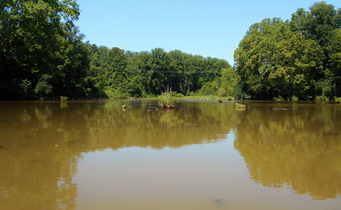
Here's a paddler's perspective from the mouth of Leith's Run...
.jpg)
I'd also like to show you what it looks like back here later in the year because it really is beautiful. I was here 4 years ago in late September and here was the view... There are some spots where you have a hard time pulling yourself away because they're so striking. This area, especially in the fall, is one of them!
.jpg)
At a curve in the river at mile 149 you'll find Sheets Run in Ohio. You can paddle back a little bit and a couple pictures lie below. You'll also find a business on the West Virginia side here although it doesn't show on my river charts. It looks like this is a Kelly Paving facility. Kelly appears to be based up in Zanesville as a construction contractor.
.jpg)
.jpg)
My endpoint for this section, the Frontier Boat Ramp, would come up next as the river straightened out on the Ohio side. This is a really nice ramp and it's actually fairly new in relation to many of the others you'll see. In this regard I find it to be very similar to the K. H. Butler Ramp down below Gallipolis and the Robert Byrd Lock and Dam near mile 285. There's plenty of parking here and they have restroom facilities.
.jpg)
DIRECTIONS:
Check out some online maps and get yourself to Saint Mary's, West Virginia. Once there you'll find a couple stop lights in town. You want the one for Washington Street (the southernmost one). Head west on Washington and go 4 blocks to a dead end where you'll then turn right. From here go 3 blocks and take a left (before the road turns slightly to become a gravel road). From here you can't miss it. It's just ahead.