.jpg)
Ohio River
Frontier Boat Ramp (Mile 148.5) to New Matamoras, Ohio Boat Ramp (142)
July 2018
Navigation Charts 177 and 178
The Frontier Boat Launch is a fairly new put-in relative to many others on the Ohio but it's outstanding. It's got facilities as well. Here's the website with complete directions and a map you can print out (Frontier Boat Ramp). Below are some pictures... I travelled from here up to New Matamoras, Ohio and back today. If you do the whole thing I'd guess that it would take you about 8 hours as it did me, but you could also just come out here and float around a little.
.jpg)
When you put in here you'll look across the river and see Kelly Paving's facility across the way and just downstream. You head away from it to get to New Matamoras, going upriver. The town will become visible after a long, straight stretch of river in which there are quite a few points of industry on the right (West Virginia) side. These are often most noticeable as docking points if you're paddling on the right side. If you paddle on the left side you'll be more apt to see more of the businesses themselves but it seems as if you'll see a docking point about every half mile. As a result I saw several push boats with barges in here today even though I wouldn't necessarily classify this section as being especially crowded.
As you get about 1/2 mile upriver around mile 148 you'll see a couple old barges on the Ohio side that have been left to rust on the shoreline and not much further up you come upon another. This is a really interesting spot that appears to have once been some kind of business. In fact, there's a little unnamed cove here that you can paddle back in a little way.
.jpg)
Ben's Run is almost just across the river from this point and this little creek would come to be the longest I'd find in this section today. It doesn't go back too far though - maybe about 400 yards. I stopped at a viaduct going under some train tracks. The picture below was taken as I was coming out of the stream. It was pretty shallow overall and the algae at the bottom was pretty well visible.
.jpg)
It was at this point that I'd see my first push boat (the Luciana Moore of Murray American) around a docking point at a spot the navigation charts refer to as the Inorganic Materials Division of FMC Corporation. This was the first time I'd seen a Murray American vessel and I can't find out much about them other than that they appear to be headquartered in Monessen, Pennsylvania. For it's part the boat seemed to be quite busy. At first it was working at this point, then it passed me heading downriver and when I got back to the ramp at the end of the trip it passed me again going back upriver.
As for FMC (or Food Machinery Corporation) it's website (here) states that the company was begun by a gentleman named John Bean who seemingly wanted to create a better way to disperse insecticide. His efforts resulted in the creation of a continuous action spray pump that he peddled behind his house. His business grew from there with acquisitions of other companies to become the global chemical conglomerate it is today.
At mile 146.5 you'll have a view of what for me has become a real treat on my river trips - the site of an old lock and dam. In this case it's old number 16 on the Ohio (left) side. I'm fascinated by these and I don't look at the navigation charts too closely before I take these trips because I like to be surprised by the sight of these old structures. Here you can still see the old drive down to the water and what's more is that one of the old lock houses has been kept and it's actually been made into an residence. I thought it was fantastic!
.jpg)
On the West Virginia side you'll now be nearing Huffman's Creek and a Dominion Energy facility. As you can see I barely got into the creek but I thought the view was nice. In fact, I always try to enter streams no matter how small they are because I either get a great scene or I get a chance to view some wildlife.
.jpg)
There are some more docking points up ahead now for Momentive Performance Materials which looks to have a fairly large presence here. According to Forbes Momentive is holding company in the chemical industry that develops high performance resins and silicons for many applications and business uses. Their website is (here).
.jpg)
Upriver you may be starting to see some signs of life with the towns of New Matamoras on the Ohio side and Friendly on the West Virginia side with little Grandview Island in the middle. The shoreline in Friendly is a long string of docks from which originated quite a few boats and jet ski's today. This is a pretty large, open area which is clearly a favorite for recreation.
.jpg)
New Matamoras as a community stretches out pretty far and as I got closer to the island I noted some more abandoned barges on the shoreline. There were 5 or 6 of them and I assume they help reinforce the shoreline from erosion. From what I now understand the reason I was seeing so many of these was that this area was once a thriving shipping point on the river and New Matamoras is clearly a town that values it's history. This is evidenced by this nice webpage constructed by their Historical Society (here). Here's a couple more pictures of the area...
.jpg)
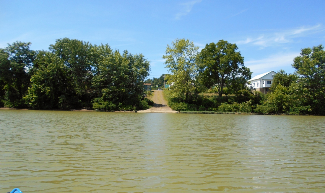
Here's a photo of what the ramp looks like. From the stoplight you see it would appear that this ramp extends from the heart of downtown although I don't get the feeling that there will be a whole lot of parking available.
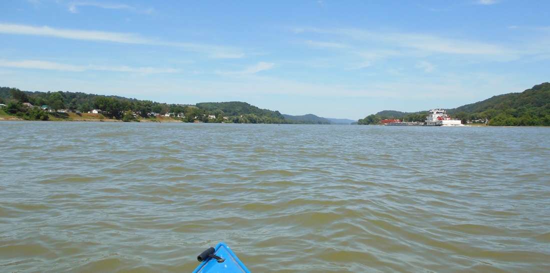
On my way back I encountered quite a few push boats. First was the Marathon vessel you see in one of the pictures above, then there was the Buck Johnson of Imperial Towing in Imperial, PA. Following these was the Linda Little of Crounse Corporation headquartered in Paducah, Kentucky. Then the aforementioned Luciana Moore of Murray American and finally the vessel below back at the ramp, the Tom Bigbee. I recognized the logo of the company (a white beaver on a red stripe) but I couldn't remember the name of the company even though I'm sure I've encountered them before. More information about most of these boats can be found at Dick's Towboat Gallery which is a fantastic website.
.jpg)
DIRECTIONS
I posted a link at the beginning of this journal which has directions but according to this site:
"From Marietta: Drive 7 miles north on State Hwy 7 (Ohio River Scenic Byway). The facility is located on the right less than 2 miles miles beyond Frontier Middle & High School."