.jpg)
Ohio River
Witten Towhead (Mile 135.5) to Hannibal Lock and Dam at New Martinsville, WV (Mile 126.5)
August 2018
Navigation Charts 179 180 and 181
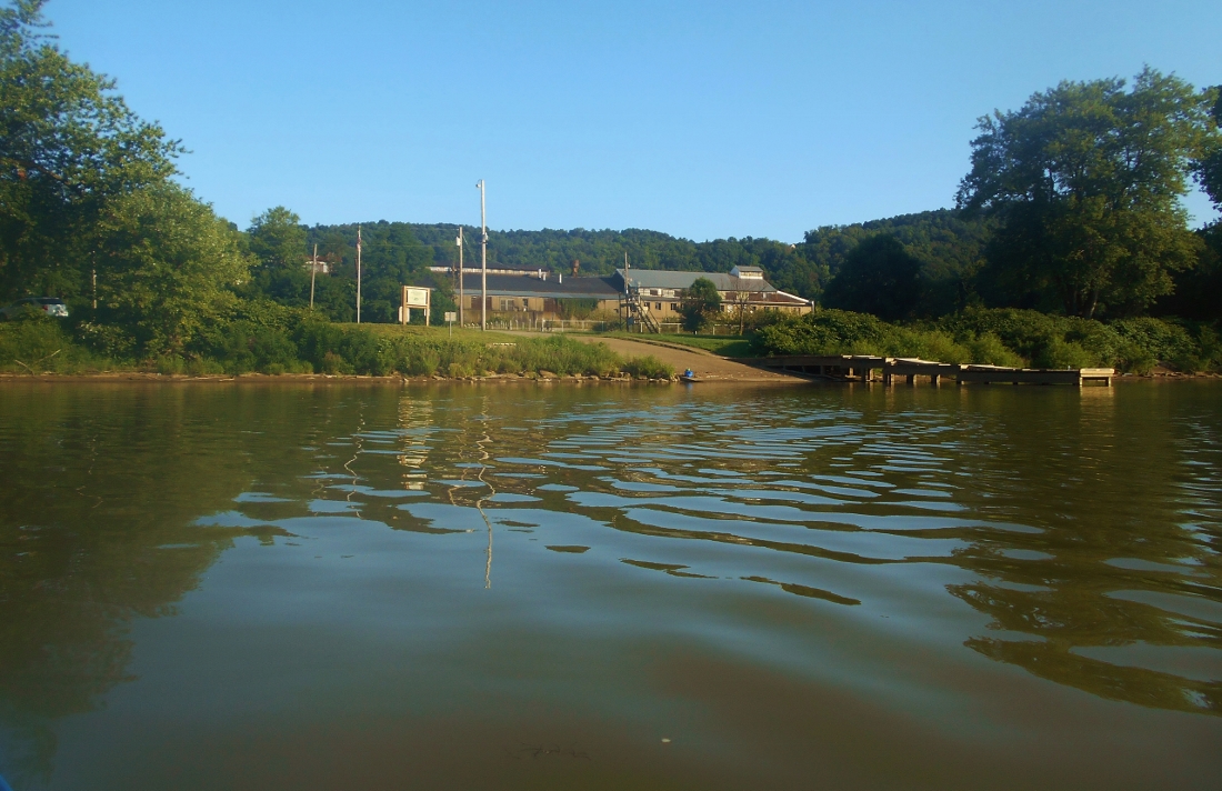
In this section you have a few choices as far as put ins. All are good ones that I'll describe herein, but today I chose the one in Paden City, West Virginia's riverside park. As I was getting my gear ready I met with the scene below, and once on the water I paddled downriver, went around the towhead and then headed upriver to New Martinsville. You don't have to do all this, of course. You could just paddle up to New Martsinville and back. In fact, you could paddle Fishing Creek alongside New Martinsville alone. It goes back 3 1/2 miles for the flat water paddler.
At any rate, Witten Towhead lies just downriver from Paden City at mile 135.5. I actually had to look up exactly what a "towhead" was. Webster's defines it as a "low, alluvial or shoal in the river." It looked to me like a small island and, turning upriver from here, you'll find that Williamson Island comes next. I found this to be one the most hospitable looking islands I'd yet encountered on the Ohio River. The entire left side (looking upriver) is almost one continuous beach. Here are some scenes from around these two landmasses.
.jpg)
.jpg)
.jpg)
.jpg)
Once you reach the upriver tip of Williamson Island you'll have also reached Paden City. There's a great write-up on the history of the town here (history) and included in this write-up is some background on the park (the William E. Ford Park). For a town of this size the complex is quite large. In fact, it runs nearly a mile along the river. I was here a few years ago and they also had a campground with some RV's parked. I didn't see any today, however, so I wonder if the park is still being used for this purpose. I am also very intrigued by what looks like an old factory building here. You can see it in the background.
Next comes Paden Island at mile 133. It's shorter than Williamson Island at just a hair over a mile long and it looks like it's being reinforced with large rock piles on the shoreline similar to the way Blennerhassett Island is down in Parkersburg. At the upriver tip of the island you'll see the community of Sardis, Ohio on the left side. This is a nice little town. I remember driving through it to reach others points on the river and I always recall it as looking like a classy place to live. It doesn't look like they have a public ramp here, however. Here are a couple views of this area.
.jpg)
.jpg)
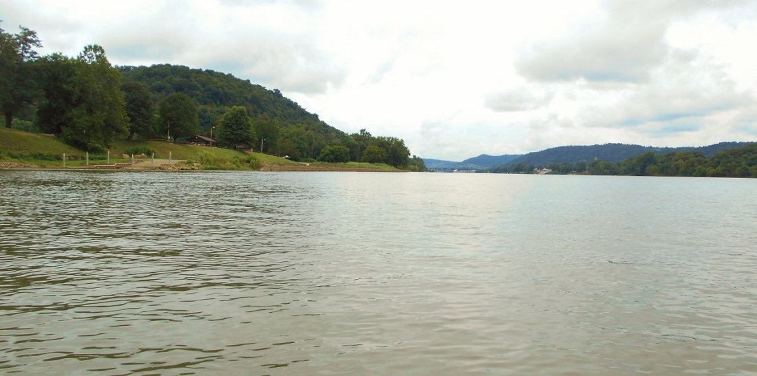
From this point on you'll mostly be in the midst of a left curve in the river on up to the dam. There's clearly some nice farmland on the Ohio side that you'll occasionally be able to spot glimpses of (in fact, it appears there's a golf course up there - Fairway's Riverside Golf Course). There will also be a couple rocky shoals where little streams come in.
.jpg)
Then at mile 130 you'll see a large line of RV's on the West Virginia side at Mullett's Campground followed by what the navigation charts indicate as being a Lhoist North America facility on the same side. The company's website appears to be down as I compose this, but according to Bloomberg the company extracts, manufactures and supplies lime, limestone, dolomite and clay products. This particular location appears to be doing quite well since I've noticed sustained activity here both times I've been on the river in this area.
From here things start to get really interesting. You'll be able to see New Martinsville up ahead, and on the Ohio side you'll spot some stairs heading up the bank to the store at the golf course. According to a sign boats are welcome and you can buy hot dogs, snacks, ice, pop and beer! :)
Just a little further up you'll see another boat ramp. This is actually on the site of another fascinating old lock and dam - in this case old number 15! This time they've made use of the old facility as a road rest stop/park which is a perfect use for one. I've not seen one repurposed in this manner since old number 27 down in Proctorville, Ohio near Huntington. If you check out the pictures below you can see where the old lock chamber was. In fact, you can even see the lock wall itself just above the surface of the water. In the second picture you can see the new lock and dam (Hannibal) up ahead in the distance with New Martinsville visible on the right. You can even spot the Wetzel County Courthouse building's spire in particular which is a pretty sight on the river. NOTE: I put in here in 2021 and I can tell you that this is a great place to do so. They also have restrooms which I've always found to be open. If you type or cut and paste "Ohio River Lock and Dam 15 Wilderness Area" into Google Maps you'll see it.
.jpg)
I can't find too much online about the history of New Martinsville but it looks like you can find out more by visiting the Wetzel County Museum which lies right off Main Street in town. I'll bet it would be nice to get a tour of the courthouse as well. It looks like a classic. More on the city can be found on their government website (here).
.jpg)
.jpg)
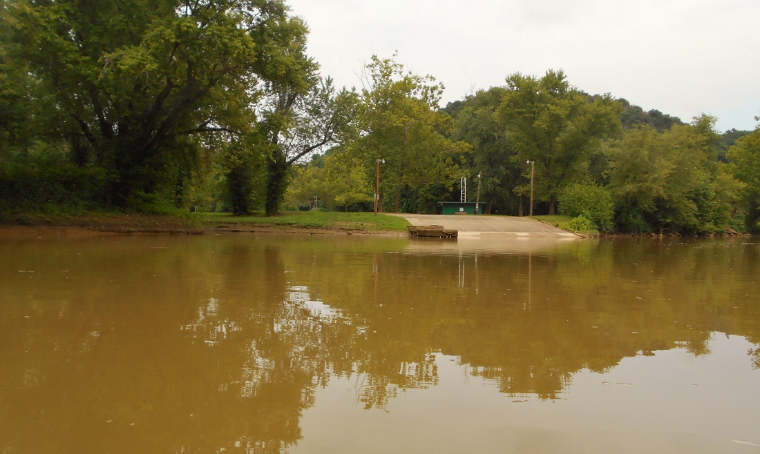
At this point it was time to explore the creek which enters just downriver from town at mile 128.5 - Fishing Creek. The way it enters is reminiscent of the way the Little Kanawha River enters alongside and downstream of Parkersburg as well as the way the Kanawha River enters at Point Pleasant. There's another boat ramp not too far back into this creek too, and in 2021 there were a lot of people camped here for the Back Home Festival. This ramp (pictured below) lies between the second and third bridge. Thus, you have 4 possible put ins out here. This one, the one at the old lock and dam, the one in Paden City and there's also one just in front of the courthouse in downtown New Martinsville.
Just past this ramp you may notice a swamped boat on the right side. Things like this always make me wonder as to what went wrong. It looks like this was a really nice boat at one time! Anyway, the view below is typical of this stream where you'll find that a railroad will follow you along the right side almost all the way. At about the 3 mile mark there's a concrete overlook on your left side that appears to be on the grounds of the Wetzel County 4H Camp.
.jpg)
As I mentioned before, I got back in about 3 1/2 miles in 2021 and here I met a couple young guys fishing on the shore at a point where the stream makes a right curve and leaves you looking at some riffles along a straightaway (below was the scene). One of the guys was kind enough to suggest the best way to portage, but I decided to head on back. I appreciated the advice nonetheless.
%20(1000x647).jpg)
Check out who posed for me here:) I've seen these kinds of ducks/geese on the side streams before but I thought this was pretty cool. These black and white, red billed birds are actually known as Muscovy Ducks and are said to be native to South America.
%20(1100x628).jpg)
Returning to the Ohio River I'd mention just a few other things. Two of these are businesses. There's one right across the river from New Martinsville on the Ohio side although the charts don't mention it. I'll try to find out what it is. The other business is a Martin Marietta Materials location in West Virginia just before the Hannibal lock and dam. I would also mention the Magnolia Yacht Club at mile 128. It looks like it's been around for quite some time. Apparently the community has a long history with boat races that were centered around this club. Lastly I'd like to mention the bridge that spans the river just before the lock and dam. According to a Wiki article this bridge is alternatively known as the New Martinsville or Korean War Veterans Memorial Bridge. I can't find much more information than that.
On my way back I had a string of push boats pass me by. Much to my chagrin, however, the pictures from this point had moisture blots in them. This was doubly unfortunate because the sun had come out and my pictures - especially at the old dam - would have been much better to post. Anyway, none of the boats that passed me were more interesting than the tandem working below. As I saw them coming toward me I only saw the one in front at first (I couldn't get a name). It was the first time I'd seen a boat pulling instead of pushing. Then I saw the one in back - the Bernard P of McDonough Marine Services based all the way down in New Orleans. I thought it was pretty cool to see the teamwork although I have no idea what it is they were transporting.
.jpg)
DIRECTIONS:
Get yourself to Paden City, West Virginia. There is only one traffic light in town. Head west toward the river and the road will end at the park after you go several blocks. This is a large park. You'll see ball fields all around you. You'll want to head all the way back to the left where you'll find the ramp. There are facilities here but they were locked when I arrived which I found surprising. They were locked all day. Please anticipate that this may happen if you come out here too.