.jpg)
Ohio River
Pipe Creek (Mile 105) to Moundsville, WV (Mile 102)
October 2016 and 2021
Th
.jpg)
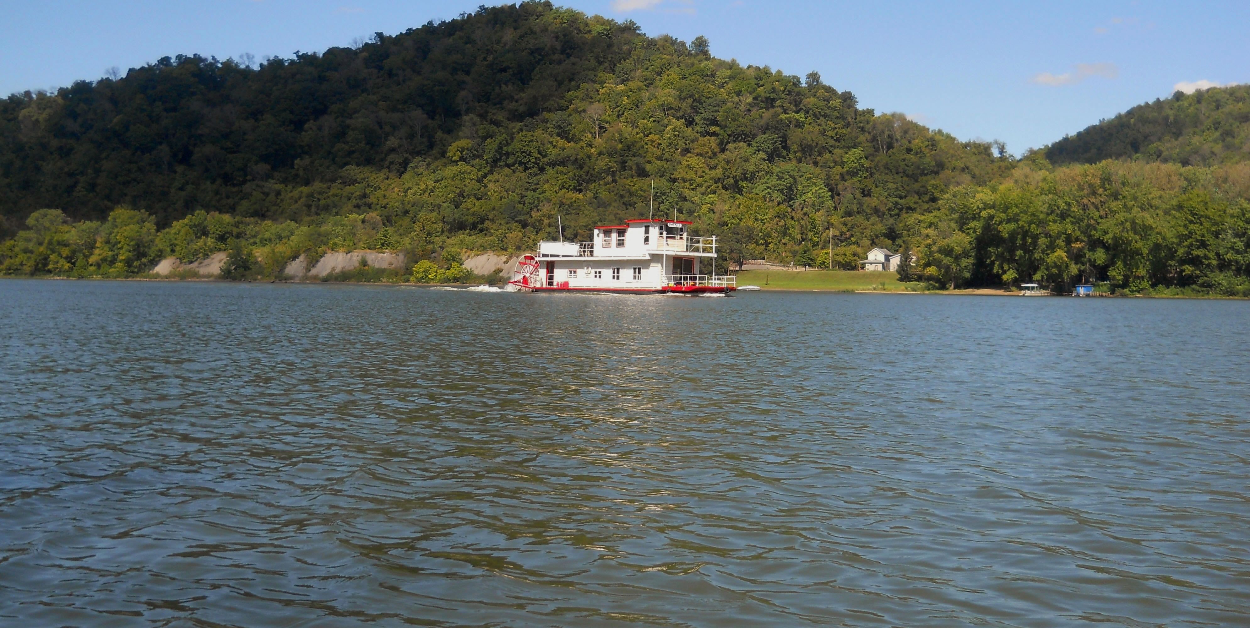
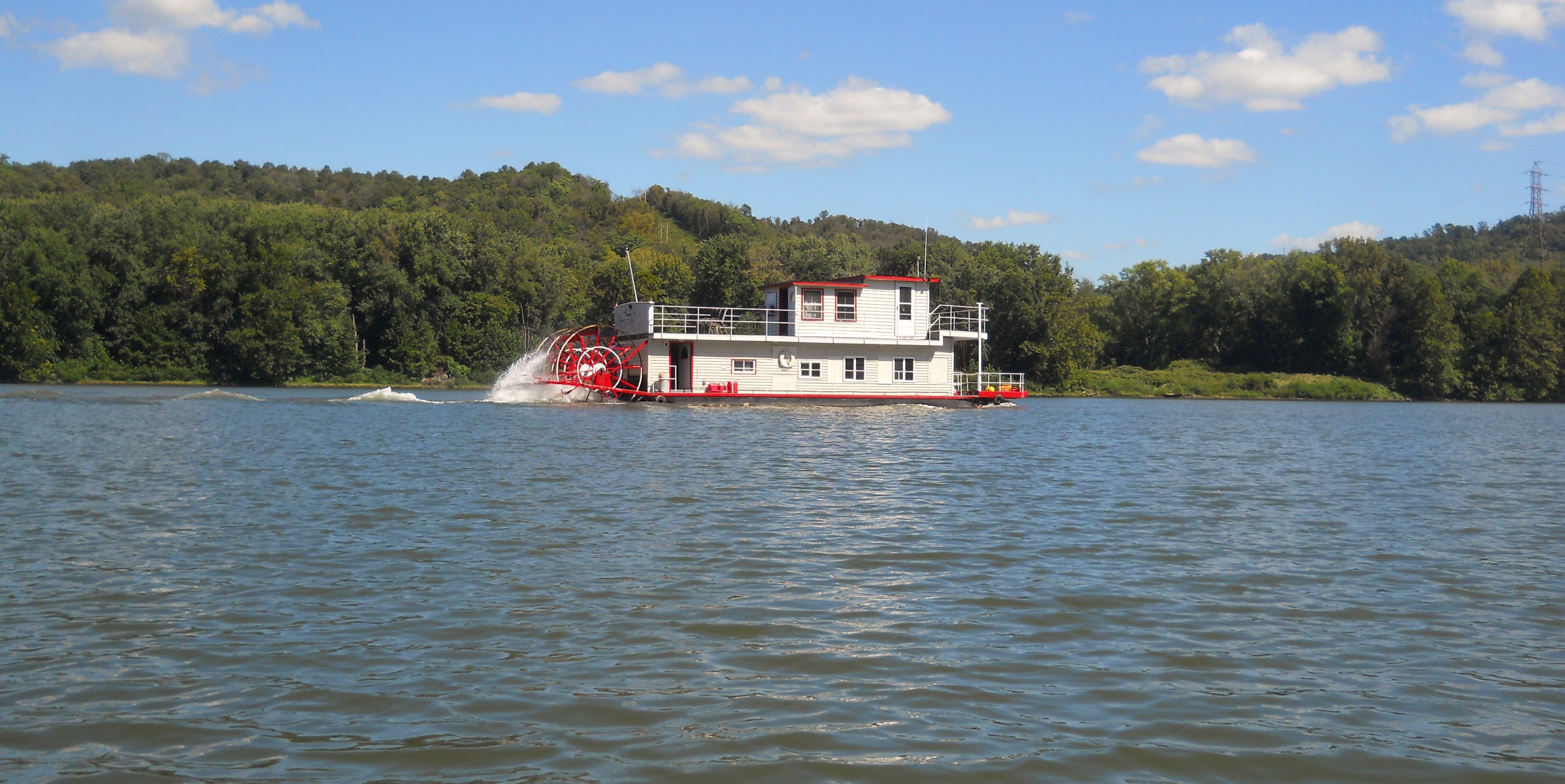
As you begin on the Ohio, you'll find a large Williams Companies gas operation up on your right side for about the first mile, while on your left side in Ohio you'll find a series of abandoned river operations all the way up to Moundsville. The first is notable for what looks a large wall of sandpiles near the mouth of an unnavigable Lockwood Run. The charts have this as once being the Mahaffee Boat Dock. Below are some photos which include a sternwheel that passed me in 2016. I couldn't catch the name, unfortunately. If anyone could tell me I'd appreciate it. My email address is at the bottom of my "About Me" page.
.jpg)
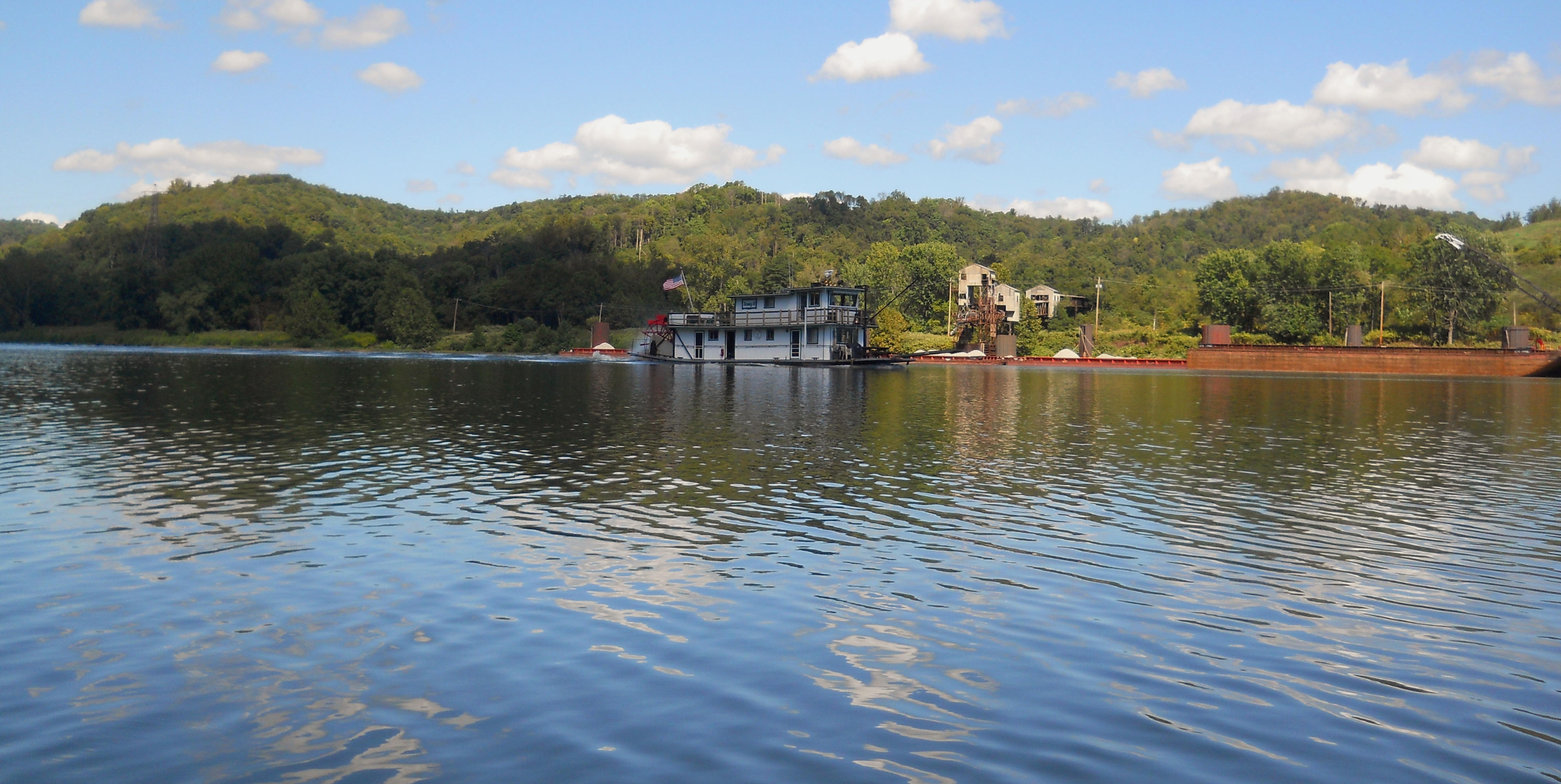
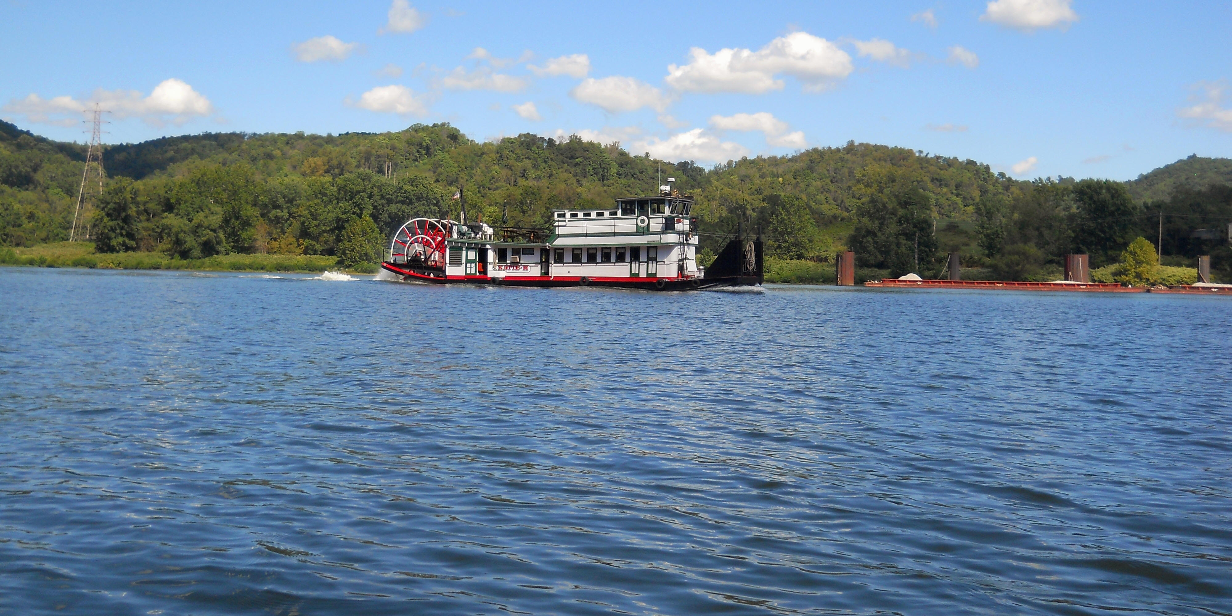
Another abandoned business (Anchor Construction accoring to the charts) lies after this at mile 104, and quite a bit of the riverside operation still visible as per the photos below. Two more sternwheel boats passed me here in 2016. The first was the Jenny B in the second photo. This one was apparently from Rayland, Ohio according to the link, and it was followed by the Katie H. in the third picture. Katie looks to originate up by Pittsburgh. :)
.jpg)
Just past the old Anchor Construction site you're likely to find a submerged barge at yet another abondoned river operation (Burrell Industries as per the charts). There's another abondoned line of mooring cells here too, and the photo below being taken looking downriver as the Stacy Lynn of Imperial River Transportation passed. Imperial is on Facebook.
.jpg)
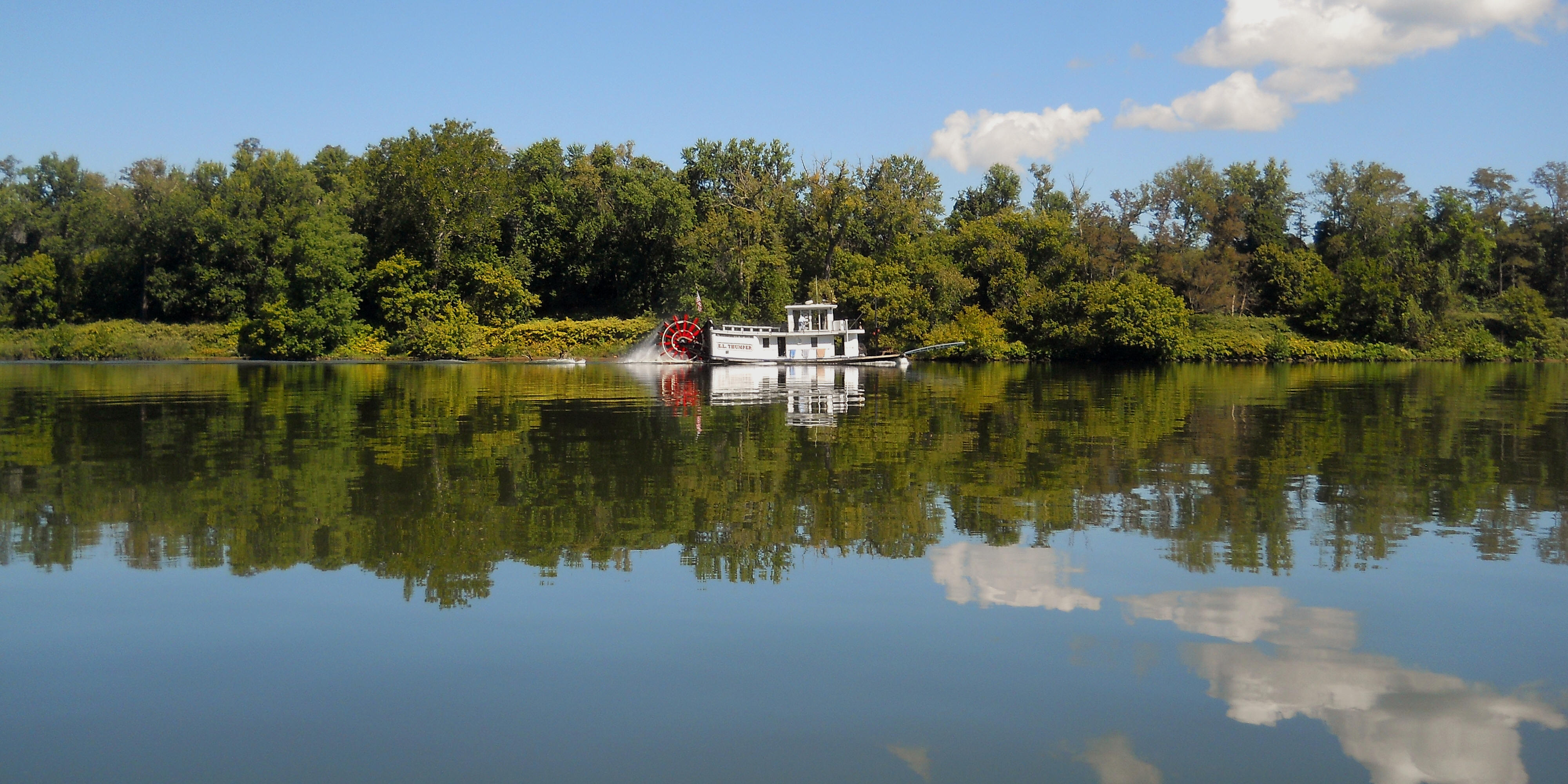
Amid all this abandoned stuff I did notice that quite a variety of plants and trees were reclaiming the area, and at one point a line of young trees reminded me of an orchard. The E.L. Thumper sternwheel passed me in this area and it was a pleasant scene to contrast with another spot. You see, vines can seem pleasant enough, but they can kill trees when they climb up and completely cover them to block out the sun they need to survive. Even if that doesn't kill a tree, the sheer weight of the vines themselves can still pull it down. I've noticed on my hikes that thorned vines have popped up everywhere in the last few years and that they're of the kind which will eventually do this.
.jpg)
.jpg)
Just as you reach yet another line of abandoned mooring cells, you'll have the city of Moundsville directly ahead at a point where the river curves sharply left. These mooring cells once belonged to the R. E. Burger Power Station which closed here in 2011, and while almost nothing remains of it up on shore there's still plenty visible on the river. This must have been quite an operation. It extended for at least a mile along the shoreline.
.jpg)
On the opposite side, the Big Grave Creek comes in just prior to reaching Moundsville. It goes back exactly one mile, at which point it splits. I found this stream to be popular with fishermen. I passed a couple at the beginning and a couple back near the end who told me that a turtle had been caught just prior to my arrival - not exactly what they were hoping for. Anyway, once you reach the end and you look to your right your eyes will meet with the peaceful scene in the first photo, while continuing to your left you'll see a couple old bridge spans just prior to the end of navigability in this direction.
.jpg)
.jpg)
.jpg)
Once back at the Ohio River you'll have those mooring cells I mentioned across the way along with the blue Moundsville Bridge front and center. The ramp I used is right up there beside it, but before reaching that point you'll have an active Ohio Valley Aggregate location (a Yager Materials affiliate) along with the Prima Marina (on Facebook). All this adds up to a pretty busy area even without the abandoned power plant. I can only imagine how busy this spot must have once been! The first photo below was taken from the mouth of Big Grave Creek while the second was taken from the Ohio side.
.jpg)
.jpg)
Next, as you approach the ramp, you'll want to be careful. Not only is there a marina on either side, but I've found this ramp to be popular on the weekedays that I've come. On a weekend they'd surely be even more popular. That said, if you find the ramp to be in use you do have another option. There's a paved area just to the right of it down by the water. You can take out here pretty easily if you wish. I've done this. In fact, you can actually drive half way down the ramp and then turn into a paved area to park your car as you put your boat on. This is the first ramp that I can remember that has such a feature.
Something else... I didn't realize it until looking at the charts just now, but apparently a ferry boat used to cross the river here and drop off passengers,! More information about the history of this Moundsville/Dilles Bottom Ferry can be found here and I'll see if I can spot the old ramp on the other side of the water in the next upriver section.
.jpg)
.jpg)
DIRECTIONS:
The ramp in Moundsville is located within the town's park. If you're driving over from Route 7 you'll take a right after the bridge and then another immediate right to reach the ramp which you'll find straight ahead. Otherwise, I'd look up "Moundsville Riverfront Park" on Google Maps to get directions.