July 16, 2008
Middle Fork
To get to the Middle Fork today I paddled upriver about 3 miles. This is because the closest ramp to it is in Beattyville at a point on the river where the North and Middle Forks have already converged. Thus, I’ll be re-paddling some of the area I covered on the
Anyway, when you reach the convergence of the North and Middle Forks you’ll notice that the one on the left (the North Fork) is a bit larger than the one on the right (Middle Fork), and as you enter the Middle Fork you’ll have farmland on each side.
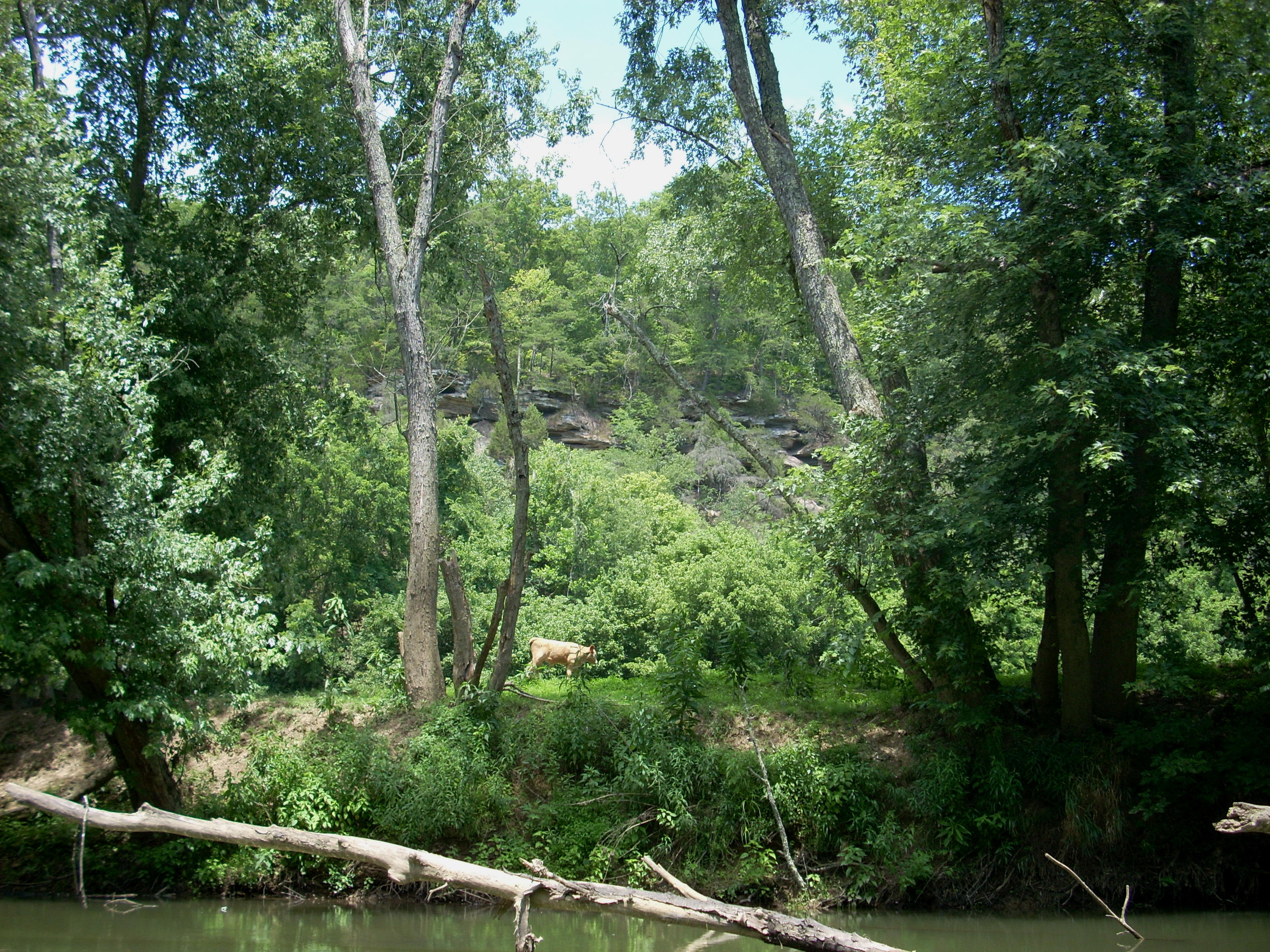
It was upon reaching a right curve near the end of mile one that I met with my first sight of cattle near the river. The first was actually a bull which seemed to take no notice of me as it walked on along. There were also quite a few cows in front of it and they likewise moved away in the direction the bull was going – upriver and away from the shoreline.
I stopped last year out of concern that if a bull (or dog for that matter) charged me, it might be able to get to my kayak in the shallow water that was on this fork at that time. The water today seemed a bit higher, but that thought was still in the back of my mind. This might be something that shouldn’t concern me at all – I don’t know.
The deadfalls on the Middle
Fork made me start to wonder again how far I’d get. They began just after
the first mile (near where Dunigan Branch enters – dry today)
Back to the present:
At mile 1.5 there’s a bridge over the river for KY52, and after that road
crosses the river it will then follow close to the water for a mile or two on the left.
There were some interesting nests under this bridge.
A dry Double Cabin Creek meets
the fork at mile 2 and I noticed some machines set up on the right bank.
Men appeared to working on something up there that I guessed was a railroad
track. Apparently this is the same CSX line I crossed under at the bridge
spanning mile 3 of converged North/Middle forks. Thus, it
seems that the road and the railroad have caught back up with the river on the
Middle Fork.
After curving a little bend I
came to my first shoal of the day. It was just a short portage and a good
place to rest a bit (this was at mile 2.5 where the Long Shoal Branch entered).
Here on my return trip I found a nice family with 4 kids playing in the water and a
couple of adults watching them. I could hear them from almost all the way
back in the stream. They were having a lot of fun. As I got closer one of the
kids saw my boat: “Look! It’s a boat! Hello boat-y!” As
I got closer though, they were a bit more shy - as kids will be. These
were nice people as I greeted them and kept going, not wanting to interrupt
their time together any more than I already had. It must be nice to
experience things like this as a family in an environment like this – definitely
time well spent.
After this shoal on my way
upstream the water became really shallow in places and I had to kind of pick my
way across and through it. There was a hay bale in the middle at one point
which must have rolled off the bank from one of the farms, and at mile 3.5 the
river made a 90 degree curve away from the road and to the right.
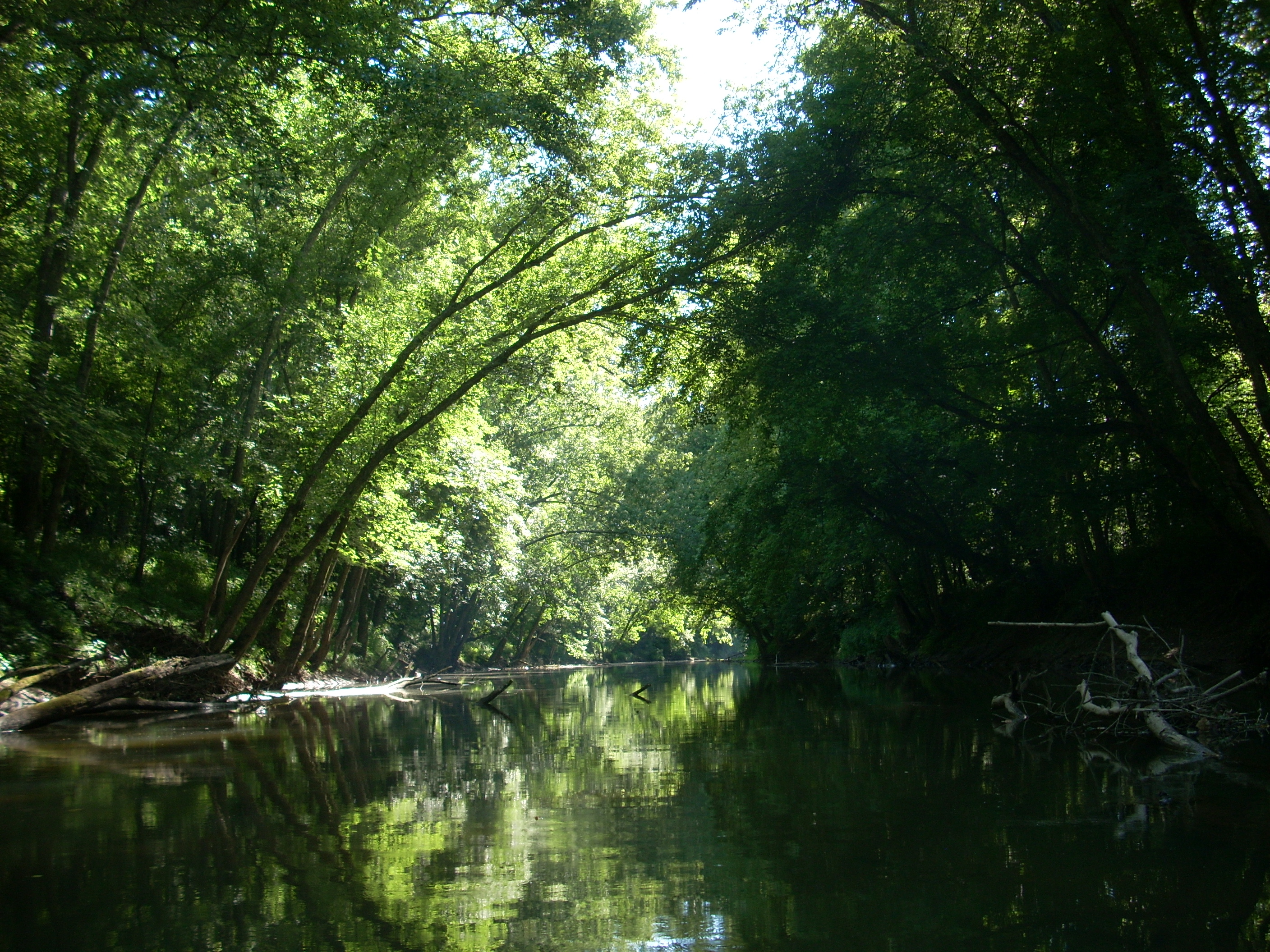
This is where it gets really peaceful. I could probably just laze
around in places like this for a few hours! It’s so nice just
hearing the birds and the wind through the trees (along with the sounds of farm
machinery, of course, but this just adds to the whole aura of a rural experience).
½ mile further and you’ll
curve sharply to the left at Horse Shoe Bend (mile 3.5 to mile 5 is one long “C”
for this bend), and the entire inside of this curve appears to consist of a
single
farm on the left. After this bend the river caught back up with the road
(or vice versa).
It would be a combination of shallow water, deadfall, current and a shoal which would halt my progress at about the 5.5 mile mark upstream. Through the deadfall I could see an iron bridge in the distance and on the shoal there were all kinds of zigzagging lines across the sand. I wondered if these tracks had been made by those little beetle-like bugs I’d seen on the water in places. Also, the wavy lines of sand on the shallow water bottom reminded me of being at the beach!

I took my time getting back because I had plenty of it. In fact, I floated all the way around horseshoe bend and past mile 4 before I even started to paddle. With the current as slow as it was, this took me an extra couple of hours.
I’d meet some
interesting people on the way back. Besides the family at the shoal, I
also paddled by some pretty friendly fishermen at the mouth of the fork.
Later on they ended up passing me on the converged forks and they actually asked
me if I’d like them to pull me back. This would have been fun, but I
had to politely decline. They would have had to stop, throw me a rope and wait
for me to tie up my boat up to theirs. This would have been an
inconvenience for them so I thought it was quite kind of them to ask.
When I got back
to the dock I also met a fisherman there who informed me that the dirt and rock
ramp I passed on Monday on the
DIRECTIONS:
At the junction
of KY 11 and KY 52 in Beattyville turn East on