HIKING
HOME
PADDLING
2008
Kentucky River
Monday, September 23, 2008
Dam 5 to Bear Branch on
Mulholand Bend (Mile 74)
Anyone reading these… wait…
Is
anyone reading these? I think some members of my family are,
but that’s probably just because they’re my family and they’re being nice.
I should say that if
anyone is reading these they’ll know that getting to the put-ins on the
Kentucky
River can often be the most
interesting part of the experience. Today was certainly no exception.
I first went through
the town of Versailles and then through some large and scenic
farms and as I neared the community of Clifton on KY1964. I then descended through a
stretch of winding road that reminded me a lot of the drives to the Valley View
Ferry and Brooklyn put-ins. Once
down in
Clifton,
however, I again got lost. The Fish and Wildlife Boating
Access Guide had the ramp as being off
Buck Run Road
and I saw a road about where it was supposed to be, but there wasn't a sign
visible. I kept going to see if I could find a confirming sign further down.
Clifton isn't that large, so I figured I could double
back if I needed to...
I needed to.
I found out later that the sign for Buck Run is receded enough from the
intersection that only people who might know where it is (those living on this
street!) can see it. Anyway, once I was on Buck Run I asked a
lady walking if she could point the way to the ramp and she told me it wasn't on this road! It’s off
Lower Clifton Road!
I was to turn around, take a
left on Lower Clifton
and go straight when the road curved. I’ll just say this:
if you’d like to head down here, follow the directions below.
I’ve already suffered all of the misdirection and made all the mistakes
for you. You won’t need to repeat them.
At any rate, this ramp is paved and it
splits in two at the end. It’s a good one, but I wasn’t quite
comfortable with it at first. Something just didn’t
feel right.
Some kind of scrap metal was strewn all over the ramp and, assuming this
was intentional, my first thought was that anyone who would do such a thing
might be awkward to deal with if I ran into them. I
nevertheless decided to go on even though I was hesitant to drive over the
metal. To avoid it I parked my car in the grass atop a little hill
and then walked all my stuff down. I hoped not to have
any awkward encounters later.
Paddling up to Lock and Dam
5 to begin this section, I was able to confirm that the lock door was now concreted,
yet there was another nice
beach downriver on the lock side. I also noted that the water flow was really low
as it was said that the central part of the state was
in a moderate drought this year. Of the water going over
the dam, most of it was coming over the ends while the middle was completely
dry. You'll also note in the photos that there are 3 metal
cylinders here just below the lock side. These appeared to be filled with concrete
and they seemed to be the same kinds of cylinders that were being input as part of the dam 9
reconstruction upriver in Valley View.
.JPG)
.JPG)
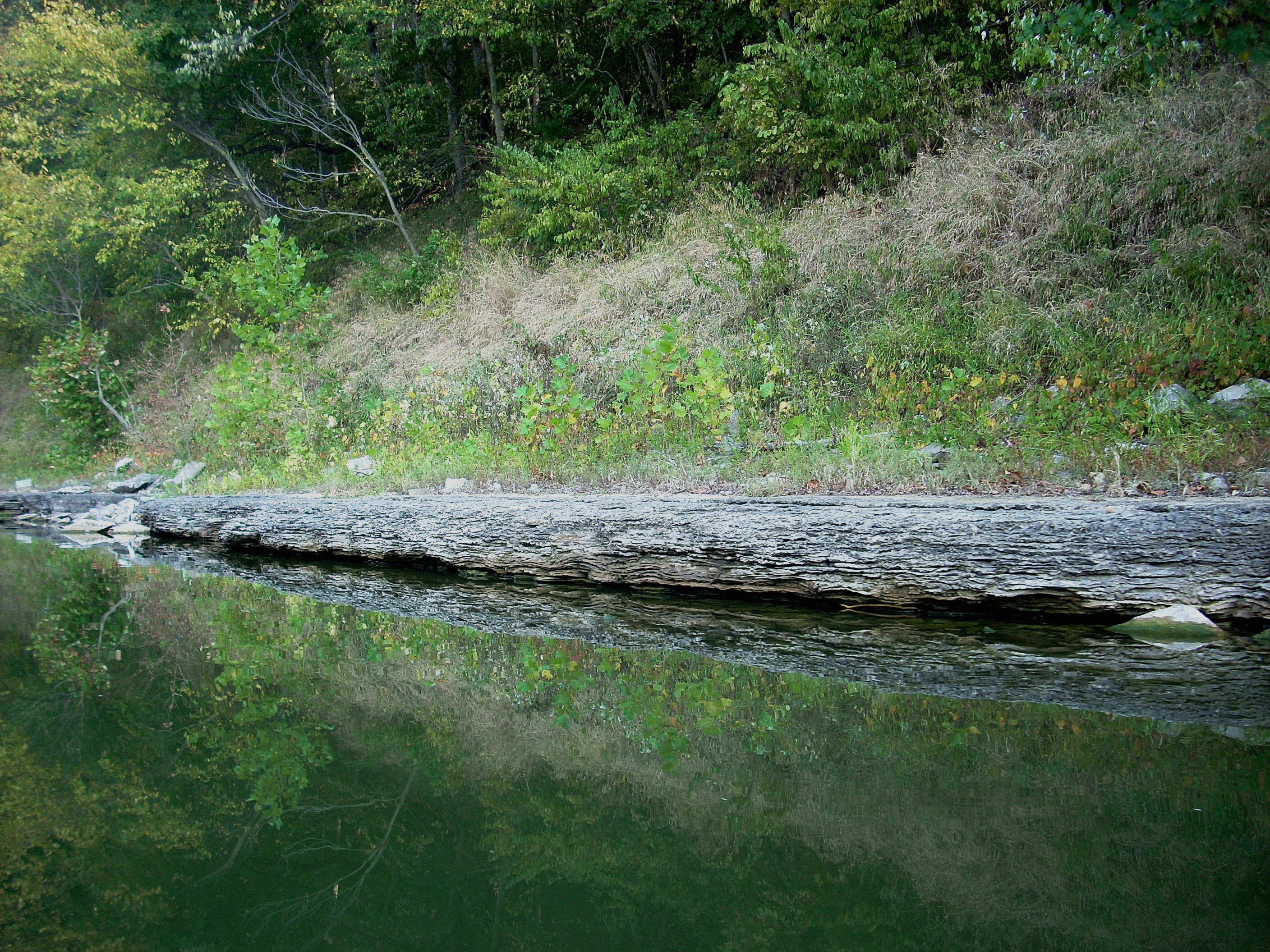
The forested hills begin on
the right side as you enter a left curve immediately after the dam.
There were some nice fall scenes in here and I noticed for the
first time that I could see glimpses of rock faces through the trees in the distance.
This will probably happen more and more as Fall progresses and the trees
defoliate.
I was only able to see the
cliffs from a distance though, because when you paddle right up to a hill the
foliage on the trees at the bottom will block your view. The
color progression that occurs is interesting. It starts
out green on the trees at the bottom and then it gets more and more colorful as
you adjust your gaze upward. At the top, the trees will
be defoliated and you’ll see the rock faces.
.JPG)
C-clop, c-clup!
I always fail to mention c-clop, c-clup! Whenever you
pass by a low overhang on the river, be it a rock formation jutting out over the
surface of the water or even a low mud bank, you’ll hear this noise.
It’s made when the wake of your boat produces a little wave which hits
these overhangs - the bigger the wake the more dense the sound.
A power boat will make the c-clop, c-clup while my kayak will usually
produce more of a c-clip, c-cloop or a plopping sound. If you
stop and listen it’s really quite pleasant!
That reminds
me, too, that power boats will usually slow down for paddlers on the Kentucky
River out of courtesy.
They don’t want their wakes to tip you over. Not all
of them do this though, and while that bothers some paddlers it doesn’t bother
me that much. My boat is
pretty stable (knock on wood!) and I’ve gotten used to it, so when boaters go
by without slowing down I don’t usually mind. In fact, I
think it’s kind of fun unless they get too close! The
Kentucky
is so placid this time of year that such waves create a little extra excitement.
On a lake with more choppy waters it might be a little different, but
not here.
Except for the Little Benson Creek further down, the incoming streams in this
first section usually can’t get out of their own way. They’re
hiding behind their shoals so that you can’t navigate them. Three
enter as you go around Redmond Bend and Bar between miles 81 and 79.5.
These include Sharp's Branch, followed by Dark Hollow Branch (incoming
from the left), and then Buck Run on the right.
In this area I
saw a couple things which grabbed my attention. The first, at
about mile 81 was one of those old boat ramps I talk about sometimes.
I got a picture of this as an example of a really old ramp.
The second was what looked like a homemade wooden boat.
This wasn’t a canoe or kayak - it was a rowboat, although I would see 2
wooden canoes later in the day. To make a point of it, I
can’t remember having seen any other boats made of wood on my travels to this
point. Maybe there’s a craftsman out here that specializes in
boats like these? They’re really nice.
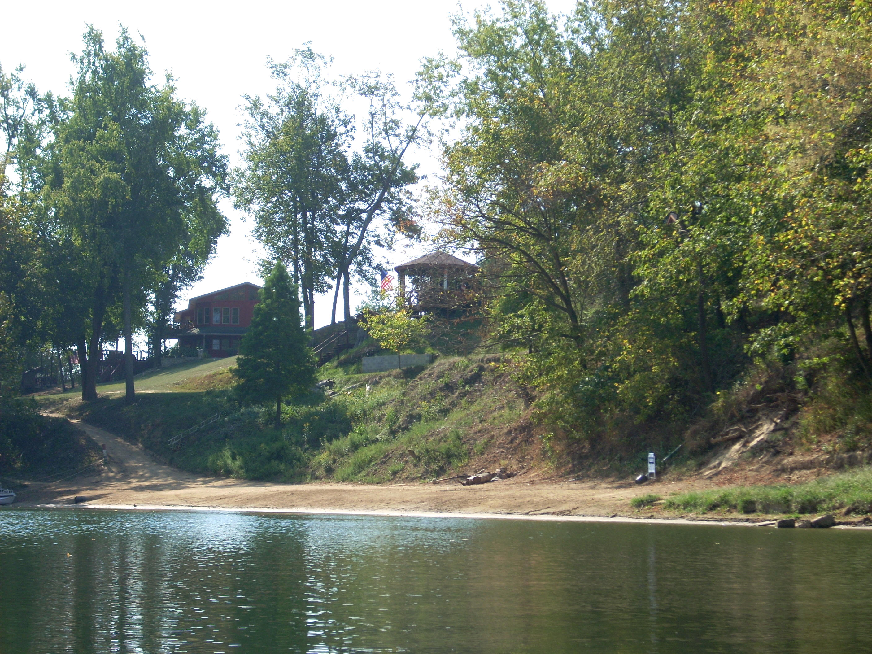
Following Buck Run the community of
Clifton
will start to become visible on the right. There isn’t much
room for it with the hills in here, so the houses will become visible one right
after the other in a line all the way down the shoreline for another mile and a
half or so. I saw something at the start of this line that I
thought was pretty cool. There was one house with 2 boats:
one was a large canoe and the other a very small kayak. Maybe
a father and his son like to paddle together? On the left
side is what looks to be farmland atop a high bank.
The boat ramp I used enters at a curve left at mile 79
immediately after the shoal formed by Ross Run. I was getting a picture of
it when
I noticed someone at the top just past my car. They
appeared to be whacking at some bushes with what appeared to be something like a
dog leash?!? The scene had the appearance of someone exercising idle
frustration and it, combined with the junk strewn all over the ramp,
really had me wondering who I might have to deal with when I got back and
whether or not my car might be vandalized.
It was especially puzzling because kids would be in school by this time.
The situation would trouble me for the rest of the day.
Mile 79 starts more or less of an “S” shape which
extends for about 5 miles down to mile 74. You’re at the
bottom of the letter to start, and the Clifton houses on the right will end
near Reindeer Lodge Bend, a left curve in the river
at mile 78. I did actually
see some deer in here on the left side. Reindeer or not, I don’t
know, but once you've passed around this curve you’ll feel like you’re back in
the wilderness again (except for one power line crossing).
When you're on the straightaways of the “S” you’ll see
occasional rock cliffs atop the hills in the distance, and on the right curve at mile 76 the Turkey Run
will enter from your left. Lover's Leap is up there somewhere atop the hills according
to the charts. There was another Lovers Leap back between mile 159 and
160 just above dam 9.
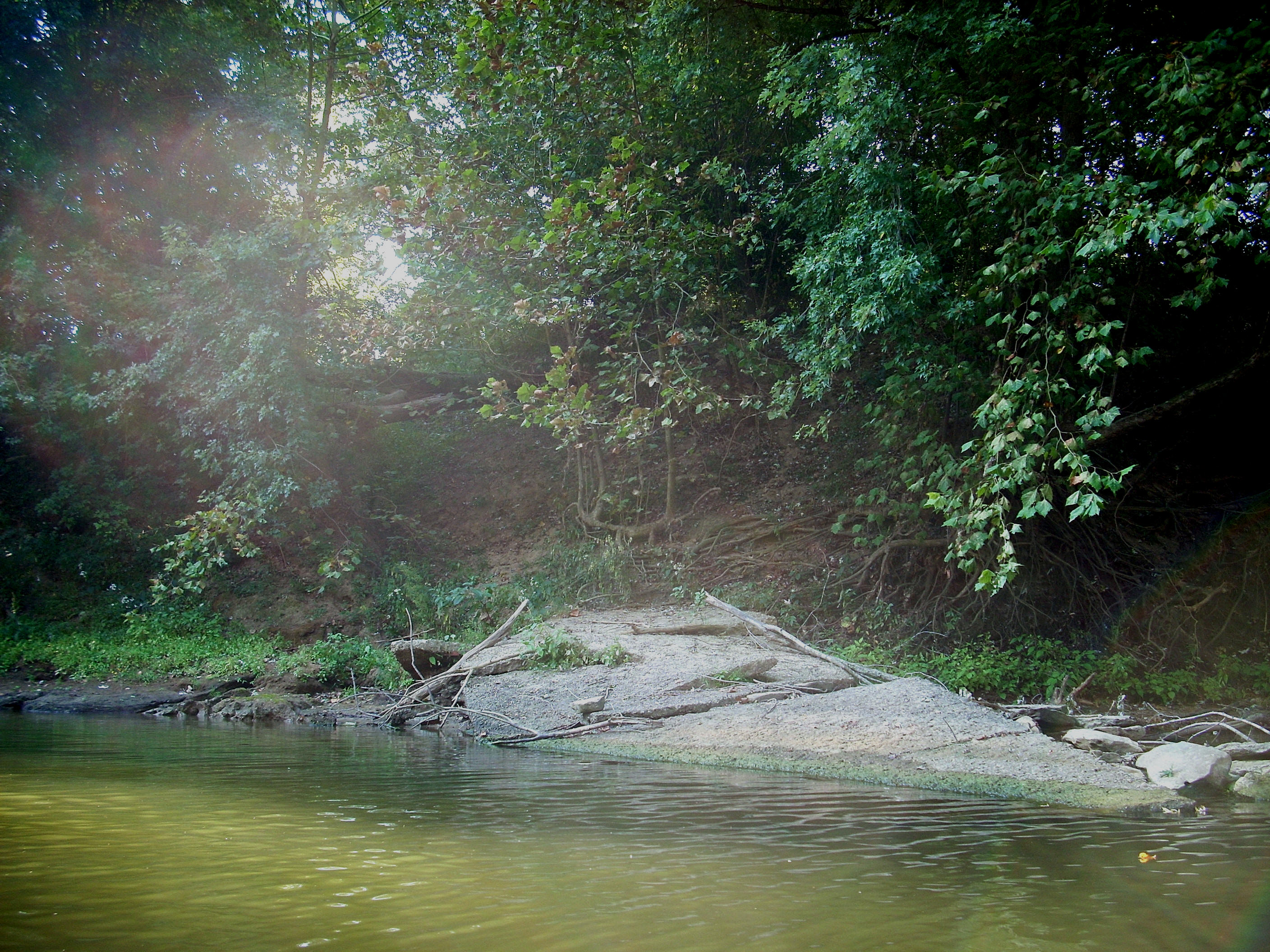
Watts Branch and Bar are on your right side just after
mile 75 while Little Benson Creek and it's bar enter another mile down on the right side
at mile 74
where the hills have begun to recede. Little Benson Bar was a
beauty! It looked like a little tropical paradise from my angle..
I wish I could have gotten a better picture of it because the one below just doesn't do
it justice.
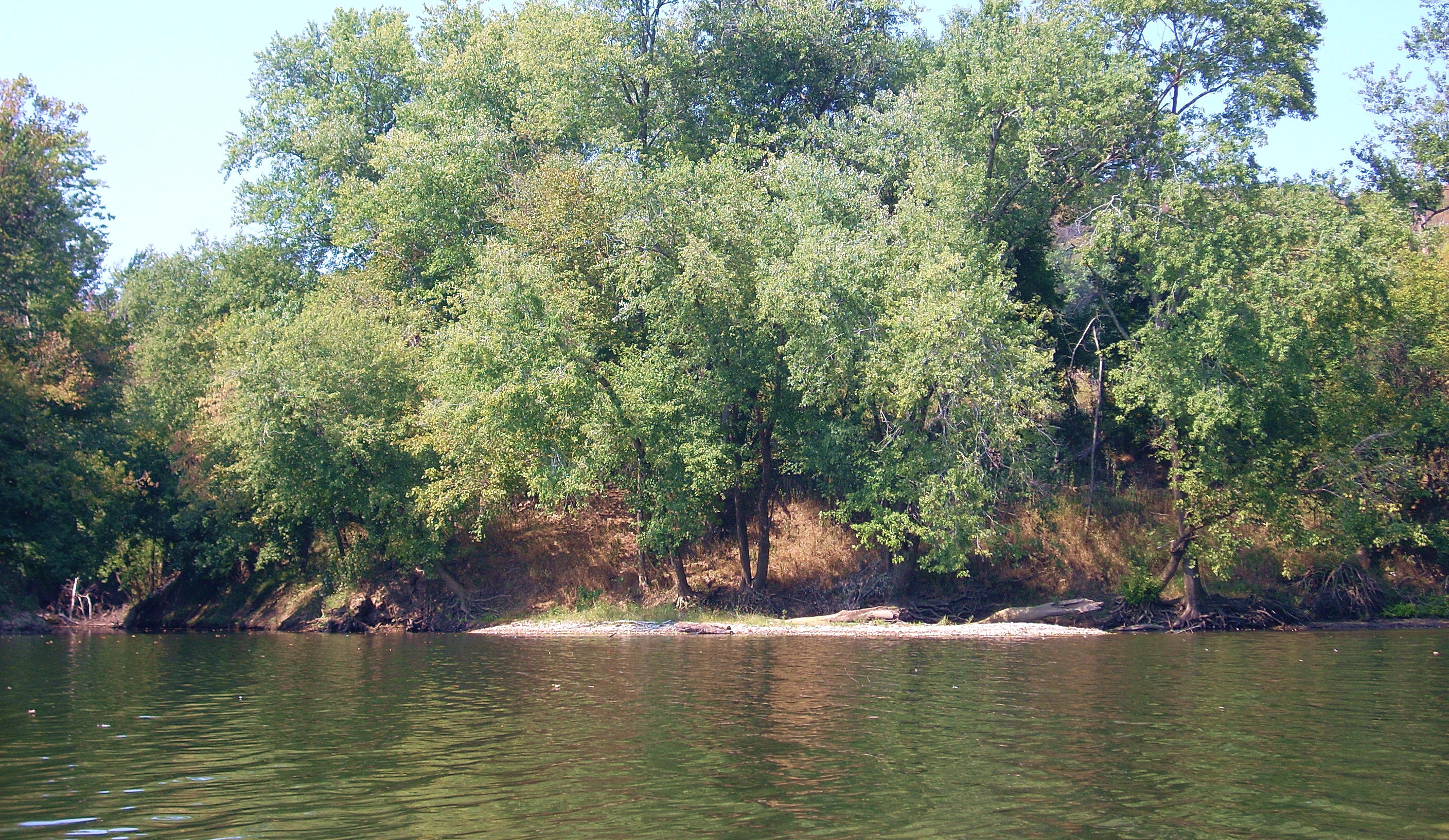
I got into
Little Benson about 200 yards. Coming in, I saw 2 more deer
and when I got to the point where I had to turn back I saw a beaver.
The water was really shallow back here and the animal was kind of walking/wading in my
direction to get to the shelter of its dam just to my left. I
didn’t see it quickly enough, however. Whilst I was fumbling for my
camera, it made it's escape.
.JPG)
This next picture below was taken from within the creek just before I emerged
back at the main river..
Meanwhile, on
the opposite bank from the creek I noted a large downed tree,
and on that tree had been set up a little pier. Wooden
steps had been made and nailed to the trunk and these extended down
to the river along with a wooden railing along one side. The
steps ended at the “pier” which looked pretty stable although it was a bit
atilt. Photo below... It’s really neat to see what a
little imagination can do! Kids would love this – as do some “grown-ups” like me!
.JPG)
At first I was going
to stop here and head back, but I figured I’d go a little further.
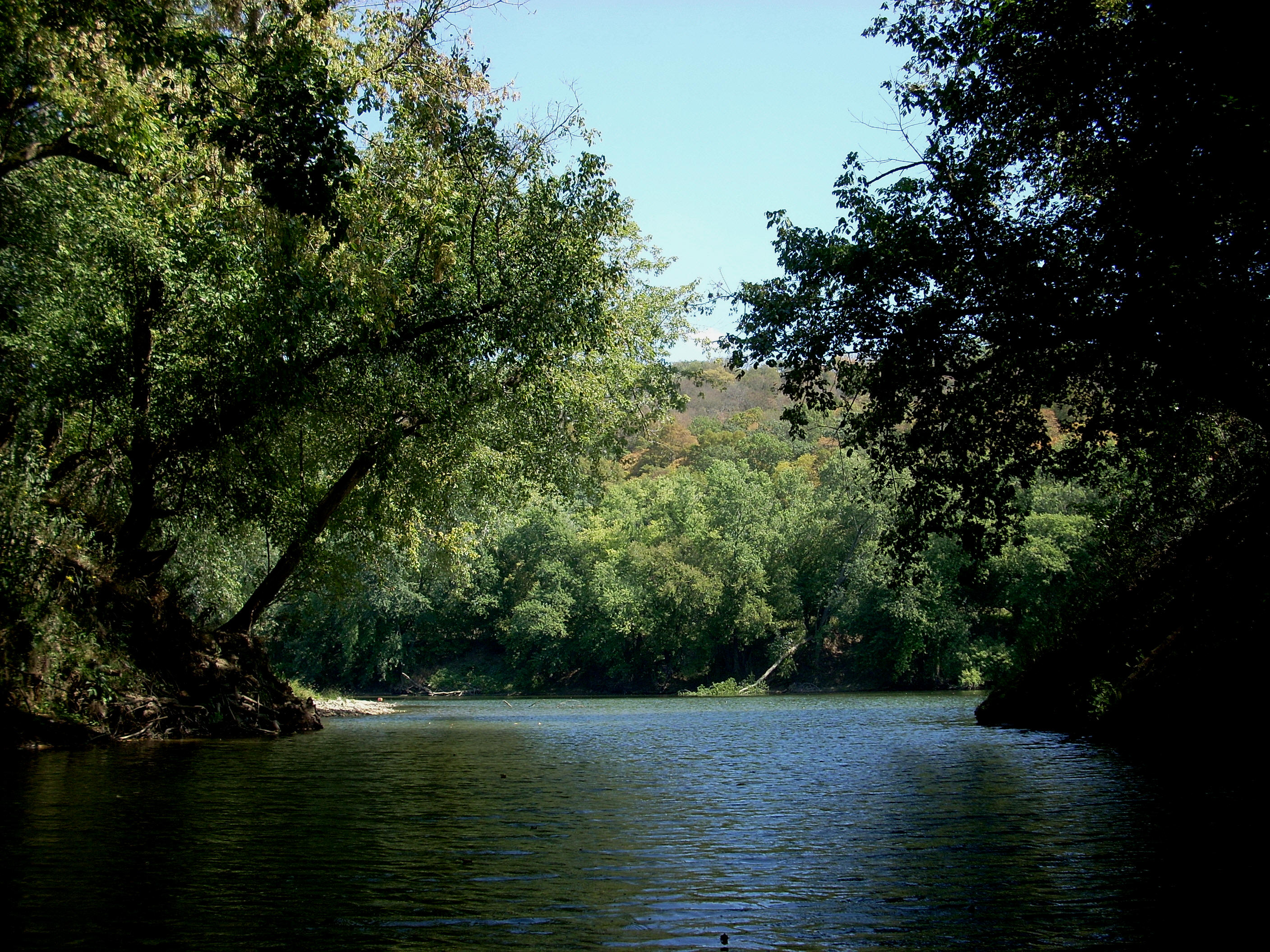
Mulholand Bend is a very short, quick little curve in the river which is
more like a bump in the midst of the very long straight section.
Were it not for this, the straight would extend another 2 miles.
Once you’ve gone
around it, the Bear Branch will enter (dry today) at a shoal on your
right. There was another paved ramp here – private I think for
Shore Acres - while there will be a little beach on the left.
Though small, this beach looks to be the only maintained one since
Boonesborough
Park way back at
mile 176. It appears to be private for some houses atop the hill.
After this I
headed back and took my time doing so. Ramps are naturally
more popular after people get home from work and, as I mentioned, I wasn’t sure
what I'd encounter when I got back. I wanted to have
people around in case there’d be any trouble. How did it turn
out? Not a hitch! There were a couple
trucks and trailers along with my car at the ramp when I returned and no people
at all - friendly or not. I probably needn’t have been
concerned. I guess women’s intuition is better than men’s!
DIRECTIONS:
NOTE: The are 3
Clifton,
Kentucky’s!
This
Clifton
is the one in
Woodford
County.
Take KY1964 (a.k.a.
Clifton Road)
west of
Versailles
to
Clifton,
Kentucky.
Go west on Little Clifton Road. Little
Clifton
is a semicircle road which may also be referred to as Broadway.
The ramp is on the southwest end of this arc. Don’t
take
Buck Creek Road,
there’s no ramp on it – at least not anymore.