2008
Froman’s Branch to Dam 6 (Mile 96)
You'll be paddling a rattlesnake in this section. No kidding! That’s exactly what the map looks like for this stretch! From Froman’s Branch (a.k.a. Brush Run) the river will wind all the way down to dam 6 which, on the map, will take the appearance of the rattle on the snake’s tail. It's a fun paddle and the ramp I used was a nice paved one which offered plenty of room for vehicles.
Kentuckians
sure do come up with some imaginative names for their communities! The
ramp I used was located in a town called Nonesuch, the center of which seemed to be a gas
station/convenience store at the intersection of KY1965 and Cummins Ferry Road
(a ferry must have gone across at the boat ramp). Meanwhile, the ramp itself is
adjacent to the Non-such Campground (Non-Such versus None Such?!) which,
according to a sign here, offered RV and primitive camping.
Getting to this
ramp turned out to be another pleasant drive, especially the further out from
Beginning the narrative at Froman's Branch
(a.k.a. Brush Run)... This stream
comes in over a sandy bar
at mile 106.5. The hills
and/or cliffs will be on your left side as you paddle downstream in this
section, generally greeting you on the outside of each
curve. The opposite side will alternatively be forested and cleared, with
the main clearings being for the 2 campgrounds at mile 105, and for the
community of Oregon close to dam 6. The turkey
buzzards I’d seen at Froman's Branch on Sunday were no longer around as I
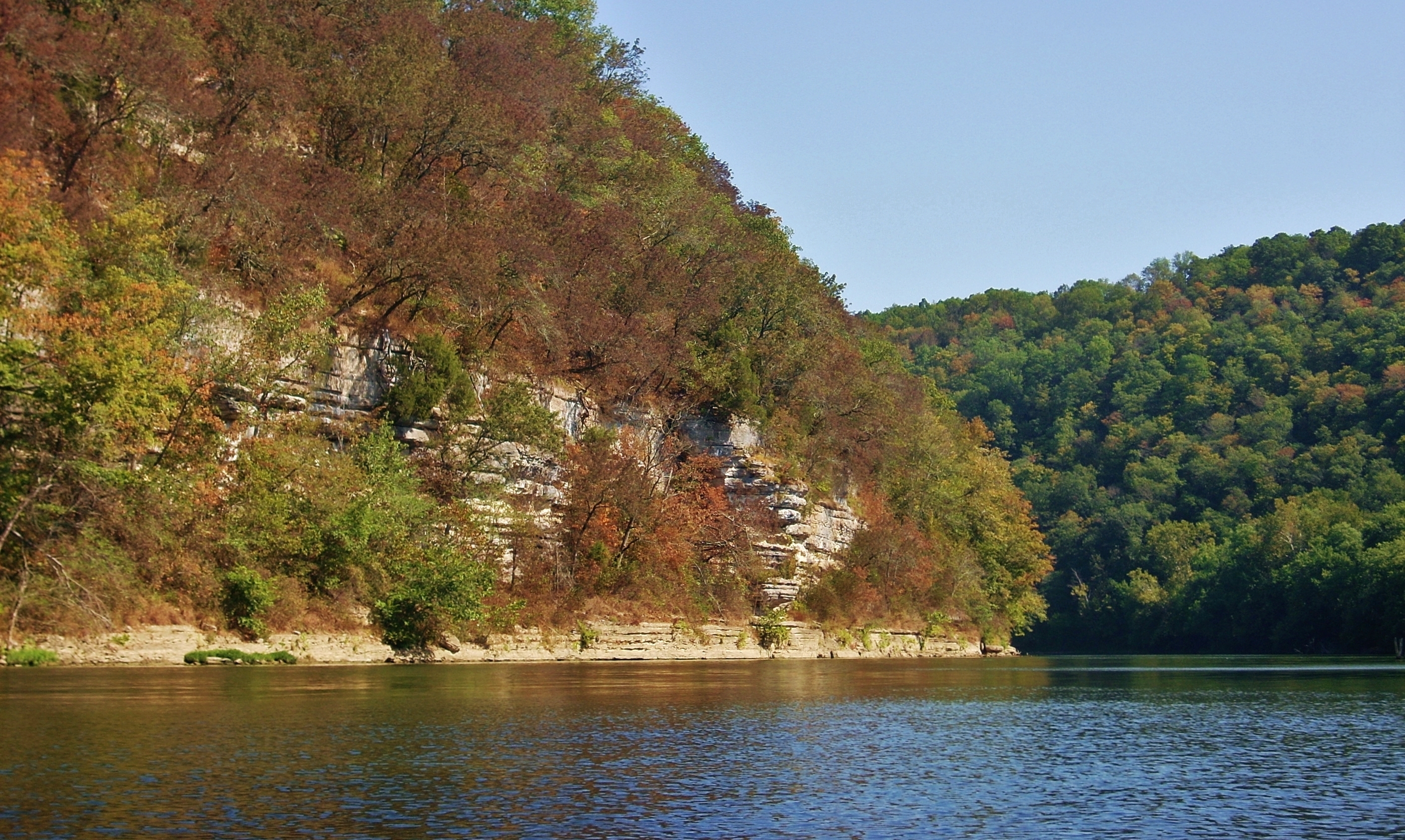
started my paddle downriver, admiring the color amid the hillside trees.
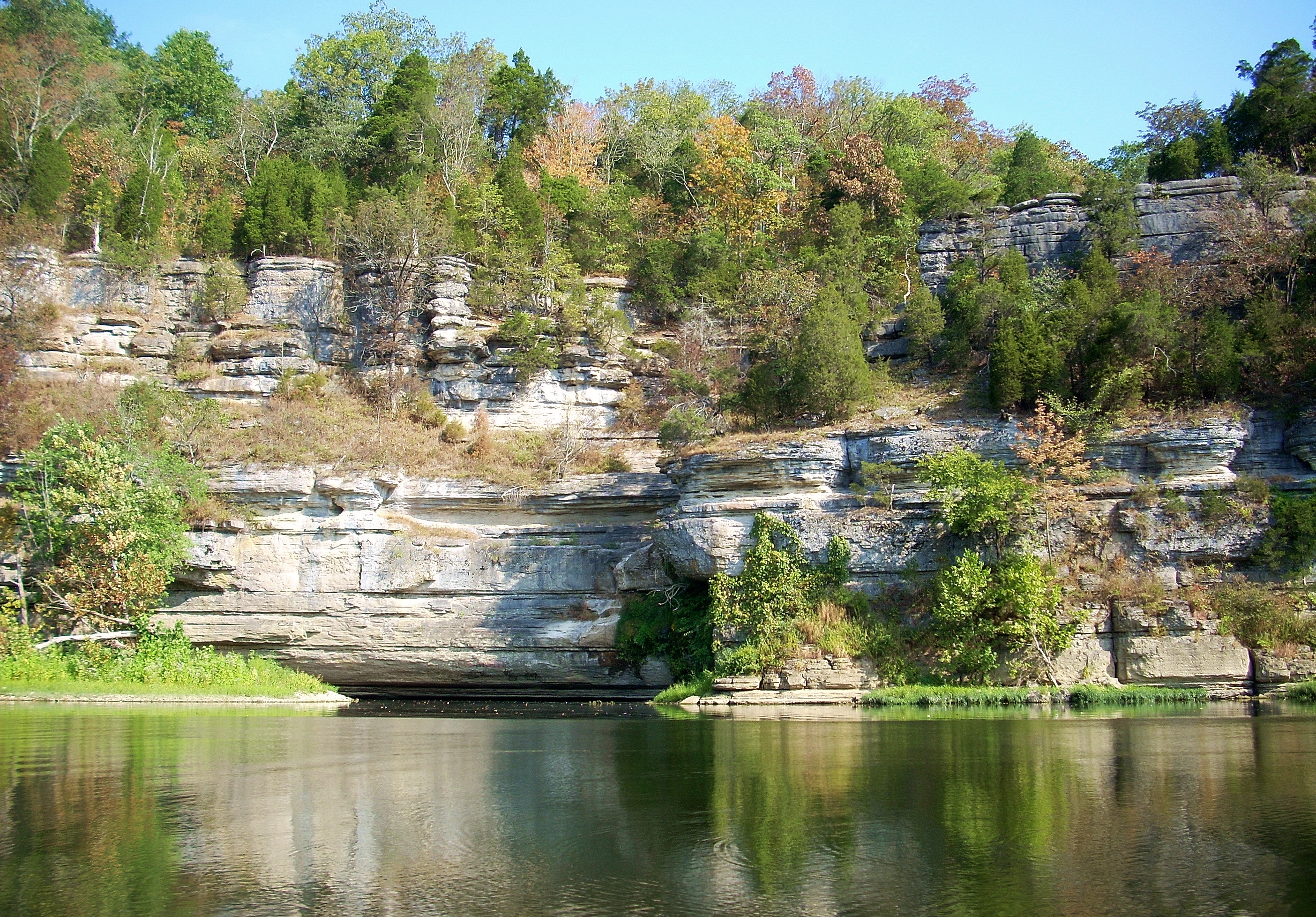
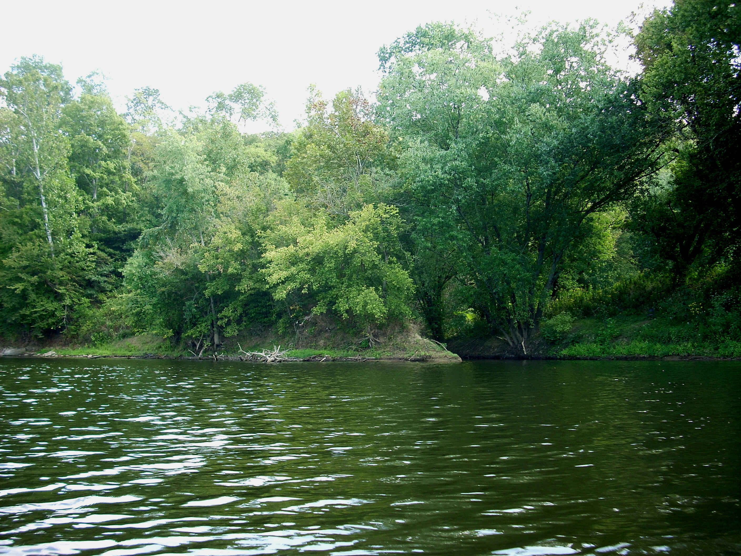
When you get to mile 105.5 the Cummins Creek will enter from the right atop a rocky cliff in the midst of a nice stretch of palisades. As such, it often provides for a great looking waterfall! No chance of paddling it, however, unless you bring some climbing gear! :) This is the only named stream on the river that I’m aware of that runs over a waterfall like this. Unfortunately I didn’t get the best picture of it, but I noticed from this point that the palisades won’t be as visible going forward. They’ll be there but, like in the last upriver section, they’re apt to be covered by trees and foliage most of the year. If you want fall color though, you certainly won’t mind this! The first photo below is of the creek while the second was taken looking upriver at the palisades.
Across from this waterfall you'll find the Cummins Ferry Resort. This business appears to cover a full mile of riverbank and it offers what looks like a good sized general store, an RV park and some hiking trails. There’s another nice boat ramp here too, and their marina looks to have the largest capacity of any yet on the river. I counted only 13 boats, but there was room for at least a couple dozen more. Interestingly, this resort is only ½ mile upriver from where I put in at the ramp at the
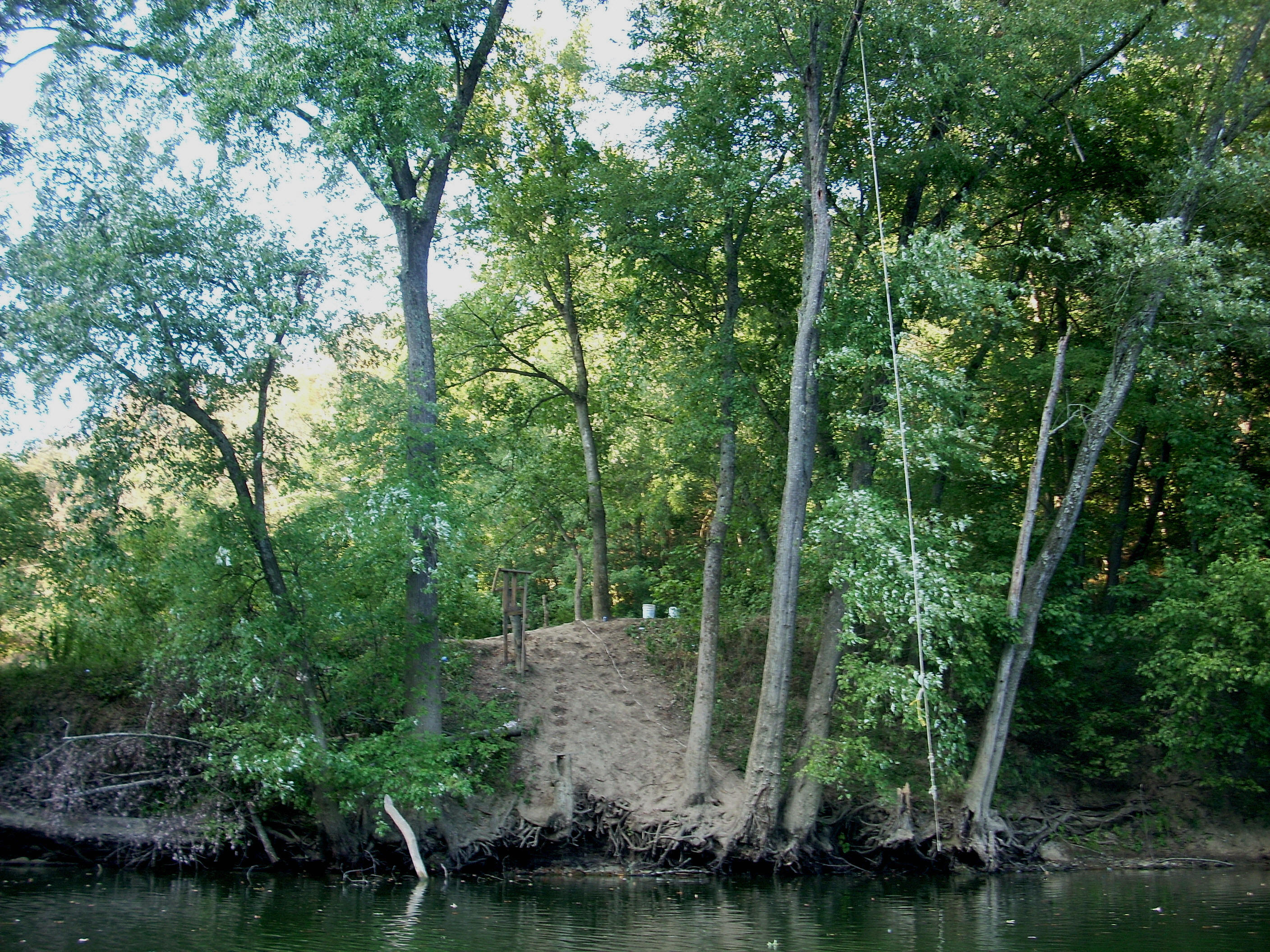
Non-such Campground. Non-such appeared to cover a little less ground and it was more cleared out except at the shoreline where it offered some really nice shaded camping spots. It also had a SWEET looking rope swing, although it didn’t appear to be attached to the sturdiest of limbs!
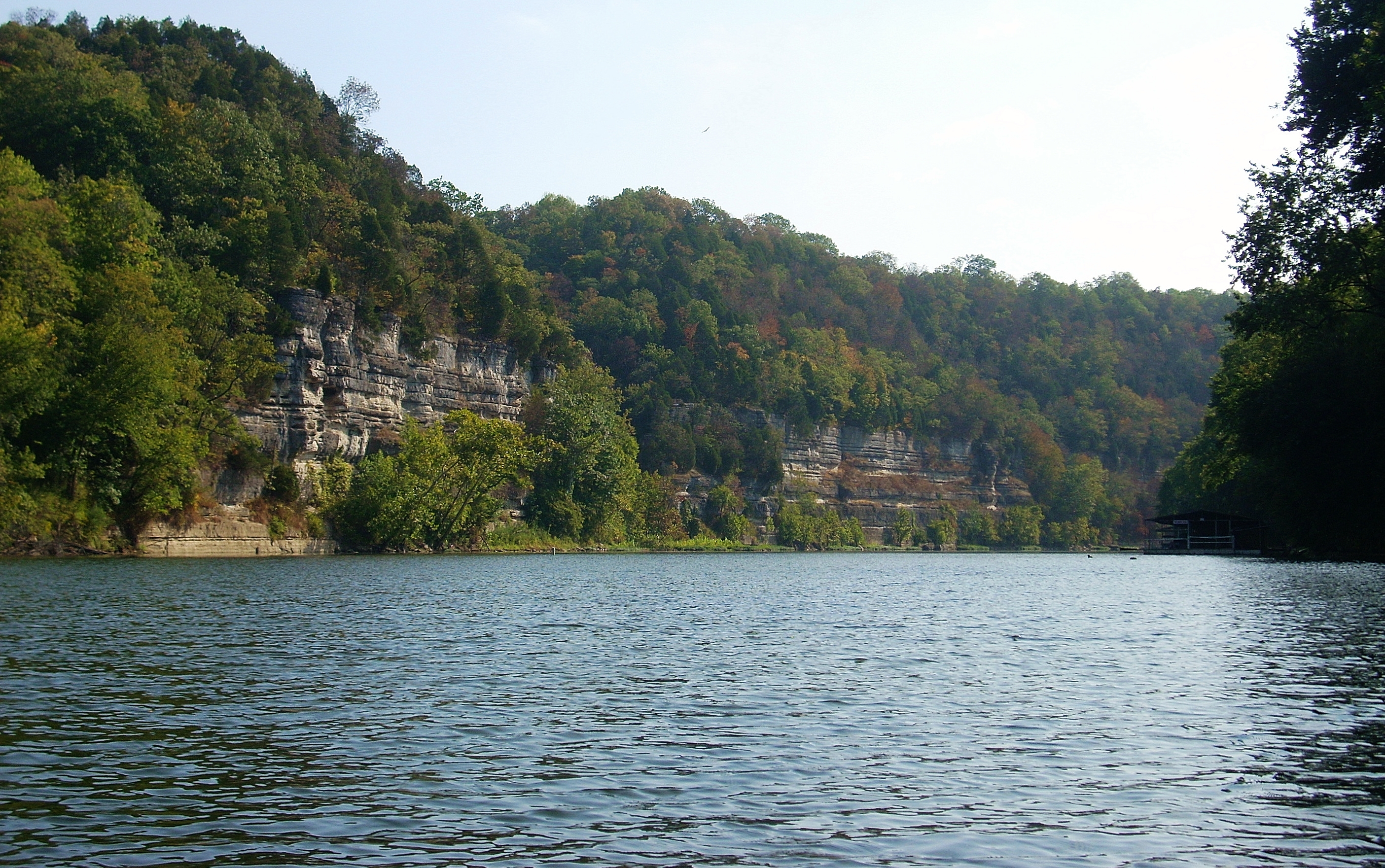
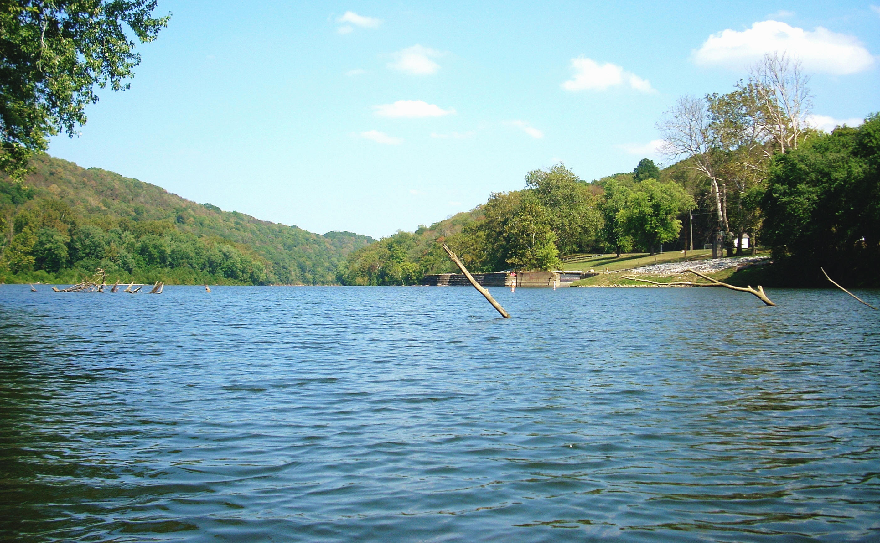
At the point of Non-such you'll be right in the center of Cummins Bend, a right curve which extends to mile 104 where the picture below was taken. Here you'll see another sharp left curve visible ahead in the distance (Chapman Bend ). You're now in the “belly” of the snake, with sharp bends interspersed with longer and straighter periods. Wilson Branch comes in at a momentary break in the mountains on the outside of Chapman Bend, but it was dry with the mouth being covered by swamp-like reeds. In fact, it was the floral diversification that might have struck me the most about the trip today. That and the minnows again.
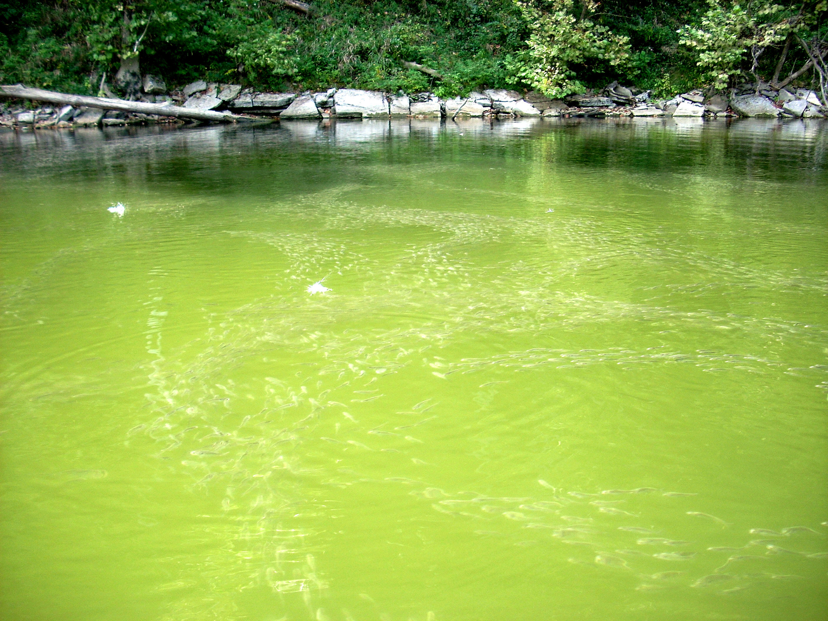
When I started this trip on the forks in Beattyville I noticed the minnows in little schools, but soon they were appearing in larger and larger waves. In the last pool they formed long lines which extended for hundreds of feet, sometimes 3 or 4 wide across the river. Well, today I found these little wonders all the way around Deans Bend, a right curve from mile 102 to 101. They'd formed one gigantic tapestry of intersecting fish highways! I was, of course, very happy to be able to witness this at all; I just wish I had been a little bit higher (say, standing in a power boat) to get the full effect of it. It was pretty amazing!
There are some
shoals from miles 101 to 99 where you can stop and rest, and at mile 99 on the
inside of the next unnamed curve (to the left) is the location of the Carr Cabin
according to the charts. I couldn’t see this from either side of the
river, however.
There’s another
ramp at mile 98 on the left about where Captain Preston’s Landing is supposed to
have been as per the charts. I don't have any information about
Preston's Landing and this particular ramp wasn't
on the charts. It looked private. Go another half mile down,
however, and you'll find a really historic spot
at a point just upriver from the mouth of the stream,
Landing Run! This is where the Harrod Party landed en route to
establishing
As I emerged
from this stream, the sight which greeted me down at the
It’s funny that when I encounter people on the river I
have a ton of questions to ask them, yet I’m either too reluctant to bother
them, I can’t think of anything to say, or I just plain forget the darn questions!
For me it's like being excited to enter a record or book store only to forget
everything on your “buy” list as soon as you walk in the door! Maybe it’s
the enthusiasm for being there or some kind of sensory
overload, I don’t know... I digress!
The
ramp in the community of
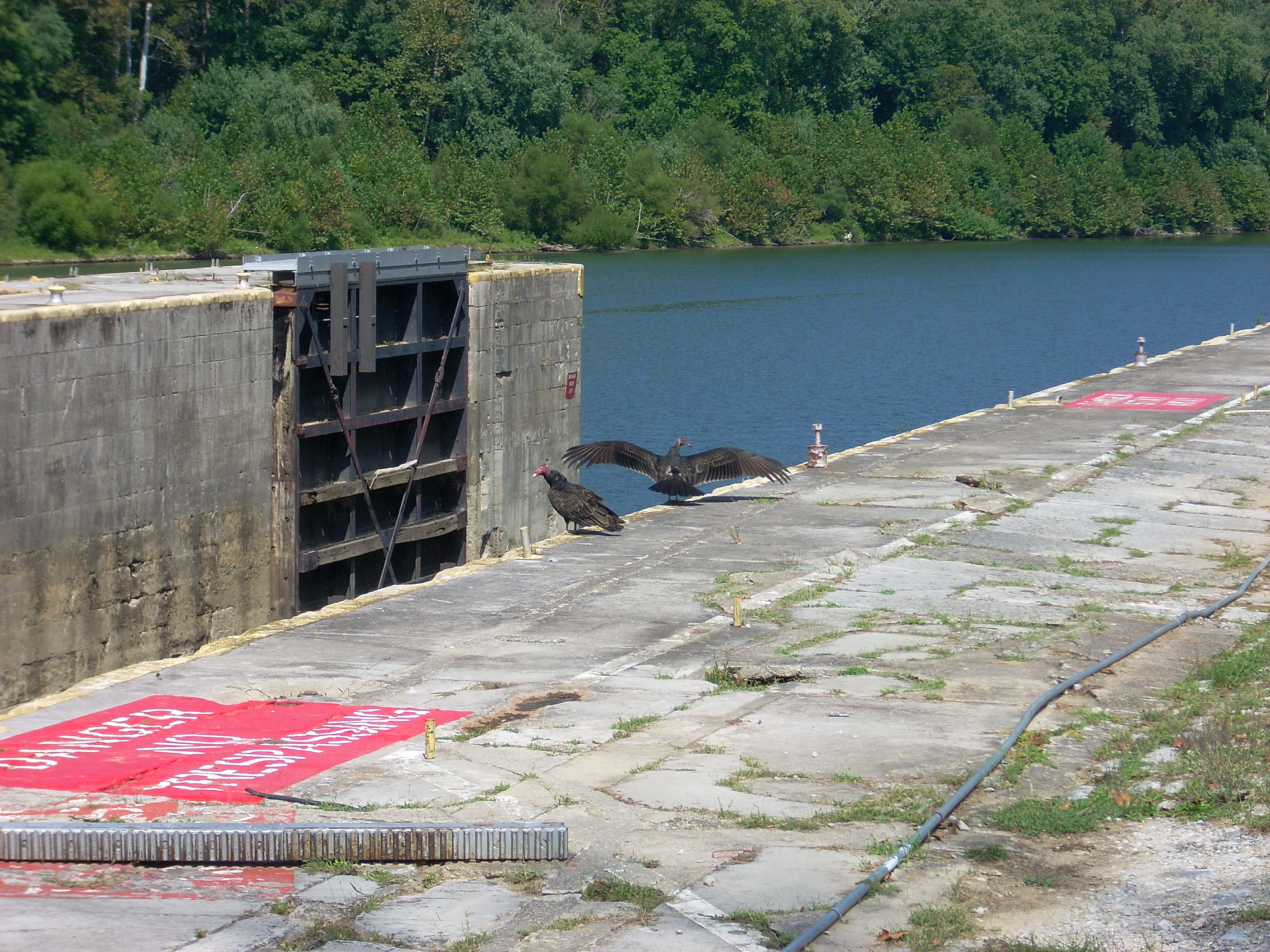
Another mile down at mile 96 is lock and dam 6 - another beautiful, park-like spot. This one looks almost exactly like dam 7 in that it lies against a short rock wall and it's no longer graced with lock houses (there were only a sheds left when I passed). It, too, can be accessed from a road on the upriver side (which was chained right before entering the grounds) and it, too, has grounds that end on the downriver side at a forest which looks like it could have a hiking trail through it.
It was pretty easy to get out and walk around at the lock side of this dam, so I did and when I got to the top I found a couple turkey buzzards in clear violation of the “No Trespassing” signs! The nerve! I think I’m OK, by the way, being up here. I certainly hope so! I just walk around the grounds - never directly onto the lock or dam (zoomed photo below). I never take any chances. Its been said that when these locks were in operation there were people who walked right off the edge and died sometimes when it was foggy out or the lights blinded them - they couldn’t see the edge!
I’ve started to notice at this point that the dams seem
to be lower and more gently sloped than the others further upstream. That, and the fact that at this one
in particular there’s a line of large
rocks in the water at the bottom of the dam chute - a
barrier to keep the boats from peril? A couple power boat
fishermen were here. There were also some people downriver on the lock
side fishing, and it was nice to see that the spot was being taken advantage of.
In fact, you’ll usually see people fishing at or near just about every dam -
especially on weekends, of course.
DIRECTIONS:
KY33 into the town of