2008
Mile 129 to Dam 7 (Mile
117)
Labor Day had snuck up on me. I hadn’t made any plans and I didn’t end up doing a thing except read and take a few long walks. It bummed me out because not only did I feel like I missed out on some fun, I also felt like I hadn’t accomplished anything. Today would help me get over that feeling. I’d be making a longer trip than usual. :)
Today I
headed out early to
At least, that was,
until I noticed a man heading toward me from one of the trailers.
I asked him if I was supposed to pay him, or if I should
just put the money in the box that was there. He said I could do either,
so I handed him $4 as per the sign and he held out 2 of them for me to take back
(apparently this ramp is only $2 for paddlers and twice that for power boaters).
The man’s honesty was refreshing, and he mentioned that quite a few people had
been out here over the past weekend – about 30 of them paddlers.
Ultimately, I left my car in the grassy area he indicated near the side of the ramp.
I then paddled
downriver to the dam, then up the Dix River, and then up to the point of the river
that I’d left off last Thursday. I’ll again relate this trip in downriver
order as I’ve done for this whole exploration, but something I noticed in passing
through the community of
As
I headed into the
Anyway, when I got to mile 129 I saw the first cows I’d
seen since above dam 10. They were on the left bank atop a
forested landing but they seemed a bit agitated - possibly because I also heard the
sound of an animal in the distance which seemed to be in some kind of distress.
Nonetheless, I was happy to see the cows. They way they just stare at you!
In their somewhat distressed state here, however, they were
moving around and “mooing” a little more than usual. Well, I was in a
pretty goofy mood by this point, so I started “mooing” too, and the more vocal I
was, the more vocal they were. We had quite a bit of noise going for a while.
Presently, though, I began to feel a little self conscious... What
if someone came to the shoreline and saw me? It would be a bit
embarrassing. The cows had me beat as noise machines anyway,
so I decided to head on out.
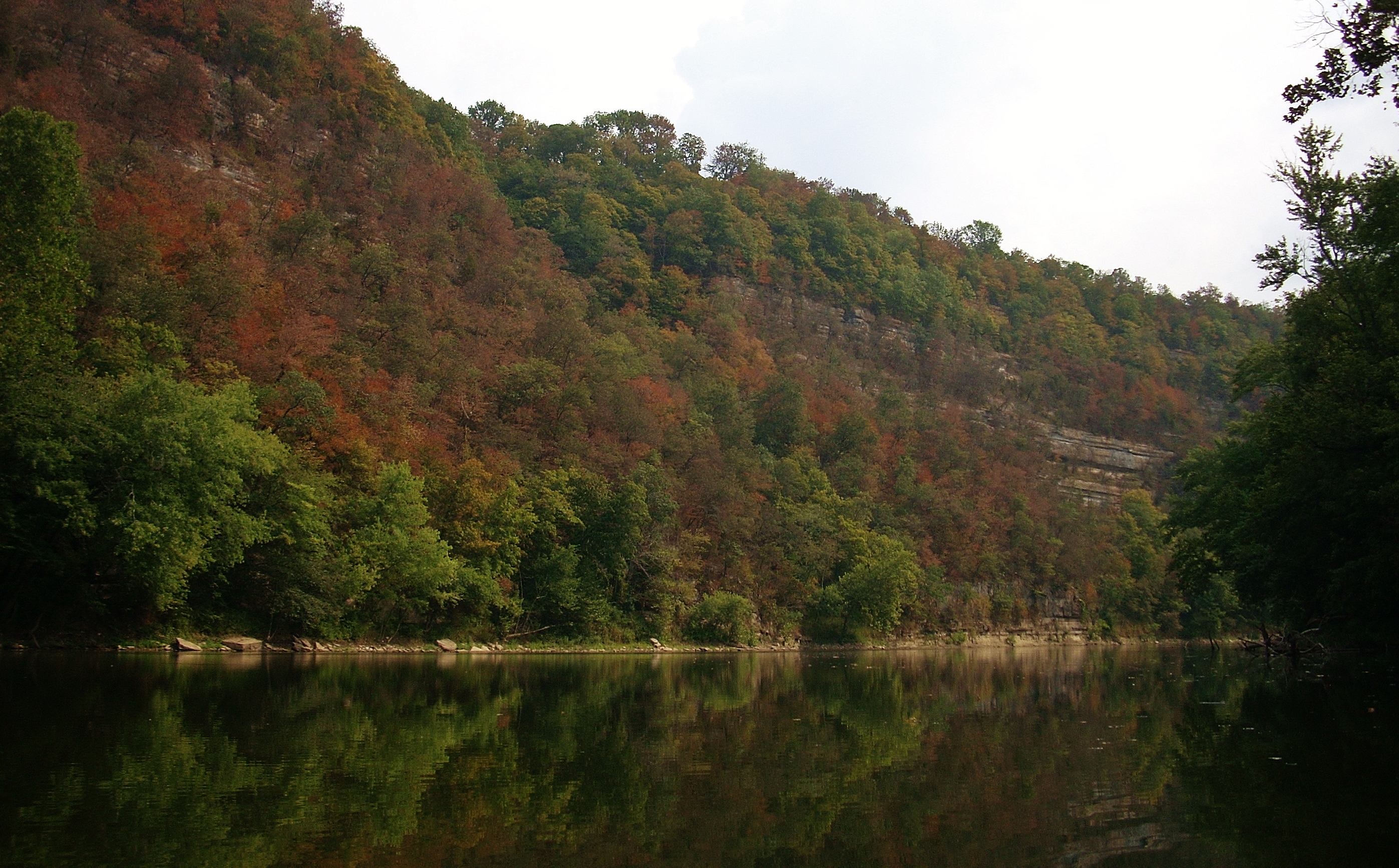
You’re still in the heart of the palisades on this trip,
and if you don’t have forested banks, then you’ll have a rocky cliff on one side
or the other the entire way. The cliff side was to the right as I started,
then it switched to the left to make room for the Jessamine Creek to come in.
It later it switched back to the right at mile 127 after the Jessamine Creek.
The navigation charts indicate that there’s something on
the left called the Halfway House at mile 128.5. This is supposedly a
chimney type rock formation, but there was nothing visible to me. Besides,
the rock cliffs hadn’t yet made the transition from the right at this point.
The formation could have been between some trees so I couldn’t see it, but the
bottom line was that I couldn’t figure out exactly what or where this was.
Please keep in mind, however, that I am not the most observant person on
God’s green earth! [I've since been enlightened on this. The
Halfway House was not a rock formation, but an actual house on this (Polly)
bend. It was supposedly at exactly the halfway point between the first
navigable part of the river up in Beattyville and the Ohio River. Nothing
remains of it now, but I'd love to see this house rebuilt to historical specs.
Hopefully it will be someday, in honor of the river! My thanks to George
Dean of Jessamine County for providing me with this info.]
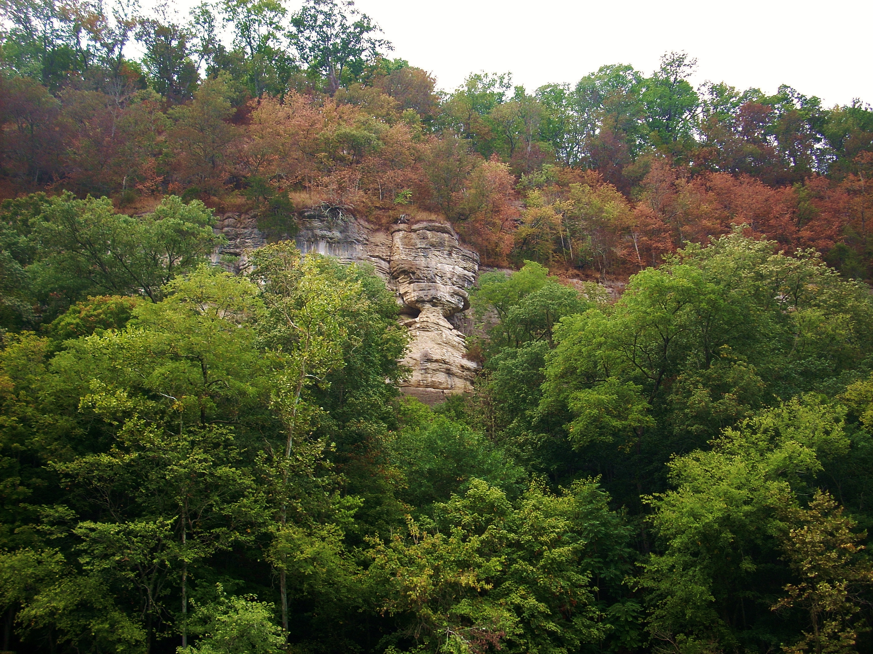
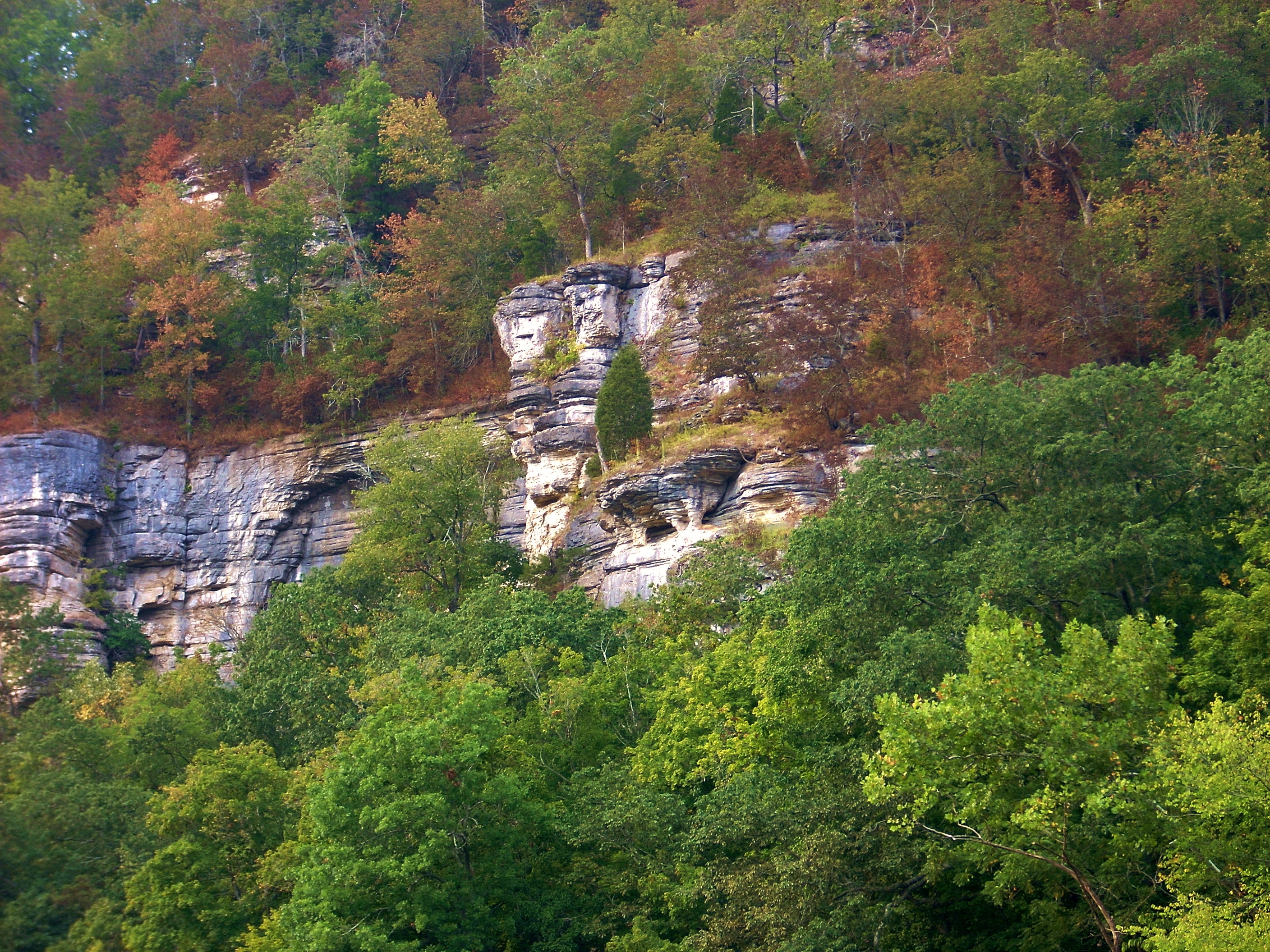
I did manage to find an “hourglass” formation as well as
an “altar” further down the river though! (Side note:
there’s a shoal on the right in this section which will be the largest of the
day, but the stream is unnamed on the charts. To me this was interesting
since some of the other creeks with much smaller shoals are named.)
The Jessamine Creek enters from the right at mile 127.5.
I got in 100 yards. This creek was named by an early explorer for his
daughter and it was, in turn, the namesake of the county. It looked like
it ran right up against a tall palisade in the distance just beyond the spot
where I was stopped by debris, but I couldn’t quite get to it.
At mile 127 back at the river you'll find the spot where the Down's Ferry used to run. There was a marker for it, but at this point I realized what might have happened to the other markers in the last pool… Remember how I mentioned in a previous entry that Kentuckians like to shoot? Well, this particular marker (#14) had been so shot up that half of it was gone! In fact, it looked like it could have been targeted from across the river by a shooter atop the mountain here. It occurred to me that even as far back as the pioneer days they needed to practice their shooting as a matter of survival. Thus, the shooting doesn’t seem so incongruous when you look at it from that perspective. Yes, it breaks the peace but aside from that it doesn’t truly bother me - unless it's meant to deface property like this - or it's aimed in my direction. :)
The palisade here recedes on the left at mile 126.5 as another crops in on the right amid what's known as Oxbow Bend (a left curve in the river). This palisade briefly remains, only to fade back into the distance again once you’ve rounded Oxbow. No sooner than it’s done with this disappearing act, the left side palisade will have returned to be with you for another 5 miles straight as your round Handy's Bend (a right curve in the river). The palisades are teasing you again!
There are three shoals along Handy's Bend if you want to rest a little, by the way.
Boat Hollow is a stream which came in dry at mile 124, while the Twin Branch came in (also dry today) at mile 122.5. It was between these that I noticed a huge tower of some kind on the same (left) side. It was thin and looked to climb ½ mile high – possibly a cell phone tower? At mile 122 the rock palisades attempted a comeback on the right side, but the left held its ground for another half mile. It wasn’t done showing off yet! The leaves, too, start to change color on the river at this time of year (late August/early September) so along with the grey palisades you can add all the other colors of autumn! The effect is simply wonderful, and in some places there’s a color progression down the mountain with the leaves changing color at the top, while the middle is almost completely defoliated and it's green at the bottom!
To that point,
the stillness of the river is another pleasant aspect to it which I’ve not
spoken enough about. When you stop you can’t hear much of anything else
besides the sounds of nature. I can usually hear
the locusts in the trees and an occasional insect buzzing nearby (perhaps too
close). Birds may be singing and I may possibly become aware of some
rustling in the leaves which is made by some animal almost always too reluctant
to be seen. The sounds of fish jumping may even be heard or there
could be some water trickling down the banks after a rain. That’s
about it! My fellow kayaker from back at the
By
mile 121.5 (where the McQuie’s Ferry used to run – there’s a marker) you’re
starting to veer left. You’re entering into Bowman’s
Just as the Bowman Family had once run a warehouse, the Major Family did as well. Their's came next along Majors Landing at mile 120. Here was another ferry as well as an excursion cruise boat! The latter must have been somewhat akin to the Dixie Belle at Shaker Landing a couple more miles down, and on the right was where I spotted what I'm calling my “hourglass” and “altar” rock formations (although the second might be what the guidebook refers to as the Devil's Pulpit - I can't tell from the angle). Am I stretching things? Probably. Finding rock formations is like trying to find different shapes in the clouds - the forms sometimes lie only in the eye of the beholder.
Nearing mile
119 the rock cliffs switch sides again to let in the community of
Getting back to
the river at mile 118.5... On the left there’s supposedly a cave which I
completely missed. There were simply too many other things to
see and concentrate on! On the right, however, I did notice
the spot that was apparently the site of an old tramway that carried timber
up to the saw mill that used to be here. Back when the
logging industry was hot, they’d float branded logs downriver from as far up as
one of the forks and they’d have something called a “boom” which extended from
the shoreline to catch these logs. There’s no longer any trace (as far as
I can tell) of this, although there was another marker to commemorate it.
The Jessamine folks with their guidebook and markers had come through again!
I wouldn’t have ever known this was here!
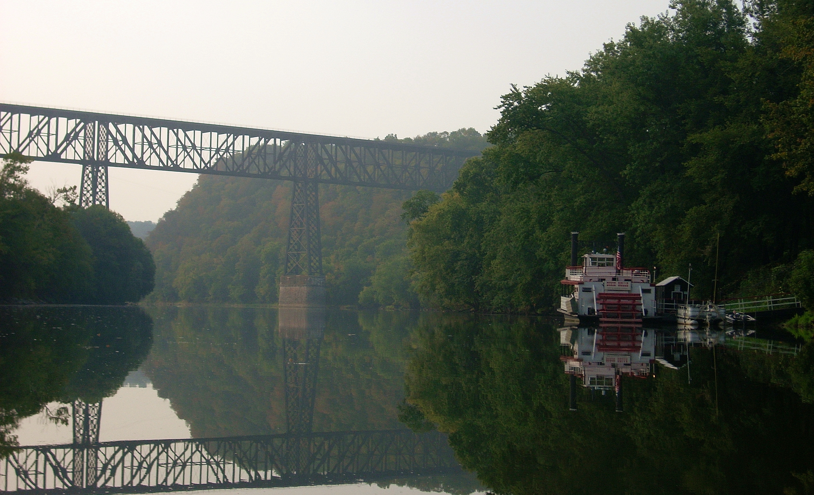
The
At the mouth of
the Dix you'll find a paved ramp (from which yet another ferry crossed the river) and as you look across you get a
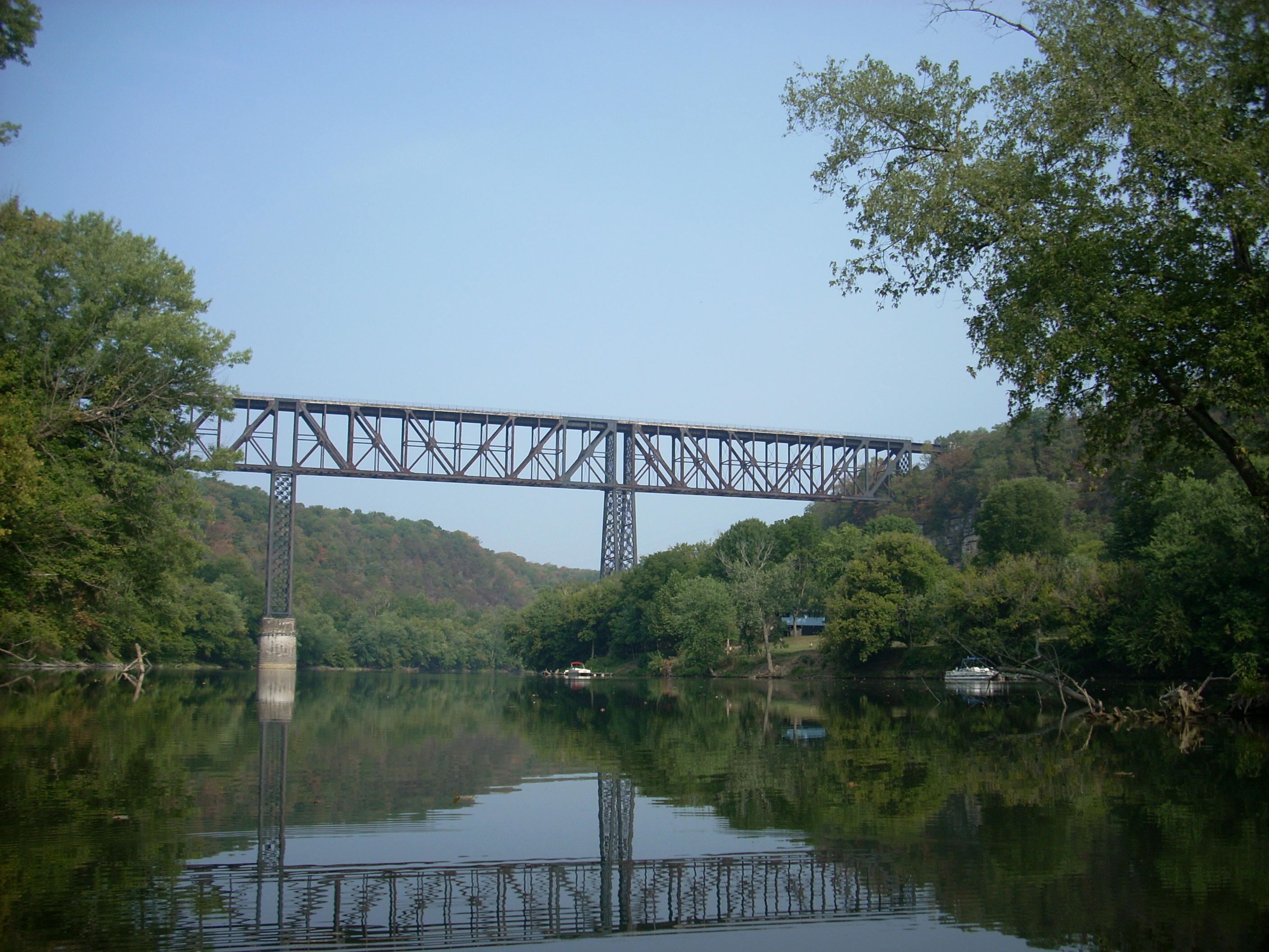
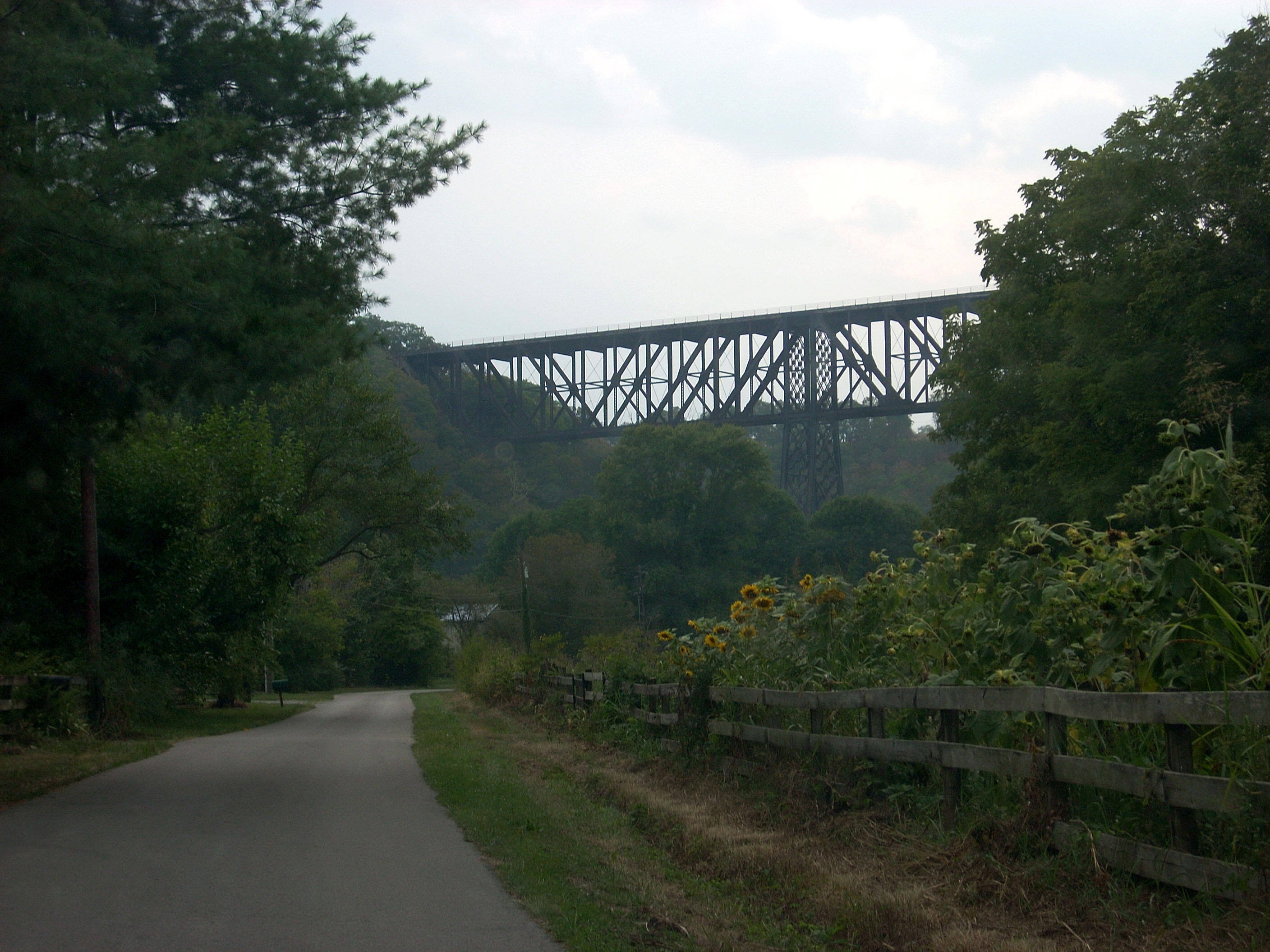
great view of the High Bridge about ½ mile down. This was an engineering
marvel back when it was built, and it still is! In fact, the present
bridge was built around the previous one, but it still retains many of the
original characteristics. It’s just larger and sturdier.
It’s said to carry about 40 trains per day! In fact, I just missed one!
This is still the highest bridge over a navigable waterway in the
The Cedar Branch comes in right after High Bridge on the left and I nearly missed it. It wasn't navigable coming in over a shoal, but there was a stone structure several yards back into it which may have been for an old bridge that once spanned it. The Harrodsburg water intake is here too, but I couldn’t see it very well through the foliage. Shaker Landing is also here as was the old Shaker Ferry. This whole mile has an absolute ton of stuff! You’ve just gotta come out here! In addition to all this: the community of High Bridge, the palisades, the caves, High Bridge itself, the Dix River, Shaker Landing and all the history in general you’ve also got the Dixie Belle (or, in my jargon, the “Dixie Belly”) which still runs trips on the river! It’s really quite remarkable!
The Dixie Belle operates from Shaker Landing, and it will take you one a one hour cruise of the
river if you like. It operates as part of the
Shaker Village of Pleasant
Hill which is a restoration of the Shaker community that was once here.
This is a fantstic place to see and it's definitely worth a visit and/or overnight stay -
especially around Thanksgiving as I've found! They have a lot of hiking
trails on the grounds too, both through the forest and farmland. These include
the Palisades Trail that overlooks the river at this spot.
Down here at this ferry landing, however, the Shakers conducted quite a bit of business as their products were in very high demand due to their high quality. The landing was also used a lot in the civil war, and the foundations of warehouses can still be seen atop this left bank. Now, I could be wrong, but I heard somewhere that the boat which appears to be used as a gear shed here used to be the Paul Sawyier shanty boat. Whether or not that is the case, there was a renowned Kentucky artist by the name of Paul Sawyier who painted scenes of the river in this area. Born in
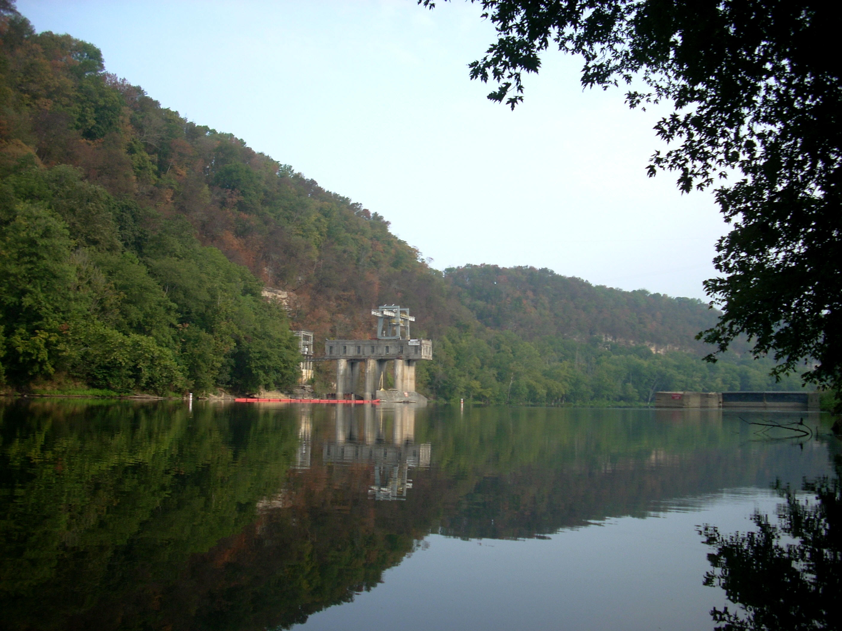
I'll conclude my narrative at
lock and dam 7 at mile 117. This one has a hydroelectric power plant
alongside it, and the lock side looked like many of the others with a fairly
steep climb of several yards through vegetation. The ladder here was
easily accessible though, and the lock (at least from this side) was not very
high with only about 10 steps to climb. Thus, a portage wouldn’t be terribly difficult from this side.
As
mentioned, when I got back to the car and headed out, I drove along the length
of
DIRECTIONS:
KY29 south to
.