HIKING
HOME
PADDLING
2008
Kentucky River
Tuesday, August
19, 2008
I75 Bridge to
Dam 9 (Mile 157.5)
NOTE:
For this section I put it close to dam 9, paddling upriver to the bridge and
then back.
I’ve mentioned before that I’m both forgetful and
that I’m a klutz. I forgot to mention something else: I'm prone to
impossibly bad luck and timing as well. :) I can’t know what’s going on up there
but I imagine it to be something like: “Hey everybody! Watch me pull
another fast one on DiNardo!” And everyone explodes into laughter.
Please don’t misunderstand. I haven’t lost all my
pride. If it’s true that hardship builds character, then I may have more
character than any 10 people on the planet! What's more, I've come to
expect misfortune. Certain situations no longer irritate me the way they once
did. I simply deal with things as best I can and hope that I don’t inconvenience
others in the process of extricating myself.
What happened?
It’s this simple: my keys were in my pocket when I went into church on
Sunday and
they were gone when I left. I covered every avenue to find them,
even going so far as to check the pews twice. What did I end up doing? I walked 5 miles back
home in my church shoes. Ouch! Then I spent Monday waiting for one
locksmith to open my car and another to mold me a new key. Fate
had cost me $155 and I still need to get the other keys made!
Good thing
my fortune is always better once I get out on the water!
Today
I drove down
the street from my place in Lexington
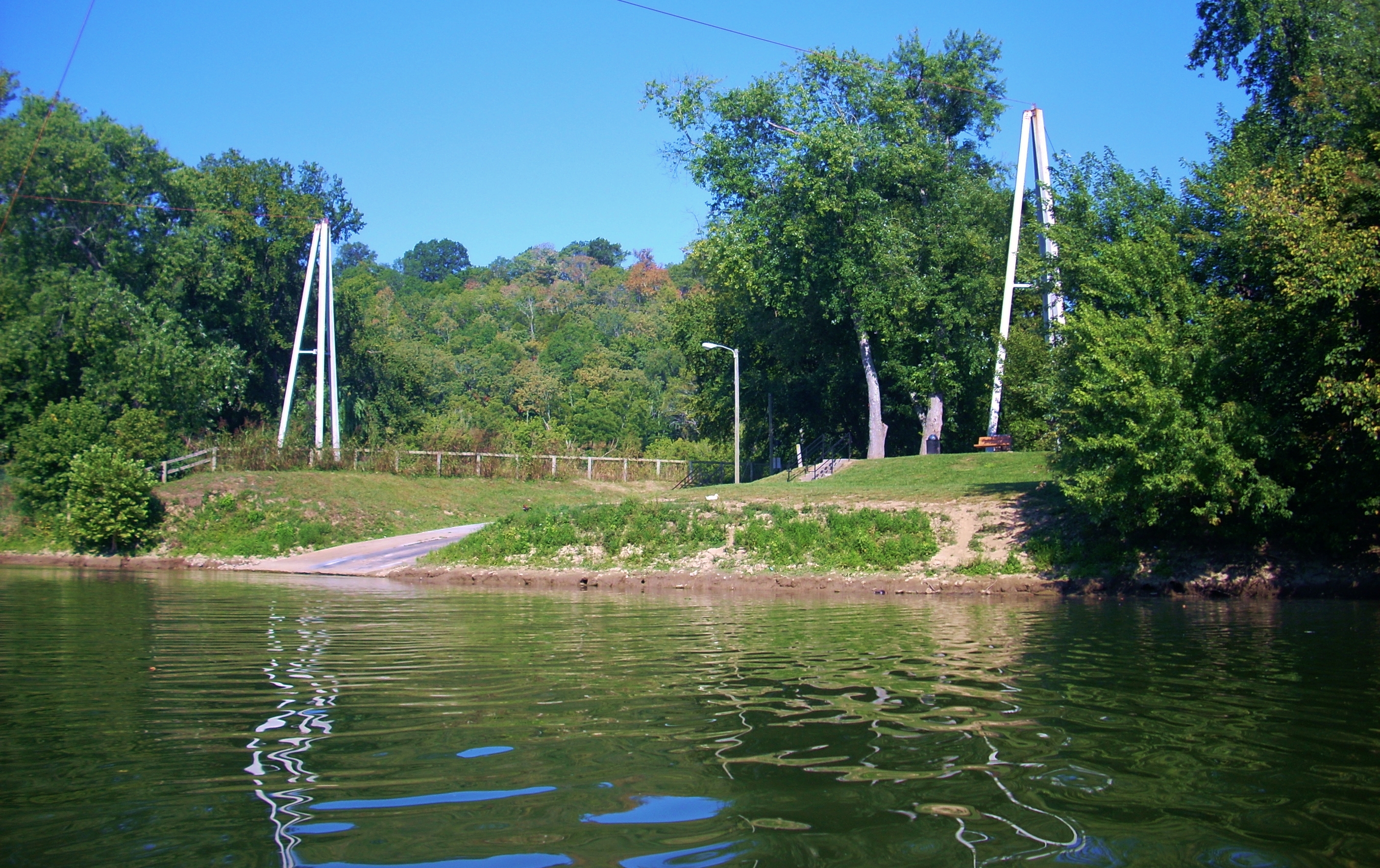
and put in at
Donaldson Park
on the Jessamine county side of the Kentucky River.
Donaldson has some amazing flood makers.
It’s stunning to see how far the river has risen in years past! This is
also the point at
which the Valley View Ferry crosses the river. As for the drive here it's simply beautiful! Tate’s Creek
Road winds through the rolling
acres of many horse farms and while the area is getting built up with a few new
subdivisions, there are still some really nice old farmhouses to see too.
This is same
the way you'd go to reach the Raven Run Nature Sanctuary, by the way. Raven
Run is a great place to hike just south of Lexington.
In fact, I’d paddle past their overlook later this day.
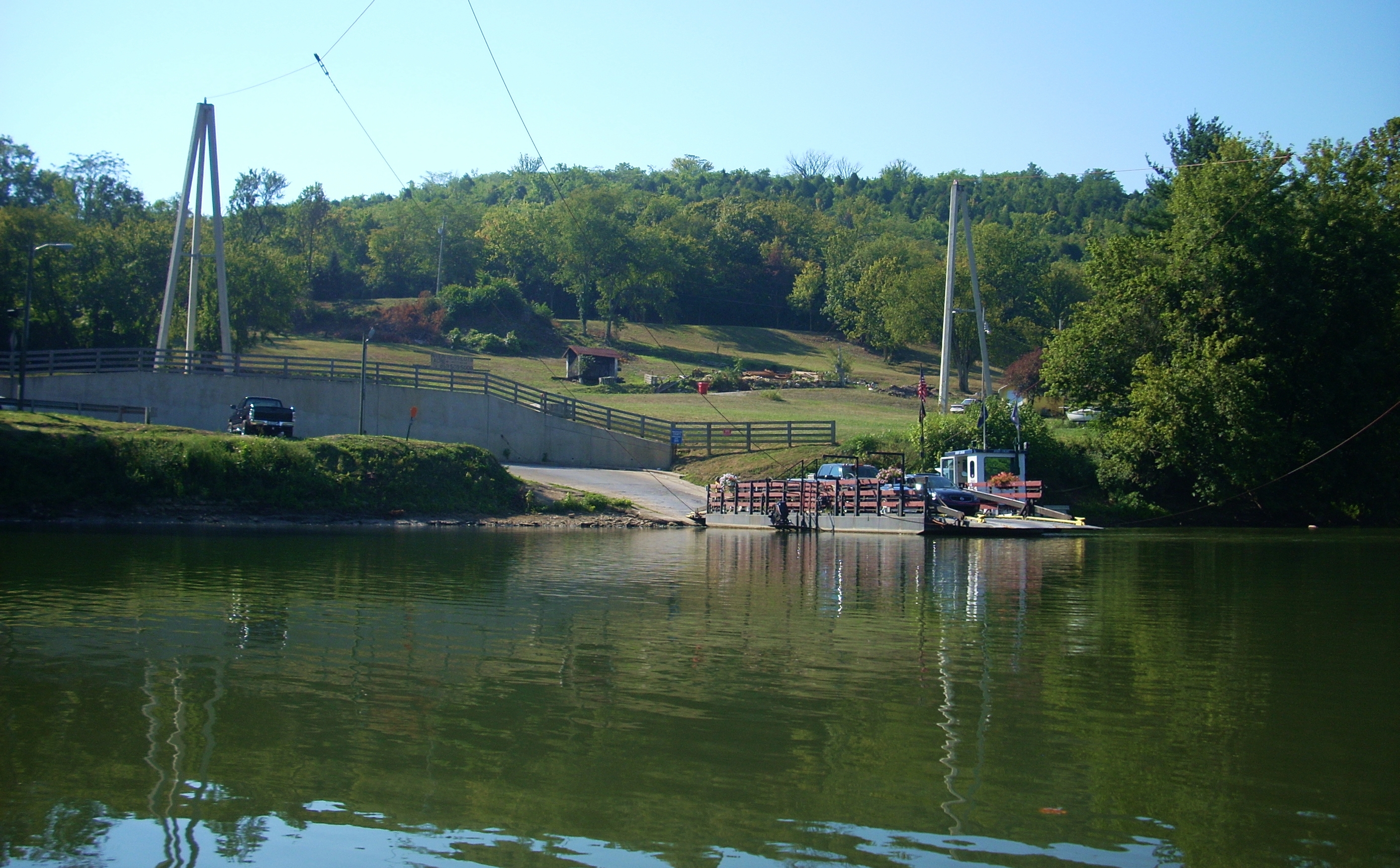
As for the
Valley View Ferry, it was established in 1785 and it’s the oldest
operating business in
Kentucky.
There used to be dozens of these ferries on the river but this is the only one
left. In fact, every time I see an easy slope to the riverbank that’s been
cleared out I automatically look on the other side to see if there’s another
one. If so, I wonder if it was an old ferry site.
Anyway, Valley View is so
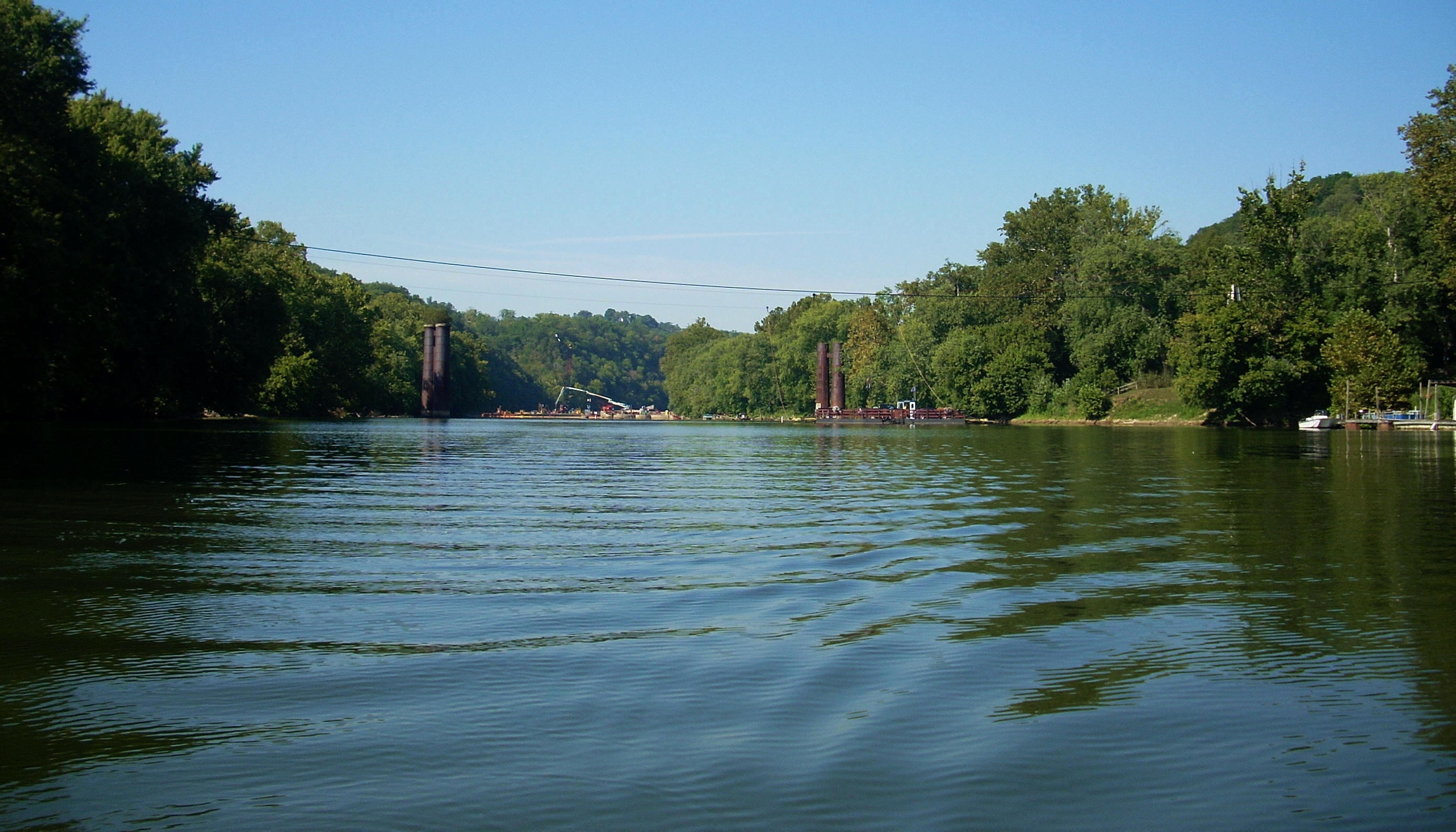
pleasant that I hear they once filmed a movie scene here. The first view
is looking downriver with the ferry visible on the right as you seem some work
being done on dam 9 further downstream. The second photo is of the ferry
itself.
I began the day by paddling up to the I75 Bridge
where I'd stopped the last time (I'm keeping with my ongoing narrative by
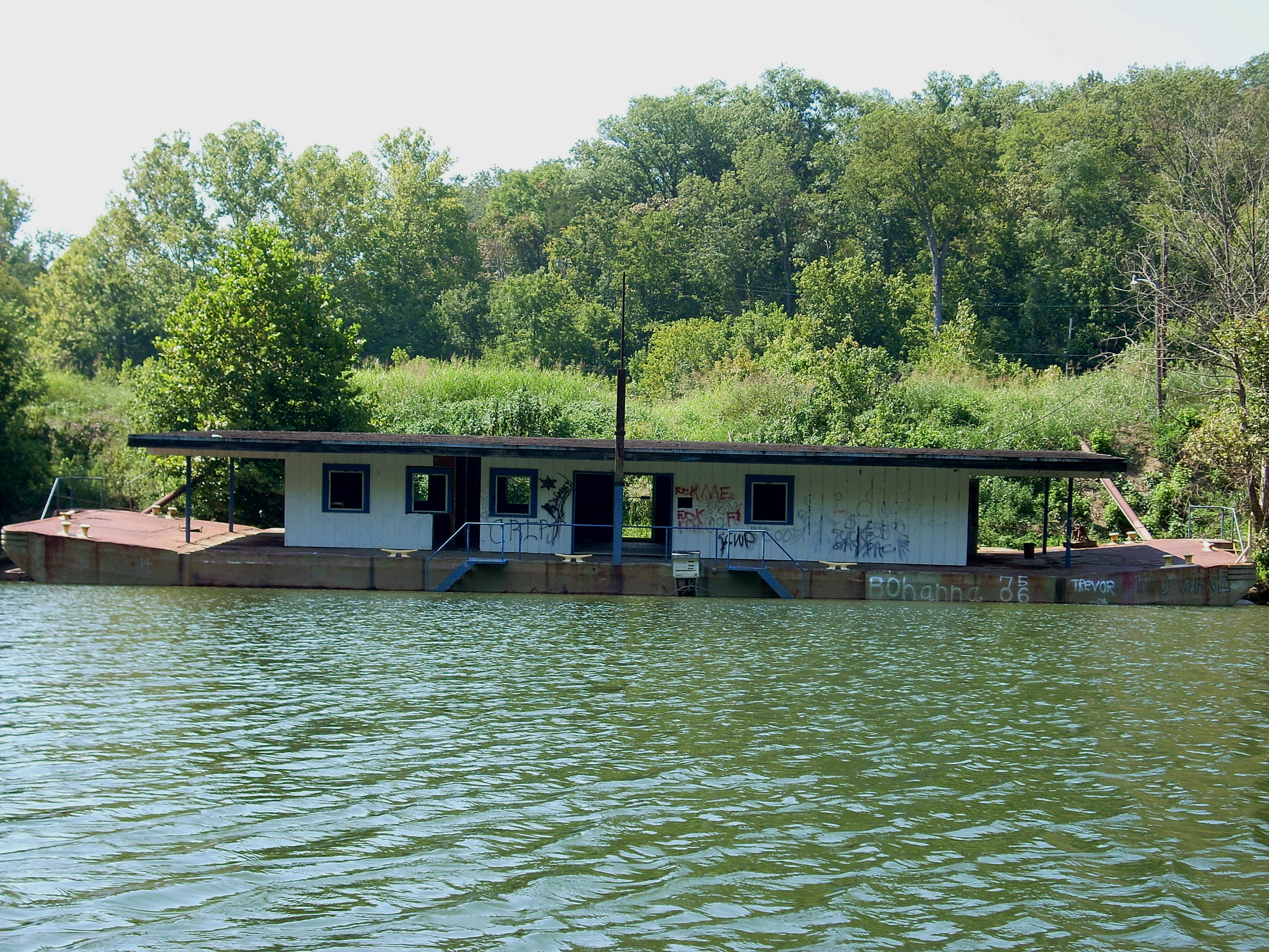
describing this section in a downriver fashion). Near this bridge
you'll find an old boat that I mentioned in the last entry. I couldn't
find a name on it, but it had a gas pump on the side so it
may have been some kind of convenience store at one point. There’s a paved ramp that comes in here
too. The Clay's Ferry Ramp is located upriver from this point where Proud
Mary's BBQ is, so I'm not sure about this one as far as whether or not it's
public.
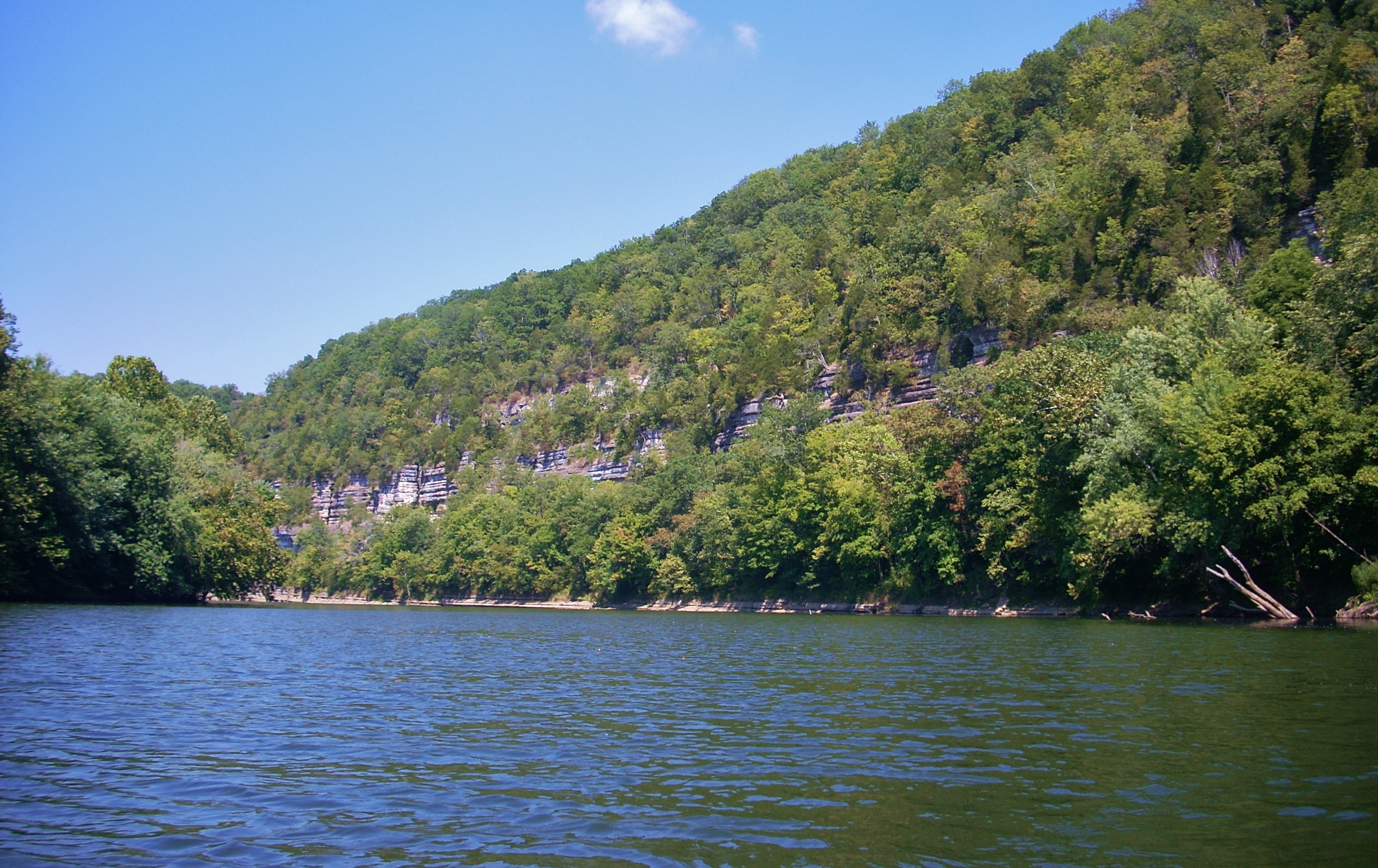
Anyhow, as you start out from
the bridge the rocky bank will be the left one. It’ll begin with just a
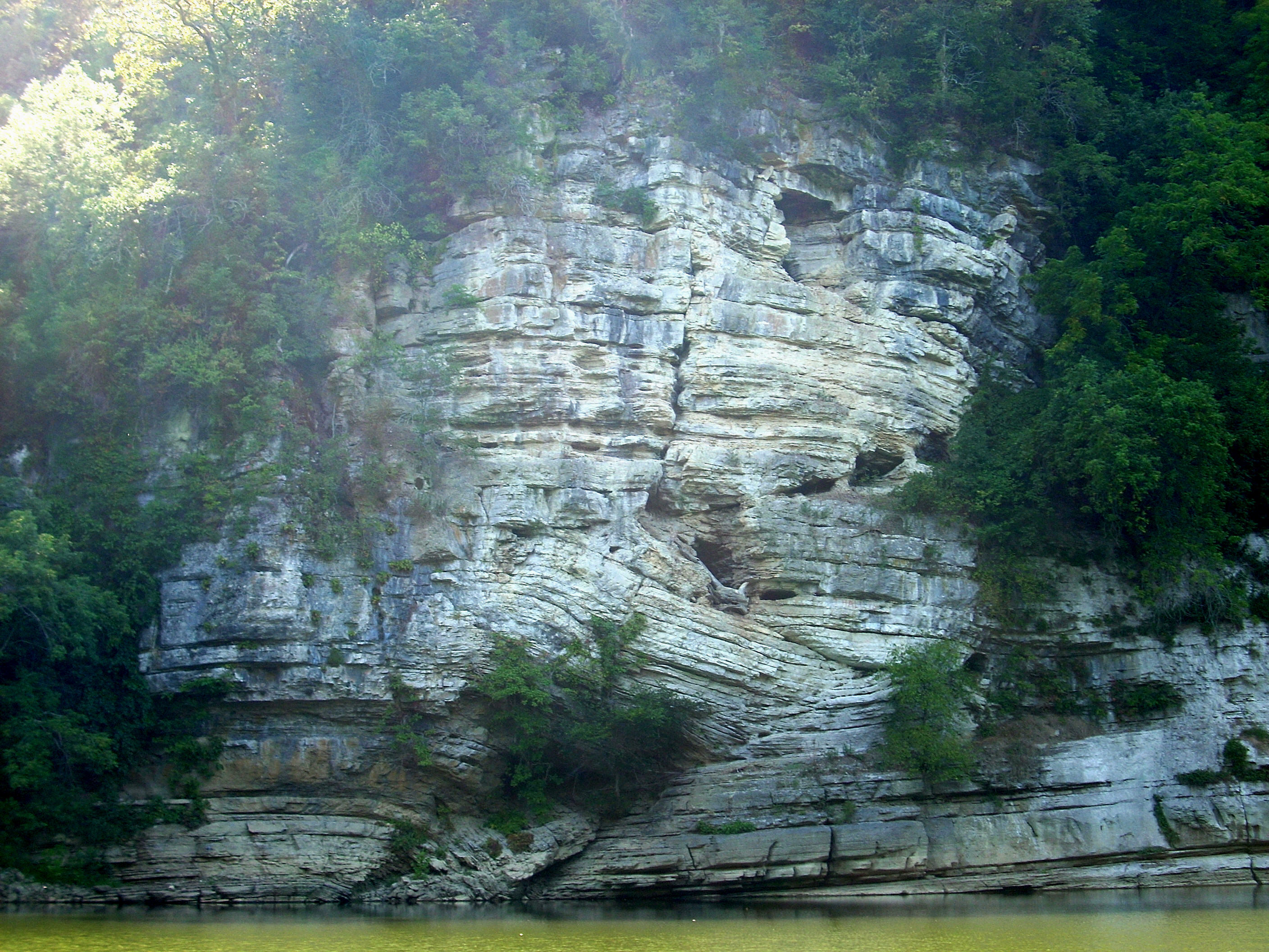
rocky bottom but it’ll end at a full palisade which contains a fault line.
Yes, a fault line! Check out the curves the rocks make – especially at the
bottom center! They seem to arch downward at a 90 degree angle.
This is called the
Bull Hell Cliff. For
that matter, you’ll know you’re fully in
the palisades region on this trip because a rock face will come in perfectly from a different side at just about
every mile mark from mile 169 to mile 165. After this, you'll find a rocky
side alternating for the next 3 miles though there’s no palisade. Mile 161
is then skipped, but
a full mile of palisades follows. What can I say?
This place rocks! Of note, too, is that the community
of Clays Ferry will be on your right as you
make the curve here. .
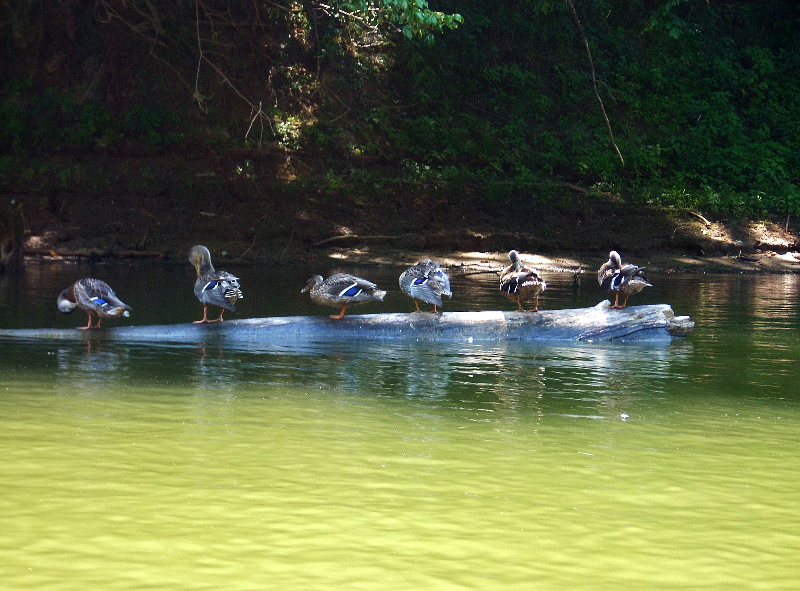
Nearing the end of mile 169, a
family of little ducks posed for me. I couldn’t believe my good fortune on
this! In fact, my luck with animals on this particular trip was quite
extraordinary. I felt like Dr. Doolittle! These ducks were
all just standing in a row on this log preening themselves. It was right after this that
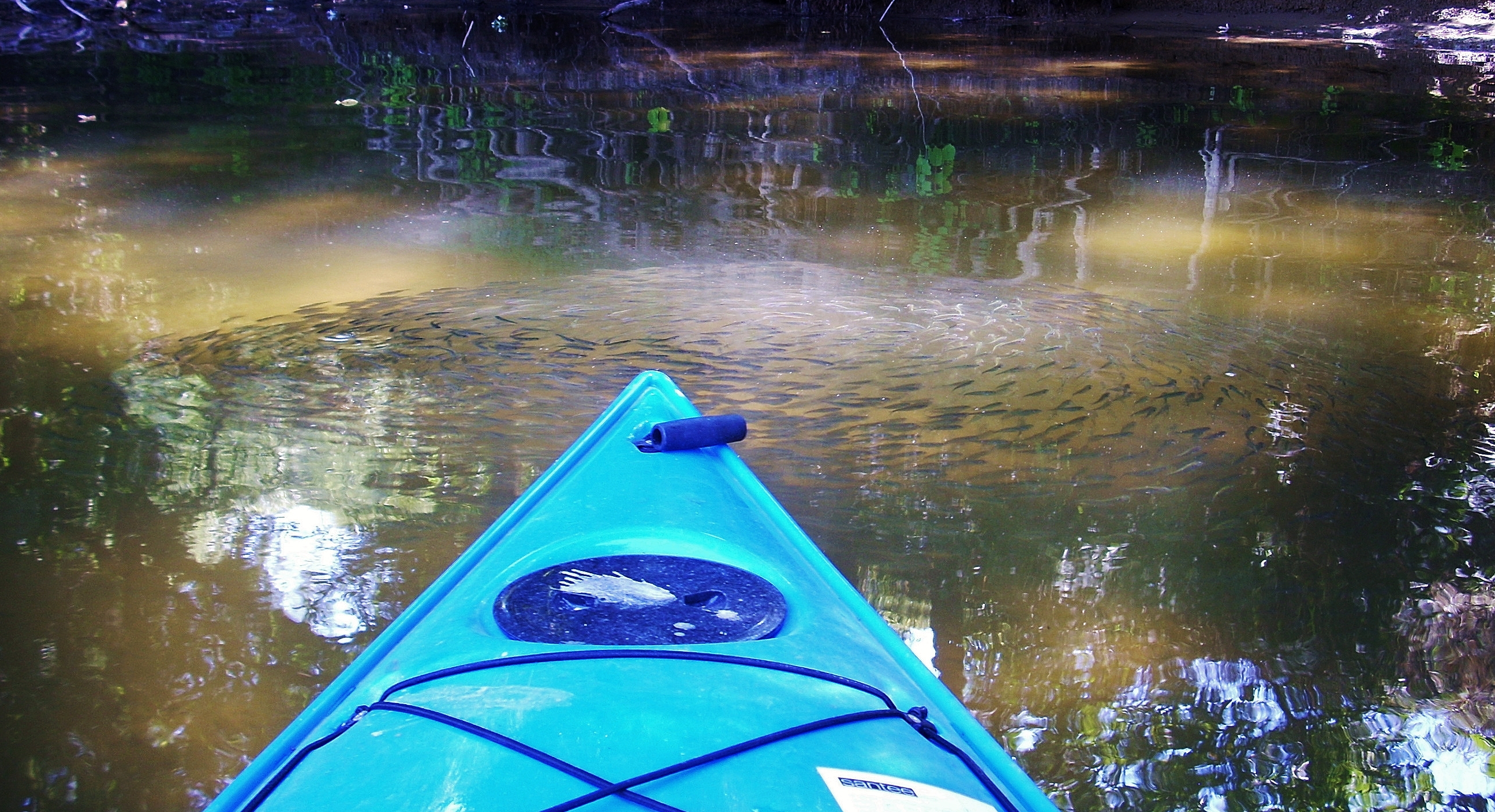
the minnows appeared again and I JUST missed getting an ideal picture of them
swimming in a perfect circular formation (although I'd get one later). I also saw
a couple deer, numerous gar,
my first wild turkeys of the year, a few squirrels and more herons and other
birds which I couldn’t properly identify.
The Elk Lick Creek comes in
next, but it was dry over a large shoal today. This would have been a
great place to stop but there were signs which discouraged doing so, and just
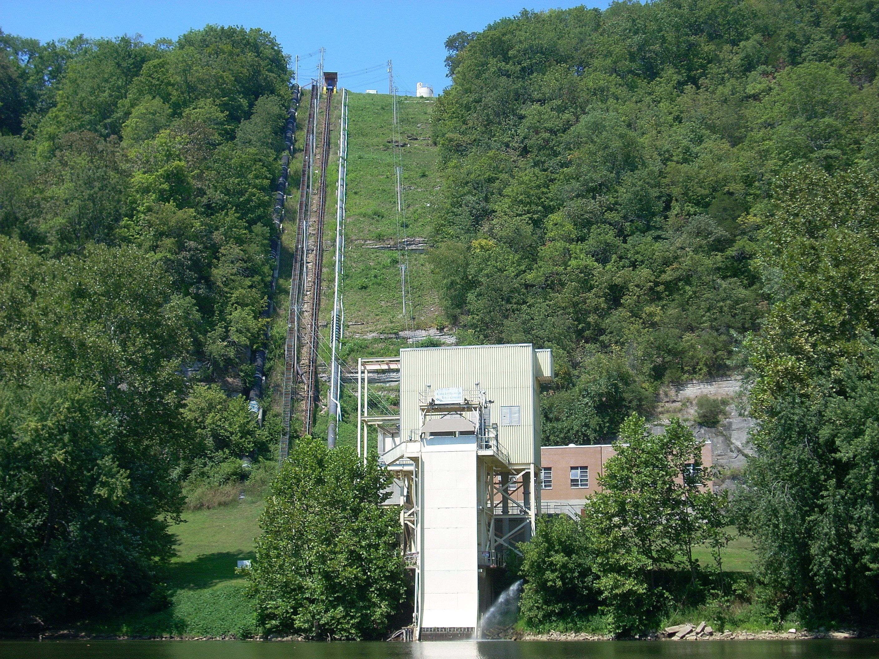
before the next palisades at mile 167 you’ll see a Kentucky American Water
intake. This location is truly amazing. There are at least 4 things
going up this mountain. The water intake itself, another pipeline which
apparently returns some water back to the river (I know this simply because
there was a flow of water coming out at the time), a staircase and a kind of
rail line. This is all accompanied by the hum of the machinery. As I
paddled by today I got an unexpected surprise too - a guy coming down in a
little cart on the rail! Altogether interesting!
A lot happens between mile 167
and 166. First, the rock faces end at the mouth of Raven Run Creek (which
I know from my hikes to be really nice). This creek comes in from the
right and the navigation here is quite hazardous. A power boat would have
to get almost all the way over to the left because a rocky shoal juts out about
75 feet from the shore - almost to mid-river. This shoal lies just
under the surface of the water, and although I’ve paddled here before, it still
nearly caught me today.
Bill
Lail Island
(said to be the only island on this river) is located immediately after Tate’s
Creek on the right, although it seldom looks like an island
except at high water. It's very slender in shape. Today its channel was blocked by debris on both
ends so it wasn’t navigable all the way around.
Meanwhile, Raven Bar lies on
the other side of the river. It has the appearance of a narrow, sandy
beach. Also on this left side is the
ominously named Devil’s
Meat
House Cave
which lies in the midst of the palisade at mile 166. I believe this to be
the very large chasm in the rock that I could only just make out
through all the trees, although I reserve the right to be wrong. :)
As the rocky character of this
left side ends, Hines Creek will come in after some power lines. It was choked off with debris from the onset,
however.
Back on
the right bank, and
down to mile 165, was a cleared out landing which looked like it
would be a perfect spot for a summer camp. It ended at what looked like
the semblance of an old ramp which was complete with a
U.S. flag at the top. Nice touch!
Contining on the
straightaway from mile 165 to 164, there was a super nice farm visible on the
left side immediately past Hines Creek which had its own ramp. There were
also quite a few homes and/or getaways on this side after the farm, and on the
right there was an interesting old stick of metal protruding from the ground
which had a metal wheel midway up. If the wheel had been at the top, it would
appear as if a pinwheel. Please forgive my ignorance, but intriguing as
this was, I have no idea what it was. The mile ends on the right with a little dock that contains
a nice shady river overlook at the top of the bank.
At a curve right after mile
164 the Jacks Creek comes in on the left. I got in about 200 feet by my
reckoning and while I was heading in I noticed what looked like a hunters
perch. There were wooden steps up a tree which ended at the platform.
Paddling this stream was irritating though… How could gnats do something
so utterly disgusting as to fly directly into your eye! I did,
however, get the picture I so wanted of the minnows swimming in formation.
There was a school of gar in this stream too so there must have really been a
fight for survival going on.
It was just after emerging
from this creek that a spontaneous stream of flowing water erupted from the left
side out of a culvert. There were also
many more fish visible here along with another really nice looking farm.
In fact, there was a series of buildings on the left that appeared to be of the
same kind of construction (log cabins with red metallic roofs) and it was on
my last trip here that I noticed a “for sale” sign in one yard.
The sign was no longer visible so I assumed that someone had
quickly snatched it up. Across from here is
the Jack’s Creek Bar on the right, and there could have been a ferry here too
as there appears to be an area cleared out on both sides.
The navigation charts now go to another
page as the banks clear a little from here to mile 162, thus revealing some nice rolling farmland.
This farmland was nice to see since it had been so elusive upriver. In
fact, I felt as though I was making up for some lost time. The rocky shorelines emerge
here again on the left.
Halfway between miles 162 and
161, the Dry Branch enters on the right. It was dry (How bout that!
Dry Branch – dry!) but on my way upriver I'd run into a nice couple
here. They were just hanging out enjoying the scenery.
The woman mentioned that she had been on a boat ride in the 1970’s that went from Boonesborough all the way to
Cincinnati.
Wouldn’t this have been nice! It seems
that those who experience this river really develop quite a fondness for it with
a tale that they’re always willing to relate. I’m always happy to meet
them! On a side note, I only
recently realized that I was misspelling Booneborough! The name has an
“ugh” at the end of it! Funny... Nothing about the community would
elicit this kind of response, yet I’ll go back and make the change. :)
After Dry Branch enters,
you’ll see open hills of farmland on the right, while the rocky side of the
river will be on the left all the way to mile 160.5. After this, the rocks
will switch to the right again at a palisade which will extend for another mile
and a half all the way to mile 159.
There are 3 really nice little unnamed streams which
come in in the midst of these rocks. In the springtime myself and a friend of mine
paddled right into them and were able to see nice waterfalls in each one.
Today, however, I wasn’t able to get in! Lovers Leap
lies atop this palisade, although I know that there are more spots with the same
name further downriver.
As this palisade ends at about mile 159, a ramp comes in
from the left side, and it appeared that there could have been another camp here
as there’s a kind of shelter atop the bank. It was here that I looked into the distance
downriver and spotted a couple kayaks near the mouth of Tate’s Creek!
Getting down there I found 2 guys fishing. Usually I’m hesitant to greet fishermen out of fear that I’ll scare away
their fish so I paddle all the way over to the other side and don’t even say
“hi”. I simply just wave. These guys didn't seem to
mind talking, however,
and it turned out that they had put in from Donaldson Park just as I had.
One of them even mentioned that there had once been a
crossing of civil war supplies near the mouth of Jack’s Creek. I'd just
passed the creek
without knowing!
On a side note, I happened to run into
one of these guys the very next morning in
Lexington!
Have you ever been surprised when, after never
experiencing a certain thing before, you happen to encounter it multiple
times in a short span? This could be a person you meet,
something you see, or simply a word you hear. This happens to me sometimes.
As for Tate’s Creek at mile 158 I ventured up about ¾ mile.
The creek was apparently named by Daniel Boone for 2 boys named Tate who
escaped an Indian attack by running into this stream.
Jessamine
County,
Kentucky
is on your right side at this point on the main river and when you're in this
county you have access to a great resource. You see, the good people of
this county have such affection for the river
that they’ve put out a guide called the
Jessamine
County Kentucky River Task Force Guidebook. This fantastic guide
contains vintage photographs along with historical information for the entire
stretch of river in this county (all the way down to Brooklyn at mile 113).
Anyway, downriver from Tate’s Creek things get pretty interesting.
There’s a private boat dock and ramp on the right and the aforementioned Valley
View Ferry runs over the river as well. Today they were doing some work on dam 9
which was visible in the distance and there were also some more of those old bridge piers
here - the same kind that I’d been seeing on the river ever since Heidelberg. I'd surmised that these
were remnants of old railroad bridges, but the guide I mentioned
provided the last clue to the mystery for me.
Apparently there was once a railroad called the RINEY-B (acronym for
Richmond,
Irvine,
Nicholasville, and Beattyville – although you could also throw in Evelyn and
Yellow Rock for the “E” and the “Y”) which used to run all along the river.
These old piers are the last vestiges of that railroad. What a fantastic
scenic railroad this would have made!!
It
all finally fell into place! The rails would have crossed
the river at the old bridge remnants I'd seen in
Heidelberg (mile
249) Evelyn (236.5)
Irvine (217.5) and now Valley View
(157.5)! I’ll see if there are any more.
Anyway, with all this – the ferry, the railroad and the boat dock – it’s
apparent that Valley View used to be quite a hub of activity! This is
especially true when you stop to consider that it’s the closest spot to
Lexington
on the river and that it would have been the point to cross the river if
you wanted to head south from the city prior to the construction of the I75
Bridge. One of the 2 gentlemen I met had also mentioned this. There
used to be a saw mill and a steamer line here too, the latter of which ran all the way up the
river.
Spears Branch enters the river just at the bridge piers
on the right, but it wasn’t really evident and at the dam it was obvious that
they were doing quite a bit. Lock and dam 9 is, in fact, similar to lock and dam 10
in that both were washed out by the 1905 flood. Thus, this location also
has a sheltered pool like dam 10 did - a pool which was apparently carved out by
the debris from this flood. We’ll have to see if there’s a large beach on
the downriver side like there was there. I’ll find out next time…
DIRECTIONS:
This is pretty easy. Simply follow Tate’s
Creek Road
all the way (Spears is the last town you’ll pass) till it ends at the river.
There’s a small park on the right (Donaldson) with a few parking spaces.