HIKING                                      HOME                                  PADDLING


2008 Kentucky River


Wednesday, August 13, 2008


Red River to Two Mile Creek (Mile 179.5)


Aren’t chance encounters amazing?  The most incredible one I ever had was when I lived in Houston, Texas during my high school years.  I was at a party one evening and a guy came up to me and asked:  “Are you James DiNardo?”  I turned out that he was a boyhood friend I had known growing up in Middletown, Ohio!   I remember being elated to see him and catch up on old times!  Well, I mention this because when I got to the ramp at the end of KY977 today I was nearly bowled over by the sight of one of the rarest breeds of wildlife on the Kentucky River – the kayaker!  There he was, across from the ramp at the mouth of the Red River.  We exchanged a wave as he paddled downriver in the direction I was to be headed.  I'd meet him a little further down.  NOTE:  The ramp I used is now paved and it's called the College Hill Boat Ramp.  You can look it up on Google maps.


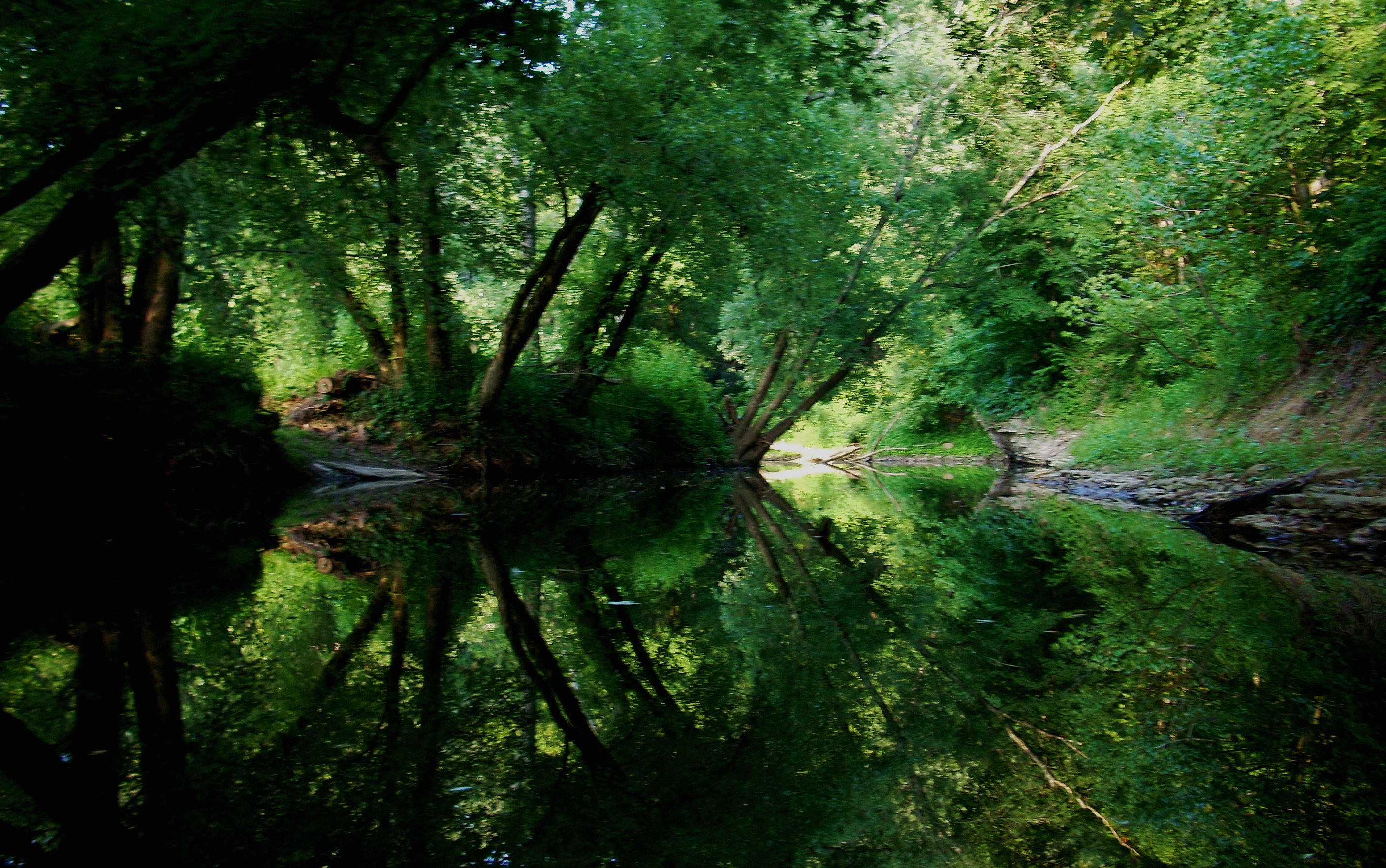
Meanwhile, once I'd gotten on the water I paddled over to the Red.  It’s not huge, maybe the size of the Middle Fork, but it may be the longest incoming stream on the Kentucky.  As stated before, I’ll probably paddle it after this Kentucky River trip is through, but I’m not taking the time now out of concern that I’ll be able to finish the Kentucky itself before winter really hits.  After all, I know that the Red (like the Kentucky) has 3 forks and it would probably take some time to paddle the whole thing.


Anyway, there’s a marina at the entrance here along with a couple more boat ramps, although the marina could just be a series of docks (it’s hard to differentiate sometimes).  In fact, there was so much over here that I decided to look at the online maps and at the Department of Fish and Wildlife's publication: “ Kentucky’s Boating & Fishing Access Sites” to find out a little more.  What I found is that this area is off Ferry Road in Clark County near Winchester, Kentucky.  Given the name of that road, it's apparent that there used to be a ferry operating here!  It made sense given the ramps on both sides of the river.  Funny, but just discovering little things like this has become a source of real happiness for me.  I really hope I’m doing both the river and the memory of the people whose lives were intertwined with it a service by writing these journals.  I apologize again, however, for my naivety.  I hope to learn much more.  


Back to the river:  there’s another creek which comes in just after the Red River on the right.  It’s not on the navigation charts and I nearly missed it because of all the other things to see here.  It looks like you can get in at least a little way with a kayak, and I did until I heard some voices emanating from around a curve.  I decided not to go on.  There may be a campground here, and I didn’t care to startle anybody who might be in an awkward position back there.  This creek was a few yards wide, I’d say, and after emerging from it you'll be up against a forested hillside on the right.  It starts with the same rocky shoreline that characterized most of Monday’s trip from dam 11, but today these rocky areas would be with me for only about half of the trip.  There’s an interesting dirt road here, too, on the right which weaves precariously up and over the undulations of the terrain.  Miss any turns here and you’ve got problems!  Farmland would accompany me on the left side.


You’ll go into an “S” curve at this point (mile 191) which stretches to about mile 187, and it was just after mile 190 where I ran into my fellow kayaker.  As it turned out, neither of us had thought that the other was going as far as what we at first imagined.  I assumed he had just put in for the day to paddle this pool and he probably thought the same of me.  Do you know though, that he had me beat hands down!  This gentleman had put in at Jackson, Kentucky on the North Fork and was paddling straight through to High Bridge, camping out all along the way!  He was also porting all the dams, apparently utilizing their ladders and a rope that he had tied to his kayak. 


Needless to say, I was fascinated by all this because he also said that he had paddled the entire river just last year in a canoe with his father.  I remembered that while eating at the Riverview Restaurant in Irvine last year I had been told about a father and son team who had done this.  This was probably one of the same guys!  Well, it’s always nice to know that someone shares your interests and I was very happy to have met this gentleman.  We ended up paddling together all the way down to Two Mile Creek.  What an encounter!  If I'd gotten to the ramp even one minute later I might never have met him!  His boat was faster than mine with a rudder as well, so he probably would have been way ahead of me.


Anyway, upon reaching the middle of the “S” you’ll begin to notice a lot of little getaways because there are houses, cabins and even some camping setups all along this part of the river - a few ramps too.  I remember seeing at least 3, including one a little way into the Upper Howard Creek, and there were remnants of even more.  Thus, this pool certainly appears to be well utilized!  Not only do you have all this and the dock/marina at the Red River, but there are also a couple more marinas:  one at the mouth of the Two Mile Creek and one further down closer to Dam 10 at Boonesborough Park Winchester, Kentucky is close, however, so I’m guessing that that’s part of the reason why.


Bull Run Creek comes in between mile 189 and 188 and I paddled it on the way back.  [I’ll mention here that I’ve come up with a real “scientific” way to determine the length of paddle-ability on these side streams.  I simply count paddles!  Each time the paddle hits the water is “one”.  Thus, I hit water on the right, “one”; hit on the left “two” – and so on].  I was able to get 80 paddles in on Bull Run – roughly 40 feet. 


Getting back to the river...  After reaching the end of the "S" at about mile 187 I 
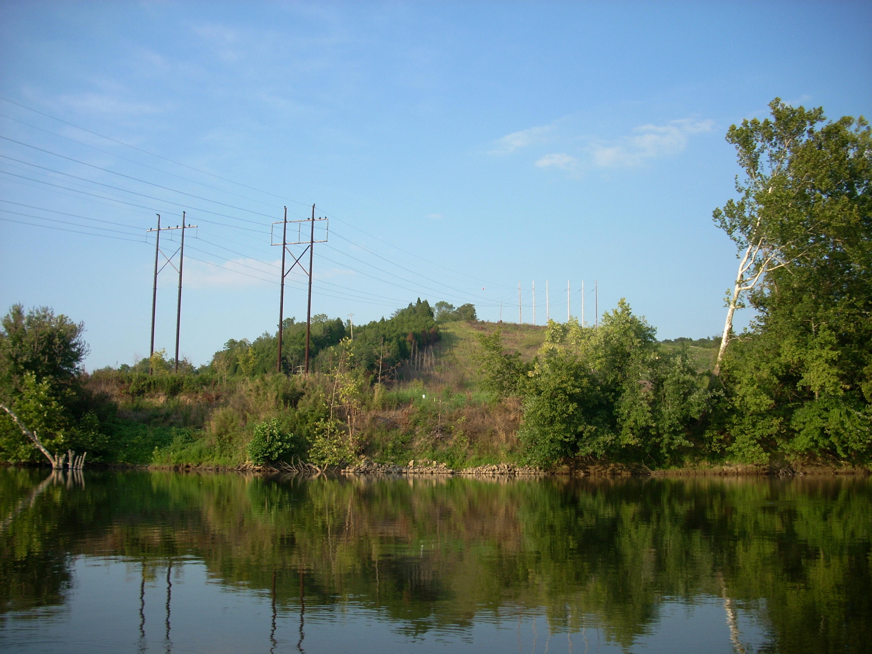
noticed that the scenery had shifted at about this point with the rocky shores moving to the left bank.  No Name Creek comes in somewhere in here from the right but it’s not much in evidence.  After No Name you can look down an alley in the river and see another house on top of a clearing on a hill at the end just past mile 187. 


There are also signs on the banks which indicate the presence of underground gas lines, and the Upper Howard Creek enters from the right, 150 feet in length.  Upon entering it, you'll find a cornfield on your left through which an old concrete ramp enters.  It still looks useable but I wouldn’t try it – a sign indicates that it’s on a shooting preserve!  I paddled the Upper Howard on the return trip just before 8PM and I knew it was getting late because I saw raccoons scurrying down from the trees which formed an “A” as they leant over each side of the creek.  One raccoon was by itself and there was another group of 3.  It was funny seeing 3 little shapes moving in seeming unison down a tree trunk.


Back to the present.  Around the left curve after mile 187, you’ll have another shape taking form at the straightaway.  A question mark! You’ll enter it from the bottom and paddle up.  As you do, there’s an unnamed incoming stream on the left with a bridge just visible which has been reinforced from underneath at no small expense with a lot of concrete. 


At mile 185 the land has again been cleared out for more power lines (this is just at the curve right on the question mark) and the Muddy Creek enters on the left side.  It was the longest of the day at about 250 feet and it was really pleasant.  Near the mouth I spotted a lone turkey buzzard hanging out on the bank and when I came out I noticed a ton of little mussel shells which had found a spot in the trunk of an old tree in the water.  It amazes me how things adapt to different environments.  Trees especially.  I've seen them grow around rock ledges and I've even seen them grow at trajectories which almost parallel the water at times.


There are some more signs for underwater gas lines as you round the long left curve of the question mark shape back at the main river.  The Indian Creek comes in at mile 184.  I didn’t paddle it although I was really tempted.  It was blocked nearly at the mouth by a jam up of debris and a little trash, which I probably could have gotten through, but I was getting concerned that I might run out of daylight on the way back.


After Indian Creek the right side begins to open up with views of rolling farmland visible between the trees, and these views emerge more and more clearly as the hills recede further from the river.  Around mile 183 there’s a lone chimney visible too which is just standing by itself out there.  It looks quite old and I wondered if it might be the lone remnant of an old homestead.  The Bar Run comes in after mile 182 (about a foot wide today) and the rocky shoreline will return for a time on the left.


Just before reaching Four Mile Creek my new friend and I spotted a turtle on a tree branch in the water.  Pretty bold, this turtle had the courage to pose for some pictures!  It didn’t appear to be a box turtle.  We thought it might be of the snapping variety.  Its color was the same as that of the tree (light brown) and it had what looked like little thorns on the back of its shell.


Four Mile Creek enters on the right between mile 181 and 180, and it looked to be about the same size as the Upper Howard Creek and the Muddy (lots of creeks in here!).  I got in a little over 200 feet.  There was a nice house with a great setup to the left of the mouth as I headed in.  The banks here are mostly farmland although it gets hillier and shadier the further in you go.  In fact, all of these creeks are incredibly nice, especially if you can get into them a little way past the mouth.  Most have a real intimate feel to them – seemingly very private.  This creek ended for me at a rocky shoal.


Past Four Mile at about mile 180 on the river there’s an interesting structure.  It looks like an old houseboat that’s been sitting for quite a while.  It’s all vandalized now, but it looks like it might have adjoined a dock or marina at one time.  In fact, the dock is still visible and it’s held up quite well.  It isn’t on the navigation charts though, so I’m uncertain about what it might have been - maybe just a nice private dock.  I’m left to wonder…


About mile 180 you’ll be able to spot an actual marina – the Boondocks Marina where I put in on last years trip.  It looks quite picturesque at the bottom of a tree-lined hillside, yet this was where I would have to part ways with my fellow kayaker.  He’d continue on to the High Bridge near Wilmore, Kentucky and I’d head back to the KY977 ramp.  Having a comrade was a nice change of pace and I learned quite a bit!  The Two Mile Creek, by the way, is right here at the marina and I got in about 100 yards.  It ended soon after I went under a little bridge.


Getting back just before dark I found some people hanging out at the bottom of the ramp.  It’s a really pleasant area to enjoy!  I had a bit of a scare getting my stuff up to the car, however.  I couldn’t find the keys in my life vest!  That’s where I always put them.  Talk about a sinking feeling!!!  I looked through everything before I realized that I’d left he keys inserted in the trunk keyhole!  Really!!!  I honestly don’t know whether I had just done this a second ago because I was tired and thinking about something else or if I’d actually left the keys in the car before I'd set out in the morning!  When strikes the forgetful man-klutz?!?  Ah, the mystery…


DIRECTIONS:


KY52 to KY 977 (only 1 way to go) in Waco.  A sign will indicate that the road ends in 10 miles.  Go the entire 10 miles and you’ll end up at the ramp.  There’s room for a few cars.


When you reach this particular spot, the landscape gets interesting.  Some power lines go overhead and the landscape has really been cleared out for them, so you’re able to see more of the surrounding countryside.