PLACES TO GO ON LAND HOME PLACES TO GO ON WATER
Exploration of Headwaters
via the Van Buren Ramp
As of today I
think I may have found my favorite lake put-in in the state so far.
In fact, if you told me that I could only paddle in one place this year,
this would probably be it. Not only is the drive out among
the most scenic I’ve been on, but this area would also prove to be the most
diverse in terms of scenery yet. You’ll be able to paddle the
lake, of course, but you can also explore some of the coves and see a portion of
the
To be honest,
it was my bad luck with boats which first led me to this lake last year (albeit
from a different ramp). After putting my boat atop the car
for a trip out to join a friend on
Anyway, I had
to take the first kayak back that day for the replacement, and by the time I did
I no longer had time to join my friend. I instead wound up at
the ramp in Taylorsville Lake State Park (a pretty big park with a good deal of
hiking trails, most of which you’ll share with horses
http://parks.ky.gov/findparks/recparks/tl/), but being at the ramp
that particular day (a Saturday) was like being at Grand Central Station!
Today and from this ramp it was much, much better.
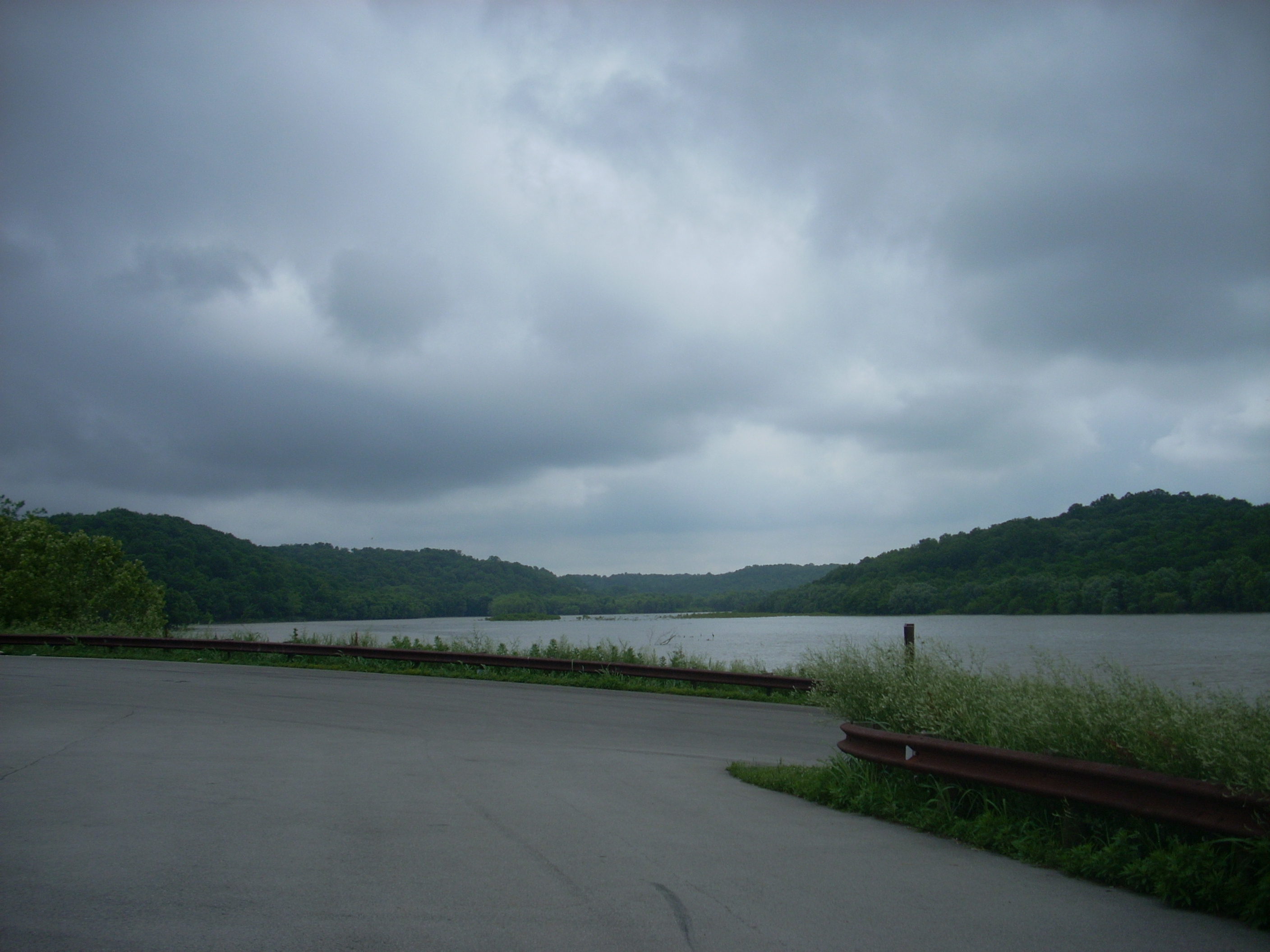
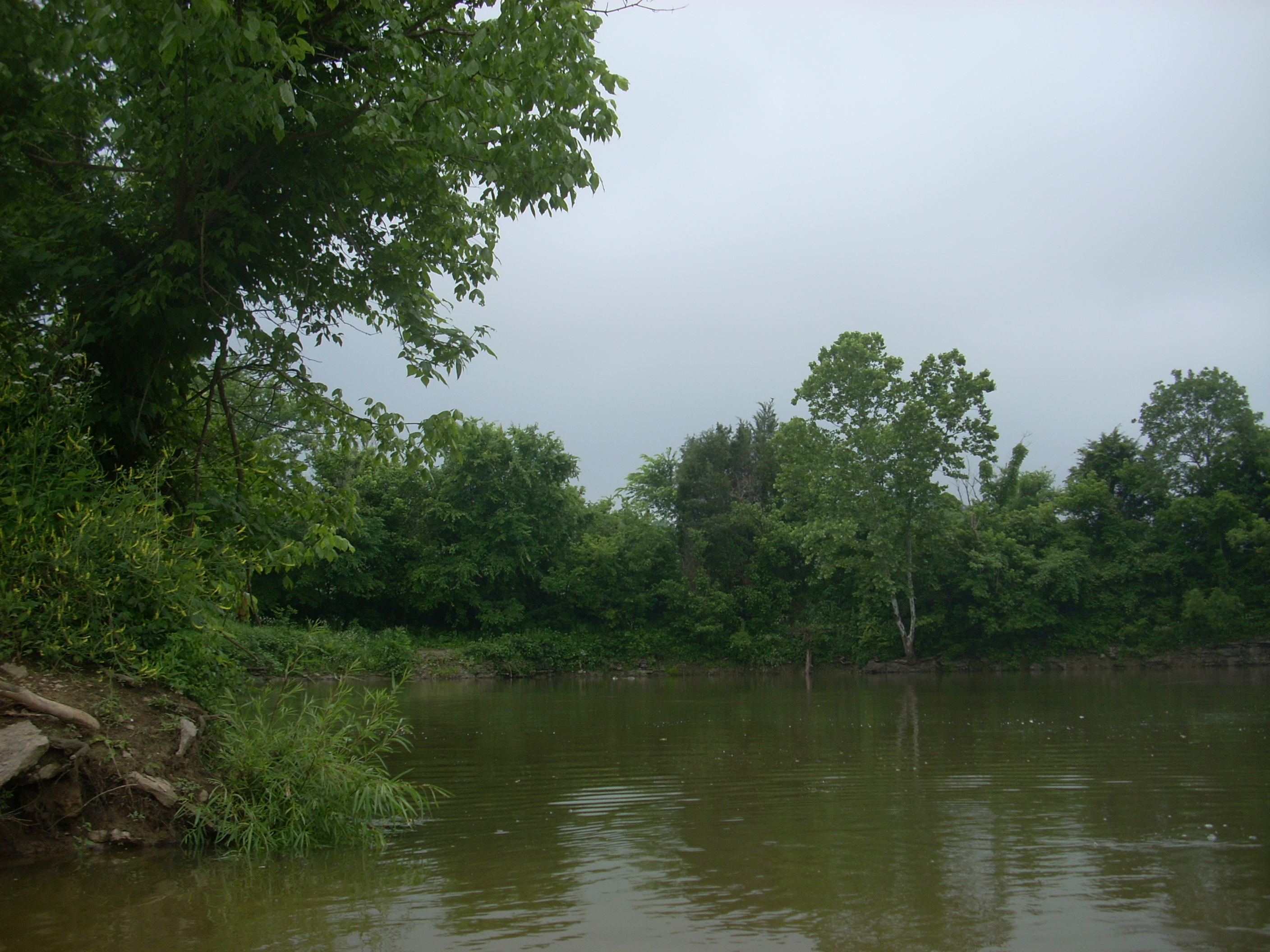
From the beginning it was clear that this was going to be one very pleasant day! I could tell simply from looking out at the beautiful scenes from atop the ramp.
Whereas my last
paddle on
There was
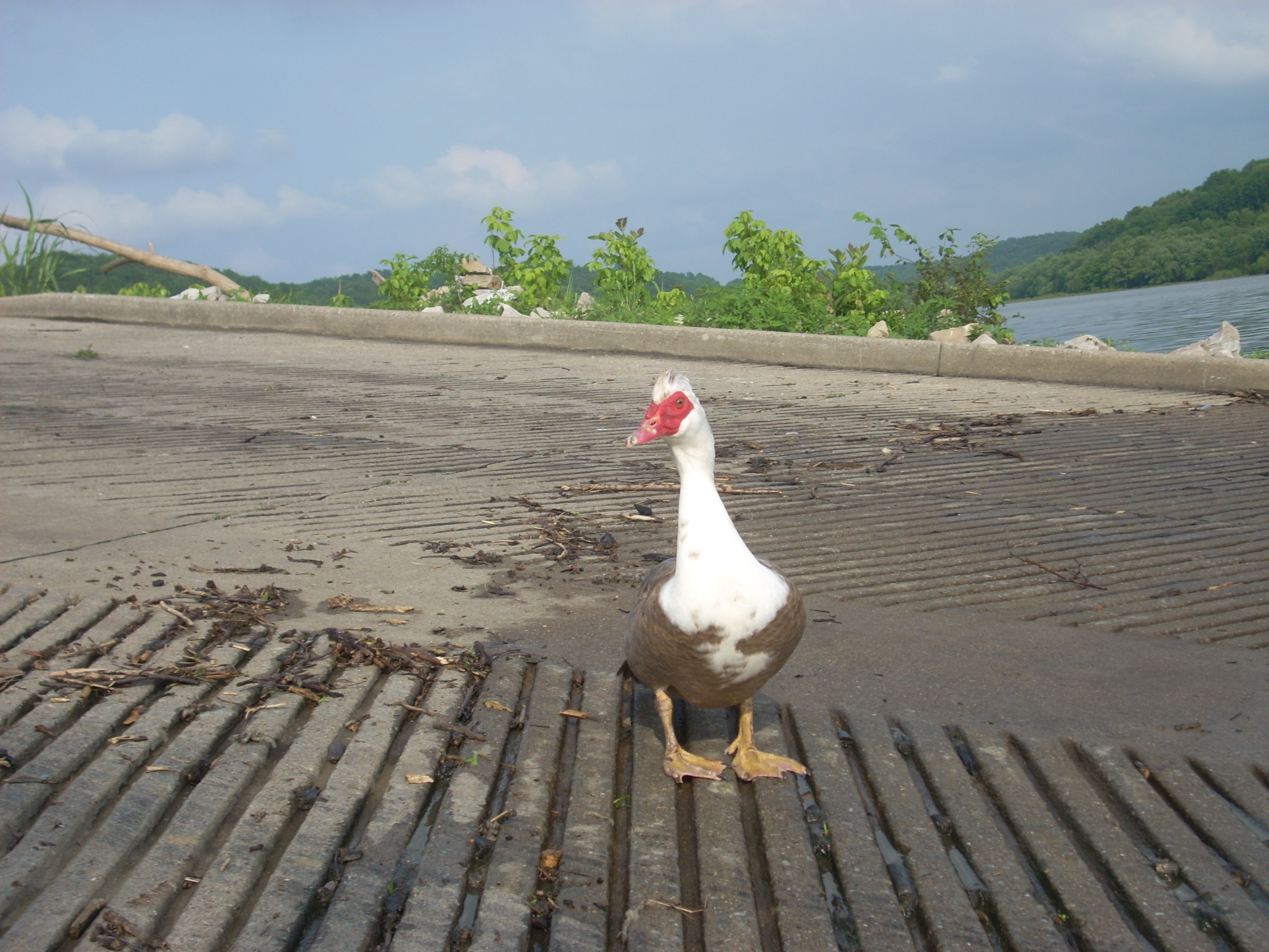
another kind of animal at the ramp to greet me though! I’ve
described it in the past as a red billed goose, but I had to look this one up.
I’ve seen quite a few now, and I was curious… Well, it
turns out that these aren’t geese at all, but large ducks called muscovy ducks.
Having adapted to colder weather, they’ve migrated from
I pondered a
bit which way to go when I got on the water, but eventually decided to head
“upriver”, or left, on the lake in order to explore the headwaters.
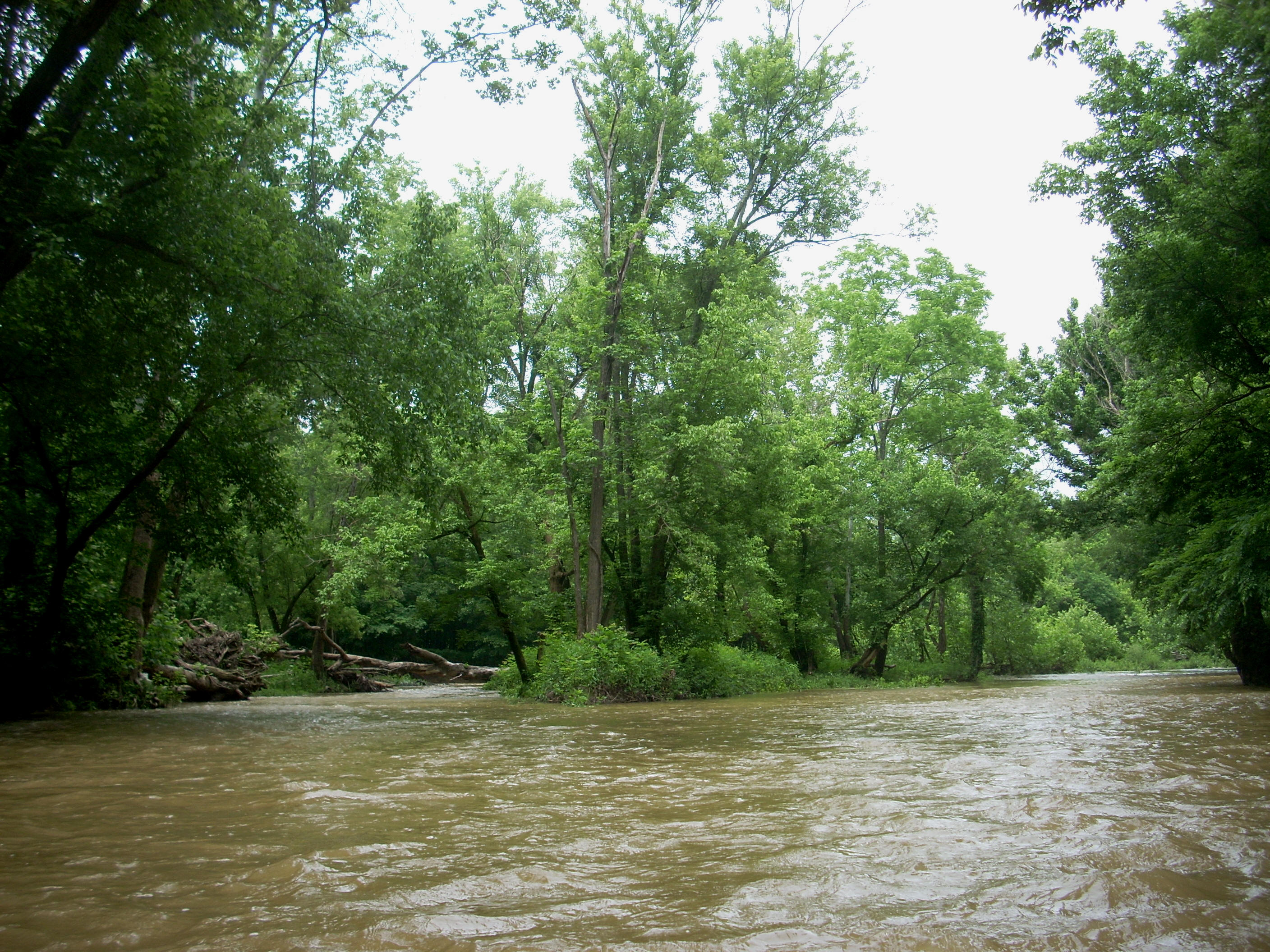
As I did, I was paddling alongside a section with very low, forested
banks where quite a bit of deadfall debris had accumulated along with a bit of
trash on the shore (although it wasn't bad, this wasn’t the cleanest lake I’ve
been on – yet it would get better the further “upriver” I went).
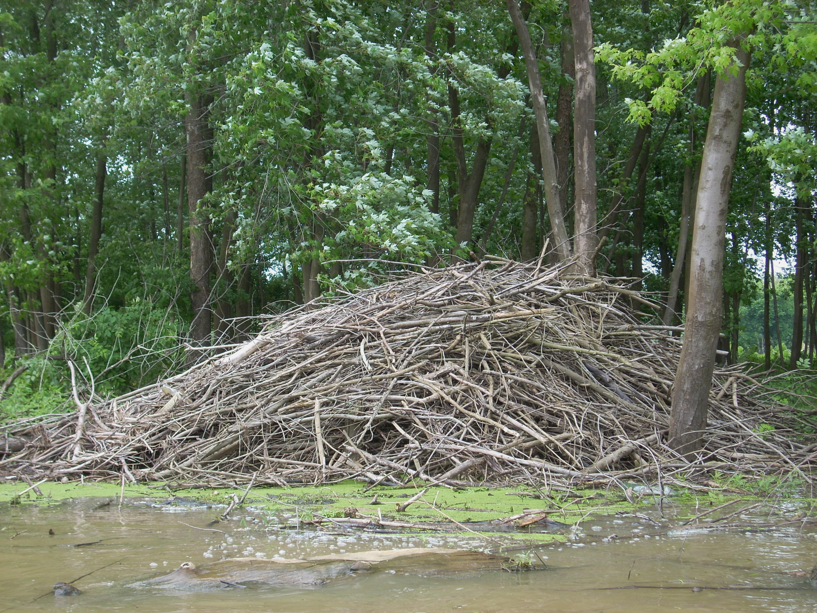
Whilst I was taking all this in, I just missed a huge beaver. I noticed it out of the corner of my eye as it seemed to lazily and reluctantly dive into the water. I say it this way because the motion was very slow. The animal had been atop a large tree root protruding from the water, and it seemed to have held its ground until the last minute. What a GREAT picture this would have made! I got one of a beaver house instead...
There were some great marsh-like coves in here during the first part of the trip today, a trip which would take the shape of an “A” frame which I’d be exploring from right to left, and at one point I startled a deer on the shoreline. I’d never heard a deer make this noise before, but this one produced the oddest sound (which, in fact, I’d hear again later)! It actually sounded more like a heron – a kind of “sckraaack” combined with a hissing – and a noise you’d never expect to hear from such an animal as a deer.
Something else
I saw added another piece to a puzzle which I’d been trying to form.
When I paddled the lower sections of the
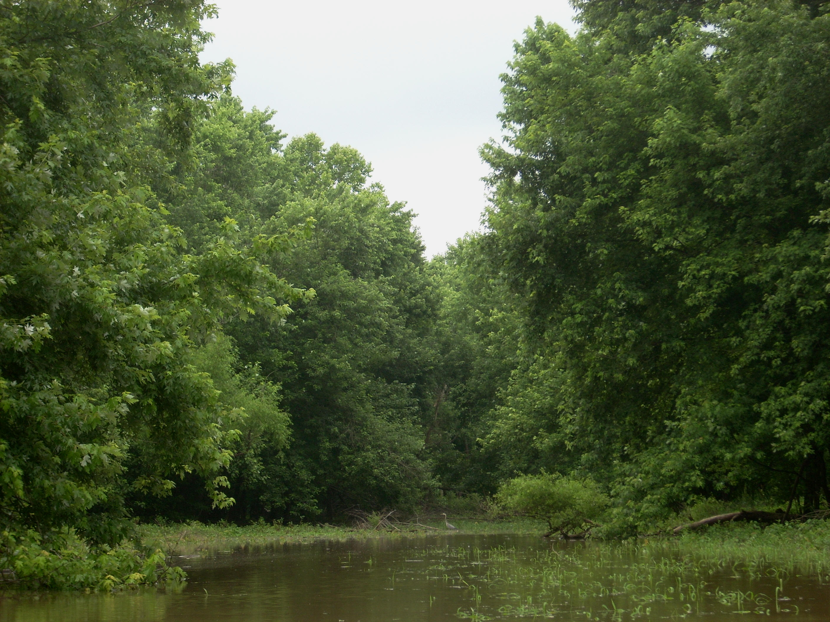
After I’d made the bend at the top of the “A” I saw the bridge for KY248 in the distance, and as I approached it I saw that there was an “ear” on the left side just before reaching it. I paddled in through the narrow base and, once inside, I encountered the most incredibly scenic little fishing pond I think I’ve ever seen – it’s amazing and it begs to be seen! Check it out… The first picture was taken looking at the entrance, the second was taken as I’d rounded the first corner, and last was taken looking back out. In fact, I should have taken a video of it so that I could show the entire thing because it’s that impressive.

I took my time to enjoy the spot, but when I was finally able to pry myself away, I was again looking up a straight section which formed the first half of the second section of the “A”. A grey, misty sky was its’ backdrop, and soon I came to a nice looking cove in which a heron had staked claim at the back end. It held it’s ground until I turned to head out, and only then did it take to flight. ?...
It was when I
reached a slight left curve to enter into the last part of the trip, that I had
a choice of 3 directions. Little streams enter here from
either side while the Salt River forms the middle, but since I’d decided to
cover the left shoreline all the way today, this is what I did.
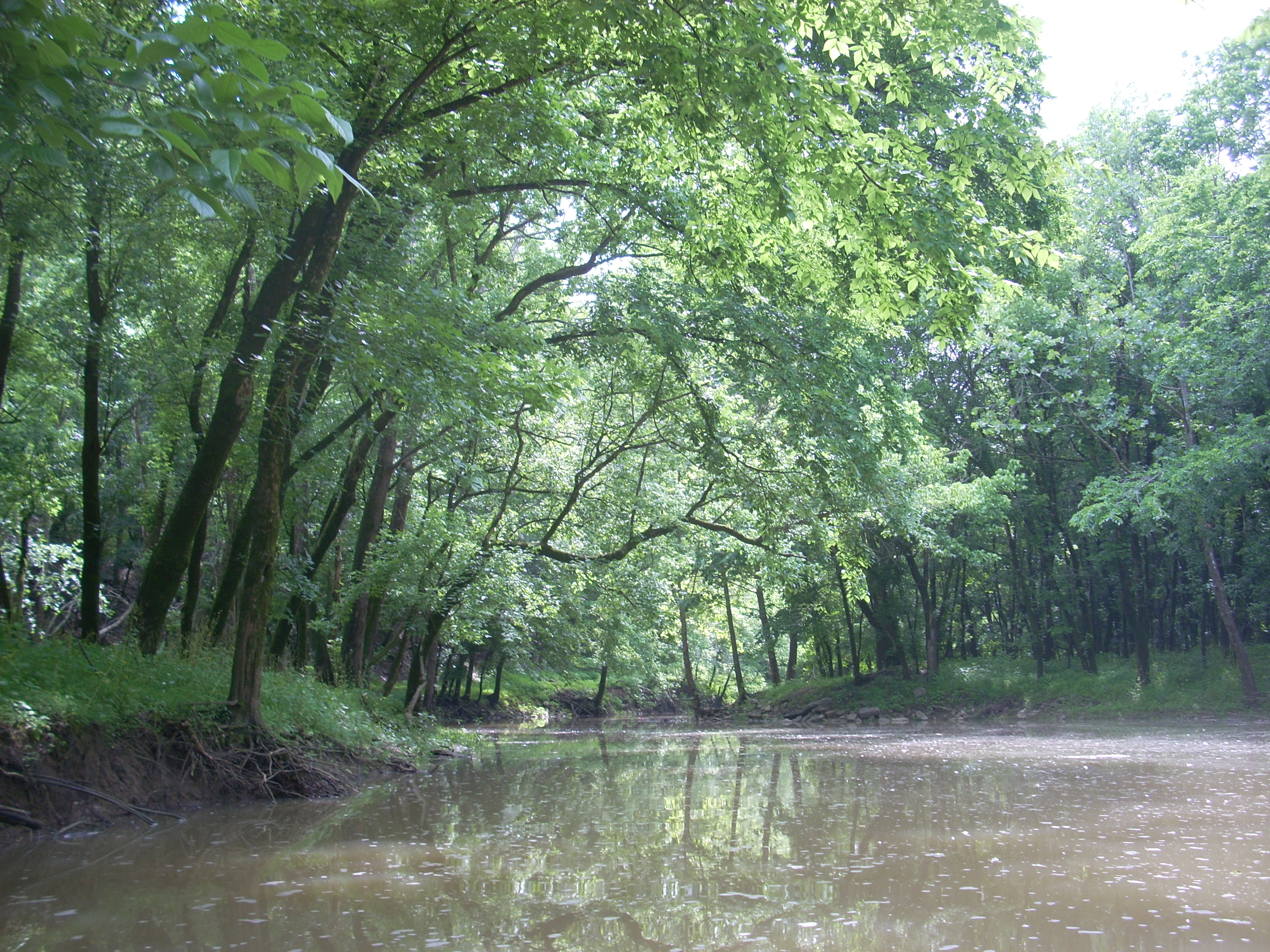
The stream on this side was quite narrow today, but it did go further
than I expected. You’ll see a few areas on the left side
which have some of those old stone fences visible.
When I came out
of this I was on the
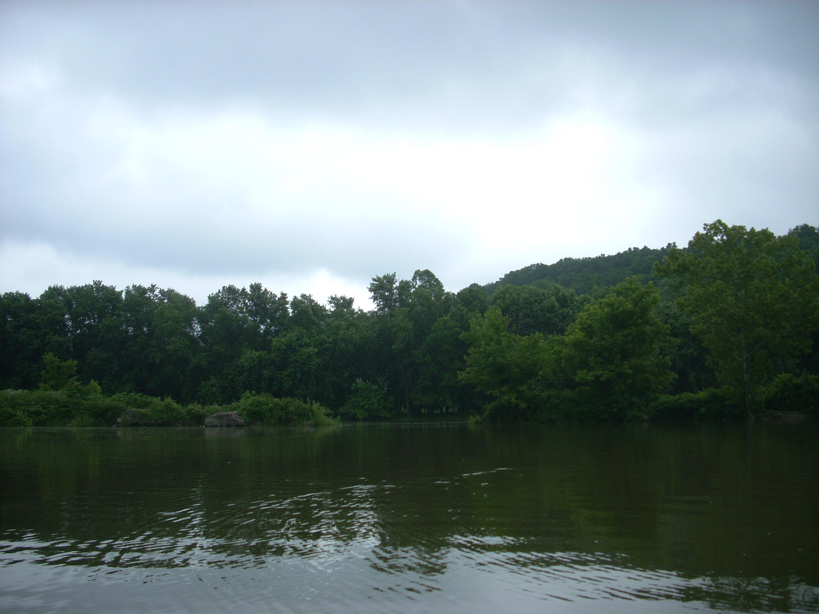
This part of
the river most reminded me of the
Presently there
was a spot in which the river split, and I tried very hard to get a picture
which would show both streams, but was unable to get an ideal one.
Whilst in the process, I saw that I wouldn’t be able to paddle that far
up the left side since the water was coming down in little riffles over some
rocks. The right side looked to have greater possibilities,
so I started up.
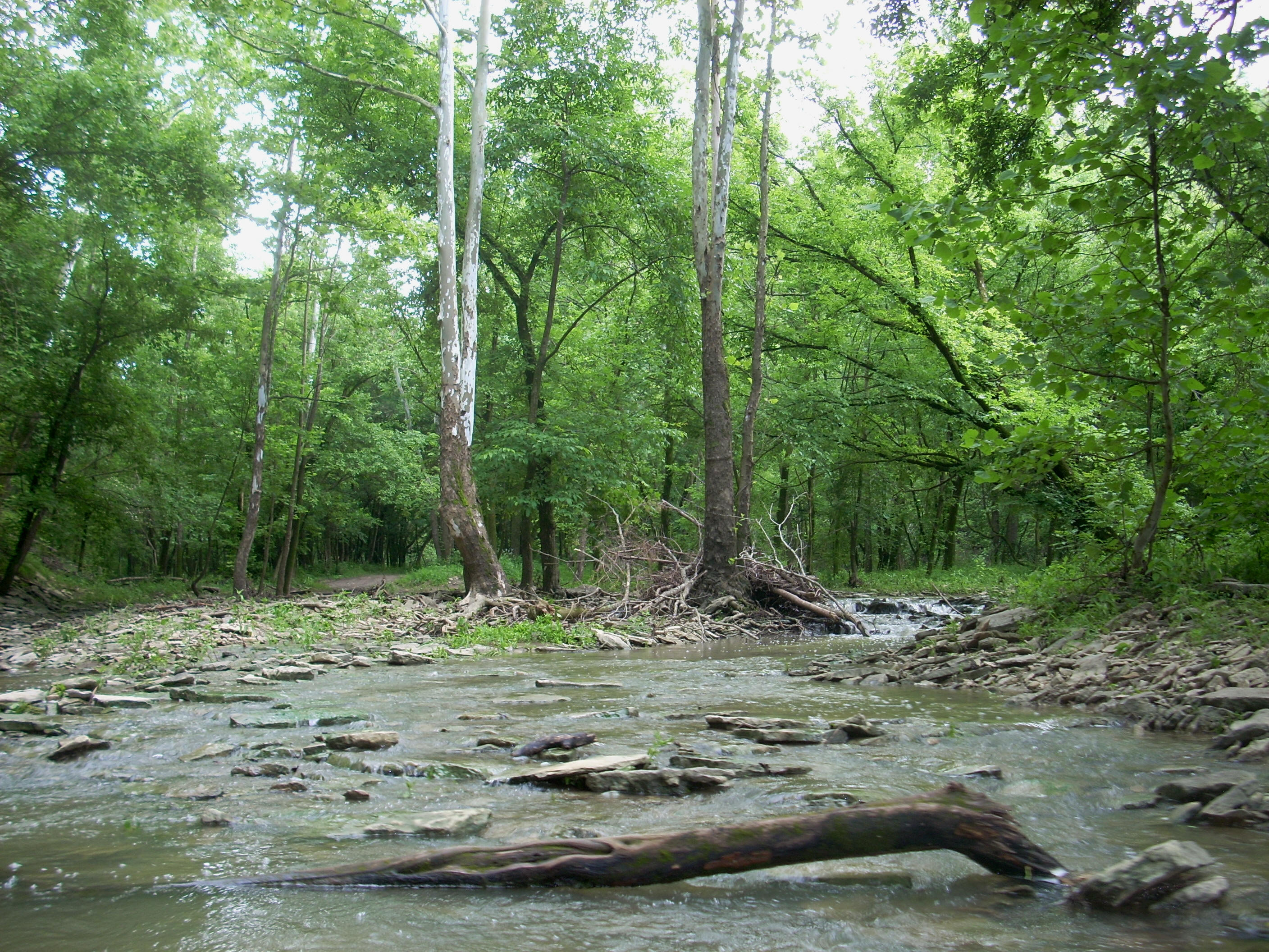
I wouldn’t get too far. The water was coming down at me at a pretty good clip, but I did notice that once I’d passed under a fallen tree, I was looking up a long straight section which would end in another split.

This may have been a little island, but I’d have to leave that as a maybe because I’d reached my end. Generally I’ll go as far up a stream as I can until I either run out of strength or run out of time. This was more a matter of strength.
I turned around
and tried to find a good spot to stop and take in the atmosphere.
I consider such stops and the float back downriver as a reward for my
efforts at paddling up streams. The best spot I was able to
find here was one in which I was able to “park” my kayak on top of a portion of
deadfall. I paused here for a while looking downstream until
a point at which I decided that, in order to avoid a “moighty spoida” (nod to
Steve Irwin up there!) jumping into my boat; I’d better get a move on.
Spiders like these deadfalls.
I thought I was
in good shape on this front, but as I saw when I reached back to get the sponge
to drain out my boat, that I was too late. This spider was a
couple inches round and in a spot where it would be very difficult (if not
impossible) to get it out - I had to do something that I loathe to do.
I don’t like to kill anything – no matter what it is – because all of
these are Gods’ creatures, but there was no way I’d be able to get this thing
out of the boat and I didn’t want to get bitten. You know the
rest. Call me a big softie, but this was deflating.
Upon returning
to the split in the river I described before, I headed up in the other direction
about a dozen yards or so to a shoal on the left side as you look up.
This was a nice spot to stop, stretch, and relax a bit.
As mentioned, I wasn’t able to paddle this as it was running over some
rocks at this point, so once I’d had my break I continued back down the main
stream.
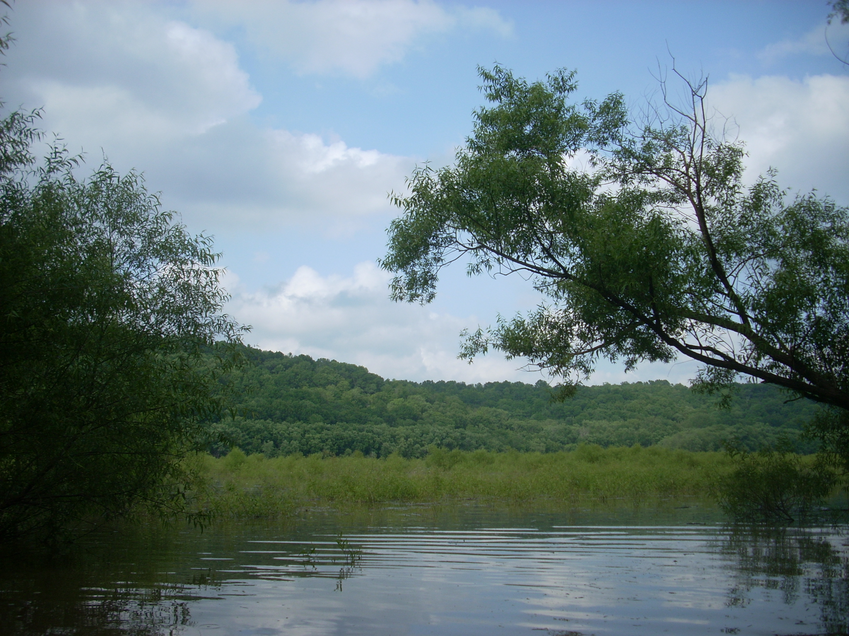
I next wanted to see what the stream on the other side of the (also aforementioned) 3-way split looked like. Also extremely pleasant with an island (this one I can verify) at the mouth of it, it ended in a grassy shoal which looked like a mini-marsh.
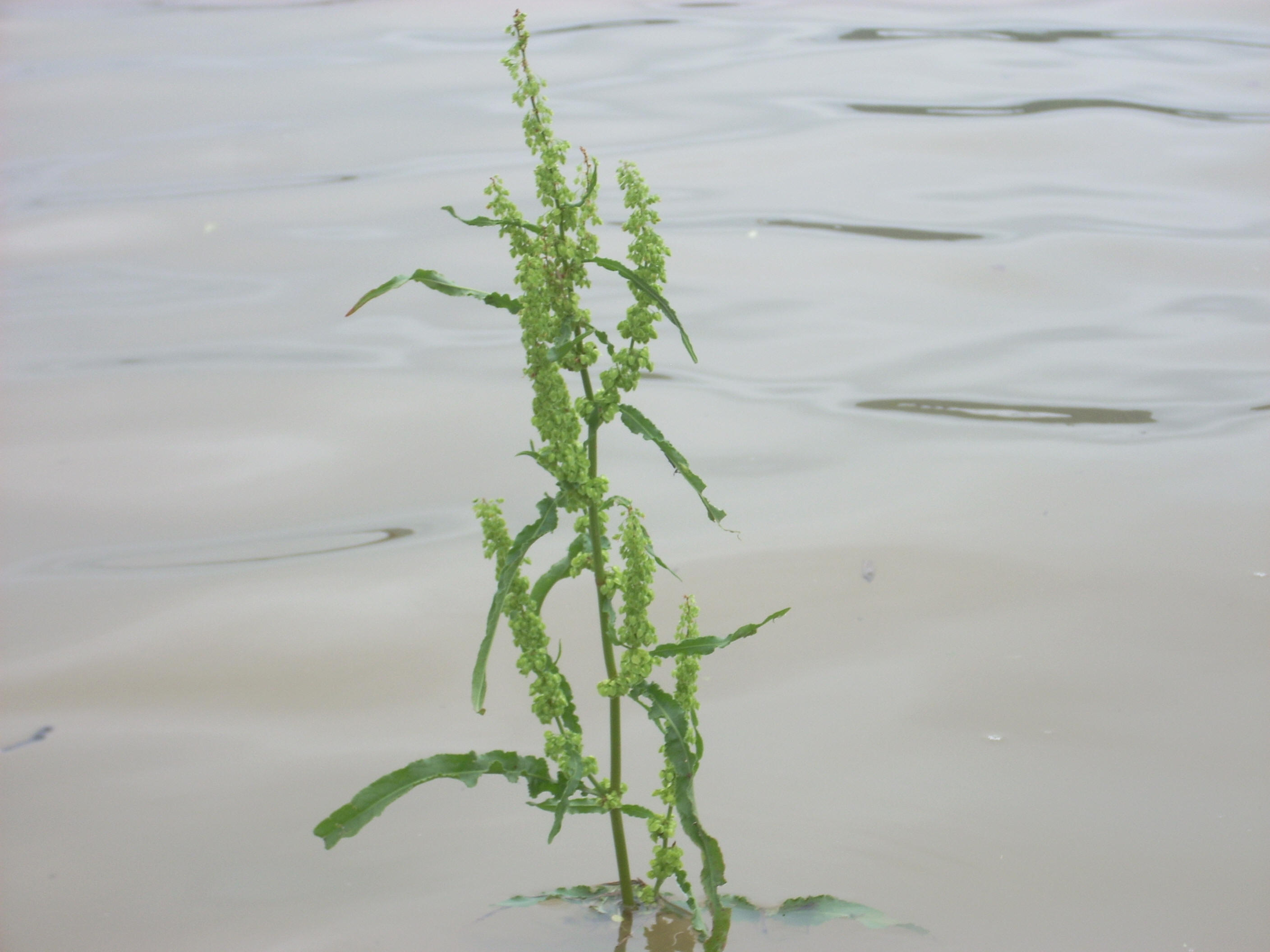
On the left side when I emerged was a downed tree which had some red fungi or mushrooms on it, the likes of which I’d not seen before.

Once back near the ramp, I took the time to paddle through the swampy area on the other side which provided me with some great perspectives.
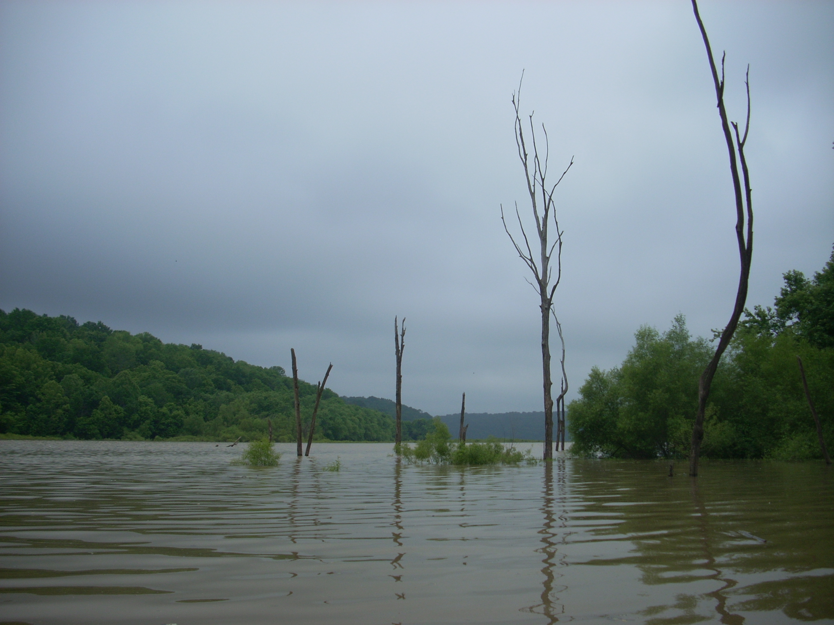
This seems like
a flood plain and I was able to “lose” myself amidst the grass.
As I did, I kept hearing splashing sounds at different points around me
and I wondered what kind of animal was doing this. Fish
wouldn’t be continually flopping around like this in the same spots, but maybe
they were otters? Turns out they were ducks – the little ones
which I’ve seen continually but have not yet been able to ascertain the name of
because I can never get a good enough picture!
The cove directly across from the ramp was the last point that I’d explore. It was partly a “tree graveyard” where power boats have a hard time entering, so it was pretty quiet. Points of the shoreline had absolutely no slope at all, and at the very back was a nice rocky shoal area.
Emerging from
the cove I decided to head back to the ramp. To do so,
however, I’d have to cross all the way over to the other side of the lake – a
sometimes treacherous proposition with all the power boats – I didn’t dawdle.
I got to the other side just fine, but I picked the wrong moment to have
done so, for there, in an arc the form of a backward “C” were 4 things:
the ramp was at the top, followed down along the arc by a couple fishing
on the shoreline, a power boat floating backwards, and then another power boat
fishing just in front of the ramp.
Perspective #1
– power boat fishing. “What the heck is this crazy kayaker
doing?”
Perspective #2
– power boat backing up. “I wish this boat hadn’t decided to
fish right in front of the ramp, and what the heck is this crazy kayaker doing?”
Perspective #3
– couple fishing on shore. “Why is this boat backing up right
in front of me, disturbing my fishing prospects? I sure wish
the other boat hadn’t decided to fish right in front of us too!
…and what the heck is this crazy kayaker doing?”
Perspective #4
– duck on ramp. “You people are all nuts!
Can anyone spare some food? …”
Deciding how to
negotiate all this navigationally was a real challenge, but as I neared the ramp
I’d made my decision. I would go around the first boat to the
right. Going the other way would risk my life if the
boat going backwards had powered up and headed straight out – and from behind
the other one, he might not have been able to see me. Then,
once I’d given the first boat as much space as I could, I’d curve sharply left
in front of the backward floating one. This would allow me to
give both him and the couple fishing some space too. It
seemed like a good plan…
All for naught
though – the boat floating backwards powered forward as I got to him, and this
completely threw the plan off - turns out he was picking up someone at the ramp.
He stopped when he saw me and I let him to go ahead.
After that I just tried to do my best. I’m not really sure if
I did the right thing, but I sure tried, and while I’m sure I screwed someone
up, they were all nice enough not to say anything if I did.
As I headed out
I gave the duck some of the dried fruit out of my trail mix and it readily ate
it, but I wondered afterwards if I probably should have wetted it a bit.
I’m not sure if a duck would be able to palate dried stuff – do ducks
have teeth to chew? I don’t think so…
DIRECTIONS:
I took KY44
north from Lawrenceburg and then took a left on KY1579. This
road dead-ended and I took another left, went about 10 yards, and then took a
right to get back on this same road (there was a sign for the ramp here).
It then ends at the Van Buren Ramp.