Little
Exploration of Head Waters Above Grayson Lake via the Little Caney Creek Boat Ramp
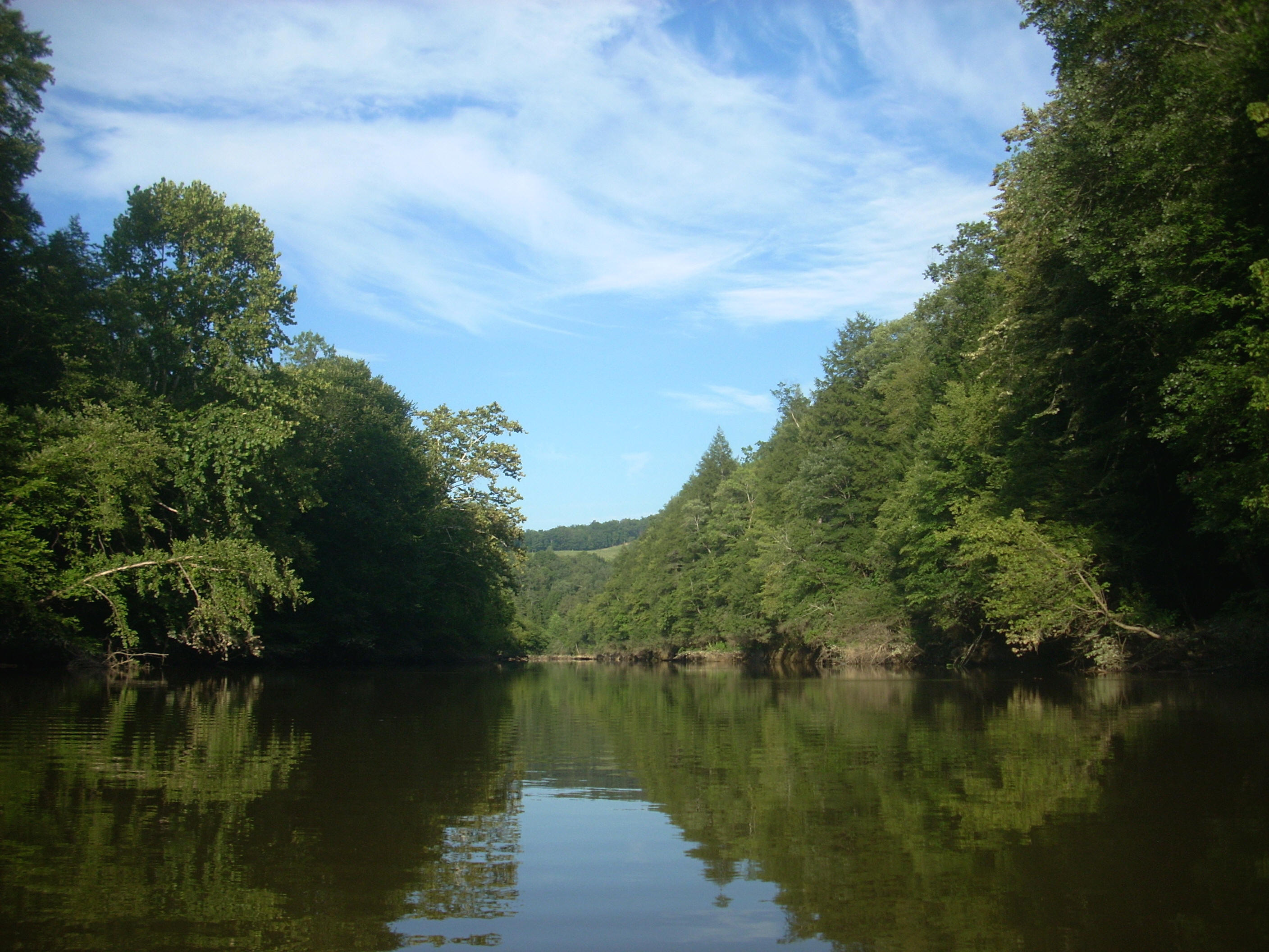
Perhaps I don’t give lakes enough credit, but aren't they really just dammed up rivers? Sure, the dams themselves are absolute marvels of engineering but when I look at a map and see a body of water that more closely resembles a snake (river) than a Rorschach ink blot (lake), I’ll generally opt to describe that section as a river. To wit - this section might techinically be considered part of Grayson Lake, but it's really the head waters of the Little Sandy River above Grayson Lake to include Caney Creek and Stafford Creek which come together to form the Little Sandy.
Today I used the Caney Creek
Boat Ramp. It lies at the point at which the Big Caney Creek meets the
Little Caney Creek and the Powder Mill Branch to form Caney Creek proper - a
main contributor to the formation of the Little Sandy.
This is a very low-lying, terrace-like area, and my original plan had been to
paddle upstream to begin as per the Fish and Wildlife map I had. Yet, when
I arrived I found that you’d need rock climbing equipment to do this - you won’t
get very far at all before the branches end at a rock faces! Look up and
you'll see little trickling waterfalls - the Big and Little Caney Creeks!!!
Anyway, with my first option not having proved viable, I turned around and began heading downstream
and in doing so one thing became quickly apparent -
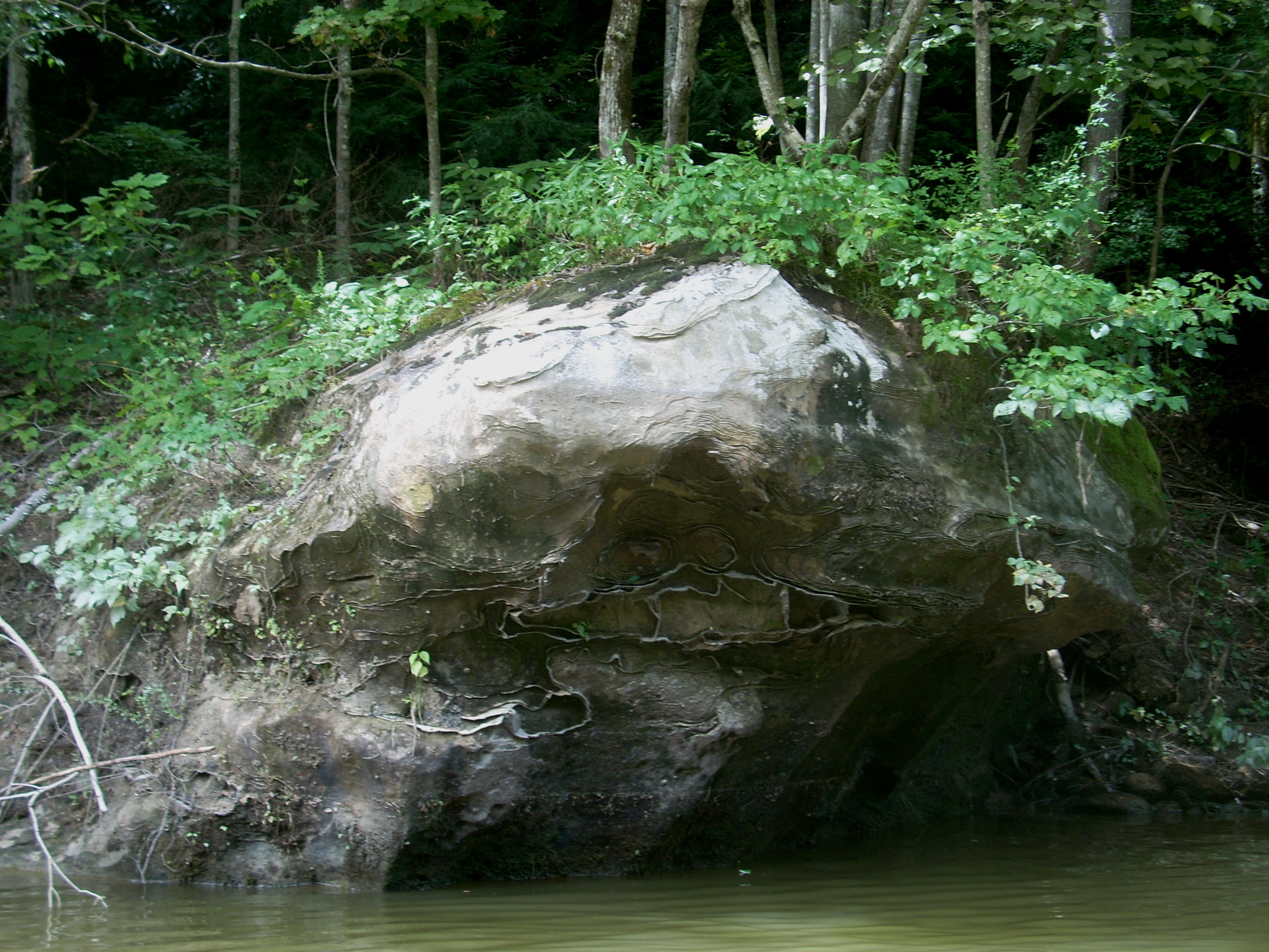
After you make the first curve (a left) downriver from the ramp you’ll enter a long straightaway, then make a tight “S” curve, to then enter another straightaway (all this could be considered an big “S” with elongated ends). As you enter the second straight, though, you’ll want to be sure to take a look on your right at about eye level. If you do you’ll be greeted by a smiling rock (below)! It’s just one of the amazing striation patterns you’ll see out here. Certain minerals must have been eroded out, leaving the hardier ones. Note in the second photo how the hardier metal seems to extrude out. In fact, it appears nearly like tin foil!
.jpg)
Once you’ve passed through this “S” (which really serves as a fine introduction to the area) you’ll have reached the intersection with the Little Sandy River. Here I took a right to begin heading upstream on the Little Sandy. I first made a slight left, straightened out, and then launched into a fairly tight right curve. In doing so, I noticed something... When you’re out here it seems that all the curves – and particularly the sharpest ones – seem to have an equally curved rock wall accompanying them on the outside. These make for absolutely fantastic backdrops. The one I saw at this point (below) also contained a shelter in the middle!
.jpg)
Straightening out from here, the Hog Camp Creek will come in from the left, but since I was keeping on the right bank for every meander today I waited until the return paddle to explore it. I’ll usually do this kind of thing to avoid confusion. You see, my mind tends to get a little cloudy at the end of a long day and besides, lakes and rivers can often be very confusing anyway with all the coves and incoming streams. I find that this strategy helps to keep things simple. At any rate, I eventually found that the view at the back of Hog Camp was one of the best of the day, with a trio of little falls…
.jpg)
Anyway, continuing upstream
back on the Little Sandy, you'll find that it generally takes on the shape
of a molar which you’ll paddle from right to left. There’s even a little
“cavity” in the center which is actually a tiny cove. I
noticed that the coves on this right side were extremely shallow to start out,
and then they got longer and longer the further upstream I went.
Next you'll find that KY7
crosses the river at the far side of the molar on a single span bridge, and
on the left just after it is another shallow cove –
Turning the map in the direction you’ll be headed in now, you’ll see an “S” and both of the sharp curves that comprise it are accompanied by some more fantastic curved rock walls…
.jpg)
There was a fairly large
incoming stream at the end of the “S”, and in looking at the Kentucky Atlas and
Gazetteer, I
believe that this was Newcombe Creek (Interestingly, I eventually found that it
took me an hour and 15 minutes to paddle up both Newcombe and the Little Sandy
from this point - that translates into roughly a mile and ½ of shoreline in each
direction). As mentioned, I was keeping to the right though, so I explored
the Little Sandy first.
The shape of this stream doesn’t really lend itself to easy description from here, but it looks most like a “V” and then an “M” stacked on top of one another. On the right side of the “V” portion at the point where another waterfall forms a tiny cove, you’ll notice an incredible spectrum of color at the top of the rocks. Either there’s a ton of different kinds of minerals in this particular rock formation or there’s a paint factory up there! :)
.jpg)
On the second half of the “V” there’s a little
incoming stream on the left (Collins Branch?) and then there’s another one on
the right just as you launch into the “M” - Stafford Creek. The mouth
of the
.jpg)
Anyway, as I headed back out and returned to my
upstream paddle, I found yet another little cove which entered from the right on
the last section of the “M”. I’d guess that I made it into this about 100
yards or so, but when you reach the very end of the “M” you’re at the limit of
the Fish and Wildlife map at a spot the maps refer to as Brokers Neck Ridge.
The
river makes a significant split here. The branch on the right is the actual
Little Sandy River. It would have eventually led me through
Meanwhile, the branch on the left was Newcombe Creek and this turned out to be an interesting one! I was greeted almost immediately on the first left curve by another face in the rocks. It was at eye-level on the right side, but with the mouth submerged. If this character could have talked, it might have warned me that things were about to get really confusing!
.jpg)
You’ll curve right from this face, then left, and then enter a straight before the creek will seem to explode. This area is just about impossible to accurately describe, so I won’t even try, but remember how I mentioned earlier that at the end of a long paddling day my mind starts to get a little cloudy? Well, it seemed as if all the incoming streams had merged together! There were so many tiny little incoming streams here that it made my head spin! One seems to be coming in from every direction!
.jpg)
I actually did explore all of these and it was worth it as one reminded me of the area around
the mouth of the Boone Creek off the
.jpg)
Having experienced all this I headed back to the ramp, in the process
exploring the aforementioned Hog Camp and
There was quite a bit
of commotion when I arrived back at the car too! A few people were fishing
there with their children – maybe a half dozen kids. It was nice to see.
You just never know what you’ll encounter at these ramps, so you've got to be
prepared for anything. Well, this might have been among my most pleasant
take-out experiences. It should always be like this! Water is a
great age-equalizer – there’s something for everyone to enjoy in the midst of a
serene setting. What could be better?
DIRECTIONS:
From I64 take the Grayson,