Little
Mouth of Bruin Creek Upstream to Caney Creek
Contempt takes many forms. Sometimes I’ll be composing one of these
journals in a restuarant or coffee shop and I’ll see someone come in, sit
in a choice place, plug in, and stay
for an hour or more without ever ordering anything! I can’t stomach this. I either
have to move and get the person out of
my sight or I leave. I wish this didn’t bother me so much.
It’s not my problem. My problem would be finishing this section of the Little Sandy
(or Grayson Lake in this area)…
The first day I came out I woke up early, drove the 2 hours it takes to get me here, and then paddled a couple miles upriver before the memory in my camera went out! Well, I couldn’t continue without the camera. I want to document the areas I visit for others who might be interested in seeing what the locations are like before they visit. Thus, I decided to shelve my frustration and experience things from a different perspective - by simply floating back downriver from that point.
The float back took me about
5 hours, but it was quite pleasant! I wasn’t going to stay upset,
you see. I was determined to get my money’s worth – about $20
in gas to get here. When it says in the Bible: “Much is demanded of
those to whom much is given.” I'm not sure that
the “much is given” part always refers to good things. I honestly think it
could also refer to adversity, so I try to bear with my disappointments as best I can and hope that my responses will be
acceptable.
"Get on with it!" You might be saying. "Where did you put in?"
Well, today I used the Bruin Creek Ramp off of Route
7 within the
Anyway, from the ramp I headed left and then made a
sharp left curve around the bend to emerge onto what is technically the Little
Sandy River, although most would consider this Grayson Lake. In fact, this
spot could well mark the transition from river to lake (or vice versa) but I
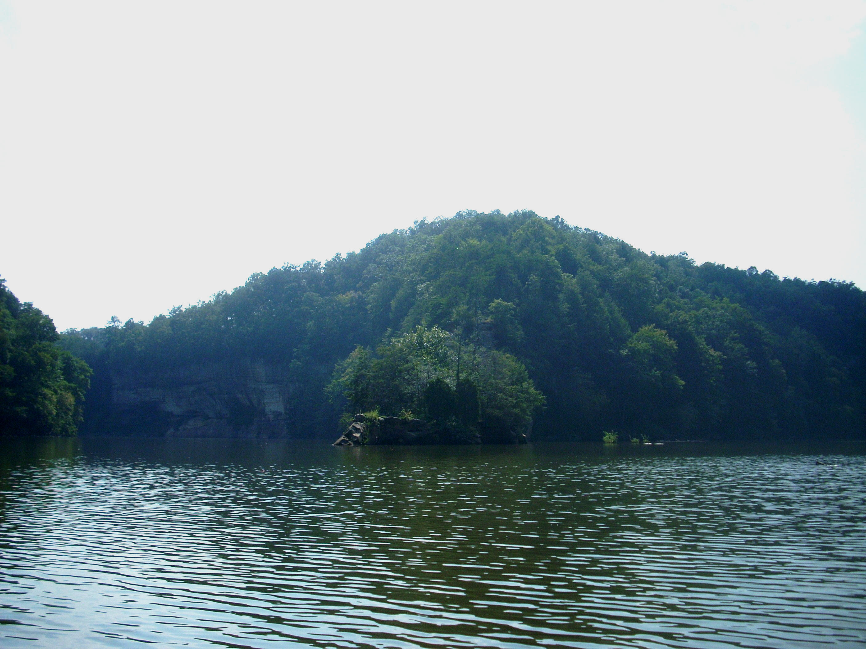
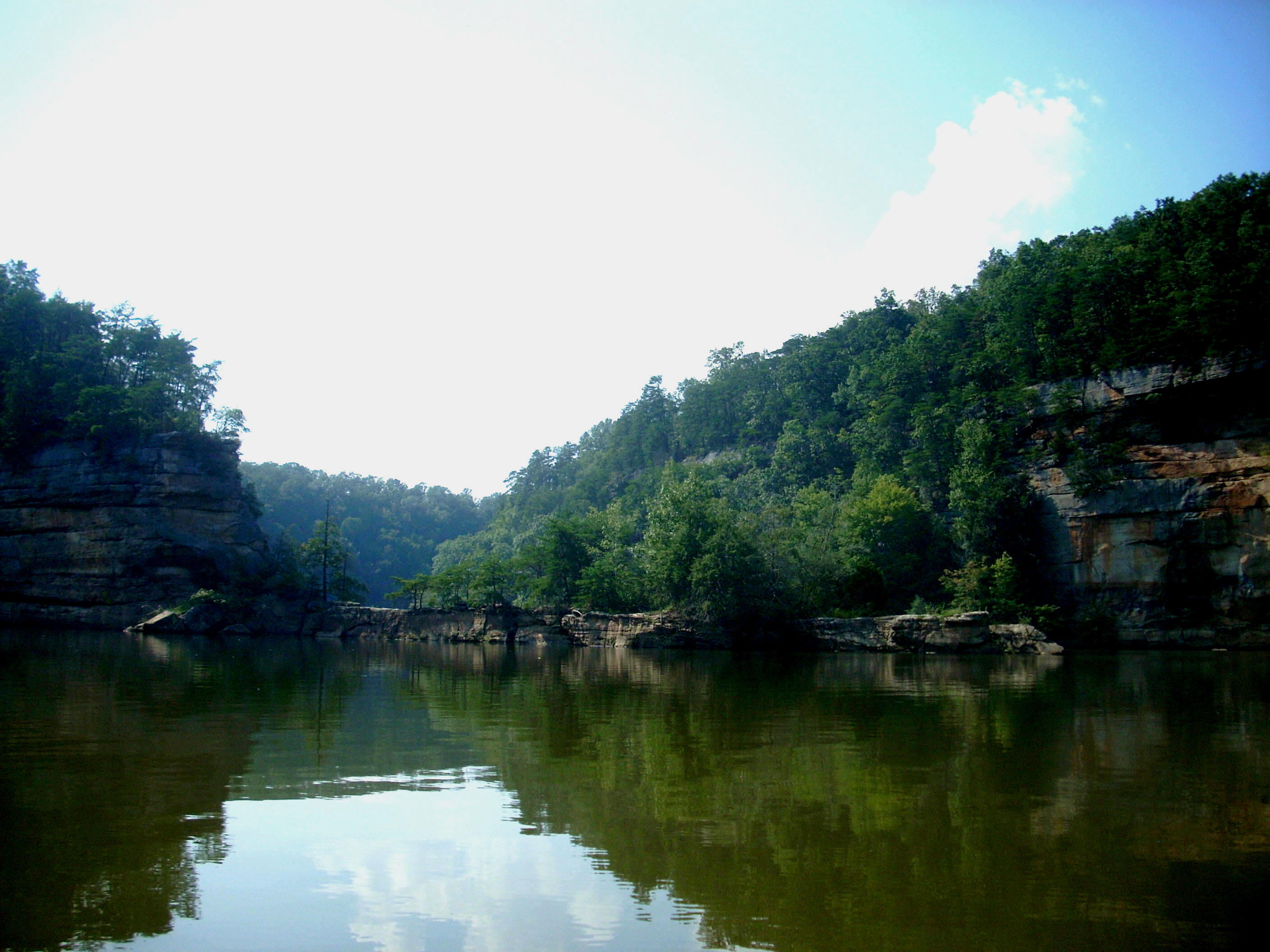
think that one of the most notable things (and it could even be called a
defining characteristic) of the Little Sandy is it's rocky landscapes.
Just like Grayson Lake is a dammed Little Sandy River,
Herrington Lake is a dammed
Anyway, as I reached the end of the curve I was looking at a very long straight section where the KY7 Bridge went over the water, and it was here that I first noticed a fair amount of trash on the shorelines (particularly on the left). This was more than I’d seen on the headwaters further upstream, although things would get better the further I went. I wouldn’t say the trash is too bad out here, but it could get that way. Later in the day I heard a “ting - ting - ting” and thought: “That doesn’t sound right…” It turned out to be a soda can under a waterfall drip (and yes, I did rectify that situation)! :)
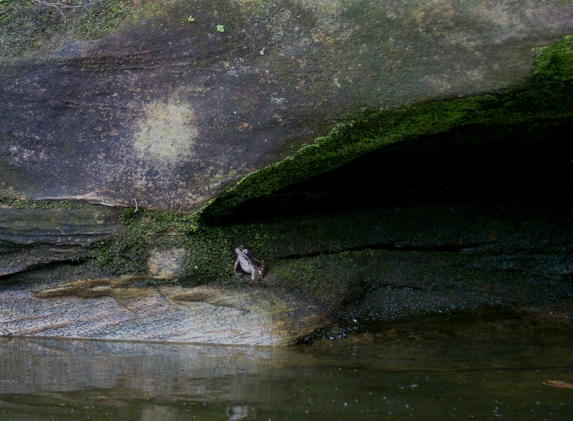
Also of note out here are all the little coves, although many are simply waterfall carved “indentations” in the rock, some of which were still dripping today. I must have passed a couple dozen. After a rain it would really be sweet to paddle out here! That not to say, however, that there aren’t any paddle-able coves. In fact, there’s one that comes in along the first straight. I was able to explore about 250 yards and when I emergedI had an encounter with the frog below. It was hanging out in the back of a little rock overhang. I'd noticed some movement as I went by, you see, and then I saw a pair of eyes…
After making a right curve
back on the river you’ll emerge into another, less lengthy, straight section.
In the center lies another paddle-able cove (also roughly 250 yards in length).
This one was carved by the Bowling Brook according to the map available on the
above website, and in back I found a nice, trickling waterfall above which was what looked like a trail fence (the Lick Falls Loop, it
appears). I understand that the Api-Su-Ahts Trails are out
here – a set of 4 circuits which provide some 25 miles of hiking!
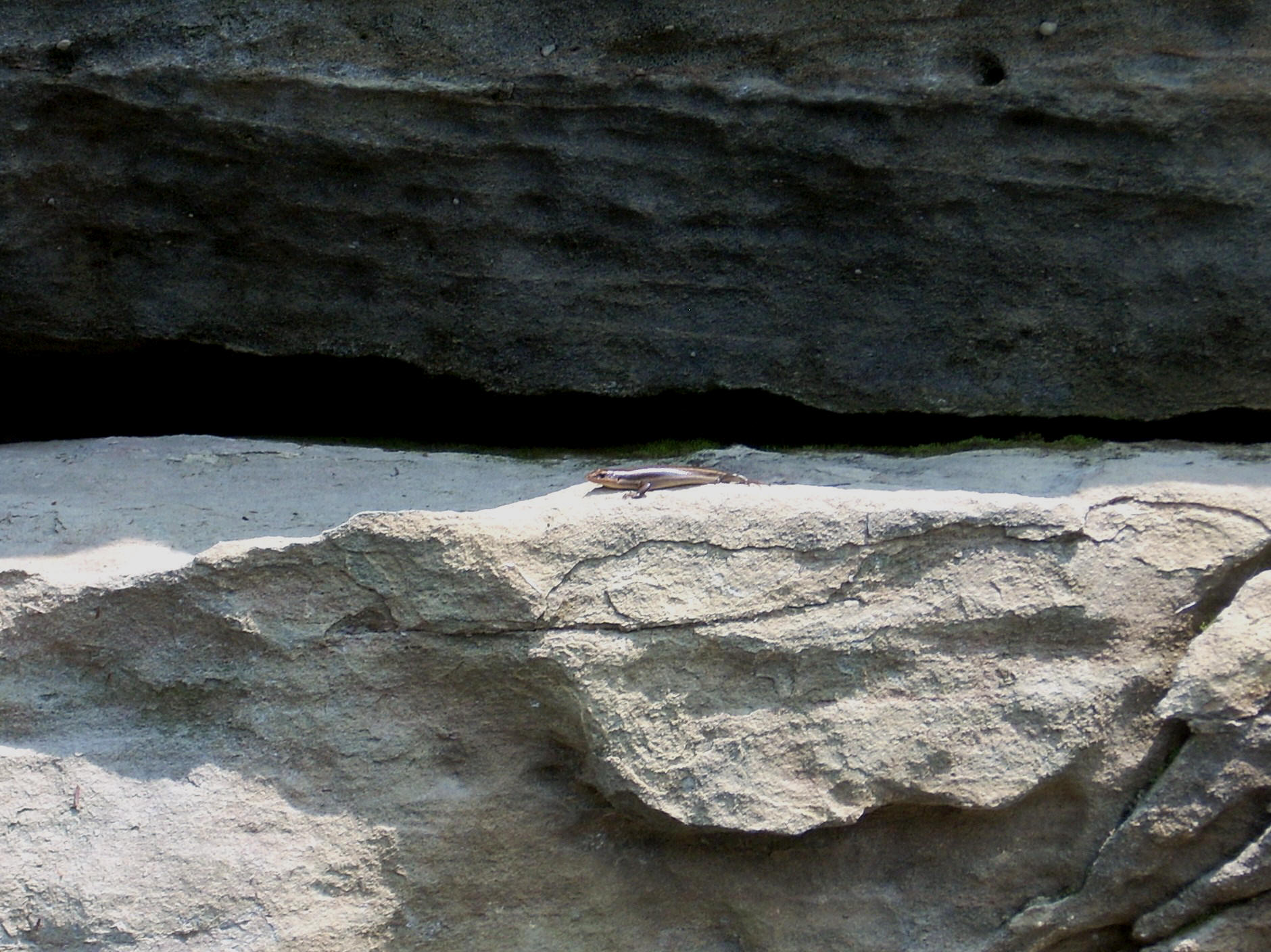
Emerging from the cove and curving left, I met a salamander posing for me on the rocks. :) Either this is a great place for wildlife viewing or I’m becoming more observant. I must mention, however, that what truly shocked me was the seeming lack of birds out here. I heard very few and only noticed a couple of them (besides heron and vultures) over the course of two days!
Next up comes the Little Gimlet Creek. This was a real beauty which entered from the right side and I was able to paddle in not quite ½ mile on my second day out. This was the spot at which I'd had my camera issues near the picturesque rock wall below…
A I rounded the first curve into the Little Gimlet Creek I encounted the black vulture below. This bird didn’t seem the least bit fazed by my being there! The picture below shows just how close it let me get…

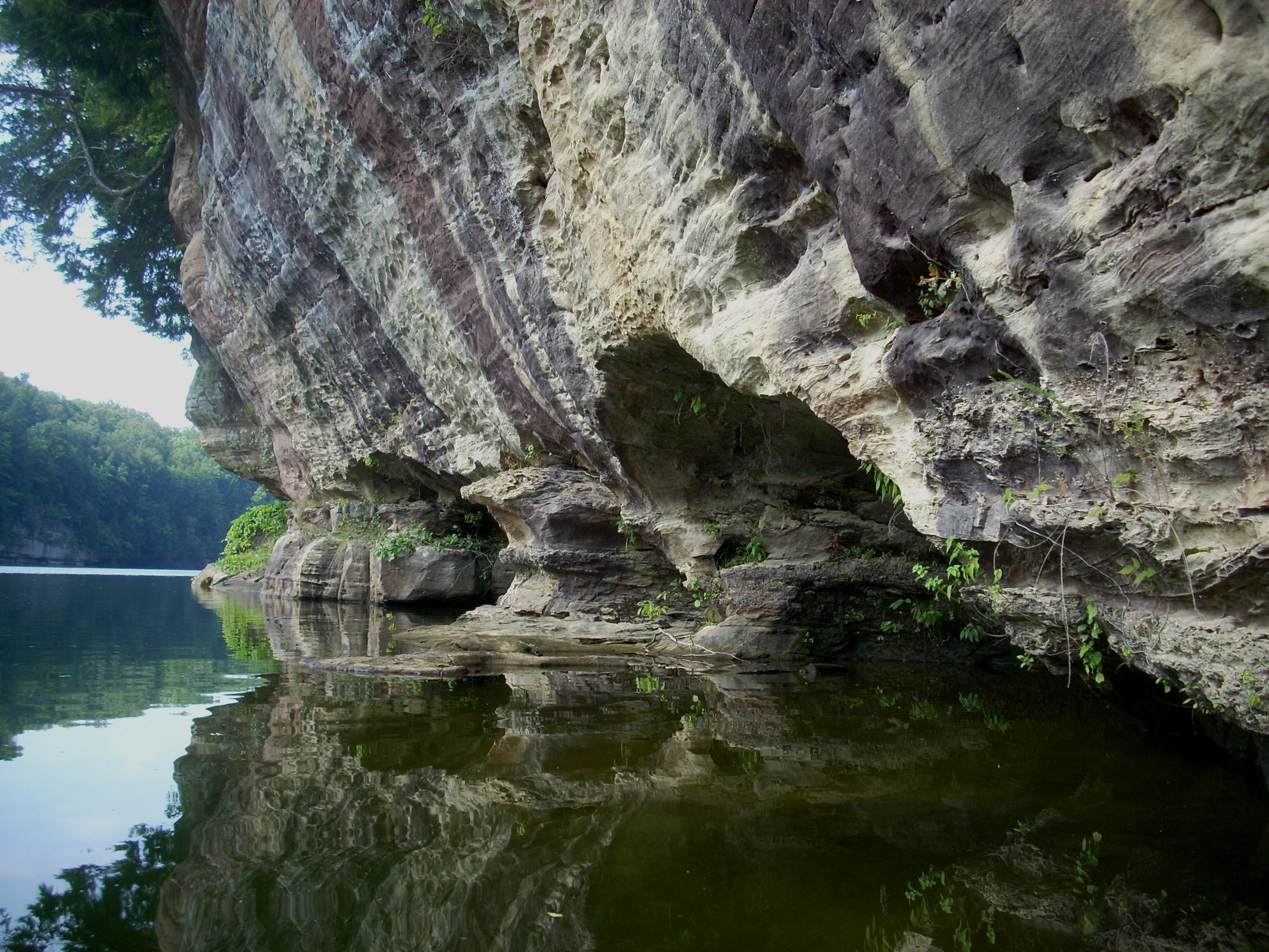
Your entry into this cove is a particularly beautiful one, by the way, with palisades that just seem to envelop you. I felt pretty small. Of interest, too, is that this cove is formed by the merging of 2 streams. The Little Gimlet is the main one, but the Lick Branch and it's falls are back here too (see below)…

The Little Gimlet itself had a nice scene at the back too, although I adjusted for - among other things - a rock with a bed sheet over it in the center of the stream!

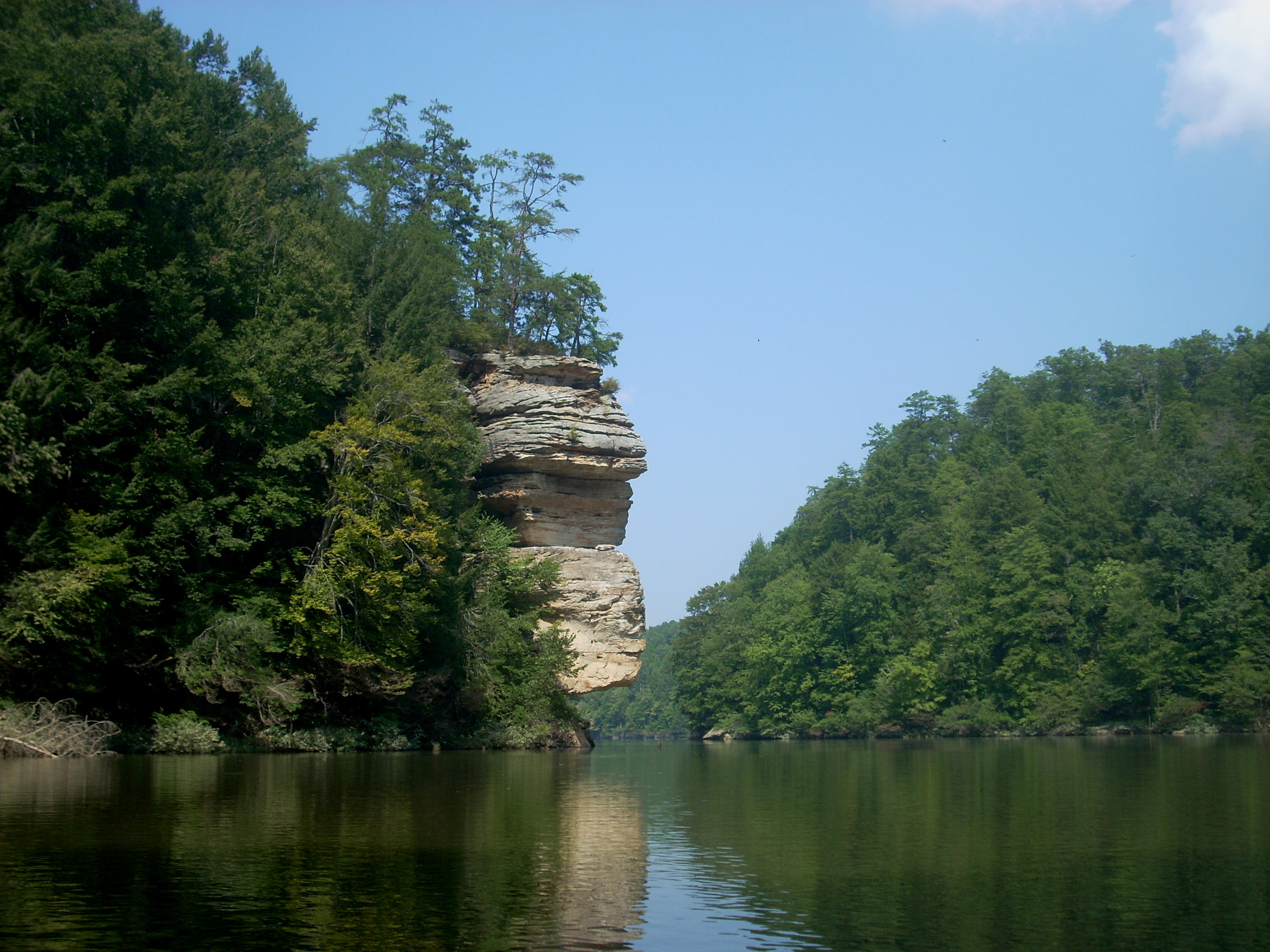
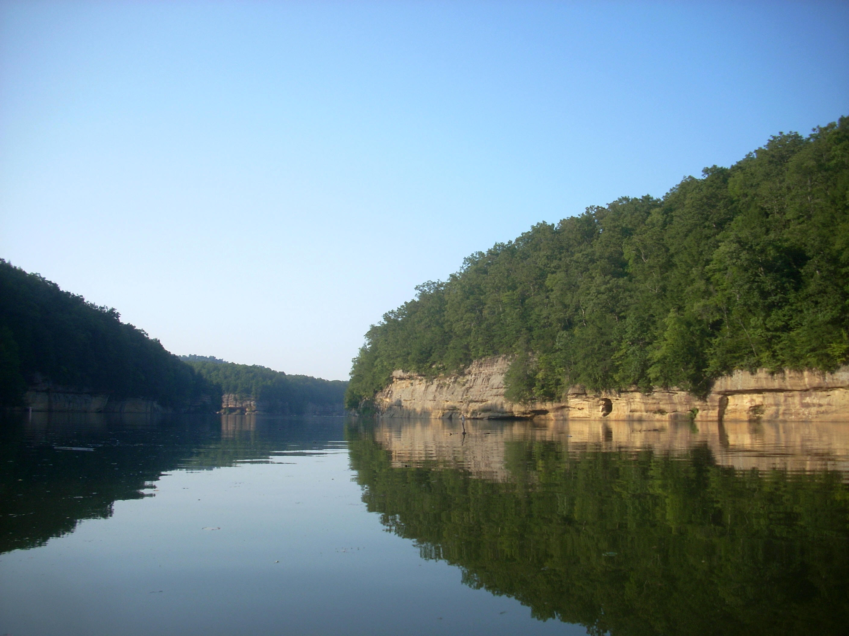
Paddling out of this area, the river next forms a backward “C” pattern. The nice rock walls will continue and they’ll actually get taller and taller the further upstream you go.
Complete this “C” and
you’ll launch into a very slow and very long left arc, in the middle of which drains
the Big
Gimlet Creek. I got in a solid ½ mile before reaching a road embankment
and, looking to my left, spotted an area that looked perfect for camping (although I’m not certain as to the permissibility of it).
Cove exploration complete, you’ll next encounter what looks like an “M” on the river and at the top of the second peak in the "M" you'll find the “Twin Bays” extending upward. I got 1/3 mile into the first and not quite 1/3 mile into the second. The first was particularly “gnatty”, but it had some of the most gently sloping shorelines since back at the ramp. The second was particularly trash strewn at the back. It struck me as sad. The beautiful heron here had to fish amongst garbage. Our society is aware of nature’s beauty, but it often rejects the gift of spirit that it represents.

The “M” in the river ended with a left curve, at the tip of which was what looked like a path descending to the water from above. This might have been another good camping spot although - once again - I’m not sure as to the permissibility of this. I’d note, too, that you’ll probably want to be careful near the rocks out here – there were quite a few honeycomb nests among them. I wouldn’t want you to get stung... I haven’t been yet, but I did have a bee somehow negotiate its way into my lap today.
Paddle another straight, and
2 more coves will enter from the right in the midst of a left curve. I got
about 300 yards into the first and about 200 into the second, but a trickling
little waterfall in the first might have been the one spot that I had the most
trouble leaving today. Funny how the simplest things can be the most
meaningful. In the midst of all the beauty I saw today, it was a little trickle
of water that might have made the biggest impression!
The last portion of my trip took the shape of a
2-tined comb. The first of the points might have been among the sharpest
I’ve seen on any body of water that I’ve explored, although the one at the northern end of
Making the second curve toward tine #2, there was a little grassy patch along the left side at the bottom of a cliff. Not knowing if this was an island or a little incoming stream I paddled back in and found it to be a little cove with a duck in the back. By this point I’d also noticed that I was getting a little loco from my energy expenditure and I found myself talking to the wildlife (something that happens frequently)!
“Any fishies back here? Fiiiiiii – sheeeeees…”
No fishies.

From here to the mouth of Caney Creek the rock palisades were near
constant companions on both sides. However, the area was again
disappointingly littered with plastic bottles floating on the water.
Perhaps it
was just someone marking their fishing location, but I sure do wish they’d use
duck decoys or something natural-looking instead… Nothing against what
they’re doing, but stunning beauty...
Plastic bottles… One of these things doesn’t belong (

Arriving at the mouth of Caney Creek I decided I’d
have to do one more thing for the sake of completion and paddle the little
grassy cove I saw. This one looked just like the last – you couldn’t tell
whether it was an island or a cove – but I made it in about 150 yards before
turning back. It was about
On the way back I wanted to get in the cove on the
left just before the Big Gimlet Creek, but there were some people swimming there
and I decided to pass it up. Another thing – while I’d encountered only a
couple power boats on the way out, I came upon no less than 15 on the way
back – all in the area between
DIRECTIONS:
I took the KY7 Exit off of
I64 and went south just over 12 miles. You’ll see a sign on your right
that has boat launch and beach indications on it. Take a left here and
you’ll wind up in a very large ramp parking lot. You’ll have crossed over
the lake a couple times on KY7.