PLACES TO GO ON LAND HOME PLACES TO GO ON WATER
R.I.P. Nikon Coolpix L11!
After about 20,000 pictures and 2 dunkings in water it finally quit half way
into my trip today. No complaints though! My next camera will
definitely be a Nikon as well. I had the lowest level model and it
really held up well!
However… I won’t be
able to be as descriptive as I usually am in this journal because of my faulty
memory. The pictures I take help to make up for the lapses, you see...
Anyway, I hope that this entry will suffice until I can get back here again.
This section is definitely worthy of a better description and more than just 2
pictures! [He notes sheepishly -
I later found out that the camera hadn’t died after all. It had somehow
just gotten waterlogged again - still works!]
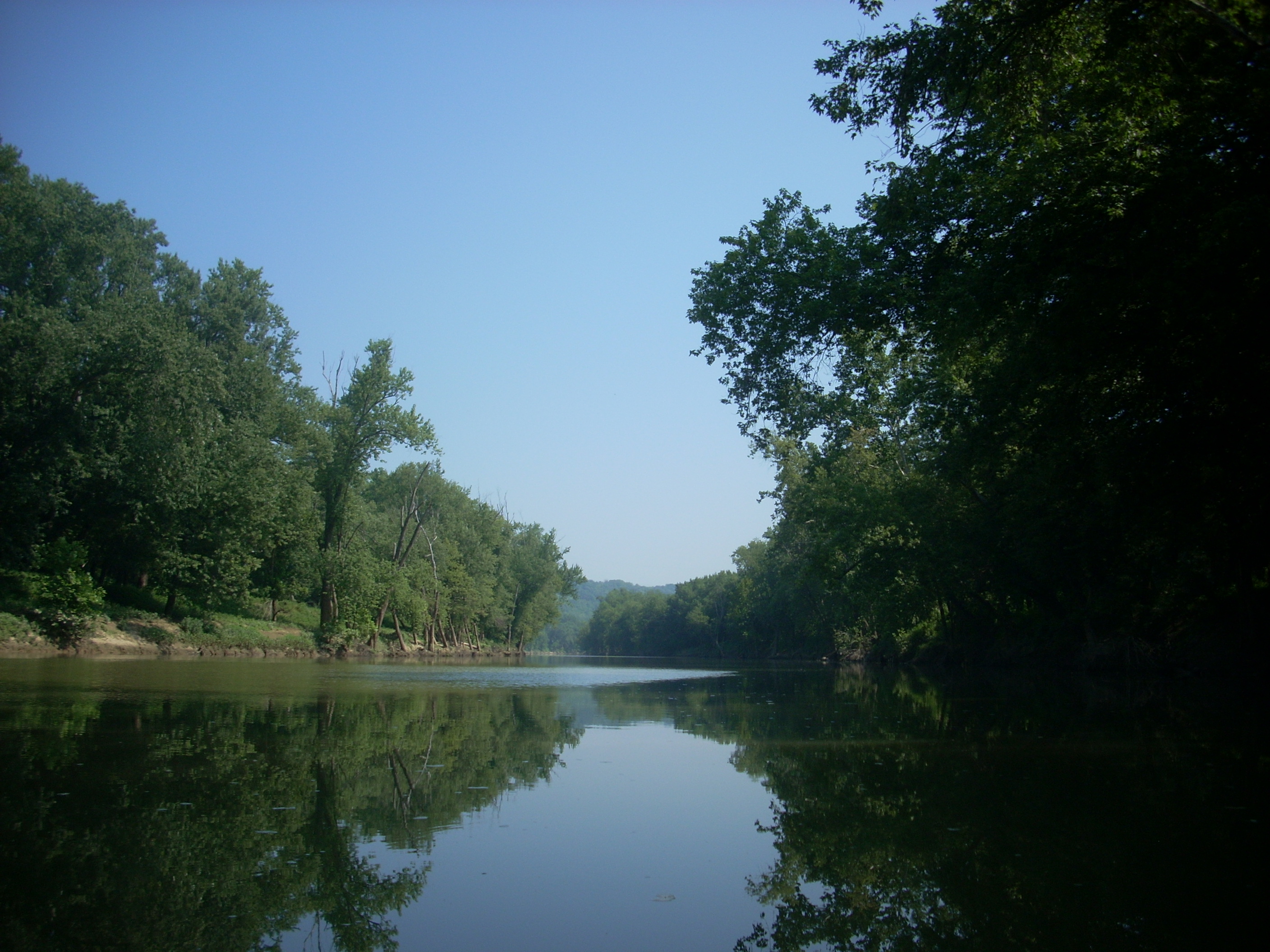
I arrived at the ramp, got my stuff in the boat, and
headed upriver... The Licking is mostly untamed, you see. There
aren’t many dams, and the ones that are out here are pretty mild.
Thus, while the Licking generally does have a flow to it, it’s just an
ever-so-slight one at this particular point. In this regard it reminded me
today quite a bit of my time on the
Also of note on the Licking is that there aren’t
too many things to note. That’s not a bad thing. This is one river
that lends itself to quiet contemplation (at least in the sections I’ve paddled
so far upstream from the mouth in
Another thing to note real quick: According to
the Fish and Wildlife’s Map of Kentucky’s Boating and Fishing Access Sites (1999
version), the point I used was one of 2 on the river in close proximity – this
one and one that was marked as “Clines on the River”. Well, I think
they’ve got them switched because I certainly didn’t see any sign of Cline’s
today. I believe the put-in I used was “#7 on the map and that Clines was
“#6”, but I’ll verify this next time when I head downstream from here to the
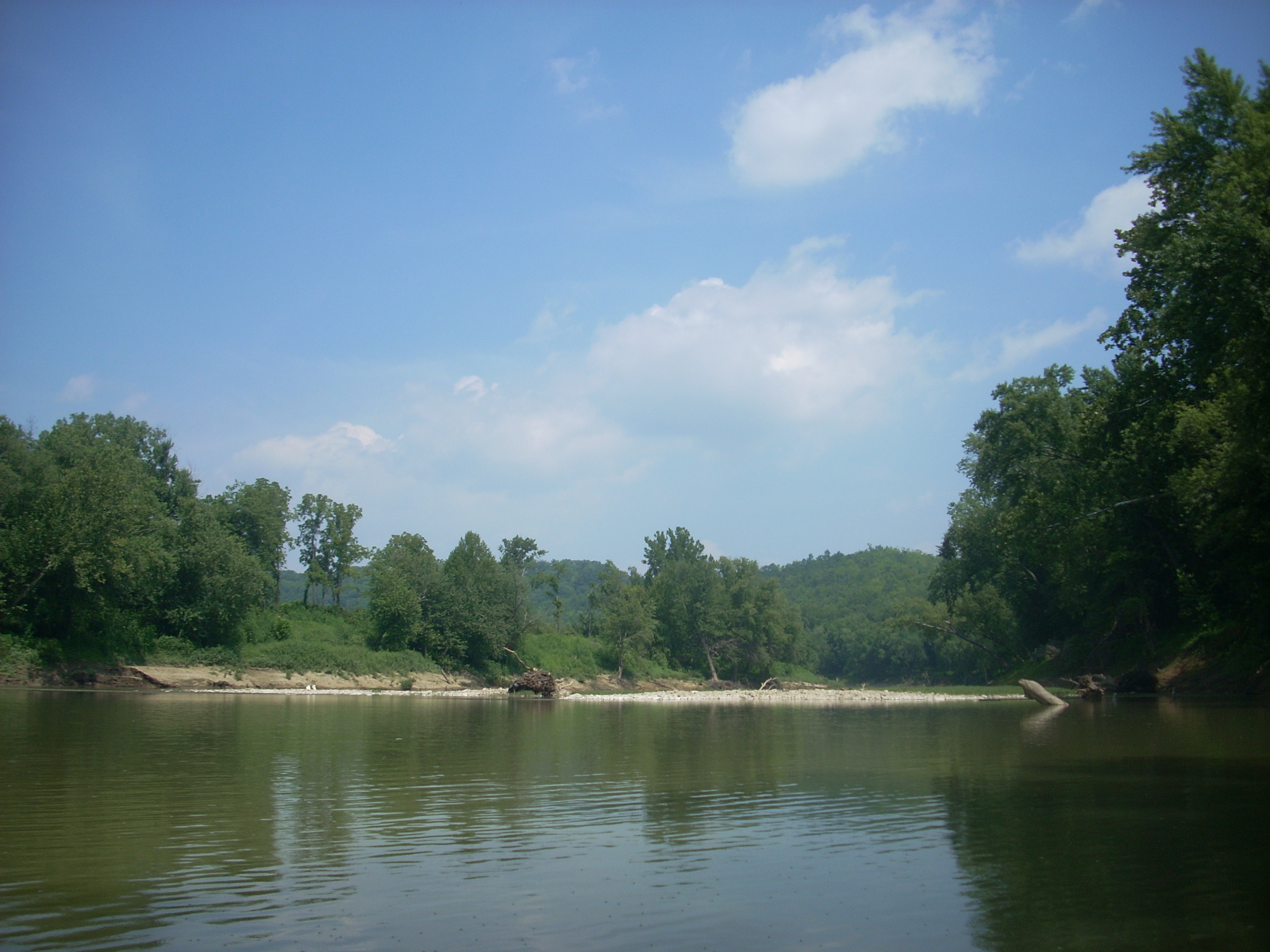
This area of the river was predominantly farmland on both sides, and at the end of the “C” was the first instance of moving water I’d have today. Looking at a map, this was at a point where 2 streams came in from either side to form a large shoal in the middle of the river. On my return paddle I met with an awesome sight here. There were about 4 guys hanging out in lounge chairs over a barbeque grill. What a great idea! This was the second of a couple things I’d seen in consecutive weeks that I wish I could have joined in on – this and the cliff jumpers at Laurel River Lake.
From here you’ll generally form a “nose” pattern if
you turn the map in the direction you’ll be heading (i.e. you’ll continue to
curve right before veering left to climb the slope of the nose). The shape
ends just upstream of the KY536 Bridge. There’s a put-in on the right just
above this bridge according to the Canoe and Kayak Guide for the sate, but the
spot looked more like private property to me. Also of note in this section
was that the communities of Ryland and
How far above the bridge I
eventually got I can’t exactly say, but I can tell you that the section looked
exactly like the stretch above Thaxton’s at the US27 Bridge. Like that
section, you can’t really paddle up and through most of the shoals from here, so
I figured I had enough time and energy left to port around 2 of them.
Then, if I came to a third I’d head back…
Well, this third shoal turned out to be (I think) the
one formed by Redmond Branch which comes in at a point just downriver from the
community of White Villa, but between the second and third shoals I saw a pair
of ghosts in a power boat. They couldn’t possibly have been there, yet
there they were - between a pair of unnavigable (for a power boat) points in the
river. There wasn’t anywhere to put-in between these, and I didn’t see any
trace of these men on my return paddle. A “Hey” greeting got no response,
but just as I went by them one caught a fish. This was the second time
I’ve seen something like this – the other was at lock and dam 13 on the
From here I headed on back, enjoying the water moving around the shoals on the
downriver paddle, and when I arrived back at the ramp there were a trio of
people fishing there. As I brought my boat up the ramp one of them made a
catch. It was the second time that I’d seen this today. Was my
presence out here bringing the people around me good luck fishing? It
hadn’t before… If I were to make a HUGE leap, however, and assume that it
was, then just maybe that luck would turn inward and start to benefit me too!
[It did – kind of - my camera did start working again but only after I’d
already bought a new one!]
DIRECTIONS:
From
I took Exit 171 (KY14/KY16)
from I75 and proceeded to follow all the KY16 signs. You’ll want to keep
your eyes peeled as this road will take many turns, but if you stay on it you’ll
eventually reach the intersection of KY2044 (don’t make the turn on KY2043
– hold out for KY2044!). There’s a YMCA on the right when you make the
turn onto 2044. Be careful here because you won’t get much warning of the
turn after you see the first KY2044 sign. It’ll come up seemingly
immediately and you’ll make a right.
KY2044 is confusing. Keep at it following the
yellow lined portions. You’ll pass a sign that indicates the end of county
maintenance. Don’t let this fool you. Keep heading straight until
you reach a stop sign and take a right onto Stewart (going past
From
From I275 take exit 79 (onto KY16, or