KY1930 (
The
ramp I used today off of Kentucky Route 1930 (or KY1930) lies within an
incredibly interesting area. To drive by it now you might not realize it
because it's a bit overgrown, but this is the site of a
pretty grandly scaled Locust Pike Park which stretches for a full mile along the river.
There’s
a very old paved road that you can still see which extends the entire distance
but it's no longer used as such.
It’s now part of what they call the Ryland Heights Wilderness Trail.
There are also remnants of an old basketball court
here along with a nice picnic spot under some really sweet looking shade trees.
One gets the feeling that this was once part of someone’s grand plan only to
have it run out of either funding or interest to keep it going. It’s incredibly intriguing to imagine what it once
looked like!
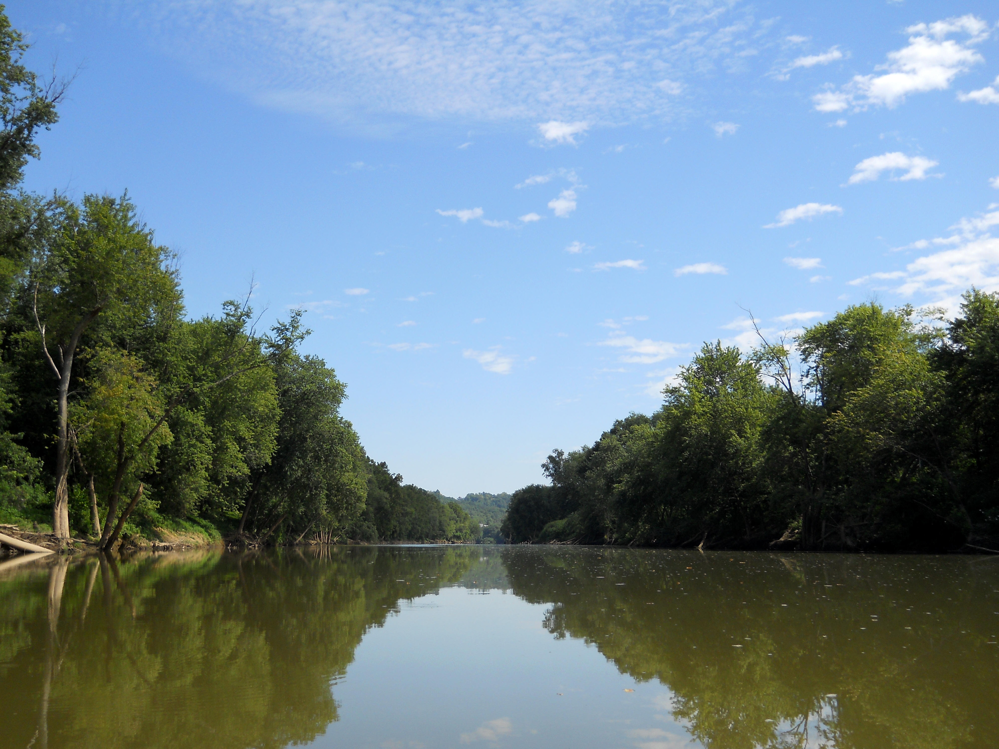
Today I did something different. I usually paddle upriver on streams that I’m unfamiliar with, but today I was going to try heading downstream. The main reason for this was that there aren't any dams in this section to worry about, but there also wasn't any appreciable water flow with all the dry weather we'd had. Nevertheless determined to be very careful, I set out…
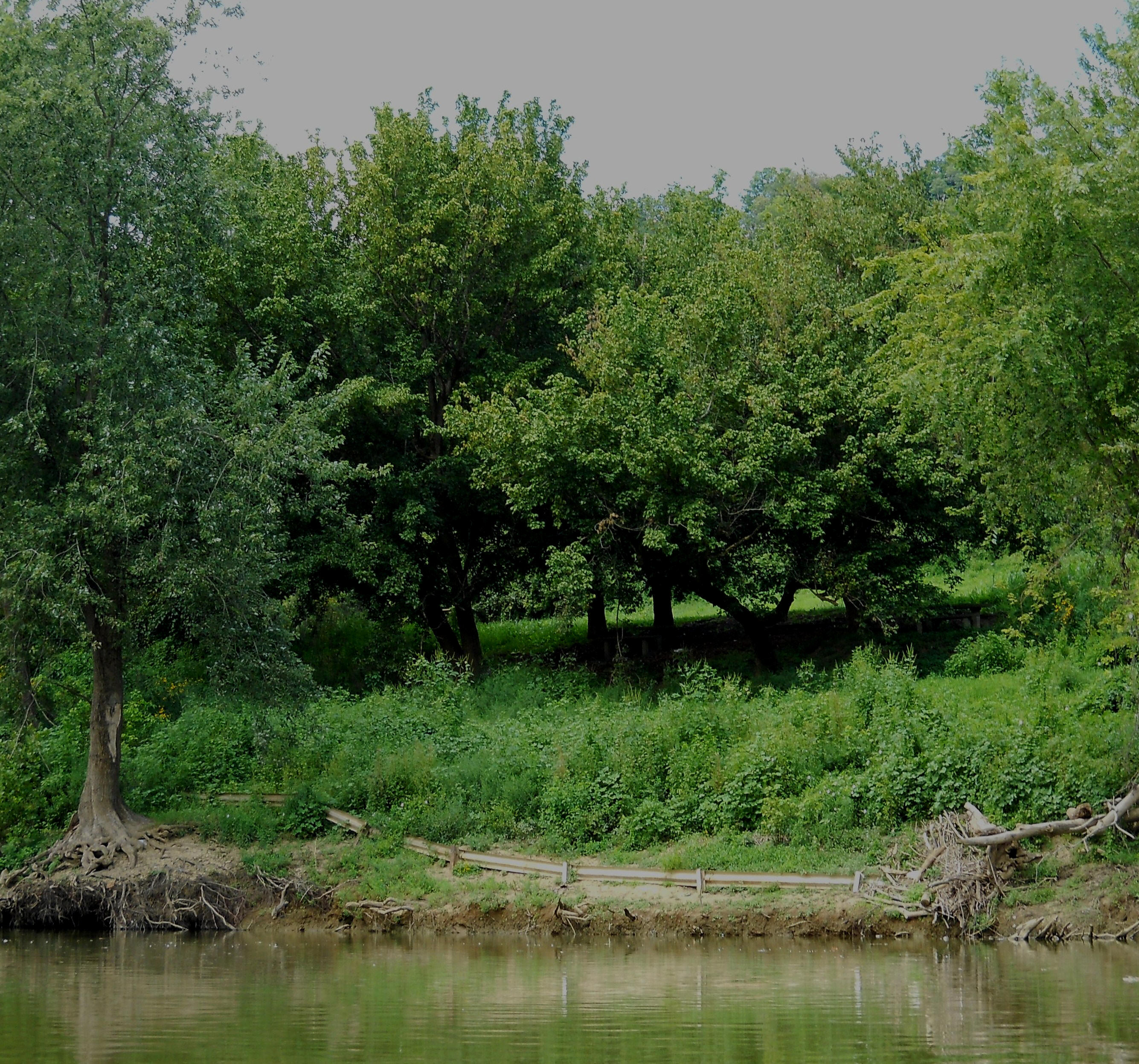
As you make an initial right curve you'll have the park on your left and it was here that I made my first general observation today. The banks would be mostly mud-lined with only very occasional rocky areas. You’ll be able to spot some houses on occasion, but they’ll eventually morph into businesses the further you proceed downriver. The picnic area I mentioned will become visible toward the end of the first curve on your left above a spot where there’s an old guard rail at the rivers’ edge.
After this you’ll launch into a long straight which ends at a shoal. That'll be followed by a long left curve. A railroad line runs this entire distance on your left side and as the river makes the left curve it looks like there’s an entire train yard up there behind the forested bank. This is all part of a company called Progress Rail. As per the web link the business is an interesting combination of recycling and railroading.
The right side at this point is
also interesting. After some residences there's a bar/restaurant called Clines on the River
(now known as
Knotty Pine on the Bayou). This looks like a nice place to hoist some
brews. There's a ramp at the spot but I'm not absolutely certain it's
theirs. Either way, you can reach the establishment from the water if you
walk up a paved lane. Signs indicate that the place might have once had
more of a shoreline presence, but I get the feeling that the river might have
washed it away one too many times to make it feasible to keep open. The ramp looks to be in
pretty solid shape and at the river's edge is a nice looking little park.
From here and for about the
next 3 miles it's generally a very long, slow right curve with an Ineterstate
275 bridge coming in at about the middle. Composed of it's own little arcs
and straights, this curve seemingly has something
noteworthy at each meander. At the first slight right, for example,
you’ve got some steel cylinders in the water. These might once have been used to
dock barges. There was a business here but it didn’t look like it was operating anymore.
UPDATE 2021: This is now an
SRM Concrete (or Smyrna Ready Mix) location. As per
the web link a family in Tennessee started this company in their own back yard
in 1999. Th
Another business came up at
the next little curve and there
were a few more of the docking structures here. I couldn’t quite tell what
kind of business this was. T
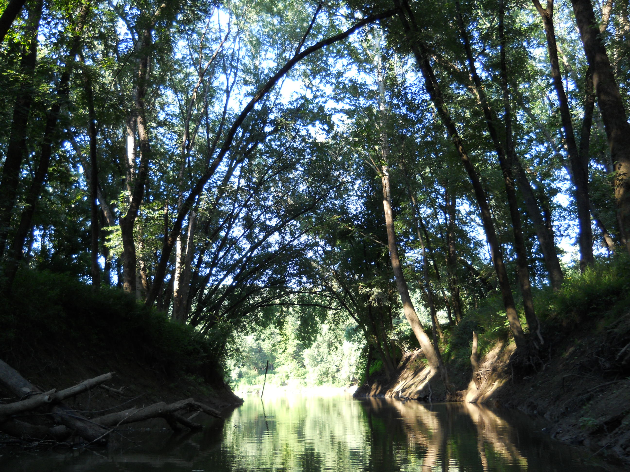
Next on the left side and between the locations just described, there's a little incoming stream that I got into about 200 yards. There was a bridge in the back and it looked like the water ended immediately after it, but I had to be a “completist” so I paddled under through a narrow cylinder of water. Boy was it dark! I got an eerie feeling as I paddled through, envisioning what might be lurking under that water! I think if I’d heard even a peep I’d have jumped out of my skin! :)
From here and not too long after you start
the next little right curve, you’ll spot the I275 Bridge in the distance.
There must have been some kind of school or sports field up on the
right - I could hear a coach barking orders on the way back. There was
also some kind of structure on the left side. Cylindrical in shape, it
looked quite old but very well constructed with a brick, windowed top – an old
water intake, maybe?
At any rate, seeing the
bridge was significant because I'd been under the assumption that this section would be much shorter than it
was. “Where the heck is that bridge?” I’d been
wondering… The fact that I was only seeing it now meant that it was going
to take me a lot longer than I thought to paddle back. I never like to return after dark because you never know
what or who you'll encounter.
After passing a shoal on the left
side under the 275 bridge, the river forms a straight section amid that 3 mile curve I
mentioned. I saw
some kind of structure on the left at the end, and when I got to that point I
found it to be what looked like another water intake (perhaps this is the new version of the one I'd just
passed). Another incoming stream followed this (Banklick Creek)
and I got in about 400 yards, passing under a couple bridges as I did (one was a
railroad span and one was for DeCoursey Pike). An ancient ramp was barely visible
through the foliage on the right, and there's a little
lake up there too on the greounds of a VFW (Veterans of Foreign Wars) Hall.
Back on the river now, you’ve just completed the
curve to begin another in the opposite direction.
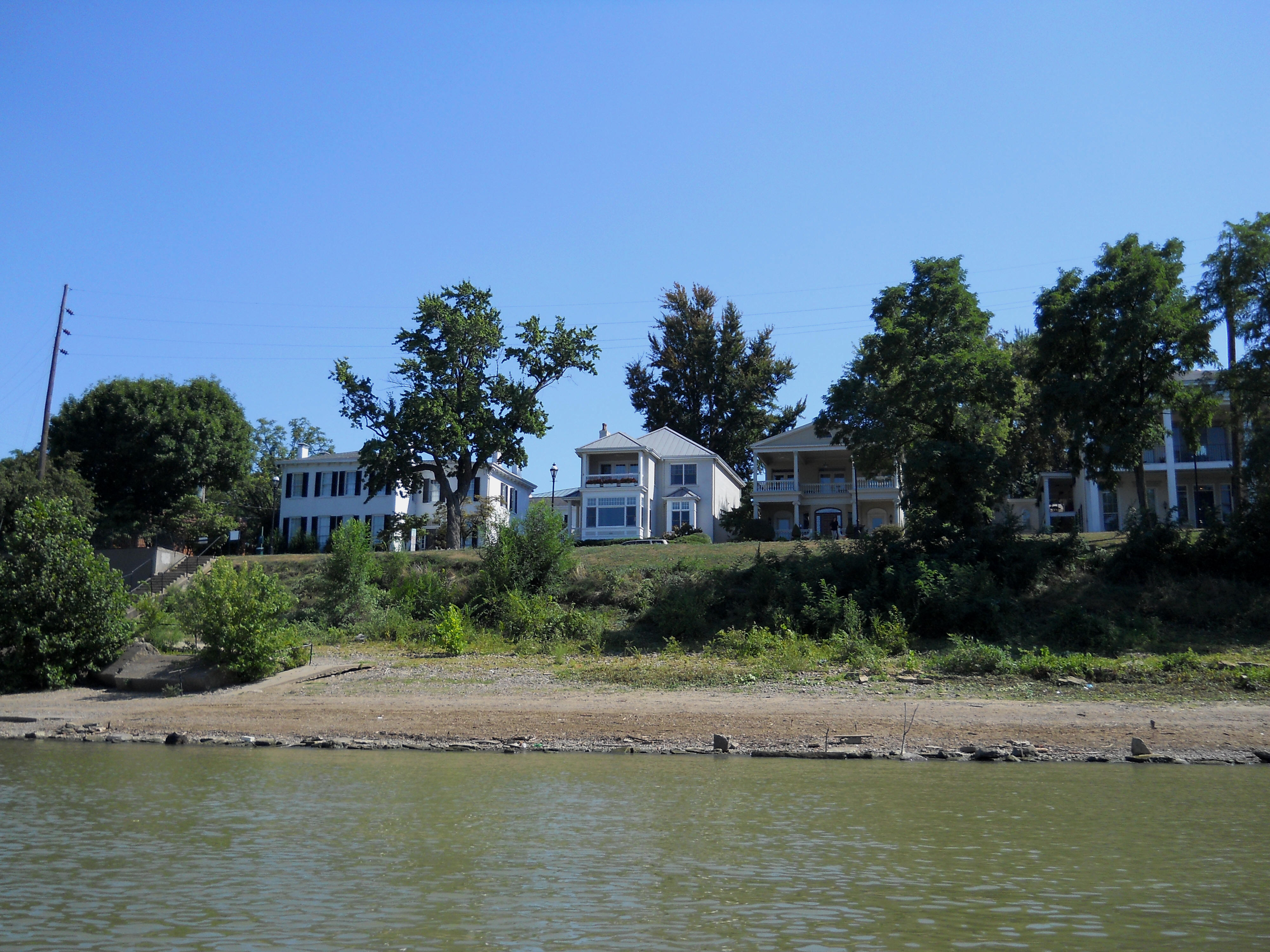
Once the river
straightens again, you'll
notice another park up on the right side. This is
Probably the most intriguing sight came next, however, at what appeared to be a steel yard. There was a crane loading a barge here, you see, and this crane appeared to be floating on the air, suspended atop some kind of rail system which appeared transparent from a distance. Slowly emerging into view from somewhere back onshore, it seemed to hover over the trees as it unloaded it’s cargo onto the barge. The whole process was kind of fun to watch, but I feel a little strange watching people work, so I didn’t stay too long. This was Marathon Oil's Covington, Kentucky Terminal.
As you make a final left curve its “Hello Cincinnati”
as you can see the tallest buildings in the distance as the river straightens
out. Another railroad bridge and a automobile bridge (for
Anyway, after passing under the
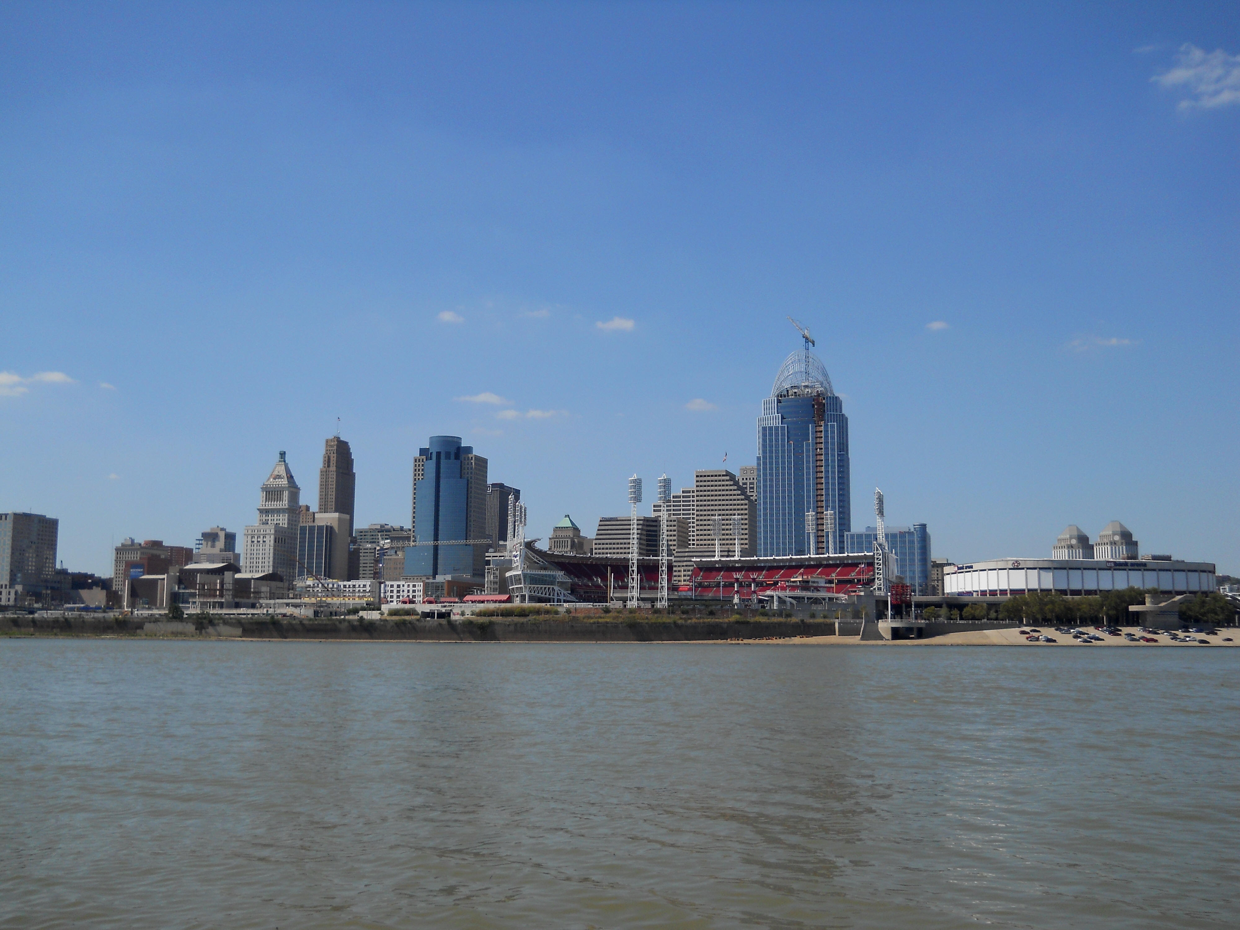
I lost all my pictures from this trip or I'd post more, but here's a look down the Ohio River…

Anyway, once I was finally
able to tear myself away and head back, I vowed to return again. Other
than Fredericks Landing on the Licking River there are access points on the Ohio
River as well with one notable exception. It would be easy to put in on the Covington side of the Licking River mouth,
but it looked as if they were discouraging it. Other access points on the
Ohio include one just a bit further upriver (Newport on the
Levy) and one further down (off of Riverside Place under the Roebling
Bridge). I’ve not utilized any major metropolitan ramps before so I’m not sure if there’d be any security concerns.
Personally, I’d rather use rural ones or make
certain that I won’t be there after dark. Speaking of which, I
did somehow manage to get back to my ramp before dark – barely – and I
still had time enough left to visit a Skyline Chili before they closed (they
don’t have any where I live now)!
Today turned out to be very
interesting! If you’re curious as to how the character of a river changes
as you progress from a rural area to an urban atmosphere, this is a great trip
in which
to do so!
DIRECTIONS:
From
I took Exit 171 (KY14/KY16)
from I75 and proceeded to follow all the KY16 signs. You’ll want to keep
your eyes peeled as this road will take many turns, but if you stay on it you’ll
eventually reach the intersection of KY2044 (don’t make the turn on KY2043
– hold out for KY2044!). There’s a YMCA on the right when you make the
turn onto 2044. Be careful here because you won’t get much warning of the
turn after you see the first KY2044 sign. It’ll come up seemingly
immediately and you’ll make a right.
KY2044 is confusing. Keep at it following the
yellow lined portions. You’ll pass a sign that indicates the end of county
maintenance. Don’t let this fool you. Keep heading straight until
you reach a stop sign and take a right onto Stewart (going past
From
From I275 take exit 79 (onto KY16, or