PLACES TO GO ON LAND HOME PLACES TO GO ON WATER
It had been on
my agenda to explore upriver from this ramp, but when I reached it, I saw that
the water was moving much more quickly than I had prepared for.
Having driven an hour and a half to reach it, however, I was at least
going to try. This would be a pretty intense workout, albeit
a rewarding one, and during it I would find a personal answer to an important
question – at least for today... To what point should you
persevere in the midst of adversity before you give in - if you do at all - and
to what degree?
The drive out
to this area from
The road
doesn’t go directly through it, but on the outskirts of
I should also
note a couple areas of interest. I just noticed in
researching this journal that there’s a park called Quiet Trails State Nature
Preserve (http://www.naturepreserves.ky.gov/stewardship/quiettrails.htm)
between Cynthiana and
Once I’d driven
through downtown
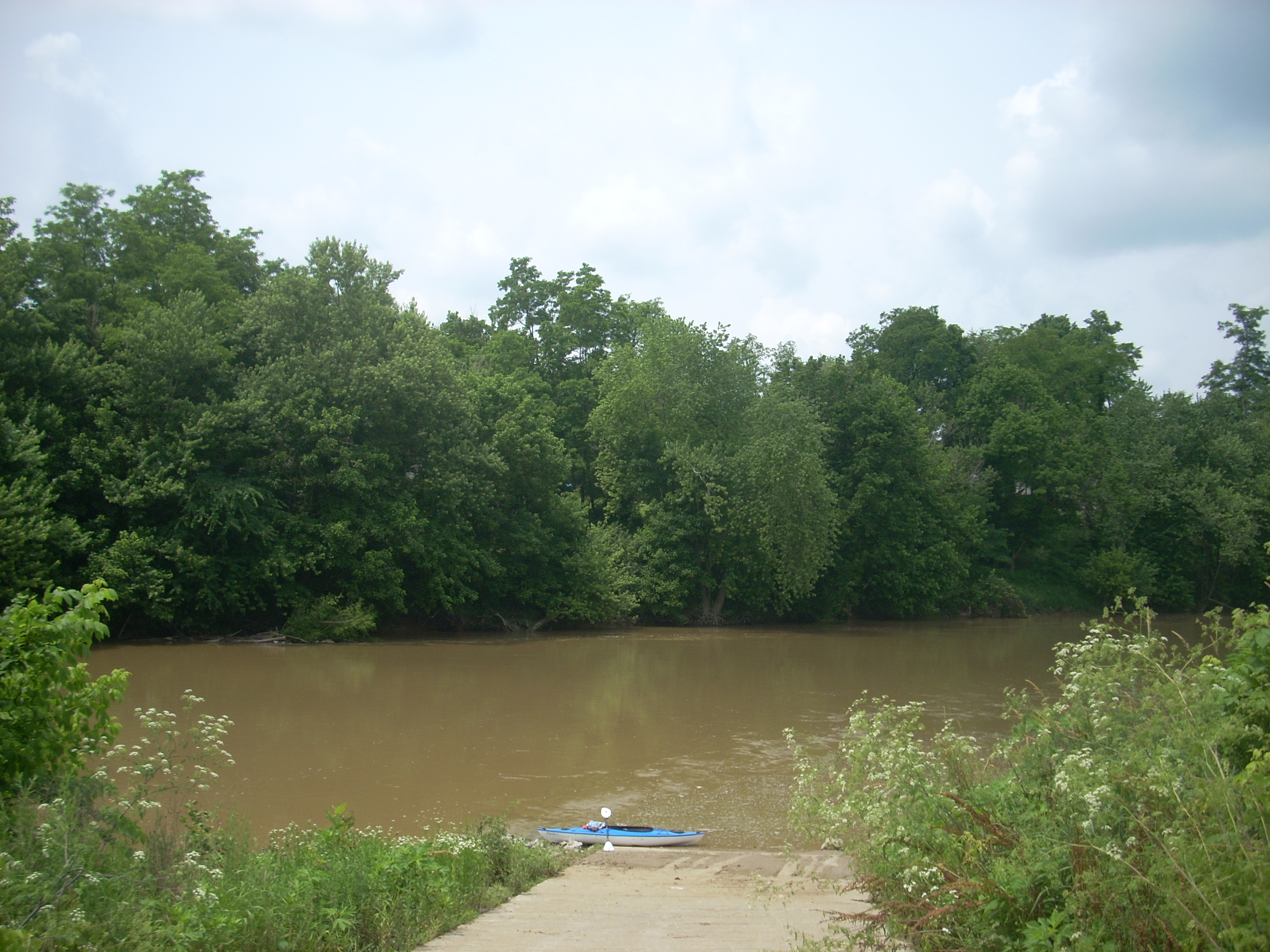
Well, upon entering the water I almost immediately found myself on the other side of the river – and moving downward pretty fast! This could get bad if I didn’t take hold of the situation – and quickly! I hammered it and very slowly got back to the other side where I found the going a little better, although I was still just inching along, and once back up to the ramp I had a decision to make. Should I continue and see how far I could get, or should I quit and go try the Cynthiana ramp? Well, I’d already spent a good deal of money on gas just to get out here and gone through all the time to unload my boat and gear. Also, what if the water had just as much of a current from that ramp - or even more? I figured I’d go ahead.

I usually like
to describe rivers as if I was paddling down them, since that’s what most people
do, but I was not able to reach a definitive landmark on my trip today.
Therefore, I’ll describe things as I went upriver and once I can paddle
the rest of the way to the next upriver put-in from the spot where I ended today
(supposedly an entry point off McKenneysburg Road in Pendleton County) I’ll
describe the whole thing in downriver fashion. So…
You’ll round a
little left curve heading upriver just after the ramp and will then find
yourself on a very long straight section of river. In fact, I
paddled the entire
This whole
section seems as remote as any I’ve seen in
When you reach the end of the straight the river will venture right. It’s been following along KY22, the road I came in on, to this point but here the river veers away from it (or vice versa). In this next section you’ll be on a long, slow curve left, and it’s about in the middle that there’s a little stream incoming from the left which I paddled in maybe 50 yards on my way back.

I noticed a couple interesting things moving in the water today. The first was near this point and it surely looked like a fish swimming upstream. The second was further up and it looked like the upper portion of a snake bobbing up and down as it made its way upstream. Both of these turned out to be the fallen limbs of tree branches in the water! Check it out...
A second incoming stream on the right ushered in the last third of the trip, and there was some grass protruding up from its’ submerged shoal, which was probably the shallowest point in the river today. I again paddled into this stream maybe about 50 yards. It’s split in 2 right as you enter with the left side being the longest – though both are only a matter of yards.

Back at the
river I had the most difficult time paddling since back at the ramp as I crossed
over the stream of water going around the shoal. At this
point I could now begin to feel my right shoulder, and I knew I’d have to start
looking for a place to end today, although I wasn’t quite ready to do it yet.
I like to expend almost every ounce of energy on these trips so as to let
a fresh, renewed energy fill me up. Also, if I quit too early
I feel like I haven’t made the most of the day.
Well, this last portion turned out to be on what I’ll now call the “never ending C curve”. It seemed to go on forever, and I was thinking with each paddle stroke that I’d see the end around the very next corner, for I was ready to turn around at the first sign of a straightening. My strength beginning to wane, however, there were points where I wanted to just give in. This conflicted with my desire to reach the end of the curve.

What I did was
to make compromises. I’d relent a bit at times to see what
happened, and each time I did, I found myself on the inside (left bank) of the
curve, where the paddling seemed a bit easier. I’d mostly
(but not consciously) found myself paddling from the middle of the river most of
the day.
The thought
then occurred to me that in life in general, as well as on the river; that it’s
sometimes in relenting that you’re able to see a better, clearer path forward.
Knowing exactly when
to relent can be the toughest part, though, when you’re so caught up in what
you’re doing, but maybe in the process of letting go you’ll find yourself at a
point where you’re soon able to travel DOWN the river of your life instead of
up!
…and that’s EXACTLY what happened on the river today! Having thus given in a bit and discovered an easier upriver path, I was finally able to reach the end of the never ending “C” curve and enjoy a leisurely float back downriver at a speed which I guessed was about 4 m.p.h. based on how quickly the scenery passed by relative to how quickly it passes when I’m paddling on flat water. The trip upriver had taken 5 hours while the trip back took 2.

I’ll plan to
paddle more of this river later in the summer when the water level might be
lower and it’ll have less of a flow, but on this particular night, I slept
incredibly well!
DIRECTIONS:
From the
intersection of US27 and KY22 in