PLACES TO GO ON LAND HOME PLACES TO GO ON WATER
Cave Run Lake and Part of the converged
North/Middle Forks of the Licking River
Warix Run ramp to ? (Near
Having kayaked some of the
Last year I didn’t have my
own kayak, so I rented one from an outfitter in the area. That boat was
not only longer than the one I have now (a Santee 100), but it also had a
rudder, so it went pretty fast and I wound up going from the Claylick Boat Ramp
to the Poppin Rock ramp that day. I don’t know how many miles that was,
but I do remember that when I got back I had pretty much expended all my
strength and energy, and I had a whale of a time getting the boat back on top of
my car! Adding to the frustration was the wind that kept blowing off the
little foam cushions the outfitter had given me to protect the roof of my car.
I scraped it up pretty good!
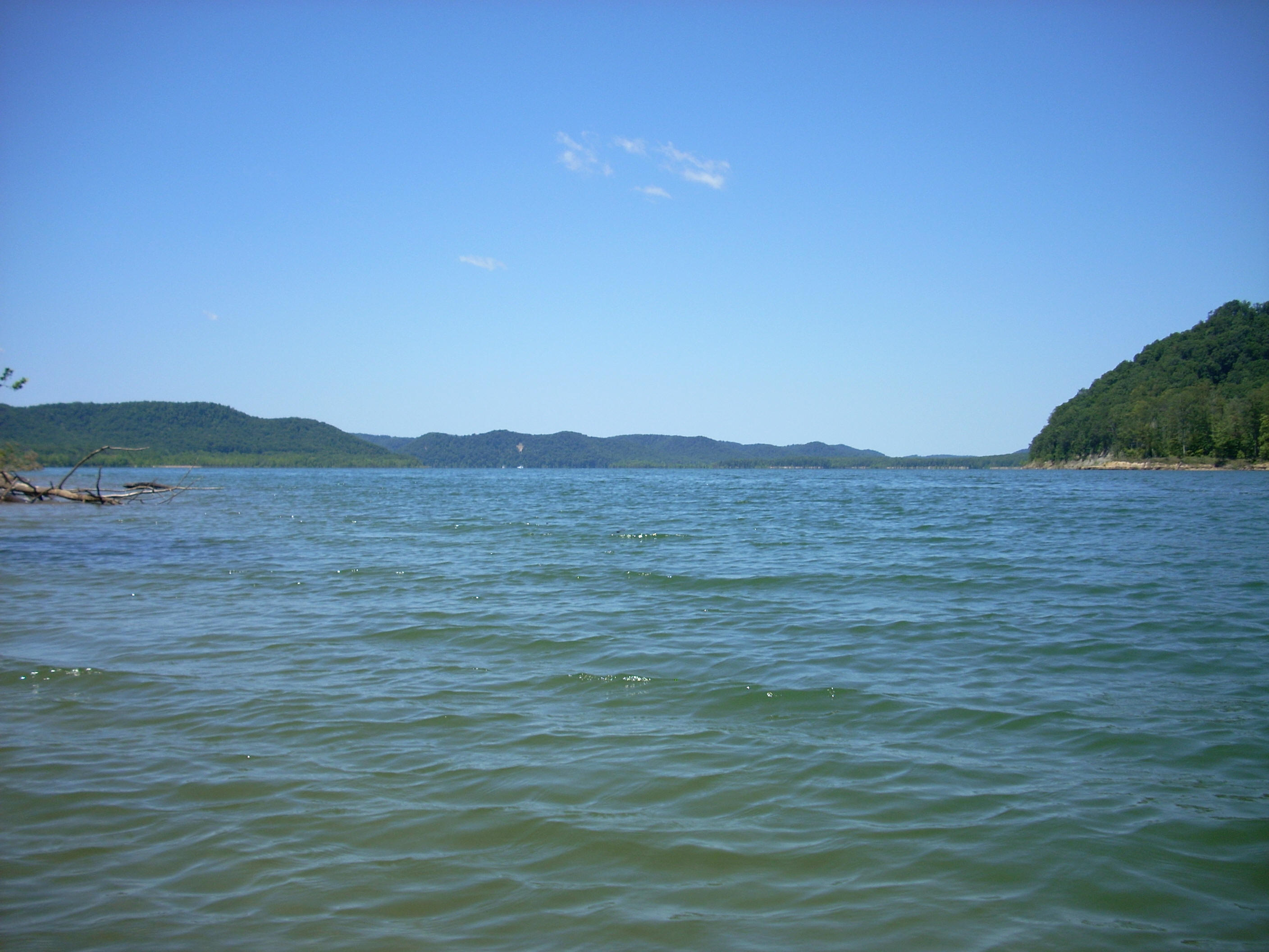
Anyway, as I started out today I noted that this lake appeared to be wider than
I didn’t use the Warix ramp
directly as a put-in today. I opted for a spot off in a grassy area to the
west side of the parking lot to avoid the power boats (I’ll use such an option
if it’s available and convenient). I’ve never had much of a problem at the
ramps in this regard, I just like to have a little more space sometimes – and
especially on days when the ramps are busy, like weekends.
Once on the water the first area I passed through was
a part of the lake where there was algae floating right on top of the water.
It was so dense that it would get wrapped up in my paddle as I worked my way
through. The shoreline here had some interesting rock formations as well
amid the deadfalls and foliage on the banks, and straight ahead - way across the
lake - I could see what the map indicated was the Zilpo Recreation Area.
From past trips I know that there’s a nice beach and another boat ramp at Zilpo.
In fact, there are quite a few ramps out here if you include both
I was following the shoreline
around to the left on this trip, and as I rounded the first bend there was quite
a large open area. This was the Claylick location that I’d set off from
last year and it, too, has a boat ramp along with a boat-in campground.
There were several tents in evidence when I passed, and the whole area – a
grassy, cleared out one – is on one side of Wilson Hill according to the map.
This area provided an interesting contrast to the wooded hills of the rest of
the shoreline.
As
I rounded the next left curve in the lake, I reached the spot where the

Anyway, I kept curving left
and was soon on the Licking. Following the shoreline contours, I navigated
around the little coves of Long Branch, Ham Branch, and Charity Branch, all of
which I found to be very pleasant save for the amount of trash that clogged them
up. In fact, it was at this point that I realized just how much trash
there is here compared to the other lakes (and rivers) I’ve been on. It’s
a bit disappointing. Among the general debris on the shoreline today I
counted no less than 9 refrigerators and 2 hot water heaters. I didn’t get
an exact count of the propane tanks, but there were several.
Be wary out here among the
“graveyard trees”. This is my term for trees which were apparently swamped
under when a dam was put in. They’re dead now, but are still firmly rooted
under the lake. Some jut way above the surface of the water, while others
lie only just underneath, and if you hit them just right, they
could tip you over. Thus, it’s best to keep a mind on your balance when
you’re out here and follow the shoreline fairly closely in case of a flip.
If you decide to take this
trip too, you’re apt to see a ton of boats on the lake section, but once you get
to the river there will be far fewer - I only saw 2 power boats and 2 jet-skis.
More wildlife will probably be visible as well – I got a nice turkey buzzard
picture where several of them were hanging out onshore, and I also took some
more dragonfly shots. I couldn’t help it... I really love these
colorful insects! Interestingly, my blue boat seems to attract the blue
ones!
I don’t know exactly how far
I got while following the meanders of the river on this day - I don’t bring a
personal navigation system with me, just a map - but I ended up heading back
about 5. When I did, I was across from a point where there was a dirt road
heading down to the lake, and there was a boat putting in here. I also
noticed a red brick structure on that side which was pretty tall and square
shaped. I don’t know what this was, but I am curious if anyone could tell
me. Anyway, my best guess is that I was across from the mouth of Cave
Branch.
Either way, I was disappointed because I definitely wanted to make it to
On the way back I crossed
diagonally over the meanders of the river so that I could paddle at a more
leisurely pace while still cutting off some of the distance in order to make it
back to the ramp before dark. I did this, of course, while keeping a sharp
eye out for the power boats! They’ve always seen me (so far!), but I never
take any chances.
Presently I noticed a
helicopter circling overhead along with some police boats. One of them
stopped and I was asked if I’d seen anyone along the shoreline. Apparently
someone had gotten lost (there are numerous hiking trails out here). I
encountered another police boat when I got back to the lake. This time I
was asked a question that I couldn’t quite hear over the sound of the motor –
did I have a lifejacket on? I pointed to the one I was wearing! Just
about all my gear is bluegrass blue at this point, so I guess it sometimes
blends together. He told me that they’d found the people they were looking
for, by the way. Between the helicopter and all the boats they’d made very
quick work of this.
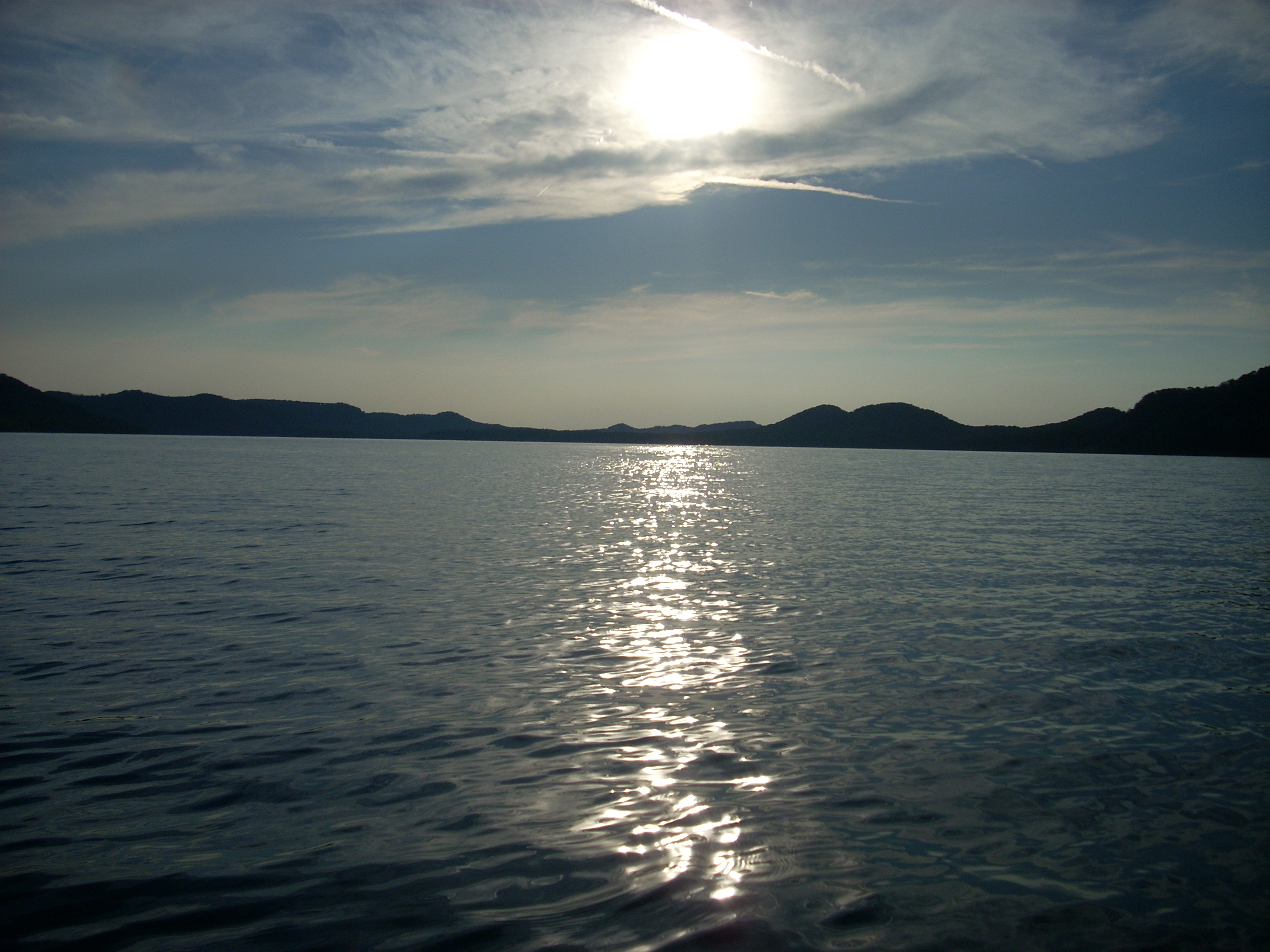
After cutting across the wide section of lake around Claylick, I returned to Warix a little after 8, taking the sunset picture below.
My general impression of the
Cave Run area today was that there’s a lot to offer out here, but while the lake
is perfect for jet-skiing, waterskiing and that type of activity, I wouldn’t say
it’s the best I’ve seen for kayaking because of the trash. The designated
beaches are incredibly nice though – I visited Twin Knobs with a group last
year, and found it to be well worth the trip.
DIRECTIONS:
I64 to KY801 South.
Pass the M.E. Clark Fish Hatchery and Twin Knobs Campground and keep a sharp eye
out for the Warix Run sign. It will be on the left side of the road
pointing to the right side. I’ll rephrase that... The boat ramp is
on the right side but the sign in on the left. It’s confusing so don’t let
this throw you. Never mind the person tailgating you – go slow to make
sure you don’t miss it. Even if you do though, there are so many ramps out
here that you’ll be able to find one relatively easily should you miss this one.