
PLACES TO GO ON LAND HOME PLACES TO GO ON WATER
US31
I missed the
moving water. I just love being ushered down a river by
gentle currents and riffles. I love the endearing sound of
the water trickling around me, and the fun of trying to choose the best way to
navigate the currents. Sure, you might get stuck if the water
is shallow, but that’s just part of learning how to navigate the water – and I
have fun with that, too.
So,
it was with all this in mind that I decided to take a break from my
I’ll tell ya - I don’t intentionally set out to buy
Christian rock music, but I’ve found that more than half of what I do buy and
listen to is Christian. I simply hear the music, find that it
really rocks, and then buy it. It’s only later that I
discover in reading about the bands that they happen to be Christian.
Many times you simply wouldn’t know this just listening to the music.
There are occasional religious references in the lyrics, but the bands
aren’t preaching - they’re just simply composing better rock music than a lot of
the other bands out there. Two examples I listened to on the
way out were the debuts from High Flight Society and Sanctus Real.
For what it’s worth, both, in my opinion, are outstanding.
Check em out on the Amazon sampler!
Anyway, the outfitter I was going to use for this trip, Big Buffalo Trace (www.bigbuffalocrossing.com),
was located just outside downtown Munfordville in the
Seeing the Green for the first time gave me the same
kind of feeling I get when I meet an extremely nice person for the first time.
I felt as if I was being welcomed as a new friend - it was very inviting.
In fact, it was so pleasant that it seemed beckon me!
I couldn’t resist... “Maybe I can just paddle around until
they get here and get a feel for the river”, I was thinking, so I drove down and
put my boat and gear in.
As I began
paddling upriver I quickly realized that the
Totally immersed in all this,
I continued paddling upriver, and once I was a little way up I looked at my
phone to get the time... Oh no… Turns out
that there had been a time zone change during my trip out here from
At any rate, this realization
having only just dawned on me, I was too far upriver to change course and go
back. I thought that maybe I’d just continue and see how far
I could get. I’d been working to coordinate a group trip for
the following Saturday out here and I didn’t think the outfitter would mind if I
did a little scouting for the trip. I continued on...
I’d only have to get out of
the boat a couple times in the first several miles, but at one point it was a
real workout as I was pounding out the paddling and still just inching along, my
course taking me back and forth from bank to bank as I searched for the easiest
path up. It was once I had
very slowly edged up and through the flow that I felt like
letting out a shout of triumph - couldn’t bring myself to do it though – didn’t
want to disturb the peace! Anyway, I would have felt very
self conscious and foolish had I done this. I let out a
“whoop” in my head instead.
At a certain point I just decided that I’d try to reach the bridge over the river that was indicated in the
Well, I wound up getting out of the boat about 6 times total on the way up to this bridge, and once I reached it I was certainly happy to have done so. I was getting a little tired, and I looked forward to the easier trip back riding the current. Reaching the bridge around
That thinking might have me
back at the park ramp before dark, although the time change couldn’t have been
in full effect - it would probably still have the feel of the Eastern Time zone
in Lexington and be fairly dark by that point, so even with the current on my
side I’d be pushing darkness - especially down on the river.
The wind had been kicking up at times too (and it’s never at my back).
It had also been mostly cloudy all day, so rain was a possibility.
I decided not to dawdle on the way back down.
Immediately after the bridge
(from a downriver perspective now) a concrete boat ramp entered the river on the
right side, and what looked like a water intake sat along the river directly
across from it on the left. I won’t be sure until I take the
trip next Saturday whether or not this actually is the ramp for the outfitter,
but my best guess is that it’s the starting point for their 8 mile trip.
This ramp entered near a little shoal with some riffles going around it,
and there were 2 sets of steps leading down to the bank. It
also looked like they had a shelter for what might be a little park or getaway.
It was here that I enjoyed riding DOWN the water for the first time on the currents instead of up. In fact, I’d have most of the moving water within the first couple miles. The river is nearly straight, but it veers very slightly about every quarter mile at different shoals. Some of these form islands in the middle, but at each one the river is compressed, creating class 1 whitewater. It’s pretty easy and very pleasant.
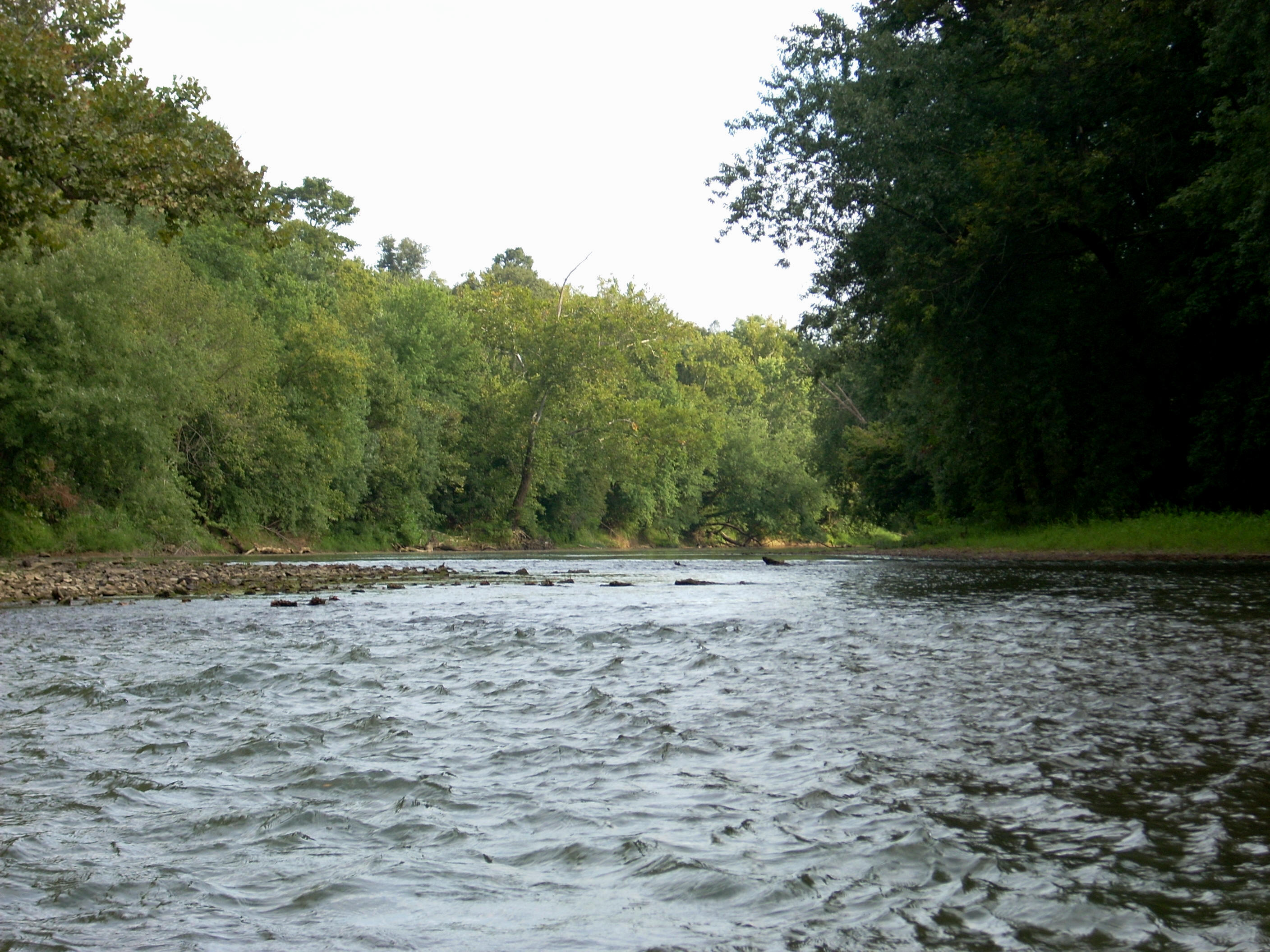
Some of the shoals in here were real giants, and there were signs that they’d been camped on, but other than that you do get a feel that you’re really in the wilderness in this section. Even though the water level for the river is determined by the releases from
In
fact, the dams that affect the flow don’t even enter the picture again for
another 40 miles down at
The scenery for this trip? Definitely
farmland on one side! That doesn’t change.
The other side is generally wooded hills, and there would be springs emanating
from these at times, mostly in the latter sections. There are
places to stop and rest, the most accessible of which are in the first few
miles. If you’re the type that’s likely to say “yuck” or
“eeeyew” at the sight of algae though, then you may not want to stop because the
algae is frequently all along the bank and definitely at the shoals.
After the first couple miles the river settled down, and
at times it did get quite shallow, allowing me to see the bottom a couple feet
down. (I found that the most navigable side, in general, was
to the left throughout this day; but when the water is as low as it was today
you’re apt to get stuck anyway.) I decided I’d have some fun
and try following the trails of the green algae on the bottom to see if they’d
point me in the right direction - they didn’t lead me astray.
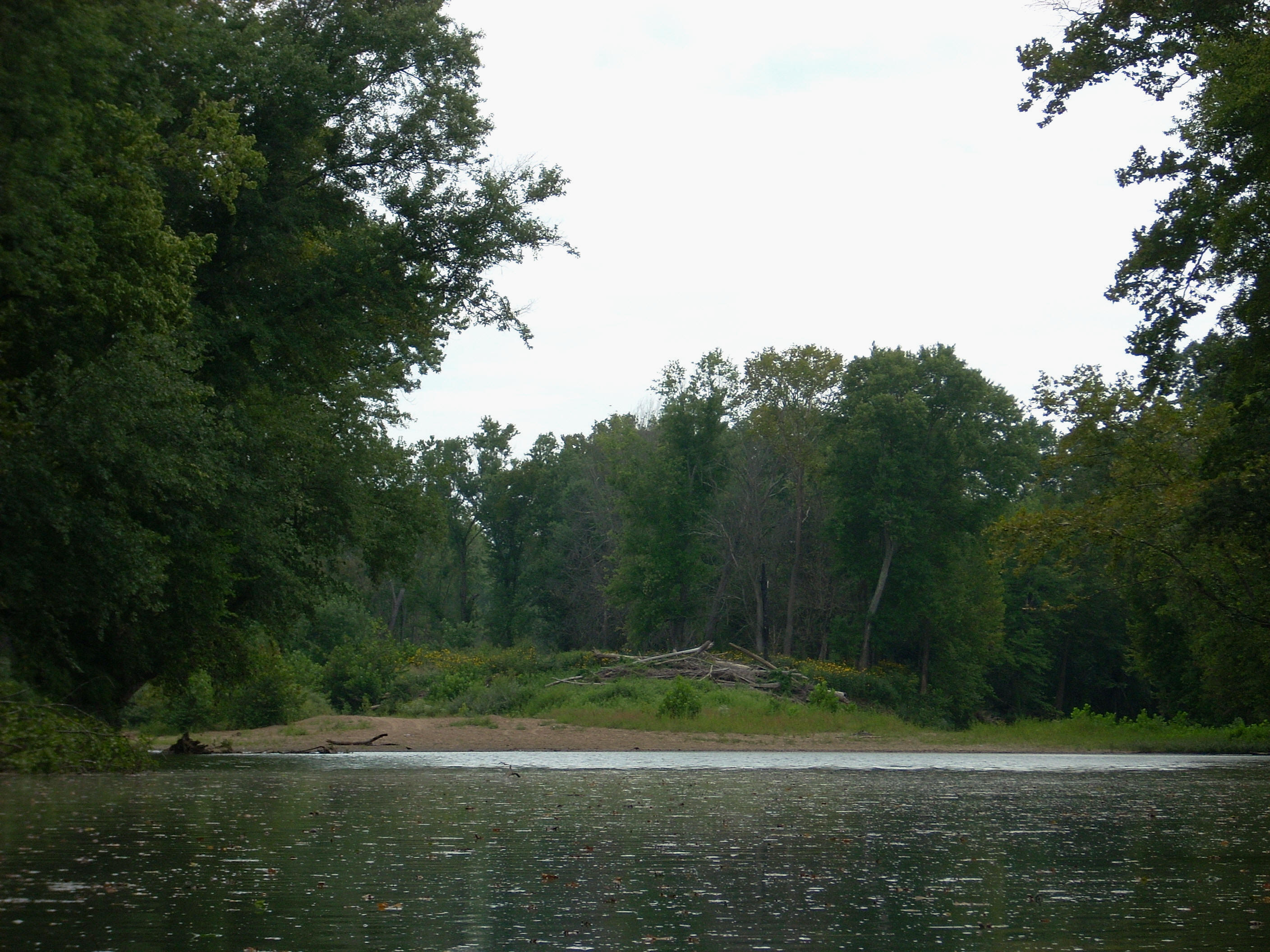
At any rate, just as the river started its first major
curve (right), a gravel ramp came down to the river on the left side along with
a dried up little streambed. The ramp definitely looked
private to me, but it was a spot to note for navigation. It
was right after this that I startled a couple deer on the right bank.
As far as wildlife, I had also spotted a beaver on the way up, and there
were some herons as well along with other birds that I am unable to name.
I’m not a birder but I think there must be many different varieties out
here.
Upon reaching a dirt ramp down to the river on the left
side I figured I’d come to about the 4 mile point of my travel downriver.
There were some cinder blocks here and another incoming little streambed
with a sign that simply said “gate”. It called to mind a
friend of mine growing up that had a dog named “dog”. No
kidding! There was also another massive shoal right after
this, although much of it appeared to have been fed by quite a bit of ground
erosion. Entire chunks of bank looked to have fallen down
into the river.
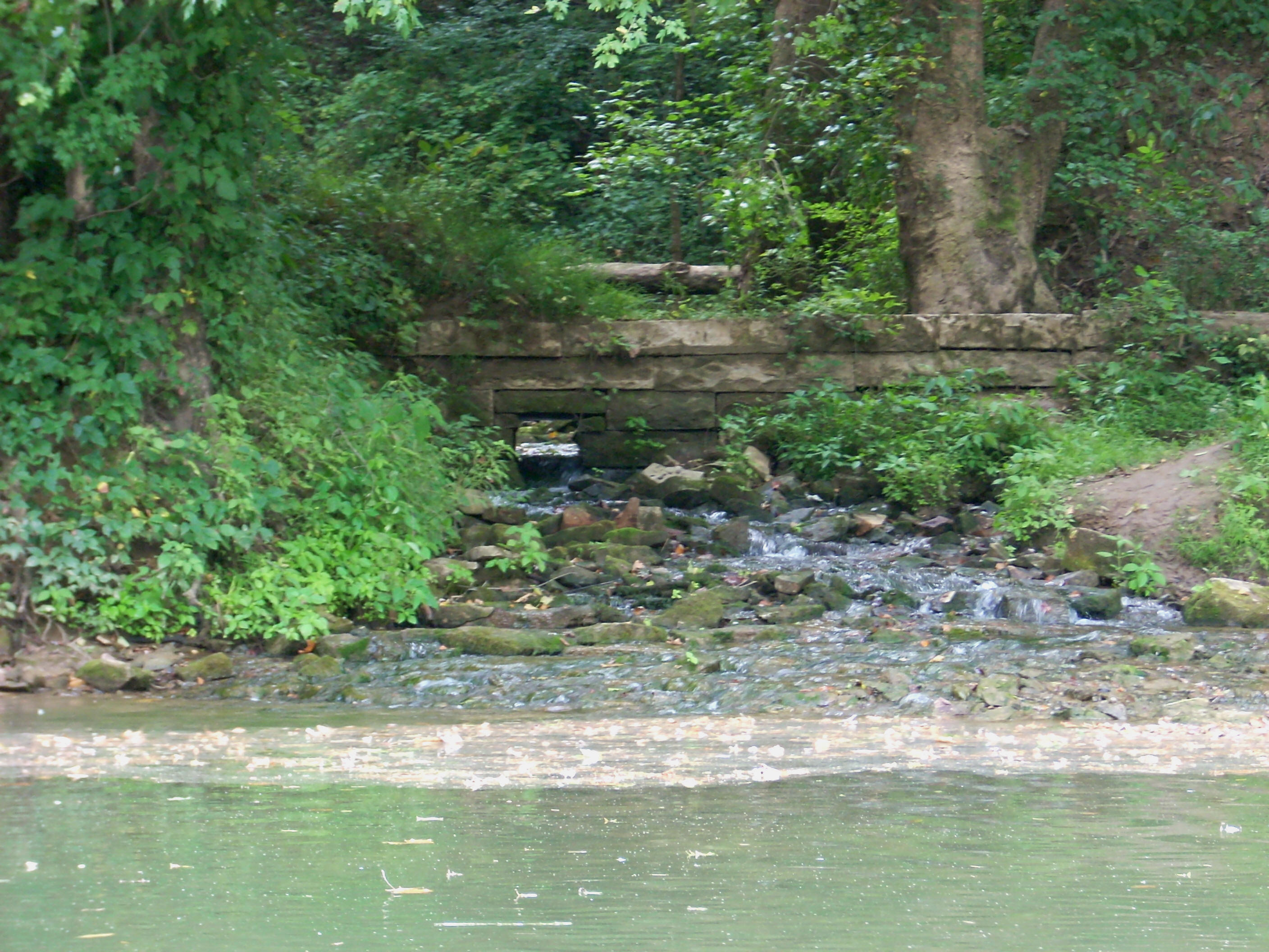
There were a few instances of incoming water in the section after the ramp, and one of these streams had a little rock wall going over it with a square hole for the water to run through. I wondered if this wall served a specific purpose, or if it was just decorative in nature - it couldn’t have been more than a foot tall.
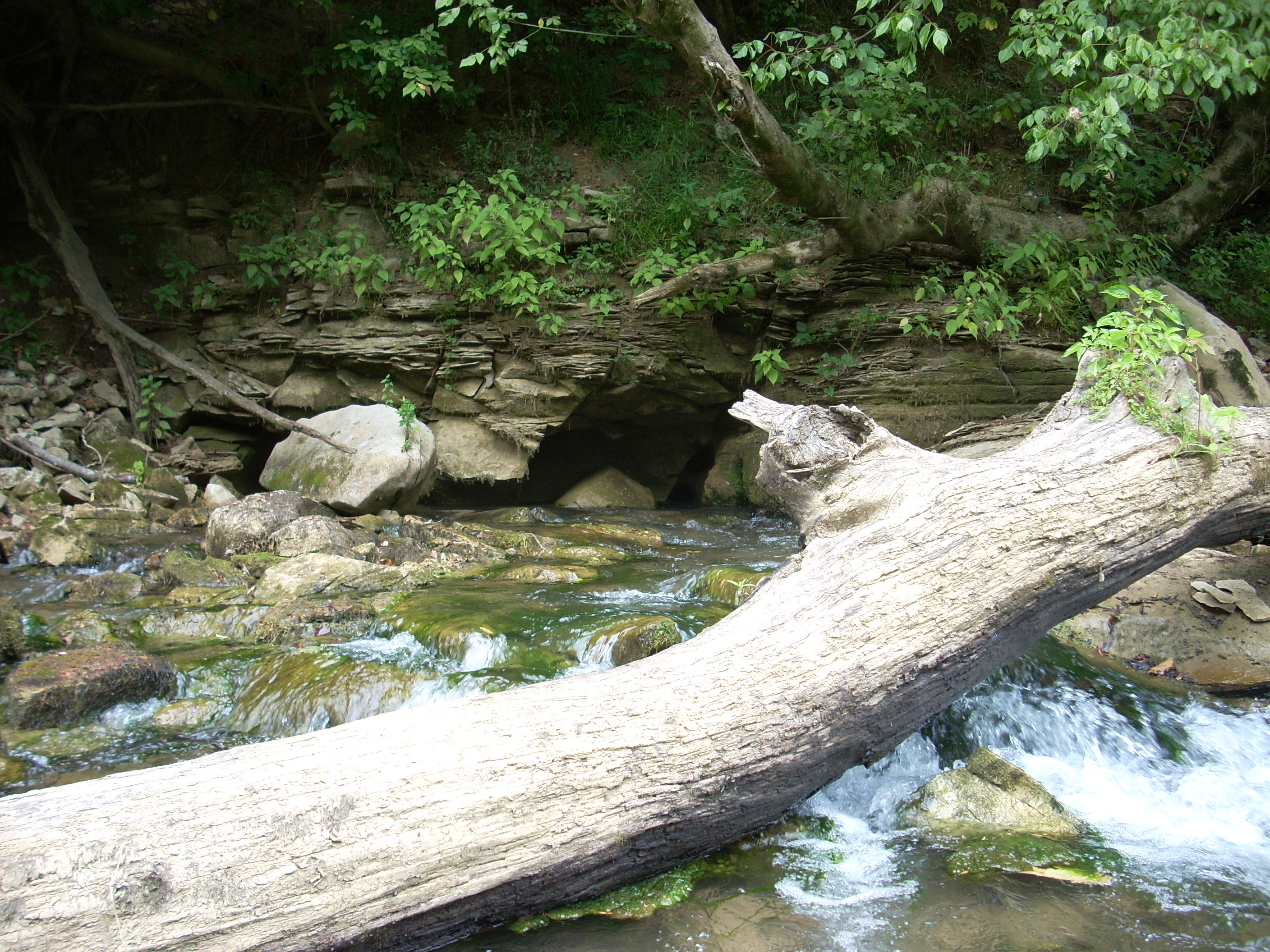
At another spot
there were 2 little trickling streams of water which appeared to go around
either side of a large rock face further up the bank - it was an interesting
effect.
At the end of a very long straightaway you’ll see
another paved ramp coming down to the river. This is
apparently the H.H. Wilson Park according to the Fish and Wildlife Boating
Access Sites publication I have (http://www.state.ky.us/agencies/fw/kdfwr.htm).
I believe this is also the 8 mile mark from the US31 Bridge, and the
takeout point for Big Buffalo Crossing trip. I didn’t see any
signs of life up at the park, although I did see a vehicle parked there on the
way up. I believed at the time that it belonged to the 2
girls I had passed in kayaks - the only people I saw today on the river.
It was getting pretty dark last 4 miles, but I did have one final bit of light which enabled me to again see a spring on the right bank which I had passed coming up. It was partially blocked by a fallen tree, and after snapping another shot of this I began picking up the pace.
There wasn’t a lot of current in this last section, and once again I wished that I had more time. Sometimes I feel like I’m going too fast and that I’m not appreciating things enough, but it was getting so dark that I could no longer see the algae on the river bottom.

It always seems to take a lot longer to get back than it does to get forward, doesn’t it? I had set out so much earlier in the day that I’d forgotten the landmarks on the river. I would think that one spot would be the takeout. It wouldn’t be. Then surely the next spot would be it... Nope! By the time I finally did get there I could see the moon and I really felt like I had made a full day of it. My first visit to the Green River had been quite pleasant!
DIRECTIONS:
US31 West into