
I needed a
de-stressing day. You see, I am not a professional website
designer. I’m a complete hack who learns only through a
sometimes
excruciating process of trial and error. Well a few days ago
I noticed
that I could no longer add pictures properly and, in the
process of trying to rectify the situation, I only succeeded in taking down the
site completely! Thus faced with the possibility of untold hours of frustration
trying to rectify things, I really needed to recharge the batteries. Yet,
with my mind so preoccupied, today would prove to be another
comedy of errors.
When I arrived at the Gwinn Island Marina facilities I met with comedy #1. I’d forgotten my wallet (there are no complimentary put-in points on this lake that I know of). Well, there’s a kind of guard shack out here just before you drive down a steep road which leads to the actual island and marina. This is where you’re supposed to pay, but since there wasn’t anyone at this station I got out of my car and asked some guys I saw if they knew where there might be a free put-in point. They said to go ahead and use the ramp - it wouldn’t be a problem this time. Well, I headed down but I didn't feel good about not being able to pay.
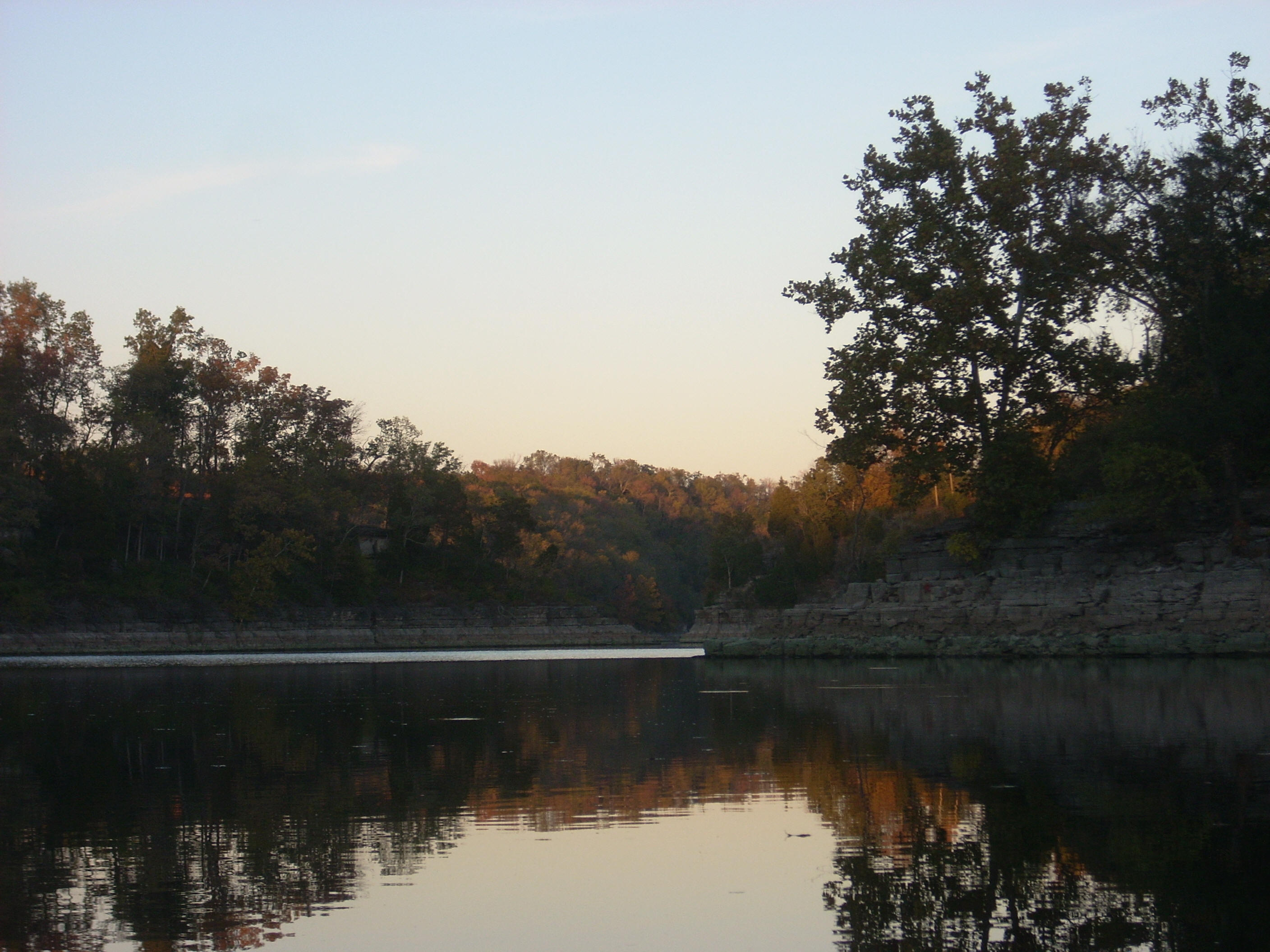
The view looking down onto the island from this spot is really amazing - especially at this time of year with all the leaves changing color. They have cabins on the Gwinn Island that you can rent, by the way. Don’t expect luxury, but if you want to come out for a fishing weekend with the guys it looks like they’d do quite nicely.
I put my boat
in without incident and started paddling “upriver” (
Guess what I also
noticed? I’d left my map in the front seat of the car! I wasn’t
going to go back...
A little way up
I came to the first junction in the lake. In fact, there were
a few options here. I’d make a left around the corner to
continue upriver, but on the other side I noticed that there were two more
possibilities. These both turned out to be routes around
another island
(
Anyway, as I made the left turn I found quite a few turkey buzzards hanging out on the shoreline rocks. They let me get quite close. To see these birds soar through the air is truly a thing of beauty, although this beauty doesn’t exactly hold up to closer scrutiny. These aren’t the most attractive of birds. Nevertheless, I never fail to see them soaring all around me on every trip I make. Turkey buzzards, heron, and kingfishers are almost always constant company.

Something that
caught my eye very soon after this was what looked like an ancient ramp.
In fact, it was so old that it could very well have been a ferry landing
spot on the old river before they put the dam in. I’m not
sure, but it definitely piqued my curiosity! I’d been
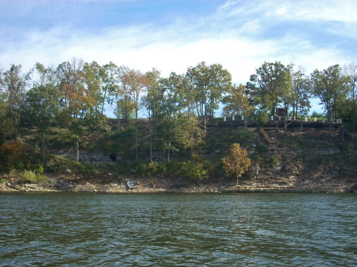
noticing some pretty grand homes too. With the exception of the area around
Dunn Island the shoreline was all property lined today.
I’m on a fairly long straightaway at this point and I can see a platform on the water at the end which has a walkway leading to it. The river then curves right, and it was after making this curve that I noticed that someone has a pretty sweet setup, complete with their own cave!
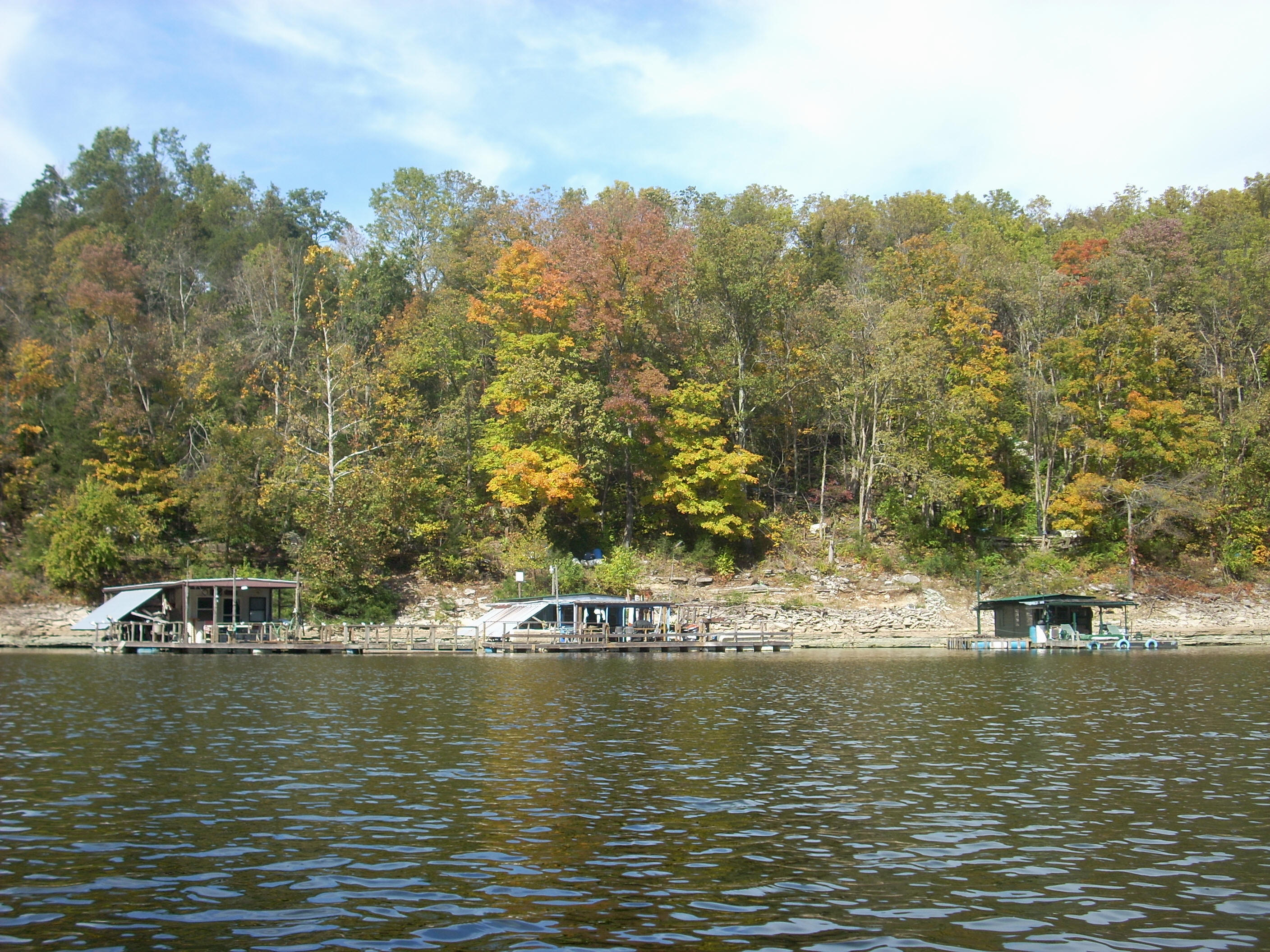
Then, at the end of a backward “C” pattern in the lake/river (it’s hard to tell where the river ends and the lake begins out here!) I spotted a trio of great looking fishing havens. These would be perfect for that peaceful weekend on the lake.
The sight of
the Kings Mill Marina would greet me at the end of the next “S” curve.
With room for maybe 50 boats, there’s also a pretty solid looking ramp
here. The spot is just before you get to the bridge over the
water for KY34. They’ve got a
At this point
I headed back
to check out

As mentioned,
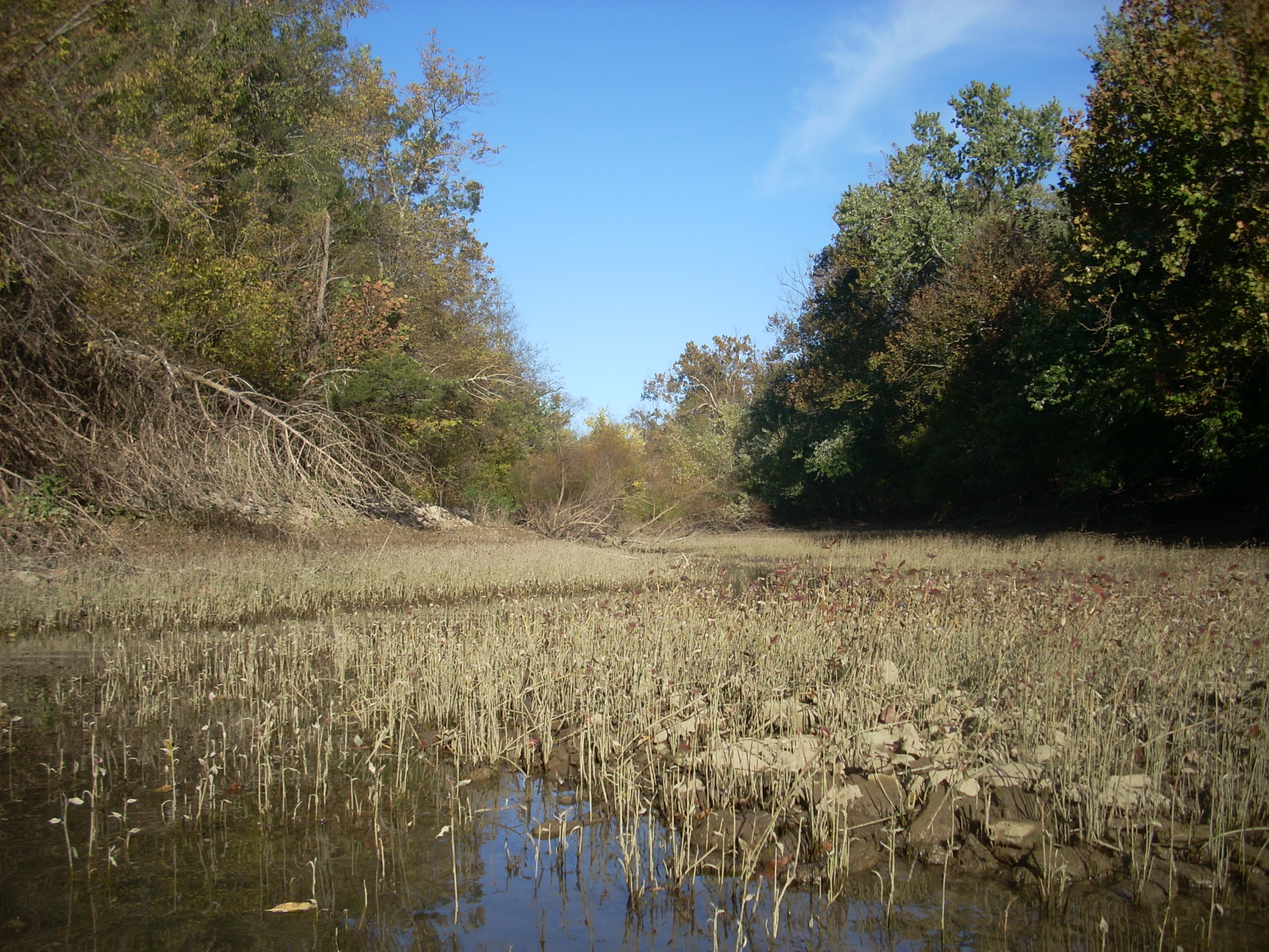
As for Taylor Creek went back pretty far, and this area seemed to offer the most privacy I’d have all day – when powerboats weren’t in company, that is! The flat water started to end in a muddy/swampy section at the back and, as I weaved in, I noticed that I was starting to force minnows and a couple larger fish up the creek as I went. I was careful to avoid hitting them.
Upon emerging
from this creek I headed back towards
Well, I'd find that the very first incoming stream went back pretty far! I usually like for these to go on for a while because I do find them fun to paddle, but it was starting to get dark and I’d have to get back soon. I thus regretfully found myself wishing that the stream would end shortly. This bothered me. I’d become more concerned with getting back that with seeing what the stream had to offer. Whenever this happens I make it a point to come back, but the feeling is like the one you have when you experience the company of someone you haven’t previously met – someone you find really interesting and fun – but you don’t have the time to fully enjoy that person's company. You want to see them again soon. Anyway, the stream went back... And back... And back, and by the time I reached the end, I knew that I’d probably run into darkness before I could return to the ramp.
Upon emerging from
this stream
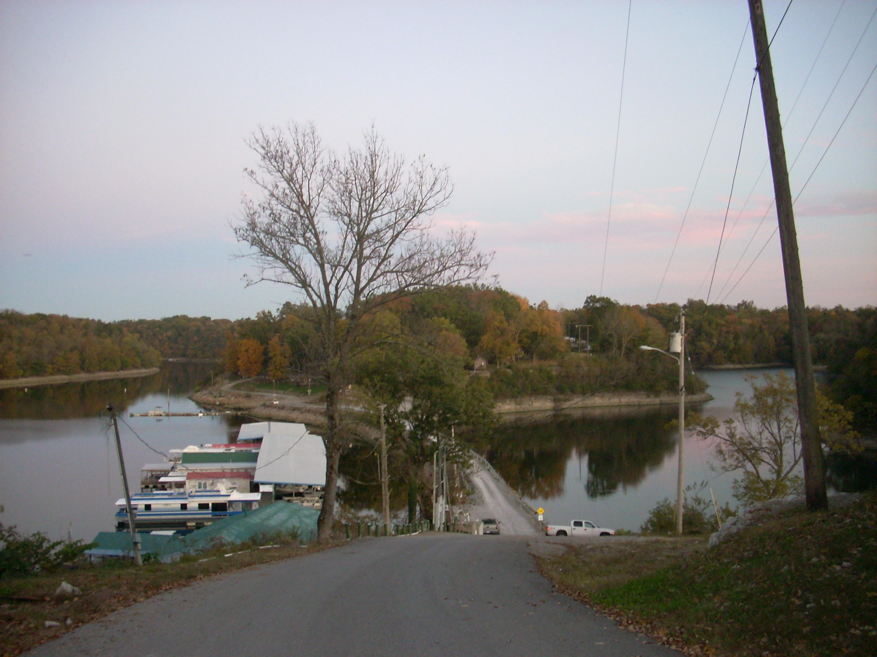
I found myself looking at the road that goes over to
At any rate,
I decided to try and
save time and take out right here – on the opposite side of the road from the ramp
- instead of paddling all the way around to the ramp.
It wasn’t easy. The slope at this point isn’t that
bad, but with the shifting rock under my feet my path up to the road was one of
slips and slides as each step threatened to send me tumbling back down into the
water – with my gear and boat!
It was only with great patience that I eventually got everything back up
to the car.
On my way out I
could hear a rock band playing atop a hill in one of the buildings
and, after taking some more pictures of
DIRECTIONS:
From
…and always
remember: “Wherever you go, there you are!”