.jpg)
Evansville’s Pigeon Creek
Monday, October 21, 2013
Pigeon Creek runs through the city of Evansville, Indiana to empty out into the Ohio River at around mile 793. It makes for a nice day trip. Today I accessed the stream by putting in from the Ohio River ramp in downtown Evansville (Pigeon Creek lies only about ½ mile downstream from this point). My intention today was simply to paddle upstream on the creek to see how far I could get. I know that the Wesselman Nature Society used to offer paddling trips on this stream, but as of 2024 it doesn't look like they do anymore. You can, however, hike along this stream on the town trail system they call the Pigeon Creek Greenway Passage.
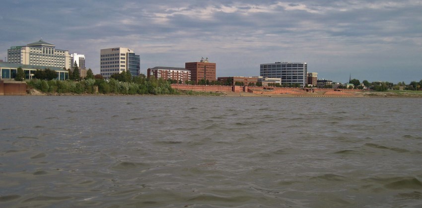
As you start your day you’ll note Evansville's incredibly nice riverfront complex. This was completed as part of a downtown revitalization project in the 1980’s in which they refortified and re-designed their break wall. In the process they made the whole area much more recreation-friendly. In addition to plenty of parking for boaters and fishermen, you can also now walk or bike along the aforementioned trail that runs through this complex and beyond all the way to the Wesselman Woods Nature Preserve if you head north and all the way to Newburgh, Indiana if you head south!
Meanwhile, you'll find that the break wall itself is incredibly interesting!
Not only does it have 3 river overlook points
incorporated into it, but it's also got placards placed at regular
intervals which relate stories about the river and its history.
They used to have hydroplane races here too.
I've been coming to town since the 1970s to
visit my grandparents and I remember these races as a great
event. I hope they bring them back someday, especially because when they
On to the paddling…
As you get on the water and start
heading downstream (or straight ahead if you're looking down the ramp) you’ll find yourself in a
stretch where the Riverfront Plaza begins to taper off to make way for the
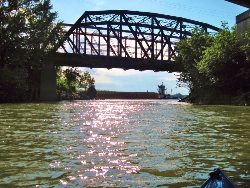
Tropicana Casino complex and then the more industrial side of the riverfront.
The casino, by the way, used to be known as The Casino Aztar and it ran off of a
beautiful riverboat (seen in the first photo below). Sadly the boat is no
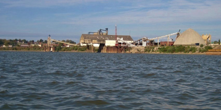
longer here. Anyway, it’s in the latter section that you’ll encounter the mouth of the Pigeon
Creek between a Mulzer Crushed Stone
location (Evansville
Materials on the navigation charts) and the Port of Evansville.
I paddled in…
.jpg)
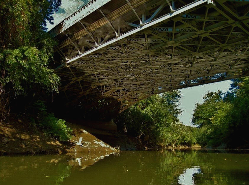
Today I'd find the
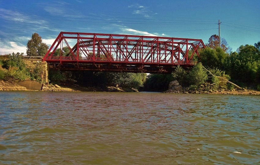
Pigeon Creek notable for its many bridges.
In fact, the stream itself is quite easy to spot due a red span right at
its entry point.
This is the Joan Marchand Bridge, a historical
landmark. It belonged to an old railroad but now
they use it as part
of the bike path. Anyway, as you paddle into the stream you’ll note that directly alongside this
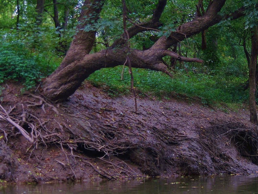
span is another – one for Ohio Street.
You’ll also note remnants of even older bridges along the
shoreline.
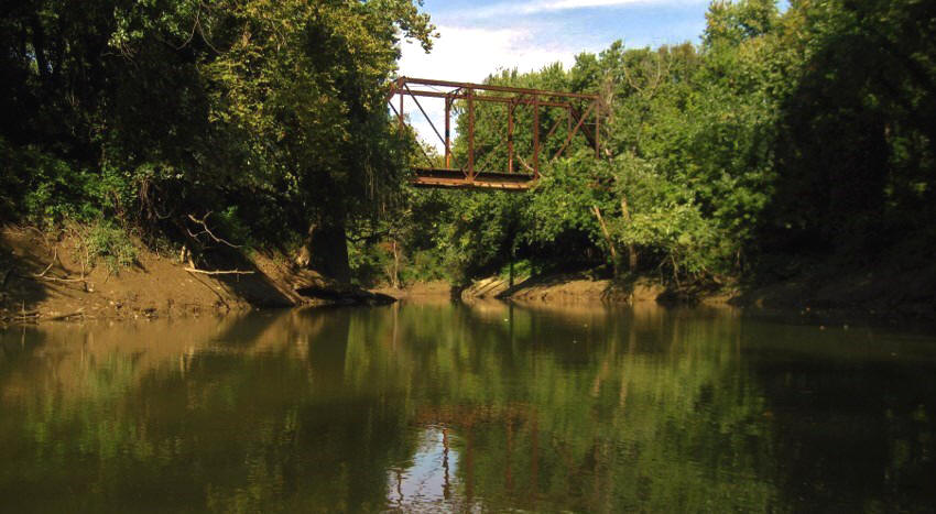
A little further on you’ll
pass under the Lloyd Expressway before reaching the site of yet another bridge – this one for Franklin
Street.
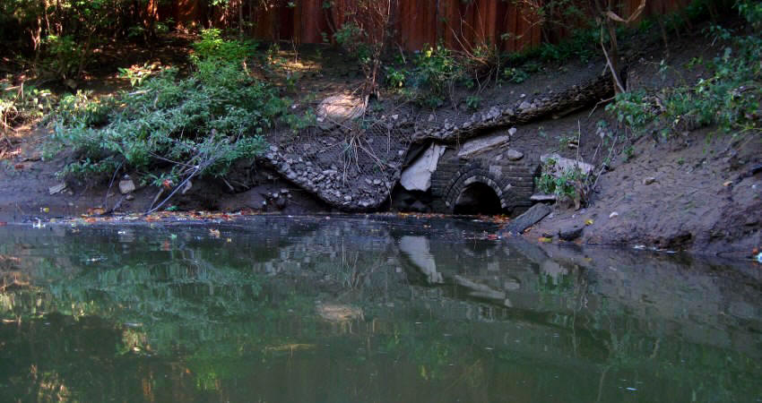
I found the area around this one to be quite interesting.
Just before you reach it you’ll note what
looks like an ancient culvert on your right side and directly above that you’ll
see what looks like a railing. That’s part of the recreation path.
You’re now in the vicinity of Lamasco Park on Evansville’s near west
side.
Lamasco is the name of a
former town which used to comprise the west side of Evansville.
It later became incorporated into the city.
As for the Franklin Street
Bridge itself, I found it notable because I couldn’t recall seeing another span
with such an interesting reinforcement structure.
Look at how the beams underneath are interwoven and instead of solid
metal in the beams themselves you’ll notice how there’s a pattern to them.
Also of note here is that you’ll have an unnamed stream entering on your
right side. I got in around 100 yards
before it ended at some industrial buildings.
Guess what’s next???
3 more bridges!
The first
two are road varieties for Delaware Street and Maryland while the third looks
like an old railroad bridge.
After this point, however, the more populated area of
“West Side Evansville” will be coming to an end. As a consequence the
bridges will begin to get a little fewer and further between.

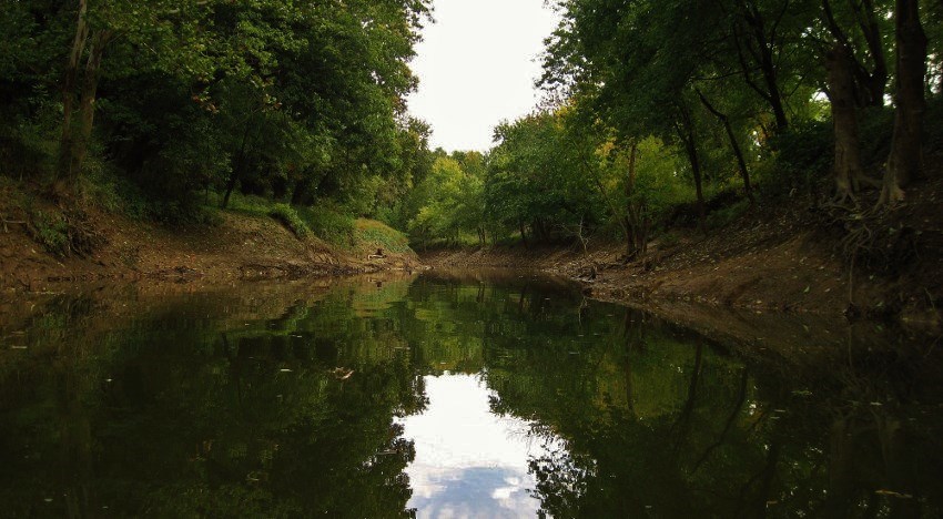
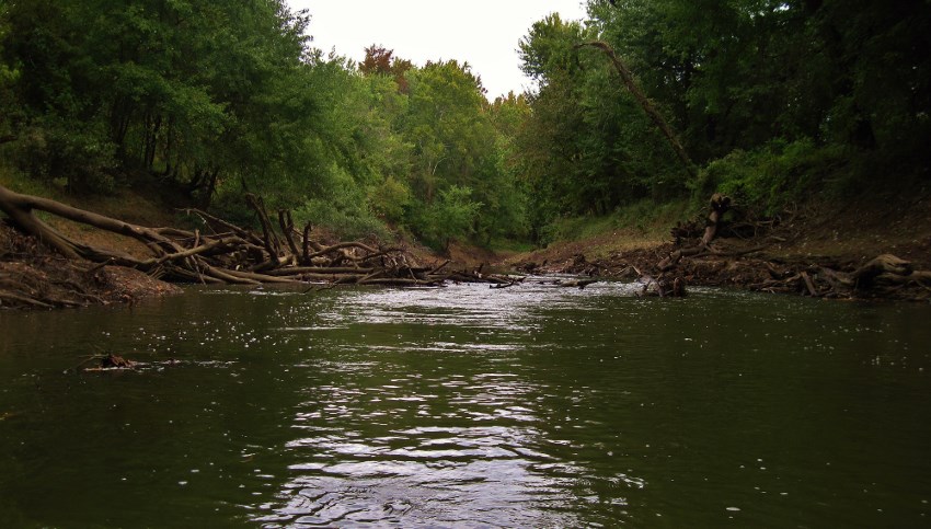
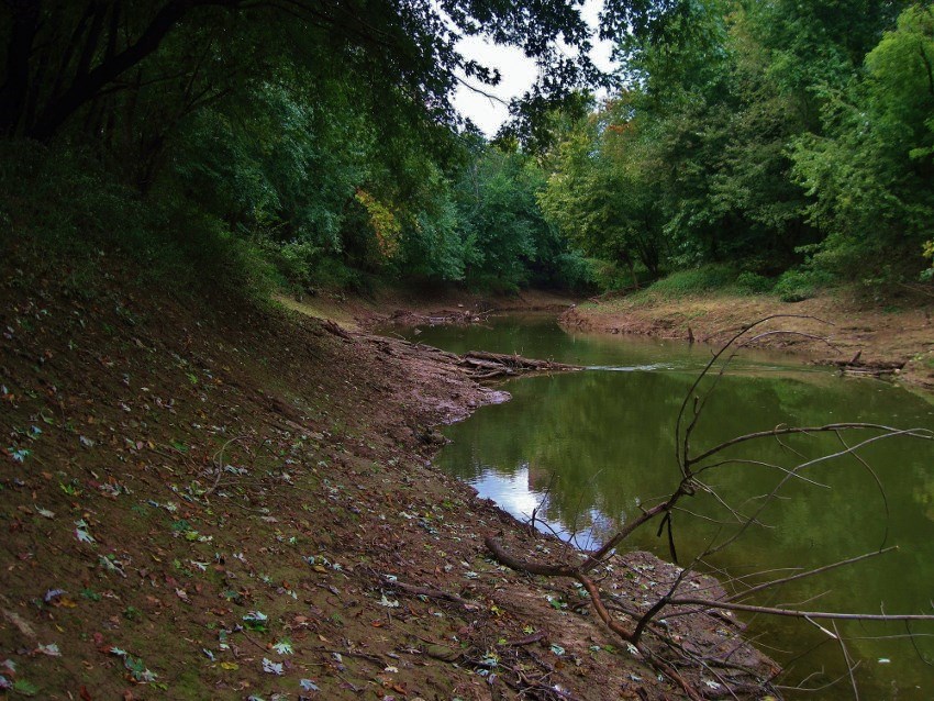
Anyway, after the bridges you’ll make a slight right curve to enter into a straightaway. It’s at the end of this straightaway that you’ll be in the area of a water intake (at the end of Dresden Street). Here I noticed some remnants of what might have been an old docking structure and I thought that the site might make for a nice fishing spot – or perhaps a put-in point?
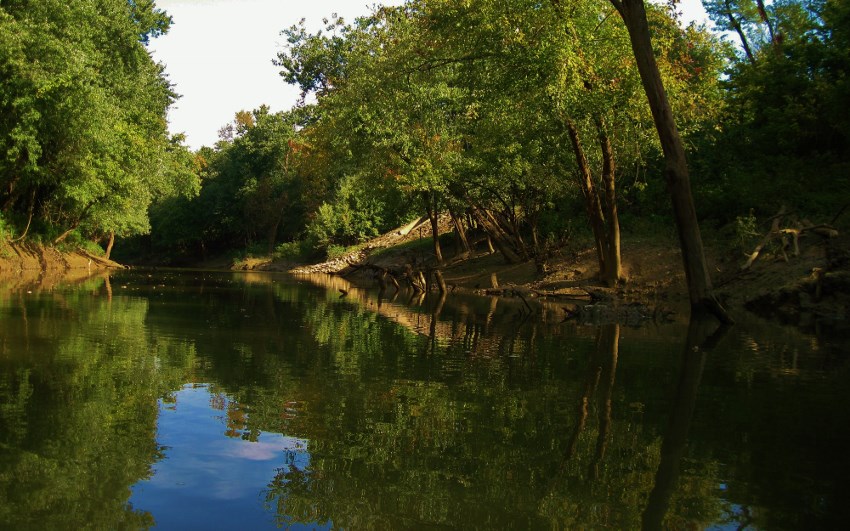
Then, coming up on your
left hand side, you’re about to encounter what I thought was an absolutely
beautiful scene at the point of another little incoming stream.
You might make it into this one around 100 yards as I did, but the beauty
of this area compelled me to stop to enjoy it for a while…

Incidentally, it was at
about this same point that I was finally able to get my first decent picture of
an otter (and yes, they are rather - ahem - “cute”!).
I had some time on my way back, you see, so instead of paddling I simply
floated along and in so doing I was able to see a lot more wildlife – the otter
below, a turtle, and many varieties of birds.

Here, too, I began to
wonder where the Wesselman Nature Preserve might be located.
I thought that it must surely be coming up and all the trees on the right
side in here had me thinking that perhaps I might be near it.
Not so.
As it turned out the preserve would be much further
upstream than I was thinking - about 2 miles upriver and past the point where my progress would end today.
Next up, you’ll meet with a sharp right curve in the river. What’s essentially happening here is that you’re “bumping up” against the foundation of Route 66, the Diamond Expressway. You’ll find that the river hits it and then retreats, heading southward for a time. Later the path of the stream will revisit the expressway to pass underneath it, but in the midst of this particular curve you’ll encounter two more bridges - the Kratzville Road/Fulton Avenue Bridge and then the First Avenue Bridge. A sign on the latter indicated that I’d come 3 miles, yet the shallow water that came after this bridge really had me wondering just how much further I’d get.


From here you’ll begin to
curve back to the left (or northbound) to revisit the expressway.
This is a very nice stretch of water where you’ll pass along the edge of
Garvin Park, but after I paddled under the Diamond Expressway Bridge that was
the extent my progress.
No
amount of muscle was going to get me through the next spot of deadfall
debris/shallow water that I was to encounter.
In fact, a even a portage looks like it might have been an adventure.
I decided to head back.
Here’s the
scene that greeted me when I got back to the mouth of Pigeon Creek…
Would I be able to pass back onto the Ohio?
(Note the gentleman standing amid the barges silhouetted against the
sun.)
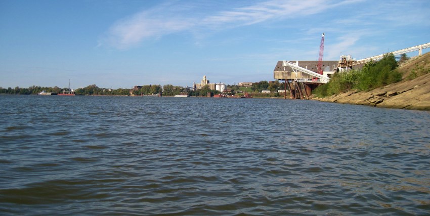
Finally, here are some scenes of downtown Evansville and the ramp along with the old Casino Aztar riverboat...

.jpg)
DIRECTIONS:
The ramp for this trip is
right in downtown Evansville along the riverfront.
Just head downtown and take a southwest turn on Court Street.
It’ll take you right down to the water.
Court Street is the one between the Tropicana Hotel and
Vectren Corp.