General Park Overview via
Tennessee State Park Website on Radnor Lake
This park provides a great (and peaceful) recreation opportunity to the residents of
What really impressed me
today, however, was the amount of work they do to maintain all the trails given
some pretty heavy use. Each one appeared to have been very well cared for and I saw
both recent and on-going signs of maintenance everywhere. They’ve either
got a pretty large staff or a few very overworked people!
Before I begin, some
background… If you enter the park the way I did (full directions below)
you’ll be driving in on a road which will eventually be blocked off by barriers,
and at this point you’ll encounter the parking lot which is back on your right
hand side. Today I found it to be a little crowded, so instead of starting
my hike on the actual trailhead (which begins
behind the restroom above the top tier of the lot) I instead opted to take off
down the blocked road to use it as access to the Lake Trail. There are a
lot of options out here. I’d bring a map if you’re unfamiliar so you can
get the most out of your trip. They have one on the Tennessee Park website
which is linked above.
My
plan today was to follow the Lake Trail around the north side of
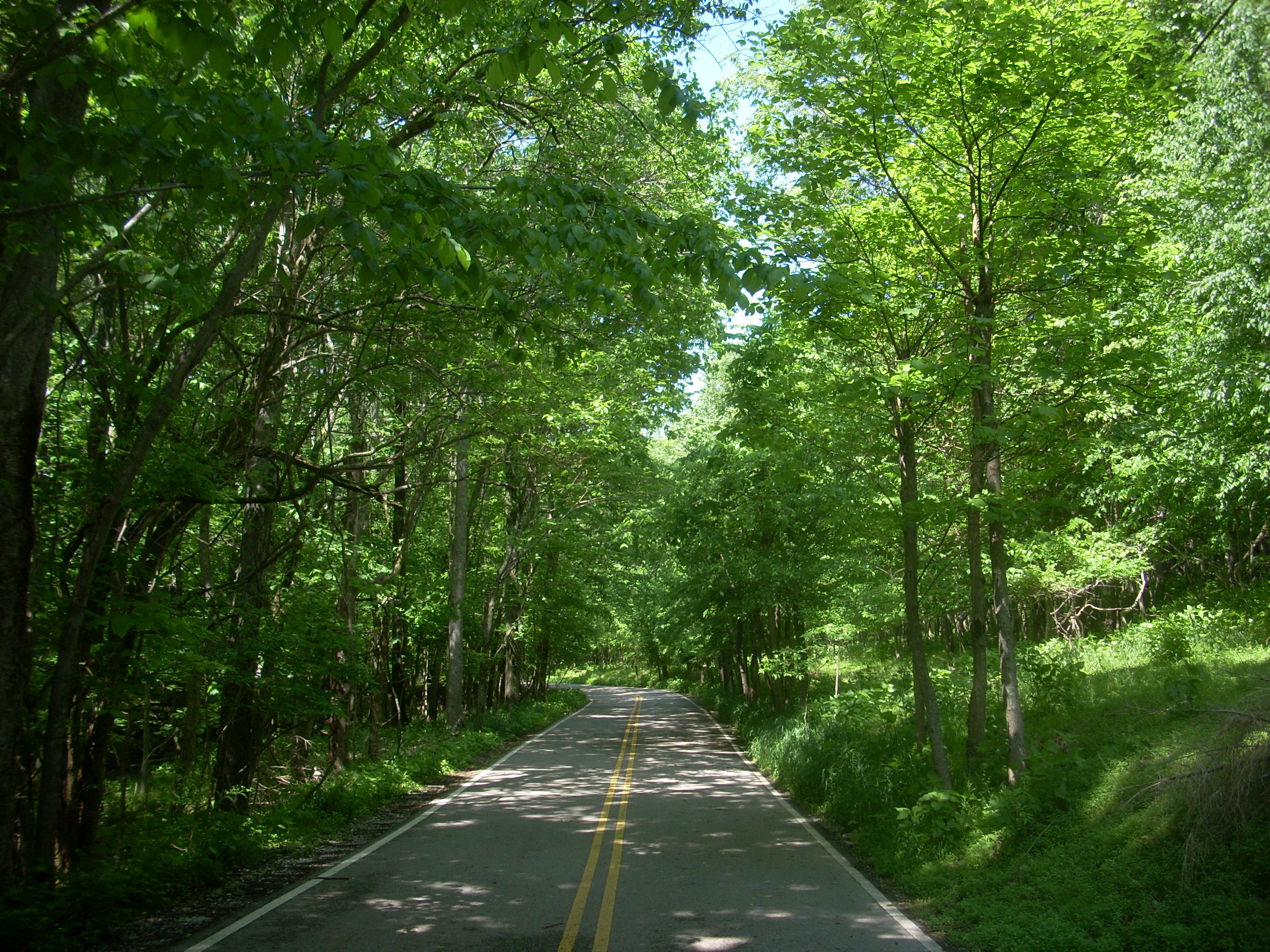
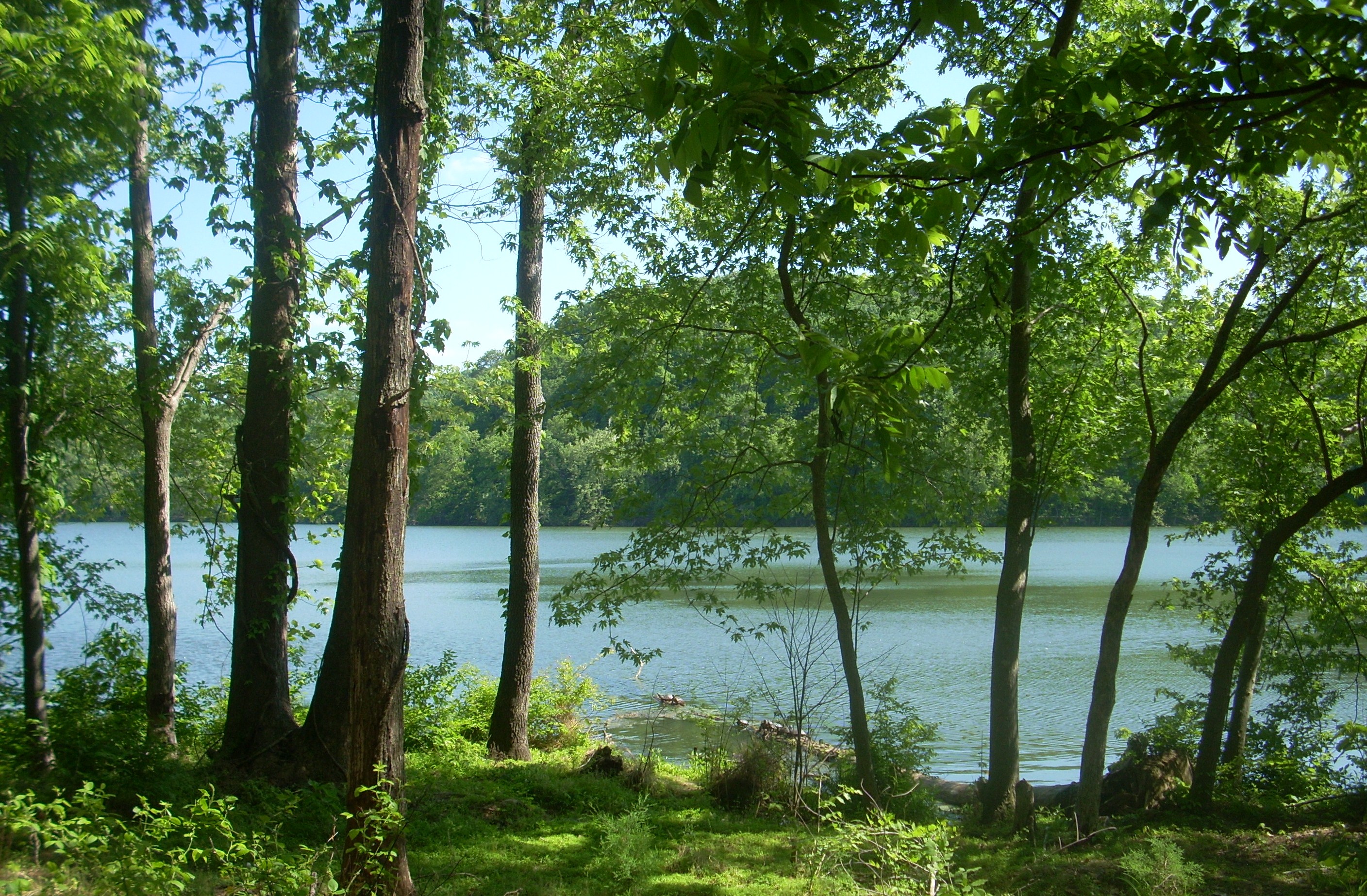
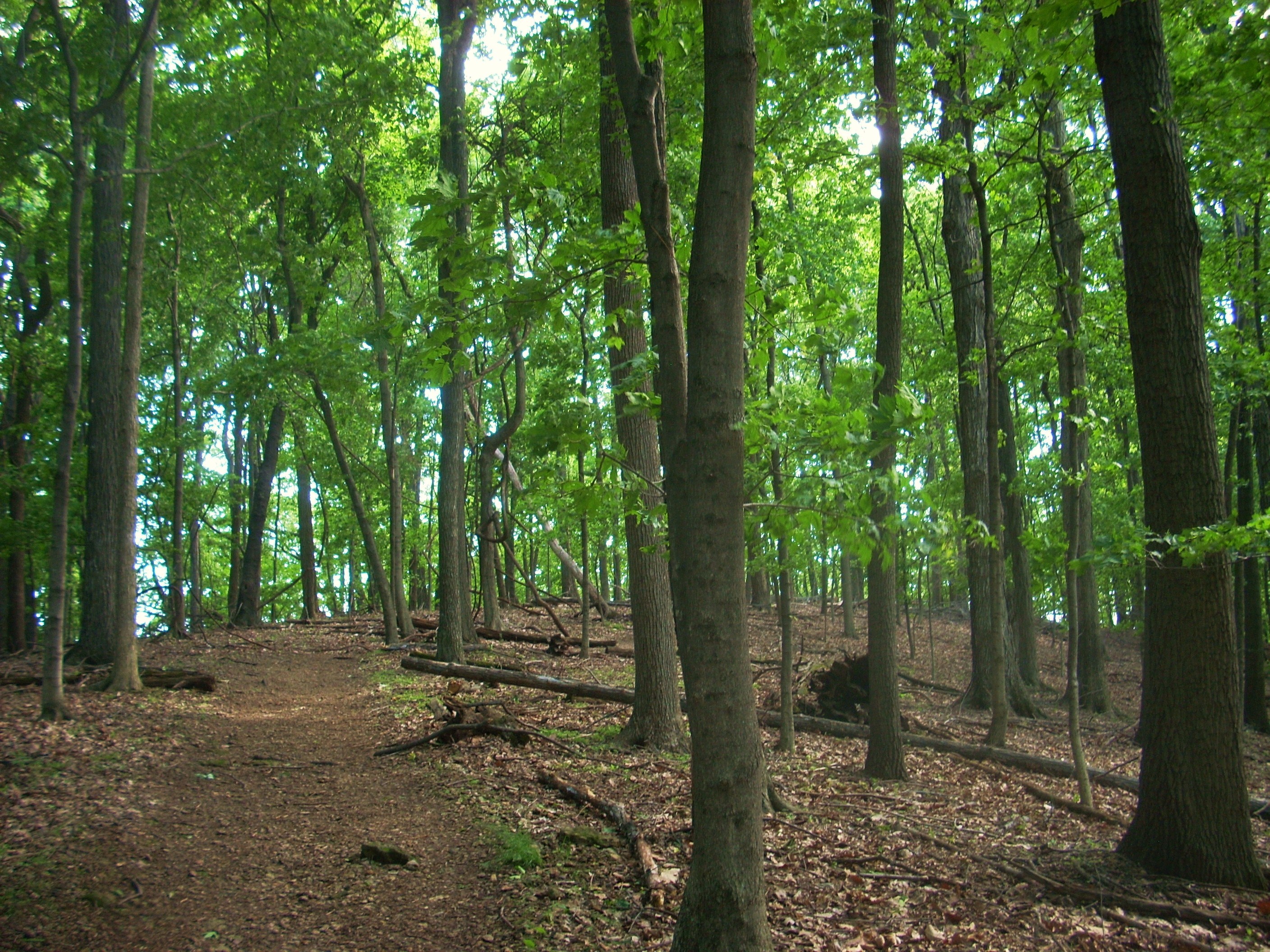
Anyway, the Lake Trail will soon begin on your right after a short and very pleasant walk down the road which today was surrounded by a forest that seemed positively alive with the fresh shades of a spring green!
You’ll find that Lake Trail
is level and pretty easy to follow, by the way. All you have to do is keep
the water beside you and if you’re traveling in this direction that means that
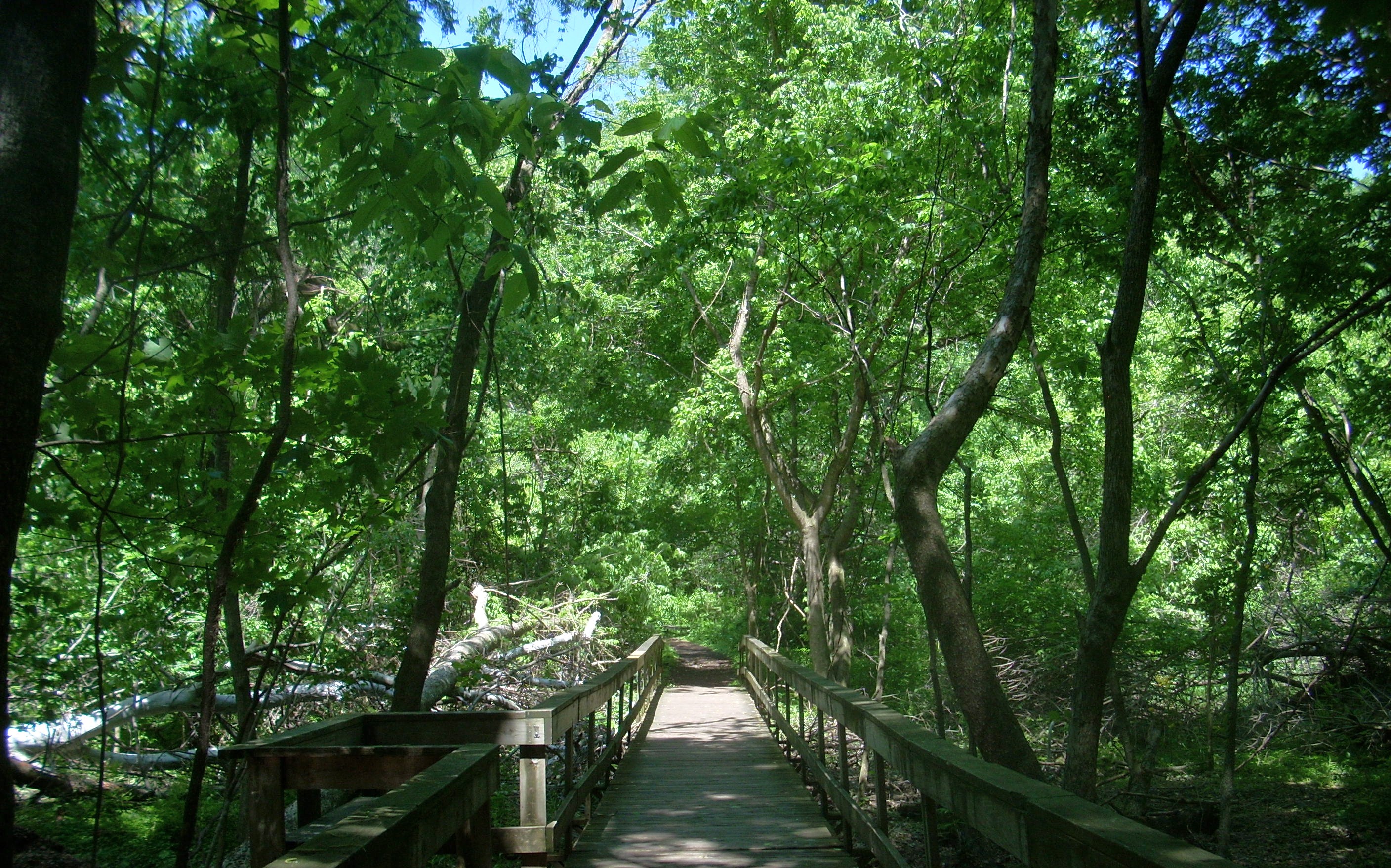
you’ll veer left at every trail junction. Doing so, you’ll span a bridge
almost immediately and then you’ll pass the first of two “Ganier Ridge” trail
intersections. The first of these will lead you right back to parking lot if you
want to make this a really short hike.
I was to encounter a majority of
my fellow hikers in this first section and I guessed that some were probably exercising
on their lunch break. This park is, after all, not that far from downtown
Shortly after you pass the second Ganier Ridge
turn-off the path will split. Here you can go either way as you continue on
Lake Trail because you’ll wind up in the same place. Then, after crossing another
little bridge, you’ll begin to break away from the lake for a time to take a brief
tour of a little alcove which has been created by one of the lake's tributary streams. Notice as you cross this particular
bridge the little “alleyways” the stream has carved out of the sediment...
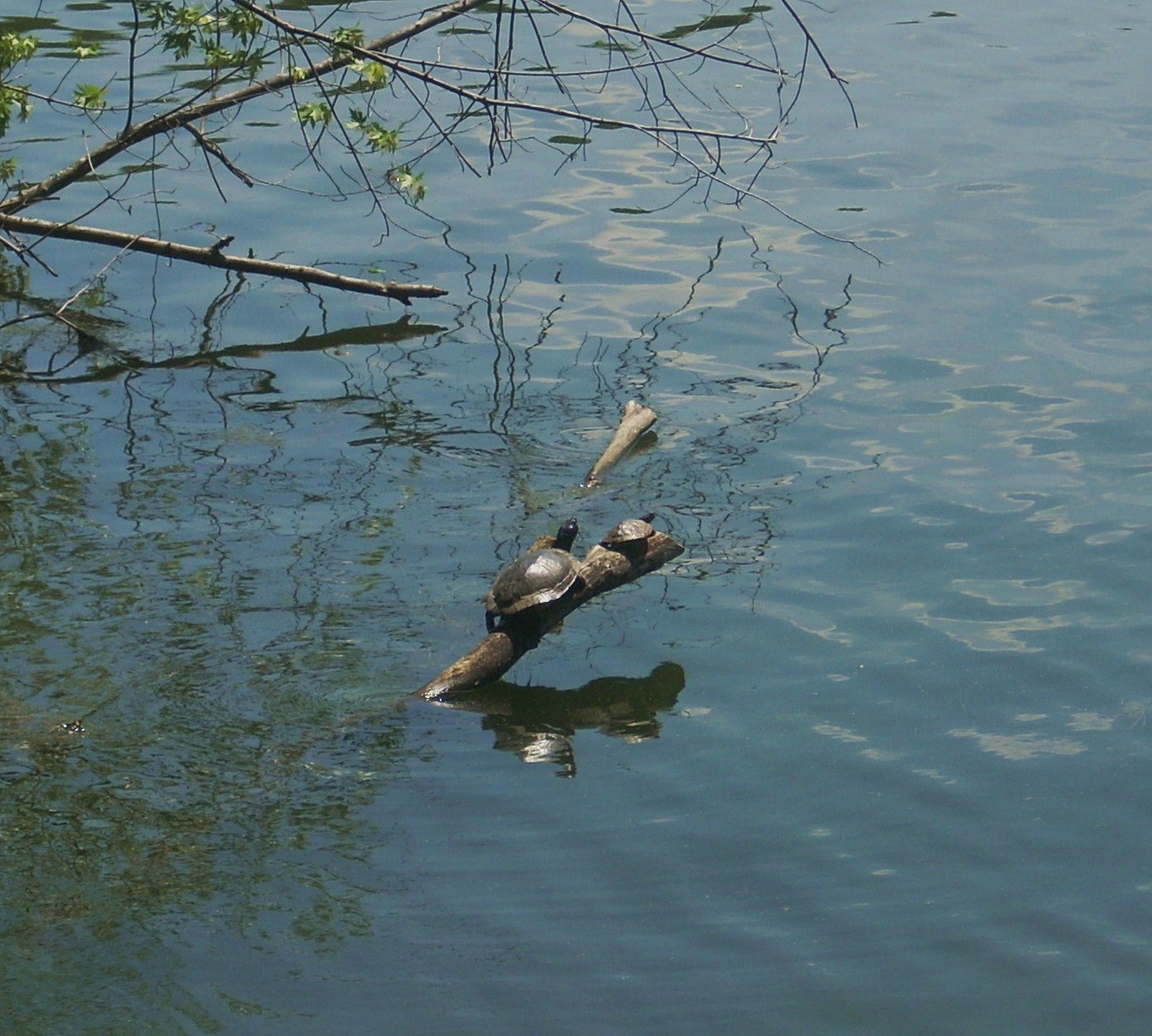
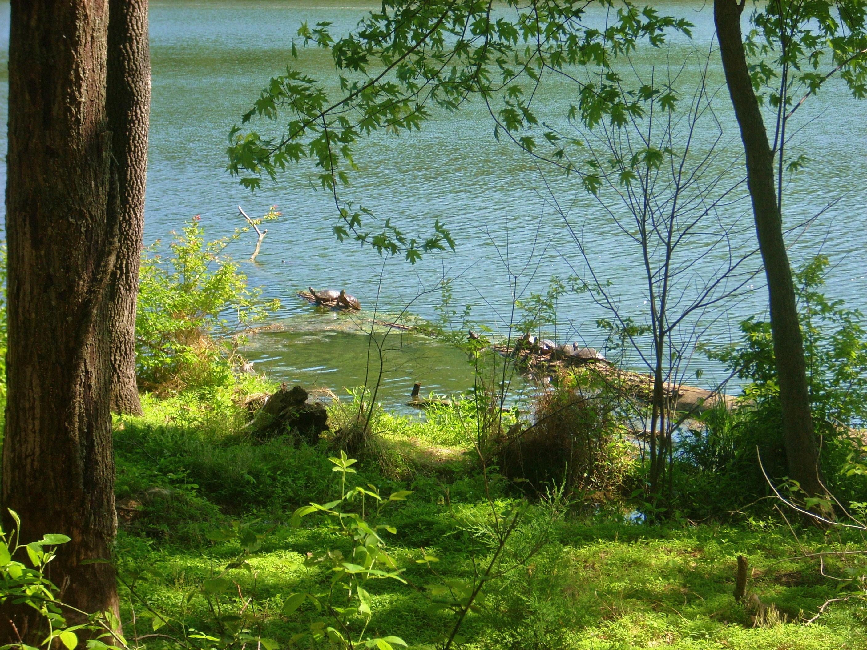
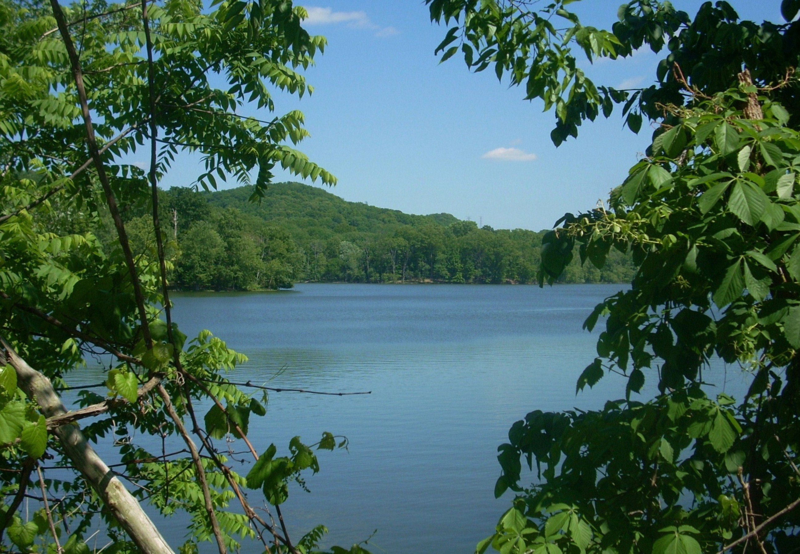
Curving left back toward the lake now, you’ll emerge pretty close to the water and here you’ll get some of you’re nicest lake views of the day. One of these comes at a particularly inviting park bench where I also noticed the first pair of many turtles I’d see on the day…
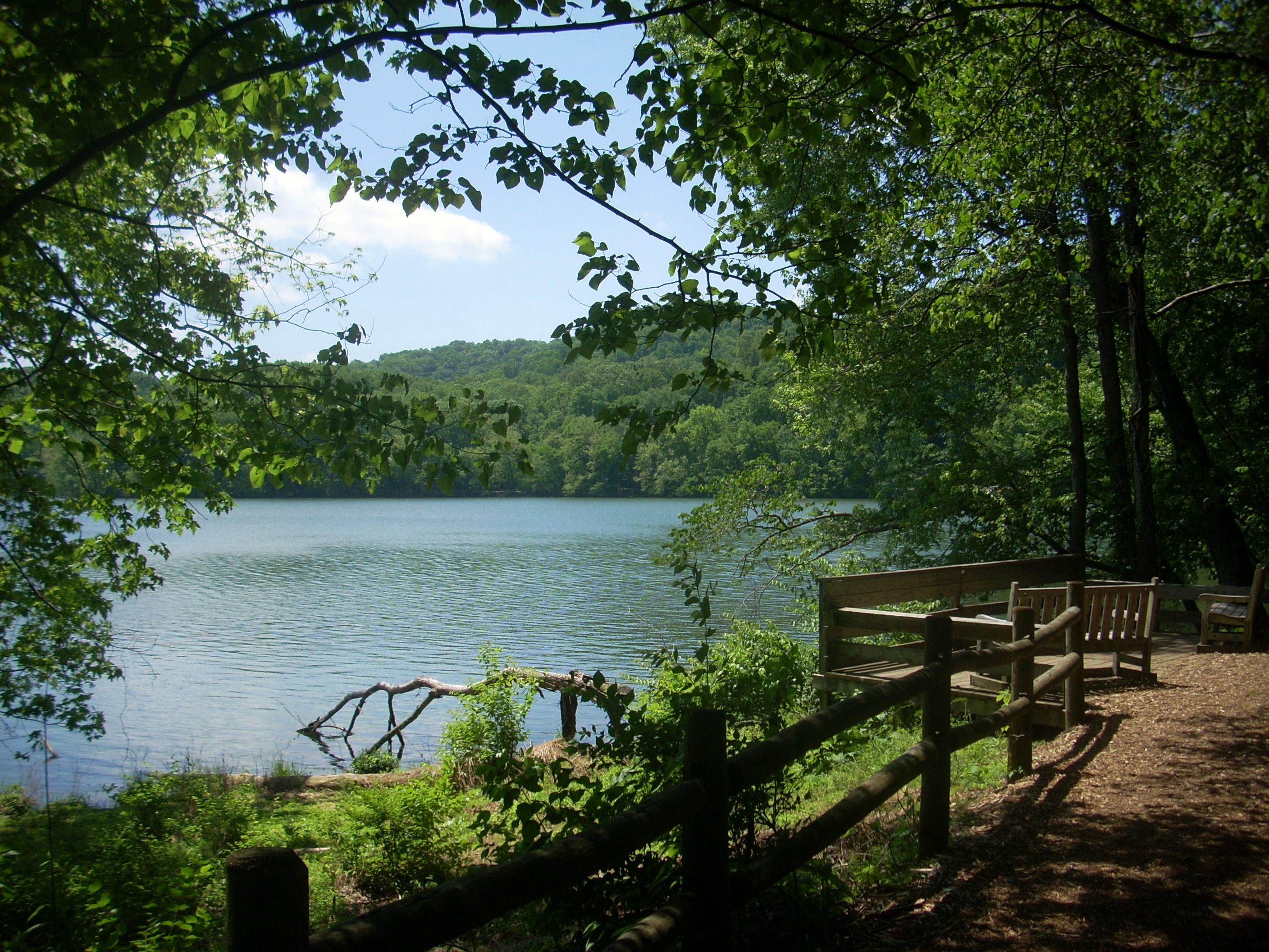
Then, after briefly passing back into another tributary stream you’ll return to the lake. I found the terrain here to be particularly low-lying and fertile today. Look at this paradise!
Soon you’ll find yourself alongside the spillway. This is where the lake drains out and you’ll take a left to proceed over it on another bridge. The birds seemed to be in a real frenzy in this area and I guessed that they were probably tending to their young nesting underneath. (By the way, if you kept straight instead of making the left turn over the bridge you’d soon arrive in another parking lot - that might sound boring, but you would get some nice views of the rushing water along a short Spillway Trail here.
Anyway, if you continue over the spillway you'll
reach a
gravel and blacktop area where you’ll find a house. This is supposedly the
Continue along the top of the levee they’ve built to
keep the water in the lake from overflowing, and you’ll meet up with the road
again (yep – it’s a continuation of the same road you’ll have driven in on). Take a left onto
it, keeping the lake on your left, and you’ll soon reach a trail junction on
your right. Here you’ll be led back into the woods where you’ll have access
to both the
Sure enough, the trail started to climb almost immediately and I met a little friend. Usually I only see the shells of snails but this one seemed to have partially emerged to more closely observe it’s environment (or to eat!). Snails sure do look pretty amazing with their little antennae sticking up out of their heads and even the shell of this one seemed to be more colorful than usual when I got a closer look at it…
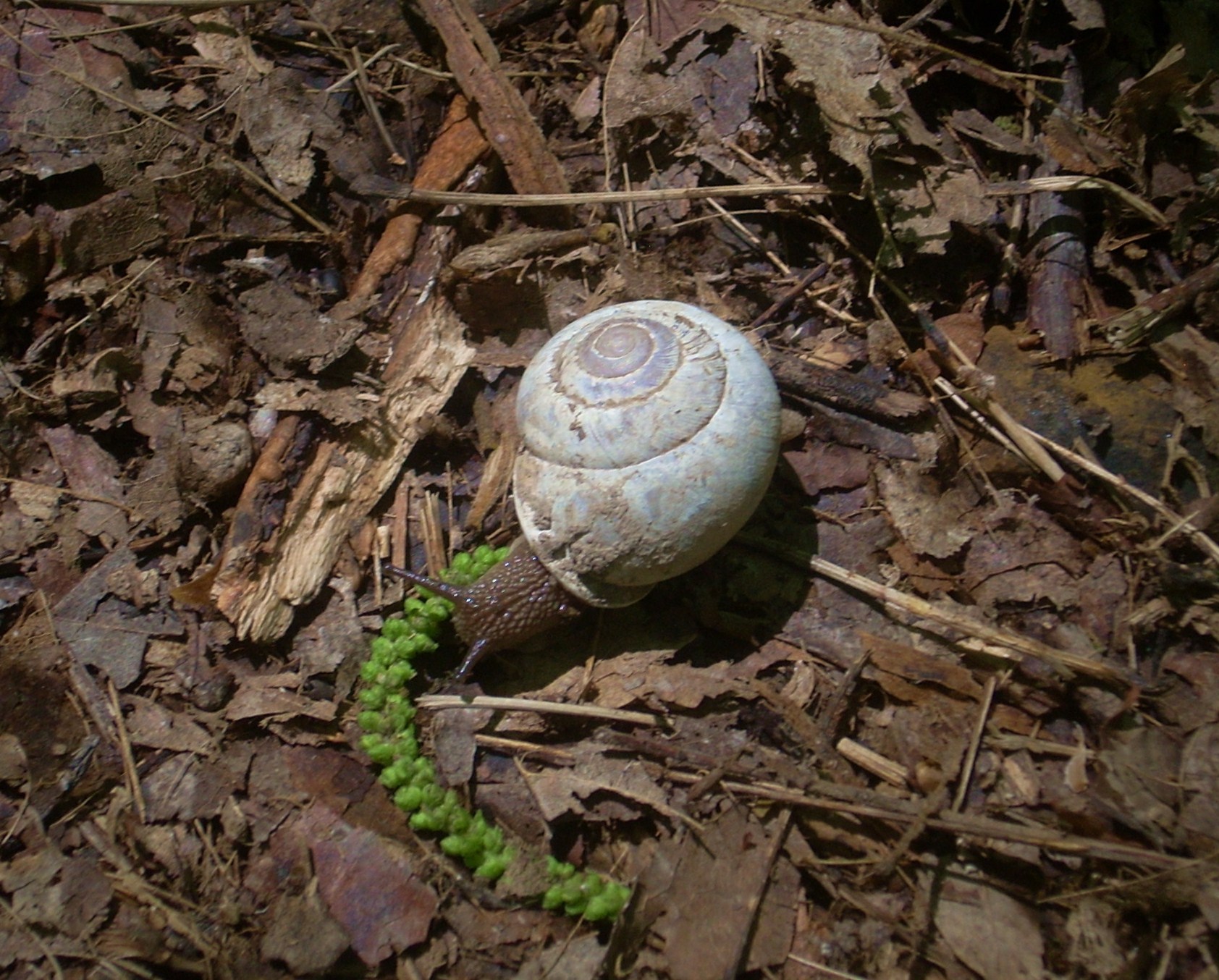
There was one problem,
however... This little creature was in a really vulnerable position lying
right in the middle of the trail. I didn’t know what to do. Snails
move so slowly that I didn’t want to move it - I might be putting it somewhere
where it didn’t want to be. Instead I thought it better to leave it where
it was and fortify its position by elevating the terrain around it so that a
boot wouldn’t crush it. To do this, I found a rock and part of a mid-size
tree branch that I put on either side. I hoped it would be enough…
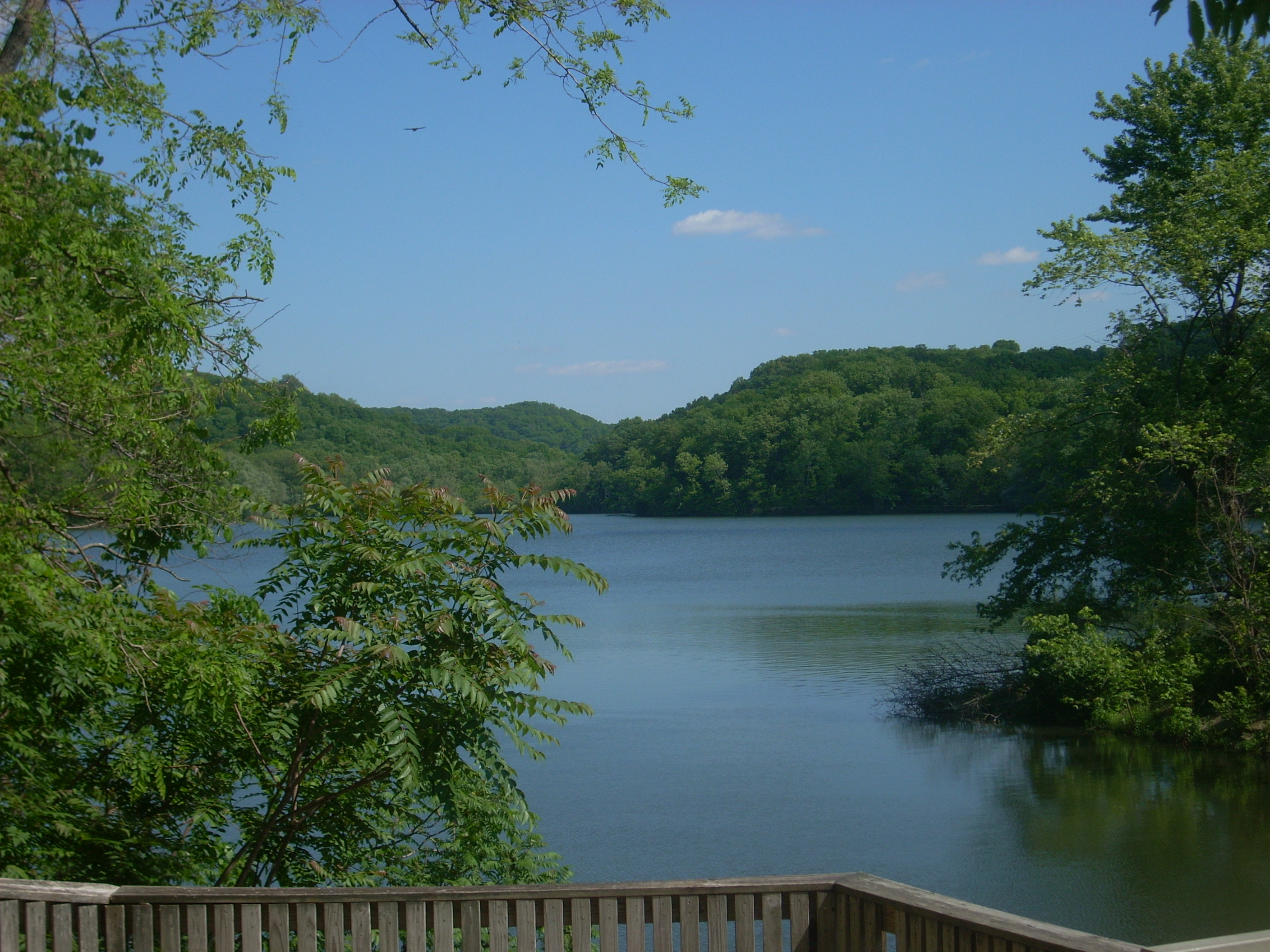
At any rate, after a fairly
good climb you’ll briefly crest out atop a ridge overlooking the lake, and
although this would probably be a great vista in the winter when the trees are
defoliated, I couldn’t see much today. That was OK - the path soon
descended and led me through an area where it was very clear the amount
of work it takes to keep this place up. In fact, I think the path would
probably be completely eroded in many places by now with all the foot traffic
were it not for the workers out here. My thanks to the Radnor Park
employees!
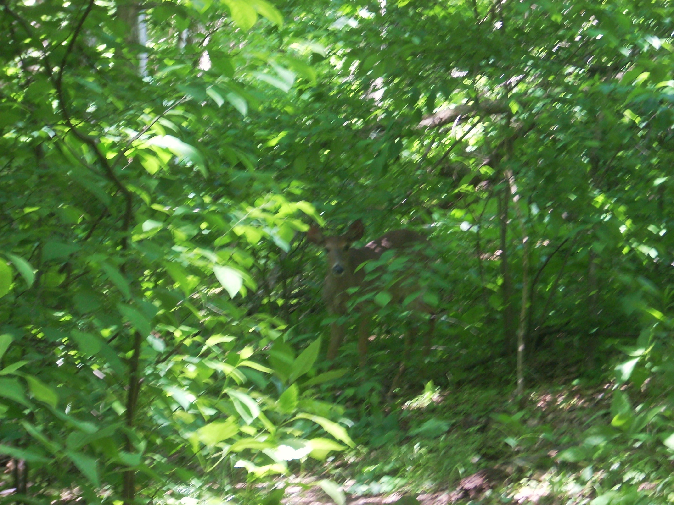
Soon you’ll meet up with the first of two South Lake Trail junctions and here you’ll continue to the right across another nice bridge. I encountered some deer soon after making this span - both the one below and a second right next to me which I didn’t even see or hear until I stopped. Patiently I waited until the one in the path moved on.
South Cove Trail ends at the second South Lake Trail
intersection when you bottom out from the ridge. Going left will lead you
on an exploration of the latter, but before doing so I first had to check out
the area to the right... Turns out, it leads to the confluence of 2 park
roads where the Otter Creek enters to form
On to South Lake Trail… This is another fairly level path that winds around the southern contours of the lake and provides some more limited views of the water just above the same road you’ll now be quite familiar with. In fact, you’ll intersect it 2 or 3 times on the mile-long path and the last of these points is where you’ll want to exit and follow the road to the left and back over the spillway.
However: If you find
yourself starting a
steep climb like I did you’ll know you’ve gone too far - you've missed the
turnoff! In fact, I’m so
dense that I was almost all the way up to the top of the south ridge again
before I realized it! I even missed my
snail friend – it was gone. If you see a wooden sign atop the ridge about
a foot above the ground with “Trial” etched in it and an arrow pointing back the
way you came you’ll know you need to turn back (unless, of course, you
want to go around twice!).
At any rate, I retraced my
steps and made the aforementioned left onto the road. You’ll also recall
that the levee comes up quickly after this and you’ll want to make a right to
cross over it. On a second trip out here with my mother we encountered
another “hiker” here…
Next it’s back over the
spillway bridge to retrace your steps on the Lake Trail until you get to the Ganier Ridge Trail
- the
steepest of all out here. This path and ridge (according to a historical
marker I saw) are apparently named for a man named Albert F. Ganier who was a
naturalist, historian and the founder of the Tennessee Ornithological Society.
Also interesting is the shape this path takes! It looks like the neck and
head of a duck!
To begin you’ll head back into and then around the same little streambed that you just crossed over on the last bridge, but when I first turned onto this path I found that I was walking through a good bit of pooled-up water. Having learned that it’s best to walk right down the middle of such a path so as not to expand the trodden area beyond what is absolutely necessary, I proceeded on somewhat gingerly.
The climb on this trail starts fairly gradually as you wind along the stream before spanning it again on another bridge (in this first section I came upon a man and his toddler son actually walking barefoot though the mire!). Then, after you cross the bridge you’ll really begin to climb in earnest. There are steps for you along the way to assist, though, and at one point you’ll also pass over some rock outcroppings. Note that the trees are of a different breed in this rocky area...
After making a sharp right turn (the ducks’ bill!) near the ridge top you’ll begin a very pleasant walk along it through the woods. This will allow you to enjoy the fruits of your climb! Again, the views in here were fairly limited today but I still enjoyed this nice stroll through the forest. There are also some park benches for you to rest on if you like. In fact, I noted these throughout the day and even saw one with a “65” on it! 65 benches upon which to sit and enjoy your surroundings!

Once you’ve completed the
ducks’ head you’ll begin to head back down the ridge, at one point along some
switchbacks. The trail ends where it intersects the Access Trail.
Take a left here and you’ll soon be back at the parking lot.
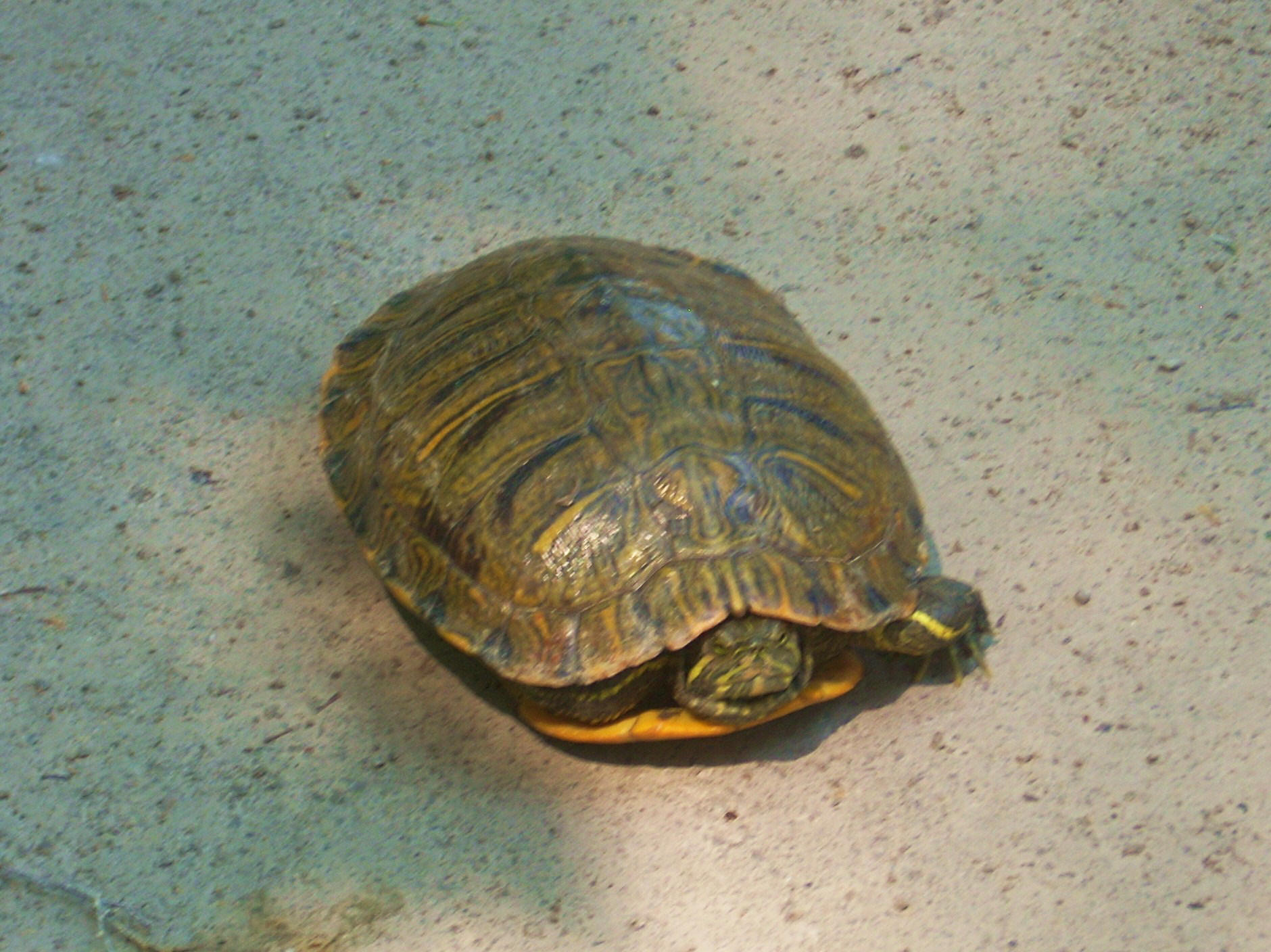
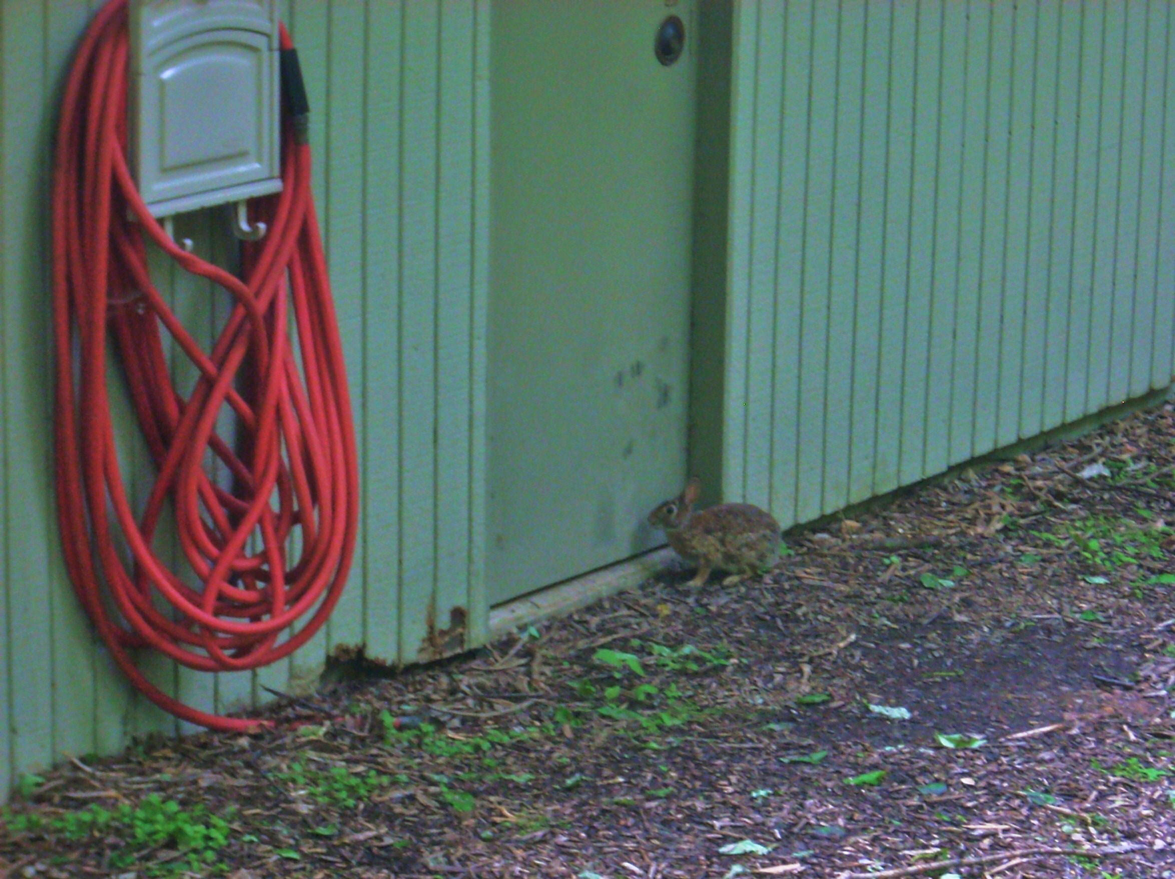
…and look who was awaiting entry into the restroom!
DIRECTIONS:
They have these on the above websites, but I came in
locally from the south via TN31, or Franklin Pike. To do this, you can
take I65 to the Old Hickory Boulevard (TN254) Exit and head west. You’ll
immediately encounter the TN31 intersection. Make a right here and travel
just over 2 miles to