Jefferson Lake (or Town Fork of
Yellow Creek) State Park
Perimeter Loop Via Parts Trillium, Logan and
Oak Grove Trails
Friday, March 30, 2012
State Website with directions
Just as I’ve gotten a lot of my Ohio hiking ideas, this one originally came courtesy of a book on hiking – in this case Ralph Ramey’s.
Today I drove down from
Cleveland and then caught Ohio Route 43 in Canton, OH to then follow it the rest
of the way to the park (full directions can be found on the website link above). What I
like about the single lane state roads is that you can avoid the omnipresent
contempt of the highways. I don't use my rear view anymore and I actually flare my
mirrors all way out so that I don’t even have to know there’s a tailgater behind me.
Dong this, I can go at my own pace and enjoy my surroundings without ever having
to get upset over something hateful.
Another benefit of the
country roads is that they’ll save you money on gas because you’re driving at a
slower speed - and since you are driving slower you’ll be able to see a lot
more, both in terms of scenery and history! In this part of
the country the scenery is beautiful and there are a lot of
classic, family run businesses here too. In fact, I stopped at
one. It looked like an original Dairy Queen in the little
town of Malvern, Ohio and when I remarked on the look of their restaurant the
nice woman behind the counter seemed proud to mention that the business had been
operating for decades at this location – and under the same family.
That’s my kind of place!
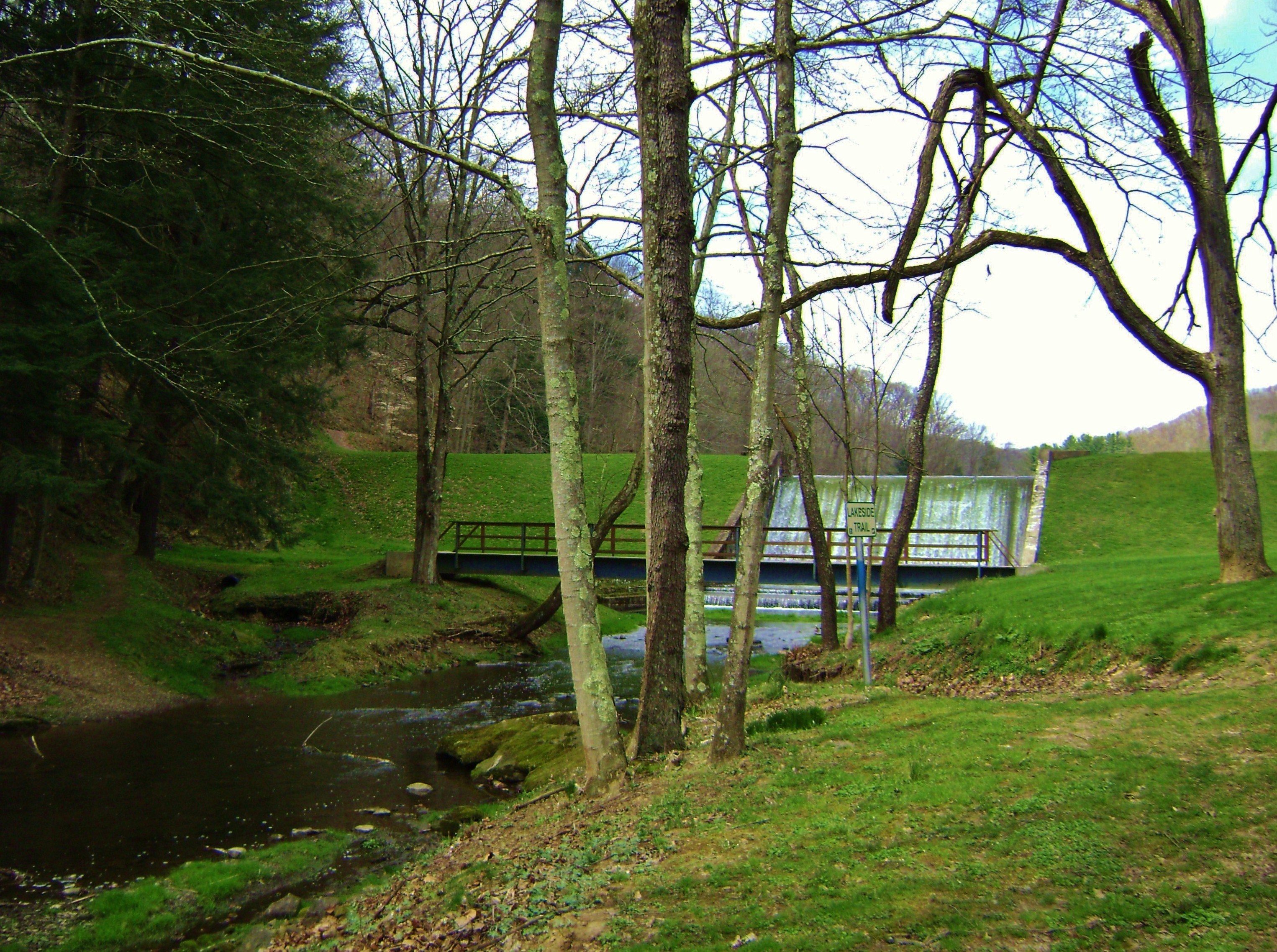
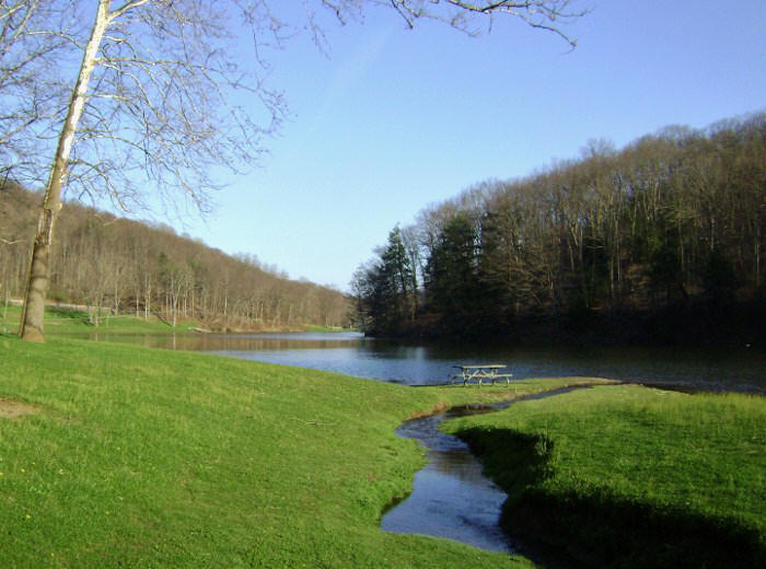
When I arrived at Jefferson Lake State Park I left the car in a lot alongside a little stream across from a baseball/softball field. The stream here is the same one which is dammed to form Jefferson Lake and at this point you’re just downstream of this dam. In fact, you’re almost sure to see water spilling over up ahead. The path starts in this direction. Cross a little bridge and you’ll begin.
When you cross the bridge
you’ll note what appear to be a couple trails heading off to the left. I
never did find out what these were (although I assumed they were part of the
horse trail system they have out here). I instead headed straight
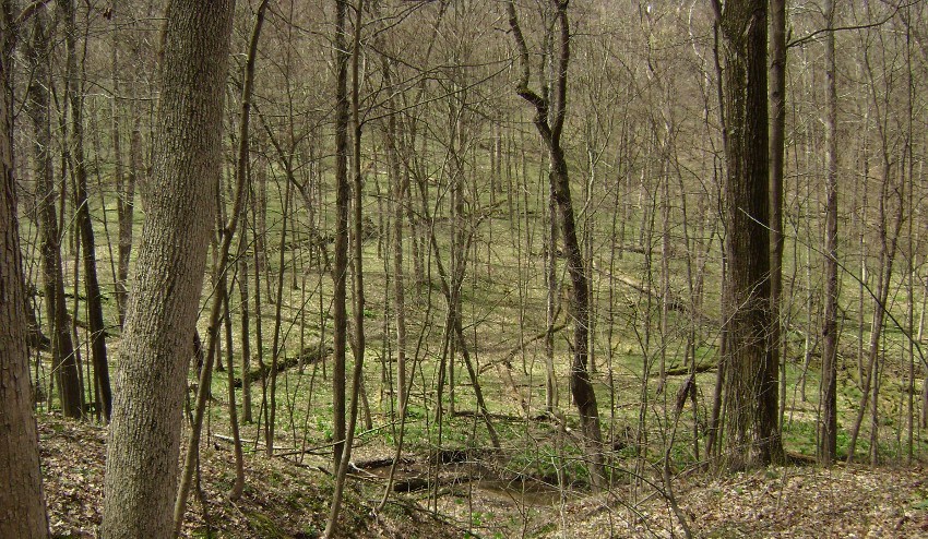
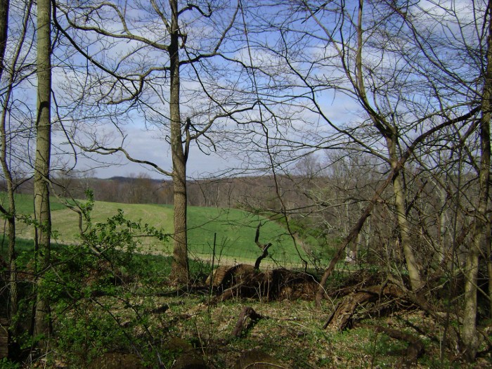
up to the top of the spillway. In fact, you'll be able to see the
route I took in the picture above. It’s up and to the left
and it’ll deposit you on the south side of the lake.
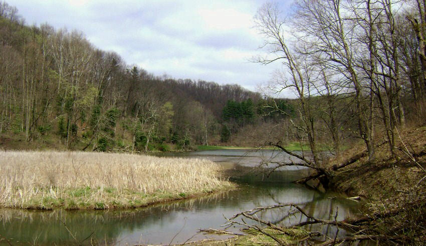
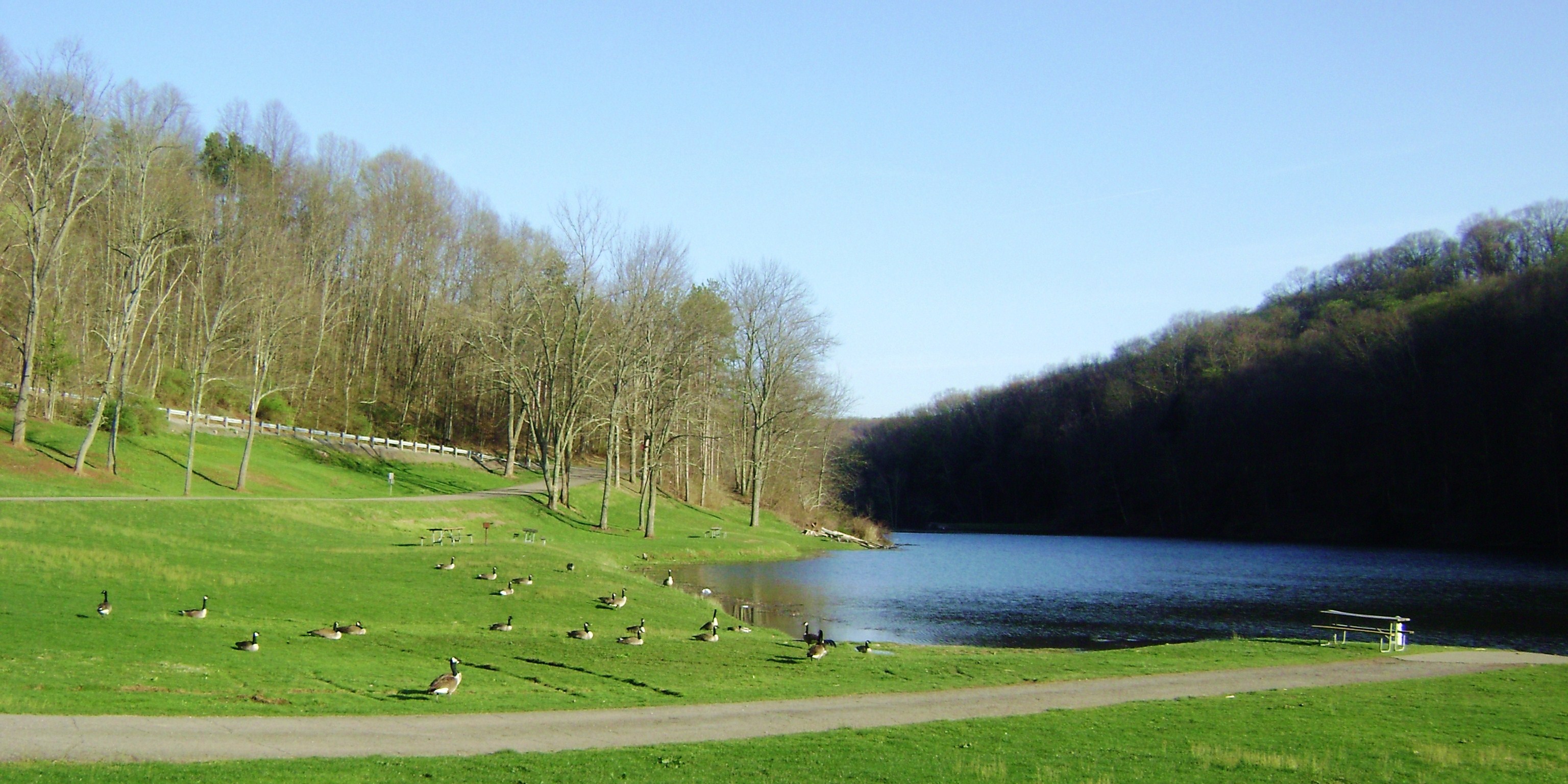
Jefferson Lake, if you look
at it on the map, is shaped much like a little “inch worm” and as lakes go it’s
not that large – only 17 acres. As you travel around it you’ll get some
great looks across the water and you’ll even see that there’s a little beach
across the way! This would be a nice way too cool off after a
long hike!
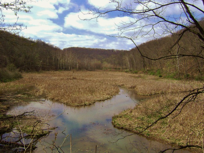
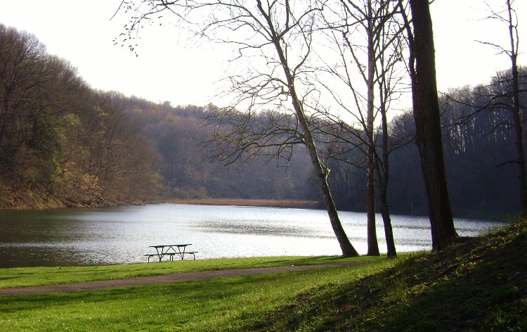
Presently you’ll pass a park picnic shelter which looks old enough to have been built by the Civilian Conservation Corp (CCC). Later you’ll be overlooking a marshy area with great views back toward the headwaters (origin waters) of the stream.
Now by this point I’d noted a
woman across the lake with a couple unleashed dogs. Hmm…
They weren’t the barking kind... I’d tested their
temperaments by making just enough noise to ensure they’d heard me. The
woman herself didn’t seem to be too concerned. I kept going…
As it was, I’d soon to meet up with them at a point where a picnic table lies in the midst of a pleasant clearing (this is the same point at which the Lakeside Loop curves to the right to cross over the stream while the Trillium Trail heads left and uphill). I paused here to meet a very pleasant woman and her dogs…
The dogs, an old collie and
what could have been a Border collie mix, were very friendly and the Border
collie had the most amazing eyes - they were almost all white with little black
dots in the middle! The woman and I talked dogs and trails.
In fact, she was very familiar with the paths out here and she mentioned
that my intended backcountry loop route was apt to be a steep one, fraught with
a combination of deep horse hoof marks and more than a little bit of mud.
It was also quite long.
Hmmm… “Well, I have to at least try it.” I said. I wanted to get my “money’s worth” after driving two hours! Besides, such trails don’t really bother me that much since they help me burn off excess energy and anxiety. In fact, I engage in activities like this as much for that reason as to escape society and see beautiful things in the wild. I want to be exhausted at the end of each trip – both physically and mentally. I think that if you drain yourself in this way you’re apt to be renewed both physically and mentally as well as spiritually.
Another odd thing is that toward
the end of these trips I actually find that my mind goes blank. Honestly. On
my out-and-back kayak trips I can seldom remember any of the things that I’ve
passed unless they’re particularly memorable. Early onset
Alzheimer’s perhaps? Well, at least I can feel good knowing
that I’ve fully immersed myself in the experience!
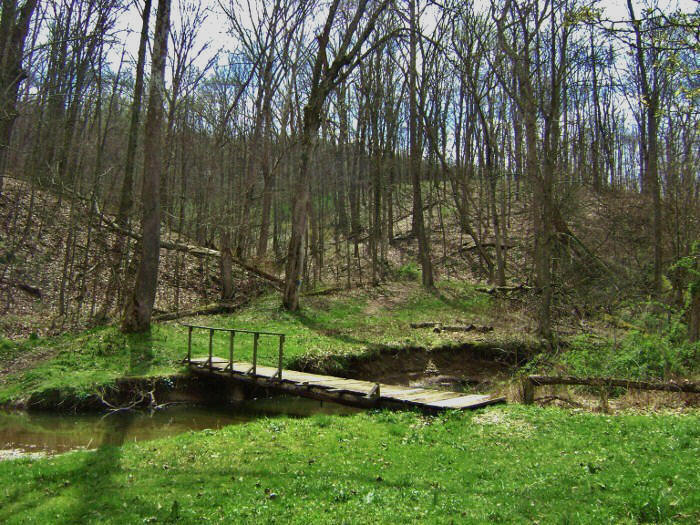
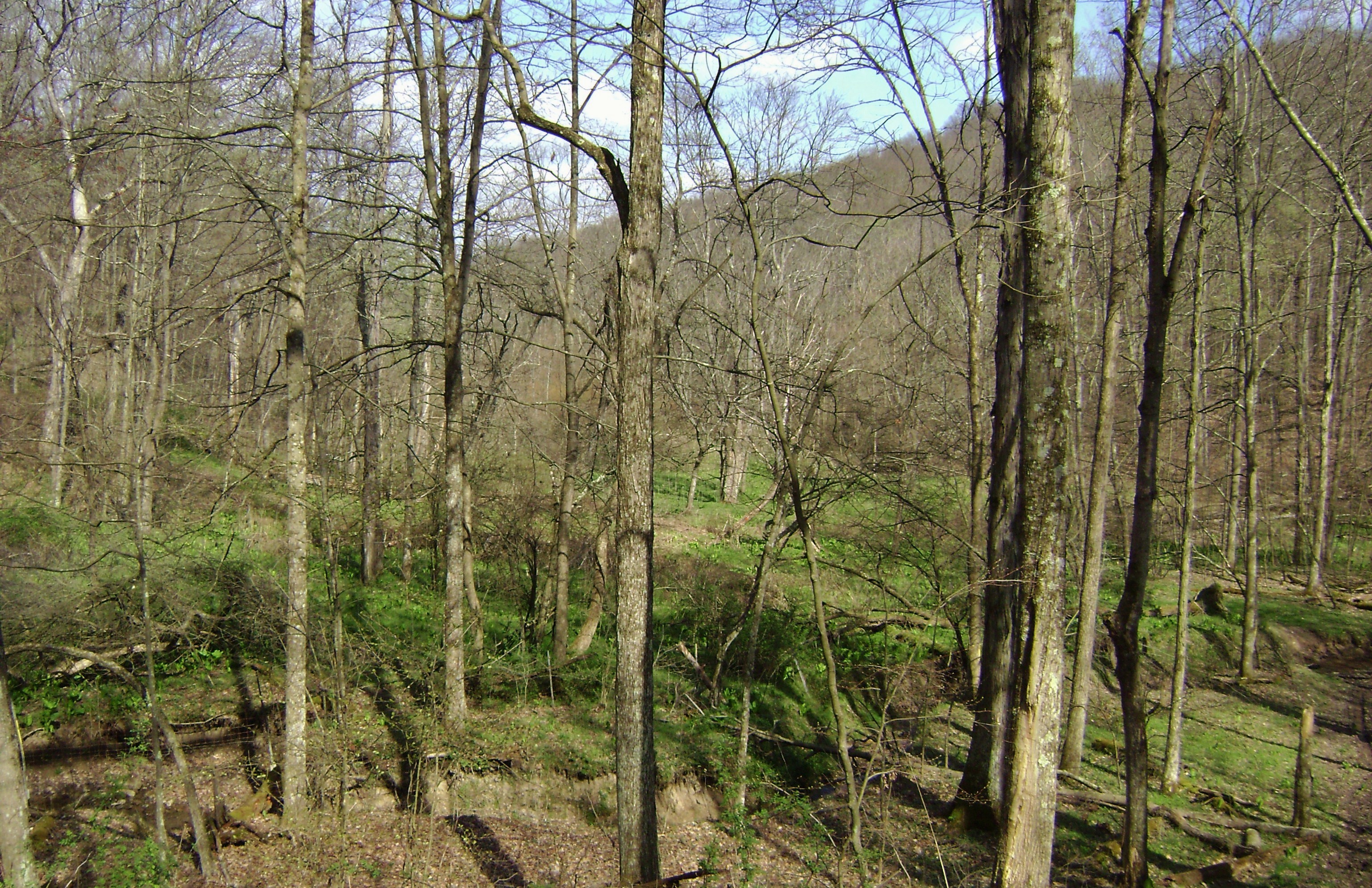
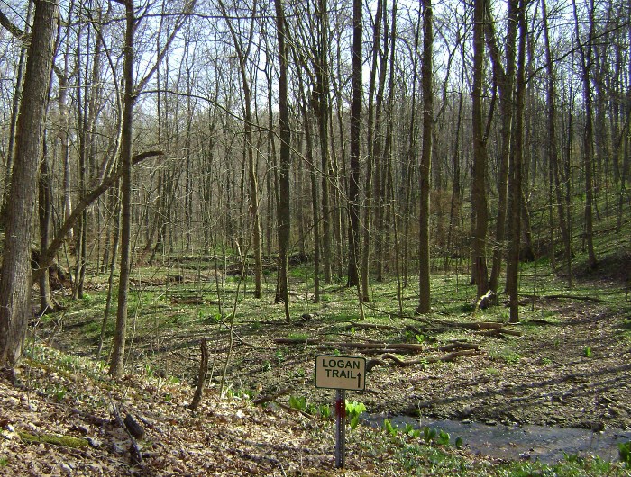
As I bid this kind woman farewell I headed uphill on the yellow-blazed Trillium Trail. There are some horse paths that come in here too, so it can be a bit confusing. As with most of the Ohio parks that I’ve visited, the horse trails out here aren’t always on the map although it does appear as if they’re marked in orange. At any rate, I kept to the right at each intersection and was OK. In this section you’ll be following an unnamed (as far as I can tell) tributary of the Town Fork of the Yellow River upstream and you'll have some nice views down into the ravine here…
Then, once you reach the end
of Trillium you’ll meet up with the Logan Trail. At 4.5 miles
Logan is the longest trail in the park. It’s marked in red and
you’ll begin on it by stepping over the stream that you were just following.
Yep – what is now but a little trickle of a stream looks to be the same
one that carved out this entire ravine and from this point you’ll essentially be
following it downstream, whereas before you were following it
upstream. You’re really getting a nice, good look at
this one! It really would make a nice ecological study for a
local high school or university.
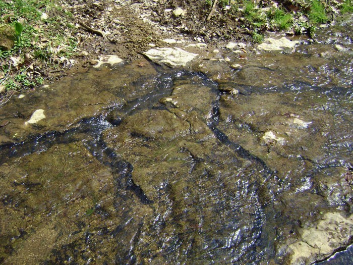
Anyway, at this point the stream is barely more than a trickle but I nevertheless found it interesting to note how the water had carved through the rock on the bottom – a microcosm of how it carved the ravine over time!
You'll begin a long right curve in the path now, one which will take you up and around a ridge. It was alongside a second stream in here that I encountered more of the big-leaved plants that I’ve encountered on many of my Ohio hikes. I’m still not sure what these are. If anyone could enlighten me I’d be appreciative.

Anyway, the long right curve I mentioned will end at the edge of a ridge top and here you’ll get some nice but limited views - not only of the valley below but also of the rustic old farm buildings which lie atop the surrounding ridges. Later the path will take you very close to one of these farms, but for now you’ll find yourself in the midst of another long right curve. This one is much tighter than the last. It’ll have you descending a ridgeline on a wide path to bottom out in a low-lying marshy area where the path crosses another stream.
The low area here is very pleasant but it’s close to where some private land comes in at an odd angle, so for this reason and one other I didn’t linger. You see, I’d also noted that the wildflowers were starting to come out and you know that when the wildflowers start to come out you’re apt to hear quite a bit of buzzing. This buzzing can sometimes be a little unnerving – especially when it’s loud and it seems to be following you! I’ve not had a problem so far because I keep moving steadily away and in doing so I’ve always found that the noise, however persistent, seems to shortly fade away. However, I always stay on the beaten path! Less chance of disturbing nests.
Anyway, in crossing the stream you’ll have made a left turn but now the path will straighten for a while to have you gently climbing a ridge in the midst of a wide, wooded section of the path. At one point in here I found that the stream had decided to use a portion of the trail as it's bed! Soon you’ll find yourself veering left. You’re about to make a detour to see one of those farms! Follow the path as it makes another tight left curve and you’ll see the following…
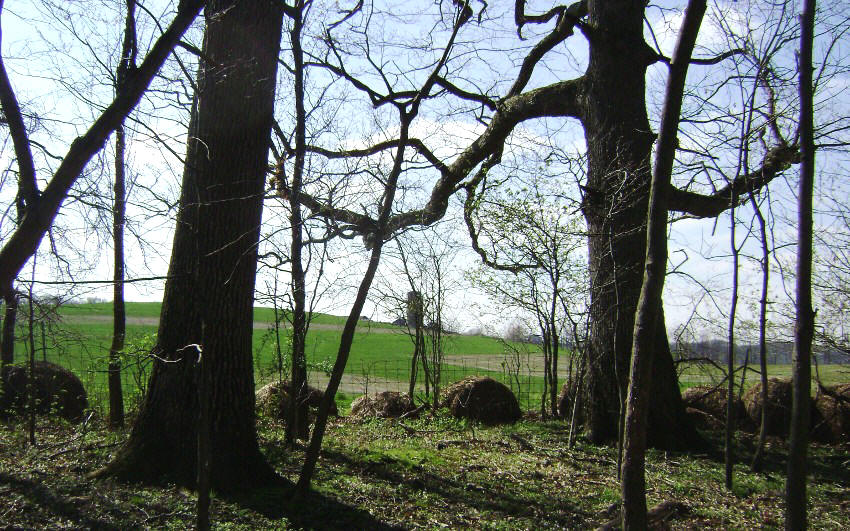
Thanks to the people who own this farm for sharing their beautiful views with park visitors!
Once you’ve completed this
curve you’ll be in a different valley. This one has been
carved out by a branch of the Town Fork which you’ll soon see below you.
Then, as you begin to descend toward it you’re apt to hear signs of
civilization - the campground areas are up that hill on the other side of the
stream. Regardless, you’ll shortly cross over the fork to make a
right turn. Here I got a bit confused. A
red arrow indicated that a right turn would keep you on the Logan Trail, but
once you’d made this turn there was immediately another marker that indicated
you were on the Beaver Trail. The two paths didn't appear to connect on
the trail map...
So what did I do? I went the wrong way – left! Not a problem though. I was soon led right back to Logan. Going this way simply takes you up alongside another tributary of this Town Fork and then curves right back around. The way you’re supposed to go takes you on a lower plane directly beside this stream. Oh well… Here’s a picture looking back the way I should have gone…
I found the next section of
path to be really interesting. You’re about to explore an
area around the convergence of two little tributary streams and you’ll start by
following one of them as it flows just to the right of you.
The other is further off to your right. You’ll actually find yourself meandering nearly in the shape of a block letter “V”
in here.
Image yourself starting on the bottom right of this letter. I’ll
call it the southern side…
Start by stepping over the
first stream and then curve left to climb a little ridge as you dip down into
the middle of the letter. Next you’ll come up the other side, at which point you’ll nearly double back upon yourself and trace the
letter on its northern side! That’s the “V”!
Oh well… I thought it was interesting…
At any rate, from here you’ll arc right on a climb up to the main campground and when you reach the top you’ll see a green-blazed path come in from the left. To me it looked like this simply led to a horse camp so I kept following the red markers which quickly led me to the camp check-in station. There was a map of the trail system carved into a piece of wood here. “Oh good!” I thought. “I can confirm my bearings.” Well, the sign was quite well done but the color codes on it seemed to be totally different from the ones I’d seen on the trails. As such, I couldn’t reconcile this map with the one I’d printed out from the park website. I was going to have to wing it. There are quite a few ways you can go here, but as the scene below confronted me I opted to take a right into the woods on a trail marked in green.
Immediately coming to a
“T” intersection, I made a left and was led down into the little gully of a
stream. The point seemed to be the origin of one of the
little lake tributaries. From here I was to meander around for a while and
when I crossed the stream I saw that I was suddenly on a combo
trail – one marked in both green and purple. I knew I had to
be on the right path now. This was clearly the Oak Grove
Trail. Problem was, it was taking me awfully close to some
private dwellings and this always makes me a little nervous.
I’d be in the clear soon though, as I strode alongside what looked like some very pleasant farmland. I even spotted a man tending the fields in a tractor. There’s supposed to be a split in the path about here but I didn’t see it. I continued straight on the path to eventually begin a left arc around the end of a ridge top. I later dipped down into a little ravine as I was nearing the end of my hike. I could see the lake through the trees. How attractive this lakeis! Check it out… Even a hack like me was able to take some nice shots here!
You’re on the northern side
of the lake now and you can basically follow the shoreline right back to your
car. This I did, although I did note a blue marked trail
breaking off to the left at one point. This was apparently part of
the Lakeside Loop, but I was so taken with snapping shots of the lake that I
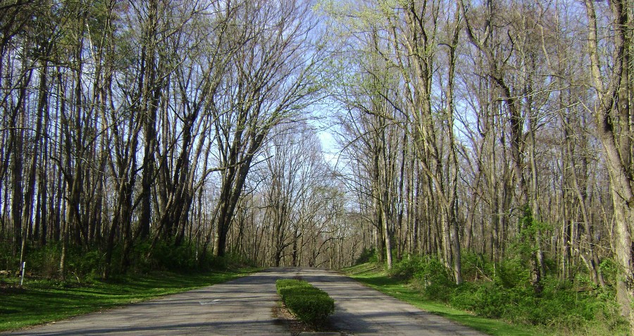
decided to simply follow it – and a portion of the road - back to my car.
I think this park is well worth a 2 hour drive from
Cleveland - or a 2 hour drive from anywhere!
DIRECTIONS:
From Cleveland I took I77
down to Canton, briefly caught US30 East and then got on Ohio Route 43 heading
south. (At this point I’d suggest re-setting your odometer.)
Go 45 miles on 43 while keeping your eye’s peeled – this road makes a few
turns. Then, at the 45 mile point start looking for a road on your
left. It looks like a half-paved gravel road and it’ll come
in at the same point as a batch of road markers on your right.
One of them points you toward Jefferson Park but it comes up so suddenly
that you’re apt to pass it up – as I did!
Anyway, turn left here and
then go 2.4 miles until the road dead-ends. Make a left ,and
then another immediately afterward. You’ll be in a parking lot alongside a
little stream. The trail begins as you make your way up to
the spillway.