Sheltowee Trace
Beginning (Southern End) to Thompson Overlook
(via the Hidden Passage Loop Trail at
An outdoor enthusiast might believe they’d died and gone to heaven on this hike! This is truly one magical experience! You start out with what looks like a pleasant walk through the woods and - presto! – you’re walking around and under a lush rock house, complete with a dripping water roof. Then – chango! – you’re walking where eagles and hawks soar on the precipice of a mountaintop, complete with stunning vistas!
You know what this hike reminded me of? A combination of 3 of my
favorites: one part Red River Gorge in general, one part Sand Gap Trail at
Let’s back up a little though – I drove through
I parked in the lot and started out a little after 10AM
(I’d get back a little over 5 hours later just so you can judge the hiking
time).
This is the southernmost end of the
Sheltowee Trace, a
278 mile trail that runs
almost all the way up to
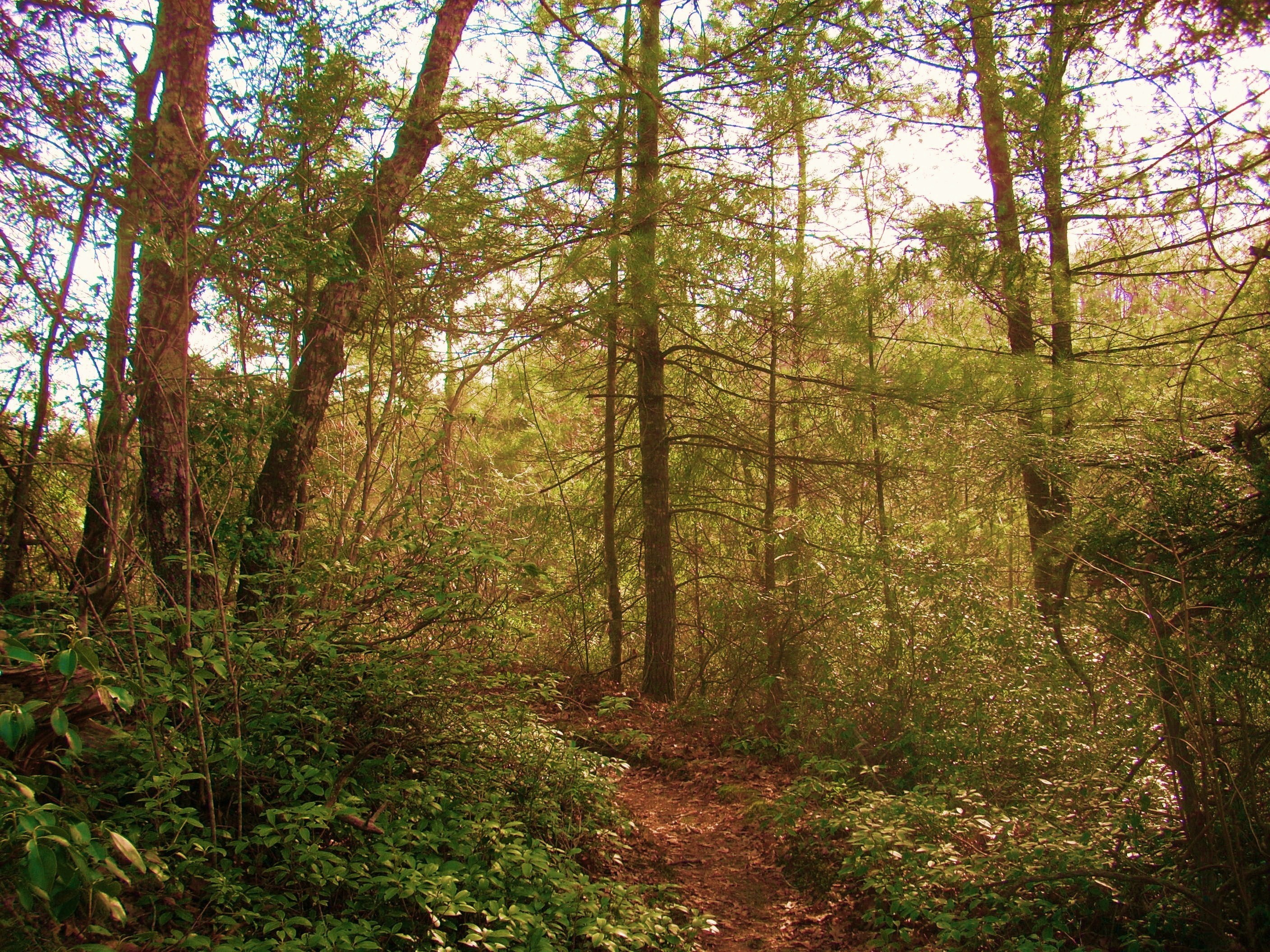
Anyway, this is what they call a “lollipop loop” shaped trail and you’ll start with a flurry of environments. First you'll begin a little descent into the woods – a woods which will seem to become a little more lush and dense with each step you take. Then you’ll make a left turn to find yourself in a completely different environment, walking on a sandy trail along the edge and near the top of a mountainside.
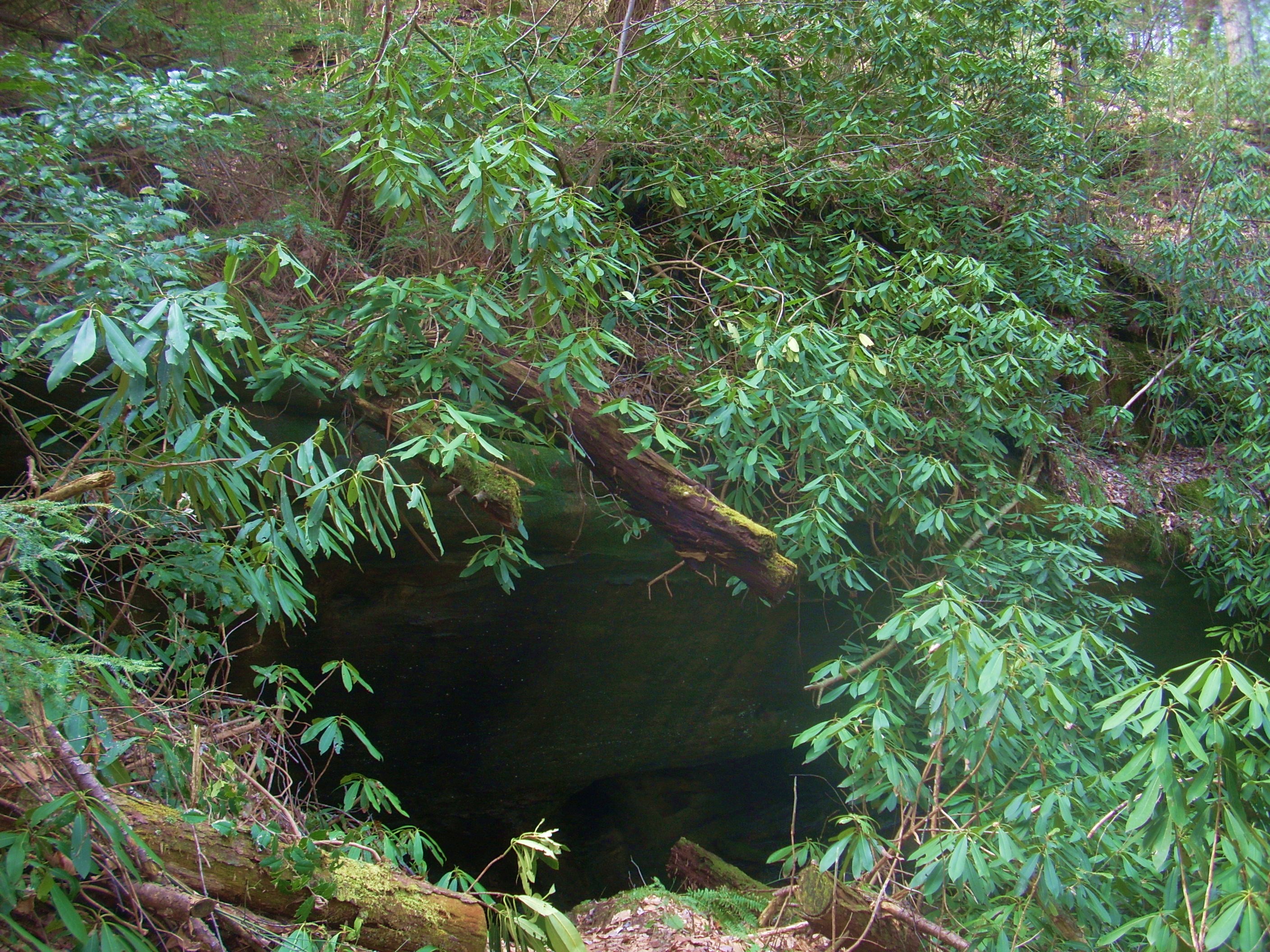
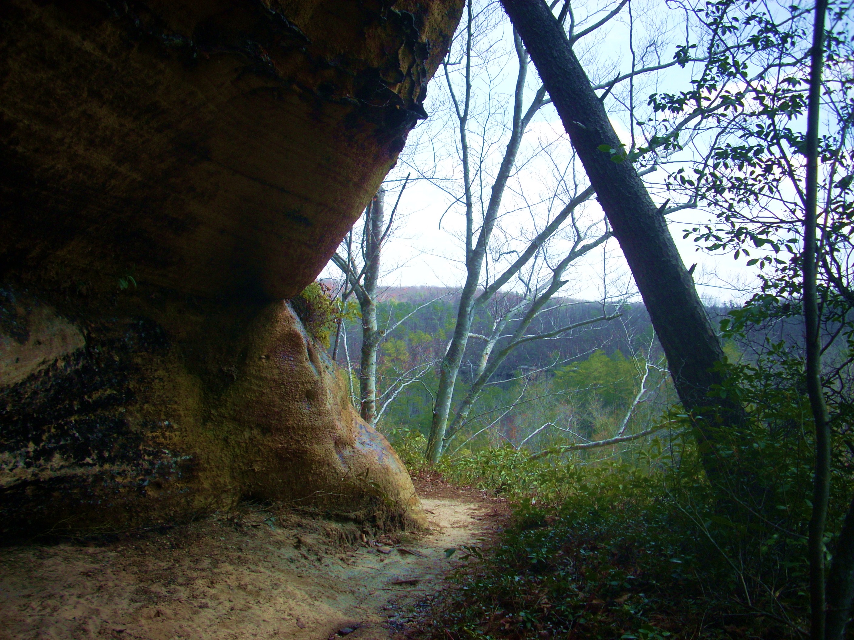
Now make another little descent and you’ll be walking alongside a rock face which has an interesting column of stone carved out. This is followed by a stroll under a large rock overhang where you’ll encounter a signpost which points out that this is a Cumberland Sandwort Protection Area. Sandwort is a pleasant little plant that is endangered both because it’s apparently only found in this area of the country and because it’s got a very delicate root system.
The “wow” factor isn't over yet… It seems nature wanted to blow your mind by throwing everything at you right from the start because once you see some stone steps up ahead you’ll have reached your first trail intersection. It’s here that you’ll want to head right and in doing so you’ll be led down to a pretty amazing little waterfall. Hopefully the rainbow shows up in the picture?
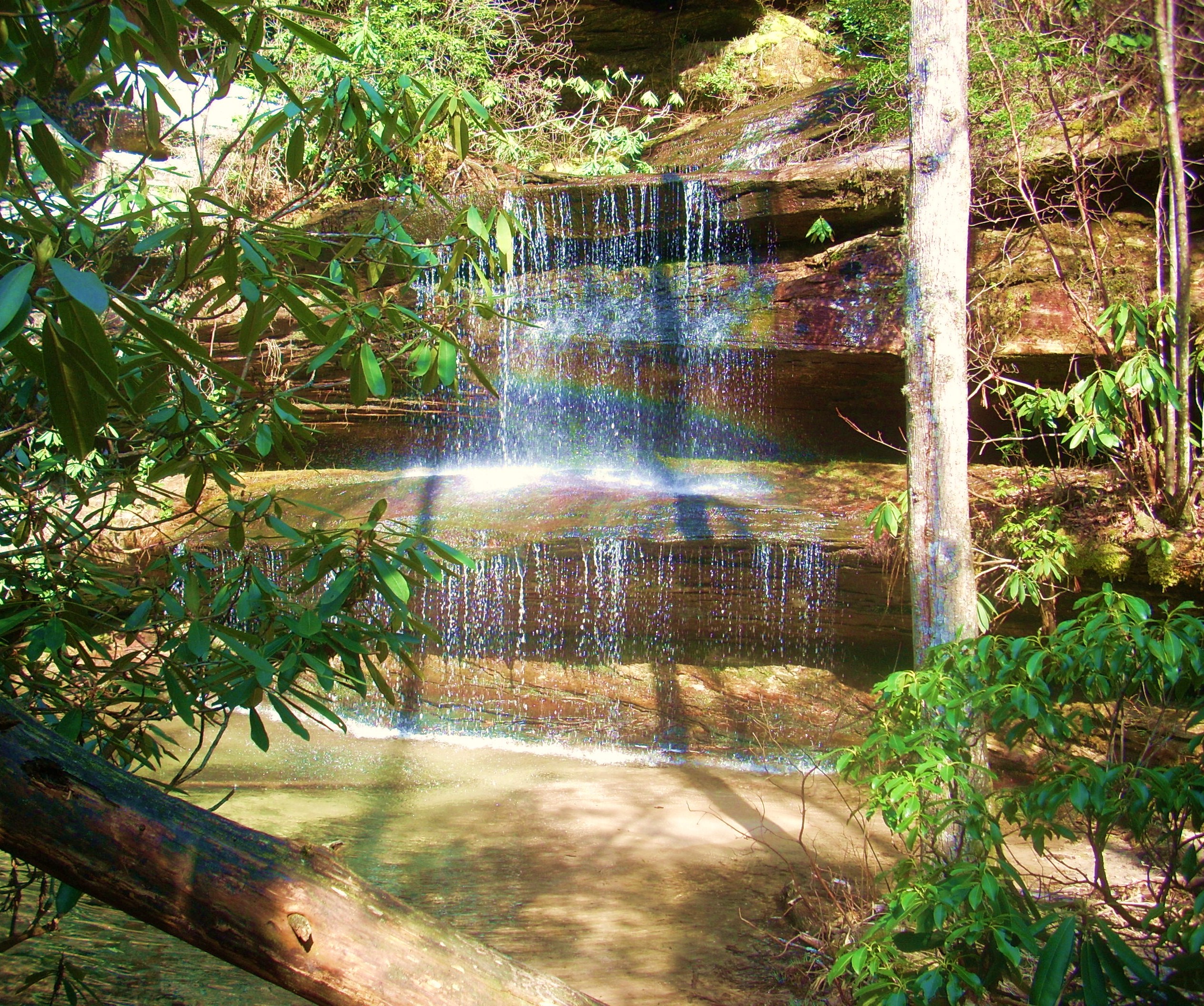
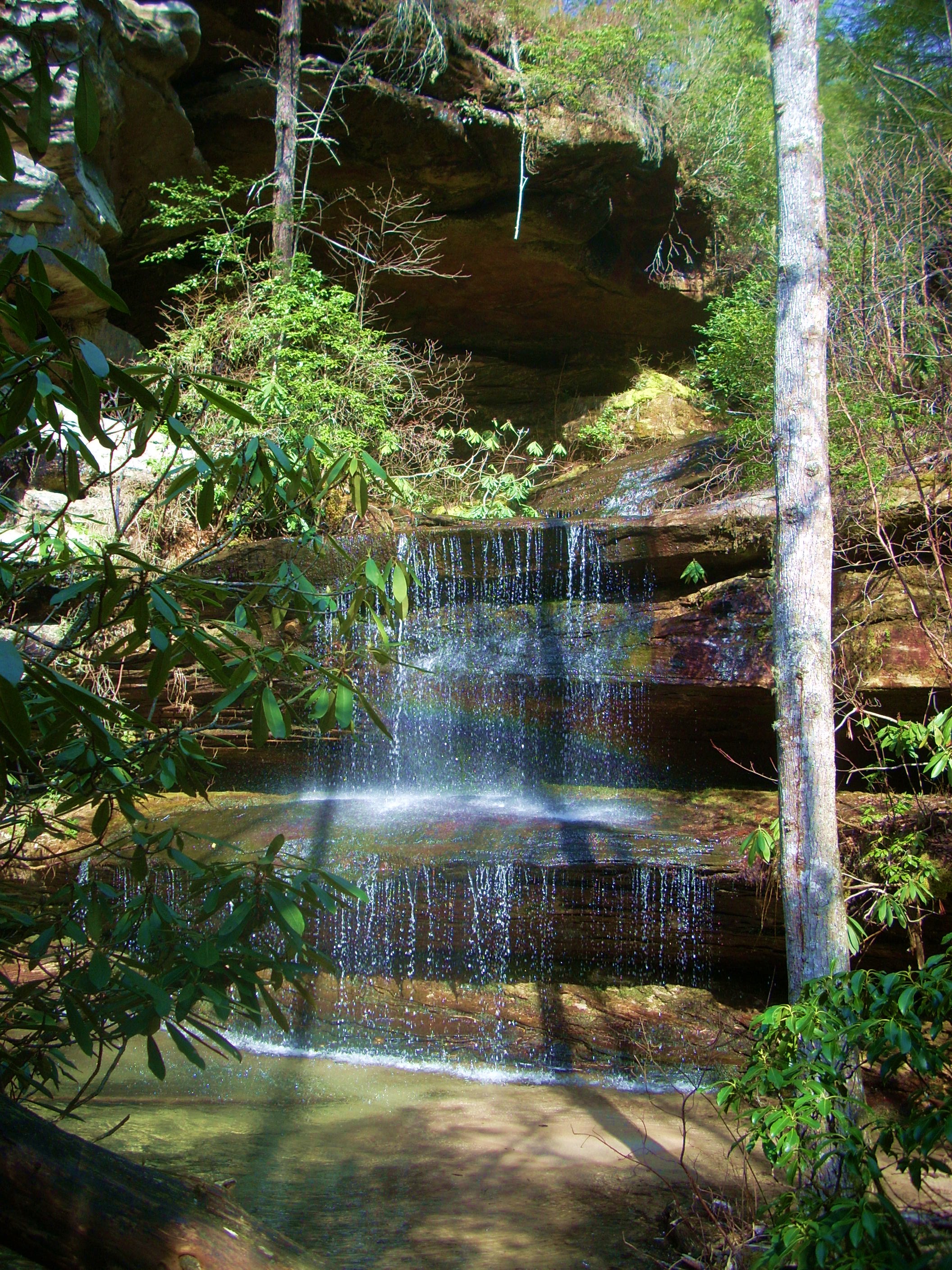
Don’t get confused here like I did though... As I read it, the book I had (a truly great one on the Sheltowee Trace - http://www.menasharidge.com/search.php?mode=search&page=1) seemed to indicate that the path runs directly through here. It doesn’t. You’ll want to retrace your steps back up to the main path once you’re done taking in this beautiful area - but by all means, take your time!
When you’re done you’ll climb the aforementioned stone steps and begin arcing to your right around the edge of a rock precipice – the same one which runs directly over the waterfall you just witnessed. Let me tell you, though, that this is one area where you’ll really need to watch your step! Just look at this drop – only one step off the path! It’s like this for much of the day.
Anyway, once you complete
this arc you’ll curve left to begin walking along a sandier path, and I found
the pine scents in here to be particularly wonderful. At one point, however, I
thought I detected a different kind of odor… “Could
I be walking near the lair of a large animal?” I imagined. I
didn’t linger...
Soon the path deposited me
into a forest at the top of the mountain where the trail immediately crossed
what looked like a seldom used back-country road. It then continued
further “inland” away from the mountainside, and what ensued was a nice stroll
through the woods for the next little while. There was another point where
I got a bit confused, though. It was one where the path seemed to lead to
a little rock overhang but – being distracted by said overhang – I missed a
sharp right turn in the path. All the foliage on the ground had it pretty
well camouflaged. I found my way again by retracing my steps.
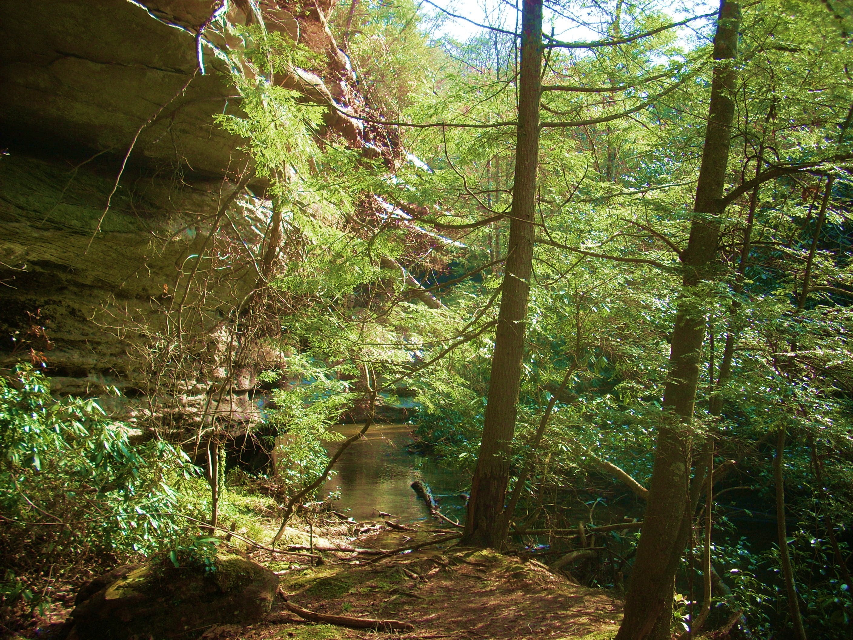
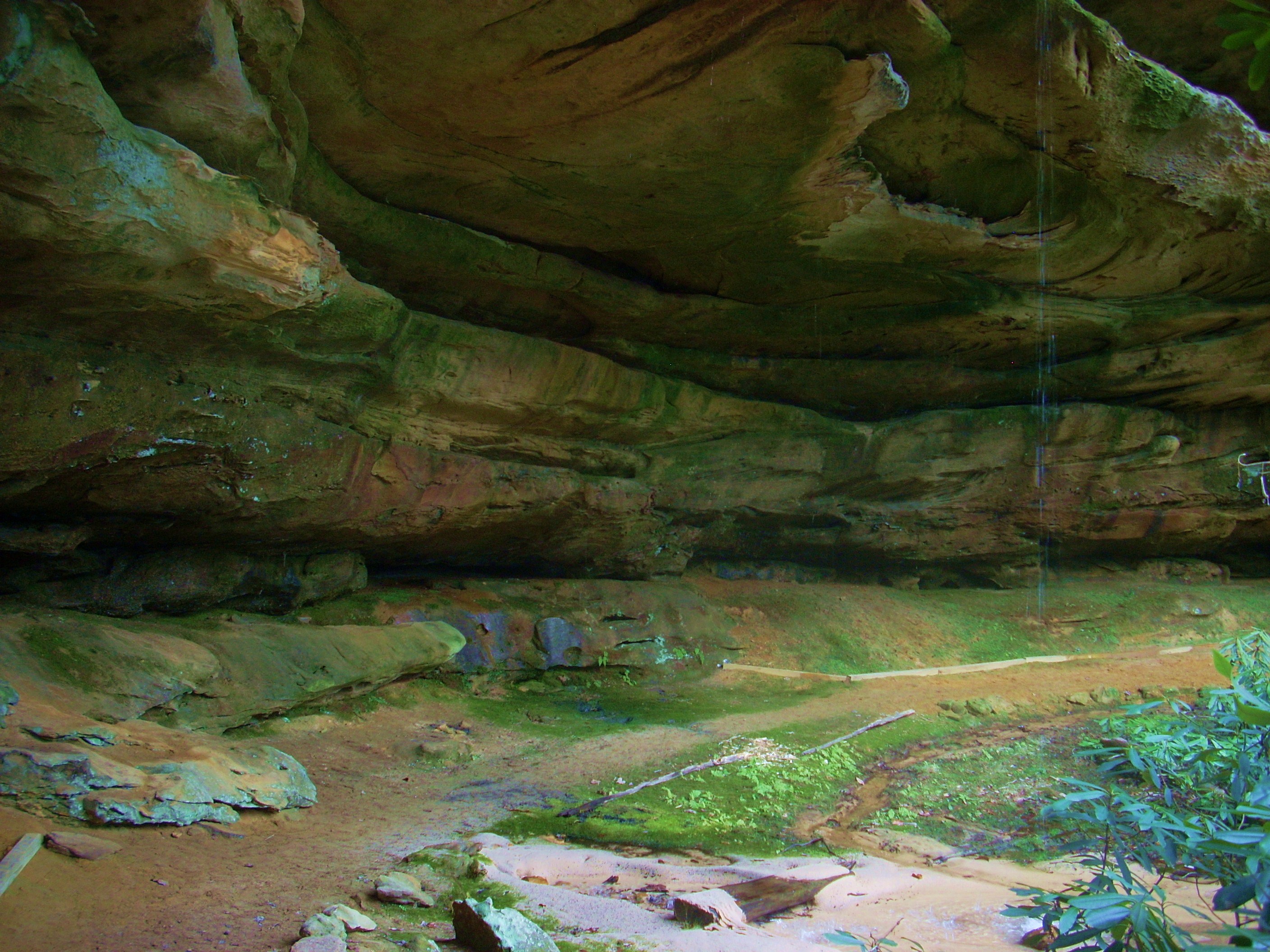
Soon you’ll begin to descend again into a lusher environment where you’ll get views like this…
…before you descend into this “hole”…
…to emerge under a cool
(literally) dripping rock house where you can rest a while and take in the
beautiful surroundings. At this point you’re not quite half way through
the loop. In fact, the upcoming trail sign will indicate that you’ve got
5.1 miles to go to return to your car back at Highway 154. It also
indicates that the Double Falls Trail intersection is 1.4 miles ahead (Pinnacle
Overlook is directly beyond that at roughly 1.5 miles).
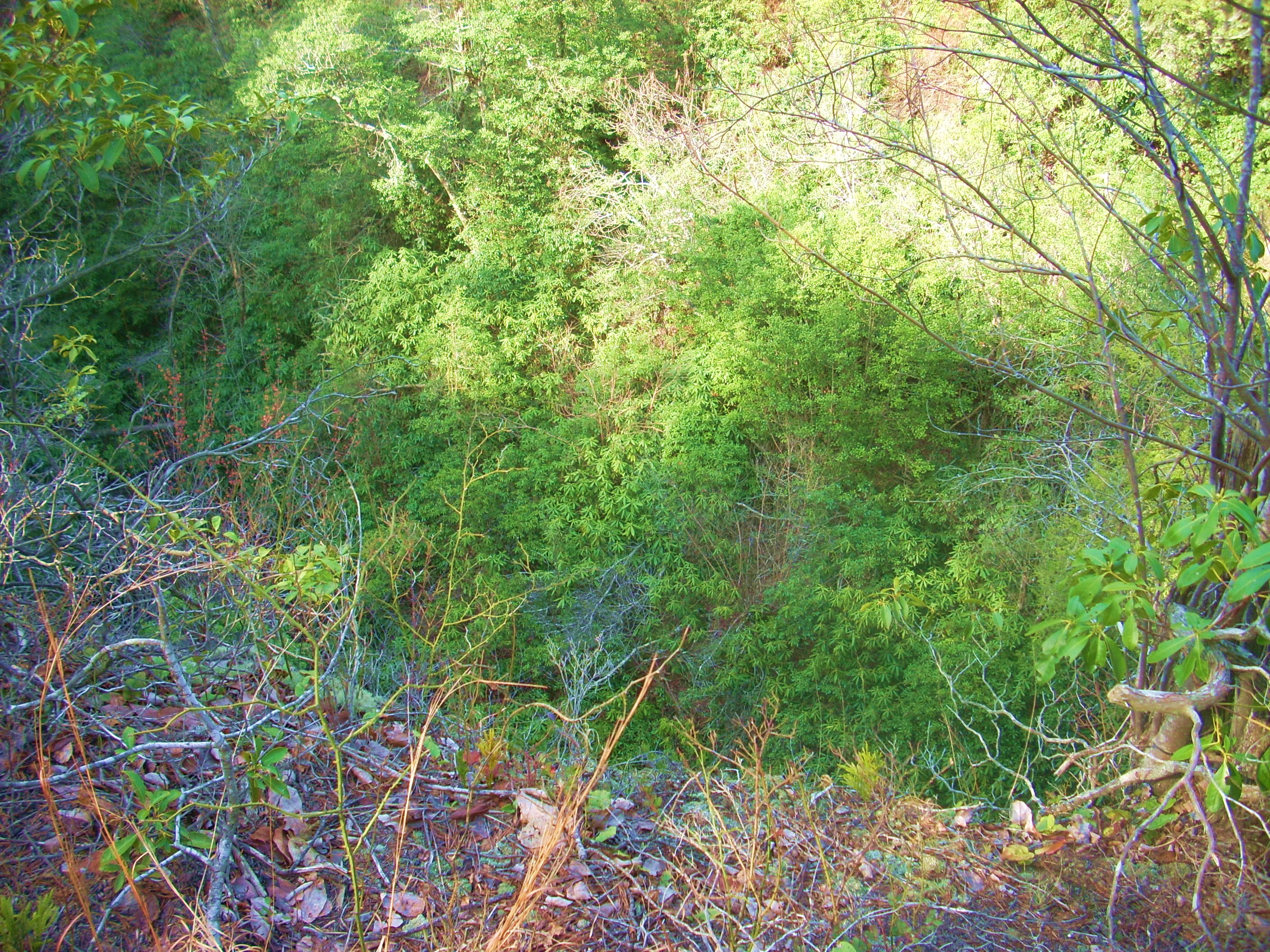
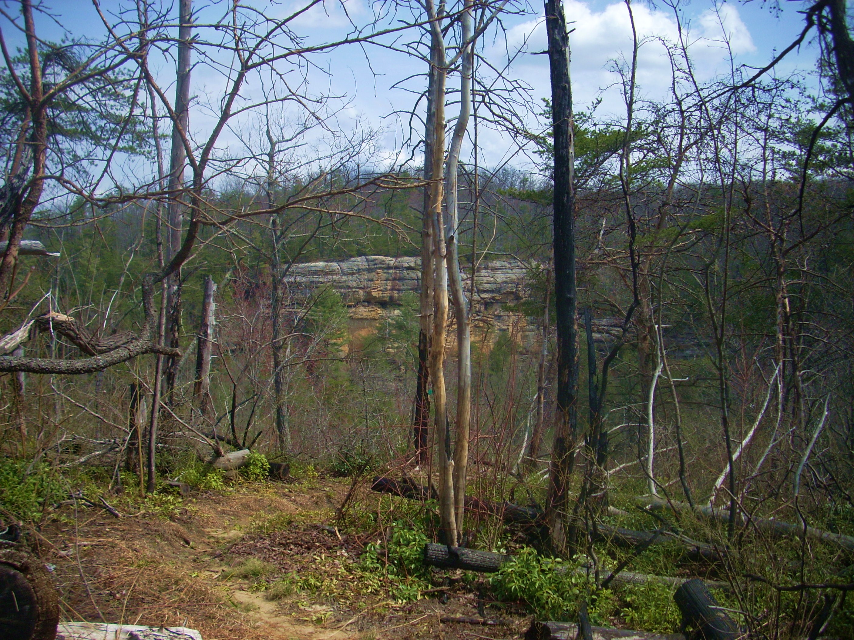
Let me also just mention here (so as not to bore the reader with constant scene-shift descriptions) that from this point to Pinnacle Overlook the scenery will again be in constant flux. You’ll always be hugging the edge of the ridgeline, but at the higher and more open points you’re again apt to get the feeling that you’re walking amongst eagles’ nests on the sandy path. These areas are also so open to the elements that many of the trees have been charred by lightning strikes (No wonder they say not to walk along a ridge top in a thunderstorm!).
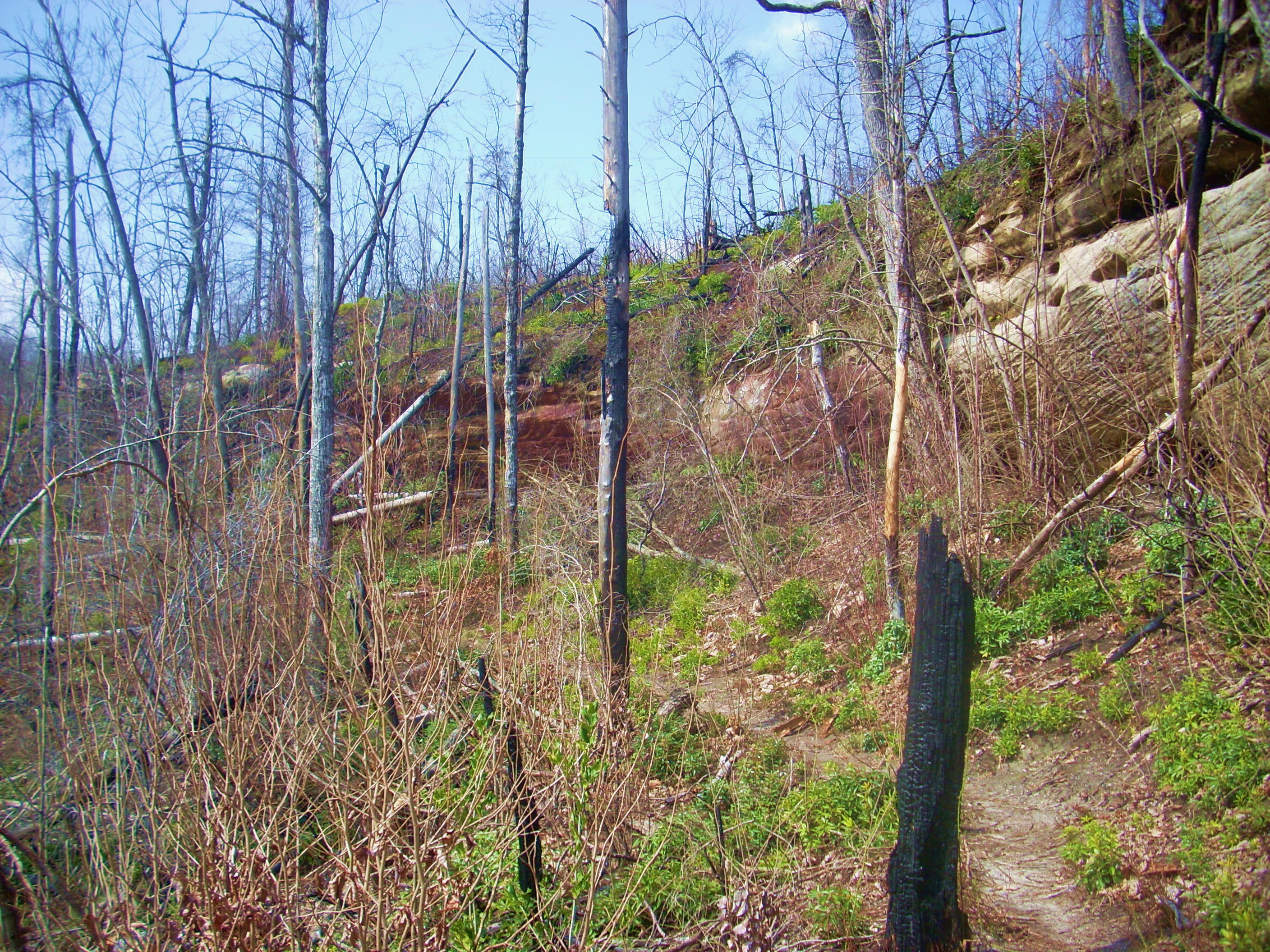
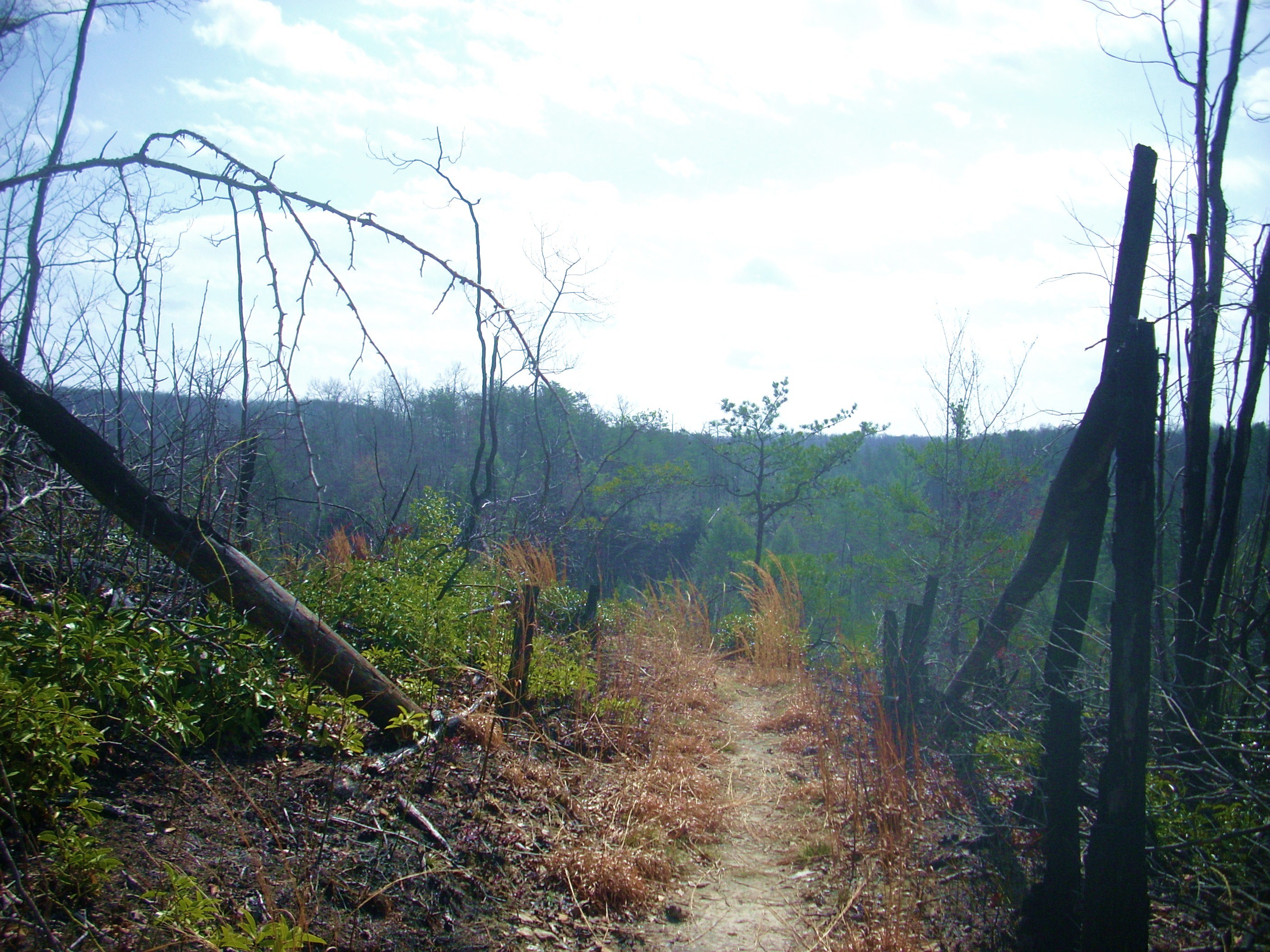
Meanwhile – in the other more sheltered and receded areas you’ll again be walking amongst the boulders and rock ledges in a very lush, green environment. Another caution, however: I’d not chance walking off the beaten path at all out here. The snakes must absolutely LOVE it! In fact, I think I probably miss quite a bit on hikes like these because I’m constantly looking down to avoid them. And, if I do stop – even just to take a picture - it’s not before I’ve thoroughly checked the ground all around me.
Now I’ll be honest and
mention that when I got to the Double Falls Trail intersection I decided to
bypass it – for today, anyway. I’ll explore it in the next section of the
Sheltowee to coincide with a hike of the John Muir Trail. I’ve absolutely
gotta do that one! How could any hiker worth his boots possibly pass up a
trail named after the legendary John Muir?!?
…and while I’m being honest,
I’ll also sheepishly mention that by the time I got to Pinnacle Overlook I
actually found it to be somewhat anticlimactic! Can you believe it?!?
Yes, I’m embarrassed!!! It’s an absolutely stunning spot, but I
guess I’d seen so much already that I was suffering from sensory overload.
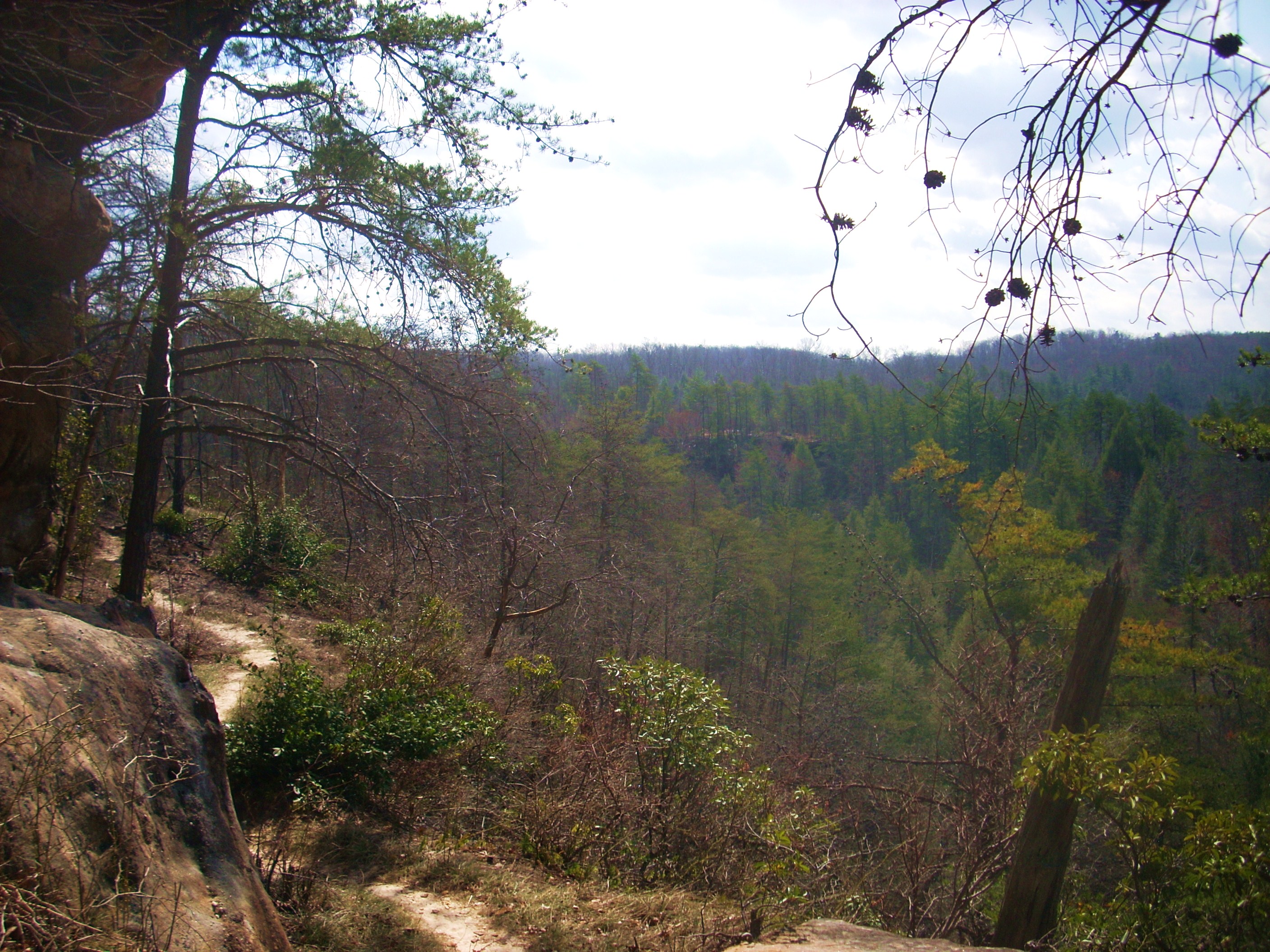
That’s the only way I can explain it. The overlook is actually a large
rock outcrop with a magnificent view of the Thompson Creek Gorge below and it
would be a great spot for a picnic lunch. In fact, there is a road which
leads up here, but I believe it’s a park road closed to traffic.
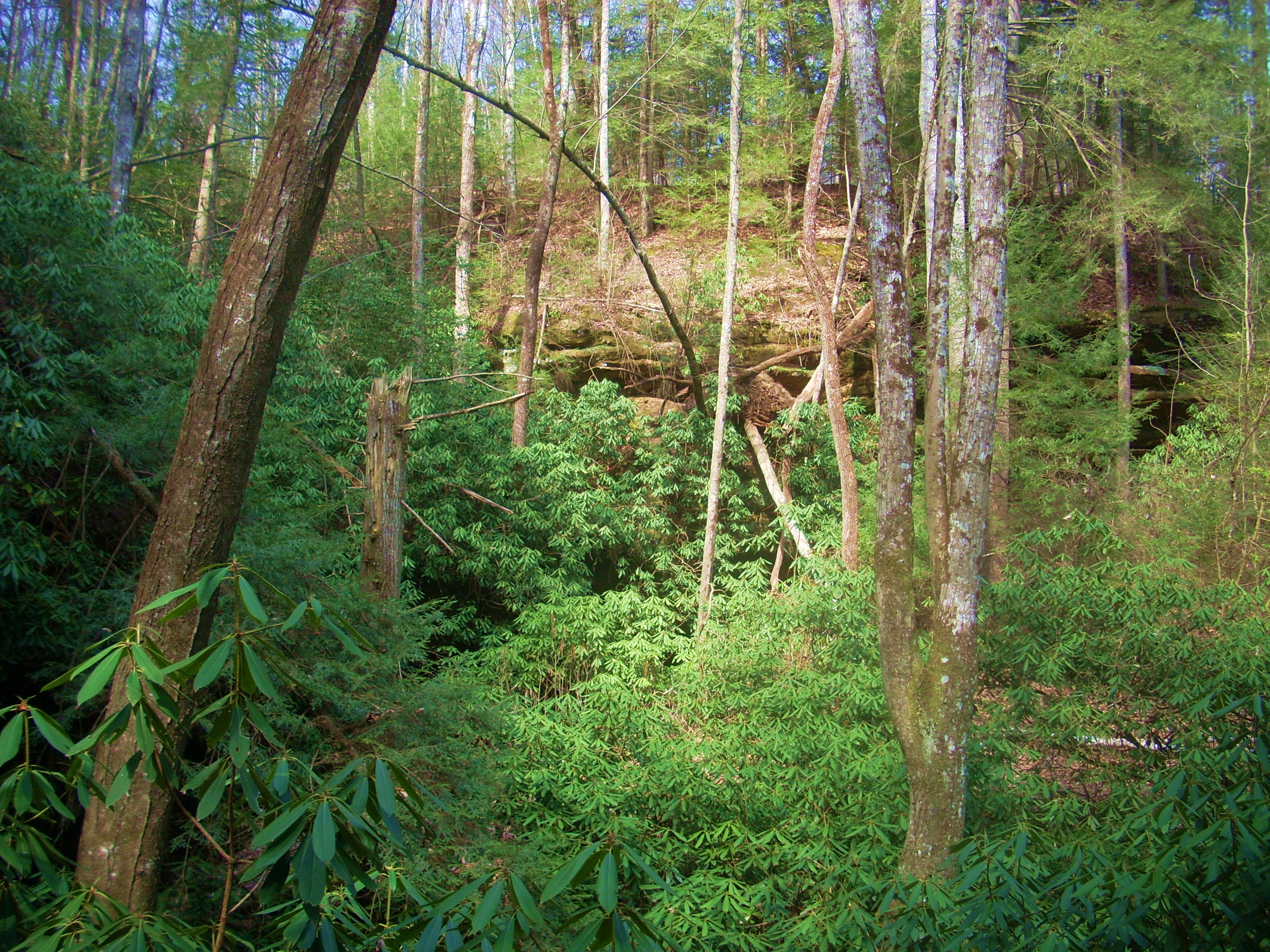
Anyway, once you’re done taking in the view you’ll turn around and look to the right of the road. This is where the path continues. A single little wooden sign on a tree stump marks the way, but I was to find that after one more open mountaintop view (below) it would be my last of the day. The bulk of the remaining time on this path was essentially a walk through the forest and for me this was a nice break. It finally gave me the perfect environment in which to relax, contemplate and digest what I’d seen this day – and was continuing to see.
You’ll quickly reach a couple
more trail intersections now in fairly rapid succession. Both are
essentially connector trails to the Rock Creek/John Muir Trail combo, but the
first is particularly significant because it’s the continuation of the Sheltowee
Trace. Let me be clear: on this particular hike I’m doing the Hidden
Trail Loop, a hike which incorporates the first few miles of the trace before it
veers off to return to the Traces’ origin. If you’re doing this too,
you’ll want to proceed left at this intersection. However - if you
wanted to follow the Sheltowee in it’s entirety you’d head right.
Meanwhile, the second
intersection you’ll reach is for the Tunnel Trail and here again you’ll want to
proceed to the left, but today something seemed to be amiss... Tunnel
Trail was the one marked with Sheltowee Turtle signs... (Sheltowee, by the
way, is a Shawnee Indian name which means “Big Turtle”, and since this was the
nickname they gave to Daniel Boone, the Trace is actually named for Mr. Boone –
something one might not realize. I didn’t at first).
Soon you’ll see an open area
up ahead and this is actually a swath of forest that’s been cut away to allow
for some power lines. It’s not immediately evident where the path
continues here, but if you walk toward your 1 to 2 o’clock point you’ll connect
with it again on the other side.
Next you’ll reach a dirt and gravel road that you’ll follow to your right to
soon arrive at the group camping area of
DIRECTIONS:
This is a pretty remote park and there’s
really no easy way to get there, although there are a few different ones.
Personally, I took I75 south from
From here it’s pretty easy – and pretty – because
you’ll dive down into a valley and cross over a beautiful looking Leatherwood
Ford and while it does seem like the drive is taking a while, you’ll soon reach
a dead-end at route 154. Take a right, go about 3 miles, and just after
the main Pickett State Park entrance on your left you’ll come to the trailhead a
little further ahead on the right. You’ll see signs which clearly mark it
and you’ll turn into a parking lot with room for about 5-6 vehicles.