Sheltowee Trace
Last year I’d
been a real oaf. I came out here and went the wrong way!
I went south on the Sheltowee when I should have gone north!
It was nice, as the trail wound around the beautiful
What you’ll see
on this hike can very nearly be broken into 3’s. In the first
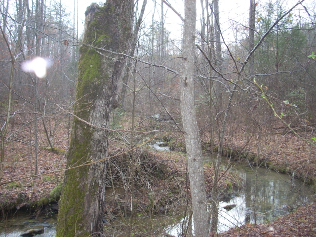
part you’ll witness a stream (Pounder Branch or one of it's tributaries) go
from infancy to maturity. In the second section you’ll follow another stream (Van Hook
Branch) as it goes from maturity to about adolescence, and in the third section you’ll
have a very pleasant stroll through the forest along old logging roadbeds and
ridgelines. Along the way you’ll meet with a wide variety of
plant life and you’ll witness a few incredibly scenic waterfalls.
In fact, in one of my books on hiking in
I parked in the
grassy lot to the left of the above 192/1193 convergence and
very carefully and quickly
crossed the road to reach the trailhead. A sign here
indicated that my intended destination, FS457, was 6 miles ahead.
I've found that
much of this southern area of
the trace can be broken up into 6 mile increments. The
last section I’d done (from
Interesting
too, was that after today I found that I hike at a rate of about 2 miles per
hour (I’m guessing that most people would be roughly similar) so apparently you
can kayak just a tad bit faster than you can hike. I've noticed before
that I paddle about 2.5 m.p.h. in a 10 foot kayak on
flat water.
Anyway, you’ll start out on a path which runs close to the roadway but you’ll gradually move away from it as Pounder Branch (or a tributary at this point) slowly enters your awareness. I didn’t actually notice this stream until it began to run in what looked like a little gully beside me – a gully which would gradually get larger and larger to become a ravine and then a near valley.
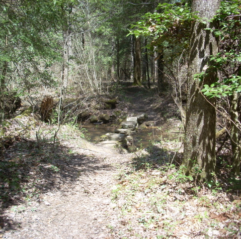
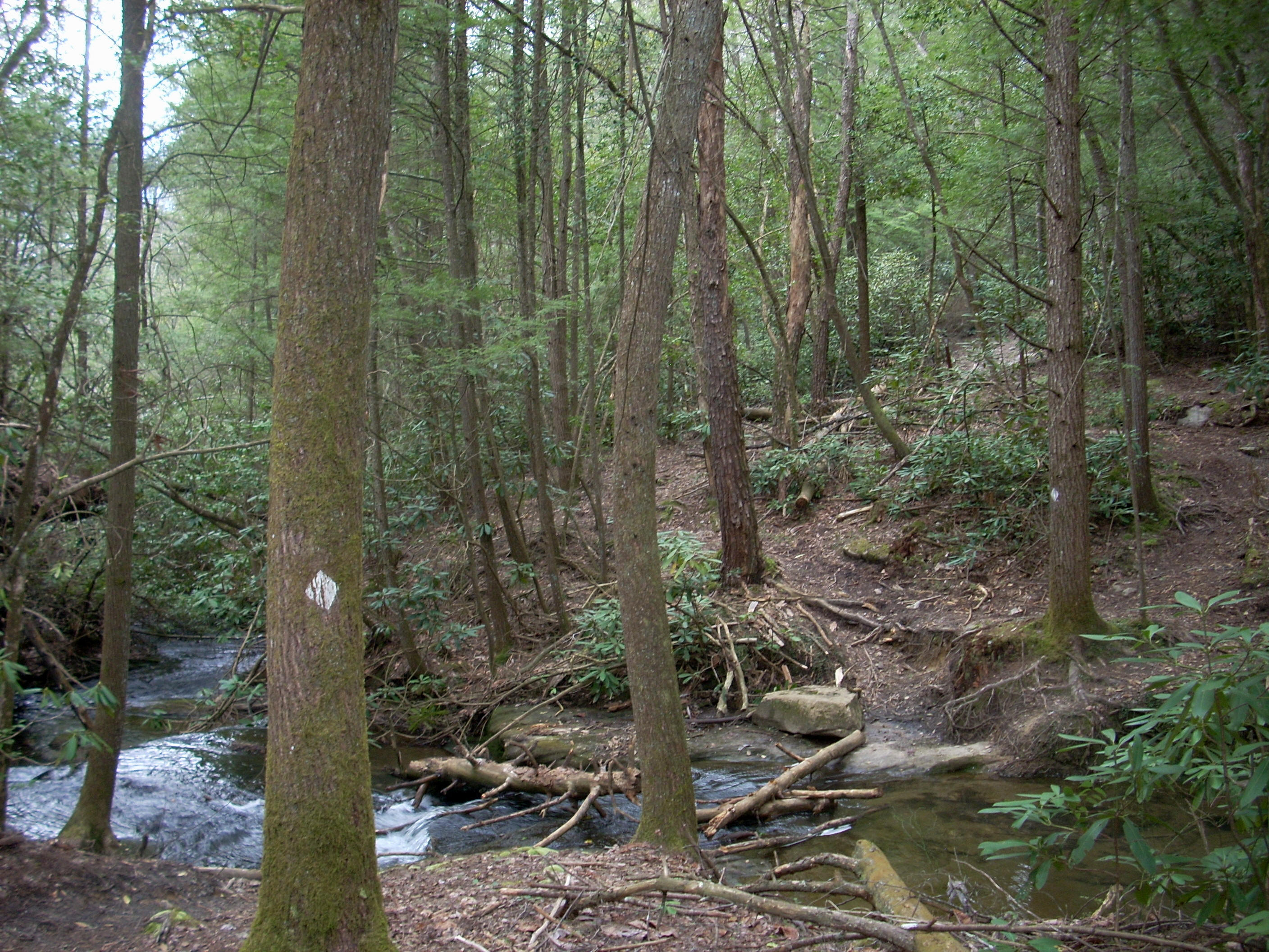
Your path will
cross over this stream several times as it flows toward Cane Creek and on to the
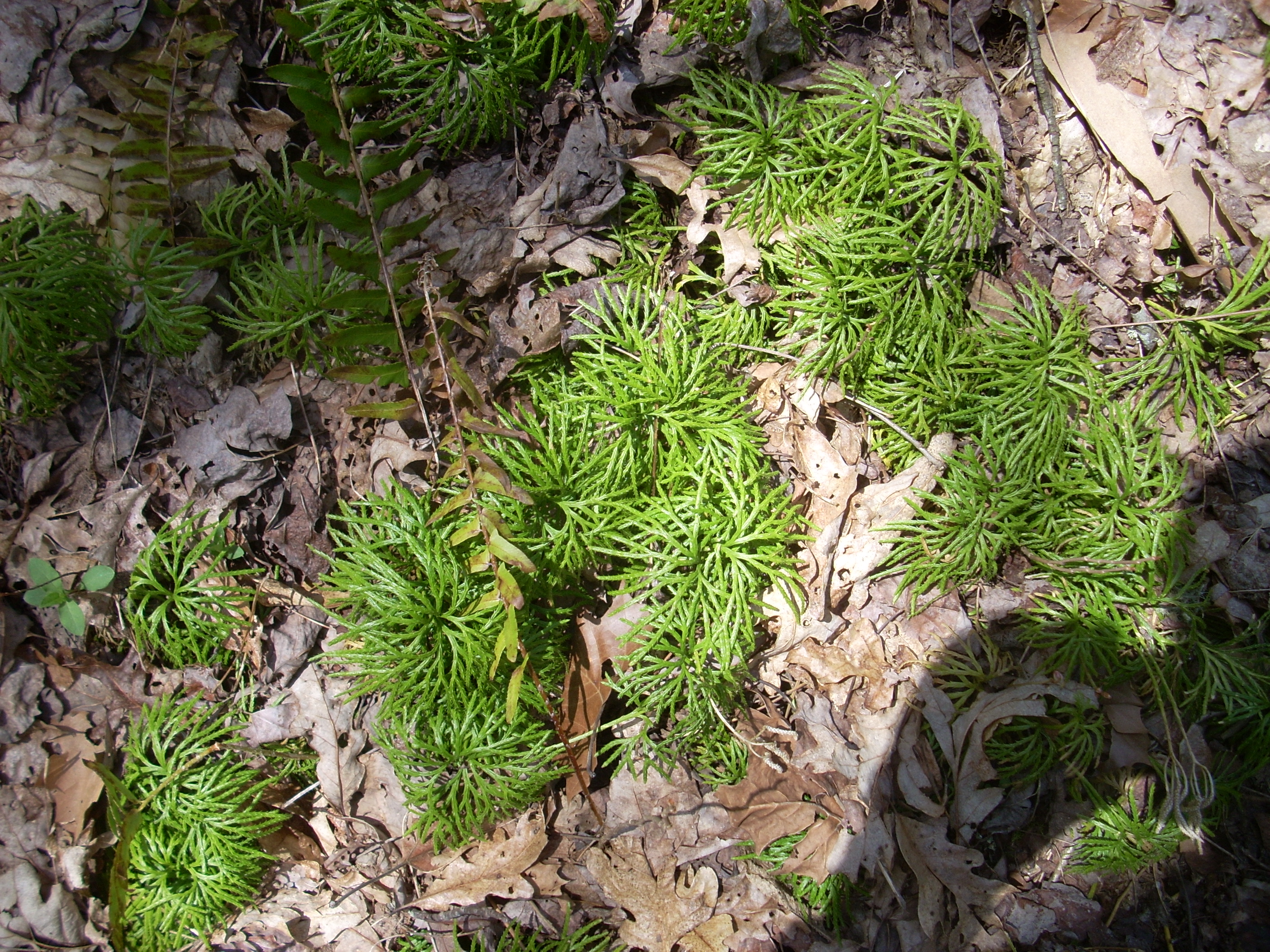
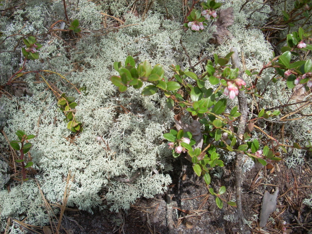
Within this first mile I also started to notice something else which would definitely become a theme today – the plant life. I saw shrubs, moss, algae, everything – and a lot of it I’d never seen (or at least never noticed) before. I’ll include pictures of these as I go along. Here’s one… Looks like some kind of grass or maybe a groundcover-type plant?
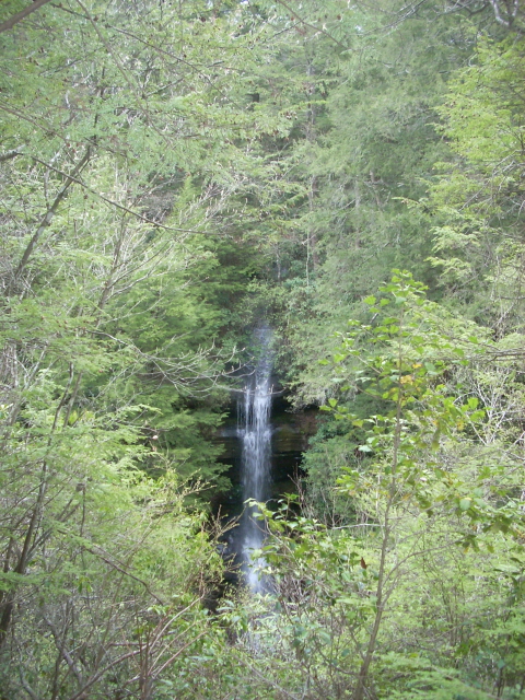
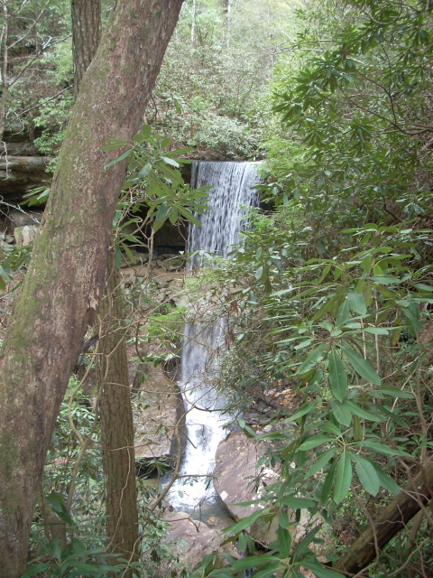
At any rate, about a mile into the hike you’ll see a couple waterfalls. The first occurs a few feet away from the path after you cross one of the tributary streams. This picture was taken looking down at it…
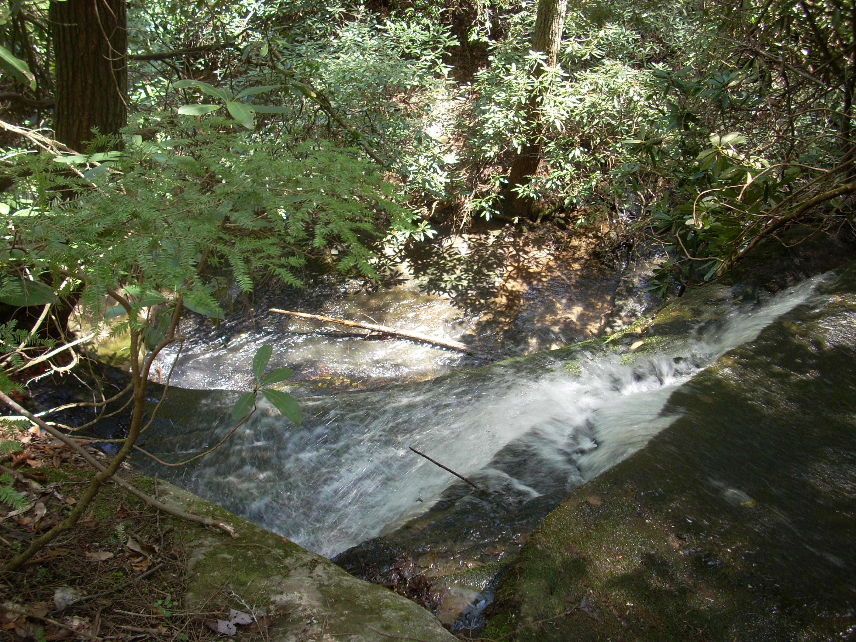
The second waterfall will become evident almost immediately afterward. In fact, the first intersecting path today will take you to a great view of it. Go right on this path, walk several yards and you’ll see it on the other side of the ravine. Here it is…
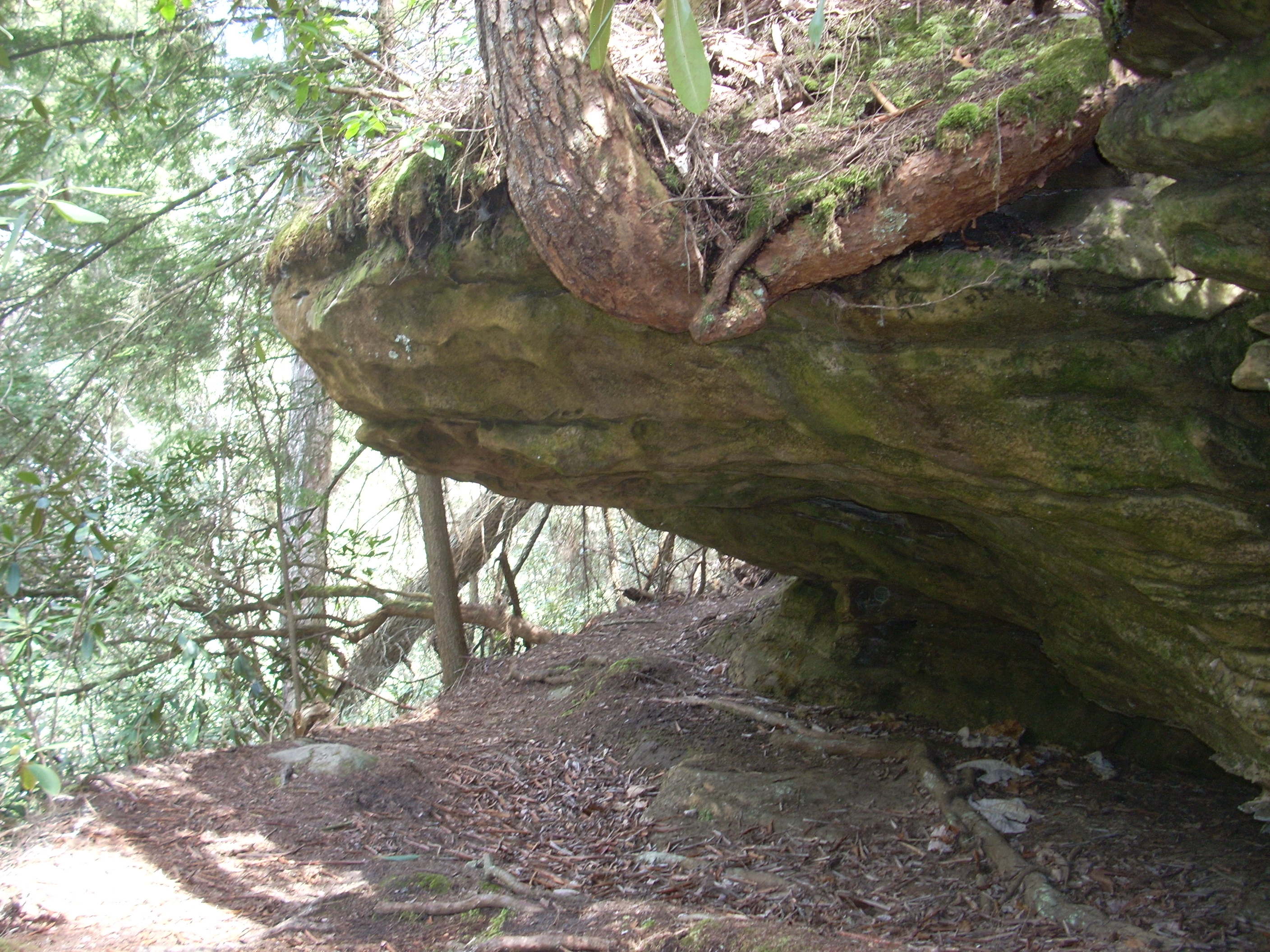
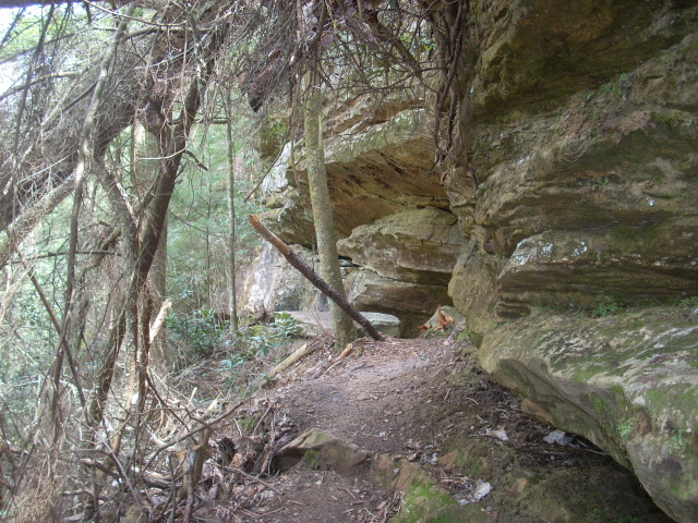
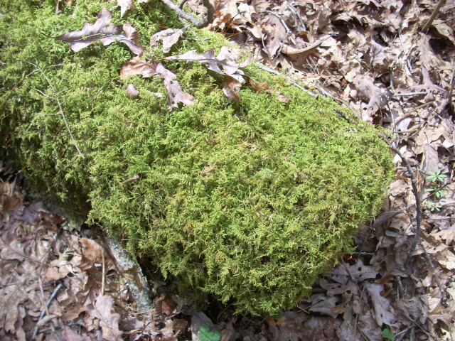
After this the route will take you right up against the rocky wall of the ravine and there will be some interesting overhangs and caves in here. Then, as you near mile 2 you’ll reach the intersection for another unnamed path and you’ll want to head to the right to emerge atop a large rock. I noticed the moss below along in this area...
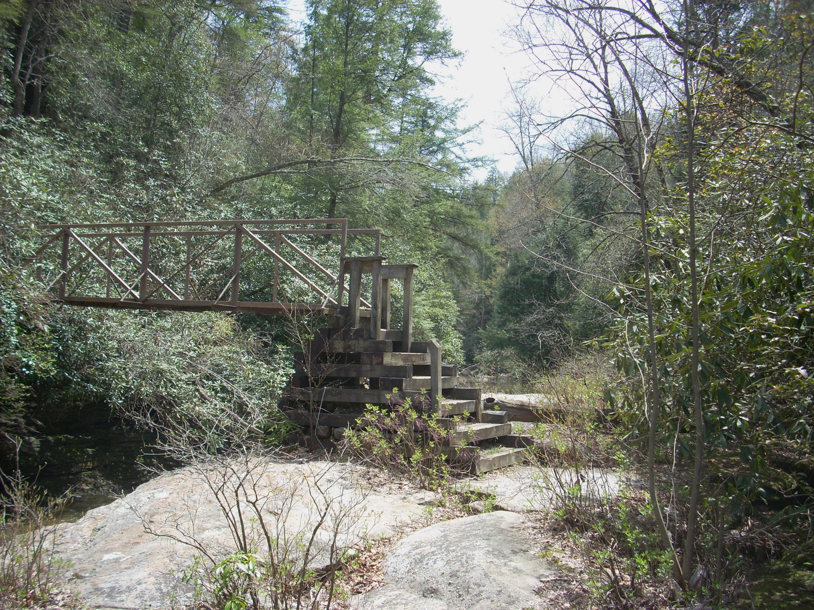
The path will presently wind you down and around this rock to emerge at the convergence of Pounder Branch and Cane Creek. At this point you’ll cross over 2 bridges in rapid succession. This is a pretty congested area in terms of water flow – and not just because of these 2 branches. Van Hook Branch must also enter very near this point (although I couldn’t tell exactly where) and the 3 of these streams will flow on to the Rockcastle River. All of this, of course, makes this a great location to stop and enjoy. It’s really fun crossing over these bridges too! The one over Cane Creek, in particular, is different in construction from other bridges I’ve seen. They put up what looks almost like a pyramid of steps on one side to give it enough of a rise to make for a level spot to put the planks across. Quite clever!
After crossing this you’ll begin winding up another ravine - this one created by Van Hook Branch. As you do, you’ll pass some more nice looking rock overhangs and caves.
You’ll probably also hear the water going over Van Hook Falls which comes up soon. The only people I saw today were out here. It looked like they were enjoying themselves at the bottom - there’s a side trail which goes down.
I continued on around near the top of the ravine and soon crossed over Van Hook above the falls. This was a particularly lush area which had me feeling like I was in a jungle (actually the whole area since I descended to the bridges has the same feel), and I noticed another white diamond trail sign here. I was in a kooky mood today so I was thinking about Lucky Charms. Y’know… What is it? Re hearts, green clovers… white diamonds?
After crossing
Van Hook you can circle up the bank in one of two ways to then reach a convergence of paths. I went
to the right to continue on the Sheltowee, but you can also go left and on to the Rockcastle Narrows East Trail.
This is a loop path that you’ll intersect with again a little over a mile up and
if you followed it it
would eventually take you to the mouth of the
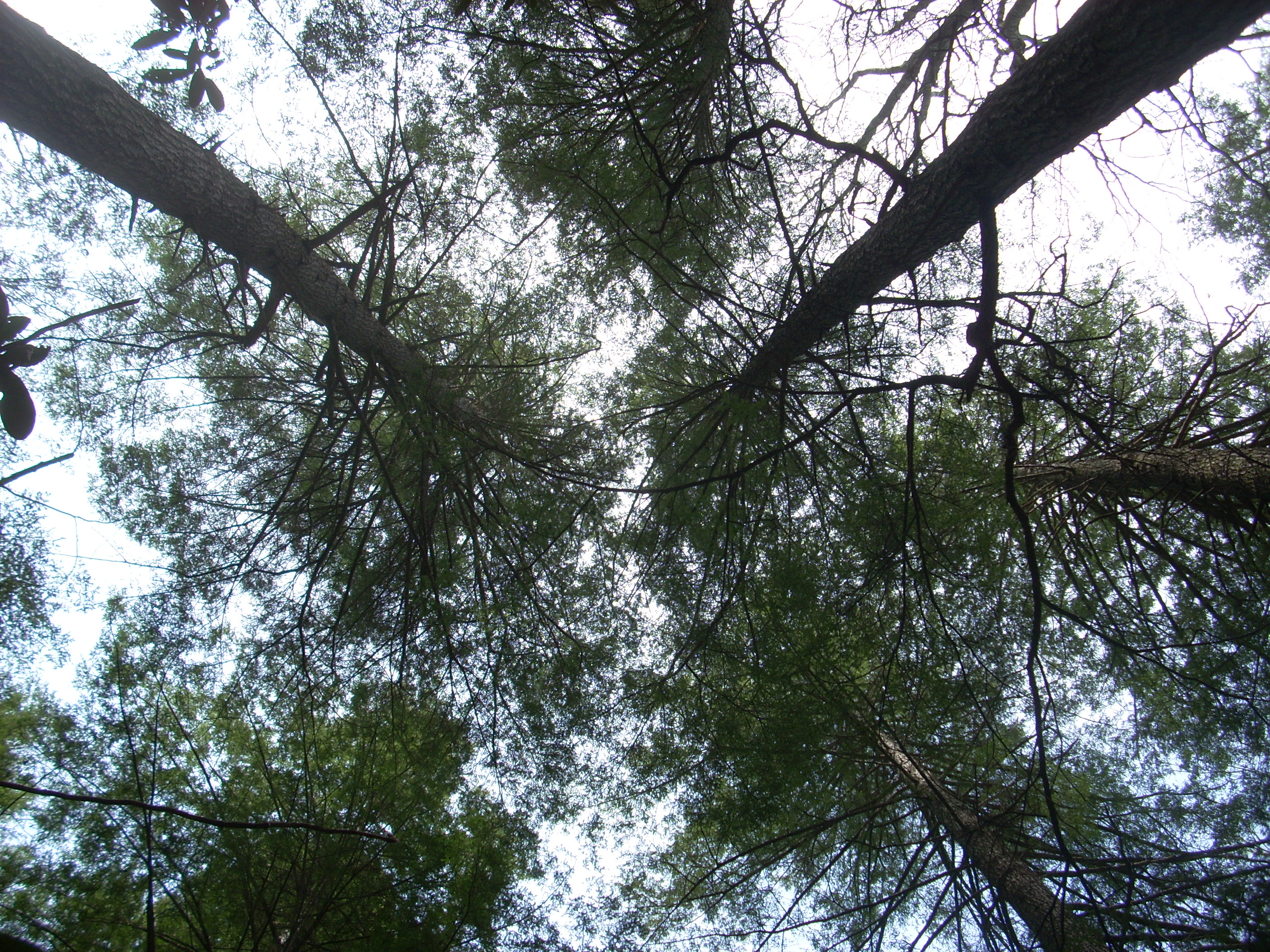
Back to the Trace for now... In this next section you’ll flirt with the top of a ridgeline as you follow up the Van Hook Branch drainage. You’ll stay at a predominantly mid-level height in general and it was in continuing through here that I really noticed the height of the trees. Some of them must be at least a century old or more – they’re really impressive.
I also noticed how the moss (at least I’m assuming it was moss although it looked like a mass of little ferns) grows on the deadfalls.
Soon you’ll meet and cross a young Van Hook Branch and one of its tributaries at about the 3.5 mile mark. To be honest, I think this is as nice a spot as any today – and that includes the waterfalls. The gentle trickling sounds of the water here are like a little symphony of sound to soothe and calm the spirits. It’s wonderful!

…until the
gants descend upon you. On the way back it would start to
rain and I might as well have been the Pied Gnat Piper! I had
swarms of them following me and I’d only be able grab a quick swig of water
before they’d be all in my face. I have a cap specifically
for this purpose which has mesh inside it which you can take out and cover your
entire head with. Problem is, it
slightly obscures my vision just
enough to have me concerned that I might miss something if I used it – I do so
only sparingly.
The other
Rockcastle Narrows East Trail junction I mentioned earlier intersects here after
you cross these little streams, but I continued right to embark on an incredibly
pleasant stroll through the woods (in fact, this area reminded me a lot of Raven
Run Nature Sanctuary). Presently you’ll reach the junction
with Forest Service Road 749 and this was to begin the series of forest roads
upon which I’d predominantly travel for the rest of my trip today.
Not unpleasant,
these roads are dirt and gravel affairs predominantly used by forest service
employees and recreation seekers. They’re often
extremely narrow - so much so that if 2 cars passed each other one is likely to
wind up in a ditch. They often end at little fences too, so
they’re very seldom traveled although I did pass by one vehicle today.
I like them though. They are unobtrusive in a way
which bows in respect to Mother Nature. They merely pass
through. They don't despoil the landscape.
I took a left
on 749 and kept following it straight until I reached its’ intersection with
FS119 (there was one of the little gates here, by the way). I
then turned right on this road and soon found myself wondering when I might see
the next Sheltowee sign to confirm my direction. The sign comes
up soon enough, but it’s not completely visible from the road.
The turnoff is on the left at what looks like the junction with an
absolutely ancient forest road. Another slightly receded road
gate for this road was a sight which disturbed my reverie long enough for me to be
able to spot the continuation of the trail which veers off just to the right of
it.
This part,
between FS119 and FS457 is nice. It’s not directly on the
roads and you’ll see some great vistas from it because it runs right along the
top of a ridgeline. You’ll generally slope up, but at one
point you'll have an unexpected little drop through some rocks.
This area would be especially nice to see in the fall with all the color.
There’s also a sign toward the end of this section that indicates that there was
quite a windstorm here in 1991. It supposedly toppled large swaths of trees – 100 acres worth
- which was enough to build 250 houses as per the sign!
The end of the
line today was just ahead at the trail junction with FS457.
You’re supposed to go left here and I did this just
to get a feel for where I’d pick up the next section of the trail the next time
I came out. Turns out, it picks up to the right of the road
about ¼ mile up where a sign indicated that it was another 6 mile hike to
Sinking Creek with Highway 80 being an 11 miles jaunt. While
there’s no real parking here, there is just a tad further
south on the road.
It’s very hard to sum up this hike with all it's diversity. I would simply say that I think it's well worth your time to come out. :)
DIRECTIONS:
Take exit 38
off I75 near