From
Trailhead 2:
I drove into
the park and quickly checked in at the shop. It can be accessed on a short
little path that begins on the north side of the parking lot.
You’ll need to sign a waiver here and you’ll definitely want to pick up a
map. I found the trails to be very well marked in the forest
sections but in the field areas the markers didn’t seem to be as plentiful and
they weren’t as clear to me in their indications. In fact, I
remember one that seemed to point right down the middle of 2 different paths!
To reach the
main trailhead you'll probably want to get back in your car and head West (past the pond)
on the paved village road.
This goes back a little over a mile and at one point you’ll dead end near the
parking lot for trailhead #1 which will be on your left.
You’ll want to go right, though, and head over a one-lane bridge.
After this I took the first right, passed alongside one of the old
houses, and parked in a mid-sized lot in the back. This is
apparently a conference area.
Now, it could
be that you’re supposed to park further down the road and there is a barn down
there... Looking at the map it appears as if this could be
the actual trailhead and check in, but they didn’t seem to have a
problem with me parking in this particular spot – and I’d already checked in
anyway. To begin the hike I took a short walk back to the
road and went left onto the Shawnee Run Trail (this is the path through the
meadow you'll have seen on your right as you drove in).
A quick note
about the 4 trails which branch off from this trailhead (#2):
Shawnee Run is the longest, as it runs all the way around the perimeter of the
As you embark
on Shawnee Run Trail you’ll essentially be taking a farmland stroll along a
gradual descent toward this trail's namesake stream. Doing so, you’ll
pass by the first of a multitude of trail intersections.
There are an absolute ton of these out here, most of which are simply connectors
that link one trail to another so it can be a little confusing – another reason
to be sure to bring a map. There was even one point early on
at which I saw a Tanyard Branch Trail sign. Get on this one by
mistake, and you’ll be taking a totally different loop around a totally
different section of this preserve. Tanyard is a 6-miler too,
so if you wind up combining this with Shawnee Run you could very well wind up
out here overnight!
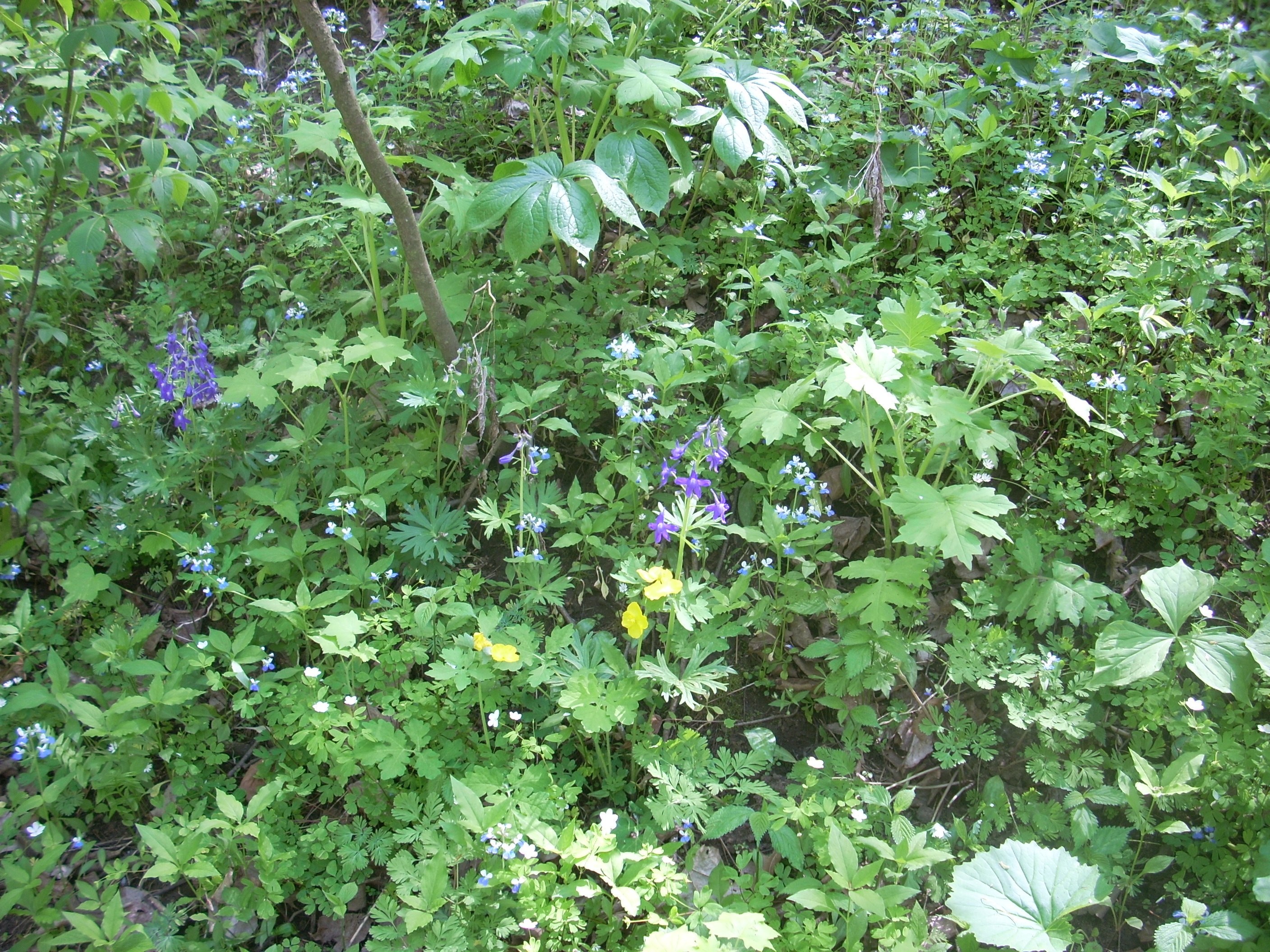
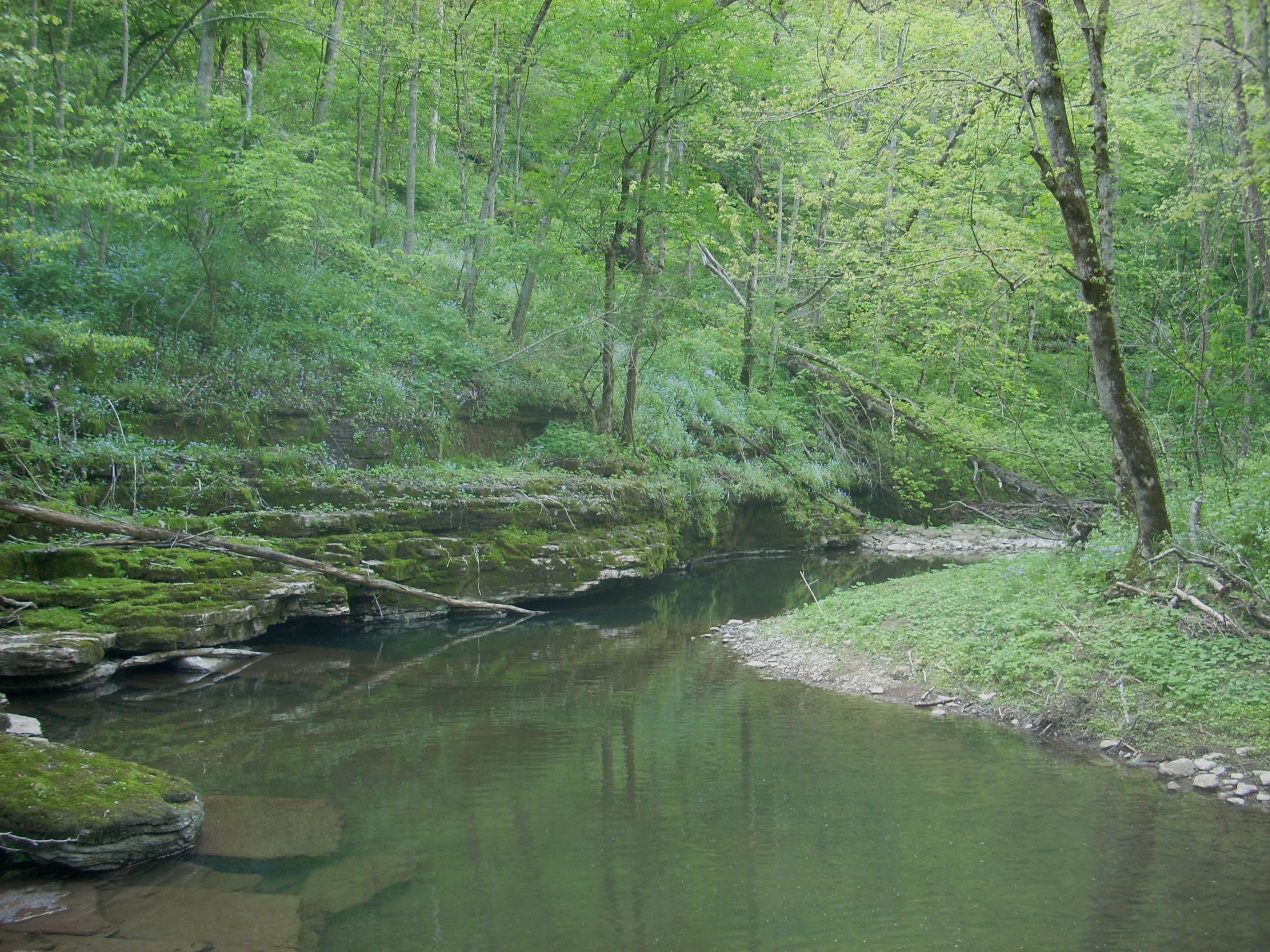
Anyway, as you near the stream you’ll be coming more and more into a forested area and when you do finally reach the water the path will cross right through it on what looks like an ancient patch of concrete. It was around here that I began to be greeted by quite a few varieties of wildflowers. I counted what I believe were about 8-10 different kinds over the course of the day.
What greeted me next was right out of the history books. It was the site of an old fulling mill along the stream where a little waterfall was coming down. The water used to be channeled from here, to cross the stream and then go into the old mill (you can still see the foundation). From the mill it was used to assist in pre-treating the wool which would later be used in garments. This whole process is summed up on an interpretive kiosk here, and you can relax and take in the pleasant sounds of the waterfall on a park bench that they’ve made available.

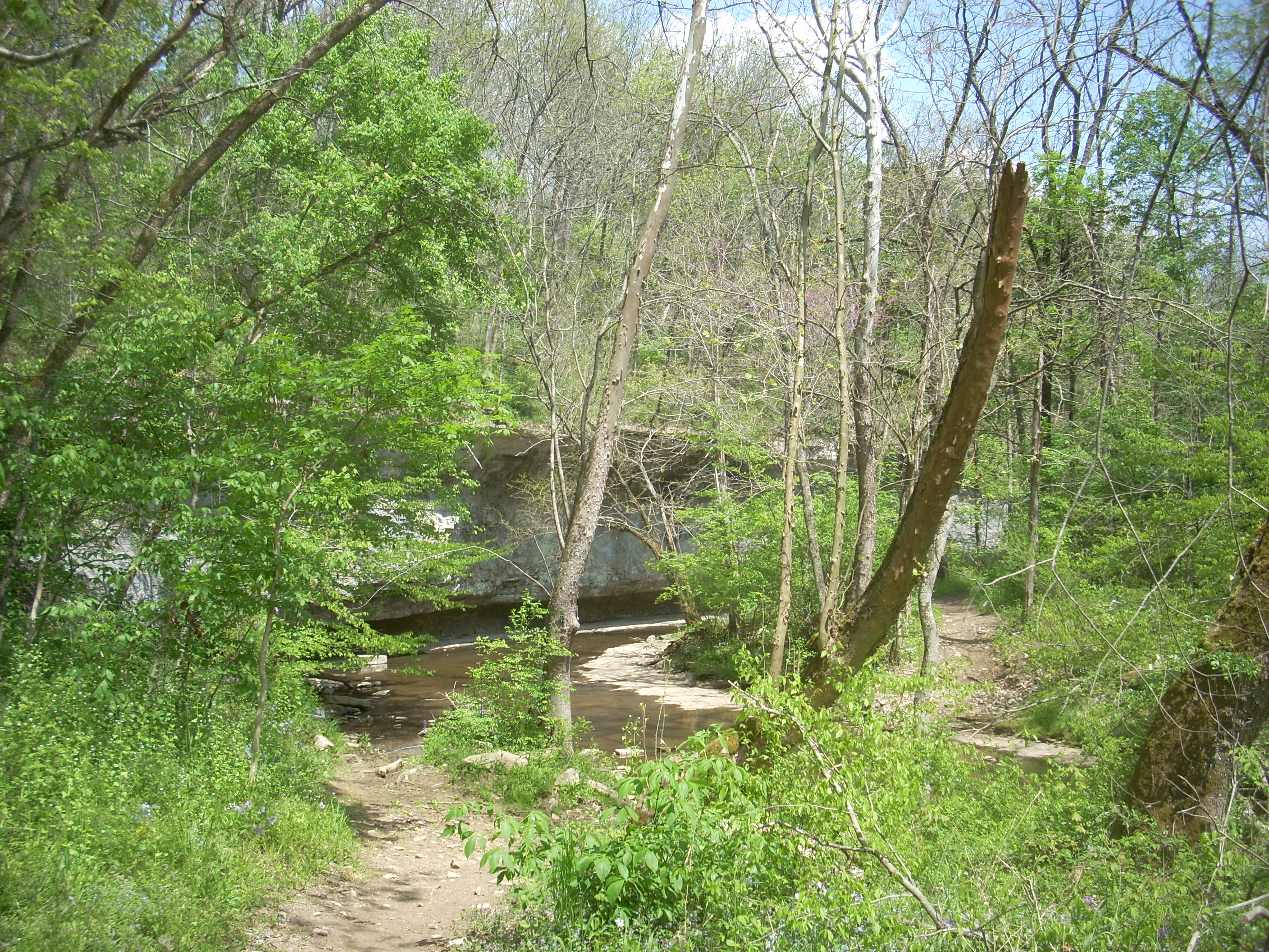
Eventually, however, you’ll have to pry yourself away from here and once you do you’ll follow along the stream for a while before eventually crossing it a couple times in quick succession. On your first span you’ll encounter a spot where the water has eroded into the rock and created a wall. Like the mill, this is another picturesque spot to stop and enjoy a while.
When you make
the second crossing you’ll begin to ascend away from the stream on a very
gradual slope through knee to sometimes shoulder-high sections of foliage along
the path. Yet, before you know it you’ll be near the top of the ridge and Shawnee
Run will be waaaay below you. Some more connector paths will
cross here and these lead up to the field sections of the West Lot Trail.
You’ll just be able to make out these fields as you look up toward the
top of the ridge.
After meandering for maybe another mile you’ll cross over a feeder stream for the Shawnee Run. There’s a scenic overlook here called Chimney Rock and they’ve got a bench for you sit and enjoy the scenery for a while if you want. Passing this point, you’ll begin the steepest of the Shawnee Run ascents (although there’s one on Chinn-Poe that will be steeper) and as I neared the top I could have sworn I heard a donkey bray! :)
Also near the top there was what appeared to be an old mine site to the left of the path. You'll want to watch your step in here. This site essentially amounted to a hole in the ground which was partially filled in with a bunch of metal and wood fragments to including an old box spring. Thus, if you leave the path you run the potential risk of either falling into one of the old shafts or of stepping on some sharp, rusty metal. There are quite a few more of these old mines around too – especially on the Chinn-Poe Trail which comes up next.
From here I found a picnic area on my right when I emerged in a field section. There was also an old barn beyond it but it did not contain the donkey I'd heard earlier. It appeared to be abandoned. The mystery was still on…
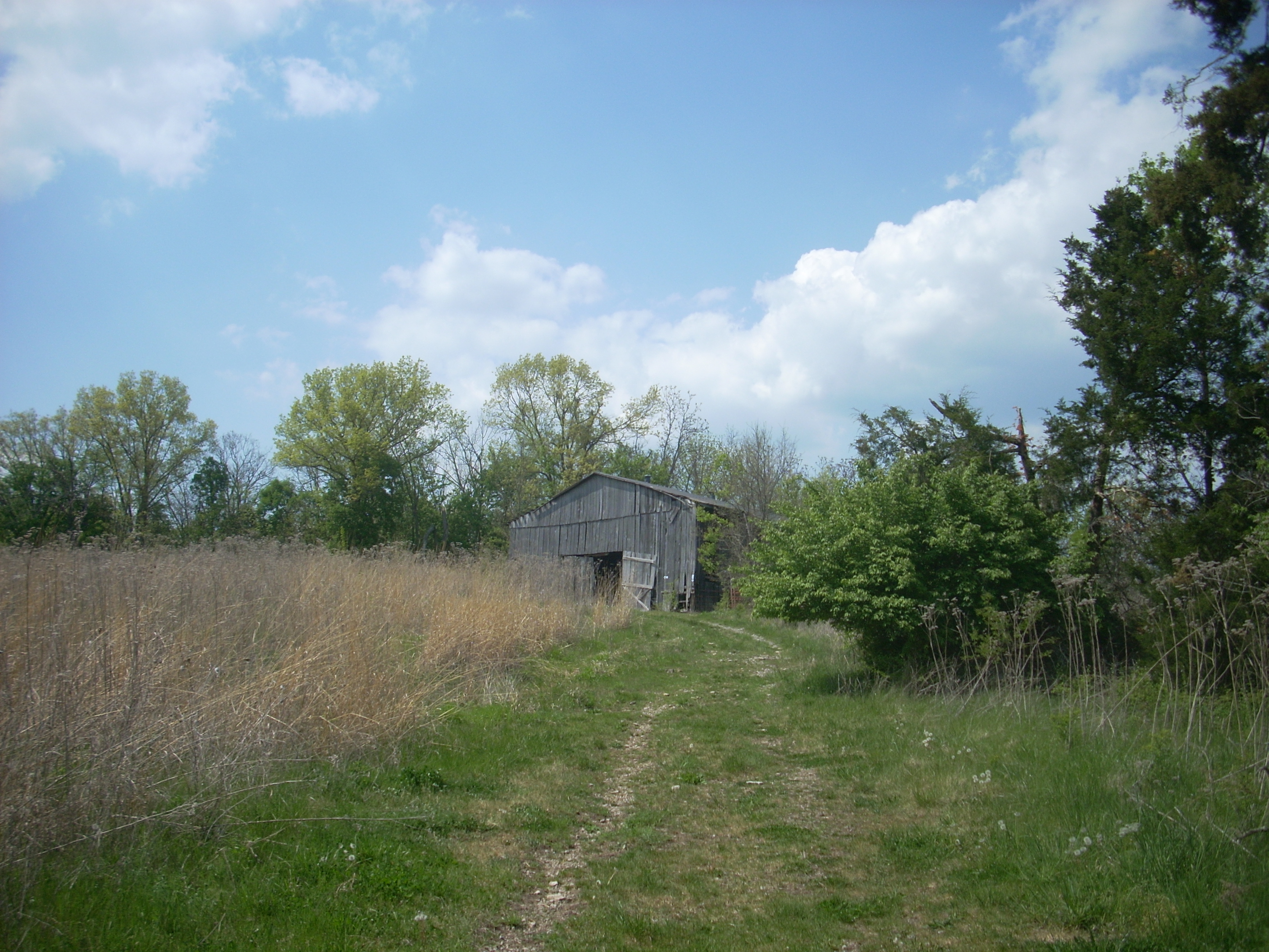
If you want to
take the Chinn-Poe Trail from here you’ll walk right up to the barn and take a
right around the side. Doing so, you’ll be led back into
the forest again. This trail is basically a walk downhill to
the forks of Shawnee Run and back, and on the first part you’ll pass by a few
more old mine sites before curving left along a level stretch of path.
Then, making a right, you’ll head down into what I’d call a little
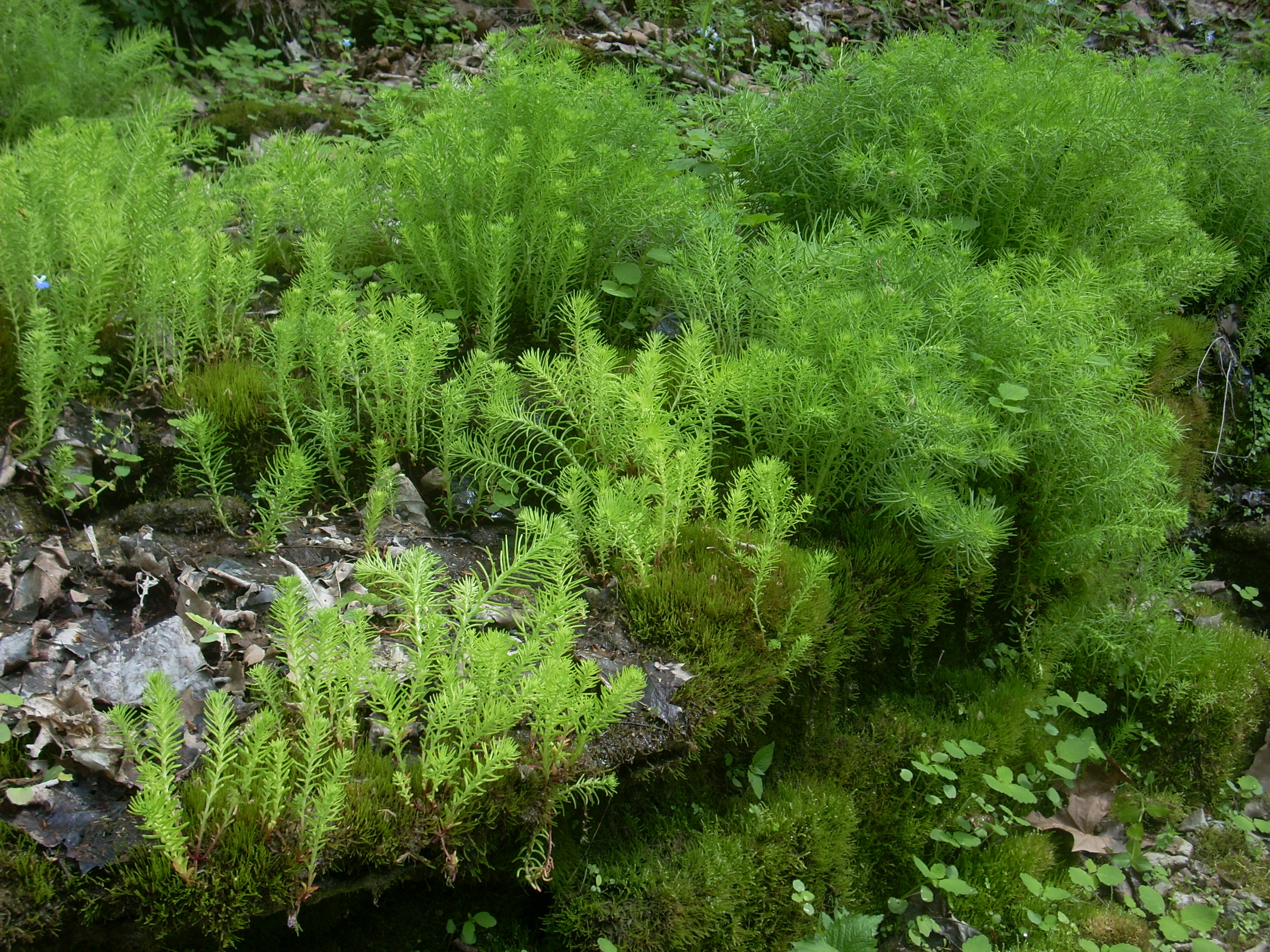
The Blue Eyed Mary’s seemed to be particularly abundant here and when I crossed the stream for the first time I met with an incredibly pleasant green scene that made quite an impression on me. I’m not sure exactly what kind of plants these are - mosses maybe – but I can’t remember seeing them before in my travels. It may sound a little odd, but some of the things I see on my excursions make me feel as though I’ve gotten some kind of special V.I.P. pass to a private nature display. This was one of those times. In fact, the whole area had that feel and I’d now consider Chinn-Poe a must-take spring hike.
When you hit
the water for the second time you’ll have reached the forks which is
the limit of the
Once I
eventually did head back up the hill and returned to the barn I continued on the Shawnee Run
Trail. In contrast to what I’d just
done, the vast majority of the rest of this trail would run through fields which
provided some nice rolling countryside views. The donkey
mystery was soon solved in this section too, as I saw that the animal was penned
in on a neighboring farm just outside the Shaker grounds.
This particular
section kind of threw me though (although you can cut it off if you want as per
the map). Up to this point the trail had generally
formed a circle, yet here you’re walking along a kind of nodule off to the side
of it. As I continued I got the uncomfortable
feeling that something might be wrong. I went from being on a
path to being on more or less of a gravel drive – a gravel drive which appeared
to lead to someone’s farm. When I heard a dog barking I
turned around and headed back.
Passing the
barn again, I reached the aforementioned picnic area and took the cut-off path
as per the map. There’s another side trail off of this, too,
which may confuse you. It takes you on a little tour of the
native grasses before it catches back up with the cut-off path.
In fact, I’ll speak very generally and say that if you only want to
follow the Shawnee Run Trail from this point, then you’ll just want to head dead
straight. Most of the next mile or so will be directly along
the side fence of the village grounds. The trails which
branch off to the left will all be connectors.
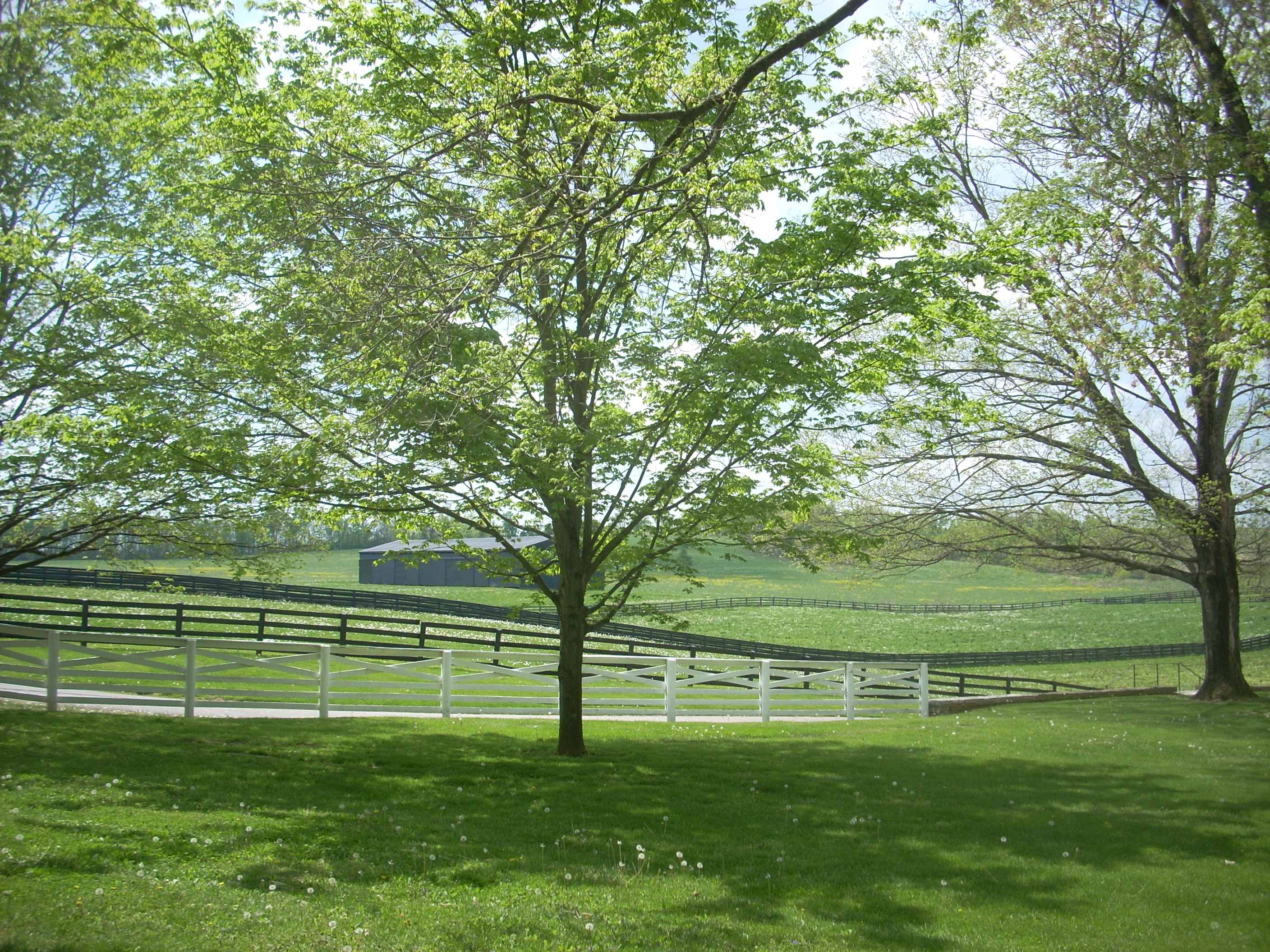
The trail will next dip you down into a section where you’ll cross over a little stream and this was where I encountered one of the more ambiguous signs of the day. What I did was just continue directly alongside the fence to begin a long and very straight farmland stroll. This is where you can pretend like you’re a farmer (if you aren’t one already!). The section will take you past a great view of the stables at trailhead #2.
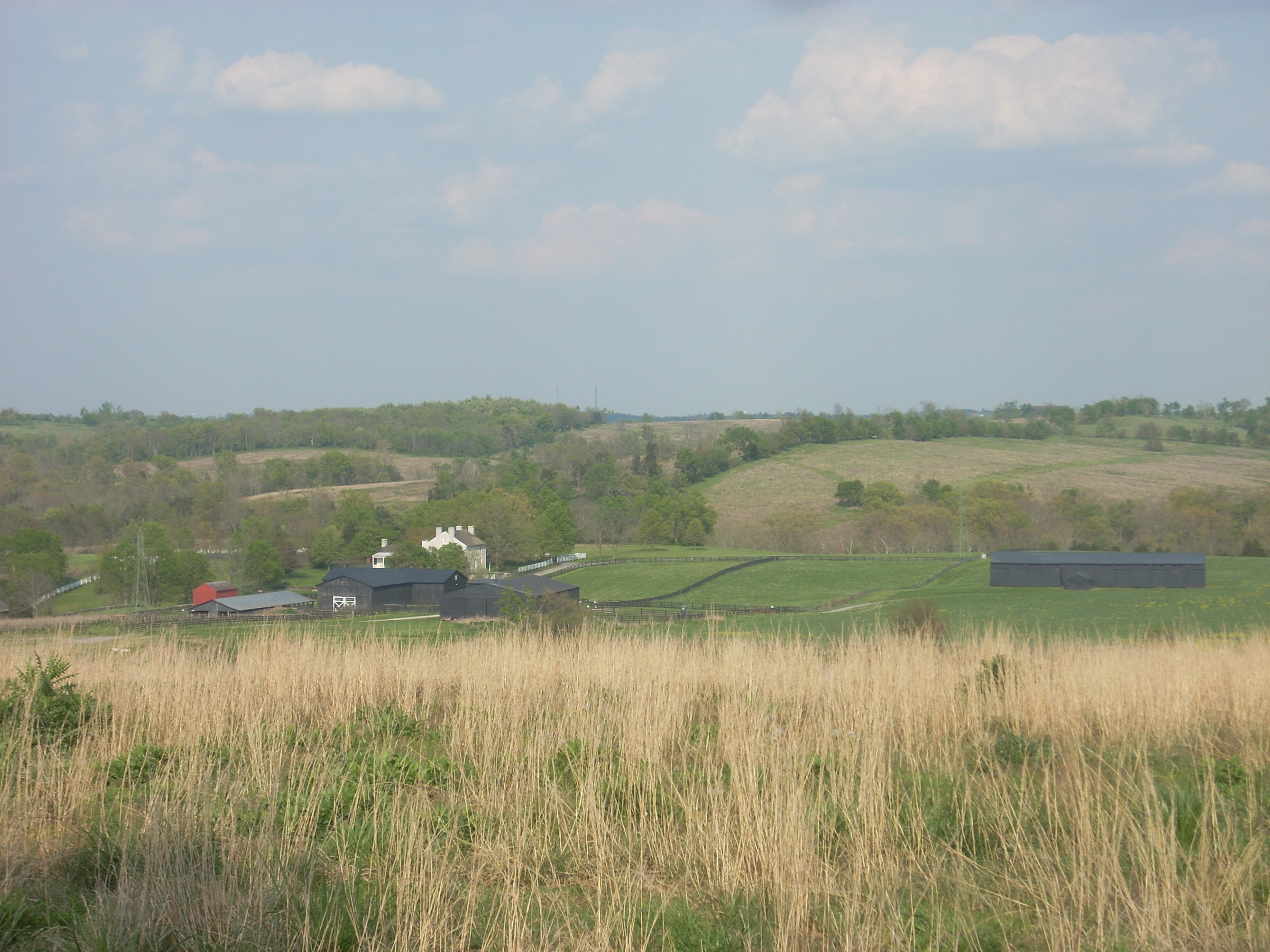
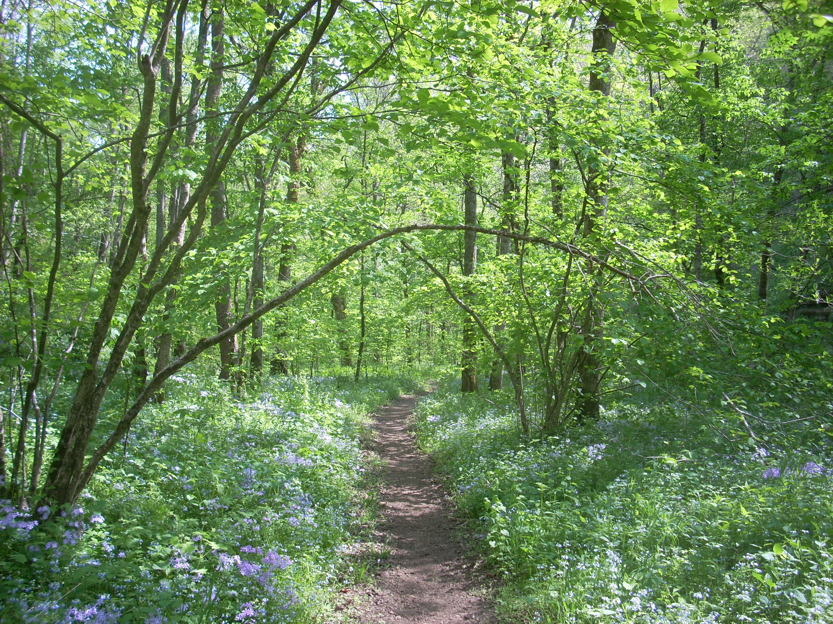
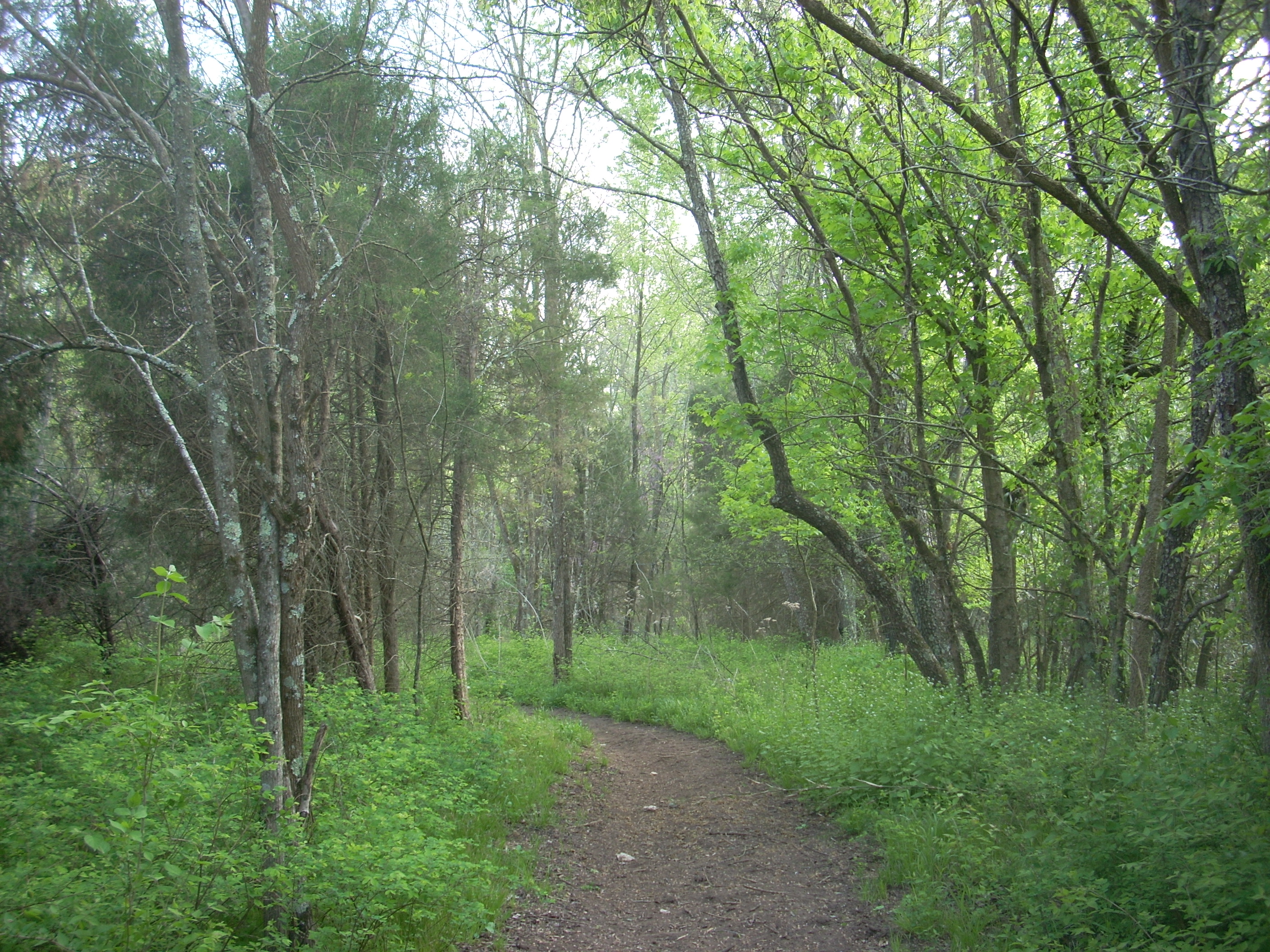
What you’re bound for is the stand of trees directly ahead of you, and once you reach these you’ll find that there’s quite a bit more here than meets the eye. As you pass through a fence you’ll find yourself in an incredibly diverse little forest – as diverse as any I’ve seen in the area – and the path will meander so much in here that it’ll make up for the last straight section. I did find this section to be very well marked and easy to follow.
Emerging from
this forest you’ll find yourself hiking alongside a white fence beside the road
you drove in on. I took my time to let the experience
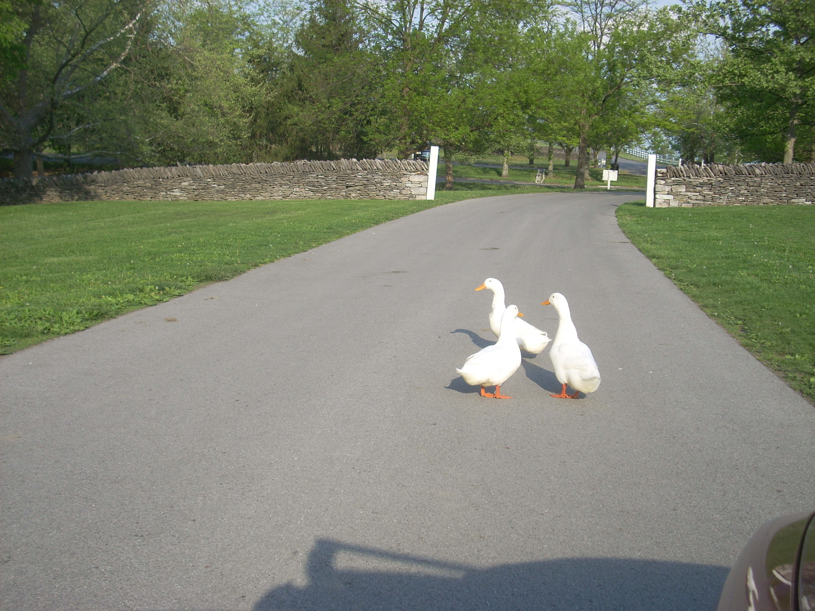
sink in before reaching my car which was just ahead. On the way out, however, I had a situation...
The geese back at the pond had my way blocked.
There were 4 of them right in the middle of the road with another pair on
either side so I couldn’t get through without either trenching the
DIRECTIONS:
Pretty easy...
The village is located southwest of