Rockcastle and Cumberland River Junction
Today I felt like doing a day
hike and this looked about right. It turned out to be more of an adventure
than I expected, however, due to some missed
confluences and some deadfalls which blocked the trail in spots. In
fact, while driving in I think I would have missed the trailhead itself if there
hadn’t been another car stopped there (see directions below).
The trail I took is called Ned’s Branch (trail #405) and I had probably gone ½ mile or so when I came to my first problem. The trail just seemed to end and I looked around for a while to see where I might have gone wrong. I knew it couldn’t possibly have ended so soon because I had the trail book with me. Frustrated, I retraced my steps and eventually found the trail again about a hundred yards down.
There's a pleasant descent here with a dense feel to the
forest and you'll come across an occasional rock outcrop which may have a little
steam trickling over it. This being the case, the area is something of a
fern and moss haven. There are
also quite a few rhododendron thickets and more than a few new blooms in the
Spring. Spring is such an awesome time of renewal!
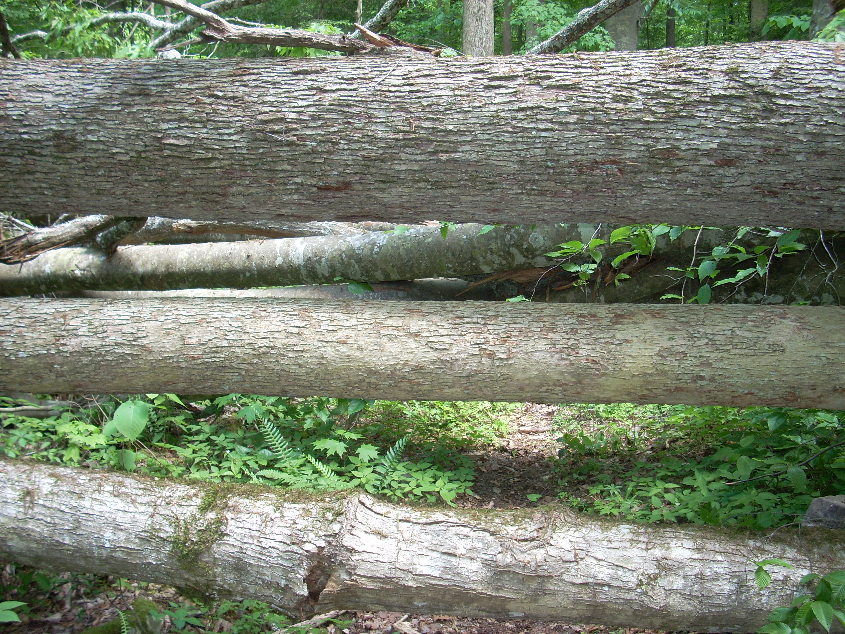
Further down I came to my second quandary. There, right in front of me was a cluster of downed trees. The cluster came in 3 series. Upon crossing a first series there was a second which effectively formed a fence of 3 large trees - one right on top of the other. It completely blocked the trail and I had to actually climb this fence to continue. Once passing the third series I was on my way again.
Soon after this came the convergence with the Lakeside North Trail, and at this point I got confused again. You’ve really got to be on your toes on this trail! It seems to peter out quite a bit and you have to really be alert to find your way. The markings seemed to me to be a little sparse and confusing as well – especially at this particular point. You’re supposed to follow Ned’s Branch Trail, you see, but it wasn't readily apparent to me which way to go. Having come to a rock outcrop I went left, crossed a little stream, and the trail was gone. I went back to the outcrop, took a right and that was the correct way.
You’ll soon catch views of the
As
you can image there's a fairly steep climb to the overlook, and at one point a
steep set of wooden steps takes you straight up a cliff face. At the
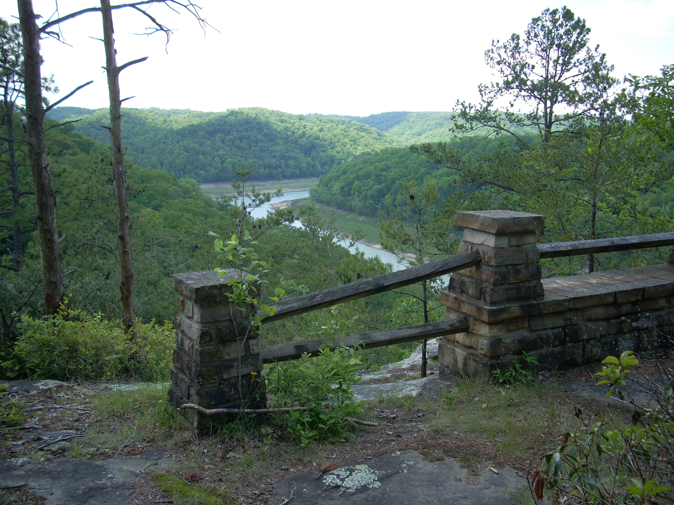
top the trail kind of meanders around and there’s a series of stone and wood
fences which, in themselves, are nice to look at. They offer great views
of the
It was quite amazing the difference between what the river looked like in the Falcon Guide picture and what it looks like now with all the work being done on the dam. The river is supposedly 1/3 lower than normal or something like that but it looks more like ½ here.
After taking quite a while to enjoy the view, I returned
down to the campground road.. You don't have to do this. You could
make the trip shorter if you want by continuing on Scuttlehole Trail until it ends
at KY3497 (the road you'll have come in on). Once there you can take take a
left on the road and follow it back to your car (assuming you parked where I
did).
Anyway, for me I hiked back
down to the campground road and then took a left. In doing so I
passed a large parking lot
with a boat ramp. This is the point of the London Dock Marina near the confluence of the rivers
- Cumberland and Rockcastle. From here the campground road becomes KY3497
and I followed this for about ¼ mile until I reached the next trail turnoff.
There was supposed to be a sign for it but it had the looks of having been
vandalized. The post was there, you see, but not the sign. This is
the Lakeside South Trail
(#412) and it descends to the bank of the
In a couple miles or so you’ll
come to
Anyway, a couple miles further you'll come to the Twin Branch Shelter which is a 3 sided structure for backpackers. It looked to have an outhouse as well. After this, the trail curves back up to the road again (becoming Twin Branch Trail at some point along the way) and at one point you'll pass a really pleasant spot which might have a little trickling waterfall. Even though I was getting pretty tired here, I did stop for a while to enjoy the sights and sounds of the spot.
The last part of the trail
is an ascent back up to the road and you’ll emerge from the trail on the other
side of the road from you car – almost directly across. The car that was
there when I arrived was gone. Considering the state of the trail and the
lack of footprint evidence, it seemed to me that we might have been the only
hikers to have explored the trail so far this year. This was quite a nice
little adventure!
DIRECTIONS:
Take exit 38 of I75 and turn
right at the end of the ramp onto KY192. Then turn left at the fork about
15 miles down onto KY1193. Shortly after that curve right on KY3497 and
about 4 miles down you’ll see an unpaved spot in a grassy/meadow area before it
gives way to the woods. Be on a sharp lookout though for the sign.