Raven Run Nature Sanctuary
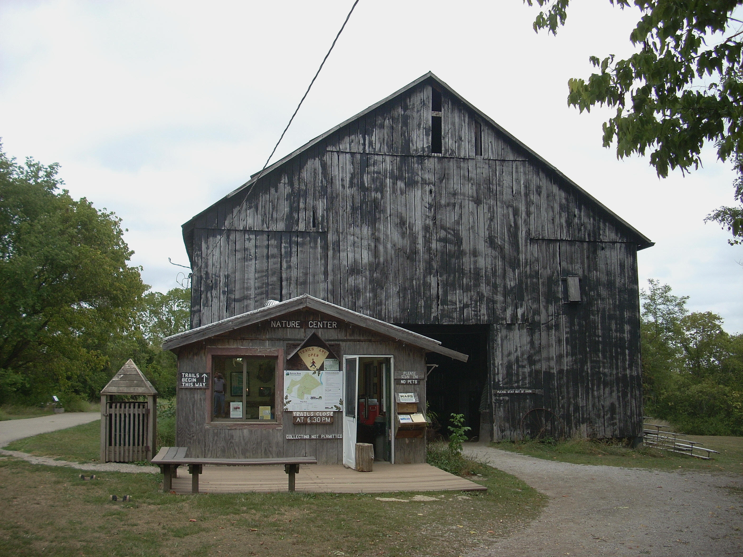
[Update: Since I wrote this journal they've built a new nature center and the paths are now accessible from behind it. It's nice and modern but I'll miss the way things used to look below.]
Raven Run is
only about ½ hour south of
The paths have an interesting structure. I’ll totally oversimplify it but, in general, there’s a large circle around a pair of "lassoes" (or lollipop loops) in the middle of the circle. One of these lassoes angles to the right and one to the left. The circle is the known simply as the Red Trail. It runs 4 miles in length and passes through forested areas. The lassoes (or Green Trails) wind around on paths that have been mown through meadowland. Next are the Blue Trails that connect both of the former paths at several points, almost like the spokes in a bicycle wheel. They can help you can make your hike as long or short as you like while still being able to explore different environments. Lastly are the Yellow Trails (the markers of which are so bleached by the sun they often look white). These split off and away from the Red Trail circle to take you to different points of interest which including a waterfall, a grist mill and a Kentucky River overlook.
And - if all
that weren’t enough, there are 2 more separate pathways: another system of
meadow trails off the west side of the parking lot leading to the Prather
homestead (built in the late 1700’s), and the Freedom Trail which has a
fantastic name because it’s paved to allow for wheel chair access.
It’s kind of steep though... If you’re in a
wheelchair, you might want to come out with someone else to assist unless you've
got brute strength to spare. To access to the main trail system you'll
need to follow the signs to the
Once
on your way you'll follow the signs to reach the barn where the old nature center
used to be (seen in the picture above), This is essentially where you'll
begin. You can go straight to reach the meadow trails or you can go right or left to start on the red trail
loop. Going left will take you past the gravesite of
Archibald Moore, an old homesteader in the area. Going right will
take you to the river overlook about a mile down the path. I
went left. You might notice that quite a bit of underbrush has
been cut down. As of this writing they’d apparently been trying to prevent invasive
species of plant life from taking over.
The first trail
junction you’ll come to if you go this way is for a blue trail (the only blue
trail I noticed which did not link up with a green meadow trail).
This is an inner loop which will eventually merge back up with this red
trail further on. If you go just 30 steps
down this path you'll see the
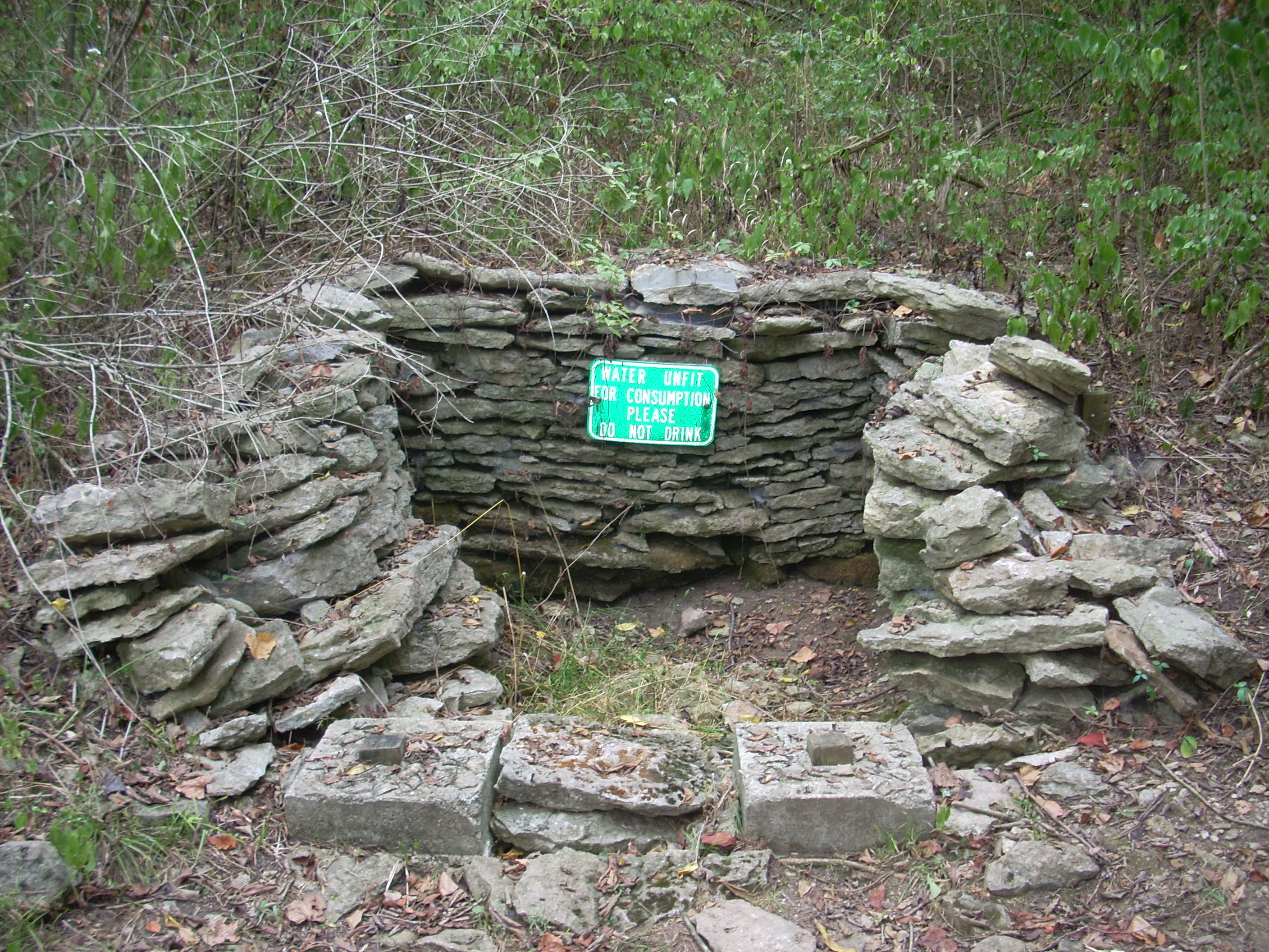
This particular
time I doubled back to the red trail after seeing the spring.
You’ll start to notice markers put up alongside some of the trees if you go this
way. These tell you what kinds of trees they are.
The first one I noticed was for a Black Walnut I believe.
There will be several more of these signs.
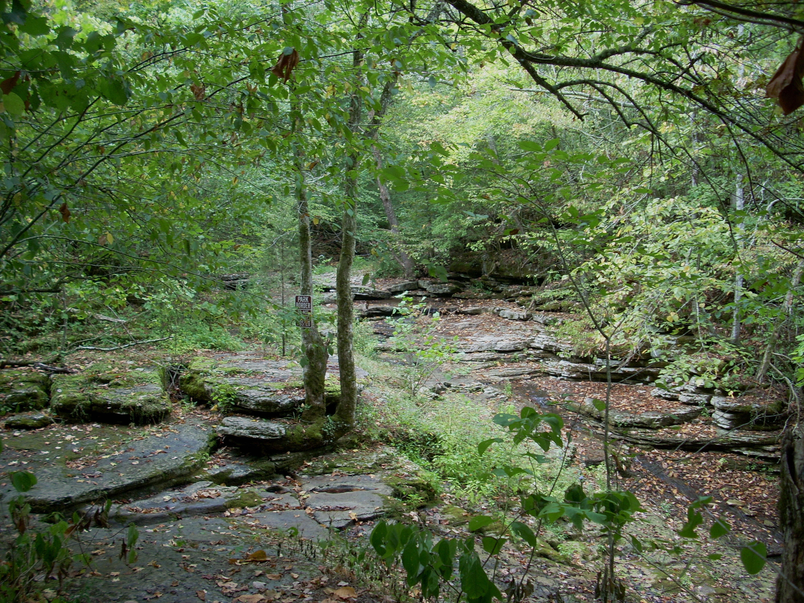
I presently came to a wooden bridge over a creek. This is the south fork of Raven Run and this particular crossing is an especially lush place in the springtime. I often stop here and just listen to the water trickle down while taking in the scenery. It’s a fantastic place to relax!
.jpg)
From here
you'll soon meet with the spot where the aforementioned
blue trail merges with yours. And, as you begin a climb, you’ll also start
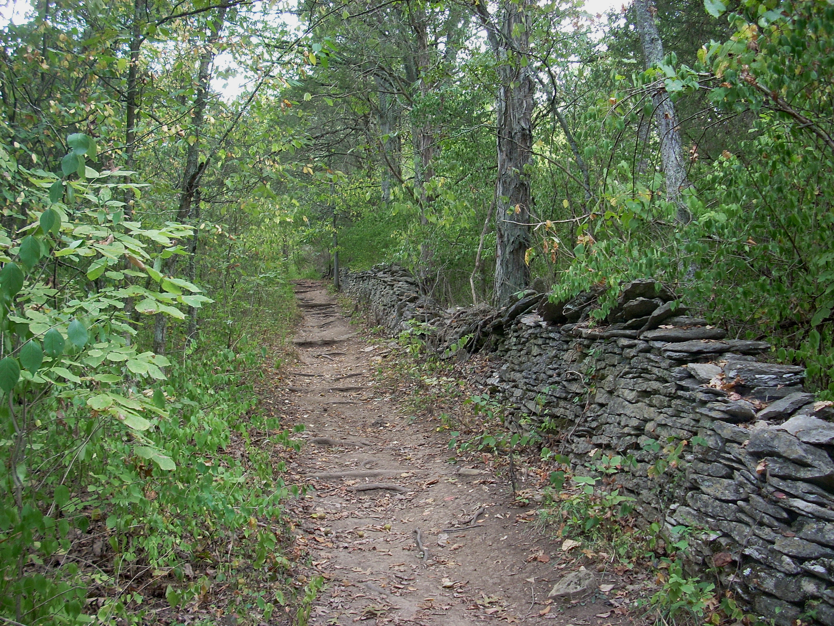
to notice some
stone fences. These are amazing and they’re visible for long
periods. These were used to divide property lines and the
stones which were used in their construction usually came from the tilling of
the farm fields according to the history pamphlet provided at the
At the top of the climb some meadowland will become visible off to your left and there will be access to this at the next trail junction. You can continue straight on the red trail or break off and follow this (about a mile) loop through the meadow. The first half will be wide open to offer nice views of the surrounding countryside. The second half will be alternatively made up of forest and meadow as you wind under clearings for some power lines. These power lines will become familiar. Just following the red trail will take you under them 4 times. This loop adds the 2 more.
Getting back to
the red trail and continuing, there was once a connecting blue trail which cut
off part of the red. It used to come in on the right but it’s
no longer open. From here you’ll make an “S” in which you’ll
cross under the power lines again on a curve left and then emerge on a forested
ridgeline after the right curve. Presently another trail
junction will enter the picture. This is a yellow trail
(looks white) which takes you down to a waterfall on the south fork of Raven
Run. This is a little out and back jaunt with a moderate descent
down the side of a ravine.
Climbing back
up to the red trail, you’ll wind back into this same ravine created by the south
fork along its ridgeline. The trail will follow back on one
side of the ridgeline, cross the stream over another wooden bridge and then come
back out along the other side, passing another spring (the Wayside) on the way.
Just after crossing the stream there’s another blue trail which will go
right (where the red goes left) which will take you back up to the green meadow trail system.
Before heading back up, however, it will follow the south fork for a little
while to offer some more lush views amid the sounds of trickling water - although not today.
It had been pretty dry.
As you come out
of the ravine and pass under the power lines again, you'll find yet another blue trail
which heads back to the meadows. Soon after this, you'll find another yellow loop which
will take you down to the Evans Grist Mill. I don't think this
should be missed. It's one of my favorite spots in the sanctuary. There’s
a marker alongside the mill which describes how it used to work and you can even see part of it at
the bottom of a wooden overlook.
Also of interest here is that there was once a dam at the convergence of the Raven Run forks just upstream from where you'll be standing at this point. The ditch behind you is what fed into and powered the mill. Furthermore, a road used to come down to this spot across from you and just upstream. It’s no longer visible, but people would drive down this road to have their wares milled. Incidentally, the spot where the forks converge is a beautiful place to relax for a while!
Climbing back
up to the red trail, you’ll cross under the power lines one last time (another
blue trail comes in) and afterwards you'll begin to follow along the southern ridgeline of
the fully converged Raven Run. I passed a deer in here that
was not bothered by me at all. It just kept munching away on
its green lunch!
There are 3
more blue trails before reaching the overlook and another yellow trail which
heads down toward the stream. This used to be one of my
favorite places to hike in the sanctuary. It’s
apparently been permanently closed now though, and is blocked off by wood
fences. A sign indicated that this was done in the interests
of preservation and safety. The only part of this trail that
does remain now serves, more or less, as a shortcut for the red trail.
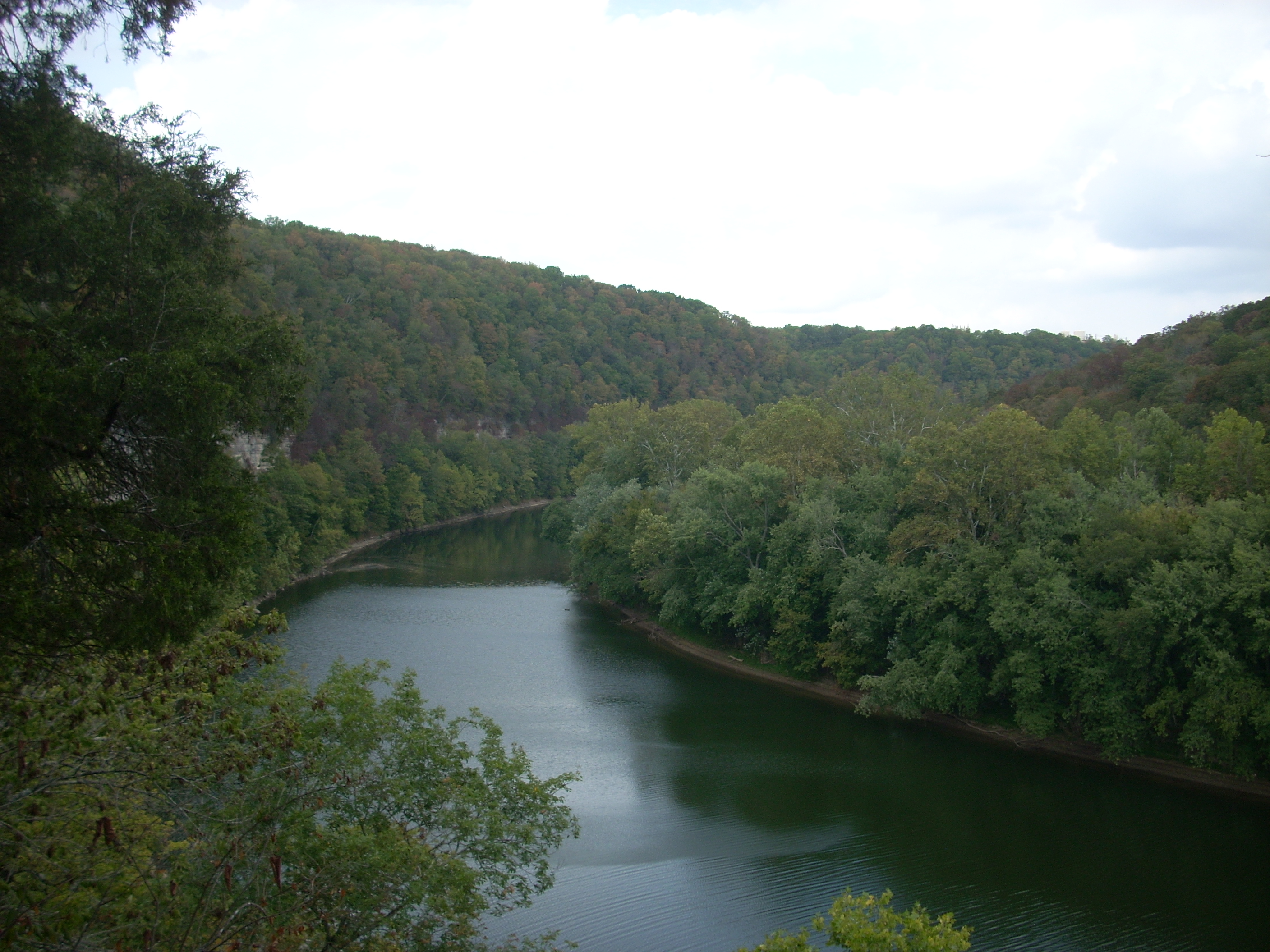
The overlook is
soon to come. You’ll reach this after a very short out and
back at the next trail junction. It’s a nice spot over the
You’ll climb a
wooden staircase on your way back up and I noticed a new little stairway made
out of rocks here. Nice addition!
At the next convergence you can go right onto another blue trail or go
left to continue on the red. I opted for the latter option to follow along the
Chandler Creek, which was dry today although you’ll cross some bridges over it.
Most of these are fairly new and are quite well done.
More stone fences will soon become visible as well.
The last convergence is a very small loop which will take you back to the lime kiln. You should see this.
.jpg)
Once you’ve made this little loop you’ll head back up out of the ravine on a steady but fairly easy slope. Most of it follows right alongside one of the stone fences all the way back. The fence will be on your right, you’ll cross through it, and then it’ll be on your left. :)
At the end
you’ll see the spot you first entered directly across from you.
From here you can explore the meadow trail system, check out the Prather
homestead, or whatever you like.
I went to look
at the Prather house. I’m really glad they preserved this.
There’s also a little cemetery next to it and another labyrinth of meadow
trails. Raven Run has a lot to offer!
DIRECTIONS:
This is off
Jacks Creek Pike. The nearest town is Spears which you can
look up on an online map site and drill down on to see this road.
After the intersection of Jacks Creek and