Pine
Laurel Cove Trail to
Chained Rock Overlook
I’m extremely conscientious of how I act toward others on the road, yet on every one of these drives the Lord seems to feel the need to remind me again of what I think he wants me to do – assist in de-stressing people. On every drive I seem to have a string of ridiculous encounters with other drivers who are either too obsessed with reaching their destination as quickly as possible or who are too stressed out to realize or care how their actions affect others on the road. I understand that I've been put on this earth to be a peacemaker. I just wish I wasn't so sensitive to the contempt which seems to follow me.
I hesitate to
mention it, but this was not the trip that I’d at first intended for today.
In fact, as I do mention it, I’m a little embarrassed!
This trip wouldn’t play “second fiddle” to any I’ve ever done!
It’s one sweetheart of a hike! In fact, this entire
location is pretty amazing. There’s a really unique
amphitheater to check out, an endearing little creek to walk up and through and
an outstanding vista as impressive as any I’ve ever seen.
Originally,
though, I was headed out to the
I always bring
a trail guidebook with me on trips that I’ve not done before, and in this
particular case I’d brought the Falcon Guide to Hiking Kentucky.
Thank you to author Michael Brown! A new version of this book
has since been released by a different author, but there it was on page 96
of my version - The Chained Rock hike at Pine Mountain State Park in
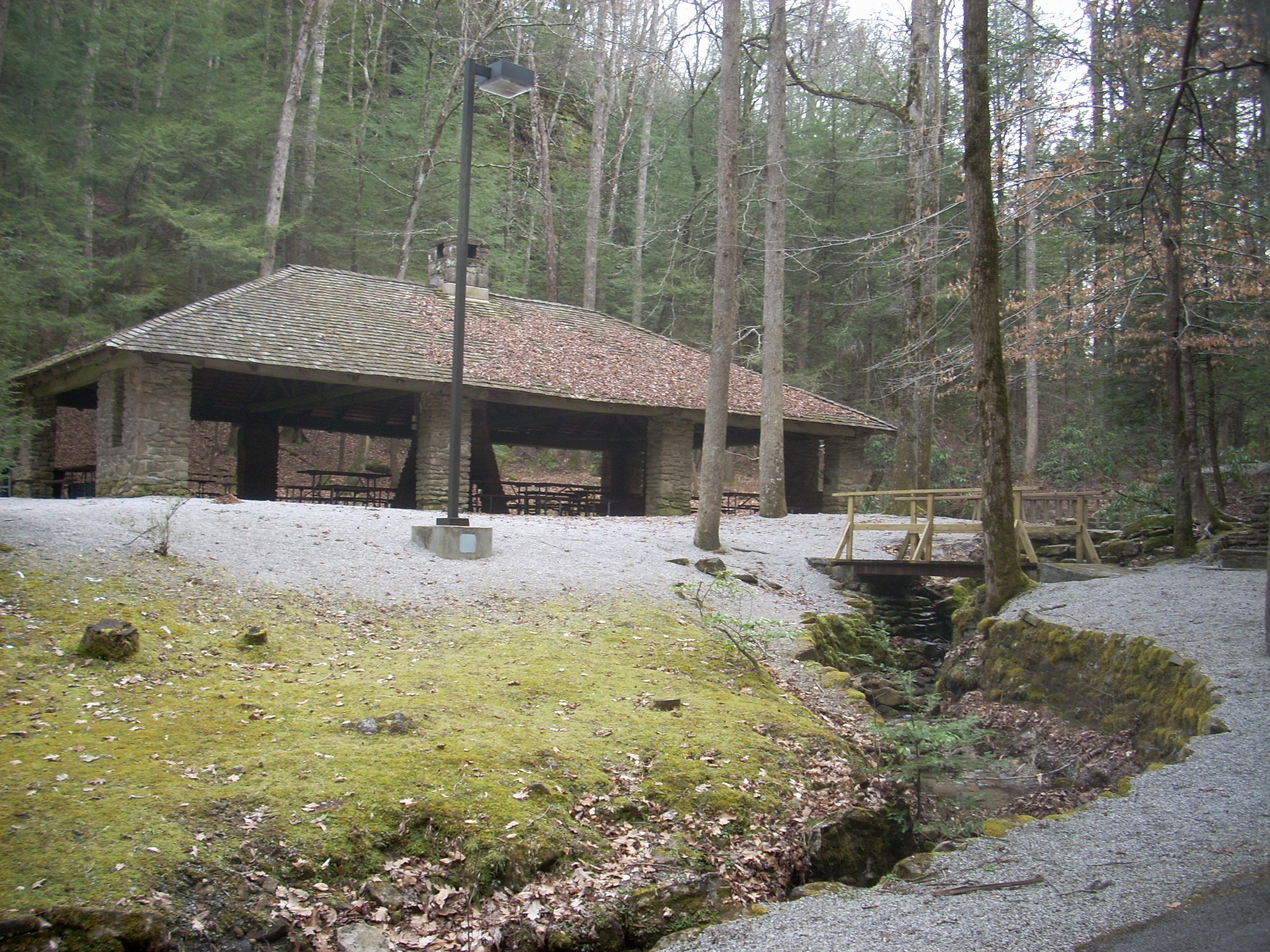
Although clearly a very popular place with an outdoor amphitheater and pavilion just ahead, on this particular day there was no one around and I began my hike by walking back down the road from where I parked to get a better look at the cabin.
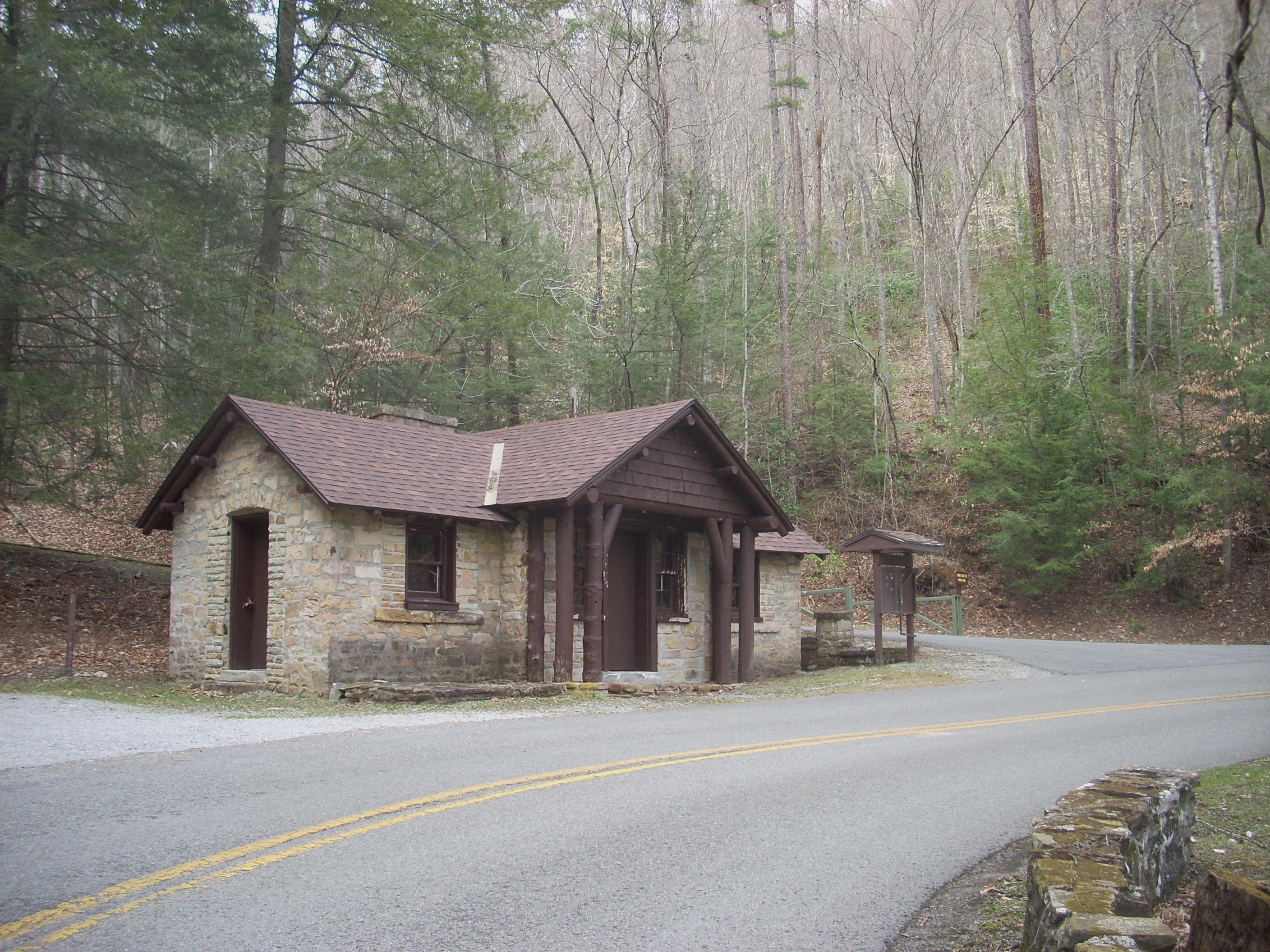
Once there I noticed
another trail heading uphill on some mossy steps (the Azalea Trail), and since a
sign indicated that it was only .5 miles long I decided to get this one in too.
What it did was wind up a hill on one side of a ravine and
then it essentially sent me back the way I’d come, overlooking the road I’d just
walked. I soon passed by a rock face followed by a descent
to the back side of the pavilion, and from this point I continued forward to
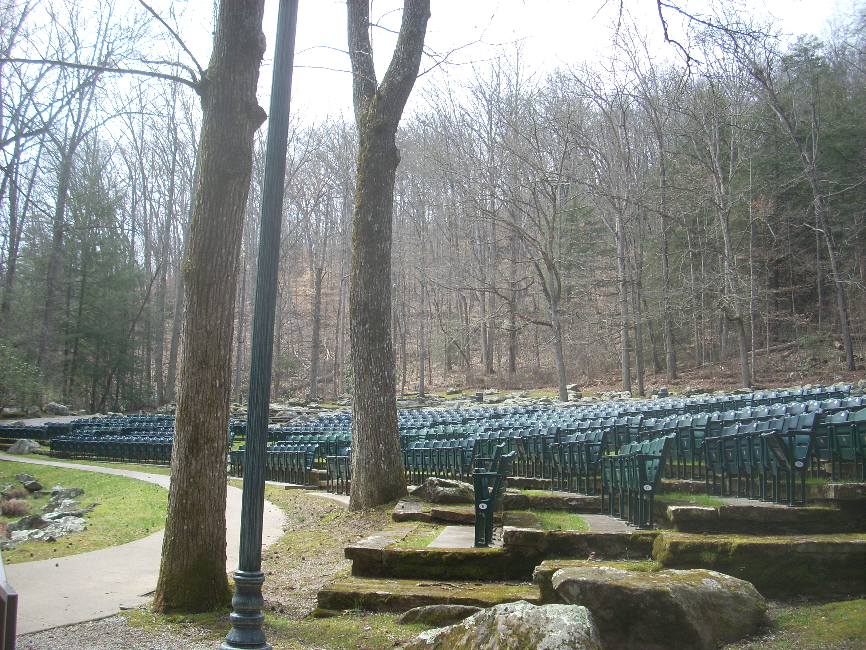
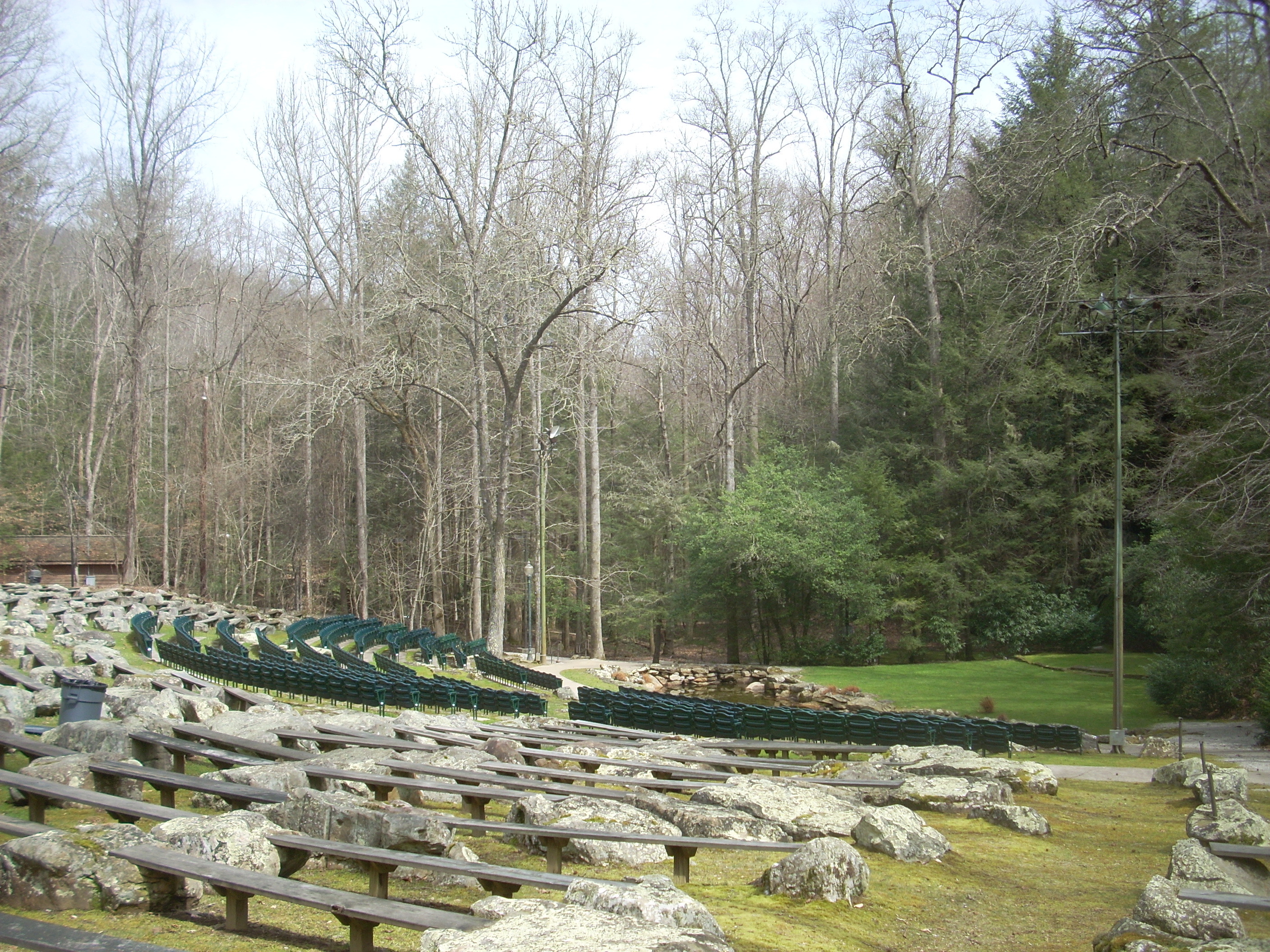
check out the amphitheater.
This one’s unique – an incredibly picturesque location. The stage, in fact, is a bed of moss and grass! As I look at the pictures I took now, though, I’m a bit disappointed. None of them, in my eyes, do it justice! I’ve decided to put up 2, but it really begs to be seen rather than just be pictured! After viewing this, I headed back to the Laurel Cove trailhead for the main part of the hike (I had effectively done a complete 360 by this point).
You can’t
really miss the start of Laurel Cove Trail. There’s a large sign with a picture
of a black bear on it! The path begins on a steady zig-zag
climb up
Anyway, you’ll
zig, then zag, then zig again to wind up at the stone arch which just about
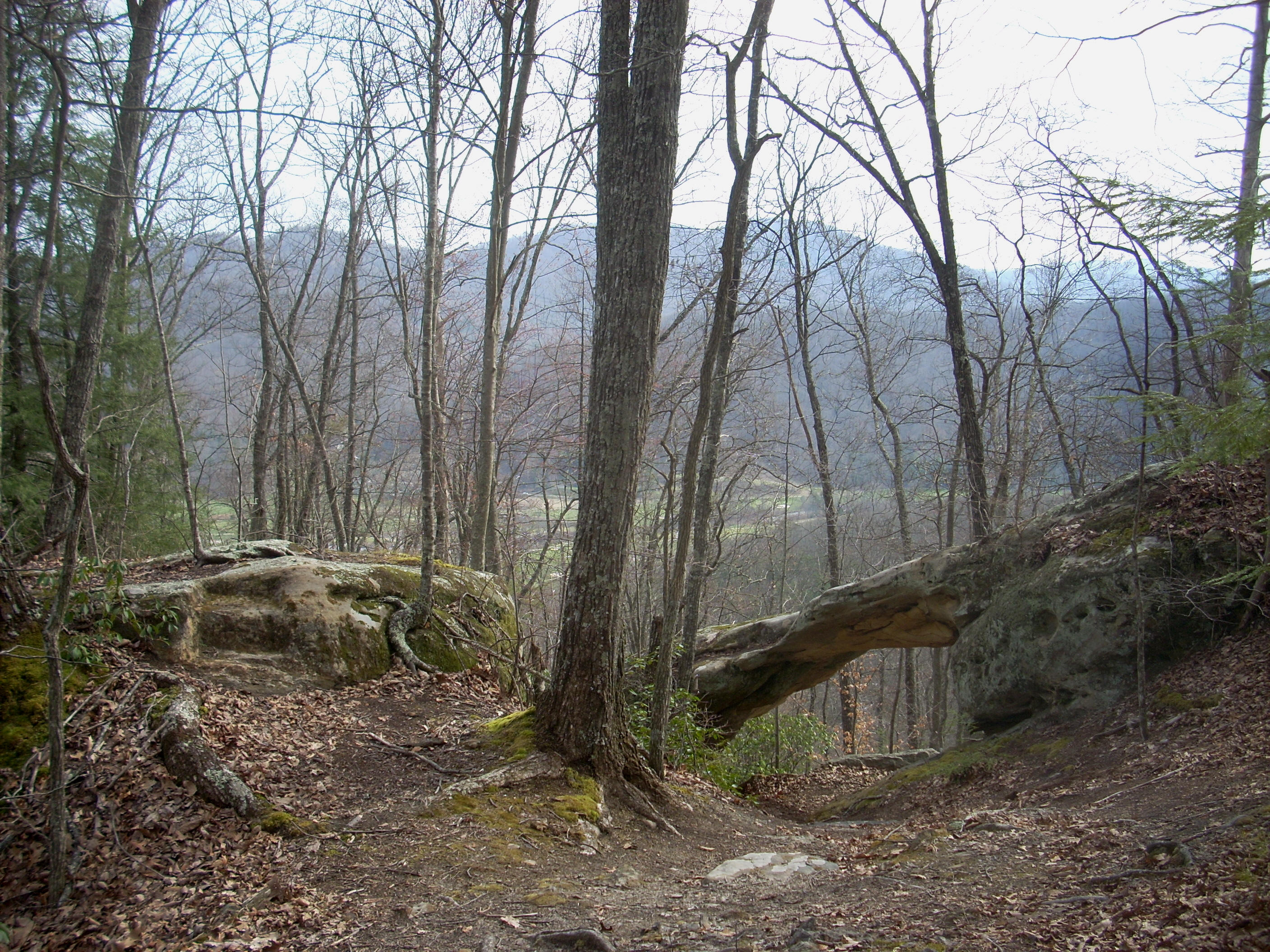
marks the half way point. For most of this section I was in
the midst of what I’d call a
“sparse-for-this-time-of-year-due-to-lack-of-foliage” woods, although you’ll
come close to a stream just at the “zag” which is a bit more lush with pines (I
think this steam is the one which eventually runs through the parking area
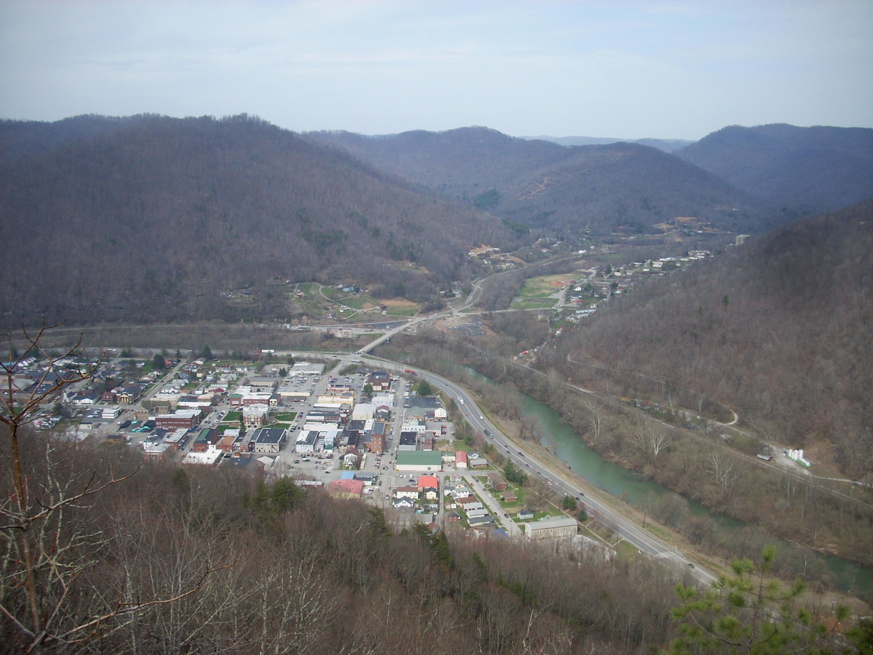
below). All this time you’ll get some great views below, and
while it was obvious that I might get an even better vista ahead I kept taking
pictures just in case. Bottom line: the
views are great, but there will be clearer and more far reaching ones ahead.
Soon I arrived at what I’ll now call the Half Way Arch over the trail. The picture below was shot looking back at it and this is a quite a spot in and of itself! I stayed a while.
That marked about the half way point in the trail. I’d say the next ¼ or so was along a nice little streambed, and this was so picturesque that I ended up taking a ton of shots. I'll post what I think is the best one.
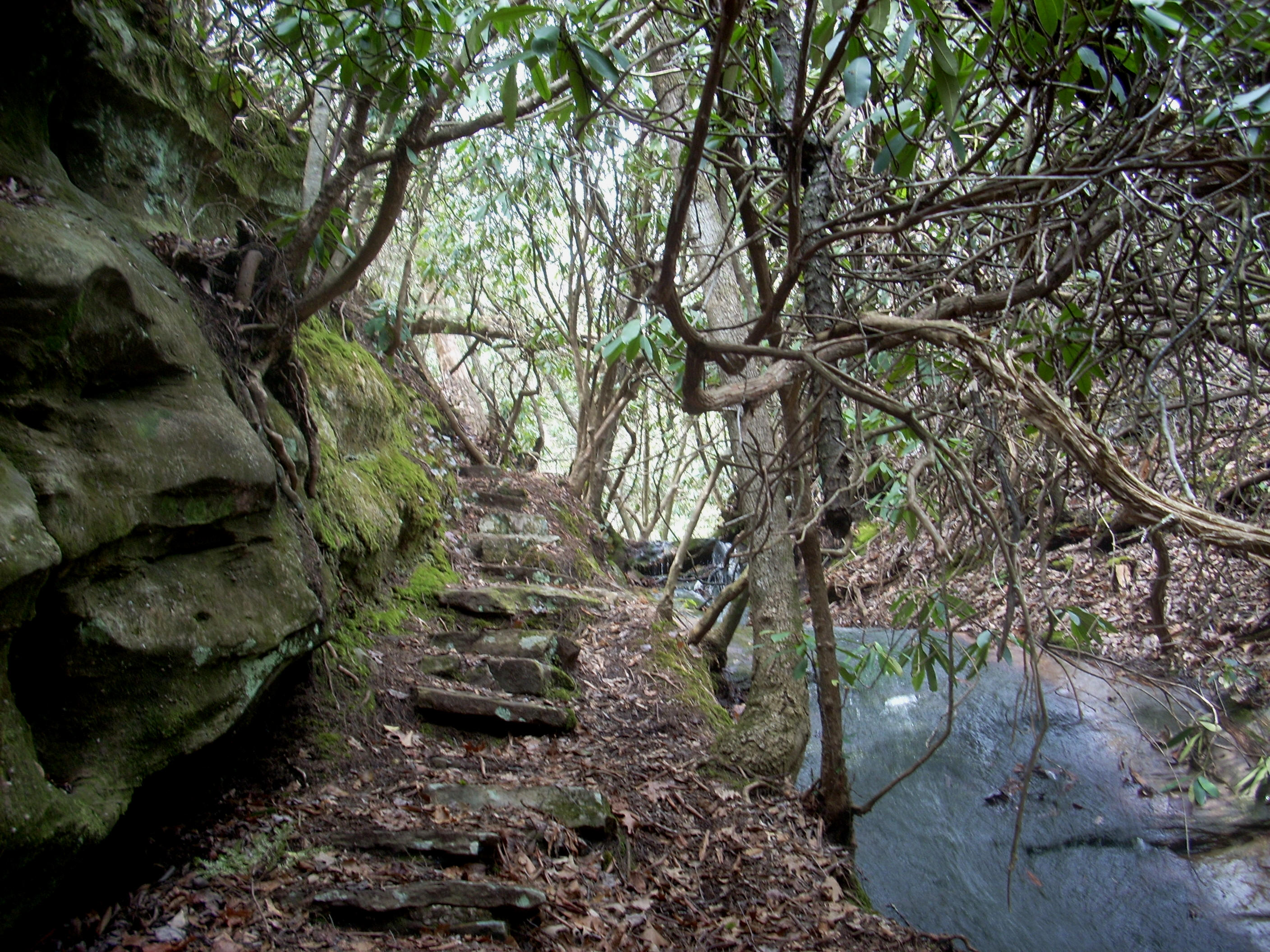
There’s one
point at which you’ll cross over the stream, and if it isn’t dry you’ll really
have to watch your step on the moss covered rocks. On
the other side there will be a trail junction and if you follow this to the left it
will deposit you on top a huge rock outcrop with some nice vistas.
I’d check this spot out, but the main trail will continue to the right
and pass through an area that surely seems like a larger version of one of those
little relaxation/meditation fountains that you can buy.
Presently
you’ll pass through a rocky area along the streambed (they’ve done a great job
with stone steps out here!), and then launch into the last ¼ of the trail as it
passes through more of the “sparse-for-this-time-of-year-due-to-lack-of-foliage” forest along the top of
this mountain. With the altitude, of course, the vistas just
keep getting better and better.
Immediately before reaching Chained Rock you’ll reach a junction with another trail (the shorter version of this hike that I mentioned before). From here you’ll make a right turn, to wind down and around this huge boulder on a very slight grade along some stairways. The incredible vistas will come up very quickly. All of a sudden – BOOM!
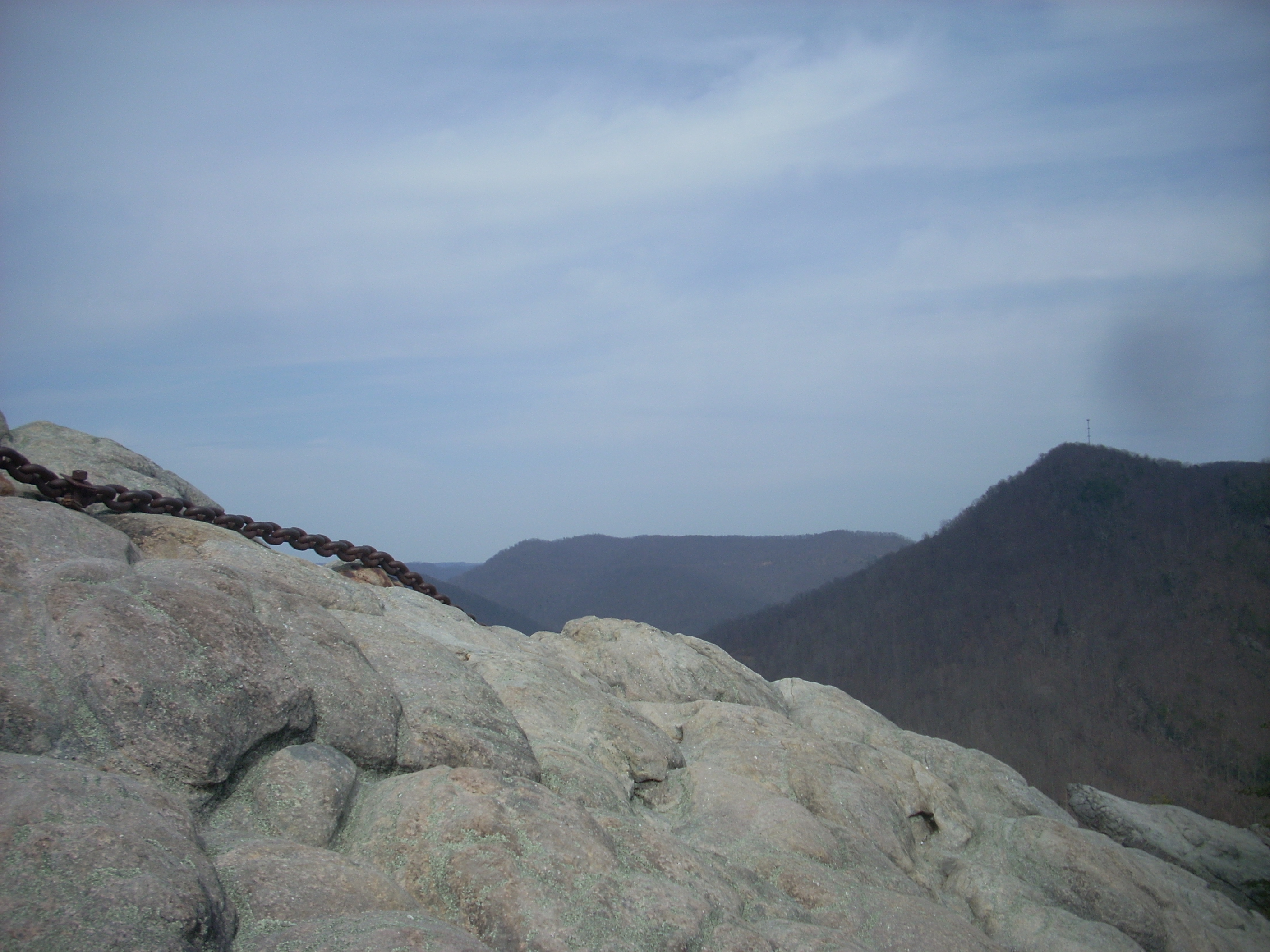
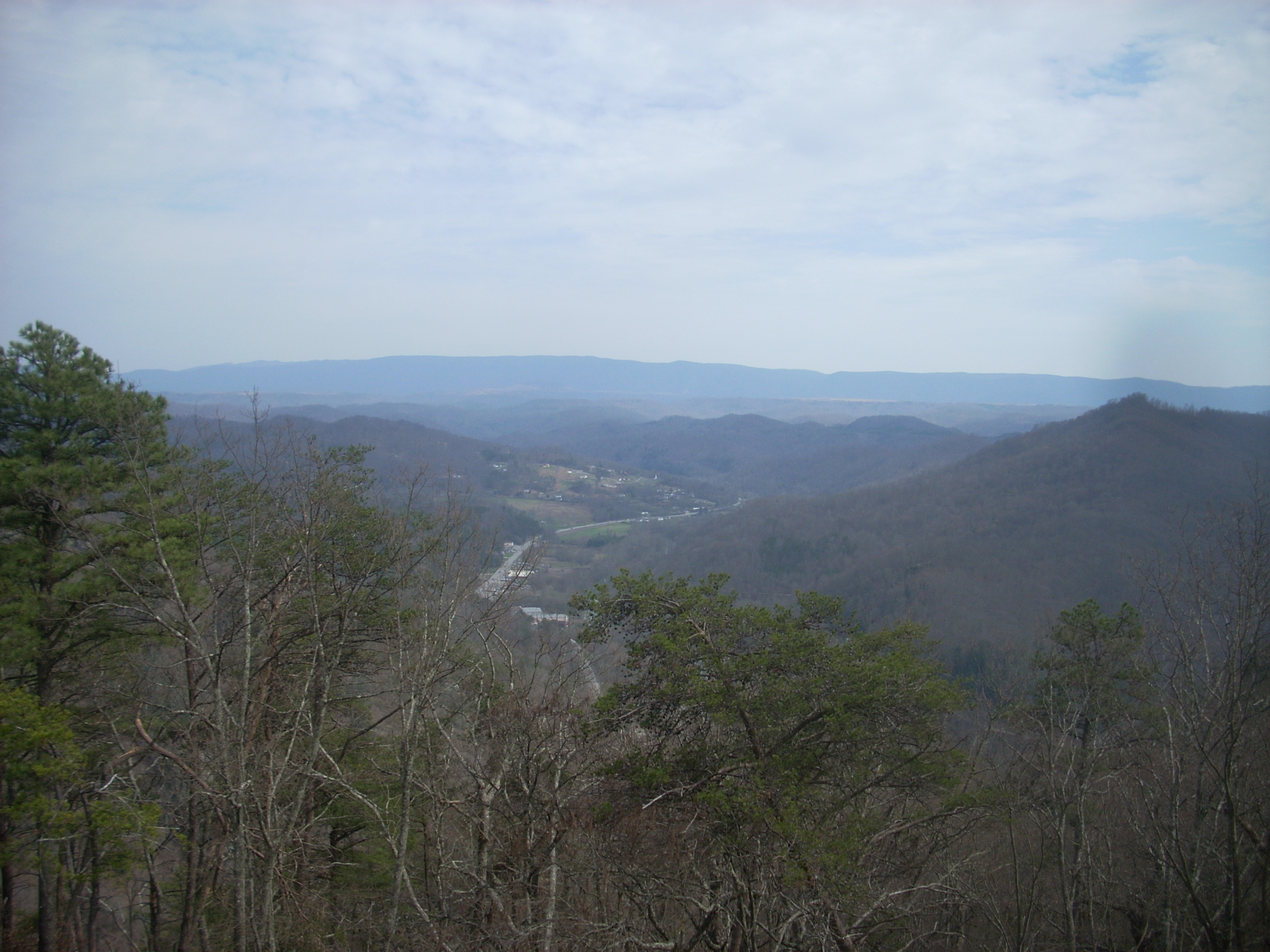
Once again, I thought I’d gotten some great pictures, yet none of them seemed to come close to capturing how stunning this place is. For example, I tried to get a picture looking down the chain as I stood somewhat precariously atop the rock – yet I’d swear the pictures were swapped out for worse ones – really! Above and below are what I consider to be the best of the lot.

Try as I might,
I could not tear myself away from this area. I must have
stayed a good 20-30 minutes before feeling compelled to move on.
I never stay too long because I know that someone might come by who wants
to enjoy the area in private as I have. I took my time
heading back down the path to my car though, as I tried to let the experience
fully sink in and envelop me. What a great experience!
DIRECTIONS:
The entrance to
the park is right off US25 East just south of