Pilot Knob
If you live near Lexington, Kentucky (or are just visiting) and you have about 3 hours including driving time to spare, then this is definitely one place to check out. Getting to the top and back takes only about an hour and the view is spectacular. In fact it’s so good in the fall that when you get to the top you’ll be treated to a panoramic view of rolling hills and trees which appear as a sea of little, multicolored cotton balls!
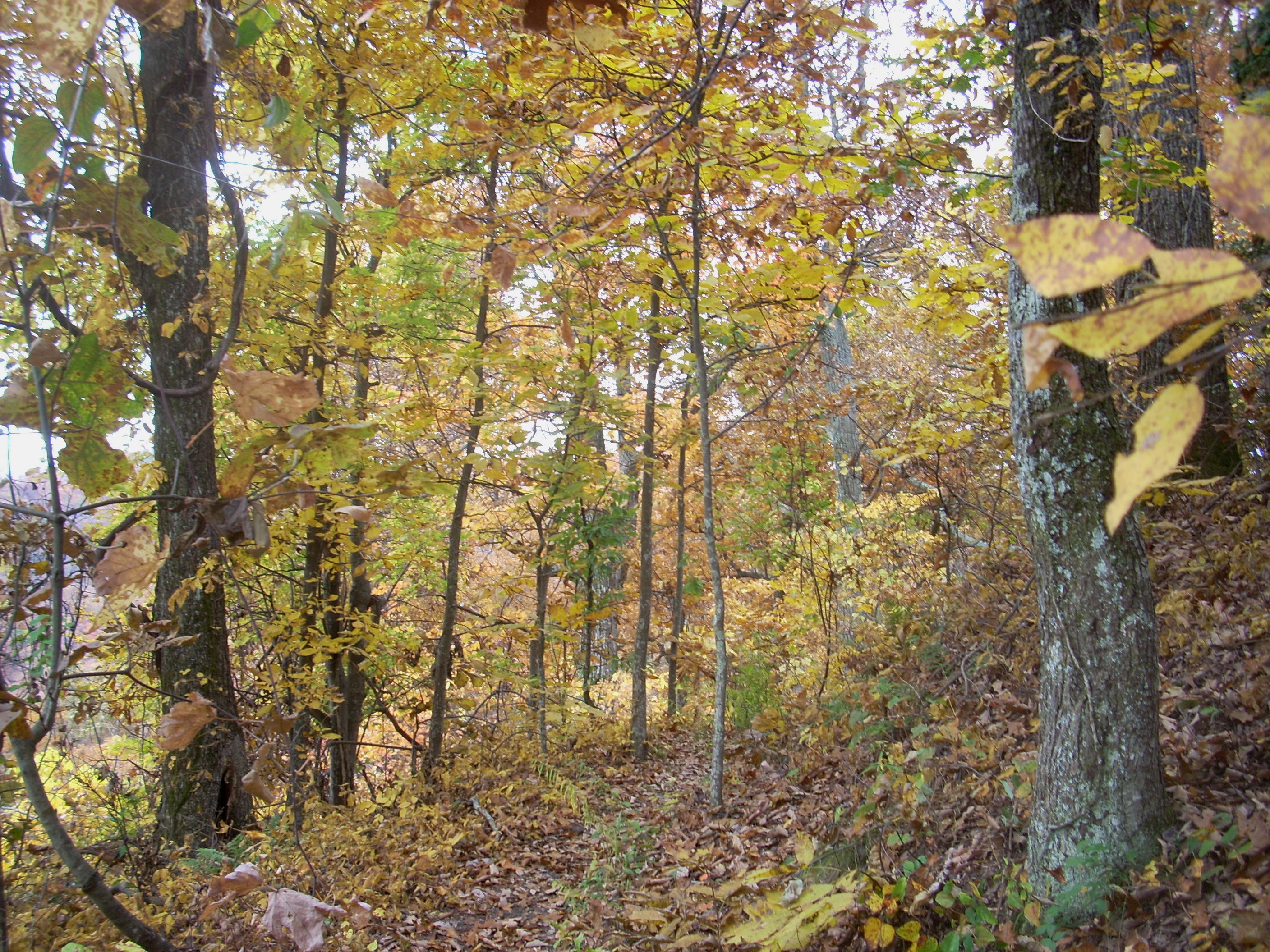
There are actually 3 separate hiking options out here which I’ll oversimplify by describing them as being at different elevations on this little mountain. The first is what I’ll call the high level trail. This one will take you up to the top of the mountain itself and it's named after a man named Oscar Geralds Jr. Mr. Geralds was apparently a key figure in preventing the dammed flooding of the Red River Gorge back in the 1960’s. This high level hike is the mot popular here. It’s a well-beaten, easy path to follow and it takes the very general shape of a question mark. Once you hit the base of the knob ¾ of the way up you’ll curve all the way around before ending at the top.
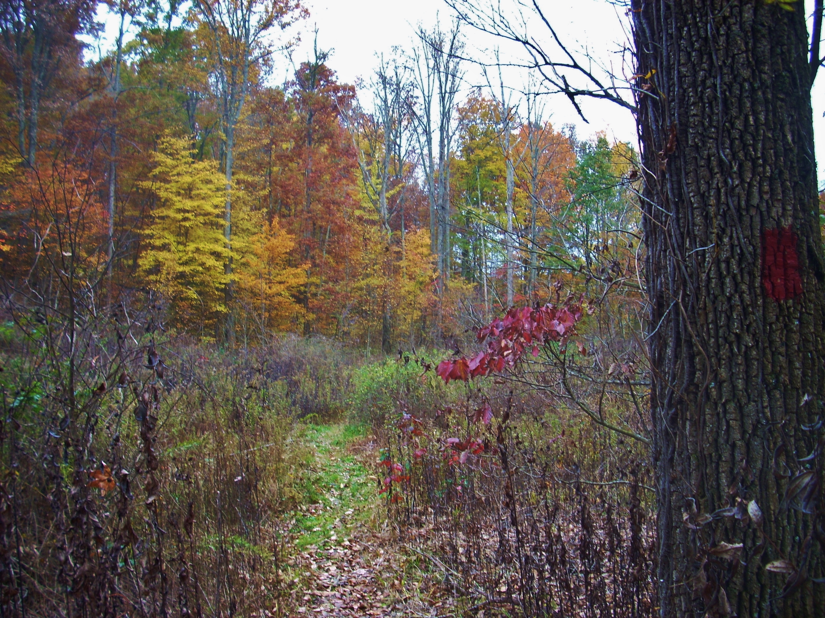
The second path is called the Sage Point Trail. This route is less traveled, but it is marked with red rectangles on the trees to assist you. Perhaps a little more than twice as long as the higher route, it comes in at about the mid-point in terms of height and it extends around the base of the knob. It catches backup with the main path at the end.up with the main path at the end.
The third path is at the bottom and it looks like it’s very seldom enjoyed, yet it’s also the most intriguing. It’s called the Millstone Quarry Trail and it takes you through a numbered sequence of old milling sites and quarry stones. The only problem (at least when I was there) wssthat it’s very hard to follow despite the fact that it’s also very shortvery short. It wss marked, it was just that the markings looked to be quite old and some must have been missing. I lost the path a couple times.ThThis trail takes the form of a “lollipop” loop.
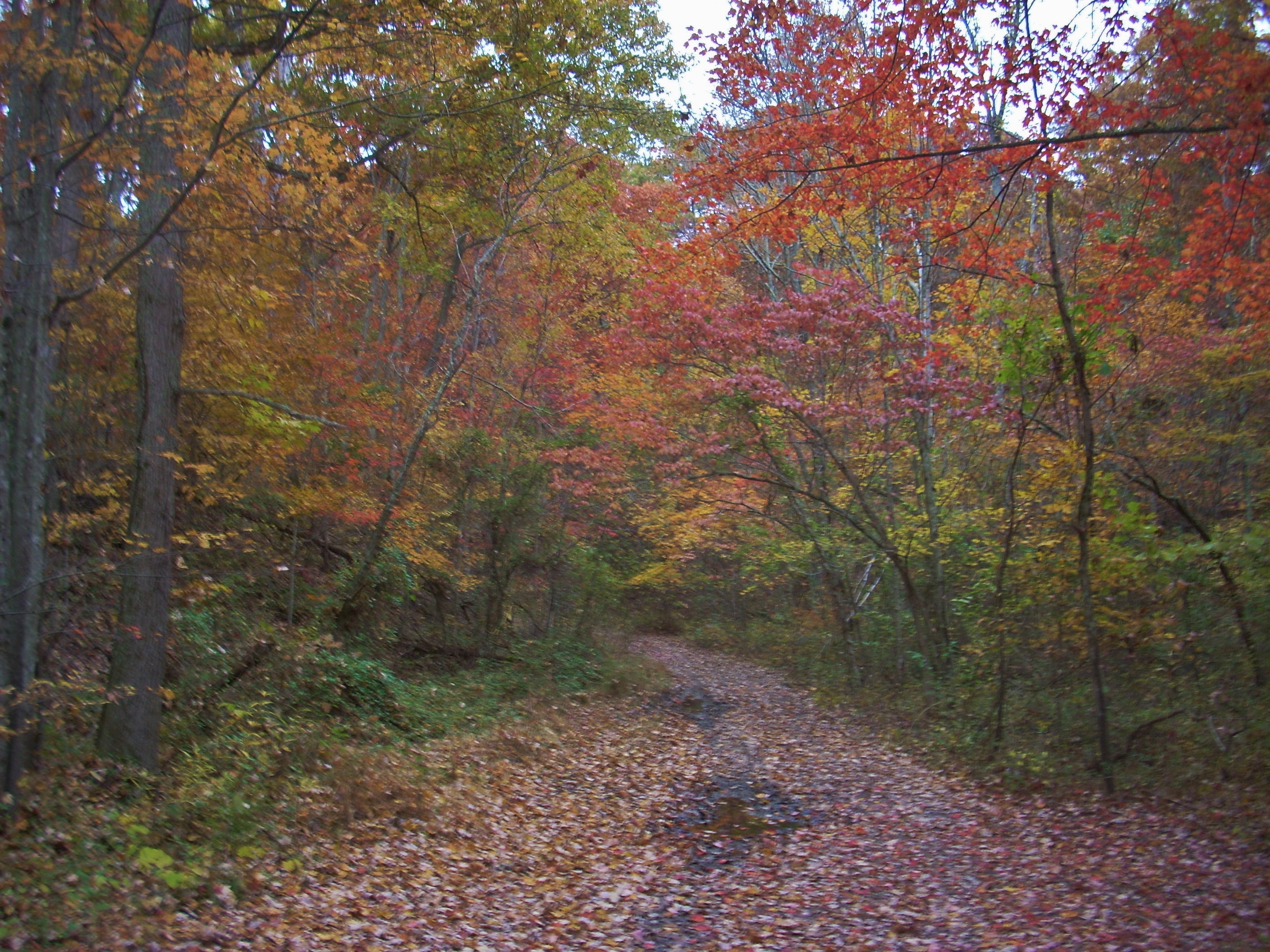
Anyway, full directions are below but hehe trail starts at the back of a parking circle. You’ll cross over a little creek bed to reach it and on the other side you’ll have to squeeze through what appears to be a series of steel posts. Soon after you’ll come to a little shelter where they sometimes have trail maps.
The entrance to the Quarry Trail comes up shortly. I would do this one last today thinking that since it was supposed to rain later that I might have a chance to get to the top first and then have the leaves on the other 2 more densely foliated paths to help shelter me. Such paths act as natural umbrellas for a time until the leaves become so saturated with water that it starts to drip off of them and the effect becomes lost.
Moving on, you’ll begin your climb in earnest. This section can be a bit of a quad buster as it’s the most difficult (moderate +, I’d say). You’ll know you’re almost done when you start to catch glimpses of the base of the rock ahead of you.

The first of 2 trail junctions for Sage Point comes into view once the trail levels out a bit and it’s between these that you’ll spot a little spring on your left. The bridge you’ll cross will pass over the little creek it forms. I should point out that it doesn’t appear to be a part of the recognized trail system, but there’s a steep climb up that I’ve known some people take here. I’ve not done it (in fact, it may be discouraged) but one time when I was out here at the top of the knob I heard some voices from just below. Turns out, it was some people who had climbed up this and were on another lookout point directly beneath me.
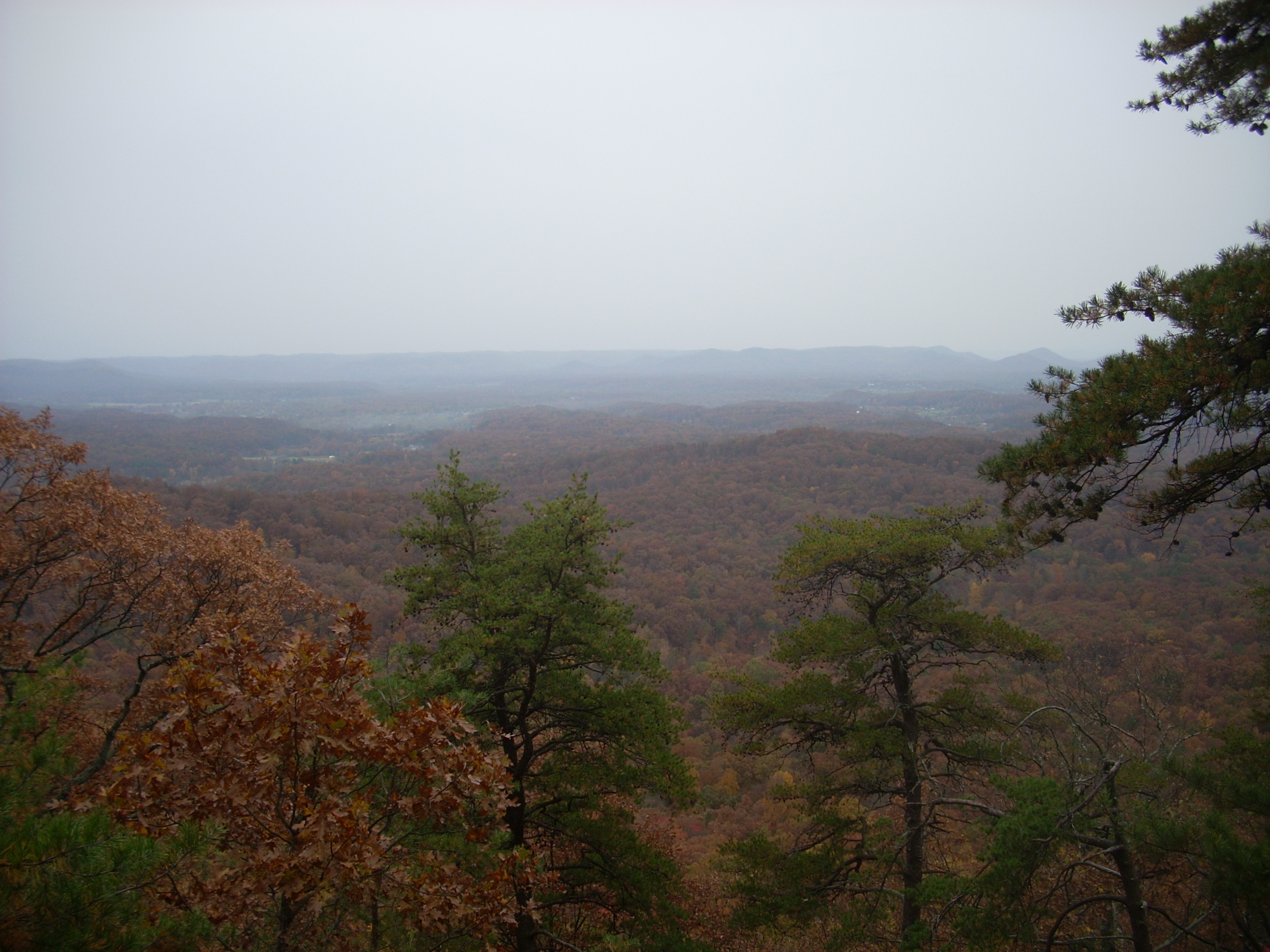
As you continue to wind your way around the mountain you’re certain to start noticing some interesting rock formations as well as some pretty amazing vistas around you. These are pretty sweet, but wait until you see what’s waiting for you at the top.
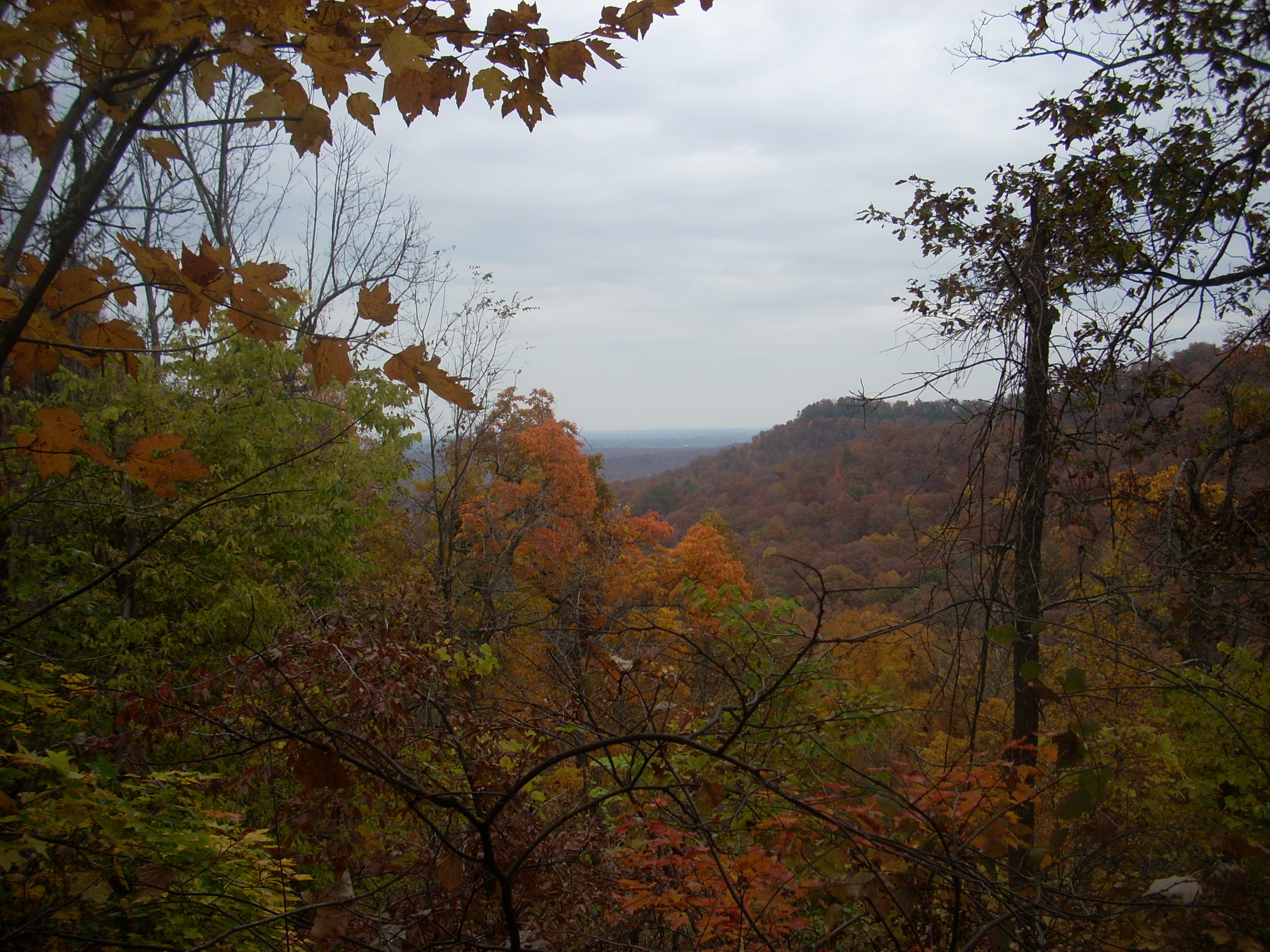
Once you’ve curved around and leveled off at the top there will be a rock formation directly in front of you. One of the vistas is located above this but there’s another (and in my opinion a more expansive one) if you keep following the trail as it curves right and goes past the rocks. Wait for it…
Wait for it…
BOOM!!!! How about that!
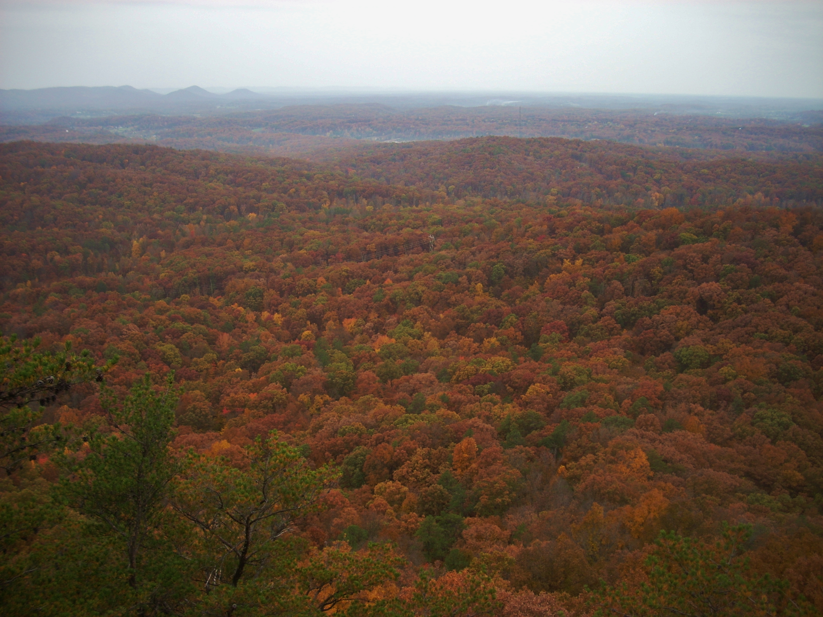
You’ve simply GOT to check out both vistas, too! You’ve worked pretty hard to get up here. Take a chance to fully enjoy it from as many different perspectives as you can get and breathe in that wonderful air as you catch a possible pine scent from the trees! This is absolutely one of my favorite spots in the state – and as you can see it's a perfectly stunning Halloween greeting card from Mother Nature in the fall! By the way, there’s a rock formation right here which forms a perfect seat to view all this. Believe me, you won’t want to leave here but you’ll eventually have to head back home! How well must Mr. Geralds have been thought of for people to have named this amazing trail after him!
stopped at the other lookout point for a few more minutes before taking my leave,end then moved on to check out the Sage Point Trail. I had explored this last year, and hlost the path at one point, but this year it was much better marked. I had no problems. As mentioned, this path sweeps out from the main trail in a wide arc and it’s a fairly level compared to the path just taken.
The first section of this arc will take you on a very pleasant stroll through the woods and you’ll eventually arrive on a gravel road. Follow this as you form an “S”, going maybe 100 yards and then look for the trail to branch off to the right over a small embankment (Follow the red rectangles – like the ones shown on the tree to the right of the picture below).
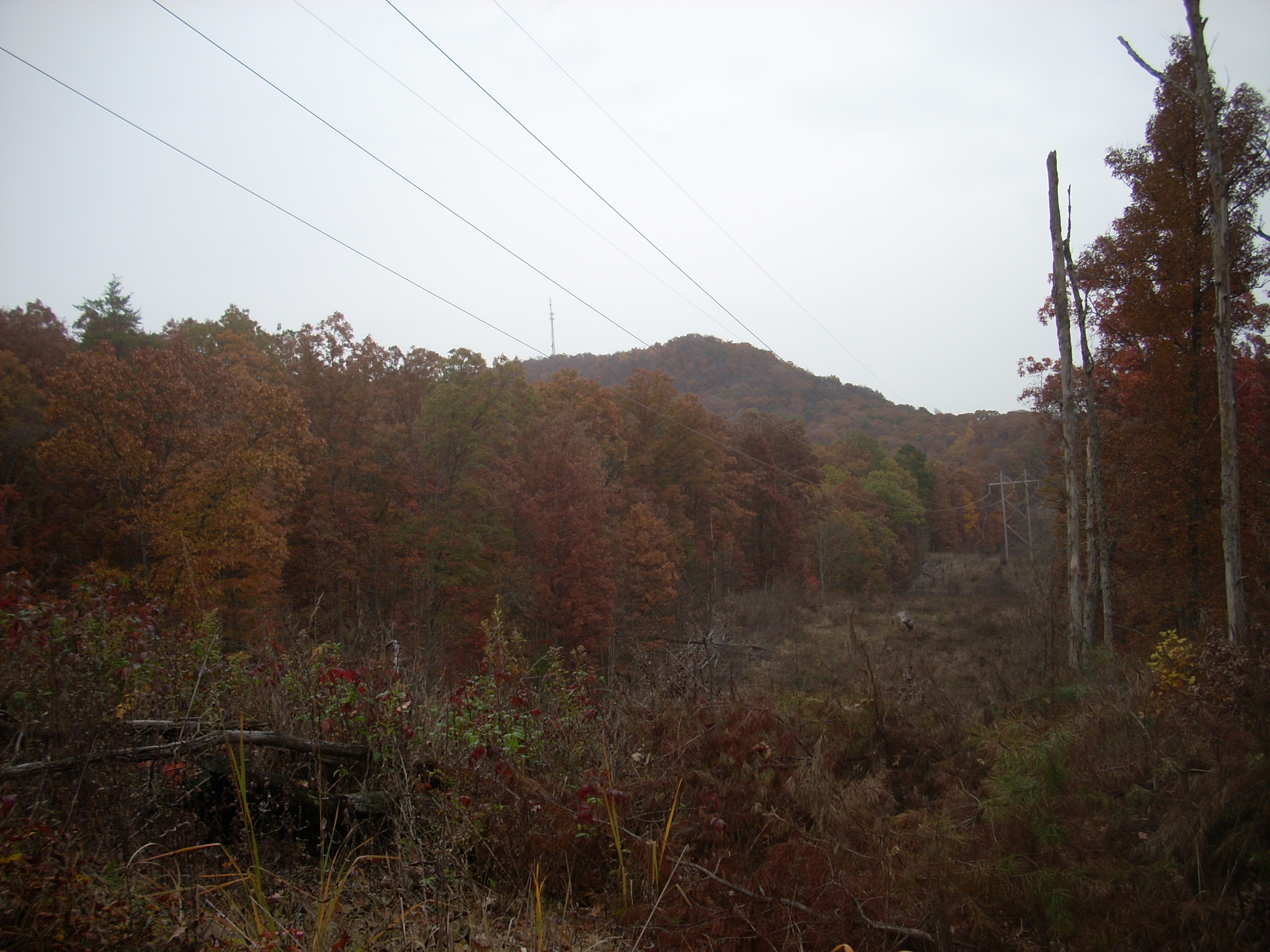
After another pleasant stroll you’ll pass through the first of 2 clearings formed from the process of making room for some power lines (first picture below). As you walk in this area you may notice that you’re treading on a bed of moss which, if you look at it closely, has the appearance of 100’s of tiny little ferns (second picture below). Upon realizing this I began to tread a lot more carefully!
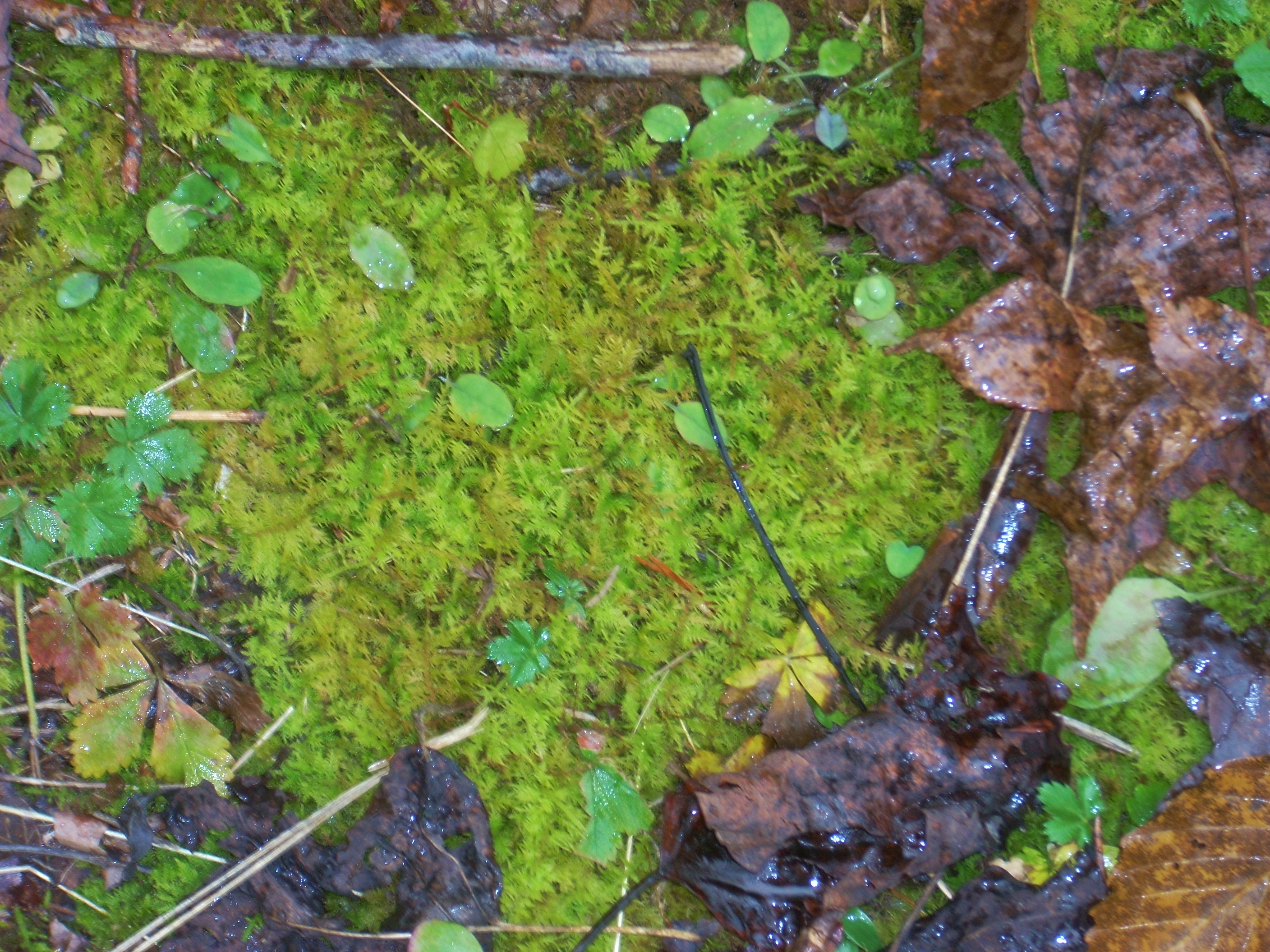
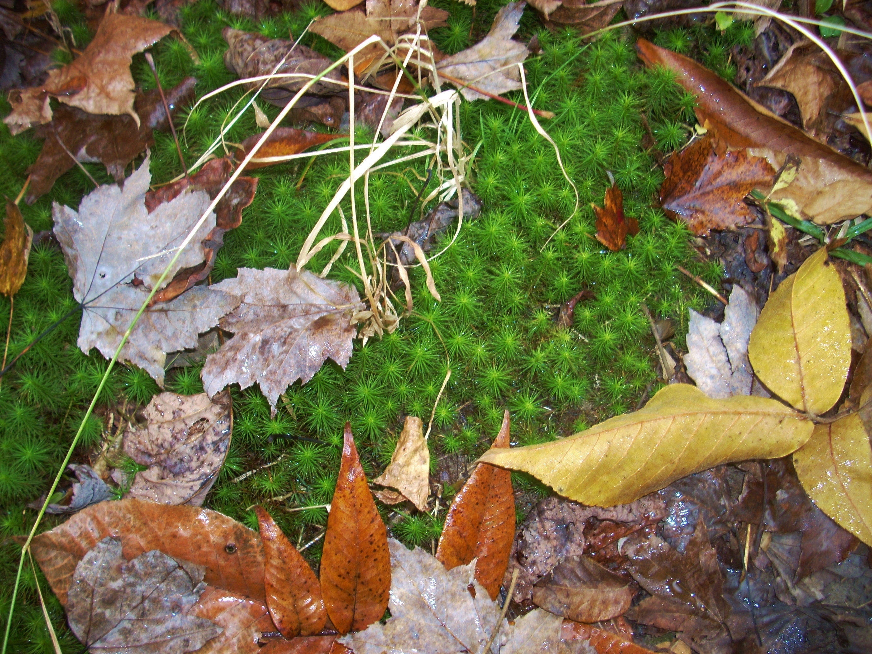
This, in fact, wasn’t the only interesting sight of moss that I would have today. Not soon after, upon crossing a stream bed, I came across the sight in the picture below. I hope someone can tell me more about what kinds of plants or mosses these are…
By the time I got back to the main trail I no longer had my natural umbrella and I was starting to get pretty wet, but I just couldn’t bring myself to leave until I checked out the Millstone Quarry Trail. This path takes the shape of what they call a “lollipop” loop, and as you get to the circular portion you'll find a sequence of numbers that correspond to different points of significance. Apparently they did a lot of quarry work out here at one point. The stones were quarried at this location and then moved via an old road to points elsewhere. I came across 7 numbers, a couple of which must have been the actual quarry sites. Others looked to correspond to rocks of different shapes. Still others must have marked where the road used to be. If I can garner more information about this I’ll update this page.
Upon emerging from this trail it was clearly time to head home. The rain was just starting to really come down and I saw a first flash of lightning just as I reached my car. It’s was like: “James, I’ve waited for you long enough. Get out of here so I can water my plants, please!”
DIRECTIONS:
I took I64 out of Lexington and then veered onto the Bert T. Combs Parkway. At the Clay City exit for KY15 I turned off this and made an immediate right onto KY15 in a northbound direction. After 3 miles I came to the turnoff. Taking a right here will put you on Brush Creek Road, and you’ll follow this all the way to the end (about 1 ½ miles). The trail begins at the back of the turnaround. Please park way off to the side on weekdays though, as this is a bus turnaround.