
Balanced Rock/Hood’s
Branch/Low Gap/Rock Garden/Original Trail Combo (Whew!)
Curses!
Drat! Oh well…
Egad!
In seriousness, my
plans for today didn't really emerge as I'd intended but that didn’t end up bothering me too much.
When things don’t work out I know that it just means that
I was meant to see something different. This was the case
today, as an unforeseen twist would take me on a path which may now be my favorite in this park – an area I’d previously missed.
Things had
finally dried up a bit in terms of weather and since I hadn’t hiked in a week I
was really ready to get out. So, in order to make up for lost
time, I thought I’d take what has become (along with the Moonbow Trail at
The drive to
Having
experienced this, I took off on down the trail which begins around the back of
the building. You’re basically on the edge of a ravine here
which has a little stream running down and it’s really lush and beautiful with
an awesome network of wooden stairs and bridges which seem to travel in myriad
directions all about the place. The bridges, in particular,
are all quite well made and it’s obvious that (along with the stone bridge which
gave name to the park) they take the “bridge” in
The trail
really begins in earnest after this and, having climbed up a steep stairway, I
took a left onto the Balanced Rock Trail which is part of this loop.
This spot is the first place which will provide a level spot in which to
rest if you like, but don’t get too comfortable as you’re only about 1/5 of the
way up I’d guess. There’s a nice shelter with a rock overhang
here.
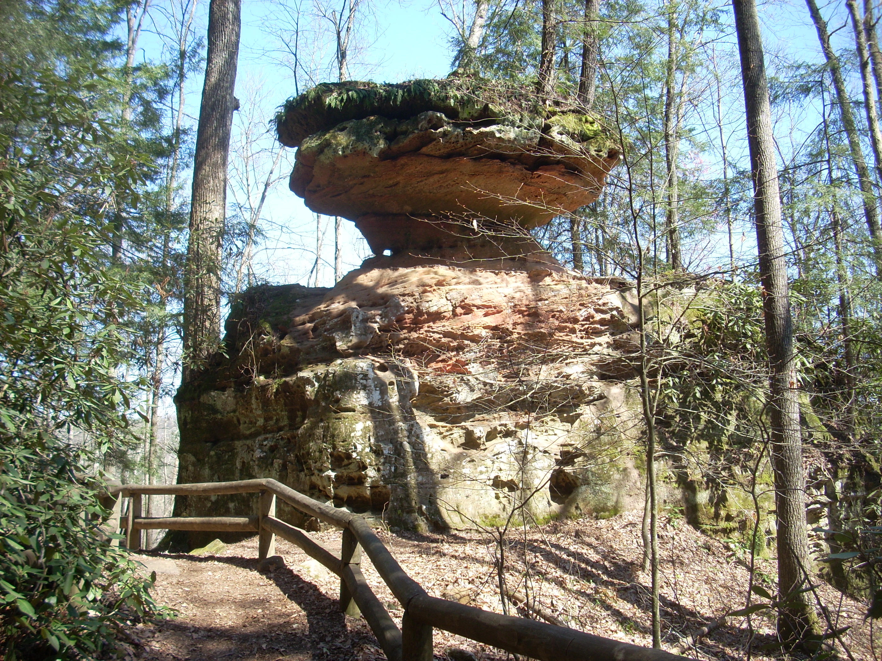
Not too long after this you’ll come to Balanced Rock which you’ll pass on your left (the picture below was taken looking back though, as it was the best view in my opinion). You really can’t miss this one. Y’know, things like this just make me want to throw my hands up in the air and laugh! They’re that cool! That rock is just kinda hangin’ out!
As you continue an ascent, you might be impressed (as I certainly was) with how they’ve either input or just carved out little stone steps in between some of the rocks to make the climbing a bit easier. For me, this just adds to the aesthetic effect.
When you come
to a second rock overhang you’ll be getting close to the top, and you’ll find
yourself in a cleared out area just to the side of the top of this ravine you’ve
been climbing up. In fact, as you look across the way to your
right you may see some people over there - they’re on the other side of the
Once you’ve passed the overhang, look up and to your left. You might see some metal steps ascending at the top of the rocks in what looks like a pretty precarious position. I’m not sure if they allow you up there or not, to be honest – I’ve never tried.
I met a family
in here - a mom with 2 young boys. I’d guess they were
somewhere between 7 or 8, maybe? Anyway, they mentioned that
they came out here every year as a kind of getaway, overnighting at one of the
rental cabins. They brought to my attention a place which I’d
not been to yet or even heard about: a place with a
suspension bridge - and you get to it by driving through a tunnel?!?
How sweet would that be!?! Next trip maybe…
[Turns out this bridge is where the Sheltowee Trace crosses over the
Once at the top
of the ridge I began walking along the semi-circle it forms (
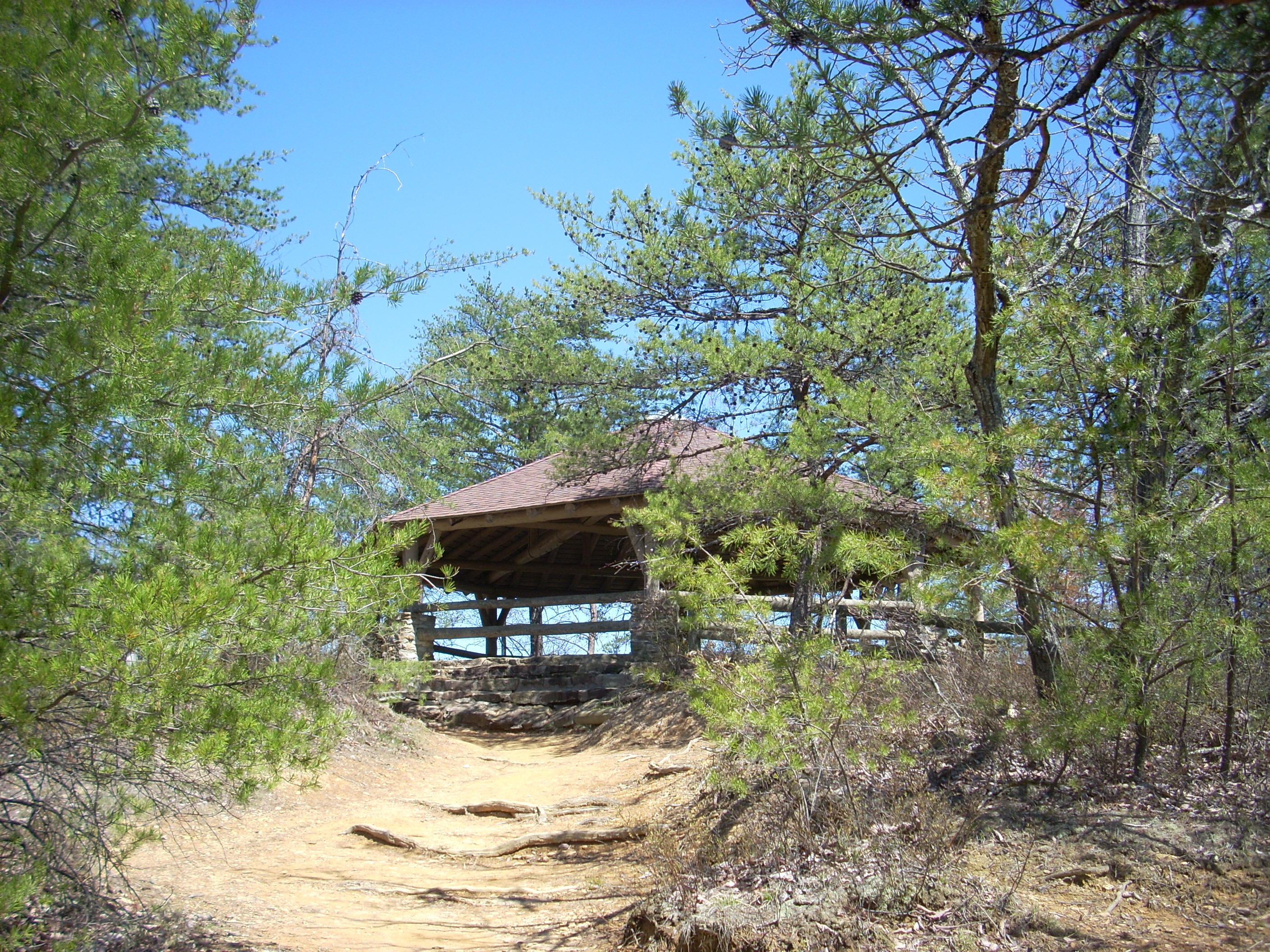
At any rate, I continued on toward the bridge and a really nice gazebo shelter for the overlook that they’ve got up here.
At this point
you can continue on across the bridge to the other side of the ridgeline or you
can go down some steps they’ve got to your left and see the underside of the
bridge. I descended. I couldn’t quite
remember where to catch up with Hood Branch, but I knew I’d find it eventually.
I had my guidebook too as I always do just in case, but that’s not nearly
as much fun to me as trying to find a place on my own!
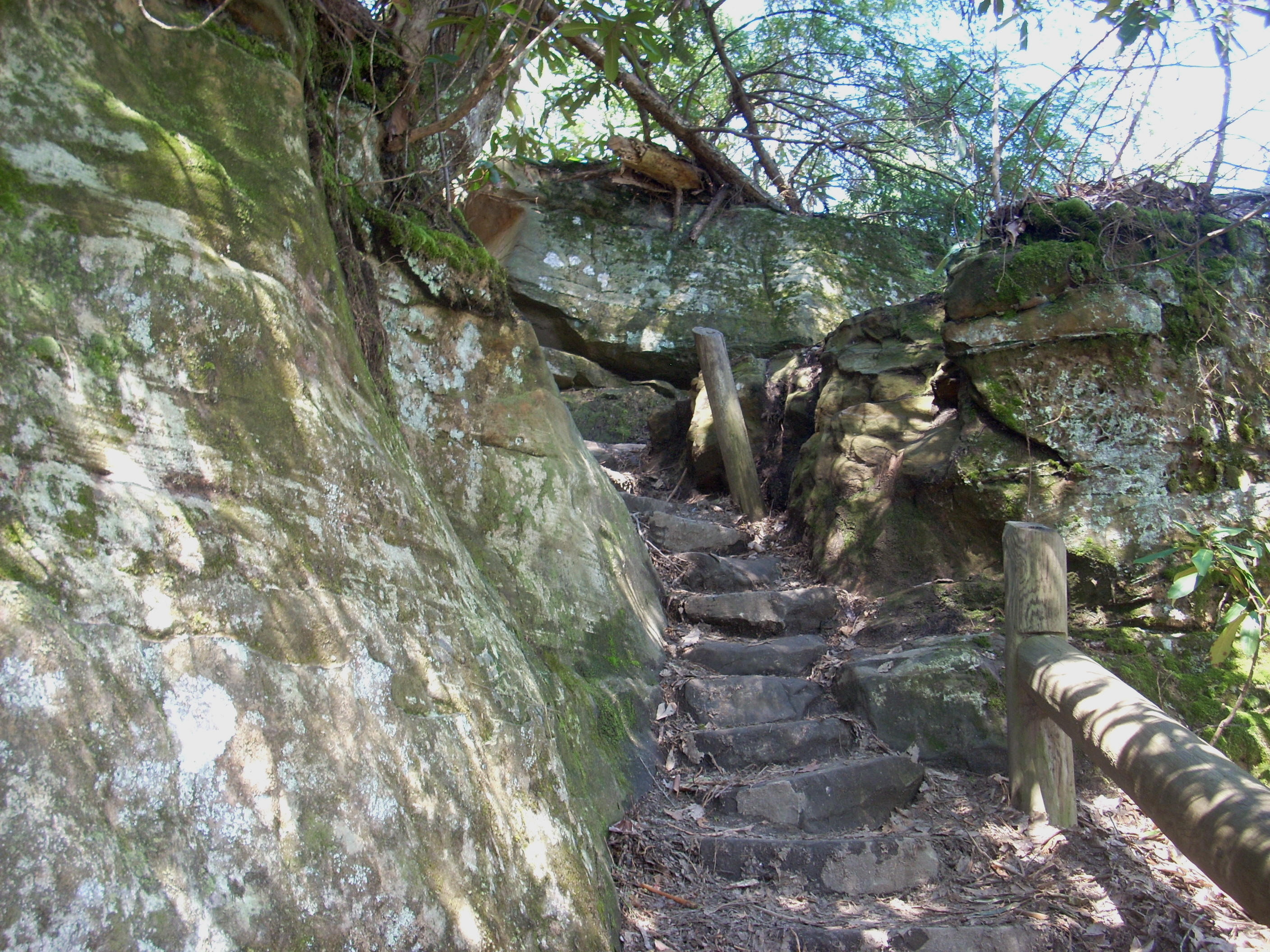
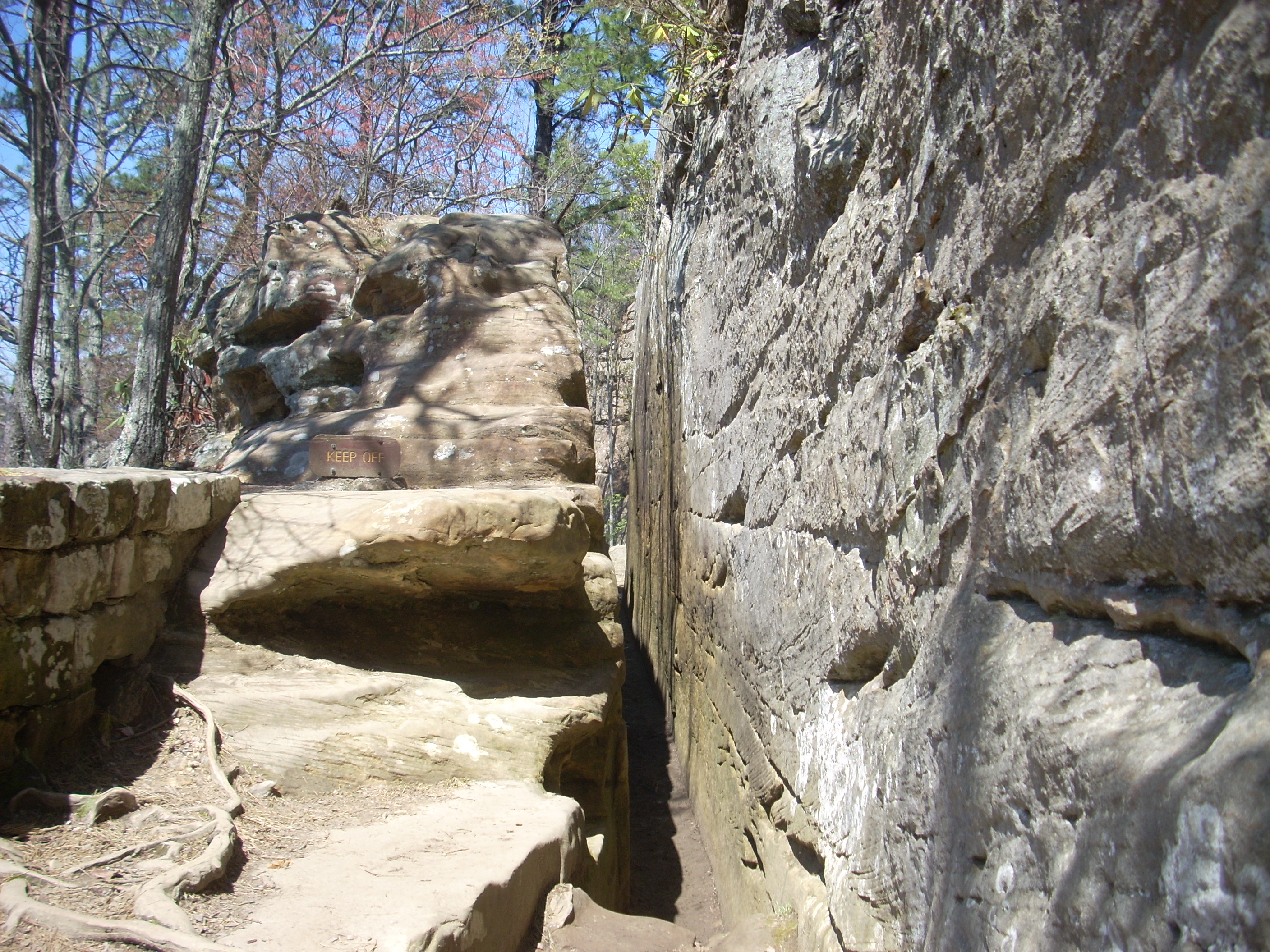
It’s when you get to the bottom of these steps, though, that you encounter a little space (maybe a tad more than a foot wide - maybe) through the rocks which you have to pass through – “Fat Man’s Misery”! At this point, I’m pretty much throwing my hands in the air and laughing again even though I’ve seen this before! Unreal! You have to walk through it sideways (the second picture was taken looking back)!
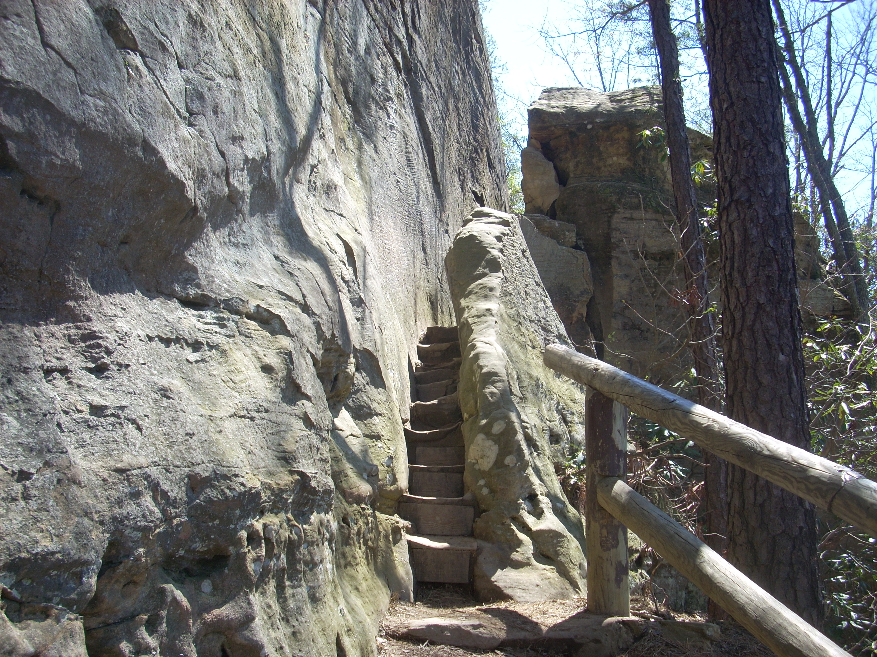
At the bottom of the steps you’ll have the bridge straight ahead and Hood’s Branch will head off to the left. You'll be on Hood’s Branch for the next 3 miles of this loop I'm describing today, eventually winding up in the parking lot for the skylift. Didn’t I mention the skylift? :) It’s coming up…
At any rate, as
I started on this path, it quickly became clear that it was very similar to Sand
Gap but with a couple of exceptions: it’s about 5 miles
shorter, of course, but it’s also not quite as peaceful because of all the
people you’ll hear from atop the bridge. It will,
however, take you around several ridgelines as it undulates anywhere between the
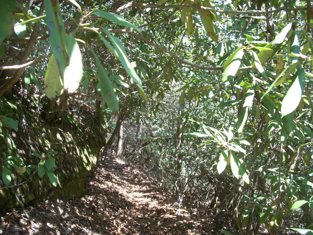
bases of the mountains and the tops of them. As you meander you’ll be moving through jungles
of rhododendron which will give you a dense, lush feel in the Spring and Summer
months.
Anyway, once around the first ridge it’ll get a lot quieter and you'll get a better feel for the forest around you. You’ll also pass many little trickling streams which come down from various spots and many of these have little bridges over them. There are, I’d say, nearly a dozen of these just on Hood’s Branch alone and as I walked a thought occurred to me... At times I feel as if I’m not adequately describing the things which I pass. I try to describe the most visible things, of course, but there’s so much scenery that I do pass which I don’t describe. This isn’t because it isn’t memorable. Every inch of every hike is memorable to me.
The thought,
however, was that even though you’ll pass large areas where the scenery appears
to be much the same, it’s these areas which provide the most depth in terms of
your experience. The popular spots are great in terms of a
sensory experience, but I think there’s a level at which nature “speaks” to a
person more deeply. The areas which seem to be similar for
long stretches may, in fact, be the areas where the things you are experiencing
etch themselves more deeply into your being and bring you the peaceful feeling
which so often overcomes you on a trip through the outdoors.
Sorry, I’m not
usually this deep as far as my thoughts go… are my trips
through the outdoors driving me insane? Possibly…
Anyway, just before I got to the junction where the little loop for the Upper Hood’s Branch Trail came in, there was a wooden plank bridge (which went over… guess what… Hood’s Branch!). I stopped in the center of this for a while to watch some spiders. Look at the incredible shadows they form on the water!
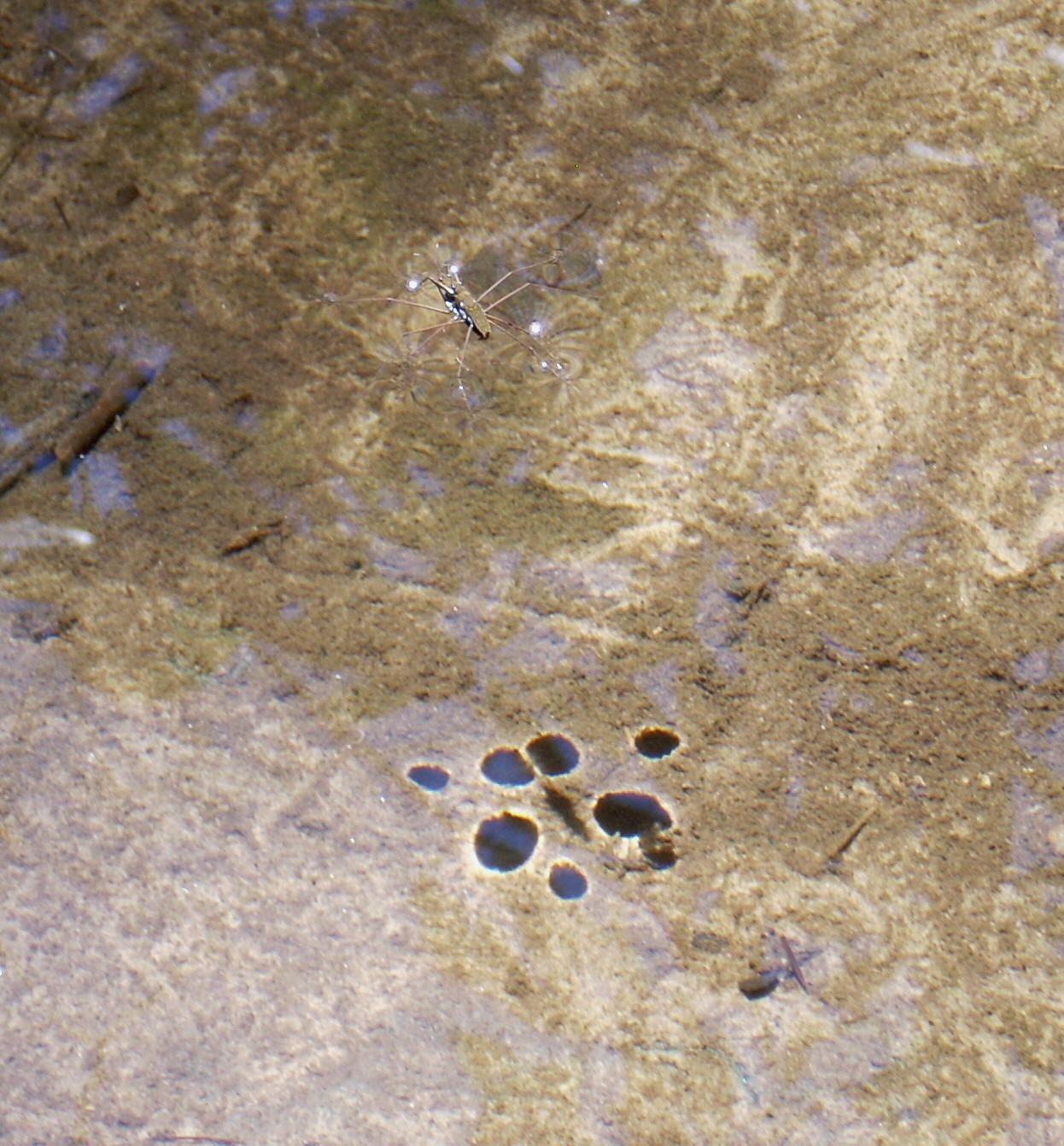
The shadow is
much more visible than the spider itself, but these arachnids really seemed to
be getting some exercise. It appeared as if they were
attempting to stay in place against the little current of this stream and every
time the water would float them down they would kind of “skim” back up.
It was fun to watch.
After crossing
the bridge I went left at the sign for Upper Hood’s Branch which was the area I
had not previously seen. Upper Hood’s is a loop and there’s
another sign almost immediately after the bridge.
This particular one is a bit confusing, however. Since this
trail is a loop you can go either way but this sign only points in one
direction - I think it should point in both.
Lemme tell ya though - this section of the trail really rocks! Literally. It takes you to a series of rock overhangs which today had little trickles of water going over them. Well, by the time I got to this point I was perspiring quite a bit. Should I do it? Why not? It wouldn’t hurt anything. I walked underneath and cooled off.
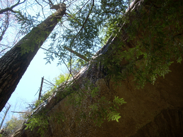
There’s a large
portion of this trail which is almost a continuous rock overhang. It’s so
awesome that the hawks must like it here too! At one point I was startled
at
what sounded like a huge animal in the brush - it turned out to be a hawk.
Usually I’ll see large birds flying around and I’ll think that they’re
hawks but they’ll almost always be turkey buzzards. This one
was definitely a hawk.
As you come around the back arc of this circle you’ll cross over another nice bridge. This one spans what was today a nearly a dry streambed. There’s also a point where you’ll almost think (at least I did) that the trail will end at a cave wall, but it won’t. It’ll follow just to the left. I’ll just be honest and say that I really could’ve stayed out here for a couple hours just taking all this in. It's a great spot!

Right after this, there was one point where the trail went right up and through the root system of a downed tree.
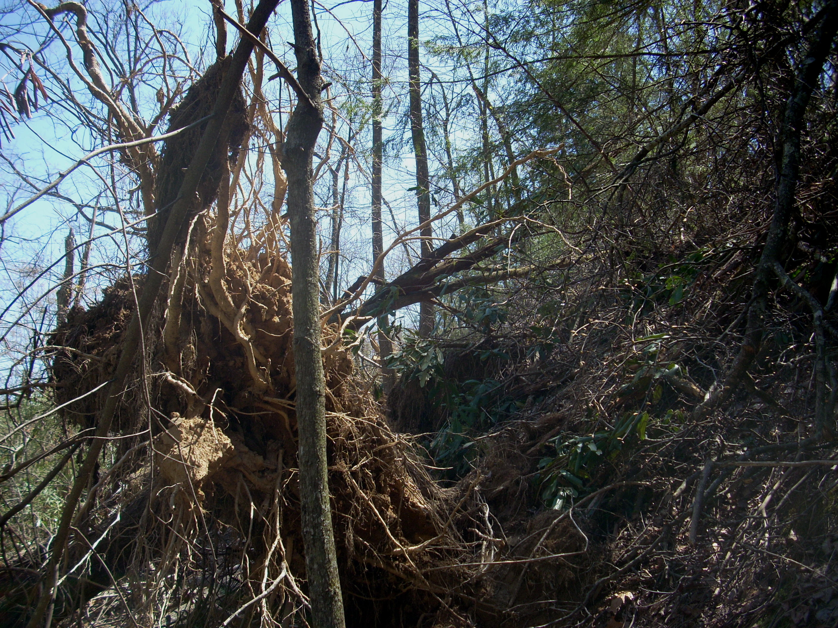
Negotiate through some more rhododendron jungles in this pine forest, and you’ll soon be back by the sign at which you started this little circle.
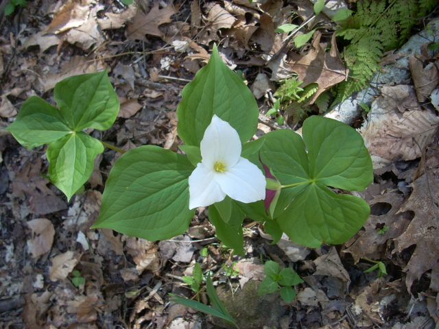
You should really take some time to appreciate the pines though, because at times you’ll catch the most amazing scent from them! Also entering my awareness in this section was a lone dogwood tree which provided a bit of color amid the sea of brown and green today. I did see some wildflowers too, but not nearly as many as I usually do at this time of year.
Below is one of the ones I did see, however. I believe this to be a trillium only because I now have a "cheat sheet" of the flowers that I got by taking a picture of the illustrated wildflower chart back I saw back at the Activities Center when I started.
The path
follows very closely along Hood’s Branch now as it meanders down through the valley which the stream created. It’s a gradual
descent at first, in which you’ll catch more great pine forest scenes.
Always interesting to me, as well, are the simple meanders of the streams
which can
outwit themselves by doubling over and tying themselves in knots to form lakes.
They call these oxbow lakes. I suppose there can also be oxbow ponds.
It’s a really
interesting phenomenon.
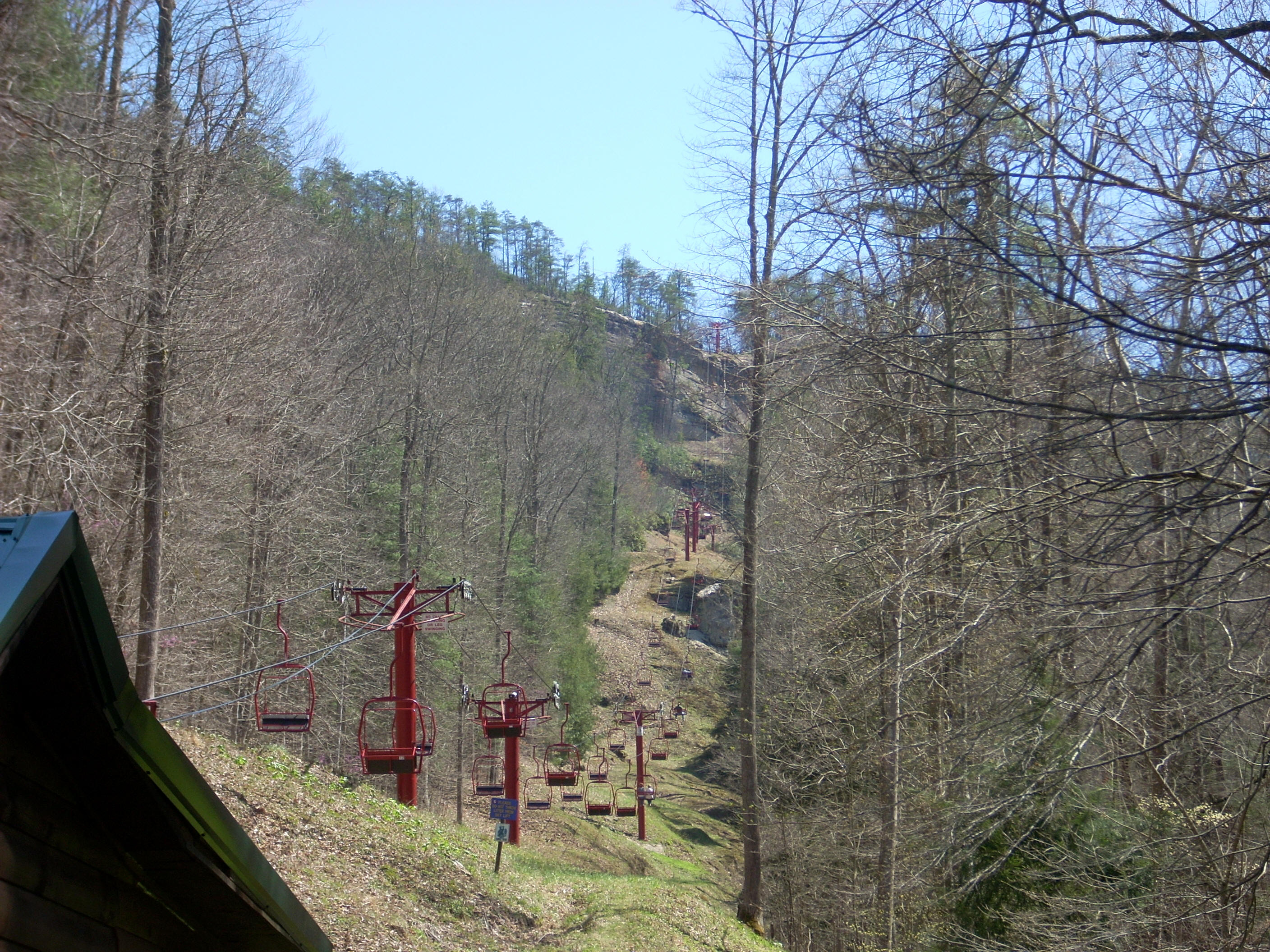
At one point there’s another nice little shelter at which you can take a breather. At another point I noticed a couple people down in the valley below me. I was thinking: “Hmmm… I don’t think that’s part of the recognized trail system… Those people probably shouldn’t be down there…” Well, it finally dawned on me as I began to see more and more people on this “path” that these people were in the air! They were on the skylift! The angle had given the appearance that they were fellow hikers. :)
The lift
ascends from the parking lot that you'll reach shortly, and it will cross over Hood’s Branch in the
lower part of this valley before taking you to the top of the mountain.
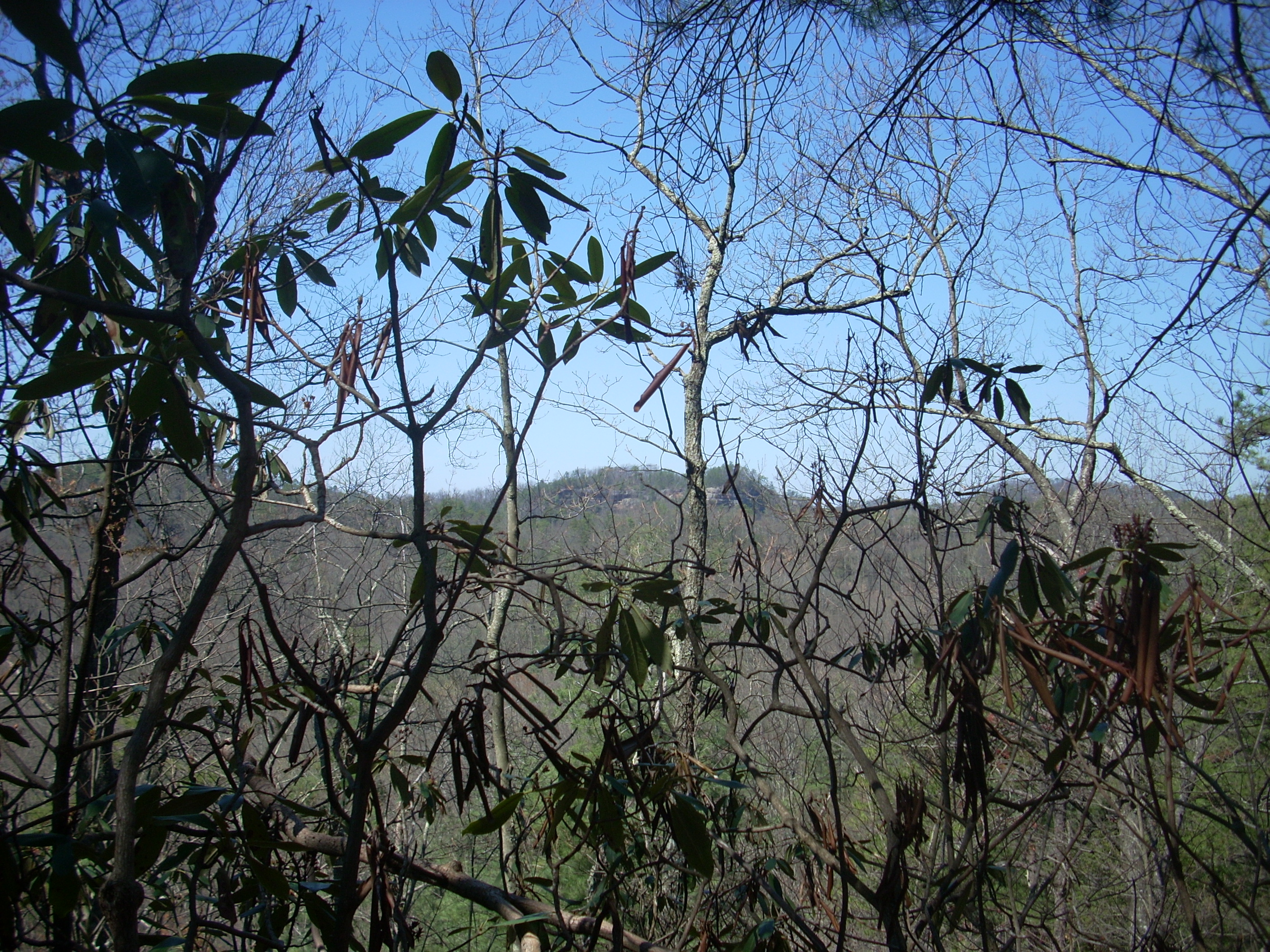
In fact, you’ll be able to see the rock cliffs on the other side of this
valley on your right. By this time you’ll also be hearing
signs of civilization with the people on the skylift, the people on top of the
mountain, and the hum of the machinery from the lift.
Presently
you’ll start to descend more earnestly as said parking lot and a miniature golf
course emerge into view. Things get a little interesting
here. This trail loop I've been describing continues all the way over
on the other side of the parking lot at about the 1 o’clock point. When it restarts
you'll be on the
Low Gap Trail.
However, I took a little
detour before continuing in order to get a closer look at the skylift station.
I don’t remember it, but my parents brought us out here when we were kids
and, since I’d never taken the time to walk up to it on my previous hikes, I
wanted to get a decent picture. It actually looks a lot like
the entrance you’d see to a ride at King’s
After this, it
was on to a somewhat confusing series of trails which started with the one
called Low Gap. The trail took me up and through a little
ravine that might just have been the namesake of this trail.
In fact, at one point it looks like the path follows directly along a drainage
route so that you might be walking right through a little
streambed when it's raining.
Then, when you reach the top of the ridgeline you may notice that there are quite a few large boulders lying around. There’s even a neat little area where the rocks are all almost totally covered in moss. I was guessing that by this point the Low Gap must have morphed into the Rock Garden Trail. There are also other intersections along this section which will take you back up to Natural Bridge, but I continued straight on as I headed in the direction of Hemlock Lodge. This area, by the way, was starting to get really crowded even for a weekday. A party of about 20 people passed me at one point.
The Battleship
Rock Trail was the next but it, like the Sand Gap, was closed today.
Yet again, and almost immediately after this, there will be yet
another junction. This one is for the Original Trail and
you'll see another little shelter visible just a little way up. These were built by the Civilian Conservation Corps
and this particular one had a 1934 marker.
The CCC was started by Franklin Roosevelt to employ people after the
depression and it made me wonder… President Obama has talked
about the government employing people for infrastructure projects…
Will the CCC be “restarted”?
I took a left
onto the Original Trail and then took an almost immediate right to soon arrive back
at the exact spot where I’d finished climbing my first section of steps today.
Before leaving I just kind of admired this little ravine for a while
with the water trickling down and all the lush vegetation around me.
What a great park!
DIRECTIONS:
I simply took
KY11 off the