4 C’s
Trail
I took this trip to get
away from my problems. Sure, they found me anyway, but I was grateful to
have been able to experience this wonderful park again.
Most of the times I’ve been out here it’s been for what they call the
Crawl-A-Thon. This used to be a weekend event that was held
every January. You could sign up for different caving trips and crawl around
in one of the more than 20 caves they have both in the park and around it.
It was quite an experience and it brought cavers from all over the
country.
For the last 2 years, however, they hadn’t had the event because of a disease that the bats had gotten. They were concerned that all the dust thrown around by the spelunkers might exacerbate the situation. Well, today I decided to hike on some of the trails that wind around the caves and I opted for this particular one because it’s both the longest (with the exception of the horseback riding Kiser Hollow Trail) and most comprehensive in the park. I had issues I needed to sort out...
Frequent visitors to
this site already know that I have a problem with all the contempt I see out
there - especially on the road. Well today that problem began to affect me
physically. After another ridiculous episode on the way out
to the park I had my first experience with an odd heartbeat.
It was a little scary and it had me feeling a little downtrodden.
I needed a
calming hike like I’d never needed one before and this was a nice path for
that because on the 4C's trail you’ll
have long, contemplative sections where you’ll be walking through the woods and
then you’ll have a surprise or three which will awaken you from your reverie and
enliven you. Take the trail in this spirit, and it will
both renew and comfort you.
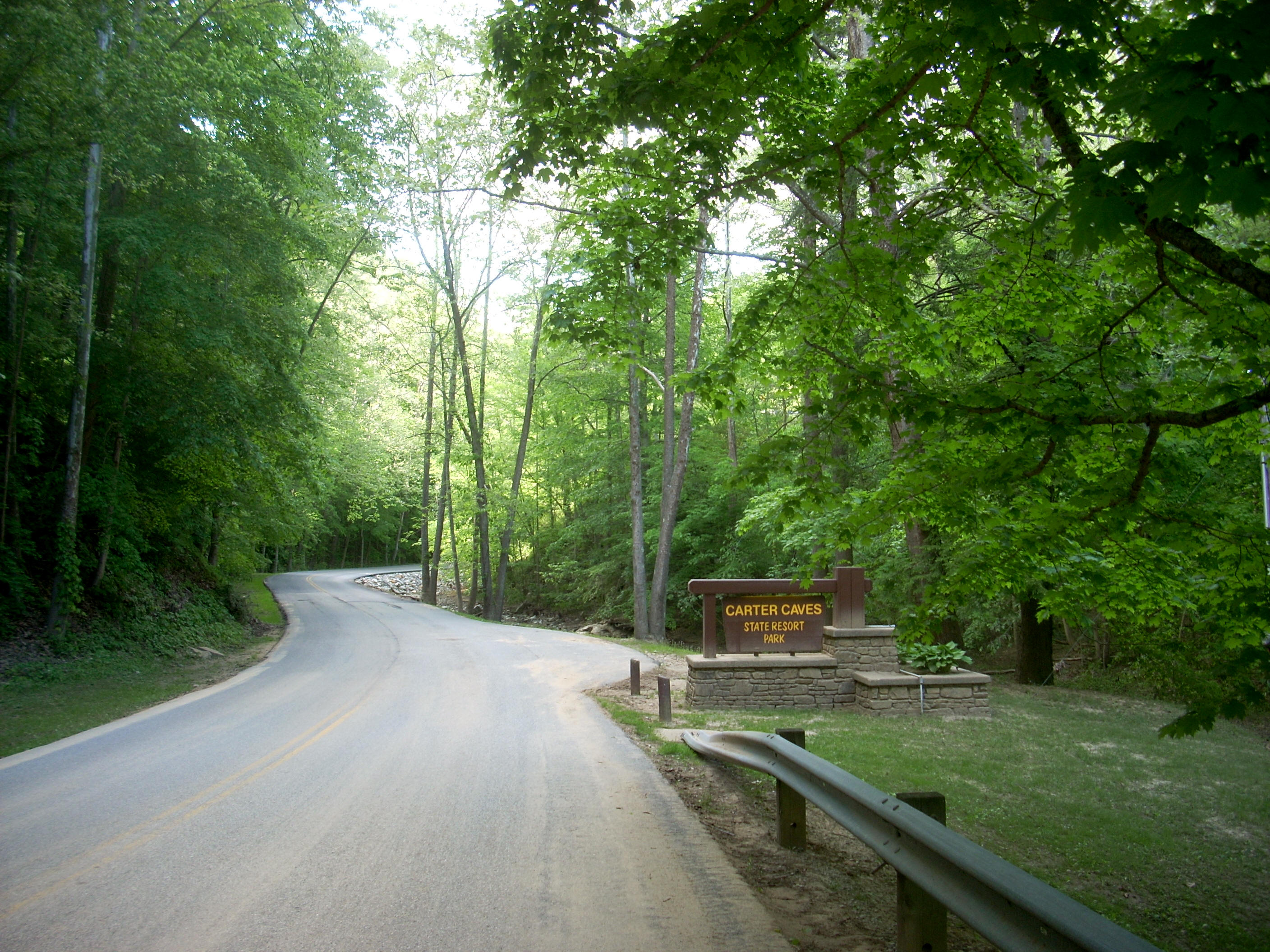
First thing’s first though: the entrance to this park (website here) is a thing of beauty! You’ll drive in along a stream on one side and a steep hill on the other. There are a few places to pull over and enjoy this. I eventually parked at the visitor center about a mile in and got on the path immediately, forgetting to even put my hiking boots on (I’d pay for this in pain later)! The visitor center is located in a sweet looking cabin, by the way!
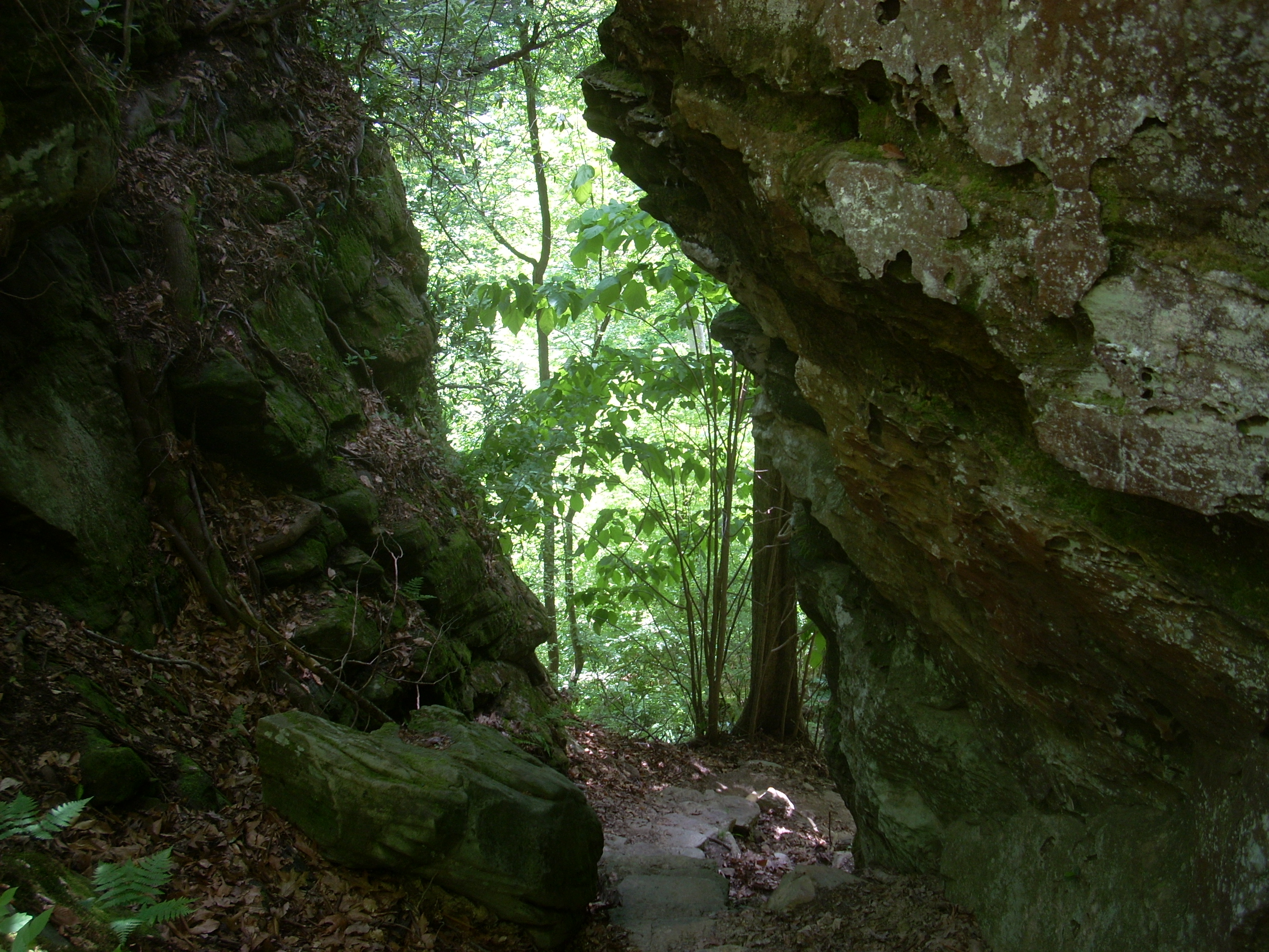
To begin the 4C’s I
crossed the park road and climbed up some steps which led me to an interesting
structure. This was actually the entrance to one of the caves
(Saltpeter). I took a left behind it and was immediately
relieved to be on my own in the forest. A clarification:
at this spot there was a sign that bore no indication that I was about to
begin the 4C’s Trail... What’s happening here is that this
first section of the path is actually shared by 2 trails - the 4 C’s and the 3
Bridges. You’ll know that you’re headed in the right
direction when you see both orange and red paint marks on the trees (orange for
the 4C’s, and red for the 3Bridges). This aside, the 4c’s
Trail is generally a very well marked one. I only got
confused a couple times, and I’ll describe these points in a bit...
Anyway, for about the
first 1/2 - 3/4 miles I was walking above the park road at about the mid-level
of a ridgeline, and at one point I passed a kind of metal grate over the trail.
I took this to be a precaution against hikers falling down into
Continuing left on the main path, I was soon headed down a steep set of stone steps which led between a couple rock outcroppings.
Following this,
you'll come upon the
spectacular scene below where you'll cross a wooden bridge appropriately called
This bridge would be a
great place to stop and meditate for a while if you want. In
fact, I was kind of surprised that it was so quiet out here today.
Being a weekend day, there were a ton of people around and a lot of cars
driving in when I first arrived. On the trails, however, I
didn’t see a soul all day.
Anyway, not long after passing
this bridge you’ll start to see quite a few more trail signs, some of which will
lead you to the park lodge and/or to
Anyway, I made
the turn and almost immediately came to a steep wooden staircase which began my
descent toward a little man-made lake (
This area was interesting. The stream was Smoky Creek (the same one dammed to form the lake) and this dam has actually created 2 Smoky Creek spillways – one flowing around either side of it. You’ll cross the first on the bridge and you’ll reach the second quite soon. It’s on the other side of the grass embankment. The path will take you up to the top of this and then you’ll cross all the way to the other side. Here, however, is one point at which the trail can get a little confusing.

Your eventual
route is directly in front of you as you walk, yet it’s on the opposite side of
the little ravine you’ll see. You’ll just need to find your
way across. I took the path left and it led me down from the
top of the embankment to the rocky streambed of the second spillway.
It was dry today, but there was a bunch of debris which made things a
little more difficult. I followed the path first but was
blocked, so I went along the little roadway I saw and was eventually able to
bumble and stumble my way back to the orange tree markings.
Then, after
climbing up a little grade, I found myself at a backwoods campsite complete with
a little rock overhang that it might be fun to try and sleeping under.
According to a sign here this was both the 3 mile point of the trail as
well as
the site of an old homestead. Camping is apparently allowed
by permit only, but there are no campfires permitted even though the word “No” had
been removed from the sign!
As for the
path, it leveled out at this point and widened too, making me think that I might
be walking on an old forest road. It continued this way along the back side
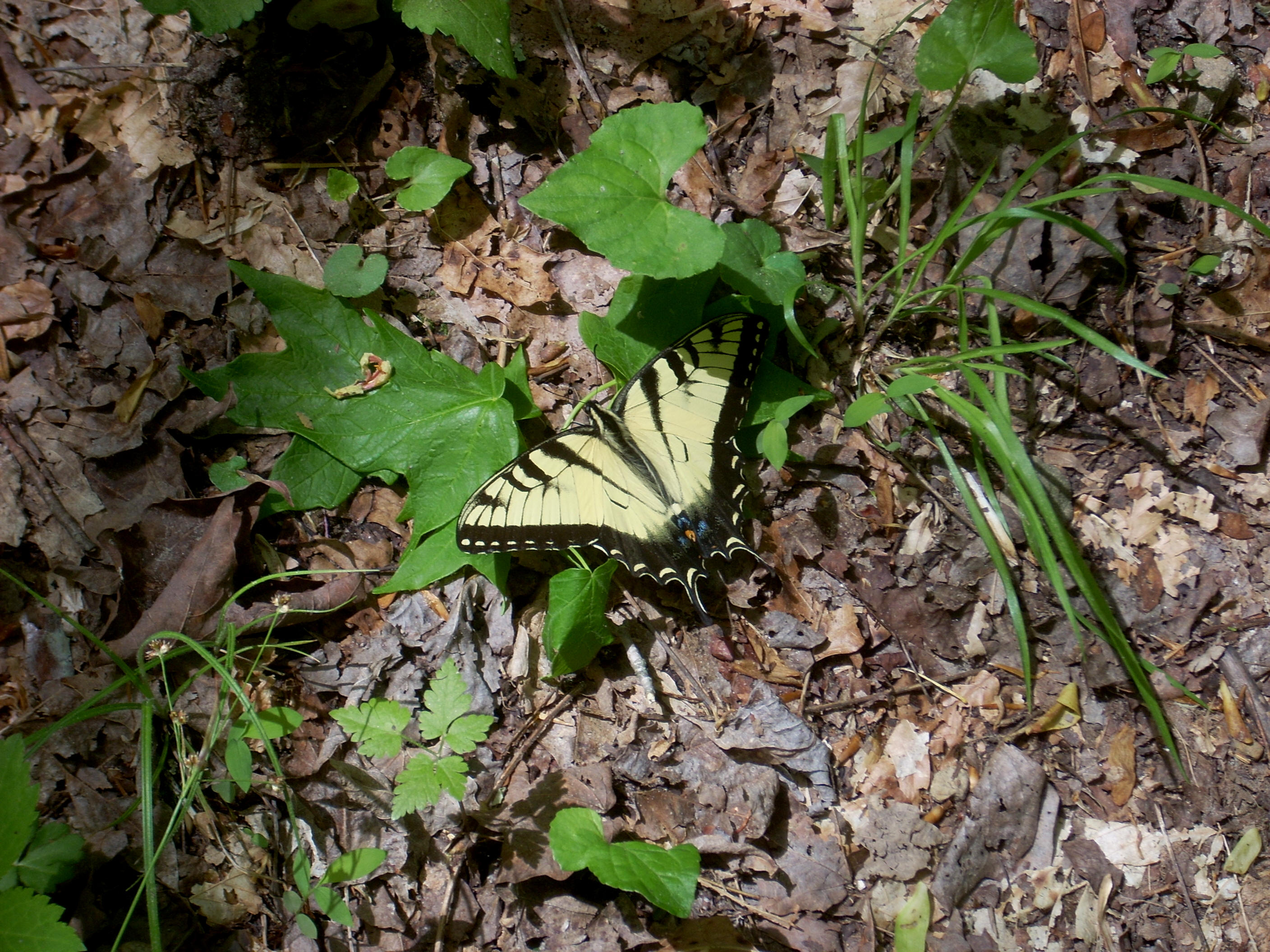
of the lake for maybe another mile and it was in the midst of my
musings in this section that I had an encounter with a butterfly.
Usually elusive, this one landed right in front of me on the path, and as
I began to ponder this occurrence my troubles finally began to fade from my
mind. Because of a butterfly? Well, not to
get too spiritual, but here’s why…
I was really troubled once about the Lord’s promise of eternal life. The concept was simply too vast for me to comprehend – so much so, that it truly frightened me to think about it too hard and so I asked my Uncle (a Roman Catholic priest) for help. What he told me is that this life vis-à-vis the next one is akin to the analogy of a worm to a butterfly. In this life we are as worms - our lives are awkward and often very difficult as we struggle to find our way. If we pass this earthly trial by leading a good and just life, however, and our lives will be transformed into something truly beautiful in heaven. Well, when I began to think of my troubles in this context they seemed a lot less weighty and my day finally began to change - I was at last on the road toward making sense of my situation instead of just dwelling on it.
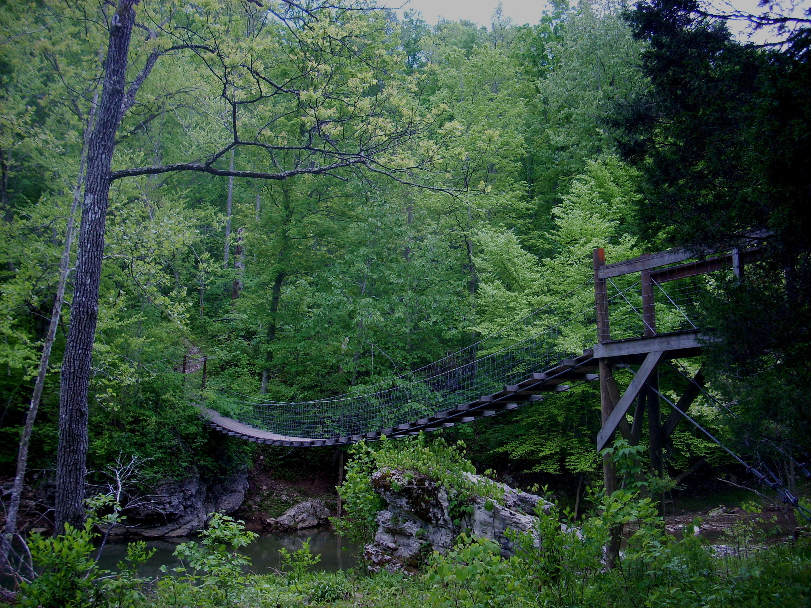
Soon, after passing by a small pond on the path, I began to notice that I was making a descent toward another awesome suspension bridge. Longer than the first, this one went over the tail waters of Smoky Creek. However, I had to really squeeze with my hiking belt on just to make it on. You see, at each of the ends there were posts spaced only far enough to let a hiker through and as I inched on by it reminded me of the tight squeezes I'd experienced in the caves at the Crawl-a-Thon!
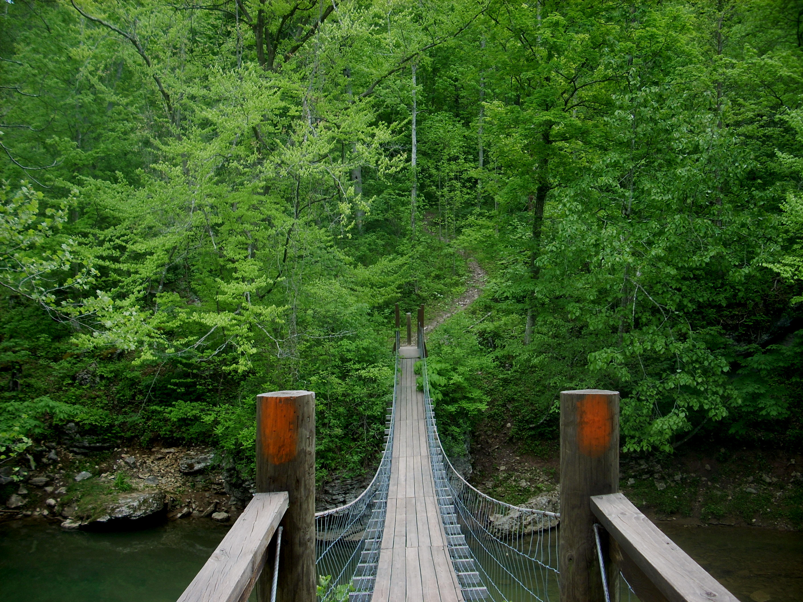
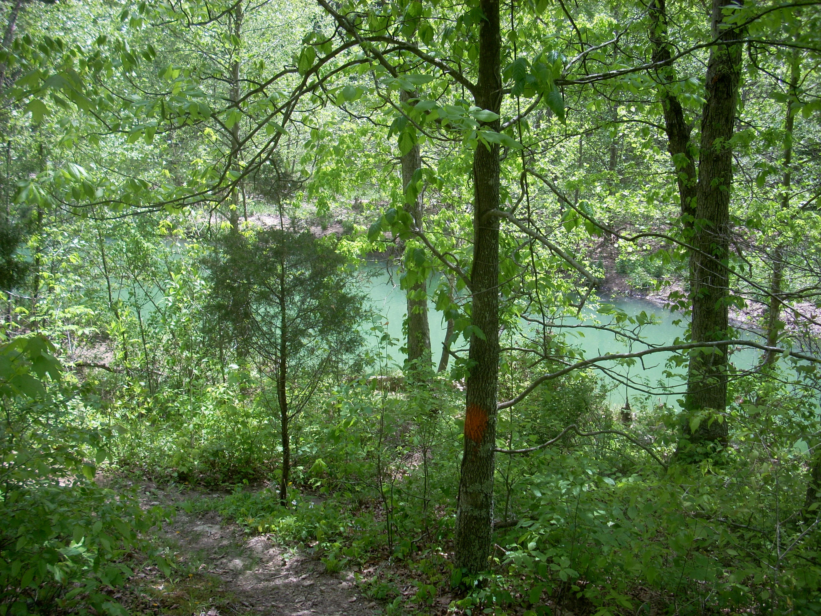
As it passes this bridge the trail will first follow alongside the creek to provide some nice spots to stop and relax. One of these was an area where it appeared that the stream had a tendency to get quite wide. Yet, today I’d say the water was only flowing over about 1/10th of the area. Continuing along the east side of the lake, I found that the path generally following a backward “C” pattern along the shore. The water here had an awesome turquoise hue, and the whole area was very low-lying so it was quite lush with plenty of wildflowers.
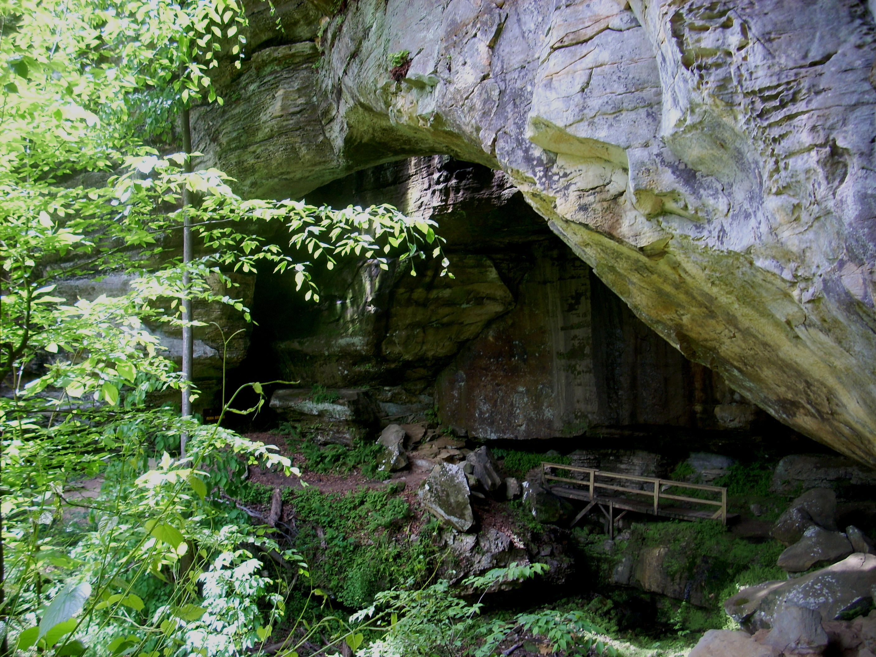
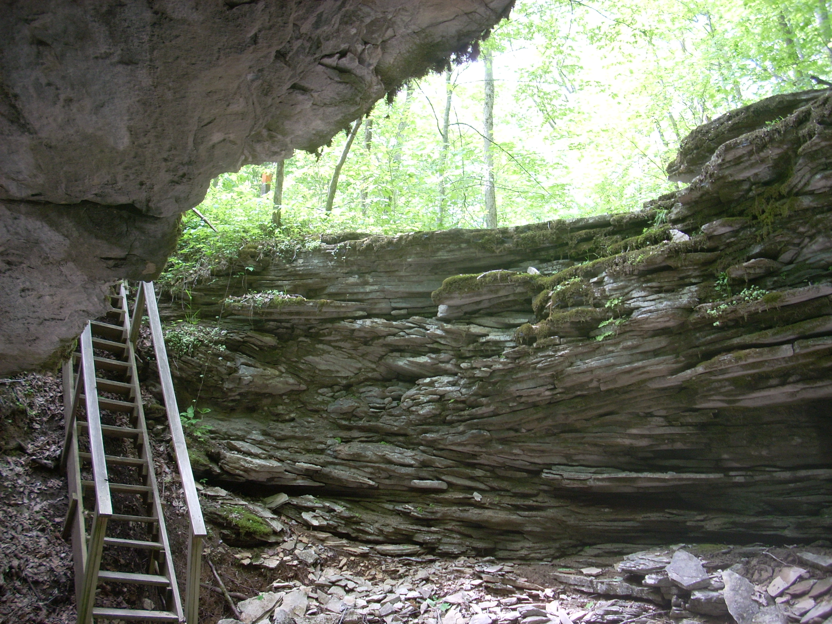
After passing a nice fishing spot down and to my right, I began to ascend again alongside one of the park's trademark rock outcroppings. This particular mid level ascent culminated in a very pleasant surprise - the Shangri-La Arch!
I was not expecting this, so it was really awesome to see, and once I passed under it I climbed a steep ladder up and out. I couldn’t leave too quickly, though, because this was yet another awesome spot to stop and enjoy for a while. This is one sweetheart of a hike!
Anyway, the
path from here might get pretty confusing if it wasn’t so well marked.
In fact, you’ll even see another trail right across from you on your left
at one point. This could be part of the Kiser Hollow Trail
(marked in yellow) which you’ll soon transect and then merge with at the top of
the next ridge. In fact, what you’ll essentially be doing –
and really from here on out – is undulate quite a bit over different ridge tops.
I found this interesting. Most of the trails I’ve been
on in the state have taken a less direct approach as they slowly wind around –
and maybe go over - one or two ridge tops. This one tackles a
few of them in a fairly short span.
Anyway, at the top of this first ridge you’ll pass through a kind of thin gate opening which only a hiker could get through and then you’ll take a left to merge with the Kiser Hollow Trail. There will be a sign to mark the way, but you’ll also be able to tell from the trees because the markings are now both orange and yellow. Of interest to me in this general vicinity was that in Browns’ Hiking Kentucky book he mentions that there was an old trail here called the Simon Kenton Trail which once intersected with the 4C’s. Apparently it’s no longer maintained, but every time I hear that name I’m reminded of this fascinating pioneer who was made a focal character in Allan Eckert's book, the "Frontiersmen" - a favorite of mine.
Very soon after
the trail merge you’ll cross a gravel road through a cleared out area to begin
walking on a grassy path which looks like another old roadbed.
This will shortly begin to descend and you'll want to keep going straight here
as there are a couple other grassy paths that come in from the left.
Once at the bottom, you’ll have a little creek just in front of you and the 2
trails will split. Kiser Hollow will go left while you’ll go
right to follow the stream. As you do you’ll
pass through yet another of those thin gate openings and this one left
absolutely no ambiguity – “No Horses” – said the sign.
At any rate,
after a fairly level walk through the woods you’ll come to the one point where I
lost the trail today. There was a mown strip through the
grass on the right, but I thought the path curved left toward the stream so I
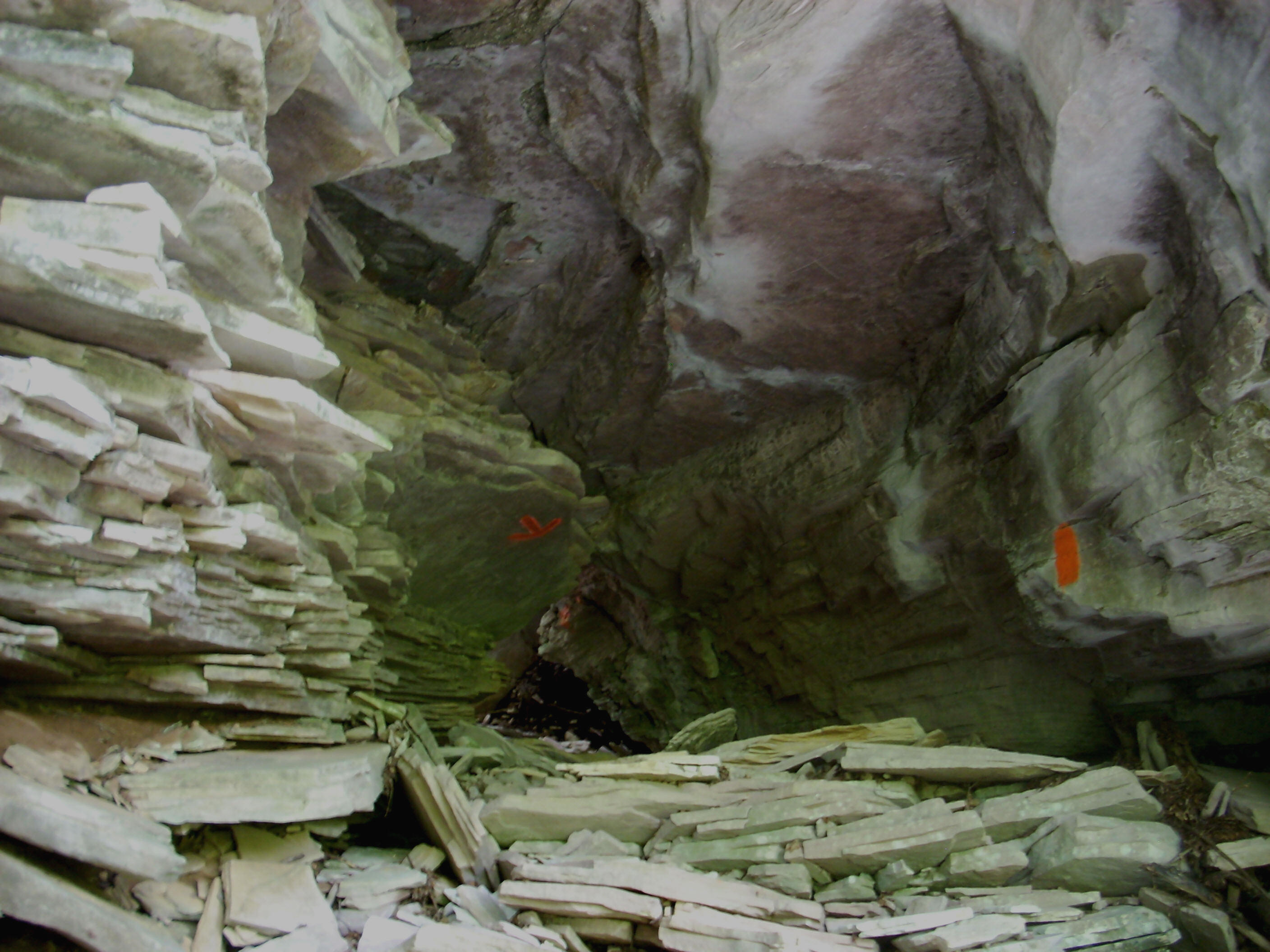
went in this direction. It was worthwhile to do because it led me to a
nice little cave, but the trail seemed to dead end at this spot and it also occurred to me that I hadn’t
seen any paint marks on the trees in a while. I headed back
to the grass!
Seeing this
mown section had really thrown me. It was totally unexpected,
and I attracted the attention of a yellow jacket in here.
Usually these only show a passing interest, but this one followed me long enough
to get me sweating a bit. I kept walking and it luckily lost
interest by the time I reached the next trail intersection. A pole with an orange marking on it will
direct you to the left.
Again
reentering the woods, you’ll begin another climb over a 3rd
ridgeline, making a left at the “T” intersection you’ll pass.
Then, making a right soon after, you’ll come alongside another series of rock
walls which will help to define the last stretch of the trail.
Mother Natures’ artwork is quite evident in the incredible striation
patterns in some of these rocks! Meanwhile, you’ll see and
probably hear the people down at the visitor center shortly.
Take a right when you reach the Horn Hollow Trail intersection and this will
lead you down to it and to your car. You’ve just walked
almost all the way around the perimeter of the park!
Before leaving
I had to check out the cave I passed here. There’s a short
little rocky path leading to it. The entrances were gated
off, but it looked like this was one of the caves they offered tours of.
I also checked out the cabin which has a nice gift shop.
Both are well worth your time – as is this wonderful trail!
DIRECTIONS:
Take US64 to
the exit for US60. You’ll then follow US60 East for about 2
miles as per the website, and then take a left onto KY182.
Follow it for about 3 miles to the park entrance which will be on the left (this
will come immediately after you cross a little bridge on a sharp right turn in
the road. I parked at the visitor center.